Boundaries and Charters of Virginia
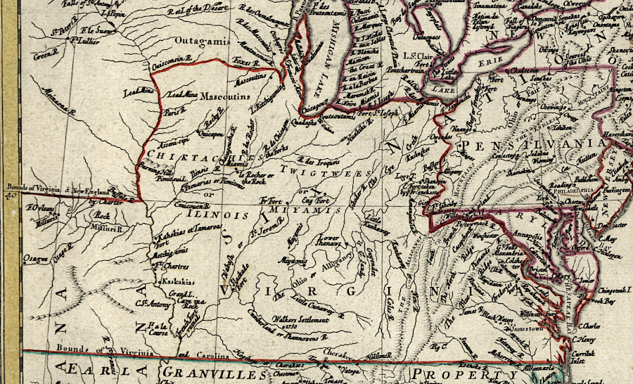
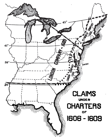
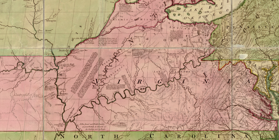
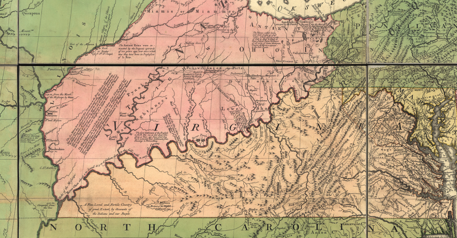
based on its 1612 charter, Virginia claimed the Ohio River Valley and westward to the Pacific Ocean in the 1750's
Source: Library of Congress, America Septentrionalis a Domino d'Anville in Galliis edita nunc in Anglia (by Jean Baptiste Bourguignon Anville, 1756)
Virginia's edges were defined initially in charters issued by the King of England as grants of land to private investors. Those charters did not use natural features such as rivers or mountains to define the edges of Virginia. The English were unfamiliar with the landscape. Between 1606-1612, they identified northern, southern, and western boundaries by arbitrary distances from Jamestown - or by leaving the western boundary open across the entire continent.
The history of colonial land grants is confusing, but essential to understanding the location of those boundaries. As John Smith noted about 400 years ago:1
- "...for as Geography without History seemeth a carkasse without motion, so History without Geography, wandreth as a Vagrant without a certaine habitation..."
The extended disputes over colonial boundary lines was driven by the primary motivation of colonial investors to get rich. There were nationalist, religious, and other motivations as well, but the potential to acquire land at a low price and sell it at a profit was the key factor in defining how the edges of Virginia were finally drawn. Queen Elizabeth I, and then King James I, could make awards of land and settlement rights by royal charter. Competing claims by Spain, and by the "naturals" who already lived on the land, could be ignored.
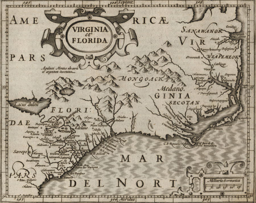
European mapmakers identified claims to territory by Spain and England, but ignored potential Native American claims
Source: University of North Carolina, Virginia et Florida (by Gerhard Mercator, 1610)
The three ships that brought 104 colonists to Jamestown in 1607 (the Susan Constant, Godspeed, and Discovery) were financed by and filled with people who sought economic advantage. The desire for freedom of religion or increased individual liberties was not the driving factor in the initial settlement of Virginia in 1607. Instead, the goal of the initial colonists and their backers in London was to increase personal wealth.
The investors who financed the project to colonize Virginia were venture capitalists, "adventuring" or risking their wealth in the hope of getting even richer. The colonists who sailed to England were also seeking to increase their personal wealth, seeing opportunity in Virginia just like the founders of the company. In their charters, Queen Elizabeth I and King James I was careful to reserve the rights for 1/5th of the gold/silver, just in case the English ran into the same wealth discovered by the Spaniards in Mexico and Peru.
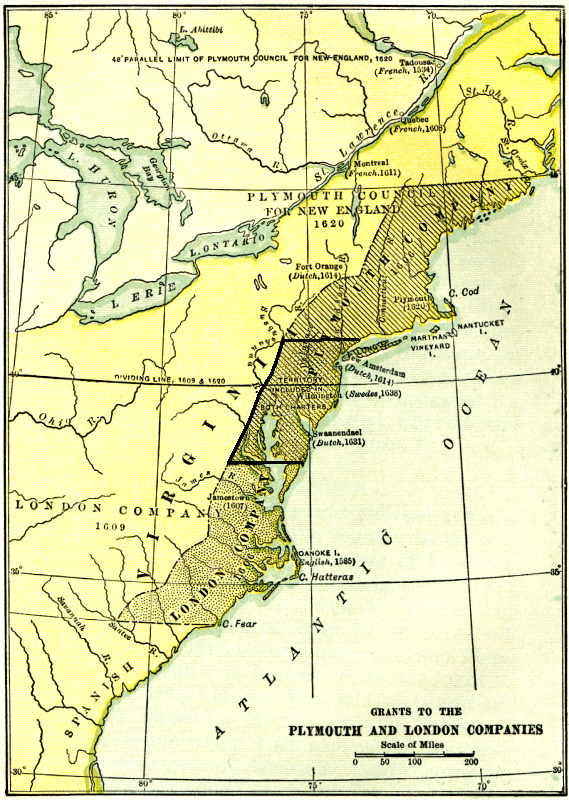
The investors ultimately incorporated as a joint stock company, the Virginia Company, with a coalition of capitalists based in London and Plymouth. The London-based investors focused on settling the Chesapeake Bay region. The capitalists based in Plymouth, who were more familiar with the fishing grounds off Newfoundland, focused on settling lands further north. Both the London and the Plymouth companies sent expeditions to settle in North America.
The First Virginia Charter issued by James I in 1606 gave the London Company the right to:2
- begin theire plantacions and habitacions in some fitt and conveniente place between fower and thirtie and one and fortie degrees of the said latitude all alongest the coaste of Virginia and coastes of America
That was a generous grant; the area between 34 and 41 degrees latitude stretches from present-day South Carolina to New York City. James I was giving away rights to a vast swath of territory to which he had no legitimate claim, unless it was occupied by English. The Right of Discovery would be invoked later by various colonial officials and Chief Justice John Marshall to legalize the elimination of Native American title to the land, but in 1606 the key to competing with Spanish, French, and Dutch rivals in North America was to be first to occupy and defend a slice of land.
That 1606 charter created a potential overlap between the claims of the London Company ("Firste Colonie") and the rights of the Plymouth Company ("Seconde Colonie") to settle "betweene eighte and thirtie degrees and five and fortie degrees of the saide latitude." Each company's first settlement in Virginia was guaranteed exclusive control over territory within 50 miles to the north and south of their settlement:
- "they shall have all the landes, soile, groundes, havens, ports, rivers, mines, mineralls, woods, marishes, waters, fishinges, commodities and hereditaments whatsoever, from the firste seate of theire plantacion and habitacion by the space of fiftie like Englishe miles."
In addition, the company was granted rights for 100 miles inland from the first settlement. The total grant included 100 square miles or 6.4 million acres of territory, plus islands within 100 miles of the shore.
The Plymouth Company sent its first ship to the New World in August 1606, ahead of the London Company's 3-ship expedition that sailed from London in December 1606. However, the Plymouth Company's scouting ship, the Richard, was captured by the Spanish off the coast of Florida.
A second expedition from the Plymouth Company sailed on May 31, 1607. The 120 men who sailed from Plymouth in the Gift of God and the Mary and John left England after the three ships of the London Company had already arrived, and the 106 colonists in them had started to build a fort on a river the English named after King James.
The two ships that sailed from Plymouth arrived off the North American coast at the mouth of the Sagadahoc (now Kennebec) River in August, 1607. The colonists built a storehouse and chapel at Fort St. George, and perhaps other structures, on Sabino Head.
Modern archeologists knew where to excavated at the site because the Spanish Ambassador to England had an effective spy network. Don Pedro de Zuñiga obtained a map of the Popham/Sagadahoc colony, and that document was discovered in the Spanish Royal Archives in Simancas, Spain in 1888. During the Civil War, Fort Popham was constructed nearby; that stone structure can be visited by tourists today.
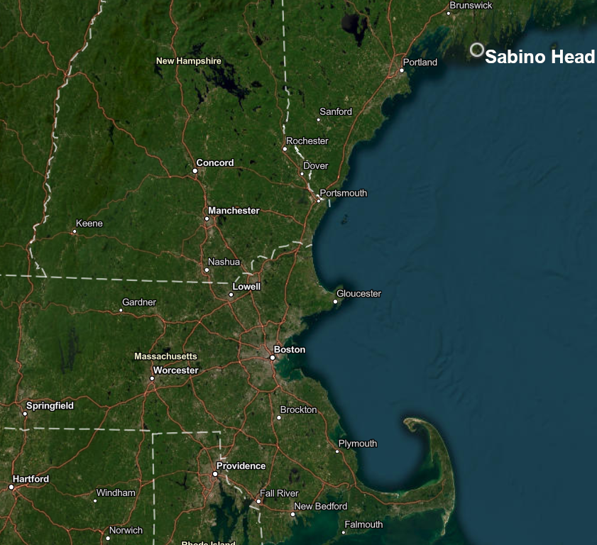
the 1607 Popham colony planted on Sabino Head was roughly 600 miles north of Jamestown (and over 130 miles north 0f the 1620 Plymouth Colony)
Source: ESRI, ArcGIS Online
The Plymouth Company's colony survived a winter in what we now call Maine. In 1608 a resupply ship brought word that the leader in the colony, Rawleigh Gilbert, had come into an inheritance. Once he settled the estate back in England of his dead brother, he would be a rich man.
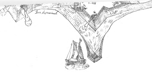
the Popham colony feared potential attack by the Spanish, so Fort George was constructed at the mouth of the Sagadahoc (Kennebec) River
Source: Alexander Brown (ed.), The Genesis of the United States (facing p.190)
Gilbert and all the colonists sailed home rather than try to survive another winter. Some left in the first English ship constructed in the New World, a pinnace named the Virginia of Sagadahoc.
The Plymouth Company charter was forfeited and the company faded into history, but the Virginia of Sagadahoc returned to North American in the 1609 Third Supply. The pinnace managed to reach Jamestown despite the hurricane which wrecked Christopher Newport and stranded the new colonists on Bermuda for the winter.
Starting in 1620, new colonists obtained charters and arrived in Massachusetts. Those charters defined the 40th degree of latitude as the southern boundary of the Massachusetts colony, overlapping the land grant made by King James II to Virginia in the 1612 Third Charter.3
After the Popham colony was abandoned and the Plymouth Company failed, references to the "Virginia Company" are typically references to the surviving half - the London Company, with its settlement at Jamestown. When James I issued two additional charters to the Virginia Company in 1609 and 1612, he extended only the rights of the London Company in North America. The private corporation survived until 1624, when the king assumed control over the then-bankrupt London Company.
After John Smith had determined the extent of the Chesapeake Bay, King James I adjusted the Virginia Company's grant when he issued a Second Charter in 1609. While the 1606 First Charter had limited the London Company's rights to just the land within a 100-by-100 mile square (plus islands within 100 miles offshore from the initial settlement), the 1609 Second Charter granted rights to all lands 200 miles north and 200 miles south of the James River.
More significantly, that Second Charter gave the private investors a massive amount of land stretching all the way across North America from Jamestown to the Pacific Ocean:4
- ...we do also of our special Grace... give, grant and confirm, unto the said Treasurer and Company, and their Successors... all those Lands, Countries, and Territories, situate, lying, and being in that Part of America, called Virginia, from the Point of Land,from the pointe of lande called Cape or Pointe Comfort all alonge the seacoste to the northward two hundred miles and from the said pointe of Cape Comfort all alonge the sea coast to the southward twoe hundred miles; and all that space and circuit of lande lieinge from the sea coaste of the precinct aforesaid upp unto the lande, throughoute, from sea to sea, west and northwest; and also all the island beinge within one hundred miles alonge the coaste of bothe seas of the precincte aforesaid. (emphasis added)
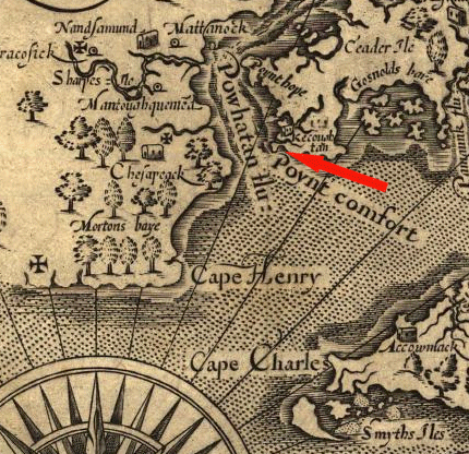
Point Comfort, as displayed on the map produced by Captain John Smith; "Powhatan flu" is now the James River
(NOTE: map is oriented with west at the top, not north - so the Chesapeake Bay extends to the right)
Source: Library of Congress
Cape or Point Comfort is the southern tip of the city of Hampton, at the site of Fort Monroe now. It is the entrance to Hampton Roads, where the James River flows into the Chesapeake Bay. Point Comfort was named by Captain John Smith in 1608, because it was "comforting" for sailors to see the mainland after entering the Chesapeake after an ocean crossing. Known today as "Old" Point Comfort, it is slightly south of "New" Point Comfort at the eastern edge of Mathews County.
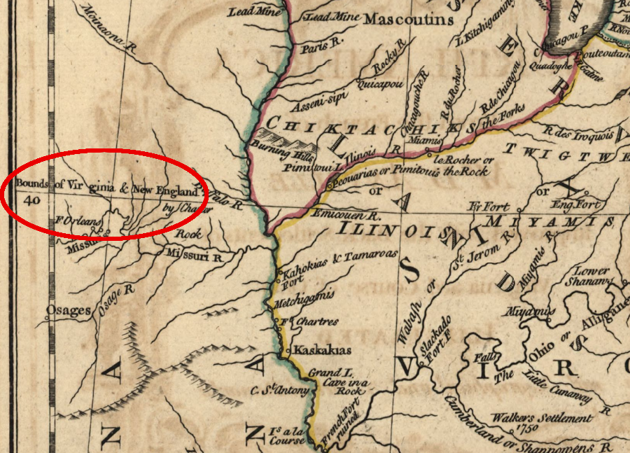
the First Charter in 1606 defined overlapping boundaries where settlement was authorized for both the London and Plymouth companies
Source: William E. Peters, Ohio Lands and Their Subdivision (p.104)
The Virginia claim based on the Second Charter included 469,000 square miles, nearly 1/3 of the land east of the Mississippi River. Modern Virginia is less that 10% of that area, with 42,755 square miles (39,481.4 square miles of land and 3,293.4 square miles of water).
The Third Charter was issued on March 12, 1612 - or 1611, if dated by the Old Style calendar. Until 1752, the new year in England started not on January 1 but on March 25. The date of the Third Charter was in 1611 by the Old Style Calendar and in 1612 under the New Style calendar - so March 12, 1611/12 refers to 1612 in today's calendar.
The Third Charter gave the colony a claim to all lands between 34-41 degrees, and expanded Virginia's colonial boundaries further into the Atlantic Ocean beyond the 100 miles authorized in the First and Second charters. The Third Charter gave the islands offshore to "The Treasorer and Planters of the Cittie of London for the First Colonie in Virginia," stating:
- all and singuler the said iselandes [whatsoever] scituat and being in anie part of the said ocean bordering upon the coast of our said First Colony in Virginia and being within three hundred leagues of anie the partes hertofore grannted to the said Treasorer and Company in our said former lettres patents as aforesaid, and being within or betweene the one and fortie and thirty degrees of Northerly latitude...5
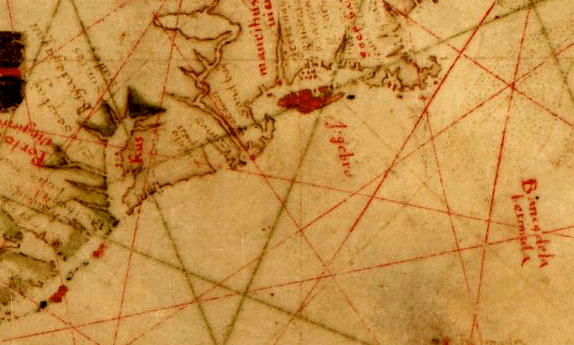
1633 map showing Bermuda, off the coast of North America
Source: Library of Congress, Pascoal Roiz, A portolan chart of the Atlantic Ocean and adjacent Continents
Why did the Virginia Company investors obtain the territorial expansion by the king in 1612? The leaders of the Third Supply fleet, sailing to the colony in 1609, wrecked on Bermuda. They spent the winter of 1609-10 on the island, and it provided a surplus of food - in clear contrast to the starvation at Jamestown during that same winter.
The flagship vessel of the nine ships in the Third Supply fleet was the Sea Venture. It was separated from the other eight ships in a hurricane, and came close to sinking. The vessel was sailed onto the reef at Bermuda, and everyone escaped onto the dry land. The shipwrecked Englishmen spent ten months in 1609-10 salvaging the materials from the Sea Venture and building two new vessels in Bermuda, the Patience and the Deliverance.
The unplanned stay in Bermuda tested the authority of the colonial officials on their way to governing the Virginia colony in Jamestown. Some sailors considered their obligations to have been completed once the trip ended in Bermuda. One of Governor Gates' clerks, thought to be Stephen Hopkins, claimed that the governor's authority was valid only in Virginia and not on Bermuda. While most of those shipwrecked were busy building two smaller ships from the remains of the wrecked flagship, the Sea Venture, some rebelled. In the end, one rebel was executed, but Hopkins survived.
The Patience and Deliverance both reached Jamestown in 1610, just before Lord de la Ware brought another relief fleet with essential food and supplies. Shakespeare may have incorporated stories about the Sea Venture shipwreck into his play "The Tempest," after Patience sailed back to England.
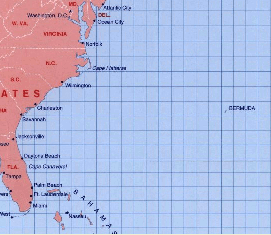
modern map showing Bermuda
Source: Library of Congress, Atlantic hurricane tracking chart/NOAA
Bermuda is roughly 600 miles offshore from North Carolina. That put it outside the 100-mile limit of islands to be included in Virginia, according to the first two charters. The 1612 Third Charter extended the colonial boundary to include islands up to 300 leagues offshore. As a result of the modification, after 1612 Virginia extended up to 1,000 miles eastward in the Atlantic Ocean.
The Bermuda colonization was very successful, but the size of the island limited the potential profits from either agriculture or selling land. The Virginia Company venture capitalists in London "spun off" their investment. They arranged for James I to issue a separate charter for the island in 1615 and sold the rights to Bermuda to those investors who were most interested, splitting the island from the colony of Virginia.
Those capitalists in England who "adventured" their funds in the Virginia colony received little return on their investment. The Virginia Company changed its approach in 1618, issuing a "Great Charter" that ended martial rule and established a representative assembly. That charter was issued by the company rather than by the kink, and had no effect on the boundaries of the colony.
King James I failed to renew the Virginia Company's charter in 1624, and made Virginia a royal rather than a proprietary (private) colony. By canceling the corporate charter, King James made stock in the Virginia Company worthless, the equivalent of declaring the company to be bankrupt. The venture capitalists who bought stock in Virginia did not make a profit on their investment, even after being given a massive amount of free real estate.
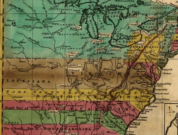
When later kings chose to create new proprietary colonies in Maryland and Carolina to reward new friends, their grants of land reduced the boundaries of Virginia. The shrunken boundaries diminished the ability of Virginia officials to sell rights to vast amounts of land. Virginia's northern boundary with Maryland was redefined in 1632 to be the edge of the Potomac River. The southern boundary with North Carolina was defined by a straight line based on latitude in 1663. When the boundary was moved slightly north in 1665, it was still defined by latitude rather than natural features.
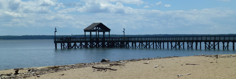
the beach is in Virginia (at Leesylvania State Park), but the boardwalk is in Maryland - thanks to a 1632 charter
After changing the boundaries of the Virginia colony, the Stuart kings did not compensate their subjects in Virginia or investors in England - and certainly did not compensate the Native American inhabitants. King James I and II, and King Charles I and II emphasized their power and marginalized the role of others, including Parliament. Their "divine right of kings" approach stimulated the English Civil War in 1642 and the Glorious Revolution in 1688, and led to the Virginia colonists "thrusting out" Governor Harvey in 1635 after he supported the transfer of Kent Island to Maryland, but Virginia colonists were unable to alter boundary decisions made in London.
Changes in the boundaries of the Virginia colony after 1612 did cause angst in Jamestown, when the king chartered new colonies within the area defined as Virginia in the Third Charter. The Virginia colonial officials lost authority to grant property deeds ("patents") to northern lands in New England (in 1620, with control over land north of the 40th parallel) and in what became Maryland (in 1632, north of the Potomac River).
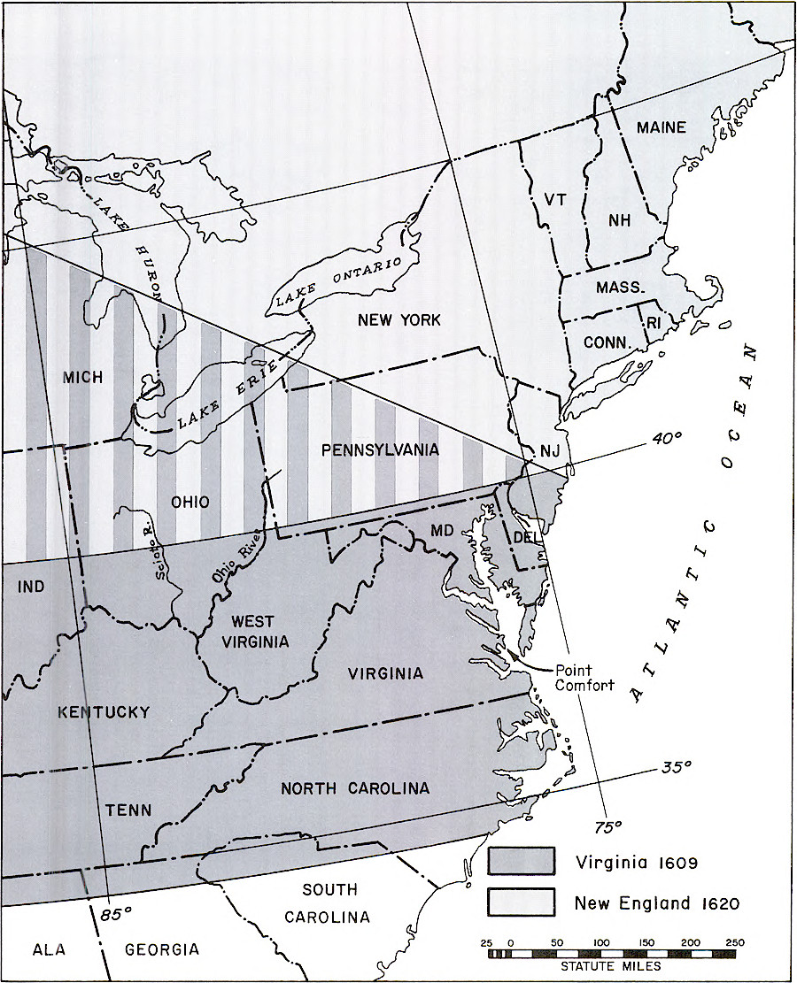
land claims based on the 1620 charter to Massachusetts conflicted with the claims based on the 1612 charter to Virginia
Source: Bureau of Land Management, A History of the Rectangular Survey System: Volume 2 (Figure 1)
Lands to the south became part of a separate Carolina colony. A 1629 charter to an ally of Charles I, Sir Robert Heath, included lands between 31-36 degrees of latitude. That grant was never implemented due to the English Civil War. When Charles II granted the same land to eight Lords Proprietors in 1663, Virginia's southern border was once again defined at 36 degrees of latitude.
In 1665, the border was moved north a half-degree to 36 degrees, 30 minutes, giving the Carolina proprietors full control over the navigable parts of Albemarle Sound - plus land along the shoreline, whose settlers wanted to ship tobacco/lumber to England without paying export taxes to the Virginia colony.
In 1705, Robert Beverley described the extent of Virginia with specific limits on north, east, and south, but with the western edge extending all the way to the Pacific Ocean:6
- Virginia thus consider'd, is bounded on the South by North Carolina; on the North by Patowmeck River, which divides it from Maryland; on the East by the main Ocean, called the Virginia Seas; and on the West and North-West by the Californian Sea, whenever the Settlements shall be extended so far.
Virginia's claim to land stretching all the way across the continent to "the Californian Sea" ended in 1763. At the end of the French and Indian War (known as the Seven Years War in Europe), negotiators in Paris determined a new boundary for the western edge of Virginia.
France regained control over the Caribbean sugar islands that the British had captured (Martinique, Guadeloupe, and St. Lucia). In return, France abandoned nearly all of its land claims in North America and transferred control over the Louisiana Territory and New Orleans to Spain. The 1763 Treaty of Paris established the middle of the Mississippi River as the new line defining the western boundary of Virginia.7
on the 1755 Mitchell map, lands west of the Mississippi River between the 36° 30' line of latitude on the south and the 40° line on the north were identified as part of Virginia
Source: Library of Congress, John Mitchell, A map of the British and French dominions in North America, with the roads, distances, limits, and extent of the settlements
after the 1763 Treaty of Paris ended the French and Indian War, English officials recognized that Spain controlled the Louisiana Territory and Virginia no longer extended west of the Mississippi River
Source: Library of Congress, John Mitchell, A map of the British and French dominions in North America, with the roads, distances, limits, and extent of the settlements
mapmakers in England assumed at the start of the American Revolution that Virginia controlled land west of the Pennsylvania and New Yok borders
Source: Library of Congress, An Accurate map of the present seat of war between Great-Britain and her colonies in North America (by John Hinton, 1776)
The claim to political authority over the lands defined in the charters is still part of the Code of Virginia, along with the official release of the Virginia claim to some or all of Maryland, Pennsylvania, North and South Carolina. Title 1, Section 1-301. "Extent of territory of the Commonwealth after the Constitution of 1776" says:8
- The authorities in determining the extent of the territory of the Commonwealth after the adoption of the Constitution of 1776 shall consist of:
- 1. The charter of April 10, 1606, granted by James the First, in the fourth year of his reign, that authorized the first plantation at any place upon the coast of the Commonwealth between the thirty-fourth and forty-first degrees of north latitude; and granted the territory from the seat of the plantation (which under this charter was begun at Jamestown), for 50 miles along the coast towards the west and southwest, as the coast lay, and for 50 miles along the coast, towards the east and northeast, or towards the north, as the coast lay, together with all the islands within 100 miles directly over against the seacoast, and all the territory from the same 50 miles every way on the seacoast, directly into the mainland for the space of 100 miles.
- 2. The second charter of James, dated May 23, 1609, in the seventh year of his reign, that granted all the territory from the point of land called Cape or Point Comfort, all along the seacoast to the northward 200 miles, and from the point of Cape Comfort all along the seacoast to the southward 200 miles, and all that space and circuit of land lying from the seacoast of the precinct, up into the land, throughout from sea to sea, west and northwest, and also all the islands lying within 100 miles along the coast of both seas of the precinct aforesaid.
- 3. The third charter of James, dated March 12, 1611-12, in the ninth year of his reign, that granted all the islands in any part of the seas within 300 leagues of any territory granted in the former patents.
- 4. The 1763 treaty of peace between Great Britain and France that established a line along the middle of the river Mississippi and became the Commonwealth's western boundary
- 5. Section 21 of the Constitution of Virginia adopted June 29, 1776, that ceded, released, and confirmed to the people of Maryland, Pennsylvania, North and South Carolina, such parts of the territory of the Commonwealth as were contained within the charters erecting those colonies, with all the rights in those parts that might have been claimed by the Commonwealth, except the free navigation of the Rivers Potomac and Pocomoke, with the property of the Commonwealth shore or strands bordering on either of the rivers, and all improvements thereon; and that at the same time laid down in the section that the western and northern extent of the Commonwealth should in all other respects stand as fixed by the charter of James the First, granted in 1609, and by the treaty of peace between Great Britain and France in 1763, unless by act of the legislature one or more territories should thereafter be laid off, and governments established, westward of the Allegheny mountains.
- Section 1-303 in the Code of Virginia documents Virginia's cession of territory northwest of Ohio River in the 1780's, after the Federal government met Virginia's requirements for accepting and governing the Northwest Territory.
- Section 1-300 acknowledges the impact on the state's boundaries due to the defeat of the Confederacy in the 1861-65 Civil War:
- The territory and boundaries of the Commonwealth shall be and remain the same as they were after the Constitution of Virginia was adopted on June 29, 1776, except for the territory that constitutes West Virginia and its boundaries, and other boundary adjustments as provided in this chapter.
westward extension of land claims by English colonies, 1755
Source: Library of Congress, A Map of the British and French settlements in North America
Virginia's northern boundary was limited at 40th degree of latitude by the 1620 charter to New England colony
Source: Library of Congress, A general topography of North America and the West Indies (by Thomas Jefferys, 1768)
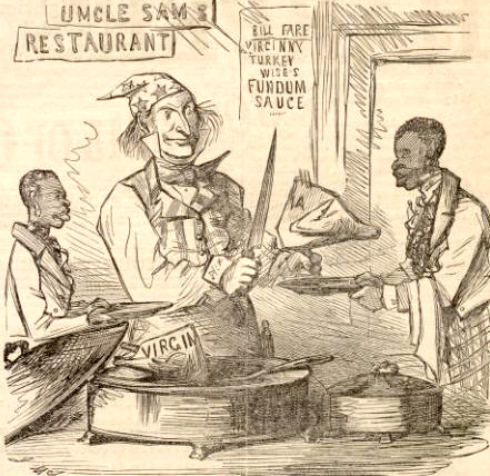
During the Civil War, Virginia was carved up. One-third of its land area was used to create the new state of West Virginia in 1863. The removal of the western counties was a significant alteration of the boundaries, but an even more dramatic change had been proposed by Secretary of War Simon Cameron in 1861.
Cameron suggested that creating a buffer of "safe" territory around Washington DC by transferring all of Virginia east of the Blue Ridge (except for the Eastern Shore) to Maryland, and realigning the boundaries of Maryland and Delaware based on natural boundaries:9
- The geographical position of the metropolis of the nation, menaced by the rebels, and required to be defended by thousands of our troops, induces me to suggest for consideration the propriety and expediency of a reconstruction of the boundaries of the States of Delaware, Maryland, and Virginia.
- Wisdom and true statesmanship would dictate that the seat of the National Government, for all time to come, should be placed beyond reasonable danger of seizure by enemies within, as well as from capture by foes from without.
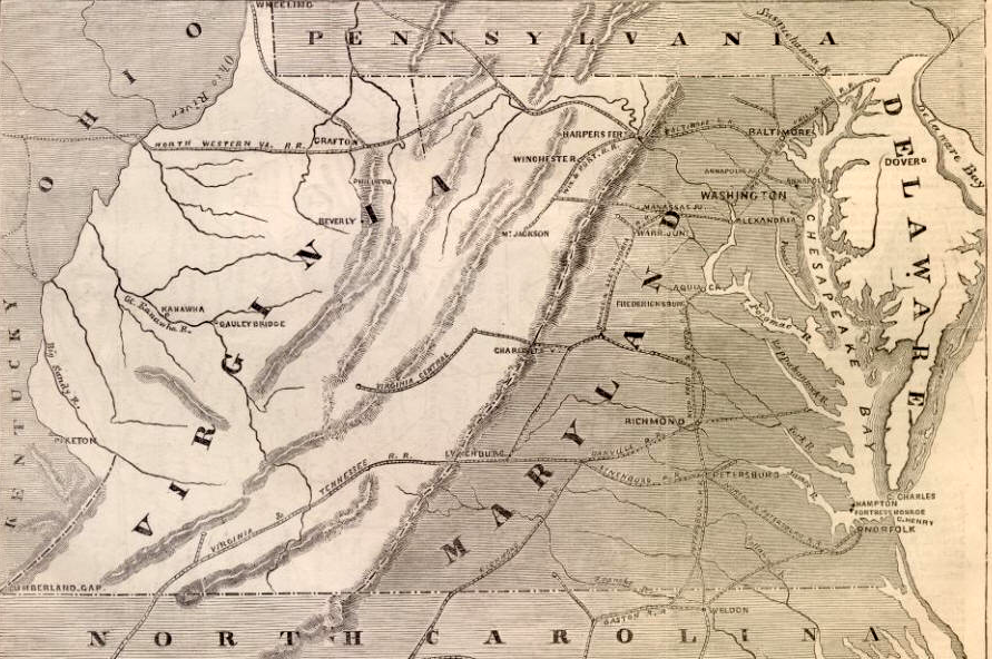
since West Virginia was established, Virginia shares boundaries with five other states
Source: Virginia: a geographical and political summary (published in 1876)
Cameron's plan would have made Virginia an inland state with no coastal waterfront, and reduced the potential of enemy forces controlling the heights of Arlington, by:
- adding the western edge of Maryland to Virginia, using the Blue Ridge to define the new state boundary
- transferring all territory east of the Chesapeake Bay to Delaware, using the Chesapeake Bay as a natural border on the east
- returning Virginia's Alexandria County to the District of Columbia, undoing the retrocession of 1846
Secretary of War Simon Cameron proposed shifting the Eastern Shore to Delaware, transferring the Piedmont/Coastal Plain regions of Virginia to Maryland
Source: Harpers Weekly (digitized by "Son of the South), Map Showing The New Boundaries Of Virginia, Maryland, And Delaware As Proposed By Secretary Cameron (December 21, 1861)
northern officials considered various ways of altering Virginia's boundaries to reduce the potential of hostile forces threatening Washington DC after the Civil War
Source: Harpers Weekly (digitized by "Son of the South), Chief Cook Cameron Divides The Virginia Goose Between Maryland And Delaware (December 21, 1861)
the Virginia-North Carolina border was defined initially by the 1728 "dividing line" survey, and in 1749 Joshua Fry and Peter Jefferson extended it further west to Steep Rock Creek in the Blue Ridge
Source: Library of Congress, A map of the most inhabited part of Virginia containing the whole province of Maryland with part of Pensilvania, New Jersey and North Carolina
Links
- Avalon Project at Yale Law School: Documents in Law, History and Diplomacy
- Boundaries of the Commonwealth (Title 1 Chapter 3.1 of the Code of Virginia)
- Council of State Governments - Boundary Compacts legislation
- Virginia and West Virginia Boundary Agreement of 1863 Virginia: Constitution of West Virginia, *Virginia Acts (Wheeling) 1862-63, Ch. 54, p.38; *Virginia Acts (Wheeling) 1862-63, Ch. 78, p. 65. *Upheld by Virginia v. West Virginia 1870 U.S. 11 Wall. 39. [1861] Virginia and West Virginia Boundary Compact of 1959 Virginia: 1959 Acts of Assembly, Extra Session, Ch. 44, p. 122, approved April 24, [1959]
- Virginia-District of Columbia Boundary Line Compact of 1946 Virginia: 1946 Acts of Assembly, Ch. 26, p. 47 [1946]
- Virginia-Kentucky Boundary (Kentucky and Virginia Jurisdiction Act of 1789) Virginia: Code 1950, Sec.7.1-6 [1789 (convention enacts articles), 1791 (articles become binding compact), 1792 (boundary becomes official)]
- Virginia-Maryland Boundary Agreement of 1878 Virginia: Code 1950, Sec.7.1-7 [1878 (as amended), superseded Maryland-Virginia Compact of 1785]
- Virginia-North Carolina Boundary Agreement of 1791 Virginia: Code 1950, Sec.7.1-4 [1791]
- Virginia-North Carolina Boundary Agreement of 1970 Virginia: 1970 Acts of Assembly, Ch. 343, p. 578 [1970]
- Virginia-Tennessee Boundary Agreement(s) Virginia: Code 1950, Sec.7-4 [1803 and 1901]
- From Revolution to Reconstruction, A Hypertext on American History from the colonial period until Modern Times, University of Groningen in The Netherlands
- Census Bureau - Boundary Changes - Virginia (from the Boundary and Annexation Survey)
- Colonial Grants, 1606 and 1620
- Charting the Future: Famous Explorers and Expeditions from Virginia (with a clickable map showing the James River to be only a 10-day walk from the Pacific Ocean)
- English Colonies in North America, 1660
- Evolution of the Mason-Dixon Line (NOTE: a 1909 publication...)
- Notes on the State of Virginia, by Thomas Jefferson: "Boundaries of Virginia" An exact description of the limits and boundaries of the state of Virginia
- Minerals Management Service - Outer Continental Shelf
- Plimouth Plantation
- Plymouth Colony Archive Project at the University of Virginia
- Potomac River boundaries (as defined for fishing licenses)
- Public Land Survey (and Virginia's cession of land claims)
- Rising Seas, Coastal Erosion, And The Takings Clause: How To Save Wetlands And Beaches
Without Hurting Property Owners (Maryland Law Review)
- Stephen Hopkins
- The Growth of Virginia's Boundaries (an excellent paper by Karl Phillips, from the 1999 class...]
- The Virginia Company Of London, 1606-1624, by Wesley Frank Craven
- Virginia Legislative Information System
- Virginia Marine Resources Commission - Boundaries
- Virginia Water Resources Research Center (Virginia Tech) - Public Recreational Rights on Virginia's Inland Streams (dealing with navigability and public ownership of riverbeds)
- William Byrd II
the Popham colony started by the Plymouth Company failed, leaving the Virginia Company with no competition in England regarding its northern boundary until Maryland was chartered in 1632
Source: The Southern States of America (published in 1909)
References
1. John Smith, The generall historie of Virginia, New England & the Summer Isles, together with The true travels, adventures and observations, and A sea grammar - Volume 1, Chapter XII. The Arrivall of the third Supply, published 1624, http://hdl.loc.gov/loc.gdc/lhbcb.0262a, (last checked August 10, 2009)
2. First Virginia Charter, 1606 (last checked August 10, 2009). In the 1584 charter, Queen Elizabeth promised Sir Walter Raleigh and his investors exclusive control over any settlement within 200 leagues, or nearly 700 miles.
3. Grizzard, Frank E. and Smith, D. Boyd, Jamestown Colony: A Political, Social, and Cultural History, ABC-CLIO, Santa Barbara, 2007, p. 189-190, http://books.google.com/books?id=555CzPsGLDMC; C. Albert White, A History of the Rectangular Survey System, Volume 2, Bureau of Land Management, 1983, p.2, https://books.google.com/books?id=1-BcVn3VhPQC; Jeffrey P. Brain, "The John Hunt Map of the First English Colony in New England," Northeast Historical Archaeology, Volume 37, Article 6, 2008, pp.69-71, https://doi.org/10.22191/neha/vol37/iss1/6; "The Popham Colony," Maine's First Ship, https://mfship.org/home/history/popham-colony/ (last checked August 5, 2023)
4. "The Second Virginia Charter 1609," American History from Revolution to Reconstruction and Beyond, University of Groningen, http://www.let.rug.nl/usa/documents/1600-1650/the-second-virginia-charter-1609.php (last checked October 31, 2019)
5. "The Third Virginia Charter 1612," American History from Revolution to Reconstruction and Beyond, University of Groningen, http://www.let.rug.nl/usa/documents/1600-1650/the-third-virginia-charter-1612.php; "Virginia", Census Bureau, https://data.census.gov/profile/Virginia?g=040XX00US51; "Could Virginia (which once included Detroit) have become a mega state?," Cardinal News, January 13, 2026, https://cardinalnews.org/2026/01/13/could-virginia-which-once-included-detroit-have-become-a-mega-state/ (last checked February 1, 2026)
6. Robert Beverley, The History and Present State of Virginia, In Four Parts - The Natural Productions and Conveniencies of the Country, Suited to Trade and Improvement, 1705, Book II, p.3 (online at University of North Carolina at Chapel Hill digital library, Documenting the American South), http://docsouth.unc.edu/southlit/beverley/beverley.html (last checked December 25, 2013)
7. "Treaty of Paris, 1763," Office of the Historian, US Department of State, https://history.state.gov/milestones/1750-1775/treaty-of-paris; "Treaty of Paris 1763," The Avalon Project, https://avalon.law.yale.edu/18th_century/paris763.asp (last checked July 23, 2019)
8. Code of Virginia, Title 1, Section 1-301., http://leg1.state.va.us/cgi-bin/legp504.exe?000+cod+1-301 (last checked August 10, 2009)
9. Simon Cameron, "Report of the Secretary of War," December 1, 1861, p.13, http://books.google.com/books?id=hb1MAAAAYAAJ (last checked June 22, 2014)
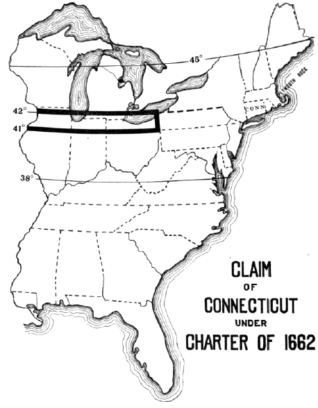
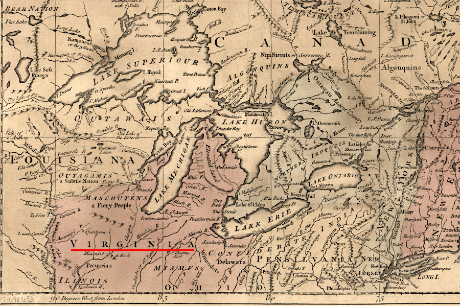
Virginia's claim to the Northwest Territory across the Ohio River was contested by Connecticut as well as other colonies, until all states ceded their claims to the Continental Congress
Source: William E. Peters, Ohio Lands and Their Subdivision (p.148)
Mapping Virginia
Virginia Places