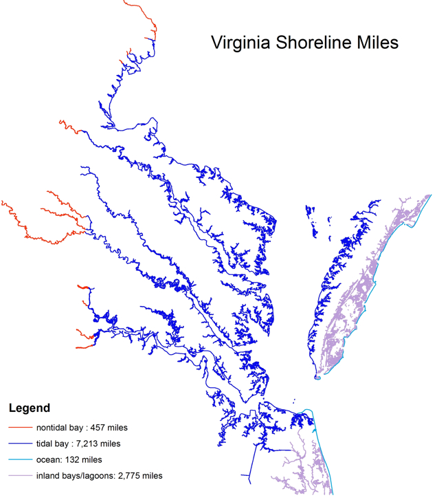
shoreline of Virginia, as mapped by the Virginia Institute of Marine Sciences
Source: Virginia Institute of Marine Sciences (VIMS), How long is Virginia's shoreline?
shoreline of Virginia, as mapped by the Virginia Institute of Marine Sciences
Source: Virginia Institute of Marine Sciences (VIMS), How long is Virginia's shoreline?
According to the Virginia Institute of Marine Sciences (VIMS), Virginia has 7,213 miles of shoreline at sea level. That includes the edges of land and water for the Atlantic Ocean, Chesapeake Bay, and tidewater rivers:1
The Office for Coastal Management in the National Oceanic and Atmospheric Administration used nautical charts to identify 3,315 shoreline miles in Virginia. That number is based on shorelines of offshore islands, sounds, bays, rivers, and creeks to the head of tidewater or to a point where tidal waters narrow to a width of 100 feet.2
A report by the Congressional Research Service identified just 112 miles of "general coastline" for Virginia. The report noted the difficulty in calculating shoreline mileage, and how it can vary significantly depending upon the scale of the charts being used:3
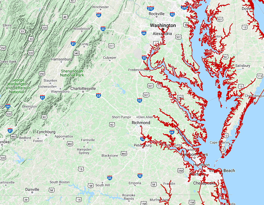
shoreline of Virginia, as mapped by the National Oceanic and Atmospheric Administration
Source: National Oceanic and Atmospheric Administration (NOAA), NOAA Shoreline Data Explorer
Along the tidal portion of the Potomac River, private land extends to the low-water mark on the shoreline, and that has been defined by an unchanging survey line. Virginia and Maryland resolved their disputes over control of the Ptomac River shoreline, which dated back to 1632, in the 1877 Black-Jenkins arbitration decision. Virginia was granted control down to the low-water mark on the river's edge.
To eliminate confusion regarding the location of the low-water mark as erosion and accretion altered the shoreline, the two states commissioned Edward B. Mathews from Maryland and Wilbur A. Nelson from Virginia to survey a fixed line in 1927. They created a set of straight lines going from headland to headland, so shallow-water embayments were granted to Virginia. The survey lines were marked by 58 concrete monuments placed on the headlands.4
On the Chesapeake Bay and Atlantic Ocean shorelines, private property boundaries extend to the mean low-water mark. Before constraints of zoning and building restrictions based on flood plains, private houses could be constructed down to the edge of the water. A sandy beach above the mean low-water mark is private property, and landowners can block the public from walking on it.

above the mean low-water mark, land is private and posted "No Trespassing," as at Salt Ponds in the City of Hampton
The state owns the submerged lands below the mean low-water boundary line for Chesapeake Bay and Atlantic Ocean beaches, and along the tidewater rivers in Virginia. The public may not trespass on private property that has been posted, but people could walk on state-owned submerged land in the water - so long as they always stay below the mean low-water mark.5
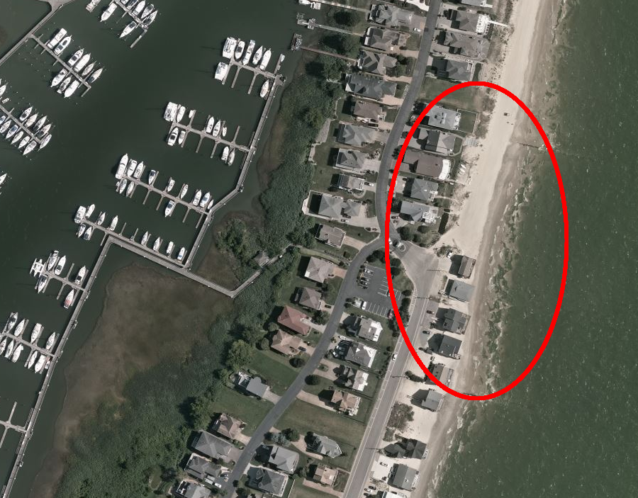
south of the public parkland at Salt Ponds, houses have been built on private land as close as possible to the mean low-water mark (City of Hampton)
Source: Virginia Department of Transportation, Bridges and Culverts
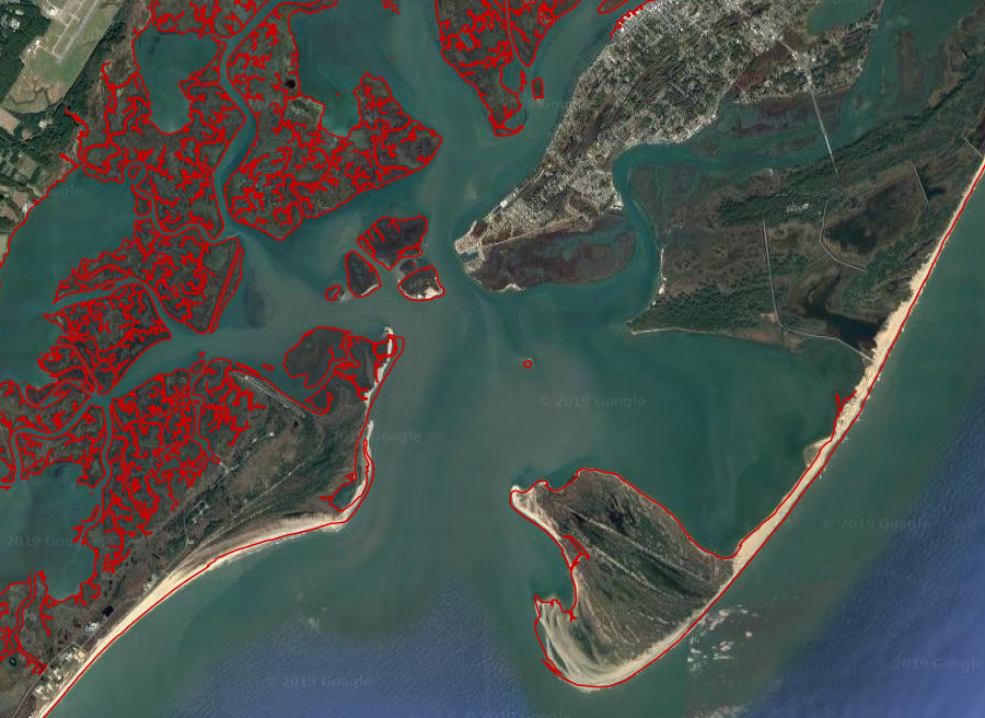
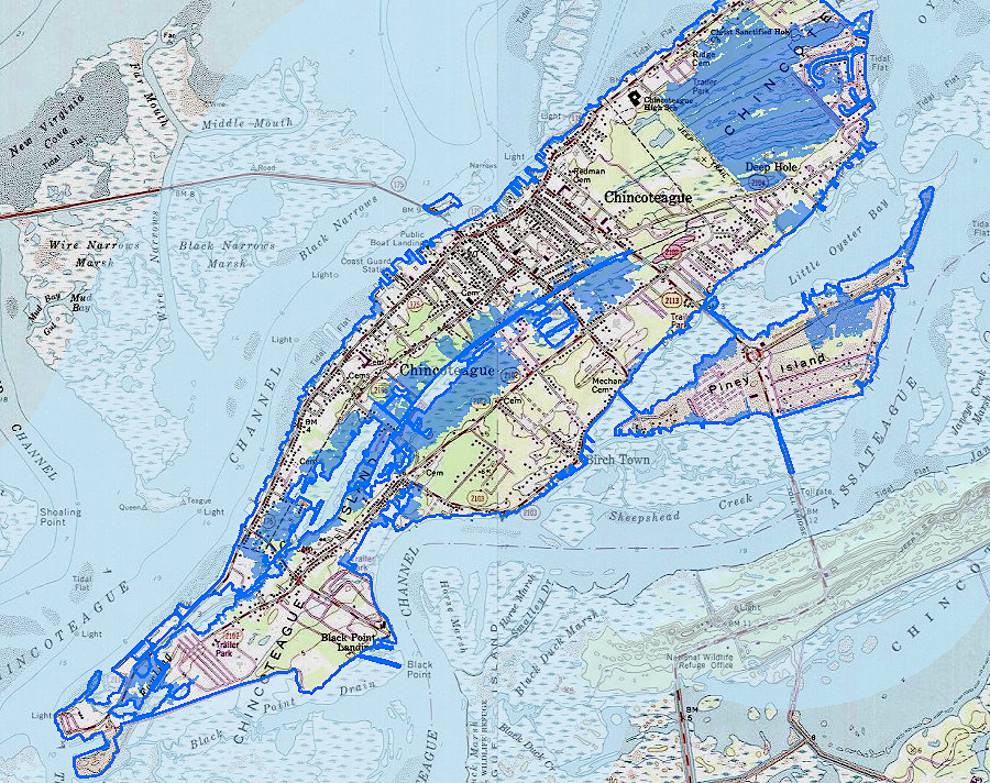
maps get outdated as shorelines change dynamically at Chincoteague and Wallops Island
Source: National Oceanic and Atmospheric Administration, NOAA Shoreline Data Explorer
rising sea levels will change shorelines; much of Chincoteague Island could be underwater by 2040
Source: Virginia Institute of Marine Sciences (VIMS), Sea Level Rise - Accomack County