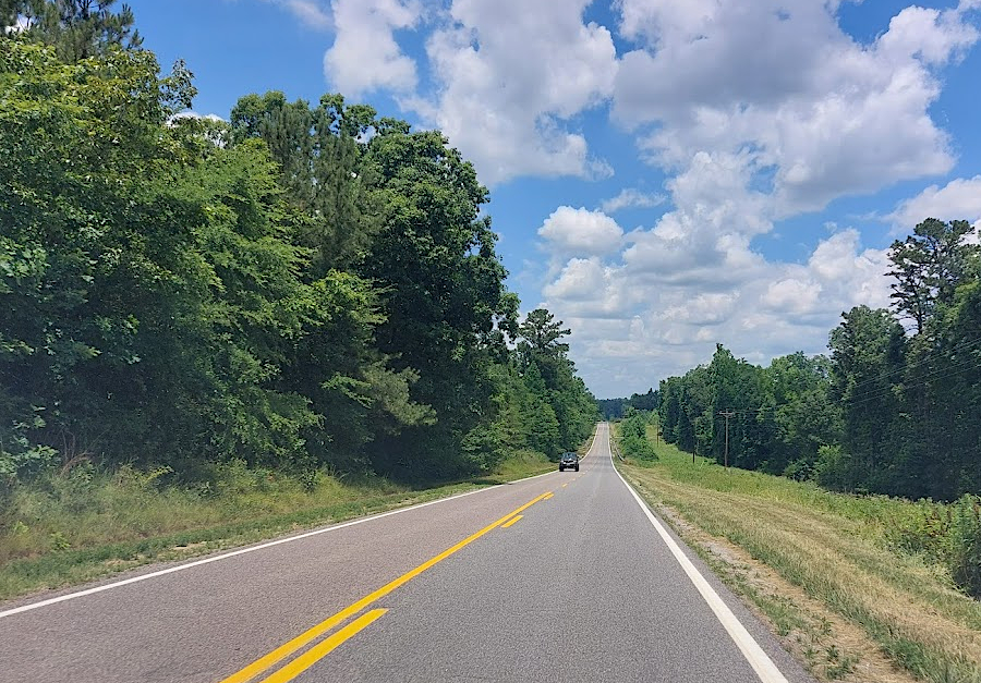
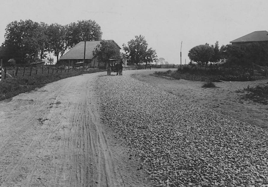
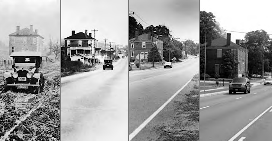
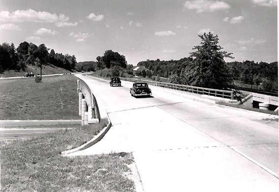
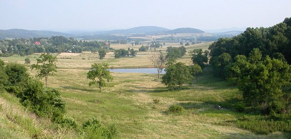
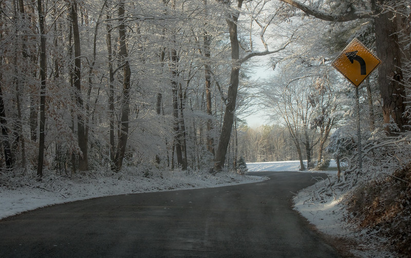
highway vista in Nottoway County
"And we came upon a greate wyde roade of a rod in breadthe and we followed it several dayes and to our greate dysmaye found oursylves backe at the pointe from whence we cayme"
(how former Professor Jim Fonseca at George Mason University once suggested that John Smith would have described Interstate 495, the Capital Beltway.)
highway vista in Nottoway County
The car window is a movie screen. Drivers and passengers can watch a bigger image than IMAX. The color is much richer than what is projected in a movie theater and far more detailed than television.
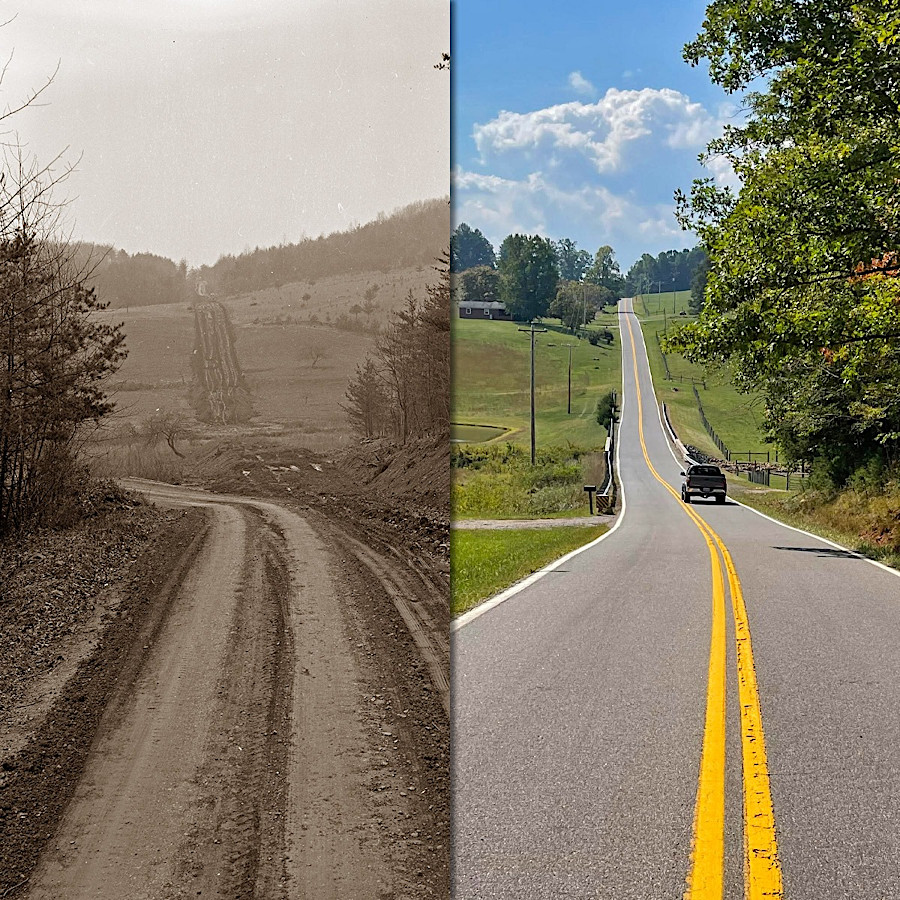
Some Virginia roads started as animal paths, were used as Native American trails, then were upgraded to wagon roads by the European immigrants. The trade in deerskins and other furs in the 1600's required carrying heavy loads on someone's back until a river provided a pathway to the market.
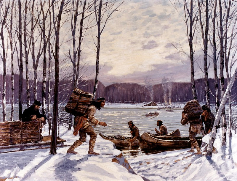
for Native Americans to trade deerskins and furs from the backcountry in the 1600's, they had to haul them by foot and canoe to a trading spot
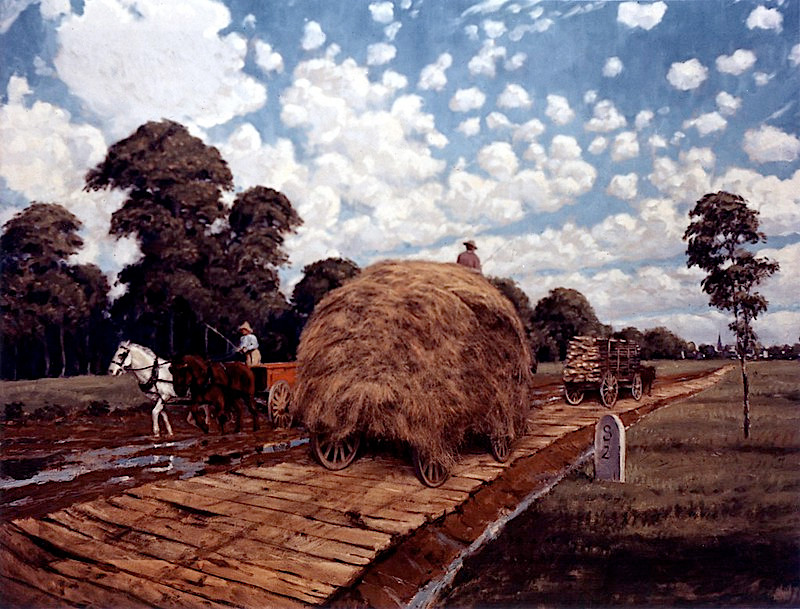
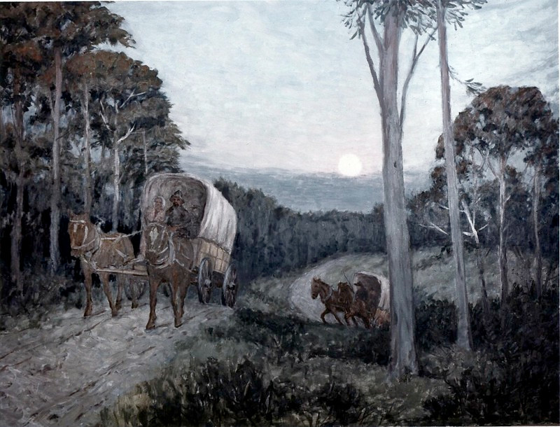
Source: Federal Highway Administration, 1827 - The Northwestern Turnpike (painting by Carl Rakeman)
The European colonists built their first road in Virginia to connect the fort at Jamestown across the peninsula to the dry land upstream of Jamestown "island." They utilized part of an existing trail which connected the site in territory controlled by the Paspahegh tribe to Werowocomoco, where the paramount chief Powhatan lived.
Road construction required packing down the soil and adding a cover of oyster shells. That effort produced a hard surface which archeologists can identify today, though the section of road leading west directly past the fort is covered by the Pitch & Tar Swamp now.
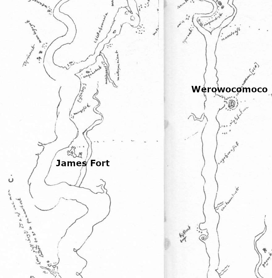
the English who built a fort at Jamestown discovered a trail connecting the site of their fort at Jamestown to Werowocomoco
Source: Encyclopedia Virginia, Zúñiga Chart (map by John Smith, 1608)
On the Coastal Plain, there are few rock "exposures" for development as quarry sites, unlike the basalt at the surface in different locations within the Triassic basins. People walking on the green at Colonial Williamsburg, between the Magazine and the old James City County courthouse, will observe that oyster shells were a common surfacing material in the new capital of the colony.
A century after Jamestown was started, the most-common material used for surfacing a road was still oyster shells. Where timber was readily available, some "plank roads" were built with a wood surface.
Farmers needed roads to get crops to a wharf on a deepwater river channel. Without the ability to export corn, wheat, and pork to customers on Caribbean islands and in Europe, Virginia farmers could only sell to local residents. Within a decade after Jamestown was settled, the population was too low and thinly-dispersed to make farming economical without international shipping to distant markets. Once the Tidewater shoreline was patented and colonists moved inland, the need for roads became critical.
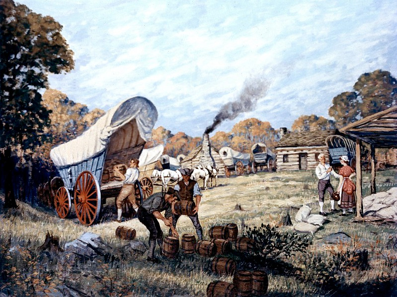
Virginia's most valuable crop was tobacco. Its value was zero, however, unless it could be transported to buyers in Europe. The typical technique was to pack ("prize") as much tobacco into a large wooden barrel ("hogshead") with an axle in the center. The barrel was rolled from farm to wharf on "rolling roads" that were wide/flat enough to allow the transport.
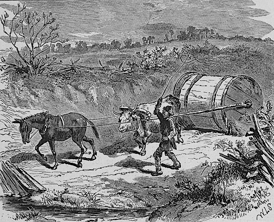
hogsheads filled with tobacco were rolled to market
Source: Slavery Images: A Visual Record of the African Slave Trade and Slave Life in the Early African Diaspora, Transporting Tobacco to Market, near Richmond, Virginia, 1873-74
Starting in 1730, barrels would be opened at tobacco inspection stations located near the wharves. "Trash tobacco" would be removed by the inspectors and burned. Such tobacco had been damaged in transport where hogsheads had leaked, though some was also included by farmers who were paid by the pound irrespective of the quality of their crop.
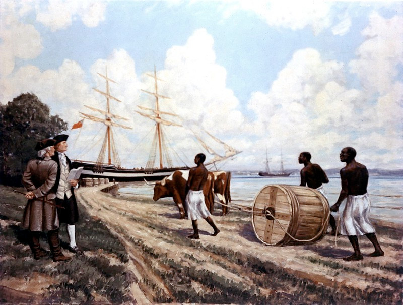
rolling roads allowed tobacco growers to get hogsheads from farms to wharves, for shipment to Europe
Source: Federal Highway Administration, The Tobacco Rolling Road (painting by Carl Rakeman)
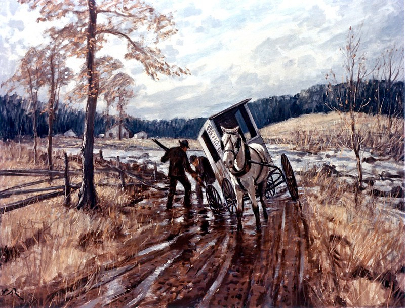
For two centuries, Virginia had only "fair weather" roads. When it rained, the roads would become soft and wagons would get stuck in the mud. Crops stayed on the farm until the roads dried and the dirt surface hardened. A farmer had to calculate if it was worth the effort to make multiple rips with a lightly-loaded wagon, or to wait for a dry spell long enough to allow a heavy load.
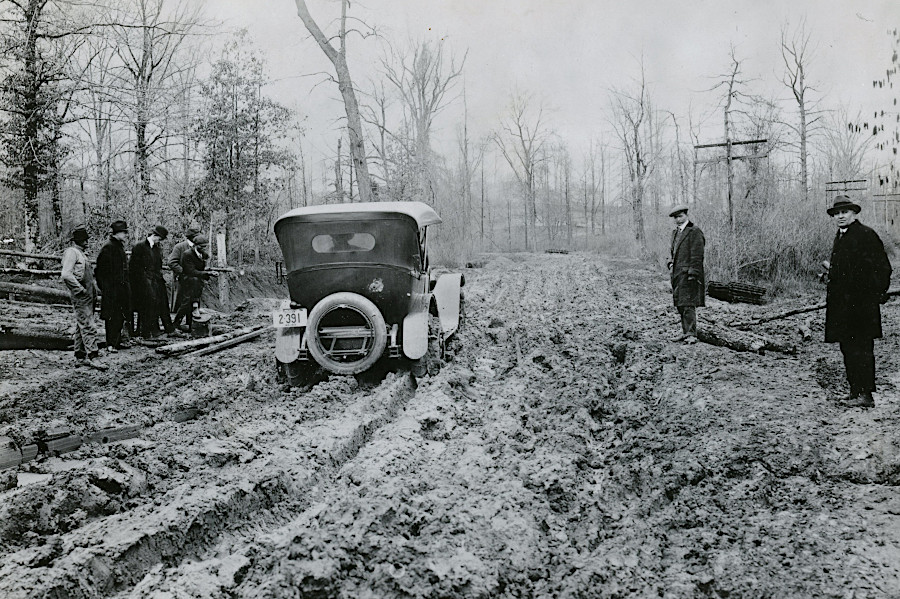
cars struggled to move on dirt roads after it rained
Source: National Archives, Mud Road Near Quantico, Virginia (1919)
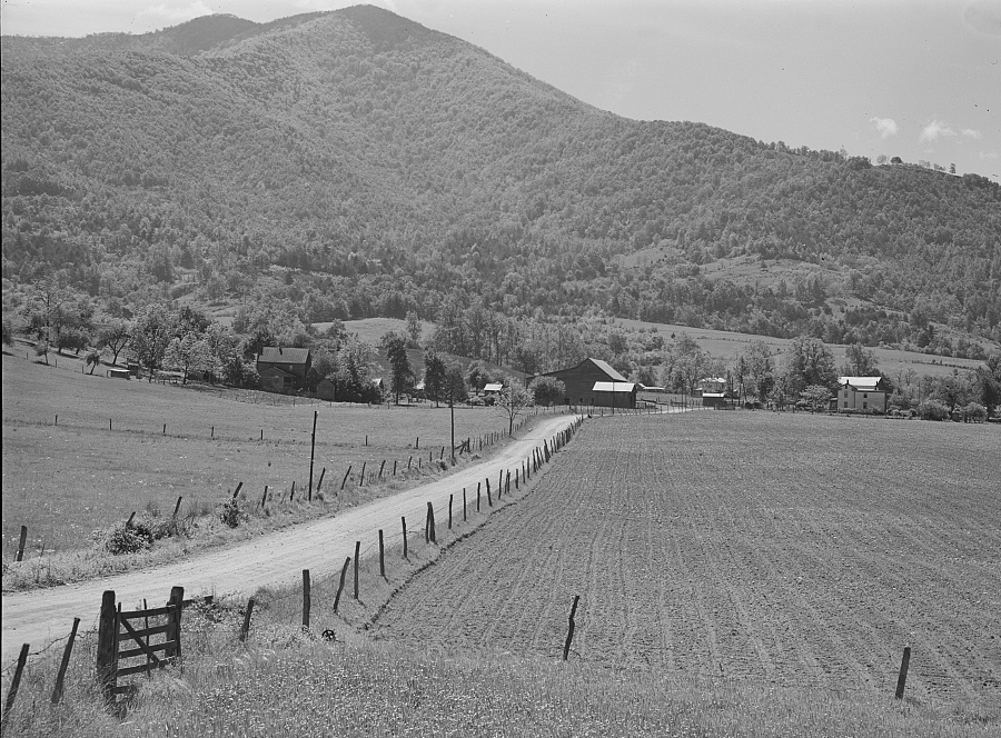
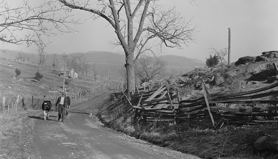
before World War II, most roads in Virginia were unpaved
Source: Library of Congress, Fertile farmland in the Shenandoah Valley, Virginia (by Marion Post Wolcott, May 1941)
The window for shipping via roads was constrained by dry weather as well. During hot and dry summers, road surfaces would be pulverized and wagon drivers would be covered quickly with dust.
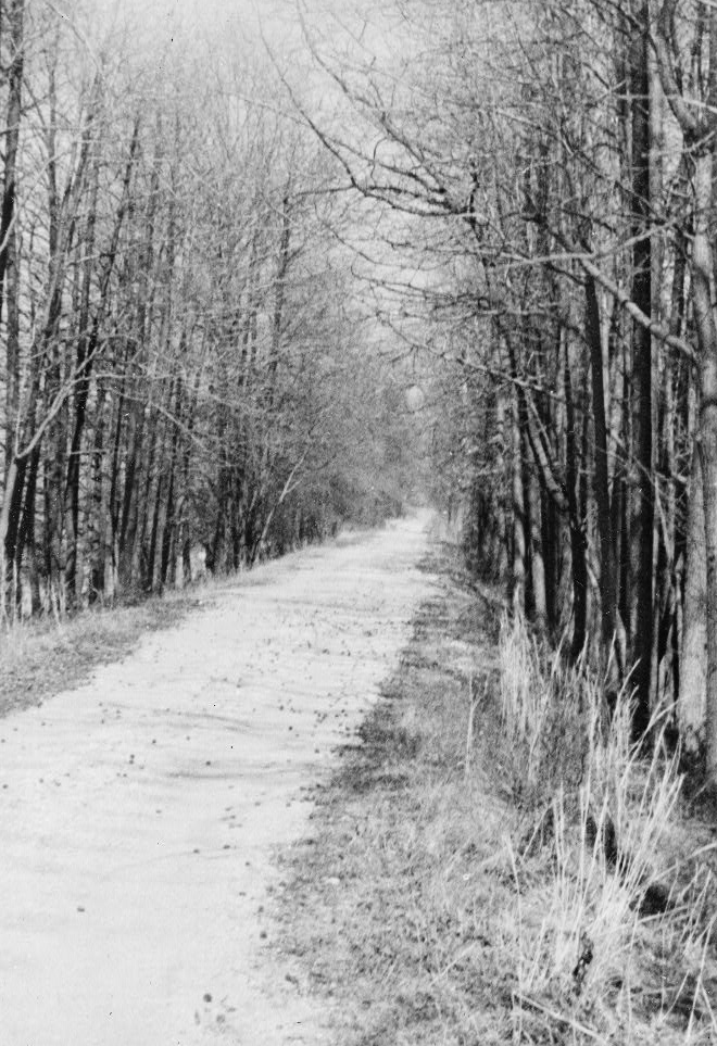
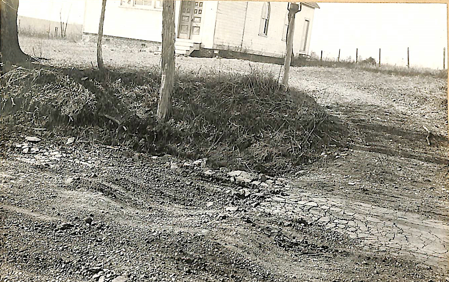
the Kings Highway in Prince William County, traveled by Washington and Rochambeau in 1781, was still unpaved in the 1930's
Source: Library of Congress, King's Highway (Remains), Parallel to U.S. Route 1, Woodbridge, Prince William County, VA
To speed the natural process of drying out the surface, roads were often located on watershed divides where drainage was the fastest. Stream crossings were avoided except at fords, where the water was shallow and the streambed was a hard rocky bottom rather than soft mud. Ferries were established on the north-south roads, to cross Virginia's rivers that flowed east-west.
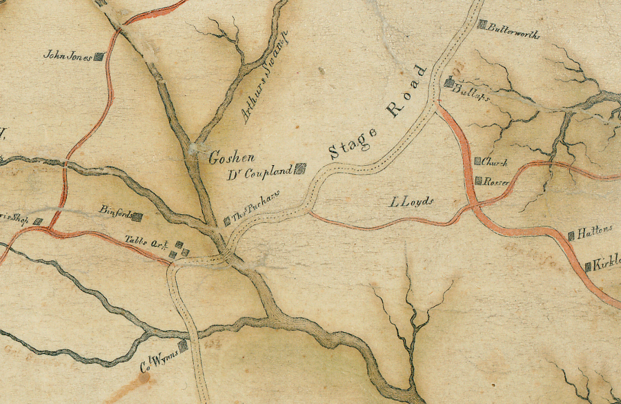
in 1820 the stage road in Dinwiddie County curved to adapt to local topography, unlike modern straight roads
Source: Library of Virginia, A correct map of Dinwiddie County (by Isham E. Hargrave, 1820)
Farmers raising a surplus of grain could minimize the shipping headache by grind grain into more-compact flour, but flour had a higher risk of spoiling before getting to market. A more-stable alternative was to distill grain into whiskey, which was a high-value and low-volume product that was easier to ship.
Imposition of an excise tax on whiskey in 1791 by the new Federal government efforts to tax distilled spirits led to the Whiskey Rebellion, threatening the ability of the new system of government based on the US Constitution. Farmers on the frontier felt that taxing whiskey placed an unfair burden on the people with the hardest transportation challenges.
grain was distilled into whiskey, reducing the transportation costs over poor-quality dirt roads
Source: Federal Highway Administration, 1794 The Whiskey Rebellion (painting by Carl Rakeman)
Chesterfield County claims present-day Midlothian Turnpike (US 60) was the first modern paved road. It was constructed in 1807 from the coal mines at Midlothian to the James River at Manchester.1
Some sort of hard surface is necessary for roads built on the Coastal Plain. Rainwater is trapped by lenses of clay within the sediments; the Cretaceous sediments are not just sandy particles that drain quickly. Wagon wheels cut deeply into the soft ground, and muddy roads after rainstorms can quickly become impassible if not surfaced with some sort of hard material.
Corduroy or "plank" roads were built by cutting trees along the route and laying them perpendicular to the path of travel. They were suitable for short distances, such as swampy areas or the approaches to a stream crossing where there was abundant timber.
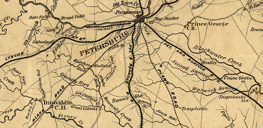
the farm-to-market links to Petersburg in 1860 included railroads and plank roads
Source: Library of Congress, Central Virginia
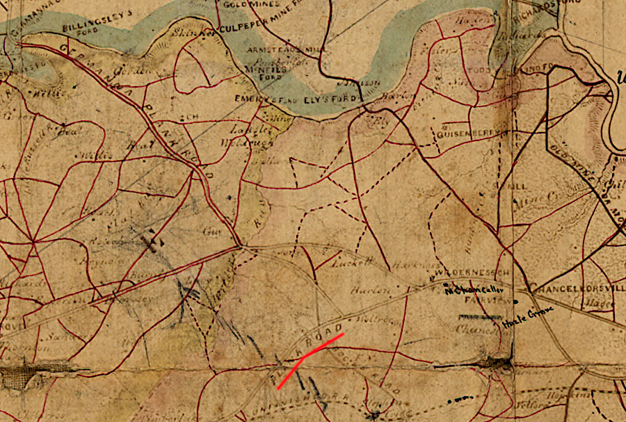
the Orange Plank Road was a key route used by Confederate troops in the 1864 Battle of the Wilderness
Source: Library of Congress, Preliminary map of northeastern Virginia, south of the Rappahannock, east of the Blue Ridge, and north of 38⁰ N. Lat.
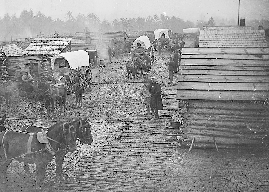
if wood was available, corduroy roads were made in Civil War camps
Source: National Archives, Camp scene. Showing winter huts and corduroy roads
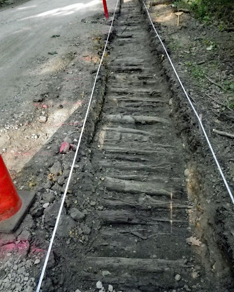
a remnant of a Civil War-era corduroy road was found in 2016 near an entrance to Lake Accotink Park in Fairfax County
Source: Fairfax County Park Authority, History Found Just Below the Surface
Logs placed in swampy soil rot slowly. In a reducing atmosphere without oxygen, the structure of wood and its ability to support a roadbed remains intact. In the 1850's, William Mahone built a 12-mile stretch of the Norfolk and Petersburg Railroad on a corduroy bed through the Great Dismal Swamp. Most of those logs, placed perpendicular to the track and covered initially with dirt excavated from the adjacent swamp, have remained in place for over 150 years.2
corduroy roads relied upon a base of logs, with dirt packed on top
Source: Wikipedia, Corduroy road
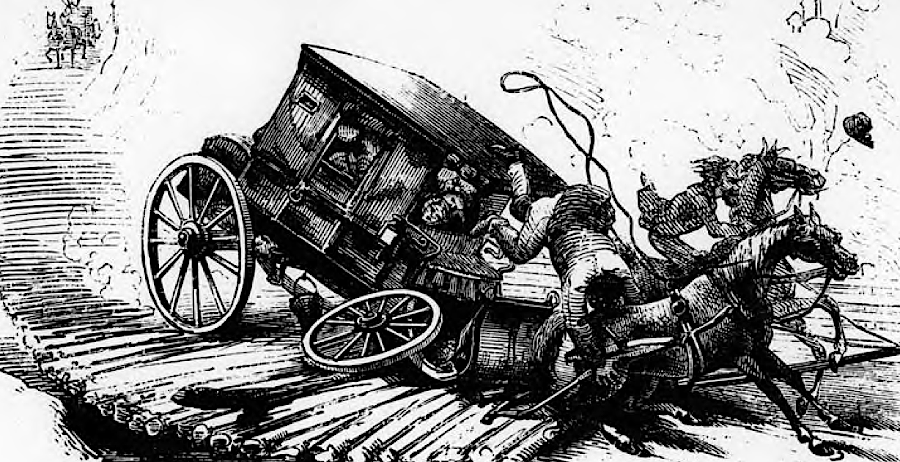
accidents could happen if a wheel left a narrow corduroy road and got stuck in the soft dirt shoulder
Source: Virginia Department of Highways, "The Most Convenient Wayes" - A History of Roads in Virginia (p.13)
Military forces found corduroy roads suitable for short-term transportation challenges, such as the movement of supply wagons and artillery.
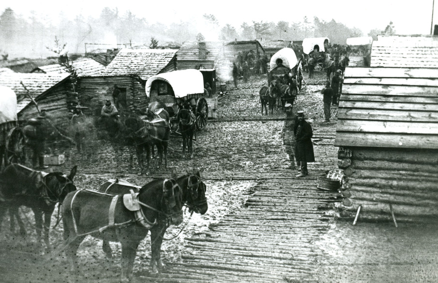
military camps built corduroy roads during the Civil War to avoid sinking into the mud
Source: US Army Corps of Engineers, Corduroy Road
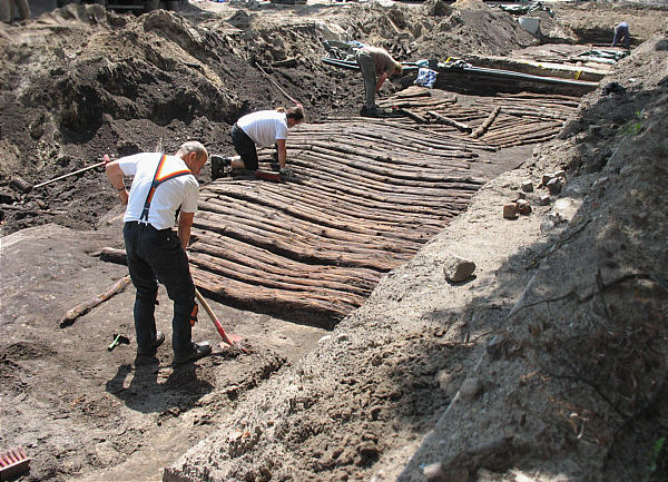
A historic corduroy road was discovered next to the Fairfax campus of George Mason University in 2015, revealing cedar logs placed on Route 123 (Ox Road) near Braddock Road in 1862 for Union forces to go from the courthouse to Fairfax Station. A Fairfax County resident noted how Confederate soldiers flattened a forest to build a corduroy road so wagons could bring supplies to the 1861-62 encampment at Centreville:3
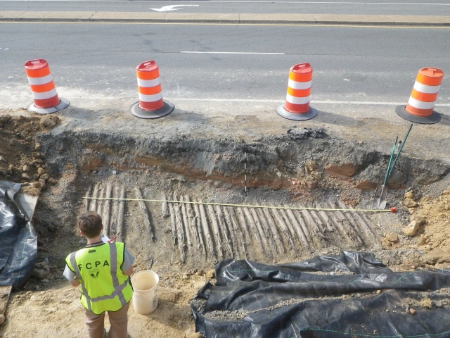
cedar logs used in 1862 to create a corduroy road were discovered in 2015 next to the Fairfax Campus of George Mason University
Source: Fairfax County Park Authority, County Archaeological Research Team, More on the Corduroy Road!!!
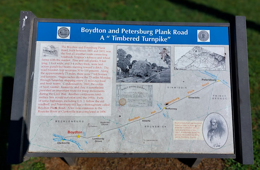
A variant of the corduroy road was the plank road. The Boydton and Petersburg Plank Road was chartered in 1850, so wagons could transport tobacco more easily from the Roanoke River valley to the manufacturing factories in Petersburg. The road was built in two phases, ultimately connecting Clarksville to the Brunswick County line. The rest of the planned 73 mile road was never finished, but the completed portion had board eight feet long, one foot wide, and three inches thick laid on top of two pairs of thick logs.
The toll road was not profitable. The planks of untreated wood quickly decayed, and the bridge crossing the Meherrin River collapsed in 1859. Since the plank road was unsuitable for traffic, tolls could not be collected.4
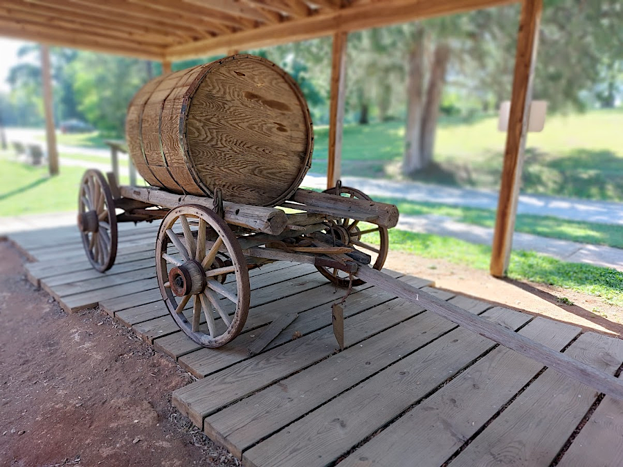
an exhibit with a replica of the Boydton-Petersburg Plank Road is in Boydton today
Several plank roads near Petersburg were significant transportation arteries during the Civil War, allowing Confederates to continue obtaining supplies after the railroads were damaged by Union troops.
plank roads used lumber as a surface, on top of soft earth
Source: Federal Highway Administration, 1846 - The Plank Road Craze (painting by Carl Rakeman)
Road quality affected Civil War battles. General George McClellan discovered in the Spring of 1862 that the dirt roads on the Peninsula would not support the pounding by the feet of massed troops. The roads degraded quickly into muddy quagmires, after passage of a few wagons and heavy cannons, slowing his march up the Peninsula.
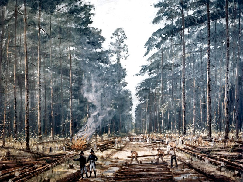
troops could construct corduroy roads, so long as timber was available
Source: Federal Highway Administration, 1820 General Jackson's Military (painting by Carl Rakeman)
Few large battles were fought in Virginia between November-May, because generals normally waited for the roads to dry out. In January 1863, General Burnside planned a rare winter offensive, trying to convince President Lincoln that he was aggressive enough to be retained as commander of the Army of the Potomac despite the disastrous failure a month earlier at Fredericksburg.
January rains, the pounding of soldiers' feet, and the weight of artillery pulled by horses quickly converted Stafford County roads into muddy pits. Triple teams of mules, and 150 men pulling ropes to move loads, were not able to overcome the weather and road conditions. Confederates south of the Rappahannock River posted signs saying "Burnside stuck in the mud," the attack was cancelled before fighting started, and the Mud March went into the history books.5
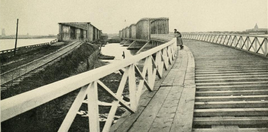
during the Civil War, planks were removed from "Long Bridge" over the Potomac River (parallel to the railroad bridge) to prevent Confederate raids into Washington
Source: The Photographic History of the Civil War, Political Objectives - Washington (p.123)
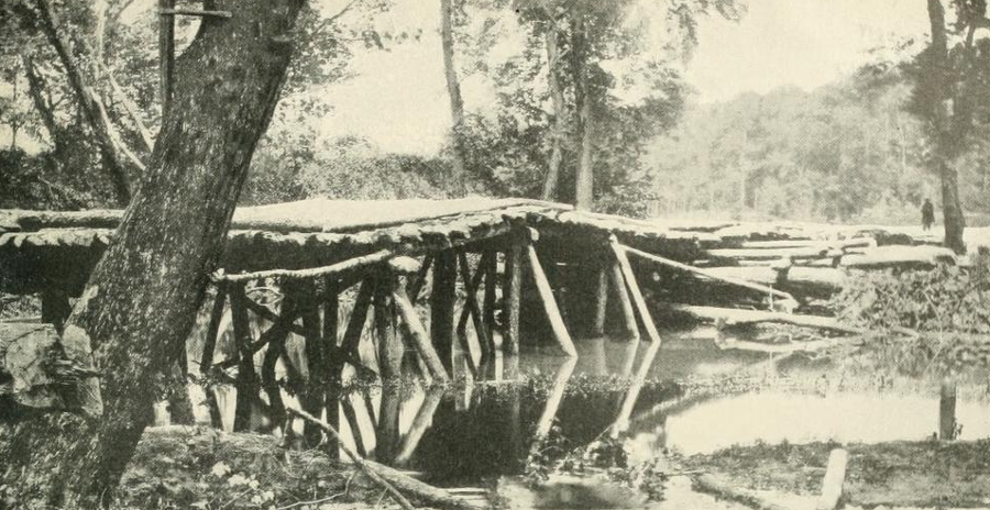
this 1862 bridge across the Chickahominy River indicates the quality of quickly-constructed river crossings during wartime
Source: The Photographic History of the Civil War, The Retrograde Crossing (p.320)
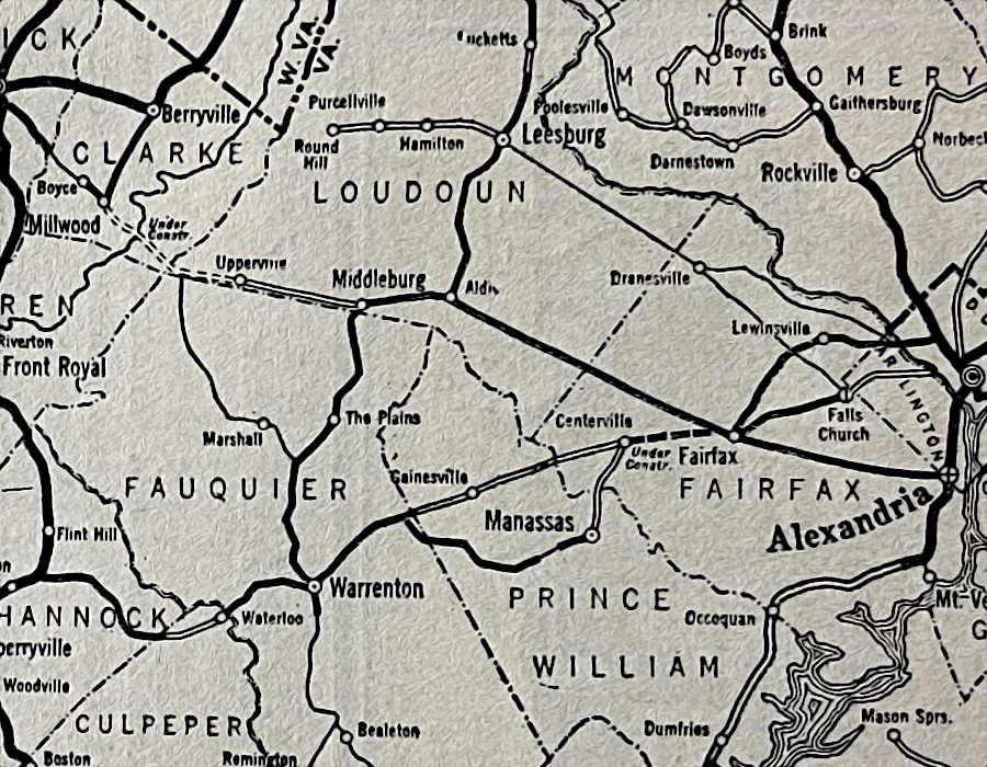
In addition to Midlothian Turnpike, the Little River Turnpike was another early road to get a hard gravel surface. That turnpike, now US50 between Aldie-Fair Oaks and Route 236 into Alexandria, linked the Blue Ridge in Loudoun County to a port on the Potomac River.
West of the Blue Ridge, the Valley Turnpike was "macadamized" with three layers of crushed rock to support heavy wagons hauling wheat to Baltimore and Philadelphia. The smaller rocks in the surface layer were bound together with rock dust - but no asphalt. Livestock found macadamized roads to be uncomfortable; the sharp edges of crushed rocks hurt the soft pads around hooves. Livestock preferred to walk on the dirt edge of macadamized roads.
wagons could use macadamized roads, while livestock preferred placing their hooves on the dirt road
Source: Sutter County Library, Photograph of Macadam Road, Nicolaus (Calif.)
Starting with the Little River Turnpike, investors and economic development "boosters" funded toll roads. In theory, users would pay enough in tolls to cover construction and maintenance costs, and investors would get a profit eventually. To subsidize projects, the Commonwealth of Virginia created the Bureau of Public Works. The state used its ability to sell bonds to foreign investors, ultimately funding an excessive number of turnpikes, canals, and railroads. The Civil War brought an end to state funding for roads, and the challenge of repaying the state debt spurred a "pay as you go" mentality in the General Assembly that lasted until the 1960's.
The Bureau of Public Works was replaced by the State Corporation Commission in 1902. The State Highway Commission was created in 1906. The Department of Highways was established in 1927.
The first section of Route 1 to get a hard surface, paved with concrete, was just south of Alexandria. Until paving was finally completed in 1927, the Richmond-Washington Highway (now Route 1) was just a muddy route with some gravel.
With funding from the Federal Aid Road Act passed by the US Congress in 1916, the state placed a gravel surface on the muddy roadbed of Route 1. At Dumfries, some entrepreneurial local residents sabotaged the road improvement project. They brought barrels of water at night to dips in the road. When cars got stuck in the boggy mud the next day, the local residents would bring horses and mules to pull the vehicles out. According to one woman in Dumfries, her fiance:6
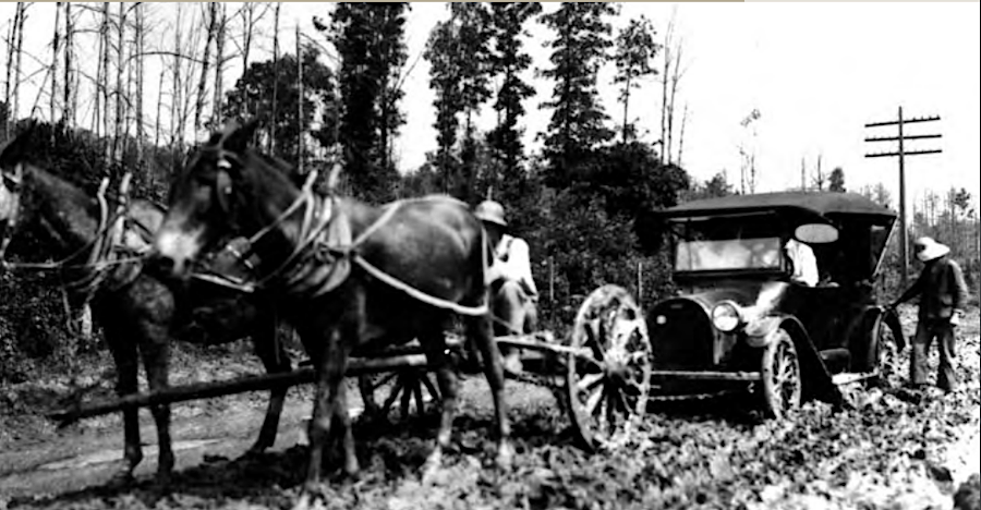
until roads were paved, farmers could earn extra money pulling cars out of muddy spots
Source: Virginia Department of Transportation, A History Of Roads In Virginia - "The Most Convenient Wayes" (p.17)
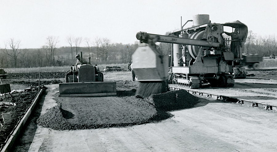
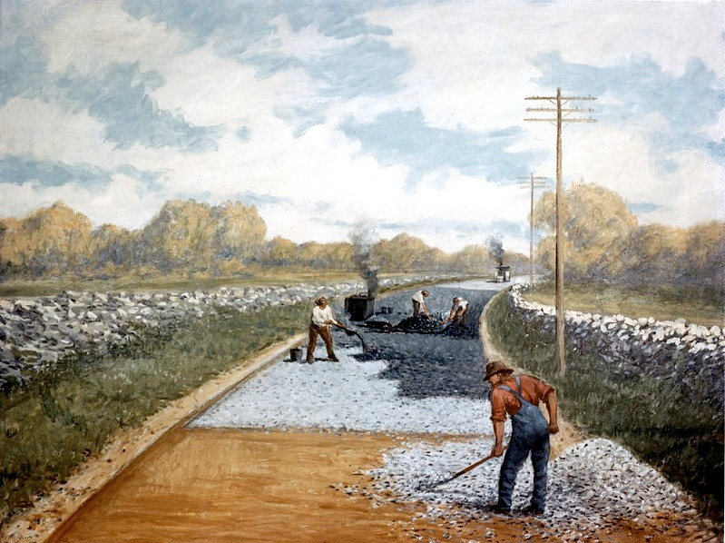
construction crews lay down a base course of rock to provide a solid foundation, before asphalt pavement is placed on top
Source: National Archives, Mixing and Placement of Base Course
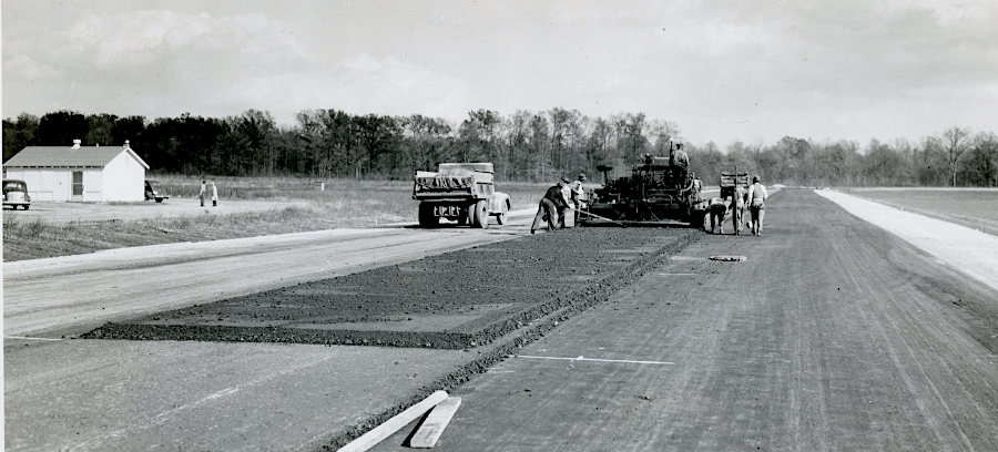
asphalt pavement is placed on top of a solid foundation, creating an impervious surface far better than a dirt road that gets muddy/dusty
Source: National Archives, Placement of Bituminous Surface
Route 1 at Dumfries, from 1919 to 2006
Source: Virginia Department of Transportation, A History Of Roads In Virginia - "The Most Convenient Wayes" (p.27)
Physical geography shaped where the first animal paths, and then trails, and then roads were constructed.
the first roads were made for one- and two-horsepower vehicles
Source: Federal Highway Administration, 1802 The Catskill Turnpike (painting by Carl Rakeman)
Physical geography still constrains transportation choices. Gaps through the mountains and narrow spots in rivers affect the cost of constructing/widening roads. Narrow valleys with many curves require low speed limits on two-lane highways in the Appalachian Plateau, in contrast to narrow-but-straight two-lane highways on the Coastal Plain.
On the Peninsula between Newport News and Richmond, Route 60 follows the watershed divide. However, with the capacity of transportation engineers to build bridges and use heavy equipment to literally move mountains, there has been more flexibility in locating modern roads.
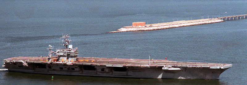
two tunnels were included in the Chesapeake Bay Bridge-Tunnel design, to ensure Navy warships would always have access to and from Hampton Roads
Source: National Archives, A starboard view of the nuclear-powered aircraft carrier USS ABRAHAM LINCOLN (CVN 72) underway. The LINCOLN has just passed the Chesapeake Bay Bridge and Tunnel (1990)
The first car in Virginia was a Stanley Steamer, produced by the Locomobile Company of America and sold as a "Locomobile." It was manufactured in Watertown, Massachusetts in 1899 and brought from New York City to Norfolk by steamship. After being ferried across the Elizabeth River to Portsmouth, John G. Wallace II drove his horseless carriage to Wallaceton. That community was on the edge of the Dismal Swamp Canal; the first car owner was not in an urban area.
John G. Wallace II would exhibit the car, and became the first person registered to sell cars in Virginia. According to a story in The Virginian-Pilot, the new vehicle brought him much attention:7
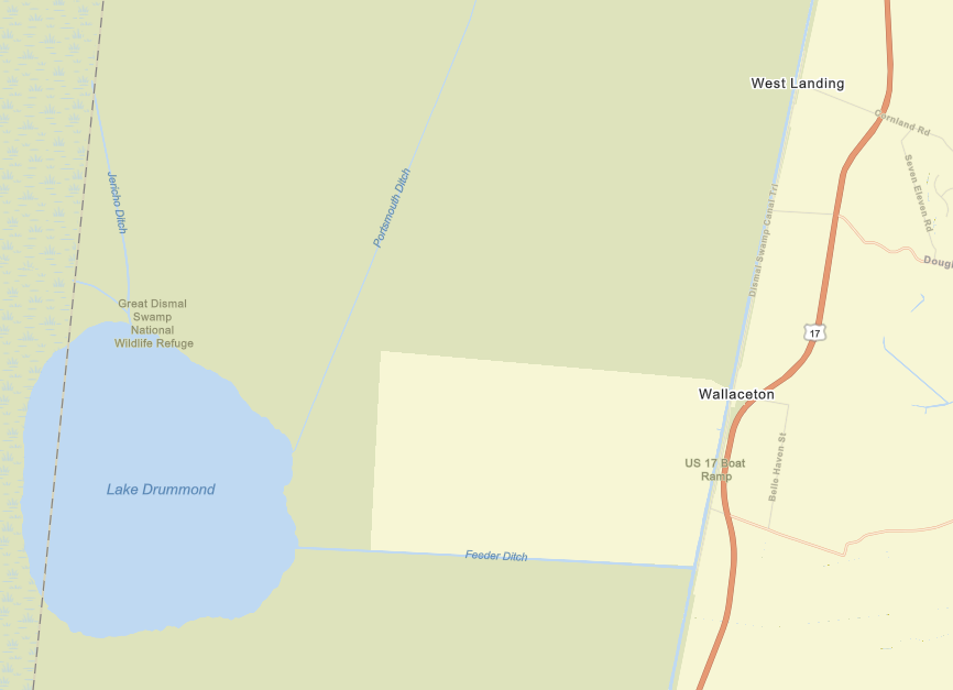
the first car in Virginia was a steam-powered Locomobile, and brought to Wallaceton in 1899
Source: ESRI, ArcGIS Online
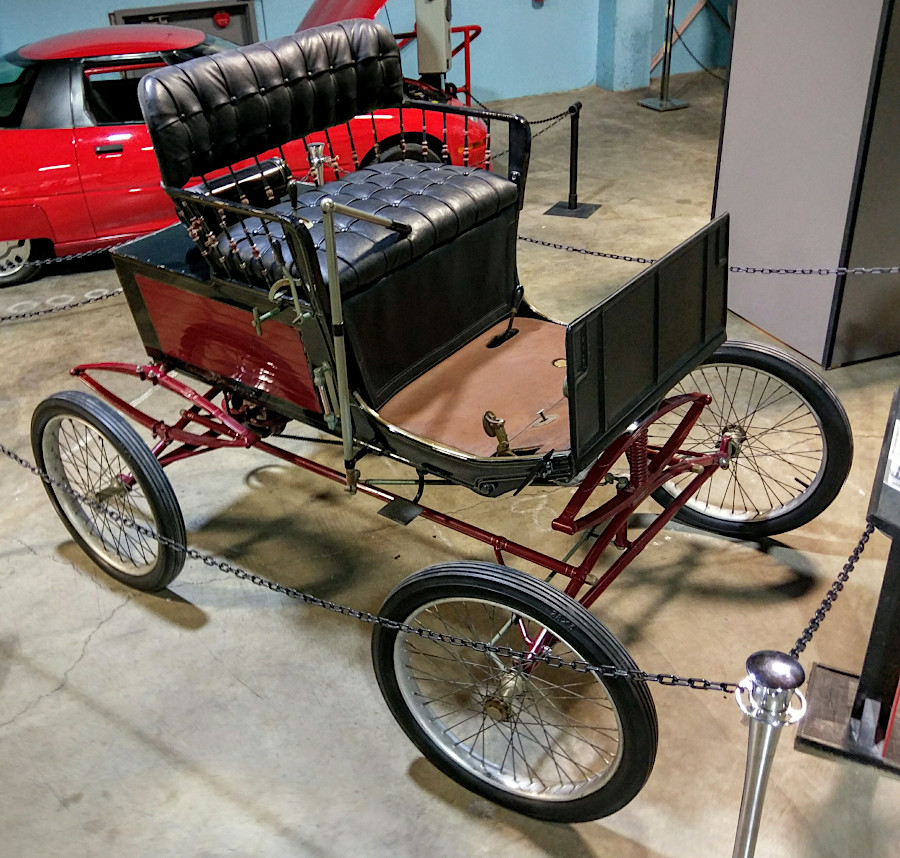
a 1900 Locomobile, comparable to the first car brought to Virginia a year earlier
Source: Wikipedia, Locomobile Company of America (photo by Jim Heaphy)
In 1906, the General Assembly created the State Highway Commission. Its members were engineering professors from the University of Virginia, Virginia Military Institute, and the Virginia Agricultural and Mechanical College and Polytechnic Institute (now known as Virginia Tech). In addition, the Highway Commissioner was appointed by the governor.
The legislature also committed state resources for construction and maintenance of roads. Since a Virginia Supreme Court of Appeals decision in 1894 had blocked the traditional requirement that residents must contribute two days annually of unpaid labor for road work, cities and counties had been obliged to use local revenues to fund road projects. In 1906, the General Assembly authorized use of convict labor. In 1908, the legislature appropriated $250,000 for the counties, with the requirement that state dollars be matched by local funds.8
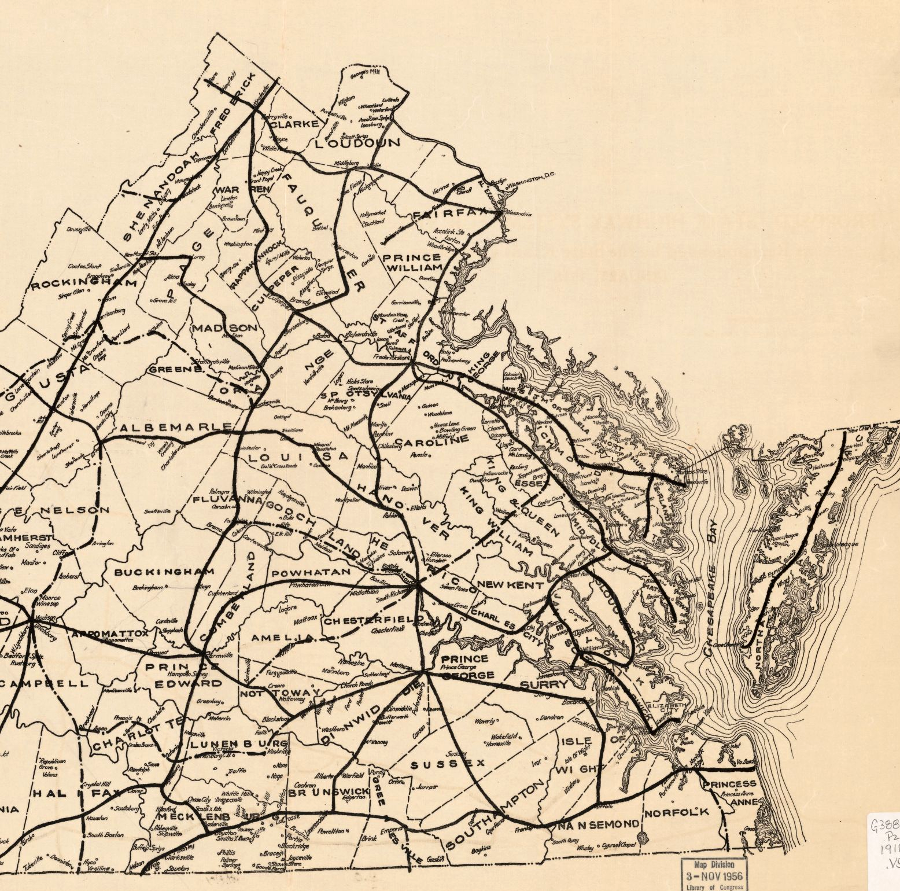
initial plan for creating a network of major highways in eastern Virginia
Source: Library of Congress, Proposed "state highway system" for Virginia, as recommended by the State Roads Committee, January 1918
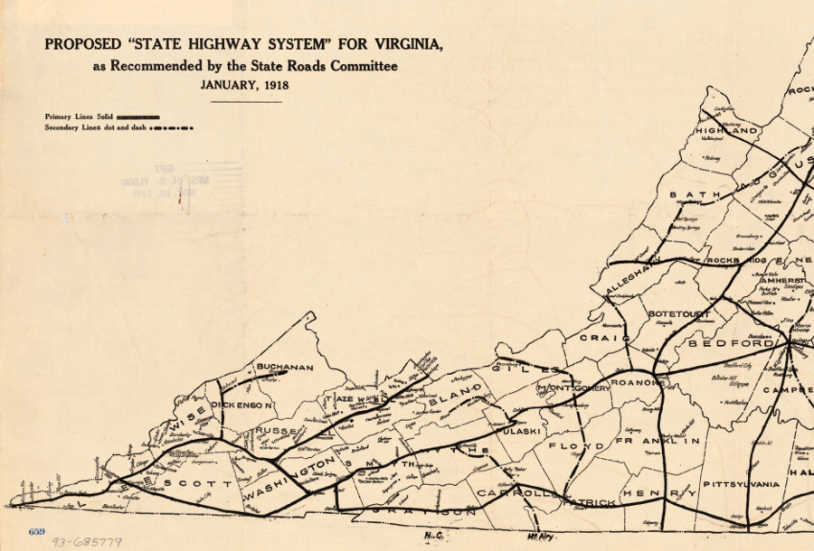
initial plan for creating a network of major highways in western Virginia
Source: Library of Congress, Proposed "state highway system" for Virginia, as recommended by the State Roads Committee, January 1918
Hupp Motor Car Corporation organized a United America Tour in 2018 that visited all 48 state capitals
Source: Library of Congress, Hupmobile United America Tour, 1918

unpaved farm-to-market road in Shenandoah Valley, 1941
Source: Library of Congress, Scenes of the northern Shenandoah Valley, including the Resettlement Administration's Shenandoah Homesteads
the King's Highway, which became Route 1 in Northern Virginia, had just a soft dirt surface for approximately 150 years
Source: Federal Highway Administration, 1913 First Post Road Project (painting by Carl Rakeman)
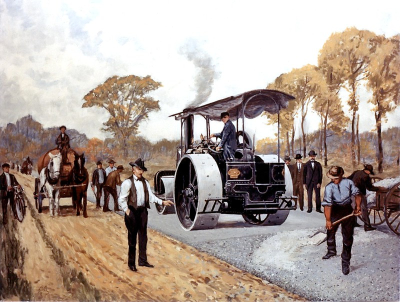
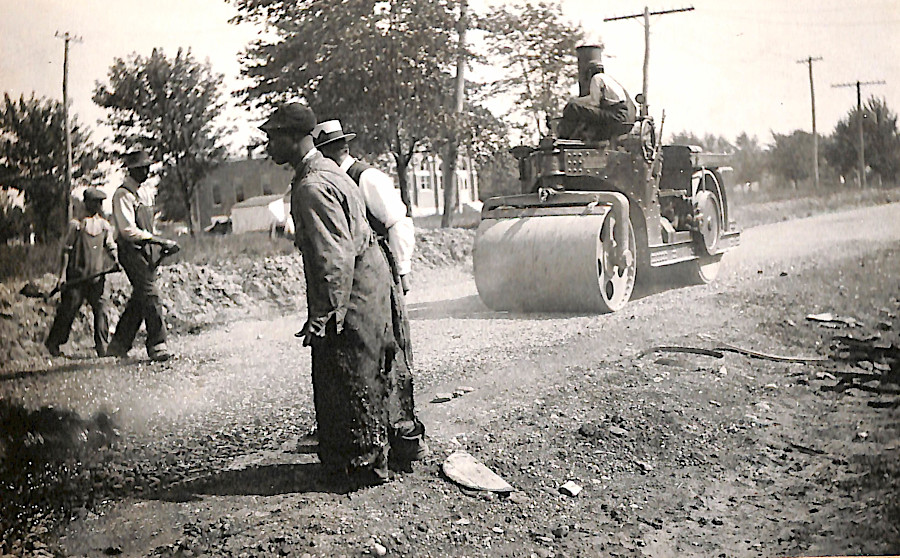
steamrollers paved hard-surface roads
Source: Federal Highway Administration, 1892 First State-Aid Road (painting by Carl Rakeman)
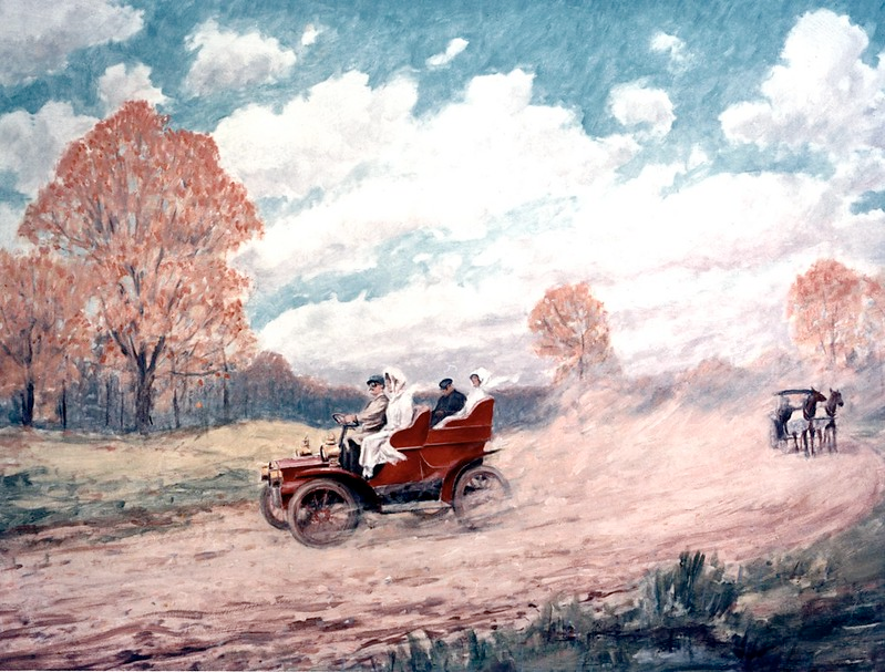
dirt roads could not support automobile traffic
Source: Federal Highway Administration, 1898 The Dust Nuisance (painting by Carl Rakeman)
tar was a more effective binder than stone dust, leading to tar-macadamized (tarmac) roads
Source: Federal Highway Administration, 1905 Coal Tar and Crude Oil (painting by Carl Rakeman)
early visions of freeways did not include guardrails for safety
Source: Federal Highway Administration, 1905 Coal Tar and Crude Oil (painting by Carl Rakeman)
the first paved roads, with an inadequate dirt base and drainage, crumbled within just a few years
Source: National Archives, Bituminous Macadam Road, Virginia
The concept of an interstate highway system extends back into colonial times. Ships could bring information to port cities, but initially roads between those cities were too poor for wagon travel. Settlers west of the Fall Line struggled to bring their heavy, bulky agricultural products to market.
After King Charles II took the throne in 1660, he ordered construction of a road connecting Boston to Charles Town, South Carolina. The Kings Highway took decades to complete. By 1735 a rider on a horse could travel it, and by 1750 it was suitable for wagons and stagecoaches. The Frankford Avenue Bridge in Philadelphia, built in 1697, is the oldest structure of that road still in use.
The Kings Highway enabled better communications between Great Britain's 13 separate American colonies. Ben Franklin became the joint Postmaster General on August 10, 1753, together with William Hunter of Virginia. Franklin took the lead, and personally traveled 1,600 miles (measured by an odometer on his wagon wheel) to determine the distances between post offices.
He advocated for better coordination among the 13 separate governments at the 1754 Albany Congress, as war with France was on the horizon. That effort failed, but by the time of the Stamp Act crisis in 1765 it was possible for letters to be carried within weeks to communities along the Kings Highway. The improved road network helped committees of correspondence in different colonies to coordinate their actions in 1765, so the joint boycott of British goods was effective enough to force Parliament to rescind the Stamp Act.
Letters and newspapers shared among American towns created a shared perspective and ultimately a shared response by all the colonies to the Coercive Acts. When the American Revolution started, a decade of information transported via roads to all towns was key to the decision of the southern colonies to join Massachusetts in a military response. In July 1775, when the Continental Congress had many action items to address, it took the time to create the job of Postmaster General and hire Franklin to ensure continued inter-colonial communications.9
Setting priorities and using government support for specific transportation projects have been controversial in Virginia since at least the French and Indian War. George Washington encouraged General Braddock to march to Fort Duquesne in 1758 first by upgrading roads in Virginia, in order to transport enough artillery to displace the French at the Forks of the Ohio River.
After Braddock was defeated in 1755, General Forbes chose to move his army by building a new road through Pennsylvania from Carlisle to the Ohio River. Virginia and Pennsylvania had competing claims to the land around modern-day Pittsburgh, and the rival colonies wanted the military to construct a route that would facilitate later settlement. Separate colonies supported separate routes.10
The different states in the new United States of America created individual road networks designed to enhance travel within each state to port cities on the Atlantic seaboard. Port cities recognized their future growth would be enhanced by attracting the inland trade; deepening harbors through dredging was not a viable strategy in the 1700's.
In Virginia, Alexandria, Richmond, and Petersburg were most successful in establishing toll road, canal, and railroad networks to draw traffic to their cities. Alexandria competed with Baltimore and Philadelphia to attract traffic from the Shenandoah Valley. Alexandria was part of the District of Columbia between 1800-1847, but after retrocession the Virginia General Assembly was willing to fund transportation projects designed so trade would go to Alexandria rather than Fredericksburg.
On March 29, 1806, President Thomas Jefferson signed an act to use revenue from the sale of public lands in Ohio to build the National Road. At the direction of the US Senate, Secretary of the Treasury Albert Gallatin published his "Report on Roads, Canals, Harbors and Rivers" in 1808. It was a blueprint for construction, but the role of the Federal government in funding internal improvements generated controversy despite support within the US Congress.
President Jefferson was concerned regarding the authority under the US Constitution of the Federal government to support the National Road. His reluctance to sign the National Road bill were soothed when Maryland, Virginia, and Pennsylvania agreed to a multi-state compact to support the road linking the Northwest Territory to Cumberland, Maryland. Approval of interstate compacts was clearly a role for the US Congress. However, the interstate rivalry between the three states prevented identifying Alexandria, Baltimore, or Philadelphia as the East Coast destination for the National Road, so construction started at Cumberland, Maryland.
Three later presidents blocked Federal funding for internal improvements.
On March 3, 1817 in his last act as President, James Madison shocked the legislators by vetoing the bill that would have used Federal funds (the "bonus" from the Second National Bank authorized in 1816) for constructing roads and canals. Madison interpreted the US Constitution, which he helped write, so it limited the powers of the Federal government to fund interstate transportation projects. He had championed adding the first 10 amendments to the US Constitution to create the Bill of Rights. To assuage concerns that the new central government would assert too much control over the formerly-independent 13 states, the Tenth Amendment reserved to the states or to the people all powers not delegated to the United States by the Constitution.
When the US Constitution had been drafted in 1787, Article I, Section 8 did authorize the Federal government to regulate commerce among the states and to establish post offices for mail delivery and roads between settlements ("post roads"). The drafters had rejected language by Benjamin Franklin and James Madison that would have authorized Federal involvement in building canals. Opponents highlighted that the proposal was unfair; only the locations along the canal route would see benefits, but support would have to be provided by all jurisdictions.
Using the same interpretation of limited national authority as President Madison, President James Monroe vetoed funding in 1822 that would have been used to maintain the National Road. President Andrew Jackson vetoed authorization for Federal support for the Maysville Turnpike on May 27, 1830.11
Since then, the commerce clause in the US Constitution has been viewed more broadly. In 1893 pressure from farmers led to the creation of the Office of Road Inquiry in the US Department of Agriculture. The US Congress also initiated rural free delivery (RFD) of mail, but only in places with good roads.
The Office of Road Inquiry advocated for creation of a Bureau of Public Roads at a time when bicyclists were leading advocates for road improvements, before the automobile era. That office proposed that Federal support should be based on the model created first in New Jersey, where starting in 1891 state aid was authorized to match county funding for road construction.
The Office of Road Inquiry became the Office of Public Roads in 1905. Logan Waller Page, an 1899 graduate of Virginia Polytechnic Institute in Blacksburg, created a road materials laboratory to determine the best road construction techniques, especially for drainage. He experimented with steel, cement, brick, and earth-oil mixtures for road surfaces. His research demonstrated that macadam surfaces could not withstand the stress of automobile tires, and identified specifications for roads that would support traffic in different environmental settings. The laboratory evolved into the current Turner-Fairbank Highway Research Center in McLean.
Page was practical and cost-conscious with his recommendations:12
In the 62nd Congress (1913-1915), there were 50 bills proposing some form of Federal funding for interstate highways. An Illinois senator proposed funding a system of seven national highways radiating out from Washington, DC. Other bills proposed highways stretching from the Atlantic Ocean to the Pacific Ocean and a north-south highway from near Winnipeg, Canada to Galveston, Texas.
A US Representative from New York complained that the bills were designed to use taxes from relatively wealthy states to subsidize roads that relatively-poor states could not afford to build, saying:13
The 1907 Wilson v. Shaw decision by the US Supreme Court, authorizing Federal funding for the Panama Canal, clearly established Federal authority to finance internal improvements. Judicial interpretation of the commerce clause to allow Federal support for funding highways had been expressed earlier in 1893 when the US Supreme Court ruled in Monongahela Navigation Company v. United States:14
President Woodrow Wilson signed the Federal Aid Road Act of 1916 on July 11, 1916. The initial funding was limited to rural post roads, those over which the mail might be carried, or roads within National Forests. Western states relied upon trains to carry mail between cities, and advocates for creating a network of roads for long-distance trips were also unhappy with initial appropriations. The Federal Highway Act of 1921 addressed the issue by requiring that 60% of the funding be allocated to roads that were "interstate in character."
The concept of cross-country highways was always part of debates regarding how to prioritize Federal funding. Bu 1938, paved roads connected all major cities. The Federal-Aid Highway Act of 1938 included a broader vision:15
The current network of interstate highways is named after President Eisenhower. He was a champion of completing a road network after participating in the 1919 Transcontinental Motor Convoy, which demonstrated the difficulty of moving troops and equipment across the country. During World War II, he was impressed by capacity of the German autobahn system to enable fast and coordinated movement of troops and armored vehicles. Federal funding to build the interstate highways was first provided during his first term, in the Federal-Aid Highway Act of 1956. During debate over that bill, Vice President Nixon described Eisenhower's 1919 experience:16
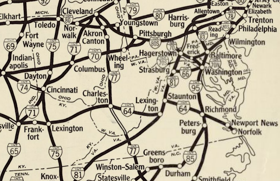
However, Franklin D. Roosevelt was the first president to propose and champion an interstate highway network. In 1934, he identified proposed routes for transcontinental toll roads, including a highway running from Massachusetts to Georgia that would pass "east of Harrisburg, west of Baltimore, west of Washington, west of Richmond, west of Charleston and Savanah..." A major benefit of the highway construction program would be providing employment during the Great Depression.
As envisioned by Roosevelt, the new transcontinental highways would bypass cities and pass through unimproved country. In 1939, Roosevelt ordered that a report proposing the highway network be revised to reduce the chance that Federal funds would be used for roads that were needed for local city traffic, and to emphasize the national defense benefits of the system.
on February 2, 1938, President Franklin D. Roosevelt sketched out five transcontinental north-south and east-west routes for an interstate highway system
Source: National Archives, United States System of Highways
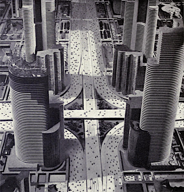
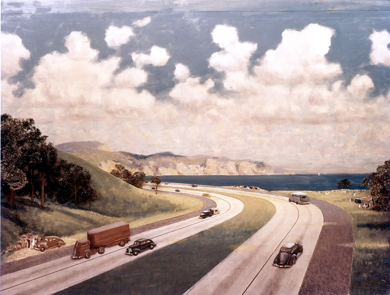
exhibits in the Futurama pavilion at the 1939 World's Fair, sponsored by General Motors, highlighted the need for new highways
Source: Norman Bel Geddes, Magic motorways (p.240)
By 1940 it was clear that war in Europe would force Roosevelt to prioritize expanding military forces for short-term defense. The Pennsylvania Turnpike, which opened on October 1, 1940, was a model for Roosevelt's planned highway system. However, funding was redirected. Road construction. other than dealing with wartime traffic, was put on the back burner.
At one point President Roosevelt had proposed funding construction of an interstate highway system through tolls. In 1939 the Bureau of Public Roads concluded in "Toll Roads and Free Roads" that a network of toll roads would not generate enough revenue to fund construction.
the Bureau of Public Roads proposed in 1939 an interstate highway system based on tolls
Source: House Document No. 272, 76th Congress, First Session, Toll Roads and Free Roads (Plate 57)
The 1939 report redirected Federal planning towards a toll-free interstate network. The mechanism for funding was resolved with passage of the Federal-Aid Highway Act of 1956, also known as the National Interstate and Defense Highways Act.
In President Eisenhower's first term, state governors had proposed that the Federal government stop imposing taxes on gasoline and automobiles so the states could raise similar taxes for their highway projects. Highway officials in the states were more supportive of having the Federal government collect the funds and distribute dollars according to a formula to the states.
The US Congress chose the option preferred by the highway officials. The Federal-Aid Highway Act of 1956 eliminated the risk that some state legislatures would cut taxes and reduce funding to the state highway departments.17
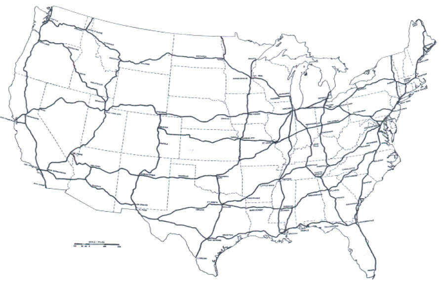
Federal officials continued highway planning during World War II and developed a proposal for "interregional highways" that would not be toll roads. The US Congress approved the Federal-Aid Highway Act of 1944, calling for designation of a 40,000-mile National System of Interstate Highways.
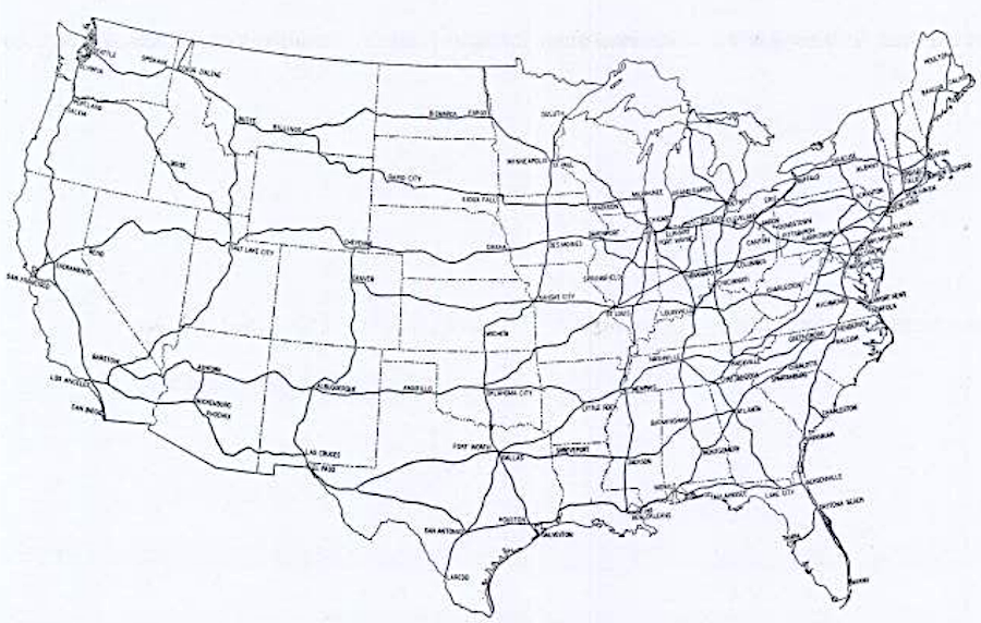
the 1944 proposal for interregional highways included a road from Hampton Roads through Richmond to Staunton
Source: House Document No. 379, 78th Congress, Second Session, Interregional Highways (Figure 1)
At the end of World War II, the State Highway Commission approved six routes for new highways crossing the state. In addition to the four routes identified by Federal planners, it added what became I-85 and a proposed interstate parallel to US 13 on the Eastern Shore. The State Highway Commission also changed the western destination of what became I-66 from New Market to Strasburg.18
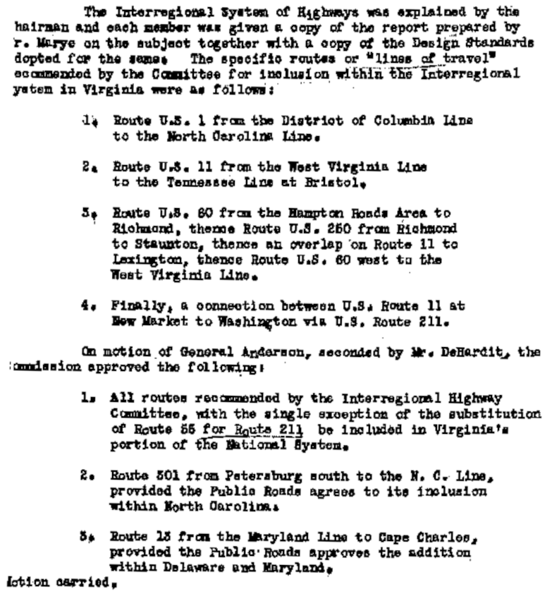
in 1945, Virginia highway officials identified six routes for new highways to cross the state
Source: Commonwealth Transportation Board, Minutes of the Meeting of the State Highway Commission (September 11, 1945)
Political geography was been a factor in locating the interstate highways. I-85 ended up directing traffic from North Carolina to Petersburg, rather than parallelling US 15 north through the Piedmont to Farmville or following US 29 to Lynchburg.
Lynchburg also lost an opportunity to be a node on I-64. In 1959 the state Highway Commission decided to build the new interstate along the "southern route," the US 460 corridor west from Richmond to Roanoke and then north along the US 220 corridor to Clifton Forge. The Federal government, which paid 90% of the construction costs for interstates, overruled the state decision on I-64 and triggered yet another debate about state's rights. The "northern route" had been recommended by a consulting firm, in part because it was 50 miles shorter and thus cost less to build.
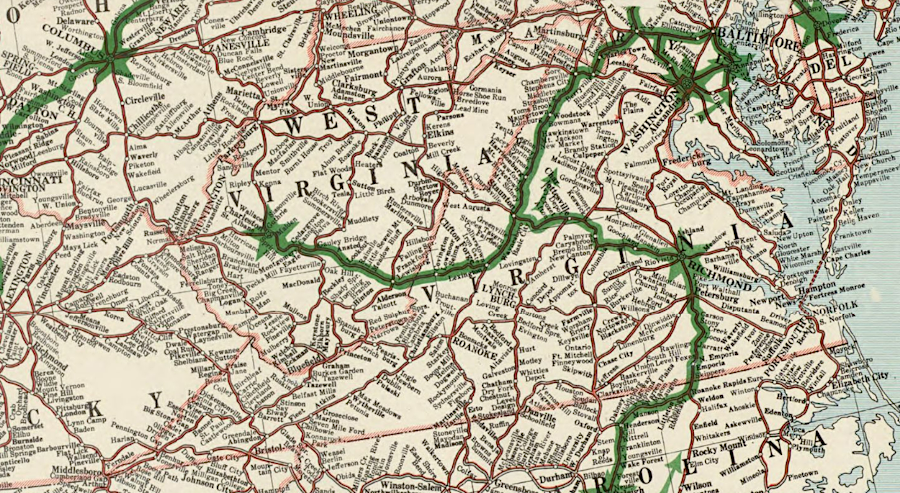
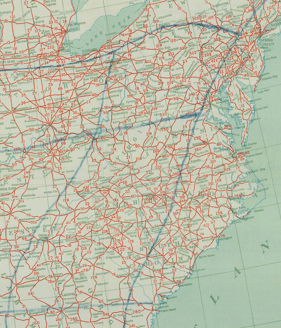
road connections from Richmond to Charlottesville and Lynchburg were equally good in 1956, prior to the Interstate Highway System
Source: Library of Congress, State of Virginia, base map with highways and contours ("Highways corrected to 1956")
Lynchburg politicians thought President Kennedy had altered the state Highway Commission decision because his state campaign manager had requested the route benefit his home town of Charlottesville. Today, Lynchburg is the largest city in Virginia not located on an interstate highway.19
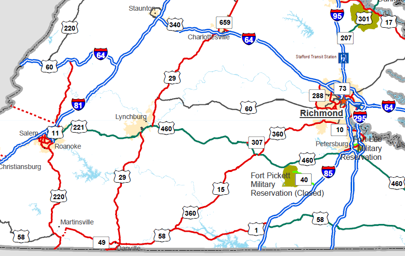
Lynchburg was bypassed by both I-85 and I-64
Source: Federal Highway Administration, National Highway System - Virginia
the Interstate Highway System as proposed in 1958
Source: Library of Congress, National system of interstate and defense highways: as of June, 1958
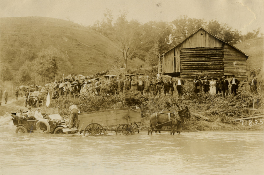
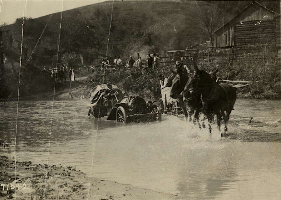
the American Automobile Association organized the 1911 Glidden Tour to support good roads in places such as Roanoke, where mules had to assist the cars
Source: National Automotive History Collection, Detroit Public Library, Mule-drawn wagon towing automobile across creek near Roanoke, Virginia, 1911 Glidden Tour and Motorists in automobile crossing creek near Roanoke, Virginia, 1911 Glidden Tour
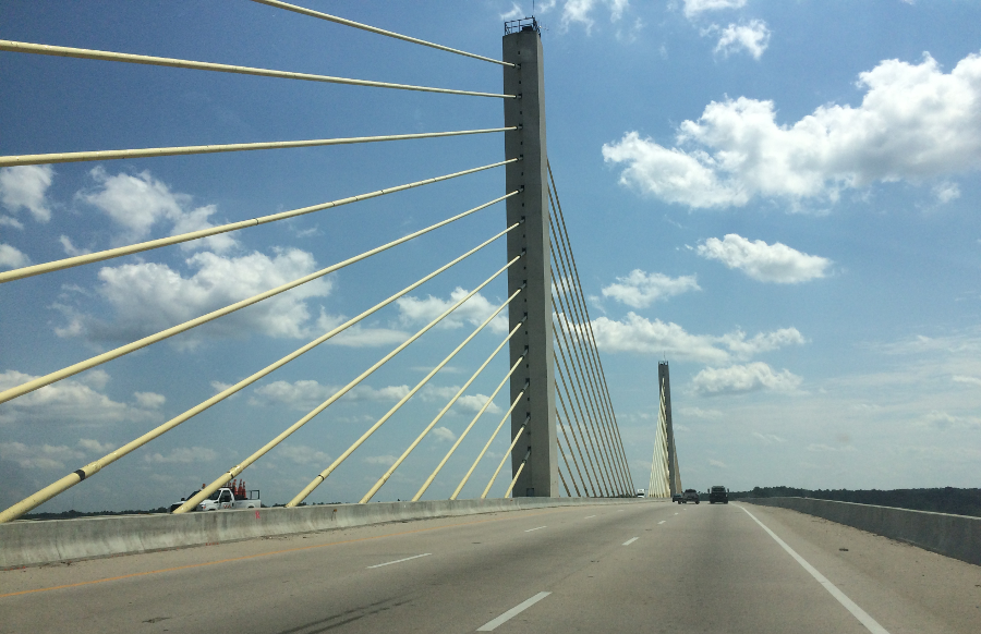
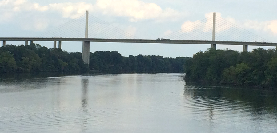
the Varina-Enon Bridge, carrying I-295 across the James River, was the second cable-stayed bridge constructed in the United States
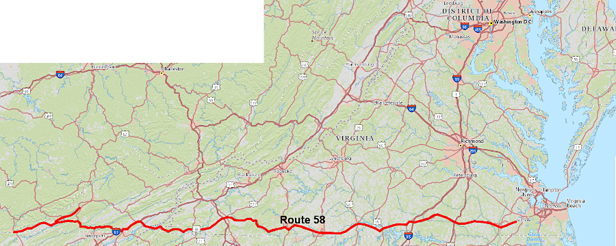
the General Assembly dedicated funding, starting in 1989, for the Route 58 Corridor project to upgrade portions of Virginia's longest highway
Source: ArcGIS Online
Source: Virginia Department of Transportation (VDOT)
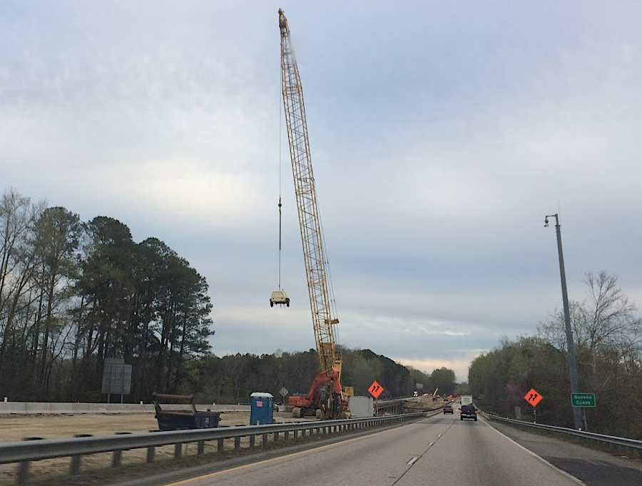
widening I-64 west of Newport News in 2019
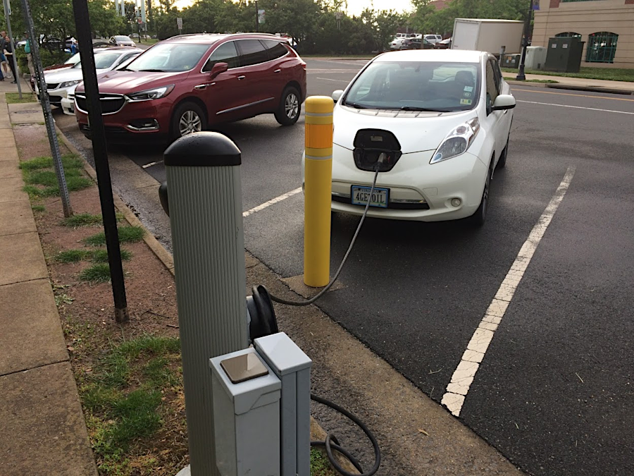
Nissan Leaf recharging at Manassas Museum
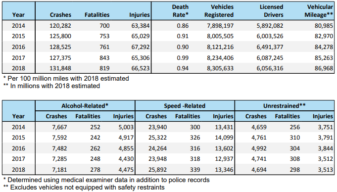
Virginia highway crash statistics, 2014-18
Source: Department of Motor Vehicles, 2018 Virginia Traffic Crash Facts
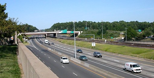
Interstate 66, looking east from Vienna Metro Station
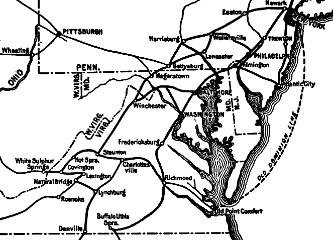
tourists in 1917 could choose among just a limited number of roads, plus a steamship to Fort Monroe
Source: The Countryside Magazine and Suburban Life (January 1917, p.13)
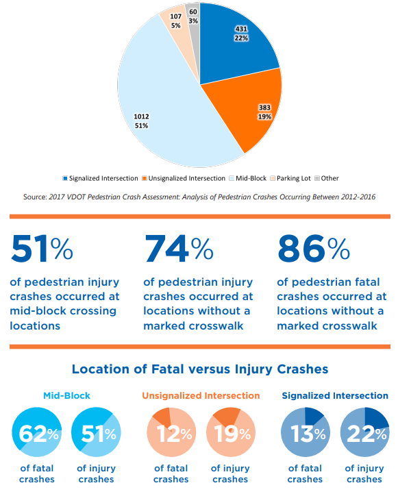
pedestrian injury crashes by crossing type
Source: Virginia Department of Transportation (VDOT), Pedestrian Safety Action Plan (May 2018, p.ii)
in 1953, Route 1 crossed the Shirley Highway rather than I-95 because there was no interstate highway system yet
Source: National Archives, U.S. Route 1 overpassing Shirley Highway near Woodbridge, Virginia
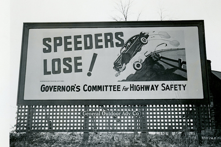
highway safety is not a new issue
Source: National Archives, Speeding Signs on U.S. Route 1 (January 7, 1950)
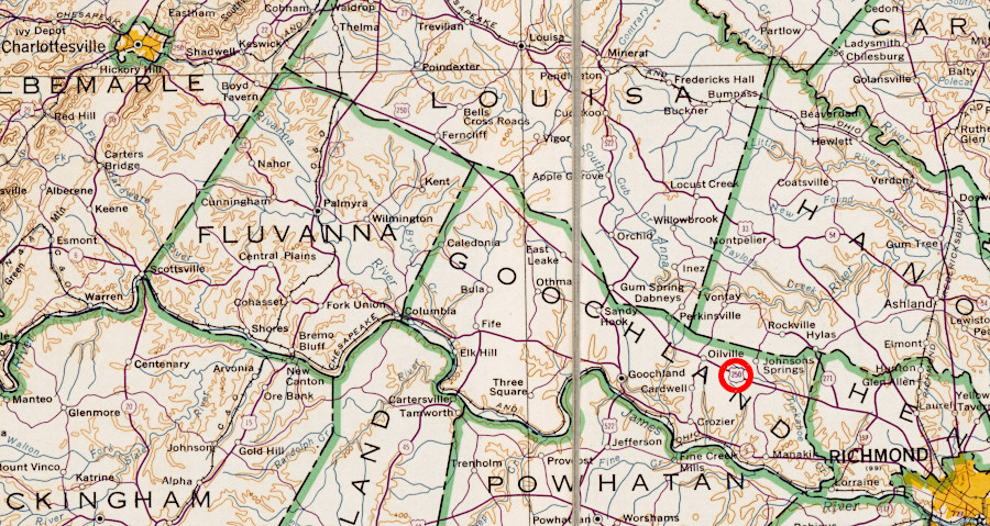
Route 250 was the primary road between Richmond-Charlottesville before construction of I-64
Source: Library of Congress, State of Virginia, base map with highways and contours (1957)

paved two-lane highway with dirt shoulders in 1939
Source: Library of Congress, U.S. Highway 60. Alleghany County, Virginia (by Arthur Rothstein, 1939)
Virginia pursued a pay-as-you-go fiscal strategy that delayed paving key roads in rural areas until the 1950's
Source: Library of Congress, Rural road. Alleghany County, Virginia (by Arthur Rothstein, 1939)
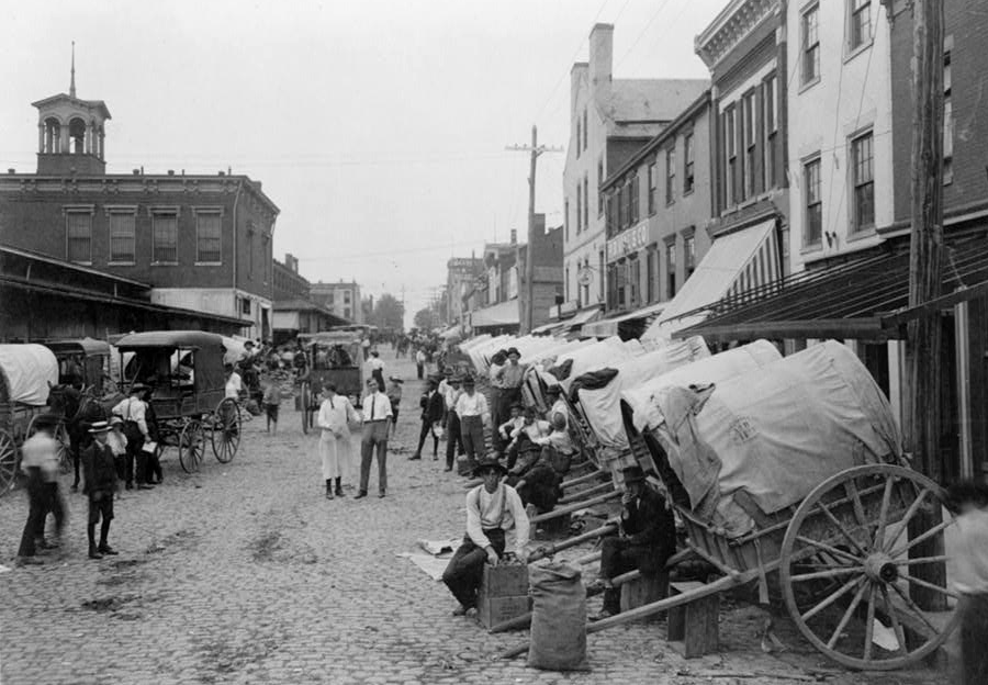
farmers carried agricultural products to markets over dirt roads and occasionally rock-covered turnpikes
Source: Library of Congress, Sixth Street market, Richmond, VA (1908)
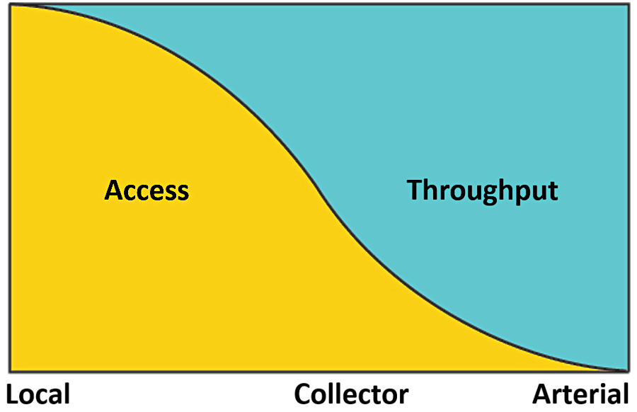
roads are classified according to how they prioritize design for access to property vs. travel mobility
Source: Pedestrian Bike and Information Center, Arterial Roads and Pedestrian Safety

toll facilities in Virginia
Source: Virginia Department of Transportation (VDOT), Toll Facilities
View from Route 50 at Paris (Ashby Gap)
the basic supply/demand problem: growth in Vehicle Miles Travelled (VMT)
vs. increased capacity of highway system, 1982-2004
Source: National Surface Transportation Infrastructure Financing Commission interim report,
February 1, 2008 (Figure 1: Vehicle Miles Traveled and Capacity)
the Virginia Department of Transportation maintains secondary roads in all counties except Arlington and Henrico
Source: Virginia Department of Transportation (VDOT), IMG_1657-2
Route 40 in Patrick County, getting paved and straightened in 1949
Source: Virginia Department of Transportation (VDOT), #ThrowbackThursday (October 28, 2021)

wagon trains of Civil War armies were powered by six-horsepower vehicles
Source: Harper's Pictorial History of the Civil War, Burnside's Campaign - Fredericksburg (p.409)

horses and wagons tore up road surfaces during the Civil War, and soldiers marched in mud
Source: Harper's Pictorial History of the Civil War, Burnside's Campaign - Fredericksburg (p.419)
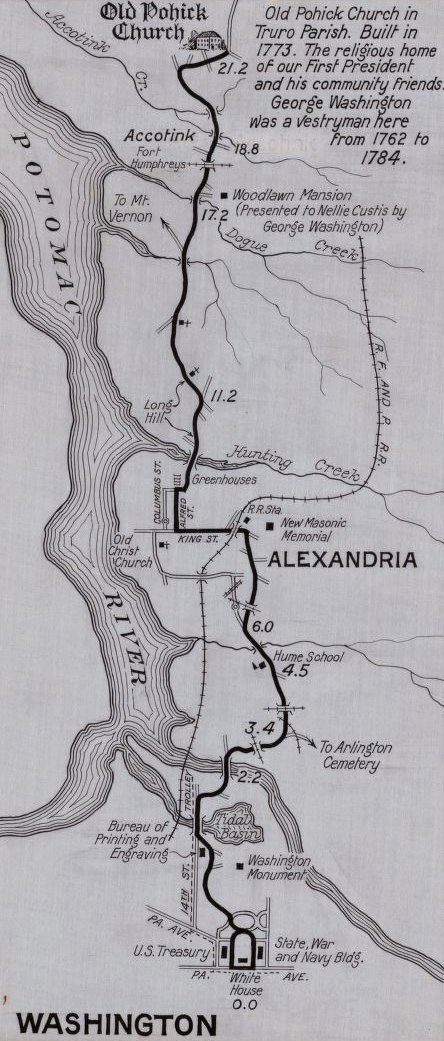
the old Native American trail, converted into Kings Highway and Route 1, connected the Occoquan-Potomac rivers until the Shirley Highway was completed
Source: Library of Congress, Route from Washington, D.C. to Old Pohick Church, Accotink, Virginia
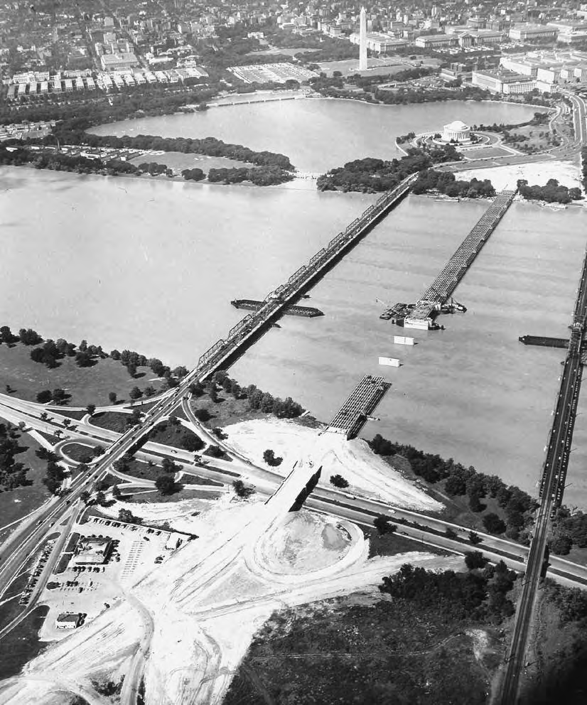
I-395 now uses Rochambeau Bridge (shown during construction in 1949), while two spans for the 14th Street Bridge have replaced the upstream bridge
Source: US Army Corps of Engineers, Capital Engineers: The U.S. Army Corps of Engineers in the Development of Washington, D.C., 1790-2004 (p.248)
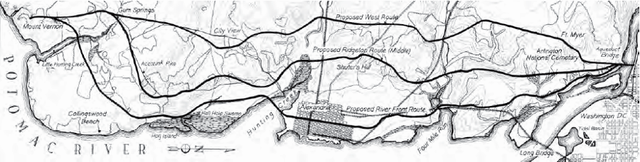
three routes were considered in 1889 for the proposed highway connecting Aqueduct Bridge to Mount Vernon
Source: US Army Corps of Engineers, Capital Engineers: The U.S. Army Corps of Engineers in the Development of Washington, D.C. 1790-2004 (p.129)
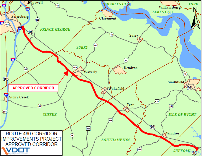
route of proposed toll road for upgrading US 460
Source: U.S. Route 460 Corridor Improvements Project
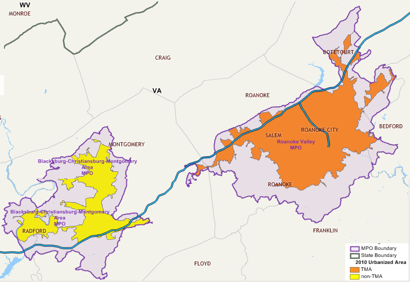
the Federal government requires communities with at least 50,000 people to coordinate transportation planning through Metropolitan Planning Organizations (MPO's), and with Transportation Management Area's (TMA's) for communities with at least over 200,000 people
Source: Federal Highway Administration, HEPGIS
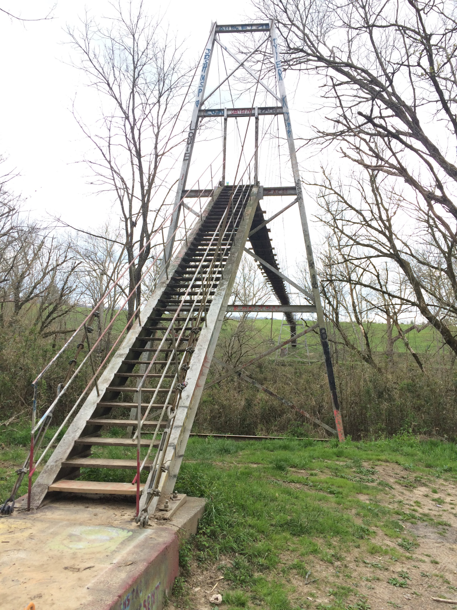
there are swinging bridges over the Powell River in Lee County, maintained as public thoroughfares
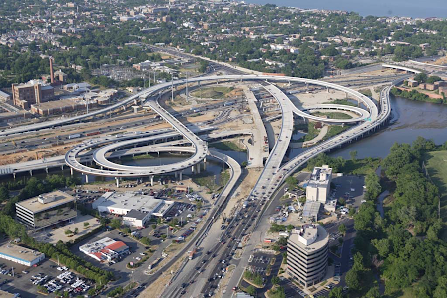
a new I-495/Route 1 interchange was constructed, along with the replacement Woodrow Wilson Bridge
Source: Virginia Department of Transportation, Woodrow Wilson Bridge Project (July 17, 2007)
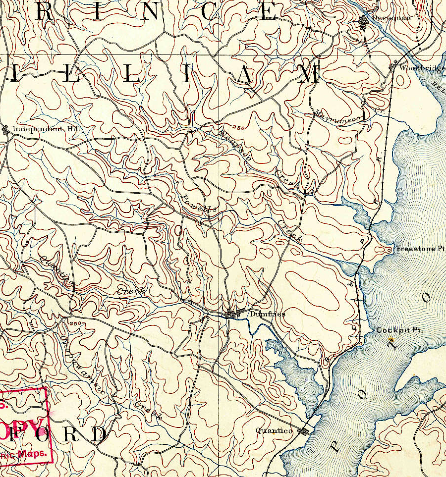
in 1890, there was a limited number of roads in rural Prince William County
Source: US Geological Survey (USGS), Mount Vernon, VA 1:125,000 topographic quadrangle (1890)
paving Mount Vernon Avenue in what was then Alexandria County (1915)
Source: National Archives, Spreading Bituminous Penetration Coat in Alexandria County, Virginia
main roads in Northern Virginia around 1925
Source: Facebook post, Northern Virginia History (by David Cuff on April 2, 2023)
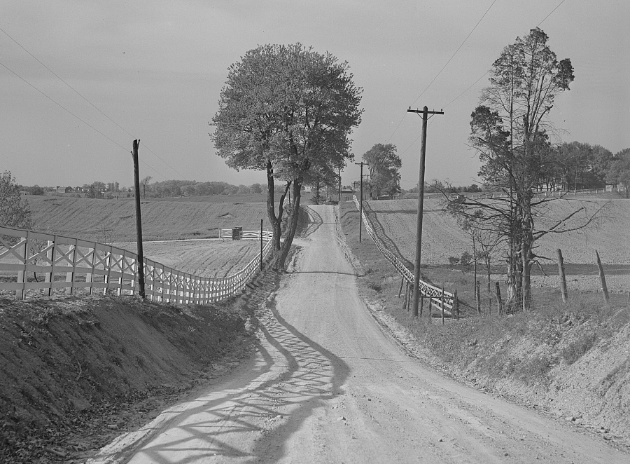
what today is Route 123 and other major roads in Fairfax County were unpaved before World War II
Source: Library of Congress, Dirt road and fence through farmland in Fairfax County, Virginia (by Marion Post Wolcott, May 1941)