The northern part of the Shirley Highway was planned during the Great Depression by the Roosevelt Administration. The road was included in a proposal from the Commissioner of U.S. Public Roads Administration for new arterial highways leading into Washington DC. The National Capital Parks and Planning Commission approved the proposal in 1934. The new road was expected to provide a bypass around Fort Myer and Alexandria, and to allow for the closure of Arlington Ridge Road and its incorporation into Arlington Memorial Cemetery.
In 1941, the plan was revised to extend the bypass south all the way to Woodbridge in Prince William County. It was not realistic to widen Route 1 through Fairfax and Arlington counties or the city of Alexandria; that would impact too many roadside businesses. It was easier to cut a new road through lightly-populated Fairfax County farmland west of Route 1, in order to provide a "back route" to Washington DC.1
The route of what was to be named VA 350 was adopted in 1940. At the time, Henry G. Shirley was chair of the Virginia State Highway Commission, a position which he had held since 1922.2
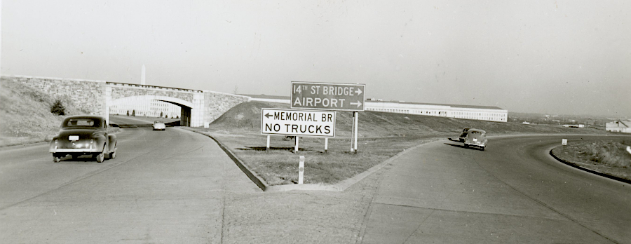
Traffic congestion to access the 14th Street (Highway) Bridge, Memorial Bridge, and Key Bridge and cross the Potomac River from Virginia into the downtown of Washington, DC was a clear problem. Key officials in the Federal government saw the need to improve access to the capital, as more and more workers commuted from new housing Virginia.
However, there were no plans for a new military headquarters in Northern Virginia at the time the new route was first designed by state and Federal officials in 1940. The headquarters of the Navy Department and the War Department were in Washington DC near the White House, on the south side of Constitution Avenue from 17th Street to 21st Street. World War II had started in Europe, and the War Department was planning a new headquarters at 21st and C Street NW. The Navy Department expected to expand into the old War Department building.
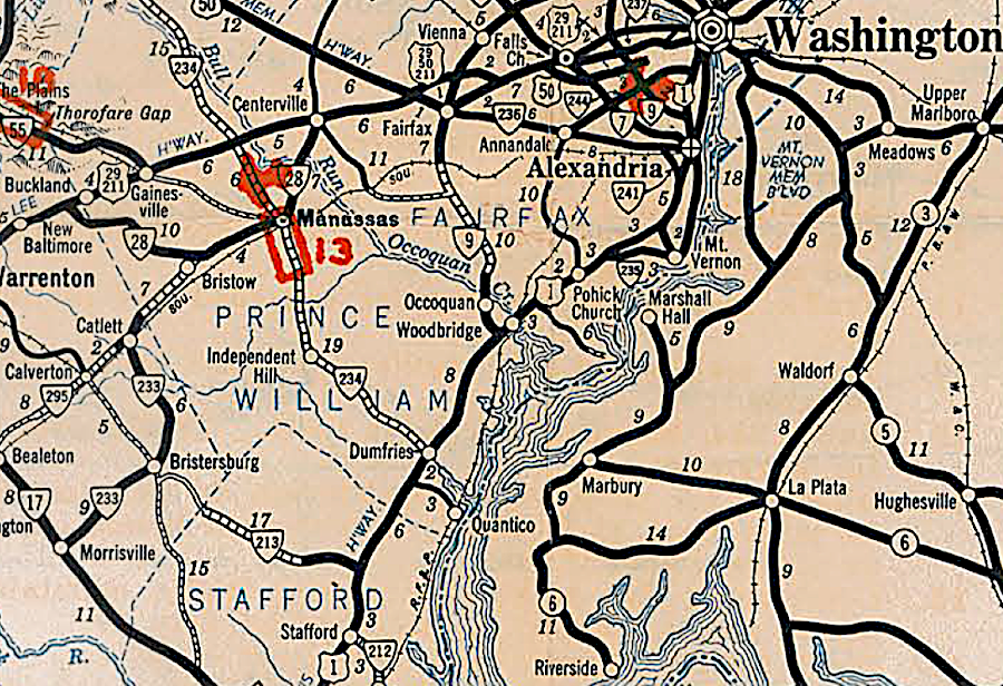
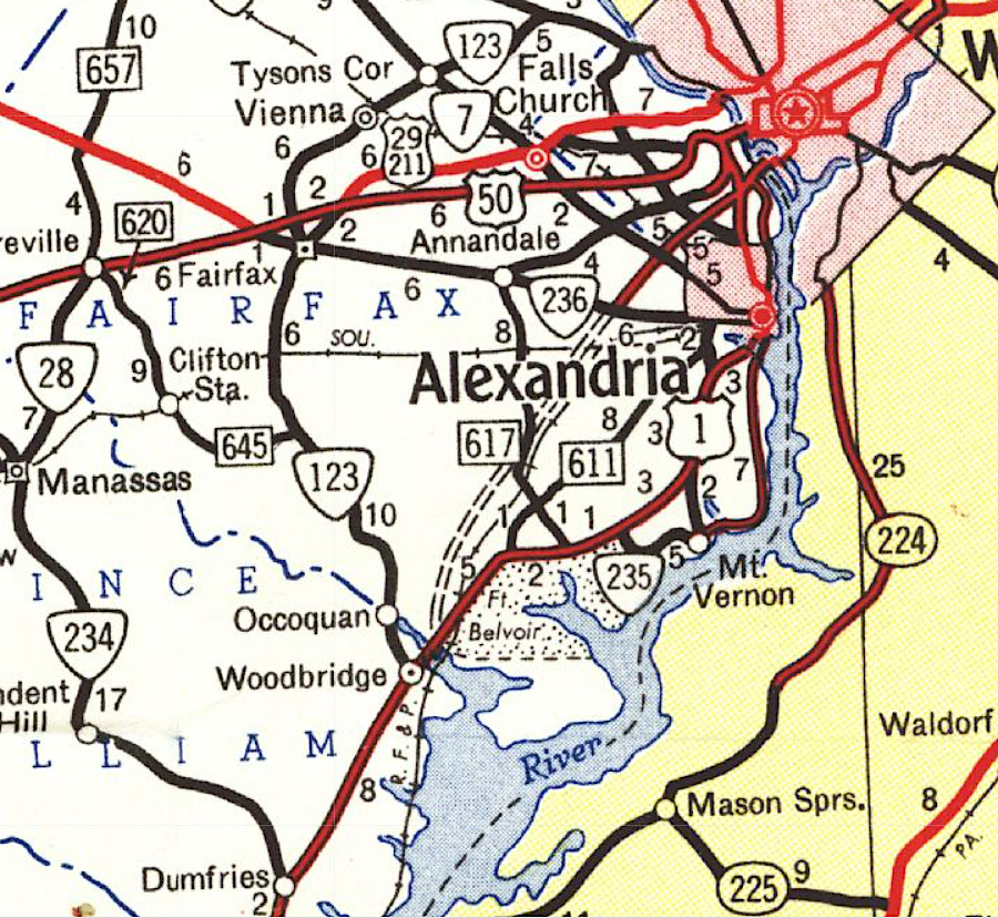
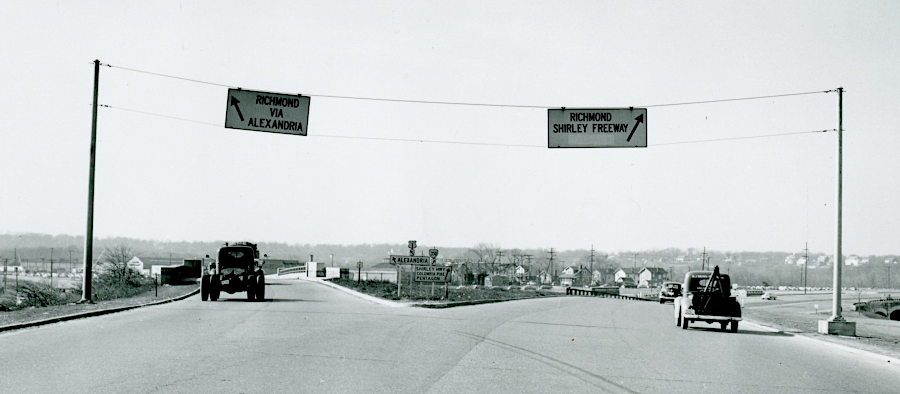
before the Shirley Highway, cars used Route 1 or Route 123 to get north from Woodbridge at the Occoquan River
Source: Virginia State Highway Commission, State Highway System and Connections (1942) (from University of Alabama Library)
By April 1941, it became clear that the need for more office space for the Navy and War departments space exceeded what was already planned. No site for a new building was available within the District of Columbia near the White House, where the commander-in-chief lived. The solution was to build a new military headquarters for both the War Department and the Navy Department on the Arlington estate of the family of Confederate General Robert E. Lee. (The under-construction War Department building on 21st Street ultimately became the home of the State Department.)
Because of road configurations that shaped the initial building site in Virginia, the new military headquarters was designed as a five-sided structure. A final route for the new highway between the Occoquan River and Washington DC was adopted after an Arlington site had been chosen for what became the Pentagon. Commissioner Shirley died a few weeks later, after which the Fort Belvoir bypass VA 350 was called the Shirley Highway.3
By 1944 the US Public Roads Administration had completed a four-mile section stretching south of the 14th Bridge across the Potomac River to State Route 7 in Virginia. That section was built as part of the Pentagon road network and maintained by the Federal government until 1963.4
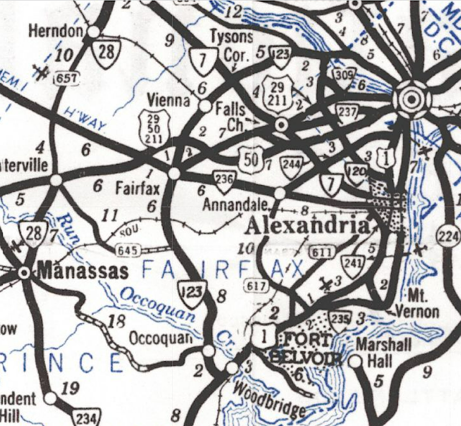
the Bureau of Public Roads built the part of Shirley Highway next to the Pentagon and the Navy Annex
Source: Virginia Department of Transportation, Virginia Official State Highway Map (1944)
Shirley Highway at gas plant in Rosslyn, 1947
Source: National Archives, Rosslyn Gas Co. Plant (1947)
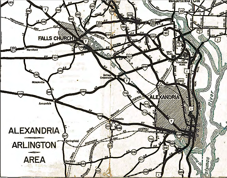
the Shirley Highway was built from the north to the south, since access to the Pentagon was a priority
Source: Virginia State Highway Commission, State Highway System (1949) (from Unversity of Alabama Library)
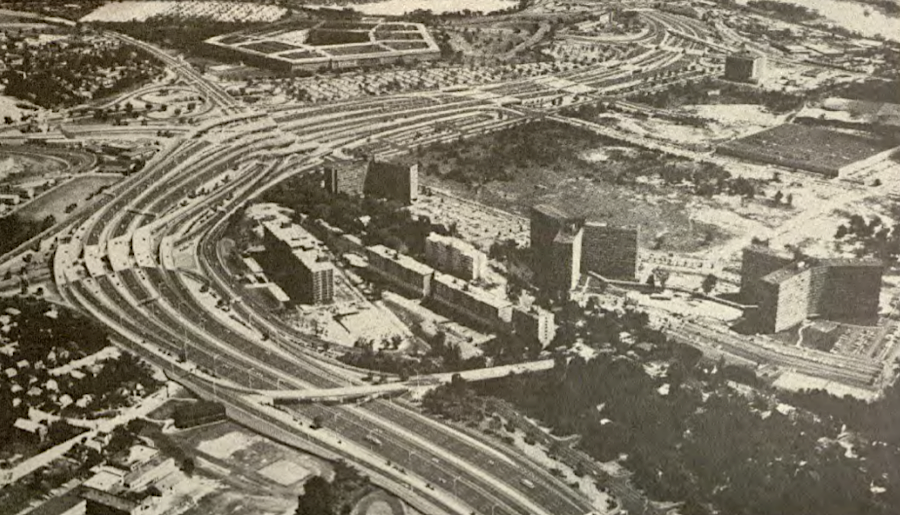
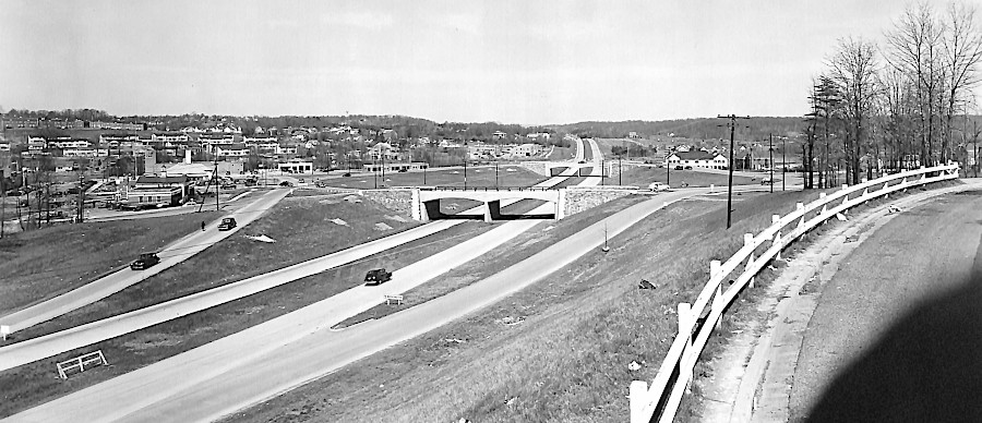
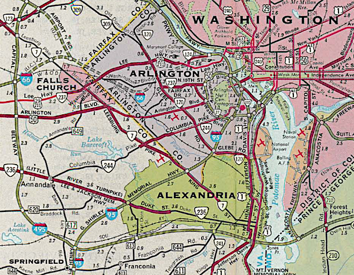
The Federal government built so many bridges at the Washington Street interchange that the site where the Shirley Highway/Washington Street mixed together became known as the "mixing bowl." That name was later applied to even more complex interchanges built further south on the Shirley Highway.
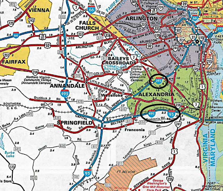
the original "mixing bowl" was the Washington Street/Shirley Highway interchange south of the Pentagon, but today the term is used to describe the complex I-395/I-495 interchange at Springfield
Source: The History and Heritage of Civil Engineering in Virginia, The Mixing Bowl Project (1970-1973)
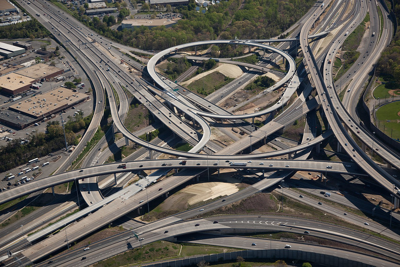
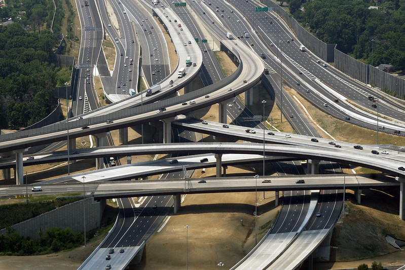
the complex I-395/I-495 interchange at Springfield, the modern "mixing bowl," has 50 ramps and bridges to separate lanes of traffic
Source: Virginia Department of Transportation, Springfield Interchange (photo by Trevor Wrayton, VDOT)
After World War II, the Shirley Highway was extended south to the Occoquan River. Four lanes were opened in 1949 between the intersection at VA 644 (old Keene Mill/Franconia Road) and Route 7 (King Street).
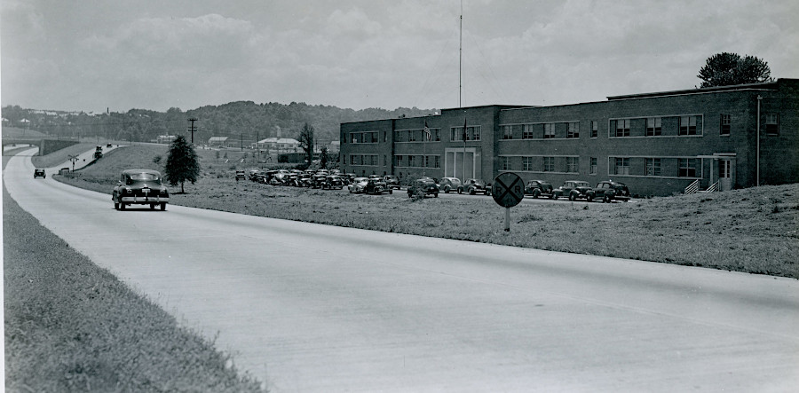
after WWII, the Shirley Highway was extended south of the original Mixing Bowl at the Washington Street interchange to the Occoquan River
Source: National Archives, Shirley Memorial Highway (1946)
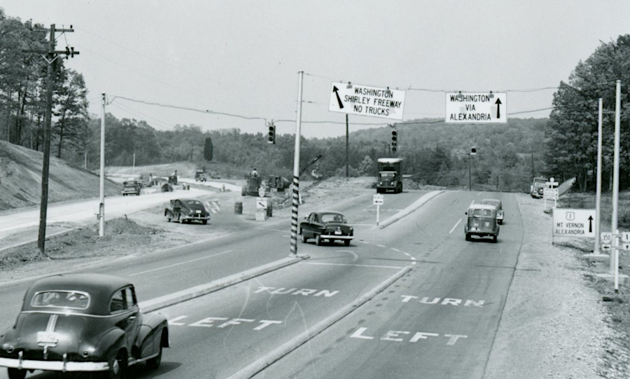
South of VA 644, there were just two lanes opened in 1949 south to rejoin Route 1 at the Occoquan River. The route was graded for a four-lane highway, but funding constraints allowed construction of just two lanes initially. Trucks were banned from that two-lane stretch.
The other two lanes were completed in 1952, at which point all 17 miles of the Shirley Highway were a four-lane divided highway with limited access. Opening up the highway to trucks in 1952 was controversial. Commuters claimed the road would be safer if trucks were prohibited. Transportation officials at the state and Federal levels rejected the proposal, because they considered it safer to move the trucks to the new freeway rather than keep them on Route 1.
The Virginia Department of Highways built its portion of the Shirley Highway before the US Congress passed the Federal Aid Highway Act of 1956 and authorized construction of the interstate highway system. The 1949-1952 delay in completing the last two-lane section between VA 644 and the Occoquan River was due to the difficulty in winning grants for funding new road projects, before Federal transportation funding increased after 1956.5
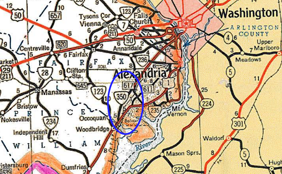
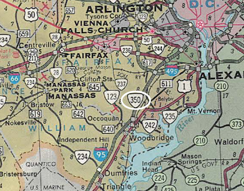
in 1949, the Shirley Highway (VA 350) was a two-lane road between the Occoquan River and Route 617 (Fort Belvoir) before being widened in 1950 to four lanes
Source: Virginia Department of Transportation (VDOT), Virginia Official State Highway Map - 1950 and 1952
The completed Shirley Highway provided a more-direct route between the Occoquan River and the Pentagon, leading to a population boom along the route in Northern Virginia. Dairy farms in Fairfax and Prince William counties were converted into housing subdivisions. Commuter traffic increased steadily, triggering a need to expand the road.
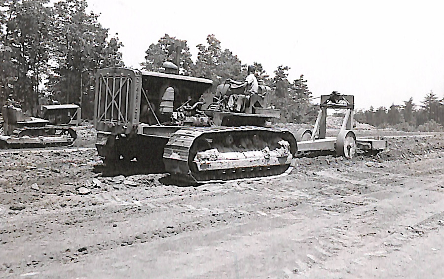
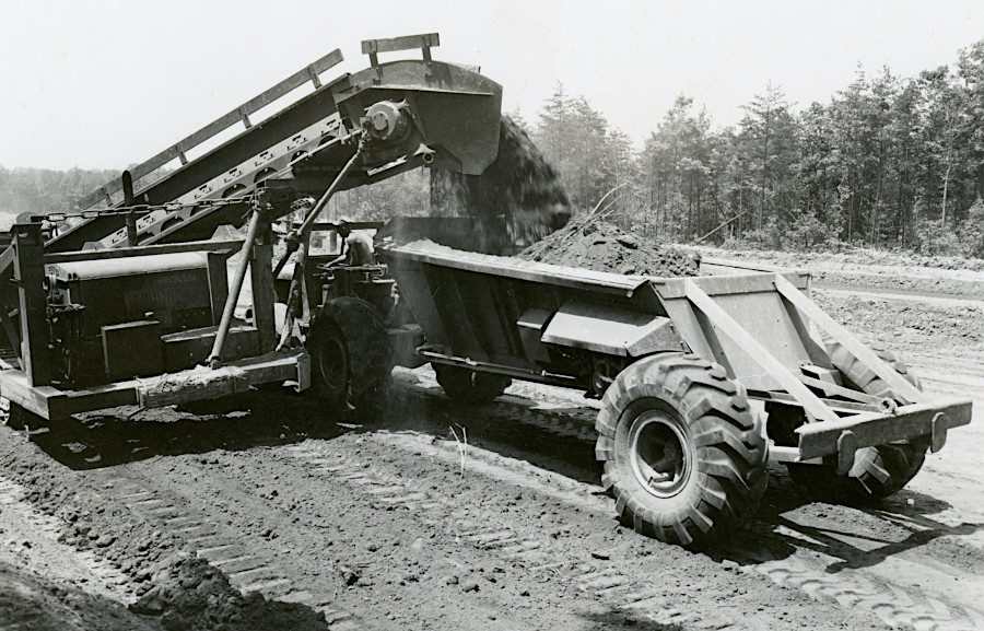
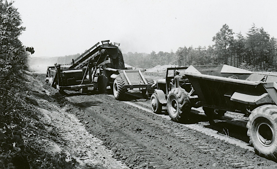
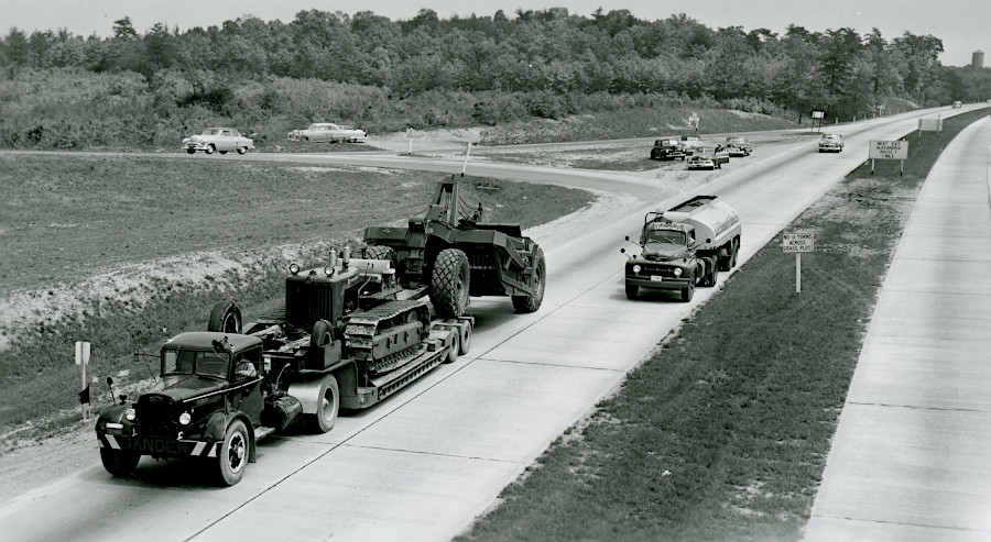
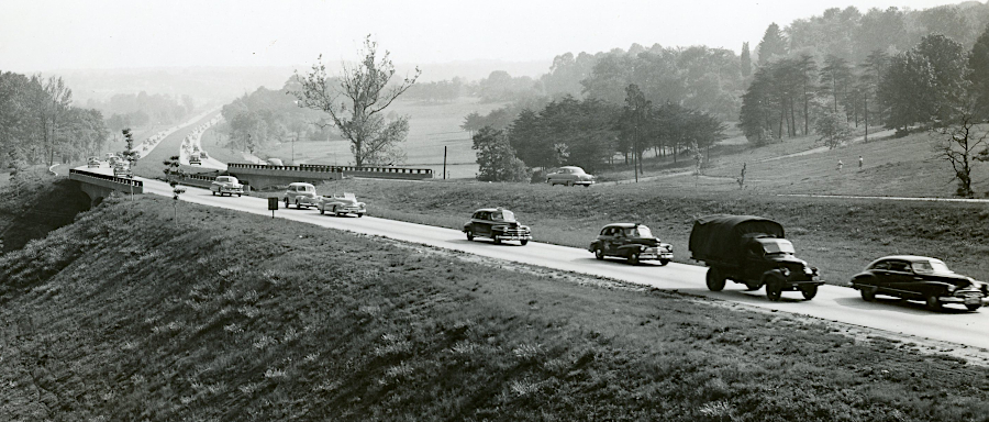
transporting construction equipment on the four lane, divided Shirley Highway in 1953
Source: National Archives, Transporting Construction Equipment
The Federal government's Bureau of Public Roads planned to expand the stretch from Route 7 north to six lanes, then transfer responsibility for maintaining the road to the Virginia Department of Highways. That stretch of road had been graded between 1941-44 for six lanes, but only a four-lane highway was built at the time.
The state agreed to the arrangement in 1955, but the Federal government did not complete the planned construction for nine more years. The Virginia Department of Highways finally assumed responsibility for the entire Shirley Highway in 1964, which was also when the Capital Beltway was completed. The Virginia Department of Highways numbered the stretch north of Roue 7 as I-95, but the Shirley Highway south of Route 7 remained VA 350 with no interstate number.
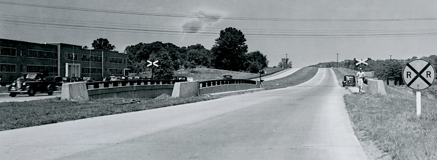
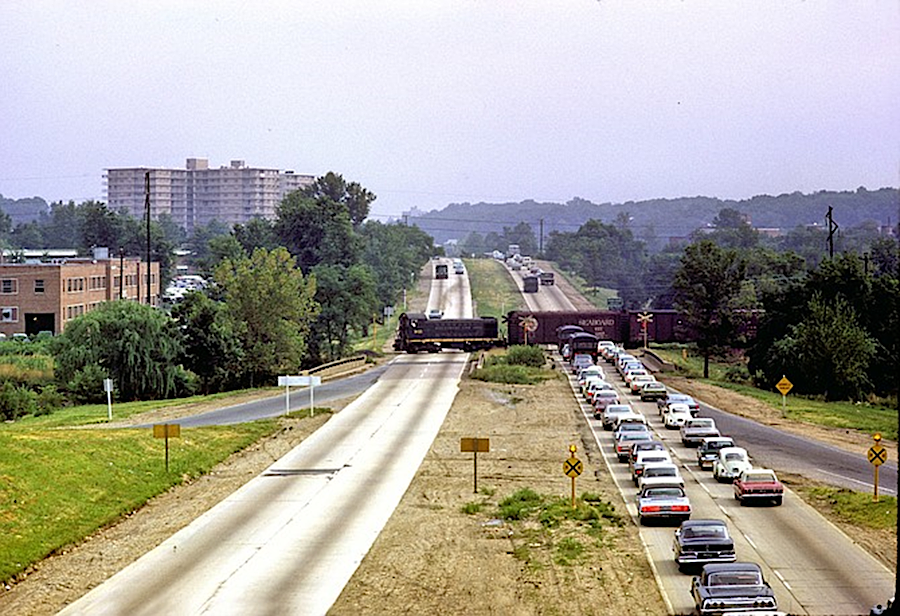
Interstate 95 had been completed between Richmond and the Occoquan River, but the Shirley Highway was not included within the interstate highway system until after the Washington and Old Dominion Railroad ceased operating in 1965. VA 350 had been constructed with an at-grade railroad crossing, but interstate highway standards required a bridge to separate rail and highway traffic. The end of railroad traffic allowed for VA 350 to be renumbered as Interstate 95 in 1966.6
The Shirley Highway was not included into the interstate system and renamed I-95 until the at-grade Washington and Old Dominion Railroad crossing was removed.
Source: Virginia Department of Transportation, Virginia Official State Highway Map 1965 and 1966; National Archives, "Bridge Over Four Mile Run," https://catalog.archives.gov/id/234116043; AA Roads, Freeways with at-grade railroad crossings
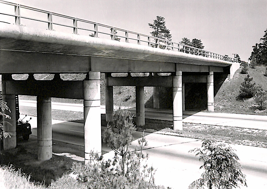
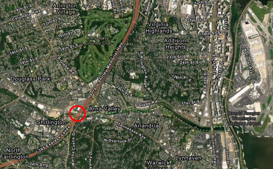
the former railroad crossing is now where the Washington and Old Dominion trail crosses under I-395 at Four Mile Run
Source: ESRI, ArcGIS Online
The Shirley Highway was numbered I-95 for just about a decade. Plans to build I-95 through Washington DC never became reality; instead of carving new highways through the city, the Metrorail system was completed. Soon after travelers coming north on I-95 crossed the Potomac River into Washington DC, the high-quality interstate highway ended. Long-distance drivers who were better prepared got off I-95 and drove east on I-495 (Capital Beltway). They crossed the Potomac River on the Woodrow Wilson Bridge and rejoined I-95 near College Park, Maryland.
To help all drivers understand the best way to bypass city traffic, the portion of the Shirley Highway between Springfield and Washington DC was renumbered I-395 in 1976. The eastern portion of the Capital Beltway was given the I-95 designation, together with its I-495 designation. The interchange at Springfield, which had become known as the new Mixing Bowl because drivers had to merge across so many lanes of traffic to reach different destinations, was upgraded.
Shirley Highway was renumbered I-395 to help drivers passing though Washington, DC to identify the best way to bypass city traffic
Source: Virginia Department of Transportation (VDOT), Virginia Official State Highway Map (1977)
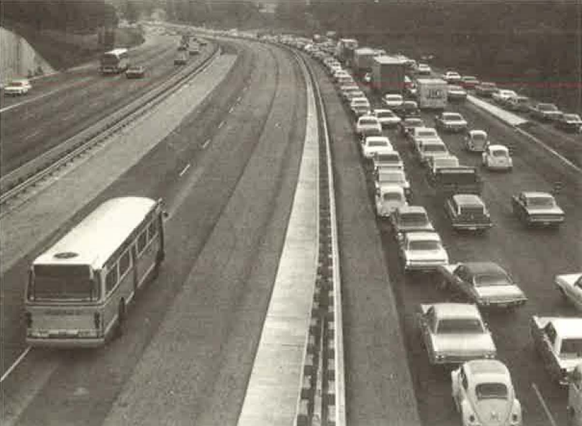
In the early 1960's, the Virginia Department of Highways planned to expand the Shirley Highway and meet interstate highway standards. Expansion converted the median of the highway into two dedicated lanes for bus traffic. The lanes were designed as a reversible roadway, with electronic gates that allowed bus traffic to go north in the morning and south in the evening. The District of Columbia agreed to build a new bridge across the Potomac River for the express lanes. 7
The express lanes were opened to carpools in 1975. Initially each car on the High Occupancy Vehicle (HOV) lanes was required to have at least four people, including the driver.
Reconstruction in 1999-2007 of the interchange at Springfield where I-395 and I-495 meet resulted in 50 ramps and bridges at the Springfield site. At one spot the highway is 24 lanes wide.8
Springfield Interchange linking I-95, I-395, and I-495 (Capital Beltway), now called the "Mixing Bowl"
Source: Virginia Department of Transportation (VDOT), Springfield Interchange
There are six other segments on the interstate highway system, from Florida to Main, that also have that I-395 number. All are auxiliary Interstate Highways, spurs connecting the primary I-95 to a key destination.9
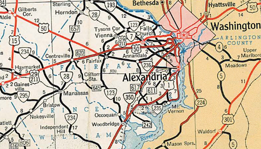
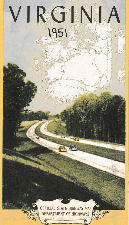
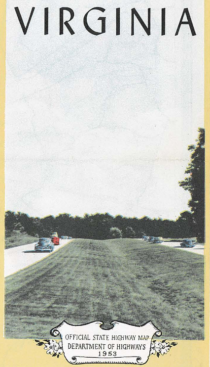
Virginia's official highway map featured the Shirley Highway in several years, including 1951 and 1953
Source: Virginia Department of Highways, Virginia Official State Highway Map - 1951 and 1953