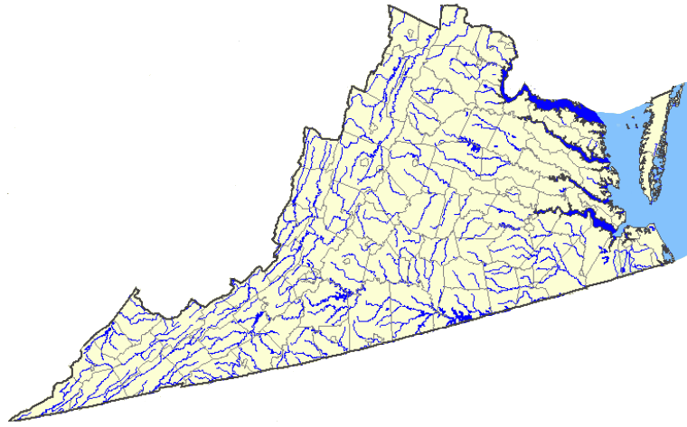
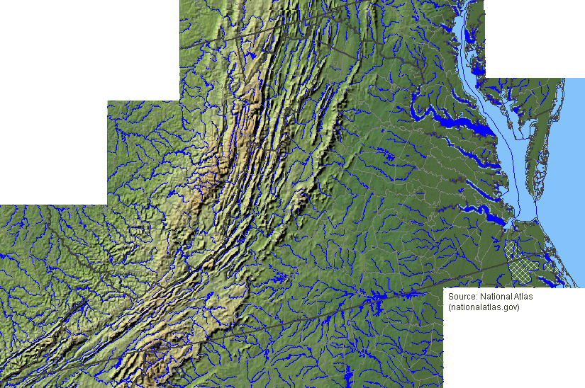
Virginia Rivers
Source: US Geological Survey (USGS), National Atlas
Virginia Rivers
Source: US Geological Survey (USGS), National Atlas
Virginia has 49,350 miles of rivers. For the last 250 million years, since the formation of Pangea, erosion has been carving into bedrock and creating channels for water to flow. The paths of the rivers have changed dramatically over time. As new layers of bedrock have been exposed by erosion, water has found new patterns of soft and hard material that diverts the flow. River channels will continue to change over time, as streams "pirate" sections and redirect flow.1
Three things that are required to create a river:
Not every place has rivers, of course - the Atacama Desert in Chile and many other deserts lack sufficient rainfall to create runoff, or to allow for groundwater to emerge at springs/seeps and form free-flowing streams.
In the Yucatan peninsula, the limestone bedrock is so porous that rainfall soaks quickly into the ground. Instead of flowing on the surface to the Gulf of Mexico/Caribbean Sea, rainfall travels underground through pores in bedrock and a system of caves equivalent to an subway network.
The closest equivalent to the Yucatan pattern in Virginia is the narrow sand dune region of beaches along the Atlantic Ocean/Chesapeake Bay. Where the gaps between sand grains are so wide that rainfall seeps into the ground, rather than runs off the surface, there are no surface river channels with flowing water. Instead, rain flows as groundwater through the dune itself, emerging at low spots between dunes to form pools with no "rivers" feeding or leaving the pool.
On Virginia's sandy Coastal Plain, some rainfall seeps into the soil - but there is enough clay in the soil to keep rainwater on the surface. Even on the Eastern Shore, there are surface creeks fed by runoff during rainstorms. For example, Nassawadox Creek flows from the town of Exmore to the Chesapeake Bay.
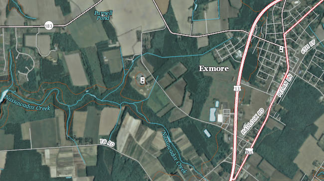
Nassawadox Creek on Eastern Shore
Source: US Geological Survey (USGS), National Map - Hydrography Viewer
Water flows in channels carved into the surface of the earth. That water is supplied by surface runoff during storms and, between storms, groundwater is added to the flow where the channels intersect the water table.
Those channels are known in Virginia as creeks, runs, prongs, branches, streams, and rivers, but there is no clear distinction between the categories. The largest channels of flowing water typically are called rivers, but some (especially near the upper edge of watersheds) may have less water flowing in them than other channels known as creeks.
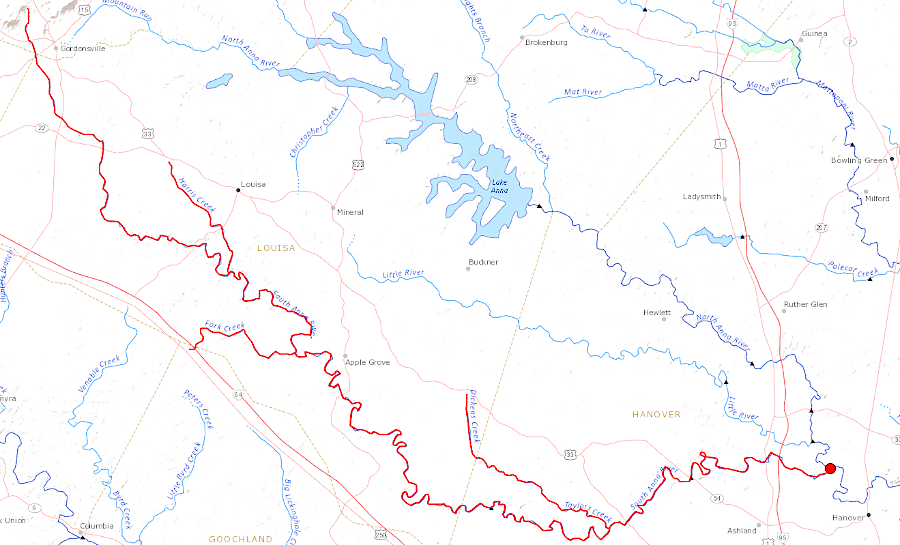
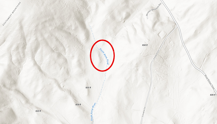
the South Anna River is labelled a river starting at its headwaters two miles northwest of Gordonsville
Source: US Geological Survey (USGS), Streamer and ESRI, ArcGIS Online
The distinction between river vs. stream (or creek vs. run) is just a matter of history and local custom. The Geographic Names Information System has 180,000 objects that are bodies of flowing water in the United States. Most are called some version of creek, brook, branch or run. Most of the 500 largest are called rivers or forks.
The National Hydrography Dataset identifies about 7,000,000 bodies of standing (as opposed to flowing) water in the United States. Most were made by humans blocking the natural flow of water.
Over 50% are called "lakes." In the eastern states, "pond" is a common term for small (less than 100 acres) bodies of standing water.
The English words "river" and "lake" are derived from French linguistic ancestors, while "pond," "stream" and "brook" have a German background. "Creek" may have come into English from a Scandinavian source.
The Europeans who reached North America already called salty or brackish tidal streams a "creek." The English who first came to Virginia sailed into estuaries and labelled the streams flowing into the Chesapeake Bay as creeks. That label was retained even after explorers moved further inland and realized that the flowing waters were fresh, without salt.
The settlement patterns of the United States, as well as the scouring of northern states by glaciers to form depressions that filled with water, are reflected in the names of waterbodies. As noted by George Stewart in Names on the Land:2
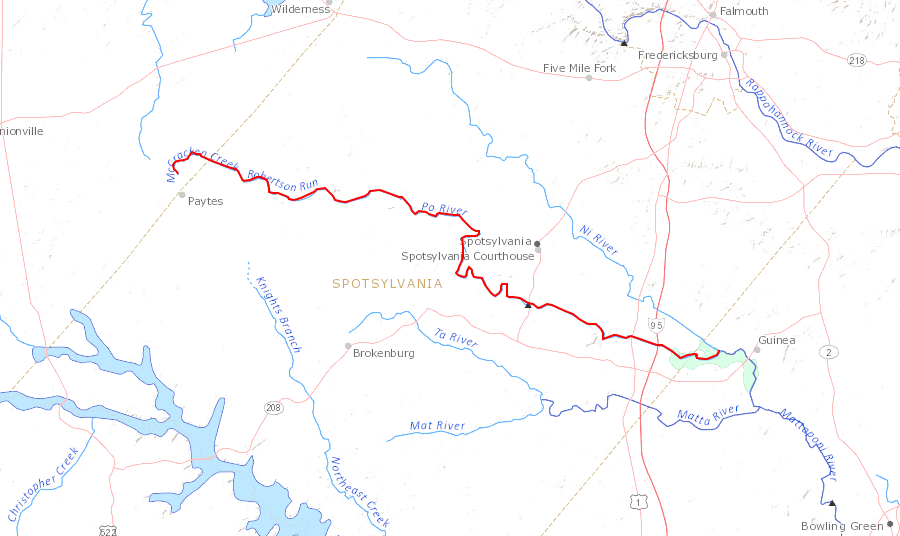
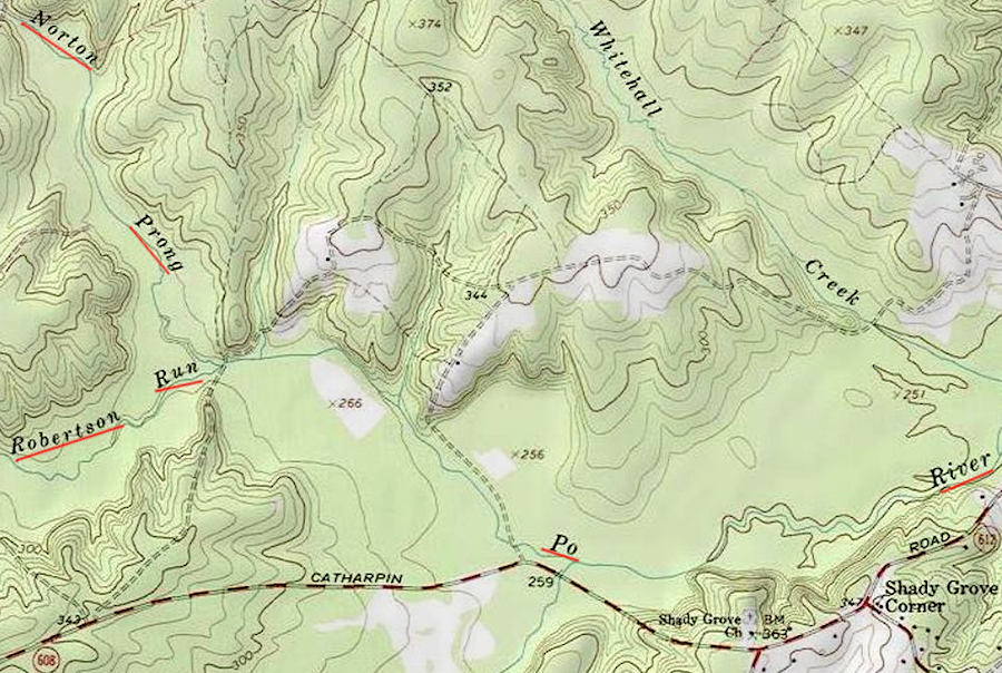
the headwaters of the Po River is the confluence of a "prong" and a "run"
Source: US Geological Survey (USGS), Streamer and ESRI, ArcGIS Online
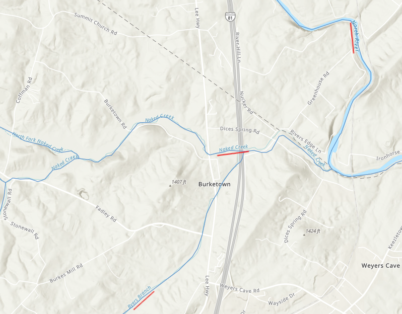
Byers Branch flows into Naked Creek, which flows into one of several streams in Virginia called North River
ESRI, ArcGIS Online
In Tidewater Virginia, though the names of watercourses may vary dramatically, the classification of a channel has great economic significance.
In the Tidewater counties, the Chesapeake Bay regulations designed to "Save the Bay" often require a 100-foot wide buffer of undisturbed vegetation along perennial streams, where water flows on the surface consistently (except during major droughts). Those buffers are known as Resource Preservation Areas (RPA's).
Channels that hold water during wet portions of the year, but where surface flow ceases during the summer or periods of low precipitation, are classified as intermittent streams. Channels where water flows only during a period of actual rainfall are known as ephemeral streams.3
On US Geological Survey 1:24,000 scale maps, intermittent streams are depicted by a dotted blue line while perennial streams are portrayed with a solid blue line. In urbanizing communities such as Hanover and Stafford counties, the determination of whether a stream is perennial can dramatically affect the number of houses that can be developed vs. acreage that must be left undisturbed as a Resource Preservation Area.
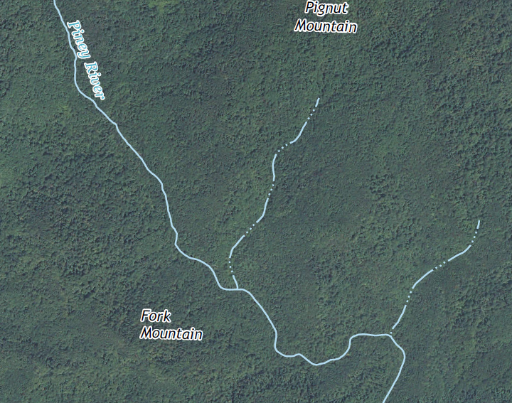
Piney River in Rappahannock County is fed by intermittent streams (dotted lines) flowing off the Blue Ridge
Source: US Geological Survey (USGS), Thornton Gap 7.5 x 7.5 topographic quadrangle (Revision 1, 2013)
The US Geological Survey maps were not intended to deal with fine-scale definition of stream hydrology, so the portrayal of dotted vs. solid blue lines on the 1:24,000 scale maps is not a valid basis for distinguishing intermittent vs. perennial streams. Jurisdictions affected by the Chesapeake Bay regulations may require developers to conduct site-specific determinations before approving a site plan or rezoning proposal.
Fairfax County chose to complete its own stream mapping project to identify perennial streams in advance of receiving development proposals, so there would be less conflict over where Resource Preservation Areas would be required. The protocol for mapping perennial stream segments had over 30 criteria, in addition to the persistence of flow during dry periods.4
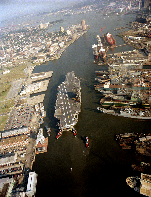
the Norfolk Naval Shipyard is located on the Southern Branch of the Elizabeth River, well protected from storms
Source: National Archives, Harbor tugs maneuver the aircraft carrier USS JOHN F. KENNEDY (CV 67) out of port as the vessel prepares to depart following overhaul at Norfolk Naval Shipyard (1991)
Source: USGS National Atlas
raindrops that fall on Mount Rogers, Virginia's highest point, will flow through streams and rivers to sea level at the Gulf of Mexico
Source: River Runner
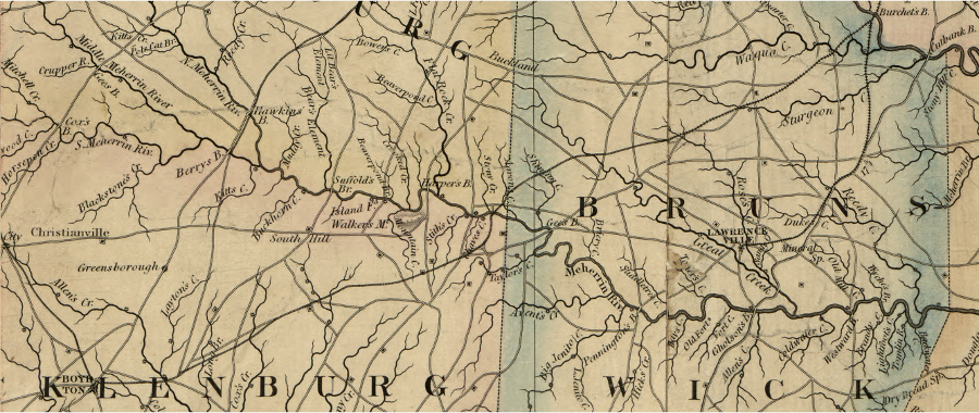
prior to the Civil War there were no major towns on the Meherrin River west of Hicksford (now the City of Emporia) - and that lack of urban development remains true today as well
Source: Library of Congress, A map of the state of Virginia, constructed in conformity to law from the late surveys authorized by the legislature and other original and authentic documents (1859)