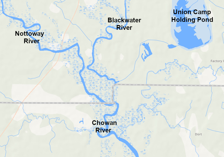
the confluence of the Nottoway River and the Blackwater River, at the Virginia-North Carolina border, is the beginning of the Chowan River
Source: US Geological Survey (USGS), Streamer
the confluence of the Nottoway River and the Blackwater River, at the Virginia-North Carolina border, is the beginning of the Chowan River
Source: US Geological Survey (USGS), Streamer
The Nottoway River is a tributary of the Chowan River. It merges with the Blackwaer River at the Virginia-North Carolina border. The Meherrin River joins less than 10 miles downstream, and the Roanoke River confluence is abou 40 miles south of the border. The waters of the Notoway River ultimately end up in the Albemarle Sound - the river is not in the Chesapeak Bay watershed.
the Nottoway River is a tributary of the Chowan River
Source: ESRI, ArcGIS Online
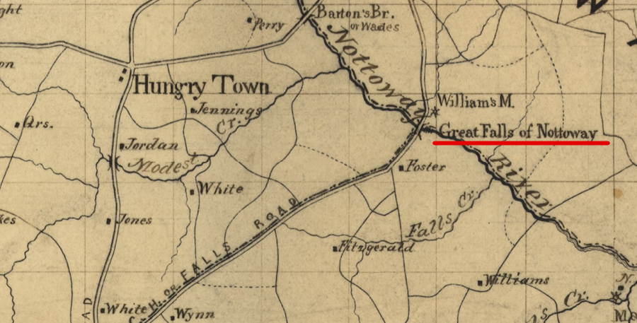
Jedediah Hotchkiss mapped Nottoway Falls in 1871
Source: Library of Congress, Preliminary map of Lunenburg County, Virginia (1871)
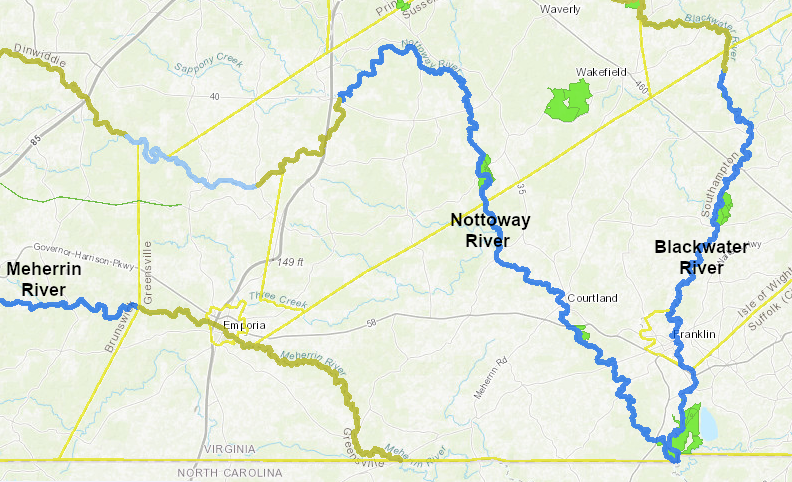
segments of the Meherrin, Nottoway, and Blackwater rivers have been designated as state scenic rivers
Source: Virginia Department of Conservation and Recreation, Virginia Outdoors Plan Mapper
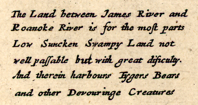
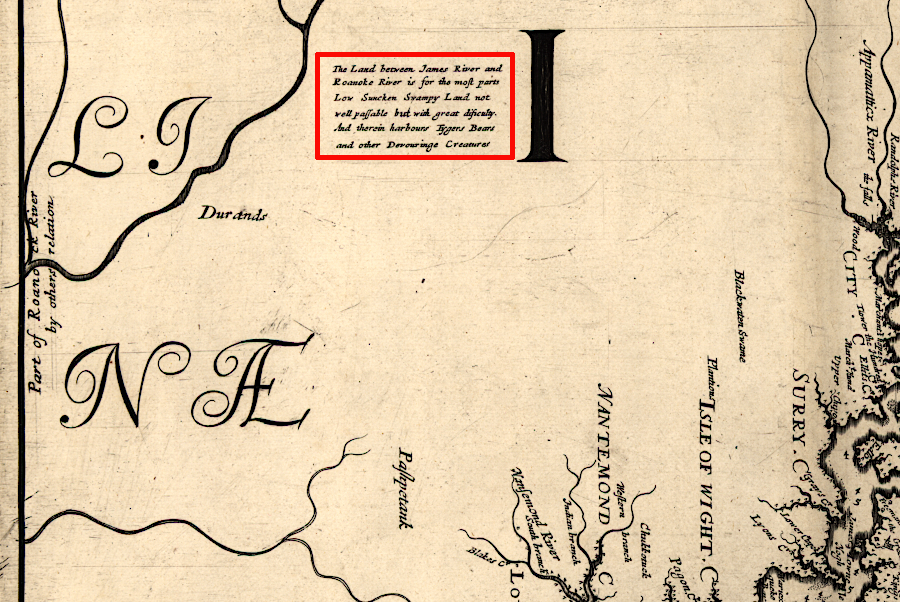
in 1673, colonists thought the Chowan River watershed was a land of tigers, bears, and other devouring creatures
Source: Library of Congress, Virginia and Maryland as it is planted and inhabited this present year 1670 (Augustine Herrman and Thomas Withinbrook, 1673)
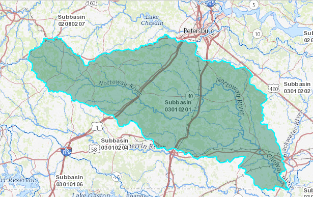
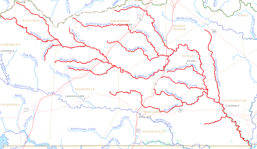
the Nottoway River watershed stretches from Prince Edward County to the North Carolina border
Source: US Geological Survey (USGS), TNM Download
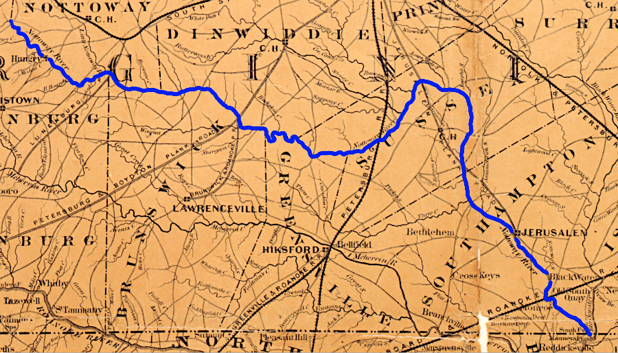
in 1861, railroads and plank roads carried crops from the Nottoway River watershed to Petersburg and Portsmouth
Source: Library of Congress, Colton's new topographical map of the eastern portion of the state of North Carolina with part of Virginia & South Carolina (by Joseph H. Colton, 1861)