Shenandoah Valley Railroad (Historic)
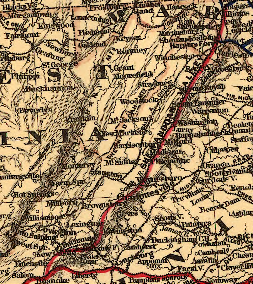
the Shenandoah Valley Railroad was built originally as a separate line, connecting to the Norfolk and Western Railroad at what became Roanoke
Source: Library of Congress, Map showing lines and connections of the Shenandoah Valley and Norfolk & Western Railways (1881)
The Shenandoah Valley Railroad was the first railroad to connect the Shenandoah Valley and Southwestern Virginia. It provided a north-south route west of the Blue Ridge between Maryland and ultimately Tennessee.
The Shenandoah Valley Railroad was a continuation of efforts to connect the interior of the United States to port cities with access to Europe. Transporting surplus agricultural products eastward to markets had been the priority objective of the transportation network ever since Virginia colonists began to move away west of the Fall Line into the Piedmont. Baltimore business interests initially funded the Shenandoah Valley Railroad, anticipating increased traffic would increase profits in that city.
The new Shenandoah Valley Railroad was planned to link up with the existing Virginia and Tennessee Railroad somewhere near the Roanoke River. The Virginia and Tennessee Railroad would provide the desired access to traffic coming from further south, diverting freight to Baltimore that otherwise would go to Petersburg or Richmond.
When the Shenandoah Valley Railroad was chartered after the Civil War, there already was an extension of a Maryland-based railroad into the Shenandoah Valley. The Winchester & Potomac Railroad had linked the northern part of the valley to Baltimore in 1836. Farmers in the central part of the Shenandoah Valley, between Mount Jackson and Strasburg, could use the Manassas Gap Railroad to send crops to Alexandria. At the southern (upper) end of the valley, the Virginia Central had crossed the Blue Ridge and reached Staunton in 1854. Tt took freight east to Richmond.
Until after the Civil War, north-south freight between Front Royal to Winchester had to be carried by horse-drawn wagons south to Front Royal or north to Winchester. Farmers sending freight northward had the additional option of using batteaux to float freight down the Shenandoah River to the Potomac River. At Harpers Ferry, trains took products to Baltimore while boats on the Chesapeake and Ohio (C&)) Canal took freight to Georgetown and Alexandria.
In 1867, the Winchester & Strasburg Railroad built new track south to Front Royal. That closed the 15-mile gap and connected Winchester to the Manassas Gap Railroad.
The Shenandoah Valley Railroad (not to be confused with the "Valley Railroad" built later) did not build its mainline through the town of Front Royal. As part of its negotiations in 1880 to cross the Virginia Midland (originally the Manassas Gap Railroad), it agreed to build its track west of town along the South Fork of the Shenandoah River. As a result, it crossed the main Shenandoah River downstream of the confluence of the two forks at Riverton. Freight traffic from Front Royal was desirable, but the railroad's primary cargo was expected to be mineral ores and products from iron furnaces on the western edge of the Blue Ridge.1
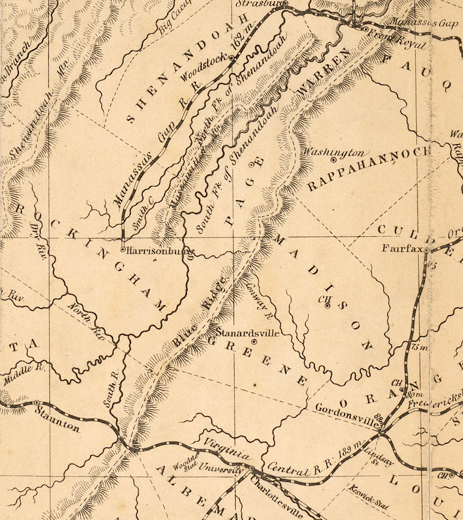
the Valley Railroad, the first railroad south of Front Royal into the Shenandoah Valley, was built west of Massanutten Mountain
Source: Library of Virginia, A map of the rail roads of Virginia
In 1879, the railroad reached the Winchester and Berry's Ferry Turnpike in Clarke County. The 1880 train depot at that location spurred development of Boyceville, soon known as Boyce. The current depot building at the site was constructed in 1913. Several wealthy local residents supplemented the Norfolk and Western Railroad's planned $7,500 in funding in order to get a $25,000 "first class" station built, rather than the standard wooden depot.
The station was sold by the railroad in 1955, though the post office remained in the building until 1984. Since then the 11-room structure has been home to a restaurant, used for storage, and housed a woodworking shop. Today the building is owned by the Boyce Railway Depot Foundation.2
The Pennsylvania bankers who owned the Norfolk and Western Railroad also gained control of the Shenandoah Valley Railroad. They kept the companies separate for nine years after completing the Shenandoah Valley Railroad track to "Big Lick" in 1881. In 1890, the Shenandoah Valley Railroad was merged into the Norfolk and Western Railroad.3
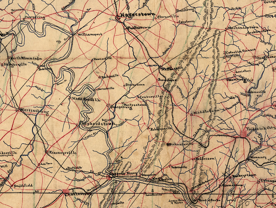
the Shenandoah Valley Railroad faced multiple options for building to Hagerstown, or connecting with just the Baltimore and Ohio (B&O) in West Virginia
Source: Library of Congress, Map of portions of Virginia and Maryland, extending from Baltimore to Strasburg (186__)
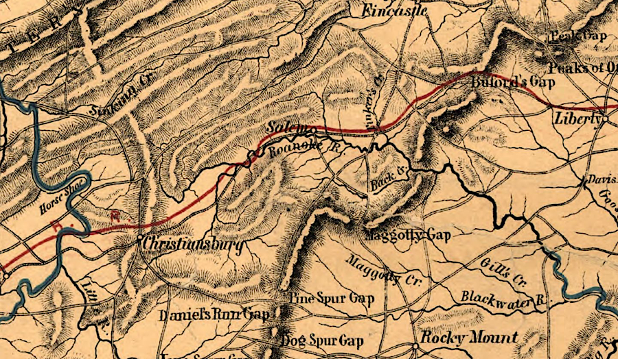
the Shenandoah Valley Railroad planned to intersect the Atlantic, Mississippi and Ohio (formerly Virginia and Tennessee) Railroad at Salem
Source: Library of Congress, Map of western Virginia (by W. L. Nicholson, 1862)
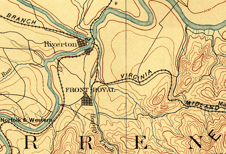
the Shenandoah Valley Railroad (soon renamed the Norfolk & Western Railroad) bypassed Front Royal
Source: US Geological Survey (USGS), Luray, VA 1:125,000 topographic quadrangle (1893)
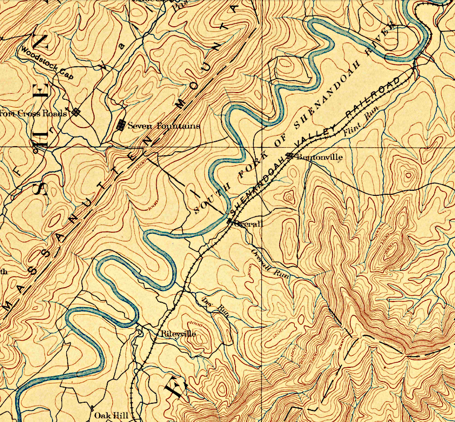
the Shenandoah Valley Railroad built trestles over tributaries flowing west into the South Fork of the Shenandoah River
Source: US Geological Survey (USGS), Luray VA 1:125,000 topographic quadrangle (1893)
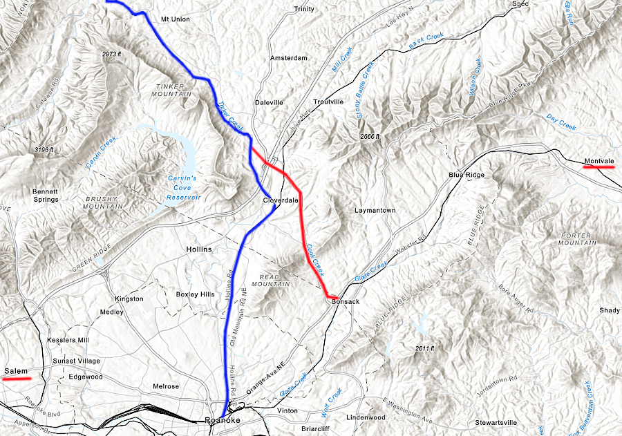
the Shenandoah Valley Railroad (blue) could have built to Bonsack (red), but Salem was too far west and Montvale was on the east side of the Blue Ridge
Source: ESRI, ArcGIS Online
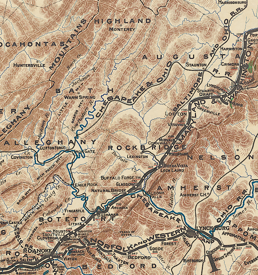
the Shenandoah Valley Railroad got to Roanoke, but the Valley Railroad stopped at Lexington
Source: New York Public Library, Mineral territory tributary to Norfolk and Western Railroad (1890)
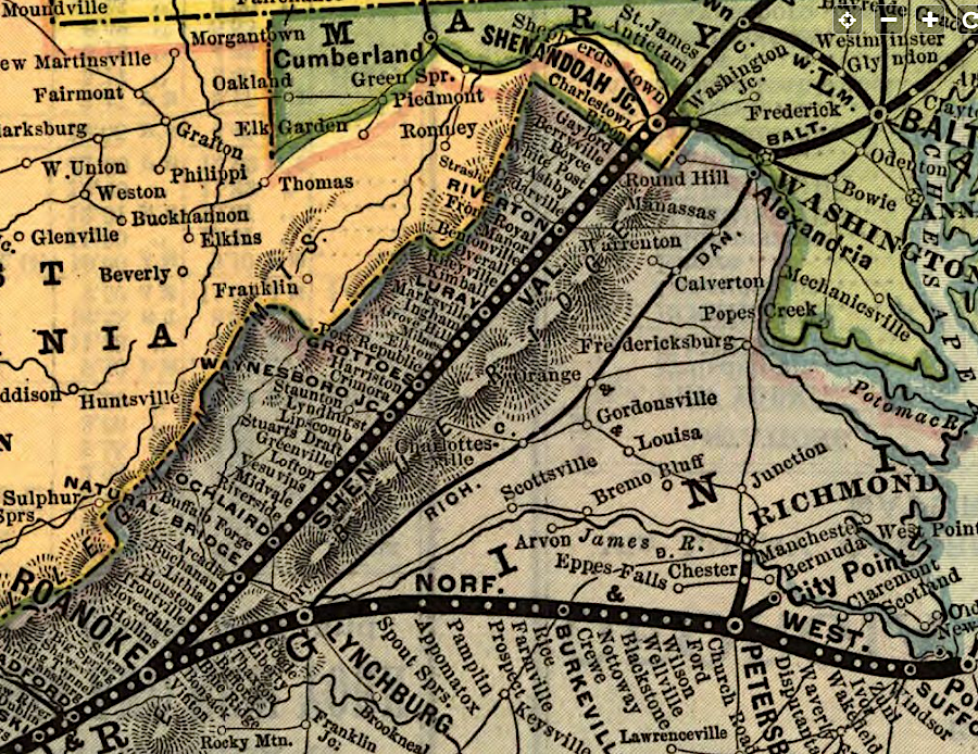
the Shenandoah Valley Railroad was merged into the Norfolk and Western Railroad system
Source: Library of Congress, Map of the Shenandoah Valley route via Luray Caverns, Natural Bridge & the Grottos (1890)
Links
References
1. John R. Hildebrand, Iron Horses in the Valley, The Valley and Shenandoah Valley Railroads, 1866-1882, Burd Street Press, 2001, p.33, https://www.google.com/books/edition/_/PDMHAAAACAAJ (last checked June 9, 2020)
2. "A New Future for Norfolk & Western Railway Depot in Boyce," Clarke Monthly, January 30, 2025, https://clarkeva.com/2025/01/30/a-new-future-for-norfolk-western-railway-depot-in-boyce/ (last checked February 7, 2025)
3. Allen W. Moger, "Railroad Practices and Policies in Virginia after the Civil War," The Virginia Magazine of History and Biography, Volume 59, Number 4 (October 1951), p.436, https://www.jstor.org/stable/4245803 (last checked June 8, 2020)
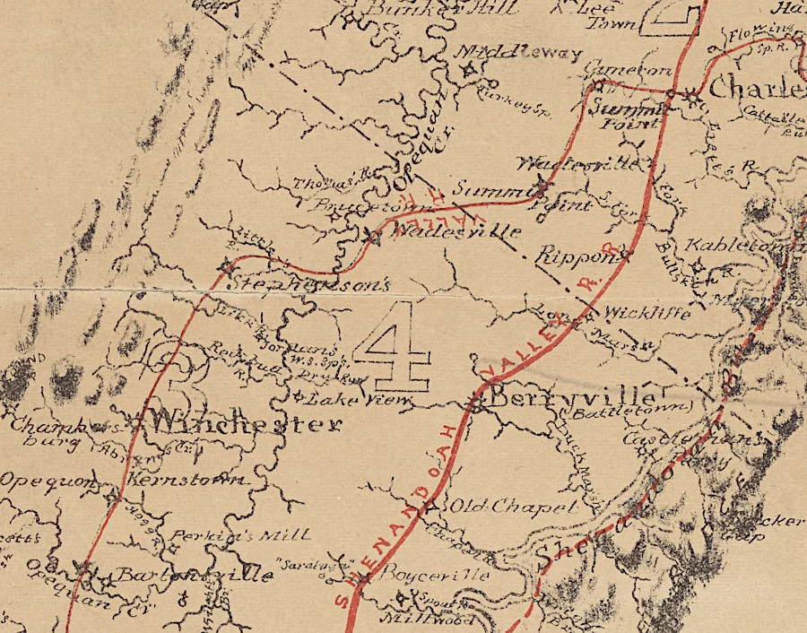
the Shenandoah Valley Railroad parallled the Valley Railroad
Source: New York Public Library, Map of the Shenandoah Valley: showing the location of the Shenandoah Valley Railroad and of the iron-ore belts and other mineral deposits (by Jedediah Hotchkiss, 1880)
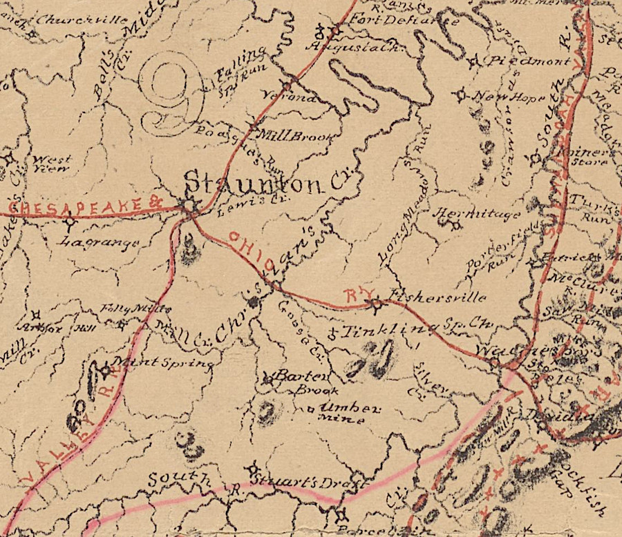
the Shenandoah Valley Railroad connected with the Chesapeake and Ohio in Waynesboro, while the Valley Railroad connected in Staunton
Source: New York Public Library, Map of the Shenandoah Valley: showing the location of the Shenandoah Valley Railroad and of the iron-ore belts and other mineral deposits (by Jedediah Hotchkiss, 1880)
Railroads of Virginia
Virginia Places


