Norfolk and Western Railway
after the Civil War, there was no railroad west of the Blue Ridge connecting the Baltimore and Ohio (B&O) with the Atlantic Mississippi & Ohio Railroad
Source: Library of Congress, A map showing the Atlantic Mississippi & Ohio R.R. and its connections from Norfolk to Cumberland Gap via Bristol (1867)
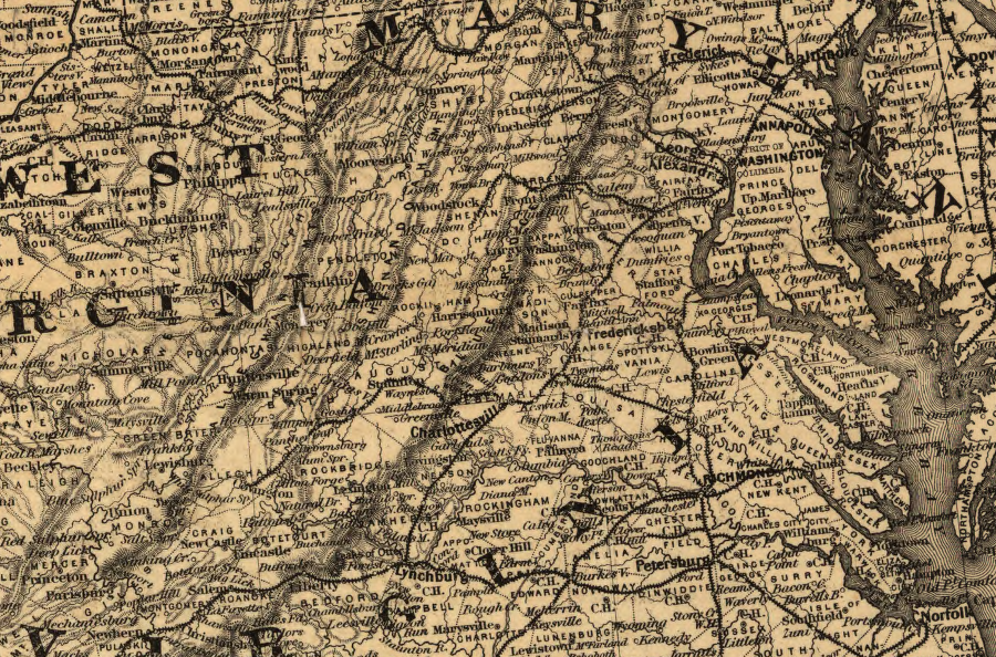
The Norfolk and Western Railroad was created in 1881, when Philadelphia-based investors were finally able to acquire the Atlantic, Mississippi and Ohio Railroad after five years of bankruptcy. The railroad merged with the Shenandoah Valley Railroad, also financed by Pennsylvania investors, and was named Norfolk and Western Railroad.
Initially, the most profitable business was hauling cotton from southern farms to mills in Virginia and further north. However, the investors recognized that they could generate traffic from within Virginia, rather than just serve as a trunk route. The Norfolk and Western Railroad expanded into the Virginia coal fields, building along the New River to Pocahontas in 1881.
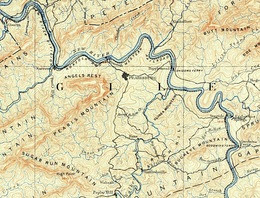
the Norfolk and Western built on the west side of the New River, then up the East River at Glen Lyn into West Virginia
Source: US Geological Survey (USGS), 1:62,500 Dubliv VA topographic quadrangle (1891)
By 1895, its debts for expansion exceeded its capacity to pay back investors. After going through bankruptcy, it emerged in 1896 as the Norfolk and Western Railway in 1896.1
"Norfolk and Western Railroad Company (1881-1896)," ArchivesSpace, https://aspace.lib.vt.edu/agents/corporate_entities/24; "Norfolk and Western Railway Company (1896-1982)," ArchivesSpace, https://aspace.lib.vt.edu/agents/corporate_entities/266; "Annual Report of the State Corporation Commission of Virginia. Compilations from Returns of Railroads, Canals, Electric Railways and Other Corporate Companies," Virginia State Corporation Commission, 1917, p.337, https://books.google.com/books?id=BN8lAQAAIAAJ; "N015-0352 Norfolk Southern Six Mile Bridge No. 58," National Register of Historic Places nomination form, Virginia Department of Historic Resources, August 28, 1995, https://www.dhr.virginia.gov/historic-registers/015-0352/ (last checked August 18, 2020)
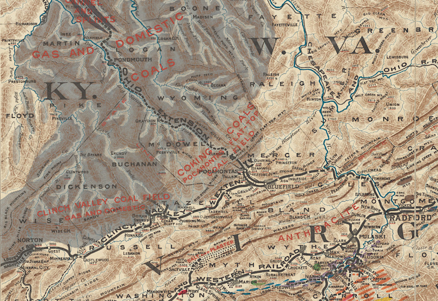
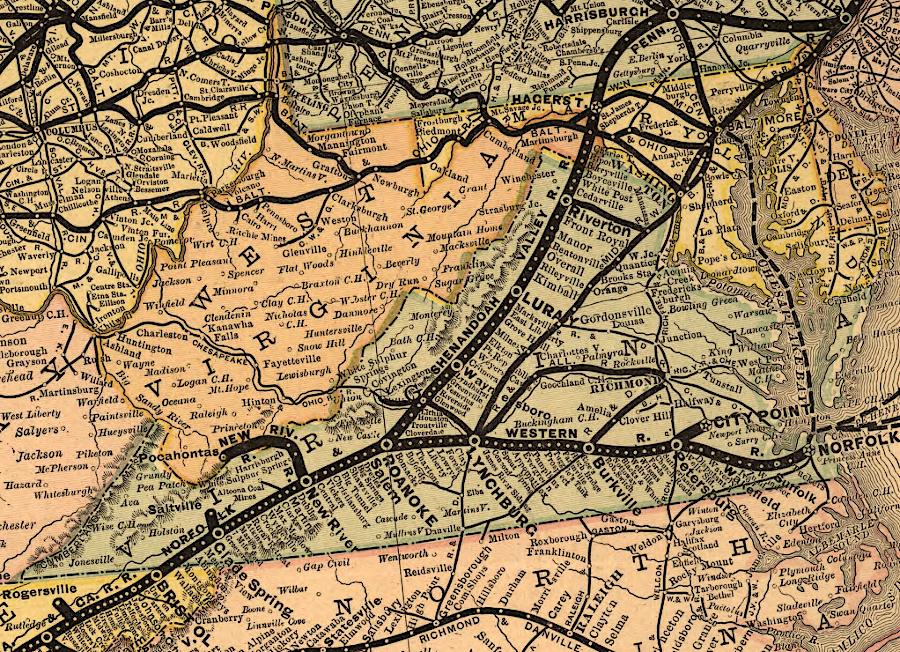
the Norfolk and Western built down the New River into the West Virginia coalfields, with the Clinch Valley Extension to Norton
Source: New York Public Library, Mineral territory tributary to Norfolk and Western Railroad (1890)
In 1888, a site halfway between Roanoke and Norfolk was chosen for the repair shops needed to maintain the steam locomotives. The rail yard and town surrounding it were named Crewe, which was the name of a major rail facility in England.1
"Crewe, Virginia – A Town Built By The Norfolk & Western," Trains21, http://trains21.org/2015/05/22/railroad-towns-crewe-virginia-built-by-the-norfolk-and-western/ (last checked May 30, 2020)
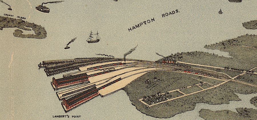
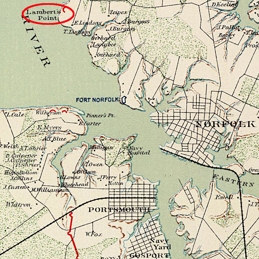
the Norfolk and Western Railroad carried coal to Lamberts Point in Norfolk in 1891
Source: Library of Congress, Bird's eye view of Norfolk, Portsmouth and Berkley, Norfolk Co., Va (1891?)
The Norfolk and Western Railroad went through receivership and reorganization in 1896, emerging as the Norfolk and Western Railway. 1
"Norfolk and Western Railway Company," Annual Report, Virginia, Railroad Commissioner, 1898, p.428, https://books.google.com/books?id=mCUaAQAAIAAJ (last checked June 2, 2020)
In 1899 the Pennsylvania Railroad and the New York Central negotiated the Community of Interest Plan. Between them, they purchased control of other major railroads in Virginia and other eastern states to manage price competition. The Pennsylvania purchased effective control of the Norfolk and Western Railway.
The rate-setting arrangement was successful. After the US Congress passed the Elkins Act of 1903 and the Hepburn Act of 1906, the Interstate Commerce Commission was empowered to establish rates that would ensure continued profitable operations. The Pennsylvania Railroad then sold a majority of its Norfolk and Western Railway stock in 1906.
The Pennsylvania Railroad then began to purchase more shares as an investment rather than to control traffic, based on the dependable profitability of the coal-hauling Norfolk and Western Railway. At one time, the Pennsylvania Railroad owned 44% of the shares in the Norfolk and Western Railway. As late as 1964, the Pennsylvania Railroad still owned 34% of the company.1
"Norfolk Southern merger family tree," Trains, June 2, 2006, https://trn.trains.com/railroads/railroad-history/2006/06/norfolk-southern-merger-family-tree; "Hepburn Act," Teddy Roosevelt Center, https://www.theodorerooseveltcenter.org/Learn-About-TR/TR-Encyclopedia/Capitalism-and-Labor/The-Hepburn-Act; H. W. Schotter, The growth and development of the Pennsylvania Railroad Company, Press of Allen, Lane & Scott, 1927, pp.260-262, pp.203-294, https://hdl.handle.net/2027/uc1.$b38943; The Penn Central and Other Railroads: A Report to the Senate Committee on Commerce, U.S. Government Printing Office, 1973, p.319, p.326, https://books.google.com/books?id=mzr30uuJI4QC (last checked July 2, 2020)
Soon after the start of the 20th Century, the Norfolk and Western Railway realigned its track at Lynchburg so freight traffic could bypass the city and use a route with a more gentle grade. New track was constructed from Forest, west of Lynchburg around the southeast edge of the city to Concord. Passenger trains continued to use the South Side Railroad's old route, crossing the James River on Six Mile Bridge east of Lynchburg to reach Percival Island.1
"N015-0352 Norfolk Southern Six Mile Bridge No. 58," National Register of Historic Places nomination form, Virginia Department of Historic Resources, August 28, 1995, https://www.dhr.virginia.gov/historic-registers/015-0352/ (last checked August 18, 2020)
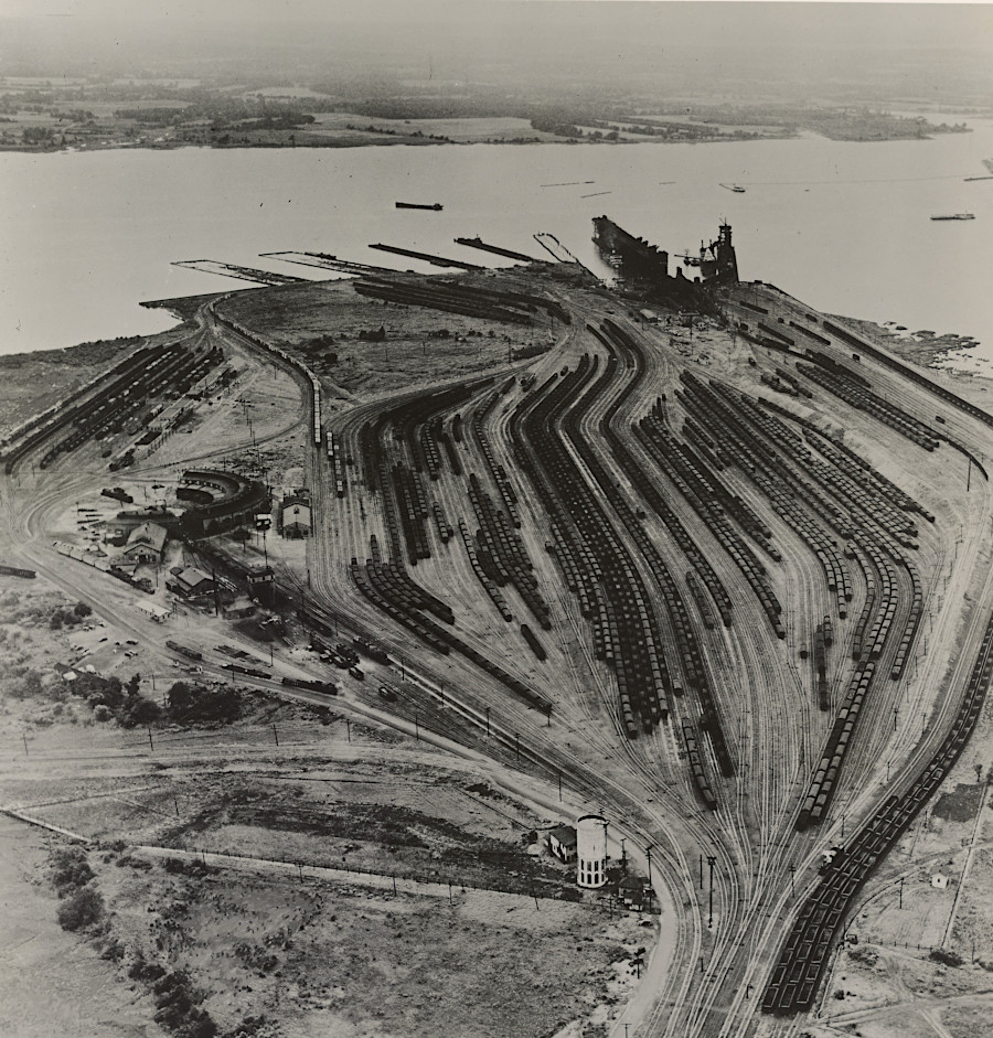
the Norfolk and Western Railway carried coal to the docks at Lamberts Point on the Elizabeth River in Norfolk
Source: National Archives, Virginia - Norfolk (1941)
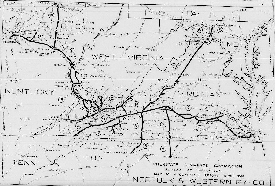
the Norfolk and Western Railway was extended westward to Clumbus and Cincinnati
Source: National Archives, System Index Map - Norfolk & Western Railway (ca. 1915–ca. 1920)
WWI OPERATIONS
1920 PLAN TO CONSOLIDATE
1940 PLAN TO CONSOLIDATE
Consolidation of the eastern railroads began after the Interstate Commerce Commission decided in 1958 to allow the Norfolk and Western Railway to acquire the Virginian Railway. The Federal agency had the authority to allow mergers, even if the effect would create a significant reduction in competition which the Clayton Act and Sherman Act might otherwise prohibit.
The Interstate Commerce Commission (ICC) chose to evaluate merger proposals in individual cases, rather than consolidate them to create the most-logical reorganization of railroads. A 1973 report to the US Senate later concluded:1
The Penn Central and Other Railroads: A Report to the Senate Committee on Commerce, U.S. Government Printing Office, 1973, pp.283-284, https://books.google.com/books?id=mzr30uuJI4QC (last checked July 8, 2020)
- This has led to a domino effect, particularly in the East, with one merger inspiring and often forming the justification for other follow-on mergers...
The Virginian Railway was a profitable competitor to the also-profitable Norfolk and Western Railway, with a track essentially in parallel from the West Virginia coal fields to wharves on the Elizabeth River in Norfolk. Combining the two allowed for a reduction in costs, but ended the Virginian's traditional shipments of coal to northern cities from the Pocahontas fields via the New York Central. The Interstate Commerce Commission approved many later mergers based on an assumption that cost savings, rather than increased customer service, would create greater financial stability for merged companies.
The 1973 report to the US Senate noted how the Virginian-Norfolk and Western merger led to a new pattern of railroads in the eastern states, concluding with the disastrous merger in 1968 of the New York Central and Pennsylvania Railroad into the Penn Central:1
The Penn Central and Other Railroads: A Report to the Senate Committee on Commerce, U.S. Government Printing Office, 1973, pp.284-285, https://books.google.com/books?id=mzr30uuJI4QC (last checked July 2, 2020)
- Innocent though it seemed at the time to be, that merger unleashed a wave of mergers that did not expire until the entire Eastern rail system was completely restructured and the Penn Central, the great house of cards, had been created. The Virginian-N&W merger ended the New York Central's access to the Pocahontas coal territory. With its valuable coal traffic theatened, the New York Central sought protection in a merger with the B&O.
- Pressed to consider merger, the B&O decided to merge instead in a two-way arrangement with the C&O. When the C&O and B&O merged, the N&W was threatened because it gave the C&O access to St. Louis and to transcontinental traffic. To counter this move the N&W merged with the Nickel Plate and the Wabash railroads... With what it regarded as its more desirable partners having already merged, the NYC finally agreed to join with the Pennsylvania in its ill-fated union.
VIRGINIAN MERGER IN 1959
The Norfolk and Western merged with the New York, Chicago & St. Louis (Nickel Plate) Railroad and the Wabash in 1964, and approval from the Interstate Commerce Commission (ICC) included a requirement for the Pennsylvania Railroad to dispose of its shares in the Norfolk and Western.
In 1962, the Pennsylvania Railroad had proposed merging with the New York Central. Divestiture of the Pennsylvania Railroad's ownership in the Norfolk and Western Railway was expected to spur competition between three main east-west trunk lines planned in the eastern United States - the Norfolk and Western, Chesapeake and Ohio, and Penn Central railroads. Otherwise, the Interstate Commerce Commission would object to one member of the trio owning a major percentage of a competitor.
The Pennsylvania Railroad gave voting control over its Norfolk and Western Railway shares to independent trustees in 1964. When the US Department of Justice objected to the proposed merger of the New York Central and the Pennsylvania Railroad, the Pennsylvania threatened to retain ownership of the Norfolk and Western stock rather than rather sell it. That would have disrupted the merger of the Norfolk and Western with the Nickle Plate and the Wabash.
The Federal government ended up supporting the merger and creation of the Penn Central, and the Pennsylvania Railroad sold its ownership of the Norfolk and Western Railway in 1968.1
The Penn Central and Other Railroads: A Report to the Senate Committee on Commerce, U.S. Government Printing Office, 1973, p.346, https://books.google.com/books?id=mzr30uuJI4QC (last checked July 6, 2020)
There were multiple proposals for unifying different railroads in the 1960's. In 1965, the Norfolk and Western Railway proposed to merge with the Chesapeake and Ohio Railway, which had just absorbed the Baltimore and Ohio Railroad. That would create a larger network to compete after the expected merger of the New York Central and Pennsylvania Railroad. The disappearance of the Chesapeake and Ohio Railway would eliminate one of the Class 1 railroads in Virginia. The Southern Railway would remain, as well as a merged Seaboard Air Line-Atlantic Coast Line.
The Interstate Commerce Commission, as part of its consideration of the proposed railroad consolidations, required the stronger and larger railroads to absorb weaker and smaller lines. In 1967, the Norfolk and Western Railway was required to absorb three unprofitable railroads operating in the northeastern states, and the US Supreme Court upheld that mandate in 1968.
The hearing examiner for the Interstate Commerce Commission recommended approval of the merger. However, the two railroads dropped the proposal after the Penn Central went into bankruptcy in 1970, just two years after it was created by mering the Pennsylvania Railroad and the New York Central.1
The Penn Central and Other Railroads: A Report to the Senate Committee on Commerce, U.S. Government Printing Office, 1973, pp.323-325, https://books.google.com/books?id=mzr30uuJI4QC (last checked July 2, 2020)
The Norfolk and Western Railway merged with the Southern Railway and was renamed the Norfolk Southern Railway in 1982.
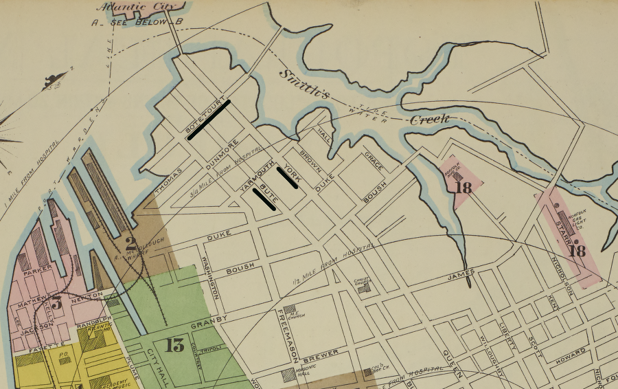
in 1887, the Norfolk and Western's northernmost docks on the Elizabeth River were located near Smith's Creek, not at Lambert's Point
Source: Library of Congress, Sanborn Fire Insurance Map from Norfolk, Independent Cities, Virginia (Sanborn Map Company, 1887)
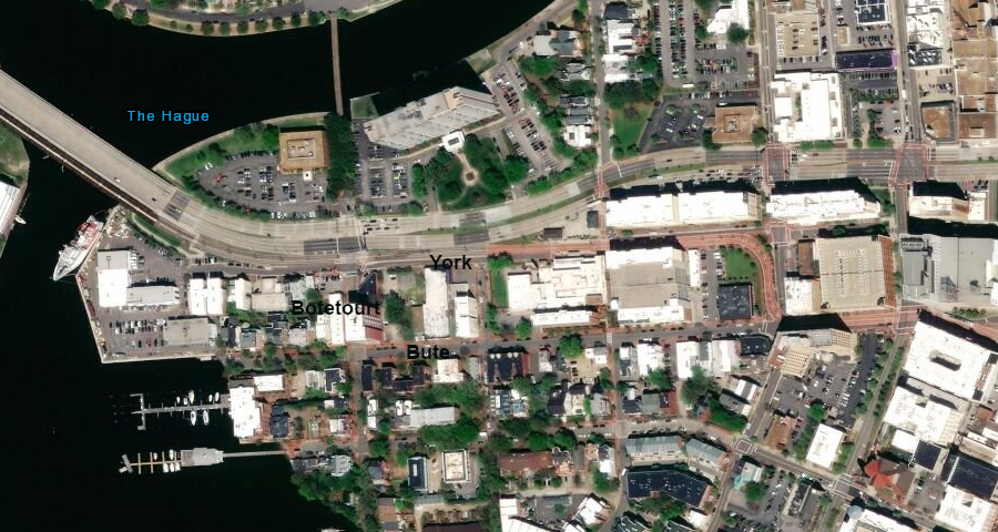
Smith's Creek is now The Hague, and the 1887 Norfolk and Western docks are now a residential neighborhood
Source: ESRI, ArcGIS Online (2018)
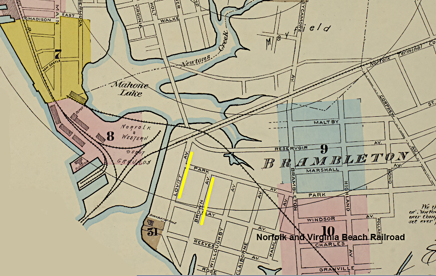
site of the 1887 railyards and stations for the Norfolk and Western Railroad and the Norfolk and Virginia Beach Railroad in 1887
Source: Library of Congress, Sanborn Fire Insurance Map from Norfolk, Independent Cities, Virginia (Sanborn Map Company, 1887)
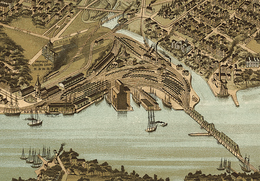
a union station location was identified for the Norfolk and Western Railroad and the Norfolk and Virginia Beach Railroad
Source: Library of Congress, Panorama of Norfolk and surroundings 1892 (2018)
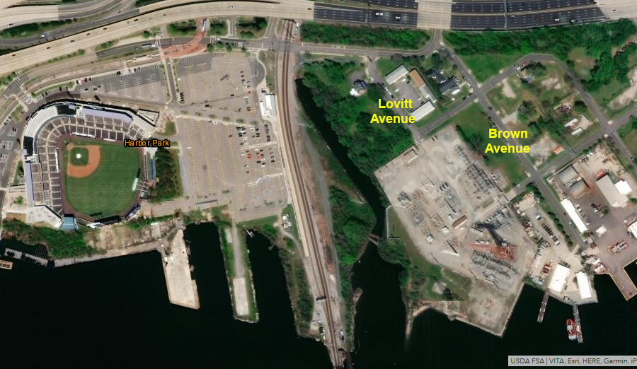
site of the 1887 railyards and stations for the Norfolk and Western Railroad and the Norfolk and Virginia Beach Railroad in 2018
Source: ESRI, ArcGIS Online (2018)
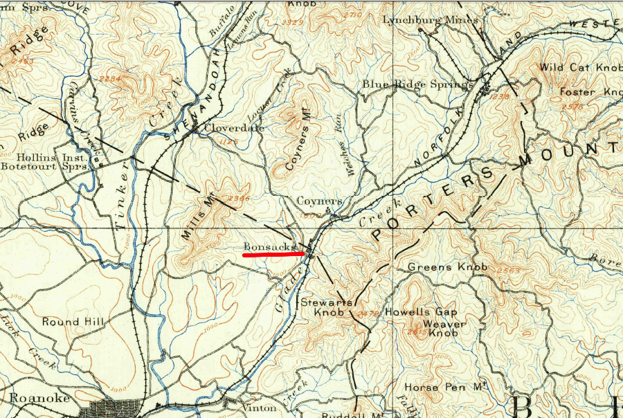
the Norfolk and Western Railroad connected to the Shenandoah Valley Railroad at Big Lick, not Bonsack
Source: US Geological Survey (USGS), Roanoke VA 1:125,000 topographic quadrangle (1890)
the Norfolk and Western Railroad built its first Norfolk docks at the mouth of the Eastern Branch of the Elizabeth River, not at Lambert's Point
Source: David Rumsey Historical Map Collection, Suffolk & vicinity (Atlas to accompany the official records of the Union and Confederate armies, 1895)

the Norfolk and Western Railroad built track west of downtown Norfolk to reach Lambert's Point
Source: University of North Carolina, From Cape Henry to Currituck Beach, including the Albemarle and Chesapeake Canal (US Coast and Geodetic Survey, 1906)
Norfolk and Western Railroad in 1882
Source: Library of Congress, The Virginia, Tennessee, and Georgia Air Line; the Shenandoah Valley R.R.; Norfolk & Western R.R.; East Tennessee, Virginia, & Georgia R.R. (its leased lines,) and their connections (1882)
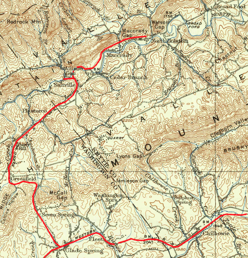
branch lines, as at Saltville, increased the freight traffic and revenues for the Norfolk and Western Railway
Source: US Geological Survey, Abingdon, VA 1:125,000 scale topographic quadrangle (1911)
Links
References
1.
Railroads of Virginia
Virginia Places