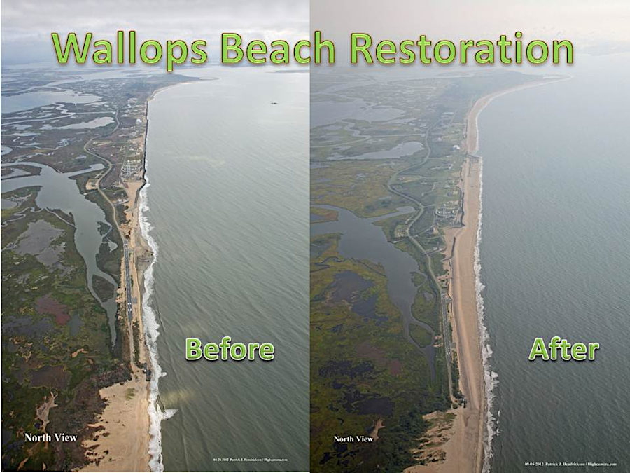
the Wallops Island Storm Damage Reduction project in 2012 was completed just two months before Superstorm Sandy, which eroded 20% of the new beach
Source: National Aeronautics and Space Administration (NASA), Wallops' Newest Beach
the Wallops Island Storm Damage Reduction project in 2012 was completed just two months before Superstorm Sandy, which eroded 20% of the new beach
Source: National Aeronautics and Space Administration (NASA), Wallops' Newest Beach
Regular dredging of the Chincoteague Inlet starves the northern end of Wallops Island from natural sand replenishment. Flight facilities built there, including launch pads at the Mid-Atlantic Regional Spaceport (MARS), are threatened by erosion.
Efforts to stabilize the shoreline in a dynamic beach setting have included construction of jetties, seawalls, and breakwaters, plus sand replenishment projects.
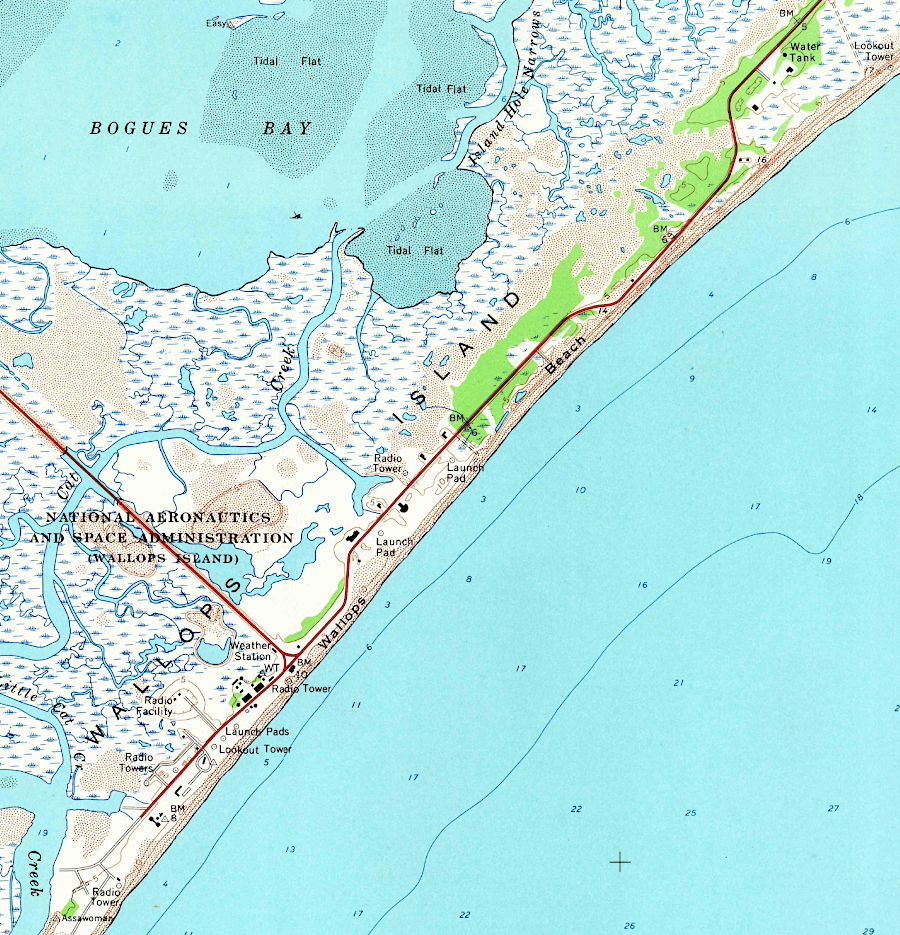
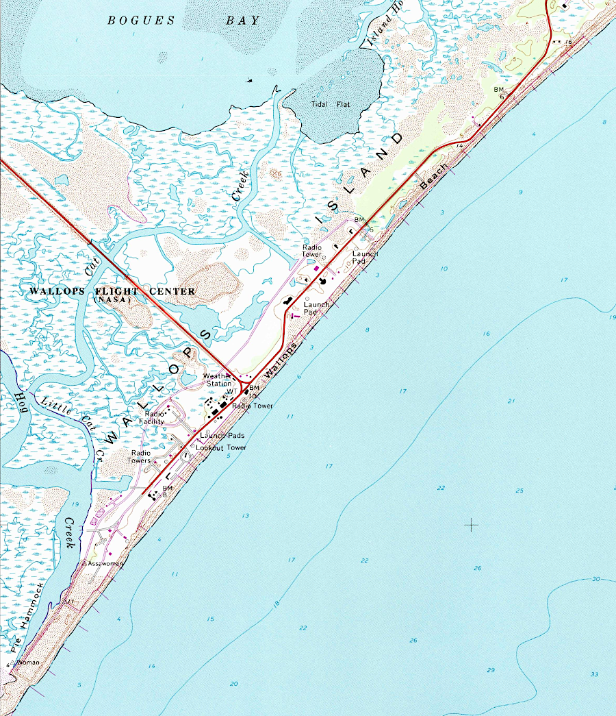
jetties were built perpendicular to the shoreline at Wallops Island to protect facilities from beach erosion
Source: US Geological Survey (USGS), Wallops Island 1:24,000 topographic quadrangle (1965) and Wallops Island 1:24,000 topographic quadrangle (1980)
In 2012, a beach replenishment project was completed to protect the spaceport facilities on Wallops Island. The Wallops Island Storm Damage Reduction project built a buffer of sand between the Atlantic Ocean and the rock seawall. The U.S. Army Corps of Engineers anticipated th sand would need to be replenished every 3-7 years. The project was timely; just two months later, Superstorm Sandy eroded away 20% of the beach.1
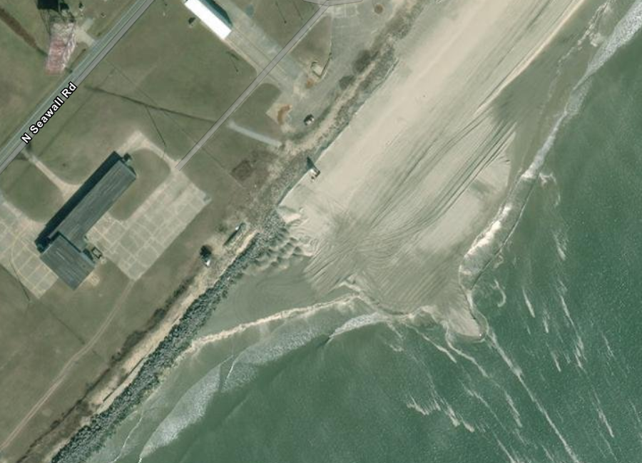
at Wallops Island, beach replenishment stopped near the southern end where a seawall provided the only protection in 2026
Source: ESRI, ArcGIS Online
By 2026, National Aeronautics and Space Administration (NASA) was seeking approval from the US Army Corps of Engineers for another replenishment project. It proposed to dredge 2.5 million cubic yards of sand from an offshore shoal and deposit the sand on three miles of shoreline to protect the Wallops Flight Facility and the Mid-Atlantic Regional Spaceport. The project also included construction of up to 4 breakwaters.2
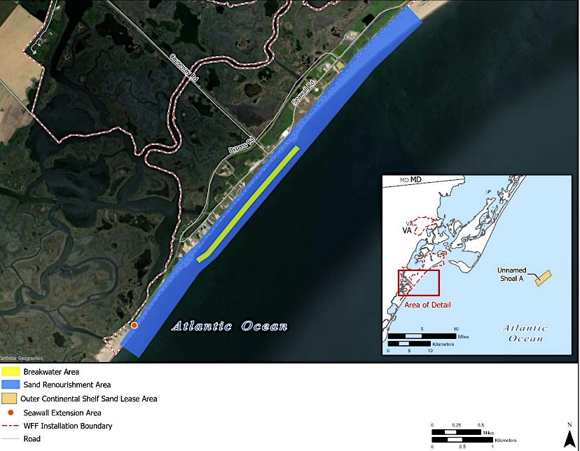
the 2026 proposal included up to four new breakwaters
Source: NASA Wallops Flight Facility, Shoreline Protection Project Joint Permit Application (Figure 4)