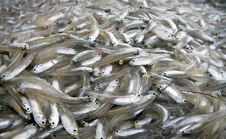
hardening shorelines reduces habitat and populations of forage fish such as the bay anchovy (Anchoa mitchilli), the most abundant fish in the Chesapeake Bay
Source: Chesapeake Bay Program, Bay Anchovy
hardening shorelines reduces habitat and populations of forage fish such as the bay anchovy (Anchoa mitchilli), the most abundant fish in the Chesapeake Bay
Source: Chesapeake Bay Program, Bay Anchovy
Owners of shoreline property threatened by erosion have traditionally installed bulkheads, seawalls, revetments, breakwaters, groins, and jetties. The hardened shoreline eliminates the habitat at the edge of water and land, reducing the food and shelter needed by juvenile fish, crabs, and other species.
By 2016, over 15% of the Chesapeake Bay shoreline had been transformed by traditional "grey infrastructure." Around Hampton Roads, that percentage exceeded 50%. Roughly 25% of the shoreline on major Chesapeake Bay tributaries had been hardened.
Hardened shorelines create a rigid shoreline that can not migrate. Blocking the natural migration of tidal marshes will gradually reduce the acreage along the Chesapeake Bay of that highly-productive ecosystem:1
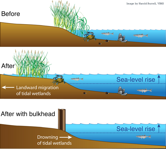
where bulkheads block natural migration, tidal marshes disappear as sea level rises faster than 2.5 millimeters (mm) per year
Source: College of William and Mary, Study reveals threat to tidal wetlands
When shoreline habitat is reduced, there is a reduction in the population of forage species such as marine worms (polychaetes), blue crabs, and bay anchovy (Anchoa mitchilli) - the most abundant fish in the Chesapeake Bay. Less forage results in a corresponding reduction in the number of predators at the top of the food chain, such as striped bass (Morone saxatilis) and summer flounder (Paralichthys dentatus).2
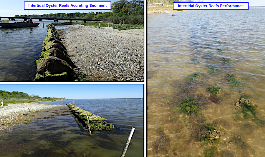
Living shorelines are now a "green infrastructure" option that minimizes the impact of altering shorelines. Low rock sills are built in the water near a shoreline to protect it from erosion by currents and wind-driven waves. The rock sill slows the flow of water, but permits it to wash over the top and even through the loosely-packed rocks. Typically sand/mud accumulates and a waterfront marsh develops between the rock sill and the shoreline, creating shallow water habitat. Unlike shorelines hardened with bulkheads and seawalls, the new marsh attracts invertebrates, polychaetes, insects, juvenile fish, and birds.
In 2020, the General Assembly mandated that the Virginia Marine Resources Commission (VMRC) prioritize living shorelines for stabilizing land:3
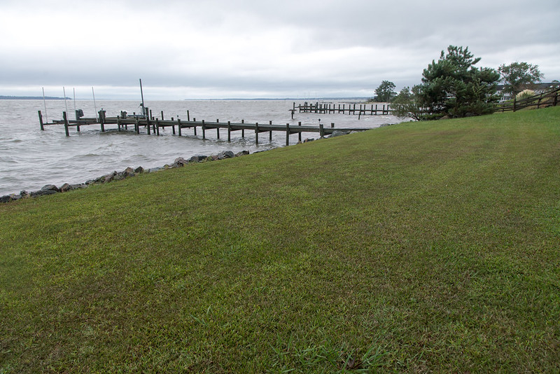
some owners of riverfront property cut grass to the shoreline
Source: Virginia Department of Transportation, Dorian - September 07, 2019
In developed areas, a high percentage of the shoreline is armored by bulkheads, breakwaters, and other physical barriers to protect infrastructure from inundation. A lawyer focused on waterfront legal cases calculated that by May 2022, the Virginia Marine Resources Commission had approved 5,983 feet of living shoreline and 6,581 feet of hardened shoreline:4
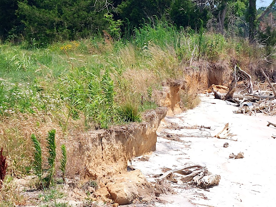
As sea level rises, the remaining marshes in such areas will be squeezed by chronic shoreline retreat. Rising water will flood the marsh near the water. Seawalls and other human barriers will block migration inland. Worldwide, shorelines along about 1/3 of all sandy beaches are already hardened.5
In contrast, elevation maps of the Chesapeake Bay show that in rural areas the low-lying fields and forests will be transformed into new wetlands. In particular, forested wetlands are at risk of conversion into tidal marsh.6
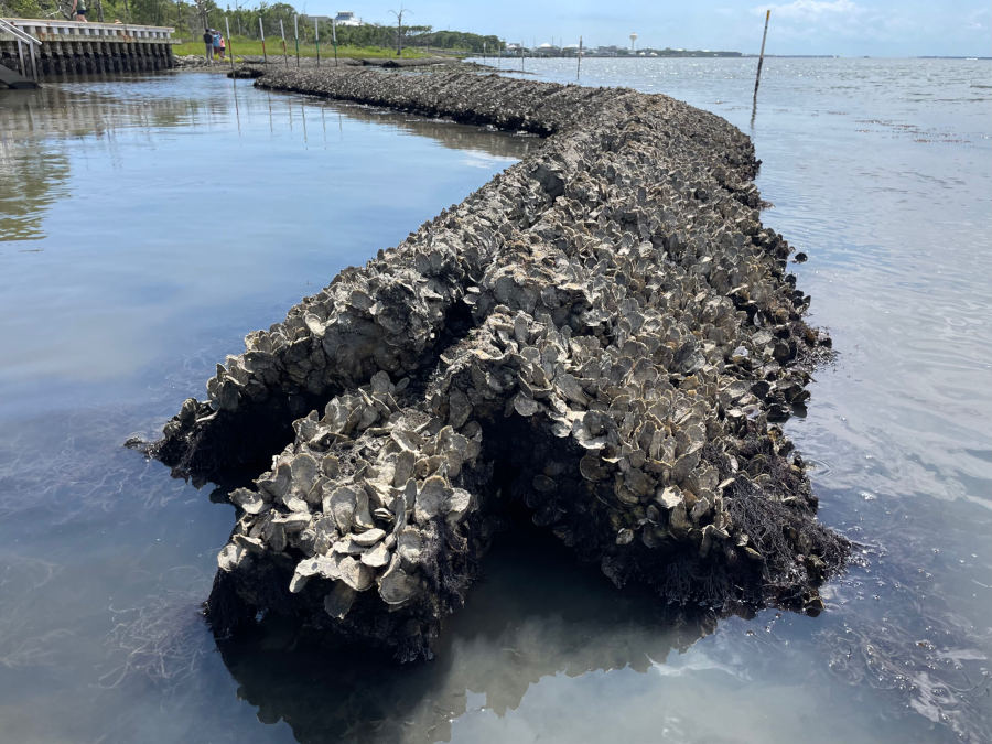
The US Navy initiated the largest living shoreline project on the East Coast in 2022. On the York River, Naval Weapons Station Yorktown constructed about 2,900 feet of living shoreline by stimulating production of "oyster castles." Concrete and granite forms, used as an artificial reef foundation, were used to create a new reef intended to absorb wave energy that was eroding the shoreline.7
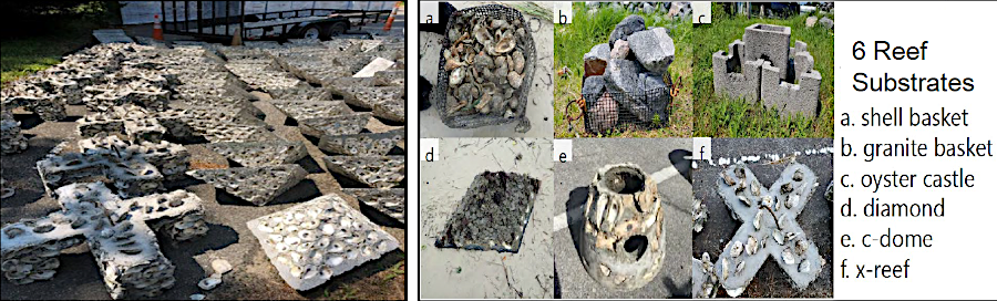
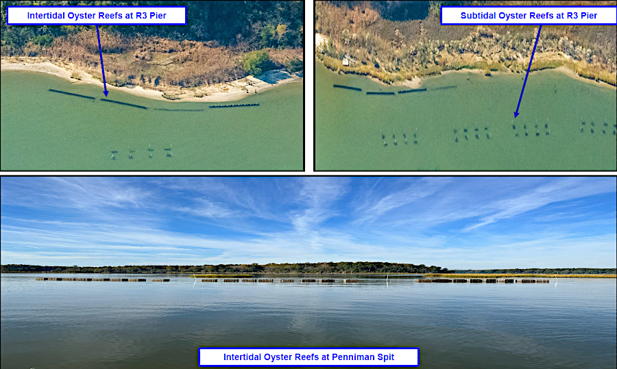
Naval Weapons Station Yorktown built a living shoreline project that included oyster castles to create a new reef
Source: Chesapeake Bay Commission, REPI Project Profile: Land Restoration, Shoreline Protection and Base Resilience at Naval Weapons Station Yorktown, Virginia
A new approach was tested in 2026 to assess if QuickReef was a feasible material for living shorelines. It was produced from marl mined in North Carolina and bound together with 10% cement. The QuickReef product was lighter, quicker to install, and less expensive. Blocks were designed to link together, forming a sill that resisted waves and protected marshes from erosion.
Unlike granite blocks, the QuickReef components were made from calcium carbonate and quickly created oyster habitat. The private company which developed the product advertised:8
a living shoreline created from QuickReef material quickly attracts oyster spat and develops into an oyster bar
Source: Native Shorelines, QuickReef©
Wind farms may have benefits like living shorelines, in addition to reducing the need for fossil fuels. The underwater structures that support the towers become artificial reefs, as the seafloor recovers from the disruption of construction. Marine animals that require hard surfaces, such as mussels, grow on the foundations and attract other animals. A new ecosystem develops where habitat has been significantly altered, due to the addition of metal and concrete surfaces to areas formerly dominated by mud and sand.9
And in theory, wind farms in the Atlantic Ocean could absorb energy from storms and reduce the impacts onshore of high winds and storm surges.
A massive number of turbines (over 400,000) along the East Coast could redirect the power of a storm, reducing wind speeds by over 80mph and protecting urbanized areas such as Norfolk. No one has proposed building that many turbines - the expected number in the Outer Continental Shelf Offshore Virginia block was just 200 - but offshore structures offer an alternative to investing billions of dollars for hardening the shoreline:10
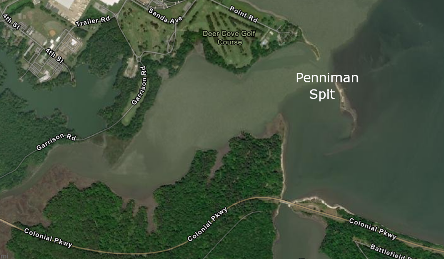
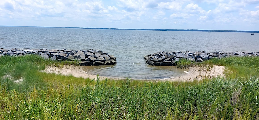
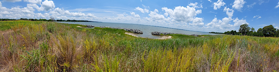
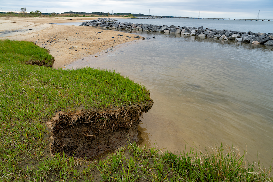
a living shoreline at Penniman Spit was designed to reduce erosion on the shoreline of Naval Weapons Station Yorktown
Source: ESRI, ArcGIS Online
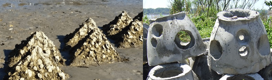
concrete forms are placed below the low-water mark and oysters use the hard substrate to grow into castles
Source: Virginia Institute of Marine Science (VIMS), Pre-Cast Reef Structures
Virginia Department of Transportation (VDOT) funded a living shoreline project at Belle Isle State Park
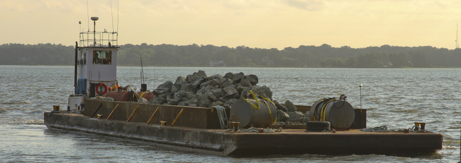
the Corps of Engineers placed rock on the York River shoreline in 2013 to counter erosion threatening the Colonial National Parkway
Source: US Army Corps of Engineers, Norfolk District Image Gallery
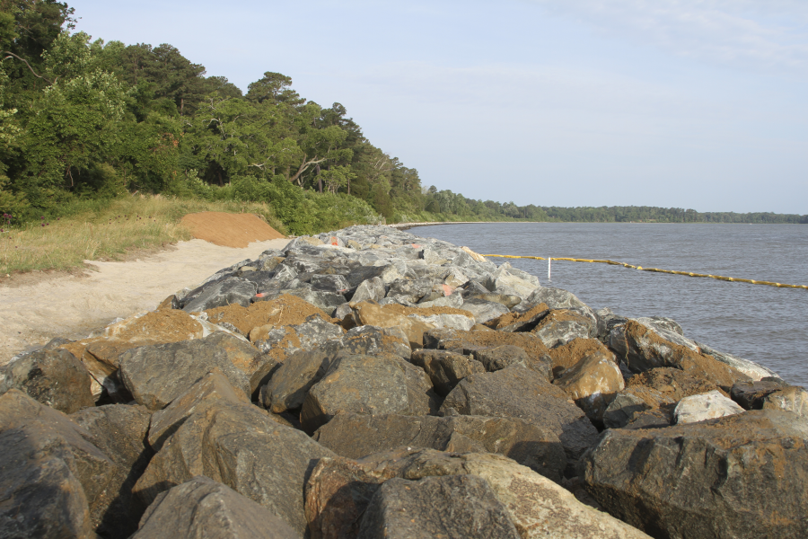
living shorelines are intended to reduce erosion of soft sedimentary shorelines
Source: National Oceanic and Atmospheric Administration (NOAA), Saving a Chesapeake Bay Watershed Marsh for Fish, Wildlife, and People
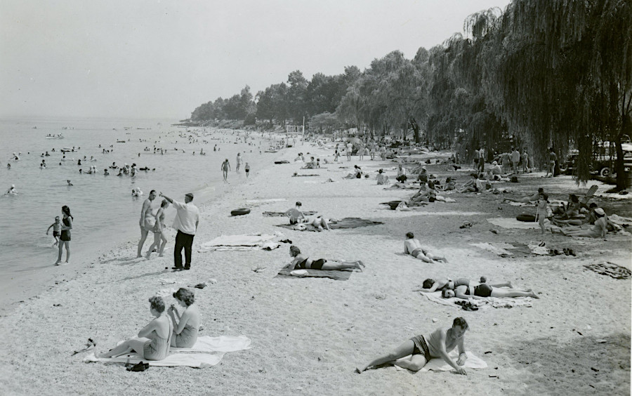
Colonial Beach before installation of sand retention structures
Source: National Archives, Colonial Beach (August 1949)
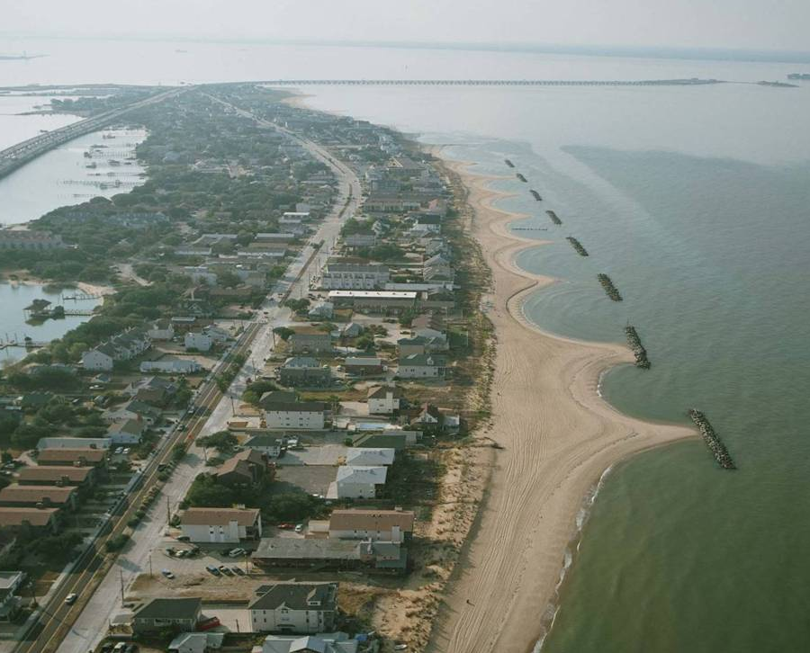
rock breakwaters, built parallel to the shore at Willoughby Bay Spit and East Ocean View in Norfolk, interrupt the natural migration of sand and maintain a beach
Source: US Army Corps of Engineers, Norfolk District Image Gallery