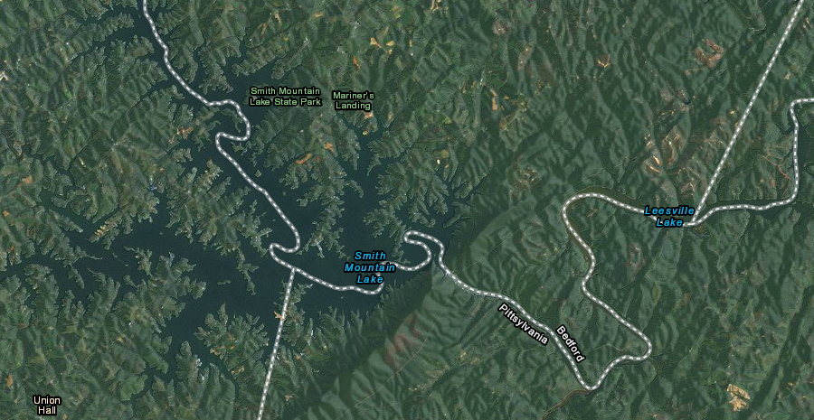
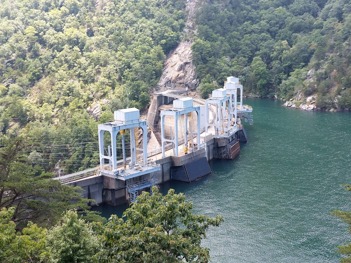
Roanoke River water is pumped back from Leesville Lake to Smith Mountain Lake, so it can generate electricity again to meet peak power demand
Source: US Fish and Wildlife Service, Wetlands Mapper
Roanoke River water is pumped back from Leesville Lake to Smith Mountain Lake, so it can generate electricity again to meet peak power demand
Source: US Fish and Wildlife Service, Wetlands Mapper
Smith Mountain Lake was created by a privately-owned hydroelectric project, built by American Electric Power on the Roanoke/Staunton River at a gap in Smith Mountain. The river had carved the gap through the hard Candler Formation, where differential erosion had created the 1,000' high ridge known as Smith Mountain. The Candler Formation is a hard metmorphic phyllite and schist, rich in mica. It was originally volcanic ash and mud, deposited on top of the Catoctin Formation in the Cambrian Period roughly 500 million years ago.
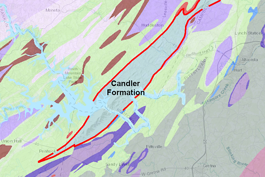
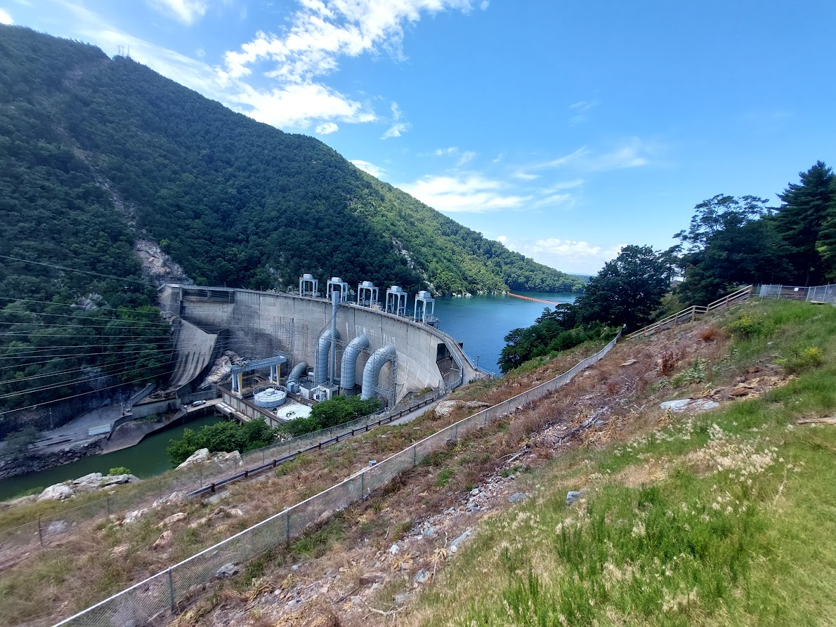
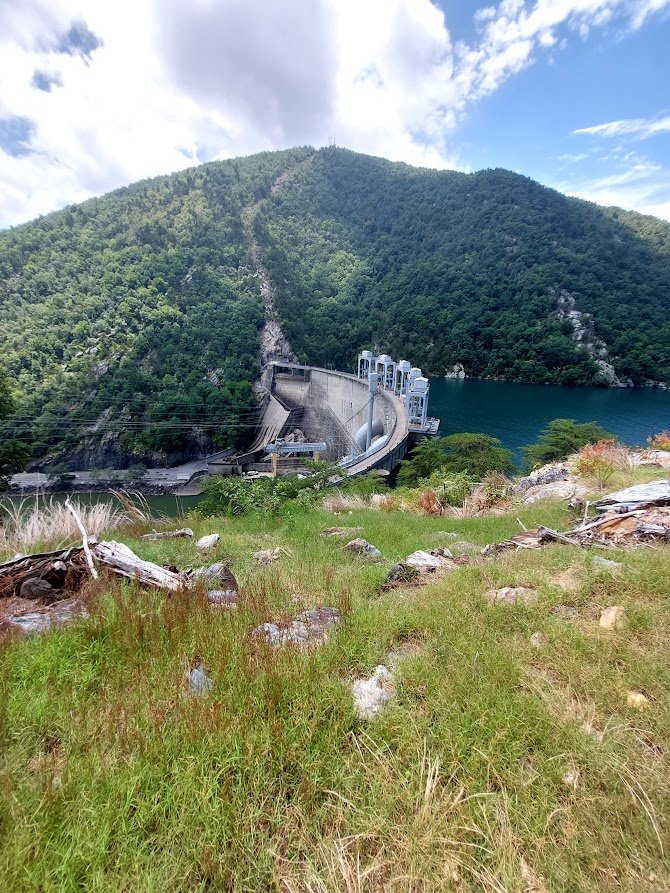
Smith Mountain Dam was constructed where the Staunton/Roanoke River cut through the hard Candler Formation
Source: Virginia Department of Energy, Geology Mineral Resources
The Roanoke River was named after shells that were used for money by tribes downstream on the Atlantic Ocean coast, while the stretch also known as the Staunton River was named after the wife of colonial governor William Gooch. The mountain supposedly was named after a pair of early settlers, brothers Daniel and Gideon Smith, who had arrived in 1740. However, it is possible Smith Mountain was the home of an early blacksmith whose profession - but not name - is remembered.1
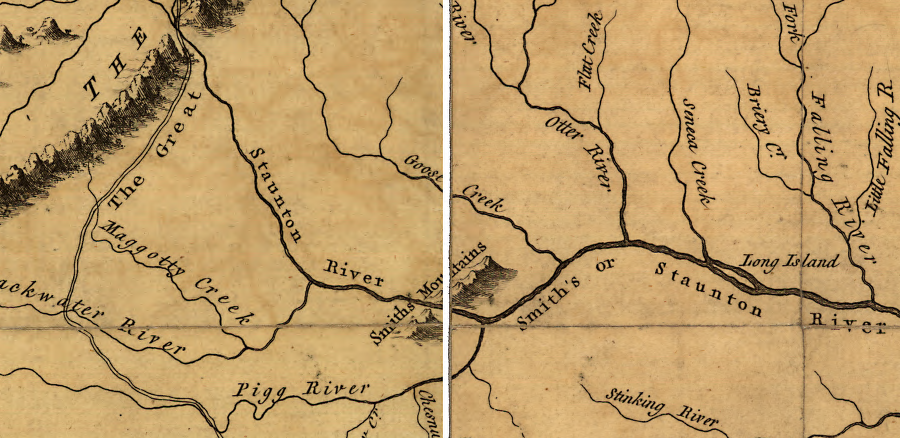
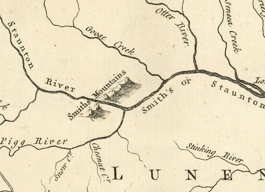
when Joshua Fry & Peter Jefferson mapped Virginia in 1751, the river running through Smith's Mountains was called the Staunton (or Smith's) rather than the Roanoke River
Source: Library of Congress, A map of the most inhabited part of Virginia containing the whole province of Maryland with part of Pensilvania, New Jersey and North Carolina. Drawn by Joshua Fry & Peter Jefferson in 1751
The first proposal for a hydroelectric dam at the Smith Mountain gap was made in 1906. The Niagara Dam upstream was built that year, 24 years after the first US hydroelectric plant went into operation in Wisconsin.2
In 1924, the Roanoke-Staunton River Power Company bought 4,500 acres in Bedford and Pittsylvania counties, and paid other farmers annually for the option to acquire their land later. The 1926 Rivers and Harbors Act authorized surveys of potential dam sites on the Roanoke River. The US Army Corps of Engineers recommended the Federal government buid 11 dams as part of the Roanoke River Project, to generate hydropower and control flooding.
The Roanoke-Staunton River Power Company determined the project was not going to be profitable, so local boosters tried to get the Federal government to build the dam. The US Army Corps of Engineers recommended a dam there, as one of eleven projects to control flooding on the Roanoke River, but Congress declined to authorize construction at Smith Mountain Gap.
After World War II, private companies sought authorization to build dams on sites that had been identified for Federal projects. The Smith Mountain site became involved in the national controversy between private corporations seeking to expand generation for investor-owned utilities vs. advocates for Federal dam construction to generate electricity for public power agencies.
Congress finally funded development of the John H. Kerr Dam, and Virginia Electric Power Company obtained permits to build dams across the Roanoke River at Roanoke Rapids and Gaston, North Carolina. Appalachian Power sought Federal Power Commission authorization in 1949 to construct a privately-owned dam at Smith Mountain, but coal and railroad companies opposed the project. They feared electricity from the hydropower project would reduce demand for coal, the preferred fuel at the time for steam-generated electricity.
Under President Eisenhower, the Federal government encouraged private investor-owned utilities to build hydroelectric projects on navigable rivers.
The 1953 US Supreme Court US v. Public Utilities Commission decision declared that the Federal Power Commission (now the Federal Energy Regulatory Commission) could authorize privately-owned dams separately from the flood control projects proposed by the US Army Corps of Engineers.
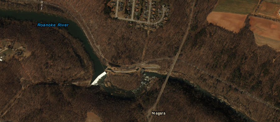
American Electric Power generates hydropower at the tiny Niagara Dam near Roanoke, as well as at the giant Smith Mountain Dam/Leesville Dam project downstream
Source: ESRI, ArcGIS Online
In 1954, American Electric Power purchased the rights of the Roanoke-Staunton River Power Company and started to buy additional farmland that would be flooded.. Residents who would be displaced by the new reservoir objected, but the local officials in Bedford and Franklin counties endorsed the project and formally abandoned roads to clear land titles for Appalachian Power.
Construction of the dam began in 1960. Gates on the dam were closed in 1963 and Smith Mountain Lake reached "full pool" on March 7, 1966. Runoff from Roanoke's extraordinary 41" of snow in January 1966 helped fill up the reservoir.3
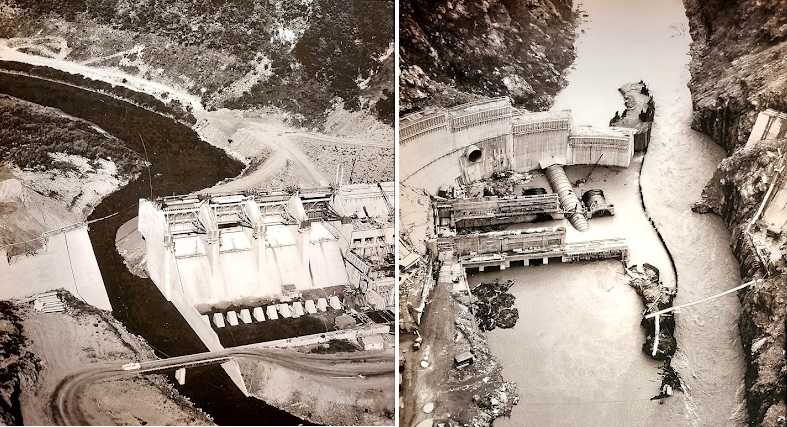
constructing the dam required diverting the flow of the river
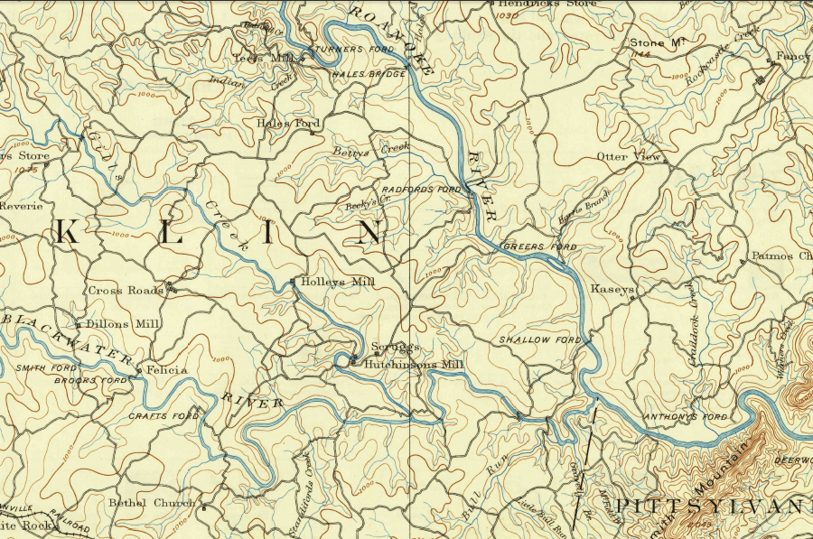
the Roanoke River passed through Smith Mountain, prior to construction of the dams that created two lakes
Source: US Geological Survey (USGS), Bedford VA 1:25,000 topographic quadrangle (1891)
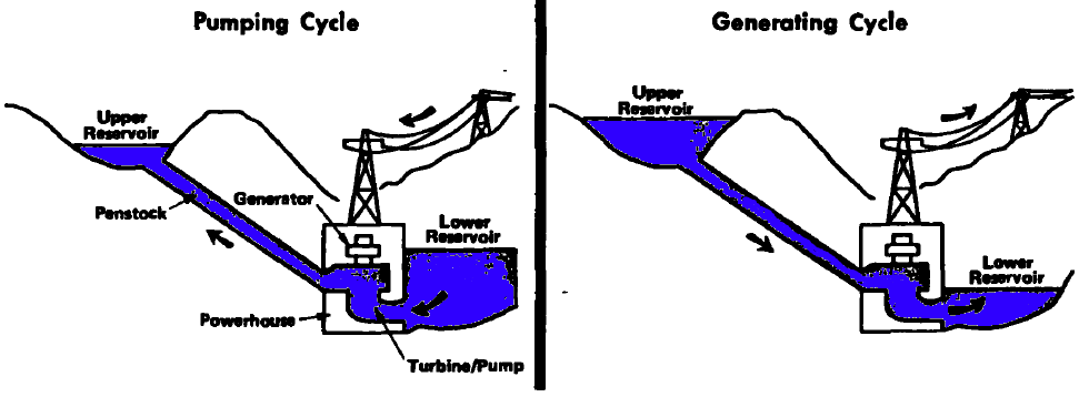
Smith Mountain Lake was built as a pumped storage project. The project uses more electricity than the turbines generate each year - normally not a formula for success for a power-generating plant. However, Smith Mountain Lake is valuable because of the times when the hydropower is generated.
Source: Appalachian Power, Smith Mountain Pump Storage Project Overview
Water is released through the turbines at Smith Mountain Lake to generate electricity when customer demand for electricity peaks in the morning at breakfast time and in the evening after workers return home for dinner. The water is trapped downstream by Leesville Dam. When customer demand is low (between 11:00pm-6:00am, perhaps), Smith Mountain Lake pumps water back uphill from Leesville Lake, so that water can go through the turbines again.
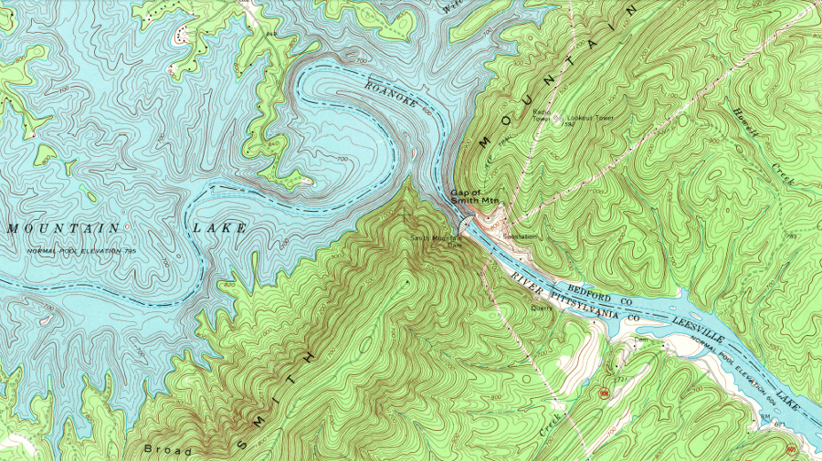
Smith Mountain Gap was plugged and Leesville Dam built downstream in 1963, to create a pair of lakes for a pumped storage hydropower project
Source: US Geological Survey (USGS), Smith Mountain Dam 7.5x7.5 topographic quadrangle (1967)
The pumping during periods of low demand uses electricity generated at baseload power plants. American Electric Power's coal-burning generators run most efficiently when they are in steady operation, ignoring the peaks and valley of customer demand. Excess electricity, produced by baseload plants during the midnight shift or in the middle of the day, is used to pump water back into Smith Mountain Lake so the utility can meet the surge of demand at breakfast and dinner time.
 |
< |
 |
 |
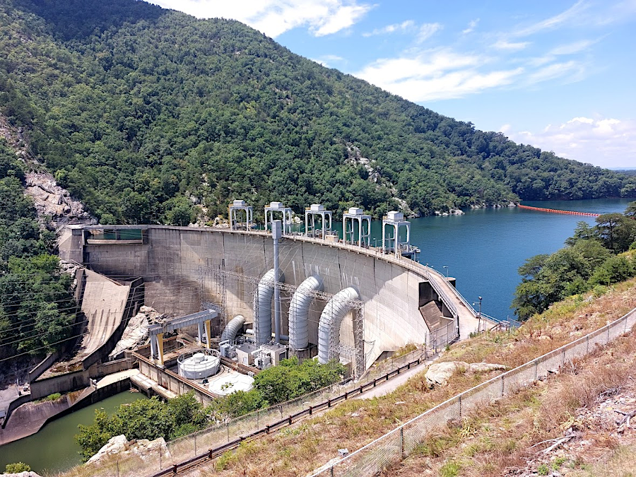
water is pumped back from Leesville Lake into Smith Mountain Lake dam via the pipe in the middle of the dam
The reservoir behind the dam at Smith Mountain is designed so water above 795 feet in elevation will flow over the spillway. Between 1966-2015, the spillway was used less than 20 times.
The reservoir behind the Leesville Dam downstream can retain enough water to raise the level of Smith Mountain Lake by two feet. When the water level behind Leesville Dam reaches 613 feet and the reservoir is full, water released from Smith Mountain Lake can no longer be trapped. The water must be released from Leesville Lake as well, and will flow down into the Roanoke River.
Twice a year, Appalachian Power conducts a test and drops water levels in Smith Mountain Lake by two feet. The water is pumped back into Smith Mountain Lake within two days. The utility warned boaters during the 2026 drought when water levels were already low, so they would not launch before the drawdown and then discover when returning to the boat ramp that they could not get their boat back onto a trailer.
The Federal permit for the Smith Mountain Pumped Storage Project includes a requirement for a Water Management Plan. That plan identifies the level of minimum daily flow below Leesville Dam into the Roanoke River. The minimum flow ensures the preservation of aquatic life; the Roanoke River will never dry up completely.
During drought periods, normal releases from Smith Mountain Lake and Leesville Lake are reduced according to the Water Management Plan. Droughts in 1999, 2001, 2007, and 2026 triggered reductions in releases. The current trigger for reducing releases from Smith Mountain Lake is a calculation that the water level has a 20% chance to drop below 790.5 feet in elevation. The record low, 787.60 feet, was reached in January 1970.
The 2026 reduction is flow occurred when Smith Mountain Lake had dropped five feet below full pond. At that low level, some docks of property owners on the shoreline were not useable. Even lower levels were expected to force closure of public boat ramps. 4
topography reveals why Smith Mountain Dam was built at Smith Mountain Gap on the Roanoke River
Source: USGS National Elevation Dataset, NED Shaded Relief - Virginia
Pumped storage plants offer great flexibility, which can be more valuable than lowest-cost electricity. Electricity can not be stored easily after it is generated; there are no batteries for multi-megawatt power plants like there are for automobiles. To prepare for a spike in demand, utilities can stockpile fuel - including water pumped uphill.
in periods of low demand for electricity, water in Leesville Lake is pumped back into Smith Mountain Lake so it can be reused to generate electricity during peak power periods
Source: US Army Corps of Engineers, National Hydroelectric Power Resources Study (Volume X, November 1981)
As described by American Electric Power, which constructed and operates Smith Mountain Lake:5
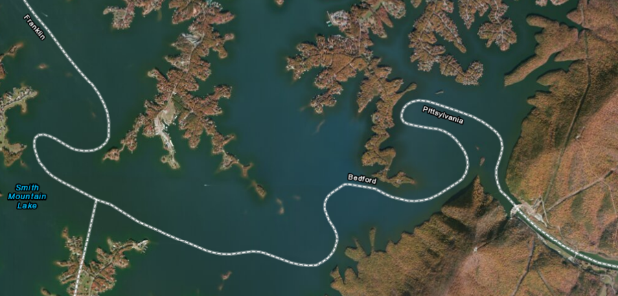
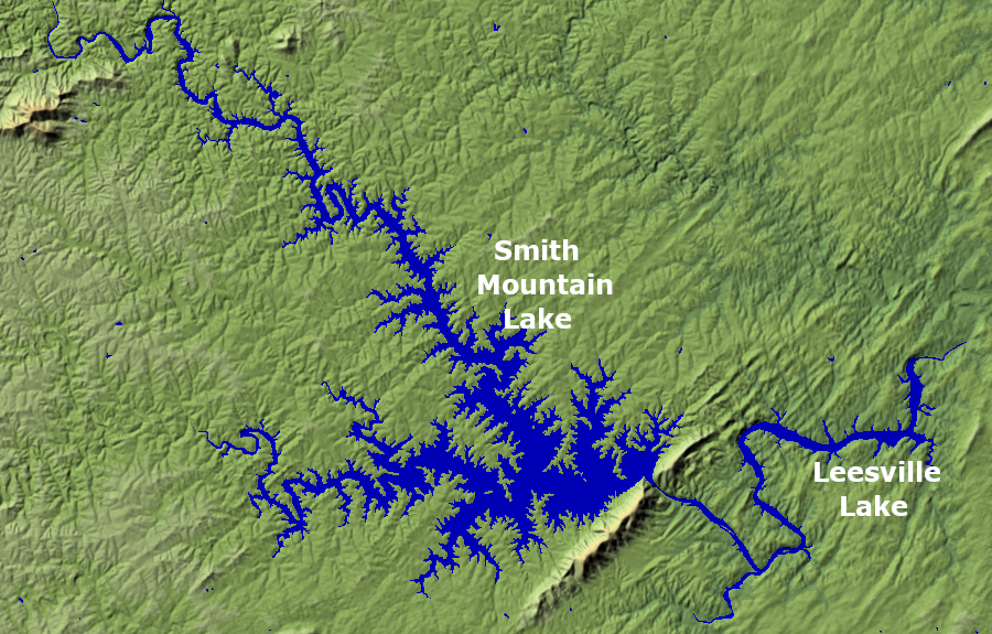
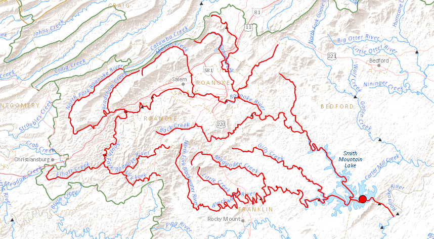
Smith Mountain Lake is split between three counties
Source: ESRI, ArcGIS Explorer
The Roanoke River flows from the Valley and Ridge physiographic province, through a gap in the Blue Ridge, and is trapped in the lake by Smith Mountain Dam on the border of Pittsylvania and Bedford counties. Creation of the artificial lake has resulted in the incongruous sight of large yachts in the middle of the Blue Ridge.
Smith Mountain Lake serves as a water supply reservoir, in addition to a hydropower generator. When the city of Bedford reverted to "town" status in 2013, the Bedford Regional Water Authority decided that Bedford County should shift its water source from Lynchburg to Smith Mountain Lake.6
the headwaters of the Roanoke River are in the Valley and Ridge physiographic province
Source: US Geological Survey (USGS), National Atlas Streamer
Construction of Smith Mountain Lake created a recreational amenity that attracted wealthy buyers of second homes. The dam was completed in 1966, and Franklin County's population grew for 40 years. The county population increased 33.1% between 1970-80, 10.7% between 1980-1990, 19.6% between 1990-2000, and 18.8% between 2000-2010. By the second decade of the 21st Century, houses had been completed on most of the available building sites. Between 2010-2020, Franklin County's population dropped by 3.3%.7
in 1963, prior to construction of Smith Mountain Dam (red circle), the Roanoke River flowed through a rural area that relied upon agriculture/forestry rather than tourism and construction of vacation homes
Source: US Geological Survey (USGS), Roanoke 1x2 topographic grid (1963)
The 2020 Census showed almost 20,000 people lived within two miles of the lake, and over 65,000 within five miles. The average age was under 48 years, suggesting that what started as a retirement and vacation community was evolving into a community of still-working residents living full-time at the lake. The boom in remote working generated by the COVID-19 pandemic spurred a new migration to Smith Mountain Lake, particularly from Northern Virginia and North Carolina.
The increased full-time population should spur new commercial development at the lake, beyond tourism facilities. In 2022, the nearest grocery stores were still nearly 30 minutes away from lakefront houses.
People moving into Franklin and Bedford County, the two counties with the majority of lakefront homes, earned on average over $100,000 per year. That was 1/3 or more higher that the income of the average person moving out of those counties. In Pittsylvania County, with just a small amount of Smith Mountain Lake frontage, the average newcomer earned just slightly more than the average resident moving out of the county.
The executive director of the Smith Mountain Lake Regional Chamber of Commerce observed:8
The reservoir is a recreational magnet. Starting in 2017, Appalachian Power Company began funding construction of underwater habitat improvements to increase the fish population. The artificial structures increase the ability of young bluegill, largemouth bass, crappie, and other species to hide from larger predators. The Virginia Department of Wildlife Resources had built over 300 by the end of 2022, with the expectation that the number of fish would grow gradually over the next 30 years.9
Water skiing creates waves that can erode the shoreline and cause rocking boats to damage docks. In 2022 the Tri-County Lakes Administrative Commission organized the Wake Education Task Force and imposed a moratorium on creating new no-wake zones, allowing time for recreational users and shoreline property owners to reduce conflicts. Fast-moving boats pulling wakesurfers then moved further away from the shoreline, reduced the number of repetitive passes, and avoided using narrow coves and congested areas.
The moratorium was renewed by the Tri-County Lakes Administrative Commission in 2024. The head of the Navigation Committee said:10
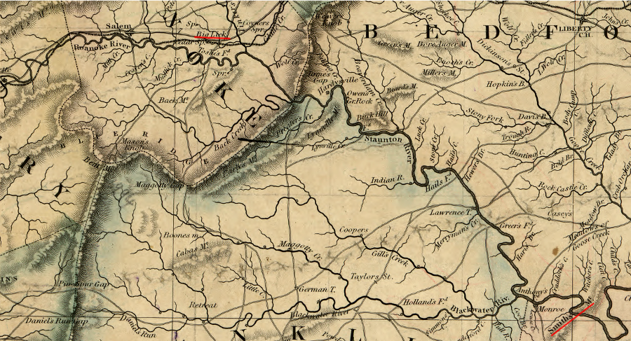
in the 1750's, the river running through Smith's Mountain was called Smith's River
Source: Encyclopedia Virginia, Fry-Jefferson Map of Virginia
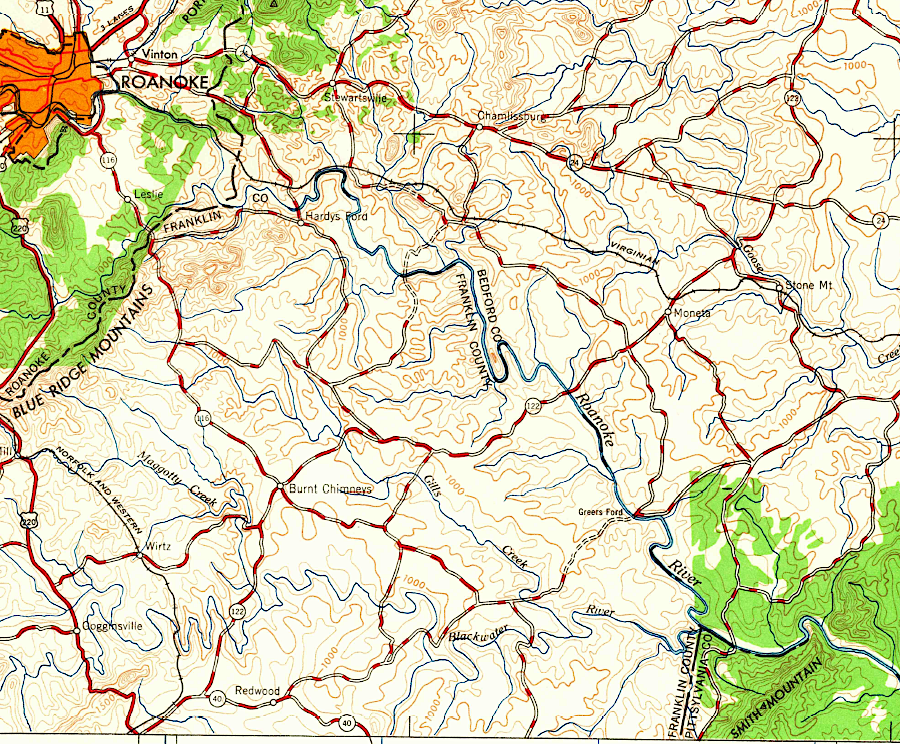
prior to the Civil War, the Staunton River was undammed - and the town on the Virginia and Tennessee Railroad upriver from Smith Mountain was called Big Lick
Source: Library of Congress, A map of the state of Virginia, constructed in conformity to law from the late surveys authorized by the legislature and other original and authentic documents (1859)
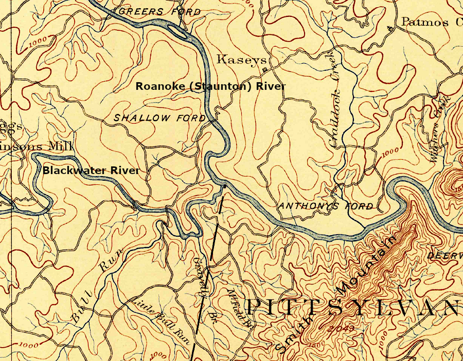
confluence of the Roanoke and Blackwater rivers, before construction of Smith Mountain Dam
Source: US Geological Survey (USGS), Roanoke 1:125,000 topographic quadrangle (1891)
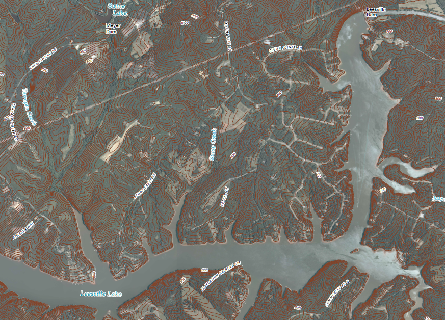
Leesville Dam and Leesville Lake
Source: US Geological Survey, Leesville 7.5/7.5 topographic quadrangle (2010)
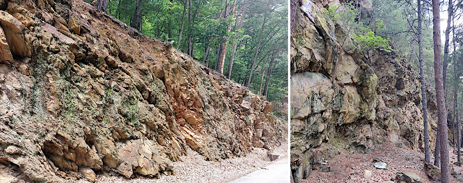
Smith Mountain is a topographic high because the mica-rich Candler Formation erodes more slowly
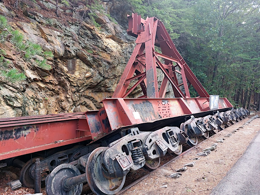
a rail system adjusted the location of a thick wire over the Staunton/Roanoke River canyon, from which materials were lowered to construct Smith Mountain Lake dam
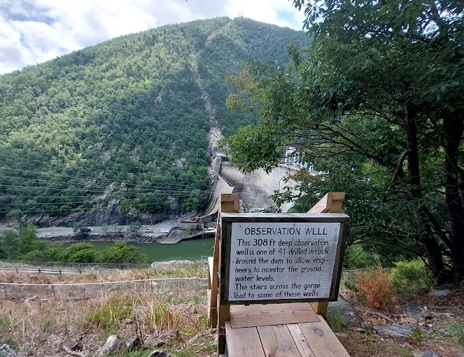
observation wells measure if water is flowing through the Candler Formation and potentially threatening the integrity of the dam's foundation
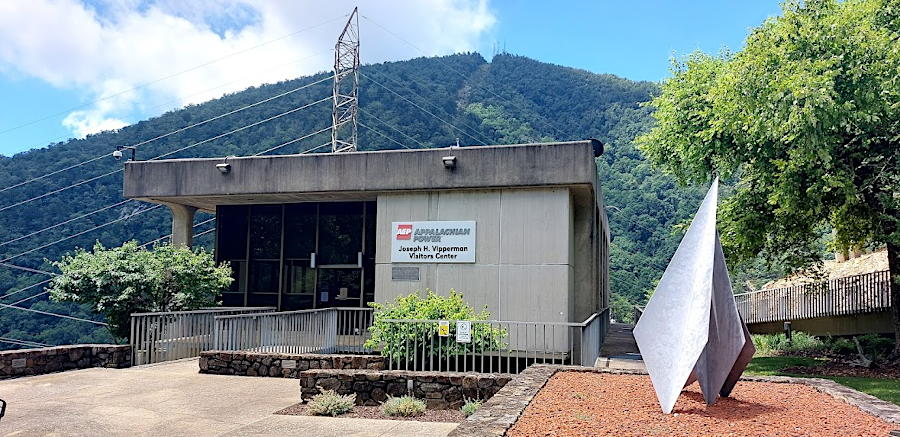
American Electric Power has created a visitor center on the north side of Smith Mountain Lake dam