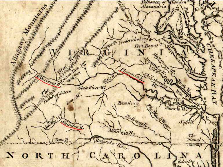
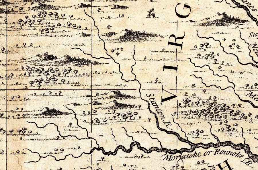
the Roanoke River was known as the Staunton River upstream of the confluence with the Dan River - and upstream of Richmond, the James River was known as the Fluvanna River
Source: Library of Congress, A map of Virginia and Maryland (1767)
the Roanoke River was known as the Staunton River upstream of the confluence with the Dan River - and upstream of Richmond, the James River was known as the Fluvanna River
Source: Library of Congress, A map of Virginia and Maryland (1767)
When place names were assigned by the early explorers and colonists, there was no Board of Geographic Names to reconcile differences and establish an official name. In most cases, the settlers in a region would ultimately adopt one place name, and alternate names would be discarded. For example, the same stream in southwestern Virginia was called both the New River and the Woods River, but "Woods River" dropped out of use quickly.
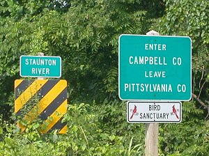
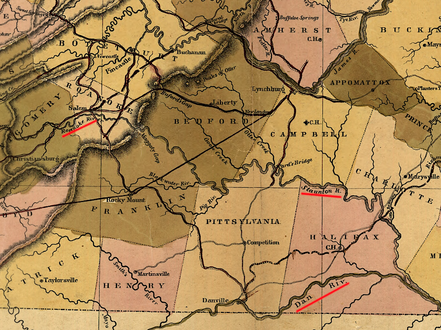
Today, all Virginia rivers stay the course and are described by just one name from their headwaters to their mouth - with one exception. The Roanoke River changes its name in the middle of its path through Virginia. A portion of the Roanoke River, from Leesville Dam to the mouth of the Dan River, is still known locally as the Staunton River.
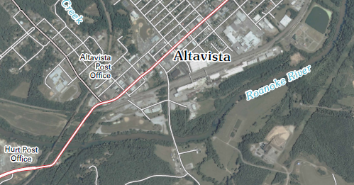
riverfront park in Altavista
Above Leesville Dam and below the confluence with the Dan River, the Roanoke River is called the Roanoke River. For 80 miles in the middle, however, it is also called the Staunton River. In 1984, 51 miles between State Route 360-State Route 761 (at the Long Island Bridge) were designated the "Staunton State Scenic River," a component of the Virginia Scenic Rivers System.1
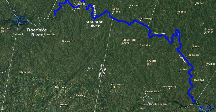
Staunton River segment of Roanoke River
Map Source: US Fish and Wildlife Service, Wetlands Mapper
William Byrd II recorded the Staunton River's name on his visit to the confluence of the Dan and Staunton rivers in 1728. He accompanied the surveyors marking the dividing line between Virginia and North Carolina. In his diary, Byrd noted that the Roanoke River forked 36 miles upstream of the "great falls" at what is now Roanoke Rapids/Weldon:2
Byrd may have selected the name "Staunton River" in 1728 to honor Lady Rebecca Staunton. She was the wife of Governor William Gooch, who had taken office in 1727 and served as governor until 1740. A city in the Shenandoah Valley bears the same name and in both cases it is pronounced STAN-ton today, but in the colonial period the pronunciation may have been different.
a 1733 map provides a clue for the traditional pronunciation of the Staunton River
Source: David Rumsey Map Collection, A Map of the British Empire in America by Henry Popple (1733)
If William Byrd II asked local residents what was the river's name before ingratiating himself with the new governor, he may have been told a Siouan word. Gooch left office in 1740, the same year that Daniel and Gideon Smith moved to the area in what was then Brunswick County.
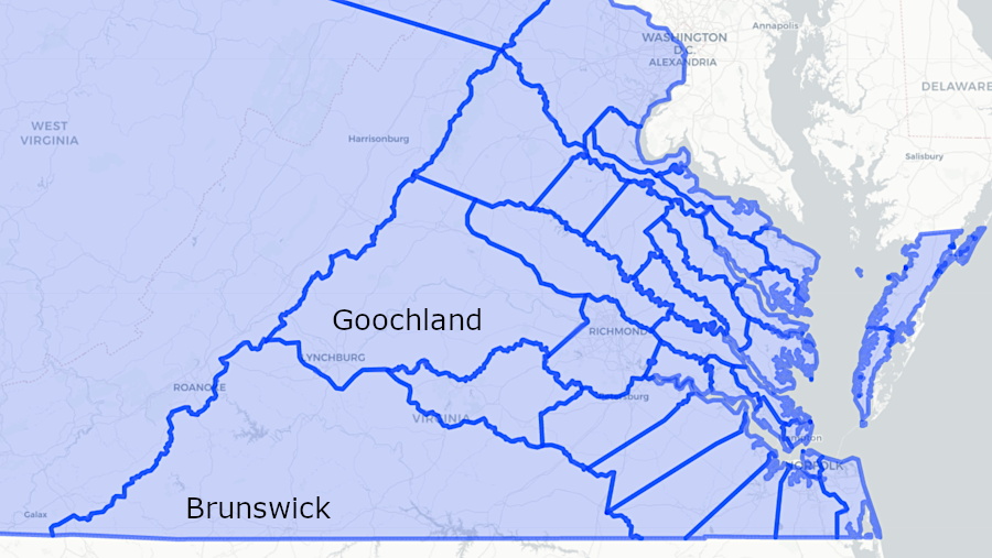
in 1740, the Staunton River flowed through Brunswick County
Source: The Newberry Library, Atlas of Historical County Boundaries
When Joshua Fry and Peter Jefferson published their map of Virginia in 1755, they named Smith Mountain and used Smith as an alternative version of the river's name.
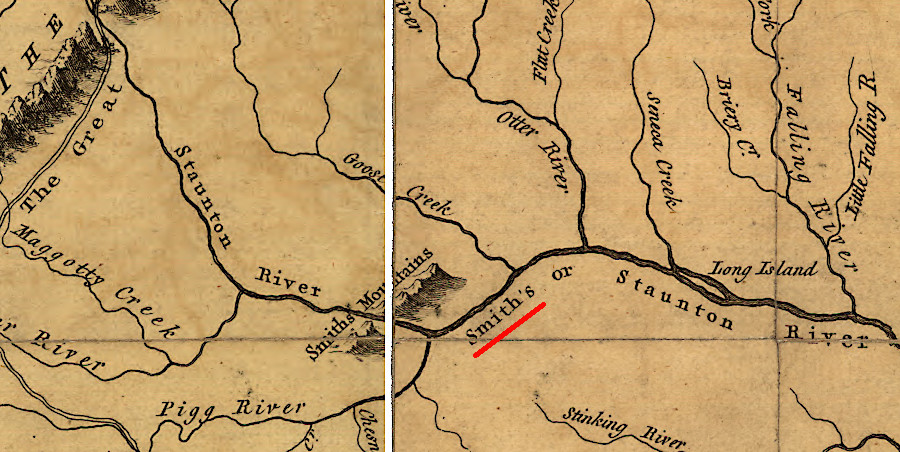
the 1755 Fry-Jefferson map of Virginia referred to "Smith's or Staunton River"
Source: Library of Congress, A map of the most inhabited part of Virginia containing the whole province of Maryland with part of Pensilvania, New Jersey and North Carolina (by Joshua Fry and Peter Jefferson, 1755)
Byrd is generally given credit for naming the Dan River. He never explained a reason, but the presumption is that the river's name reflects the Biblical phrase used to define the boundaries of Canaan, "from the Dan to Beersheba." Byrd was well aware of the Old Testament, and in 1728 he was surveying the boundaries of Virginia and North Carolina, the "dividing line."3
US Geological Survey now labels the river "Roanoke" for its entire length, ignoring local use of "Staunton River" place name
Map Source: US Geological Survey (USGS), Altavista 7.57.5 topographic map (2010)
The name Roanoke River reappears where the Staunton and Dan rivers run together - at a site reflecting the pattern of contentious name disputes between Virginia and North Carolina regarding the Roanoke River.
In 1733, the Dan River was labeled the Fitzwilliam River by North Carolina's surveyor general, Edward Moseley. He ignored the Dan River name for the river used by William Byrd, and instead indicated his sympathy with one of the Virginia commissioners who oversaw the 1728 survey.
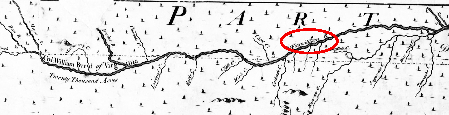
in 1733, the Dan River was labeled the Fitzwilliam River by North Carolina's surveyor general
Source: A New and Correct Map of the Province of North Carolina by Edward Mosely, 1733
During the 1728 expedition to mark the colonial boundary at the latitude of 36 degrees 30 minutes, Richard Fitzwilliam had sided with Moseley and the other North Carolinian commissioners in various disputes with William Byrd.
Byrd was a domineering character and documented the surveying expedition for history. He used the pseudonym "Firebrand" for Fitzwilliam, because supposedly he was "always ready to assert his rights vehemently or to make love to almost any white, black, or red female he saw."
Moseley clearly preferred Fitzwilliam to Byrd, but the Fitzwilliam River name disappeared and Byrd's Dan River remains.4
in 1848, Claudius Crozet used "Dan River" on his map (as well as "Roanoke" and "Staunton" rivers)
Source: Library of Congress, A map of the internal improvements of Virginia (by Claudius Crozet, 1848)
The Staunton/Dan confluence observed by Byrd has been drowned by Buggs Island Lake - or Kerr Reservoir, if you use the North Carolina name for the artificial lake.
The change in name from Roanoke River to Staunton River and back to Roanoke River is confusing. It gets even more confusing when you realize that Virginia has a second stream called "Staunton River." That Staunton River is a tributary to the Rapidan River in Madison County.
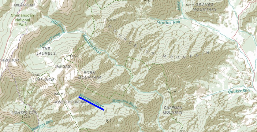
Staunton River - in Madison County
Source: ESRI - ArcGIS Online
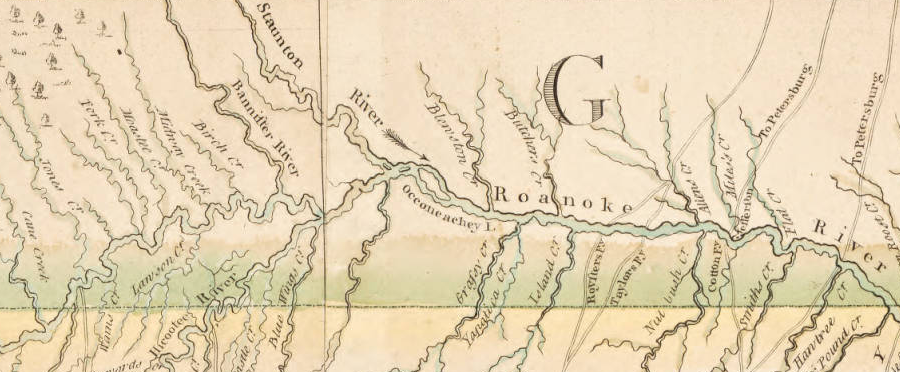
John Collet's 1770 map of North Carolina showed the Roanoke River starting at the confluence of the Staunton and Dan rivers
Source: University of North Carolina, A Compleat map of North-Carolina from an actual survey by John Collet (1770)
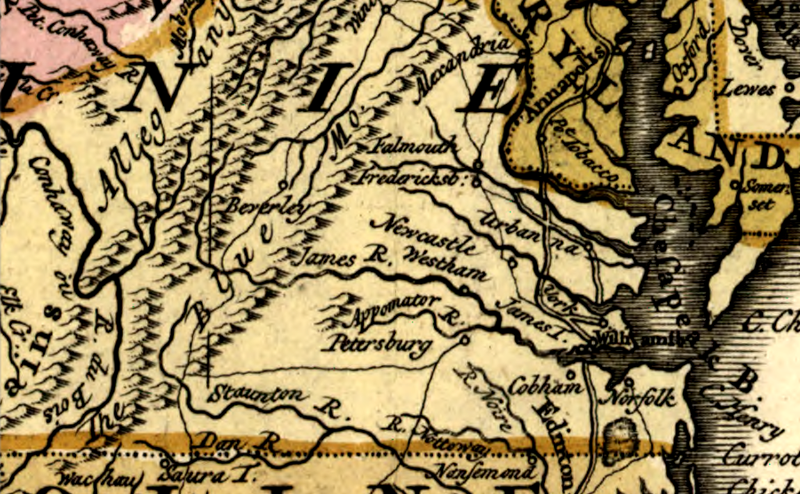
in 1755, the river upstream of the Dan was the Staunton River, the settlement at Beverley was not yet called Staunton - and Richmond was not important enough to show on the map
Source: Library of Congress, Carte des possessions angloises & francoises du continent de l'Amerique septentrionale. Kaart van de Engelsche en Fransche bezittingen in het vaste land van Noord America (1755)