rain that falls on impervious surfaces creates higher-than-normal volumes of stormwater runoff, triggering erosion
Source: Fairfax County, Glossary - Solving Drainage and Erosion Problems
rain that falls on impervious surfaces creates higher-than-normal volumes of stormwater runoff, triggering erosion
Source: Fairfax County, Glossary - Solving Drainage and Erosion Problems
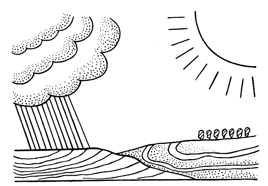
When it rains on forests in Virginia, the first droplets are intercepted by the leaves, needles, and branches of trees. During a quick rain shower, hikers underneath a tree may stay completely dry, sheltered by a natural umbrella.
After a few minutes of continuing rain, water will drip from trees to the ground. The energy of the falling raindrops will have dissipated, and few drops will create large impact craters that disturb soil particles. The drops will soak initially into the leaf litter and organic debris on the surface. If the rain shower is short, water on tree branches and absorbed in the top layer of soil will be evaporated back into the atmosphere.
If a storm continues, water will soak underground between soil particles and displace air molecules. Plant roots will absorb some of the water in the "vadose" or shallow zone, where air and water molecules switch places regularly.
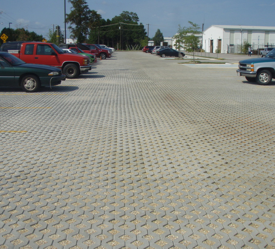
permeable pavers in parking lot at Fort Lee, Virginia allow rainwater to infiltrate soil rather than become stormwater runoff
Source: US Army Corps of Engineers, Permeable Pavers
If rain continues then additional droplets will soak deeper underground and reach the water table, the boundary below which all gaps between soil particles stay filled with water. Some of that water in the "phreatic" zone will flow towards springs and emerge at the surface, but much will stay trapped underground near where the raindrops fell.
In Virginia, the water table typically rises higher in the soil during the late winter as rain recharges the water table. In the spring, vegetation "leafs out." Plants move water from roots underground into the leaves, and transpiration into the atmosphere causes the water table to drop. Drinking water wells are drilled deep in order to intersect the "phreatic" zone, where there will always be a supply of groundwater.
rainfall infiltrates and is transpired from the soil naturally, and some stormwater runoff on the surface is also natural
Source: US Department of Agriculture, Soils & Men (1938 Yearbook of Agriculture)
In storms with a steady rain, water droplets reach the earth's surface faster than they can be absorbed. The excess will run off the surface and enter nearby streams, causing water levels to rise and occasionally triggering a flood.
The depth and width of stream channels are determined by the pattern of runoff in the local area. Stream channels near watershed divides, where the volume of surface runoff is limited, are narrow and shallow. Further downstream, the area of the watershed sending runoff into the stream is greater. The greater volume of surface runoff, and the greater speed of that flowing water, carves deeper/wider stream channels.
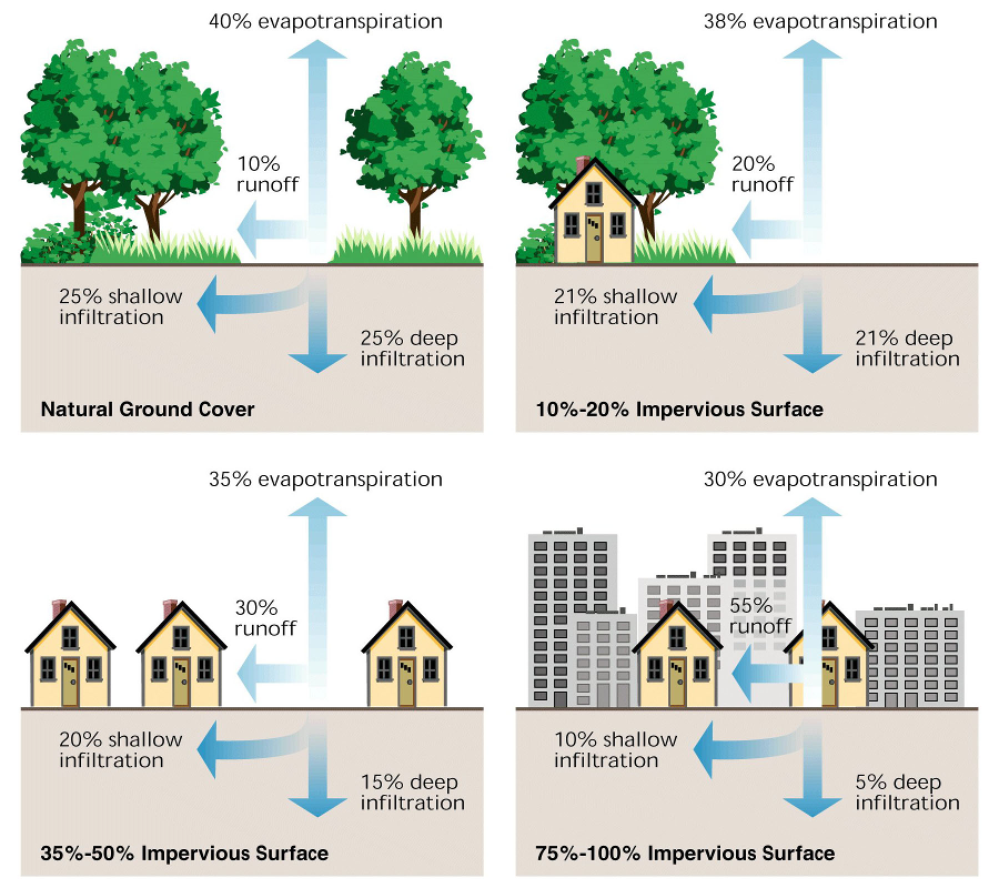
When it rains on urban areas in Virginia, raindrops often hit impervious surfaces such as roofs and roads, patios and parking lots.
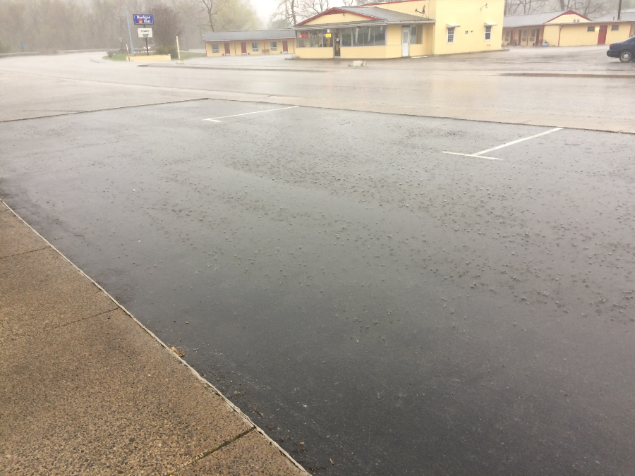
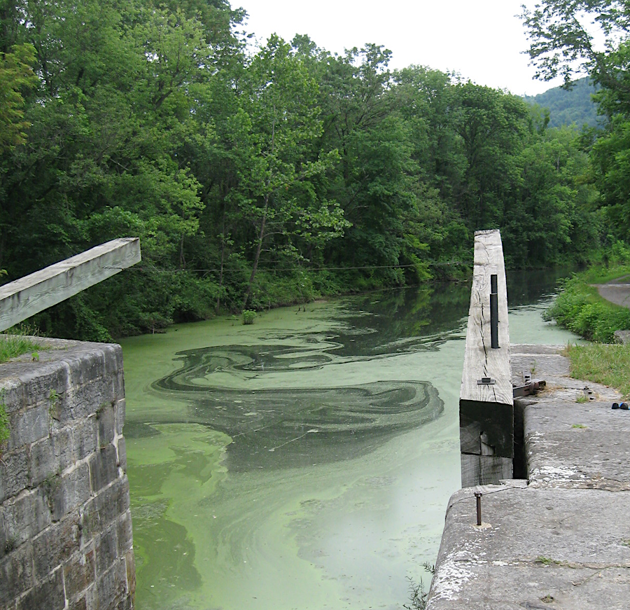
rainfall landing on a paved parking lot in Buena Vista runs off into the Maury River on the western edge of the city
That water can not seep into the ground, unlike raindrops that fall on lawns and gardens and can soak into the ground. Stormwater that flows off impervious surfaces will flow downhill, and eventually drain into a creek or lake. Runoff that flows faster than normal, with the weight of more water than normal, can cause erosion.
paved parking lots, roads, and rooftops all prevent rainwater from soaking naturally into the ground
Source: Historic Prince William, Manassas - #325
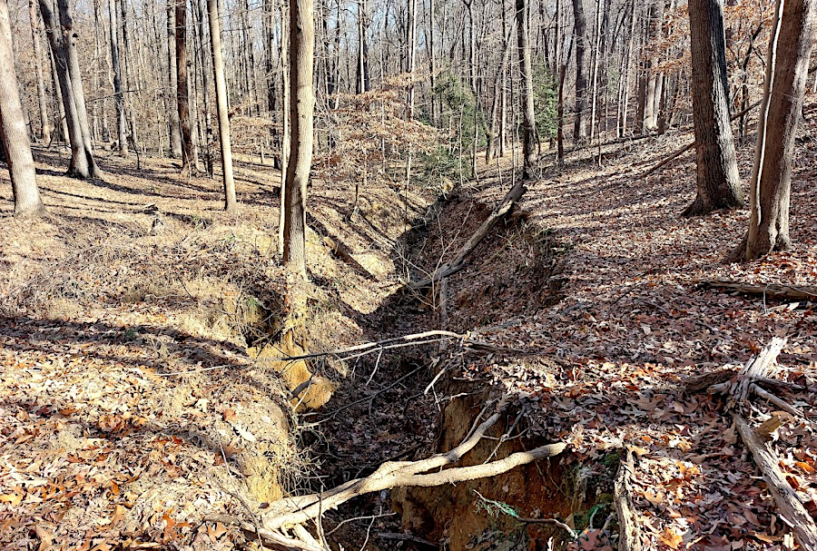
At the College of William and Mary, stormwater eroded a 25-foot deep "grand canyon" in the headwaters of Strawberry Creek. After completion of Route 199 in 1999, the stormwater pond was not large enough to retain the water racing off the impervious surface of the roads and shopping centers in the watershed upstream of the pond.
Stormwater flowing out of the pond had enough energy to incise the channel deeper, at the rate of one foot/year. In comparison, erosion that formed the Grand Canyon in Arizona deepened the Colorado River channel by just one inch per decade. The eroded sediment was deposited in the stream channel of Strawberry Creek and Lake Matoaka. In 2010, roughly 80% of the stormwater ponds constructed near Williamsburg had similar problems and failed to mitigate the impact of one-year storm events.
In 2024, the Virginia Department of Transportation (VDOT) upgraded the stormwater pond. The $2 million project was designed so a larger pond could capture and release less water at a slower speed, in an effort to mimic the natural flow in the Coastal Plain stream when the land was still forested.1
uncontrolled runoff from a parking lot has etched a canyon at Tanyard Hill Park near Occoquan
In densely urbanized central cities in Virginia, stormwater drains into a dedicate set of underground pipes - the Municipal Separate Storm Sewer System (MS4) network - before reaching the creeks or rivers. The Federal Clean Water Act was amended in 1987 to give the Environmental Protection Agency (EPA) authority to regulate "non-point source" pollution, primarily stormwater runoff from agricultural fields and through the stormwater pipes and artificial channels in urbanized areas.
most of Alexandria has an impervious surface (grey), showing the challenge in reducing stormwater flow to the Potomac River
Source: City of Alexandria, Eco-City Map Series
Normally, all the sewage from toilets in houses and businesses will flow into a septic system or to a wastewater treatment plant, where it is treated as required by the Clean Water Act before being released into a nearby stream. Normally, stormwater flows directly into creeks (as a non-point source of pollution) or through the separate MS4 network of ditches (as a point source), but the stormwater is not processed by a wastewater treatment plant.
Stormwater ponds may hold water and support cattails or other plants that remove some nutrients, before the water flows out of the pond. Most stormwater ponds trap whatever pollution is in the runoff, then release it into nearby creeks without any water quality improvement.
In 2014, runoff from a stormwater pond on I-77 killed trout in Laurel Creek, a tributary of Wolf Creek, near Rocky Gap in Bland County. Firefighters had used foam to smother a car fire after a wreck on the highway, and the foam flowed through a Virginia Department of Highways stormwater pond.
Though some foams include chlorine, the trout in Laurel Creek were killed when the degrading foam consumed the oxygen in the water. If the stormwater pond had been able to contain all the runoff from the efforts to smother the fire, then trap other stormwater to dilute it before release, then the fish might have survived.2
except in three cities with Combined Sanitary Outflow (CSO) systems, stormwater flows unprocessed to streams without going through a wastewater treatment plant
blooms of algae and cyanobacteria occur in static water with high levels of nitrogen and phosphorous, such as sections of the Chesapeake and Ohio Canal
Source: National Park Service, C&O Canal
oxygenating a stormwater pond can reduce the potential for eutrophication
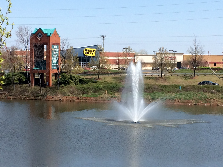
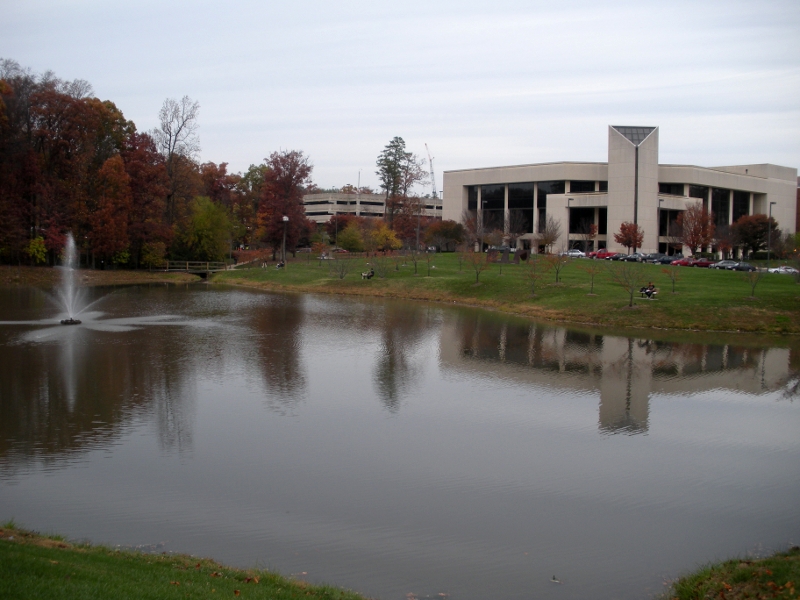
Stormwater ponds are not natural, like ponds created by beavers. In some circumstances, however, stormwater ponds have been designed to serve as an attractive amenity by providing a water view.
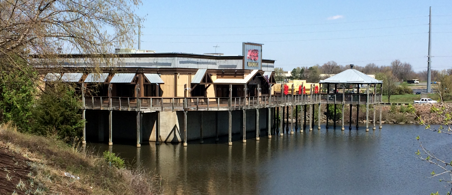
near Manassas, a Logan's Roadhouse built a deck overlooking a stormwater pond
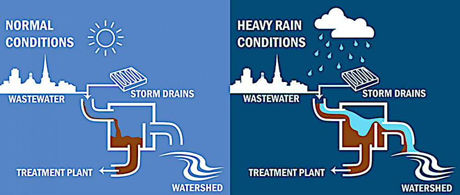
Some stormwater in three Virginia cities gets sewage treatment. In Alexandria, Lynchburg, and Richmond, the stormwater pipes are connected with the sanitary sewer pipes to create a Combined Sanitary Outflow (CSO) system. In those three cities, runoff in small rainstorms flows with the sewage from houses to wastewater treatment plants. The stormwater is treated along with sanitary wastewater, helping to control pollution.3
However, during heavy rains a surge of stormwater floods into the Combined Sanitary Outflow pipes. The extra inflow exceeds the capacity of the wastewater treatment plant, so the system is designed to force much of the water/sewage mixture through special outlets that drain into creeks and rivers without any wastewater treatment. During an August thunderstorm, for example, Alexandria, Lynchburg, and Richmond can discharge a mix of untreated human waste and stormwater directly into the Potomac and James rivers.
during light storms, stormwater in Lynchburg flows through the wastewater treatment plant
Source: City of Lynchburg, Combined Sewer Overflow System
Even in places without Combined Sanitary Outflow systems, wastewater treatment facilities get overloaded with extra flow due to infiltration and inflow (I&I) into sewer pipes and manholes. Manholes get flooded and stormwater "inflows" directly into sanitary sewer pipes. The weight of rainwater seeping underground in a storm generates enough pressure to force its way into pipes, adding "infiltration" volume that flows to wastewater treatment plants.
In 2024, the City of Alexandria installed 870 inserts underneath manhole covers. The inserts delay the inflow of stormwater through the covers into sanitary sewer pipes. That delay minimizes the peak of the surge of water flowing to the AlexRenew wastewater treatment plant, and in Alexandria the delay is expected to reduce the number of Combined Sanitary Outflow events.4
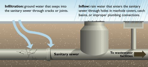
inflow enters sewer pipes from manholes during floods and direct connections such as sump pumps underneath buildings, and infiltration enters through pipe joints and cracks
Source: Salem, Virginia, Water & Sewer - Inflow & Infiltration
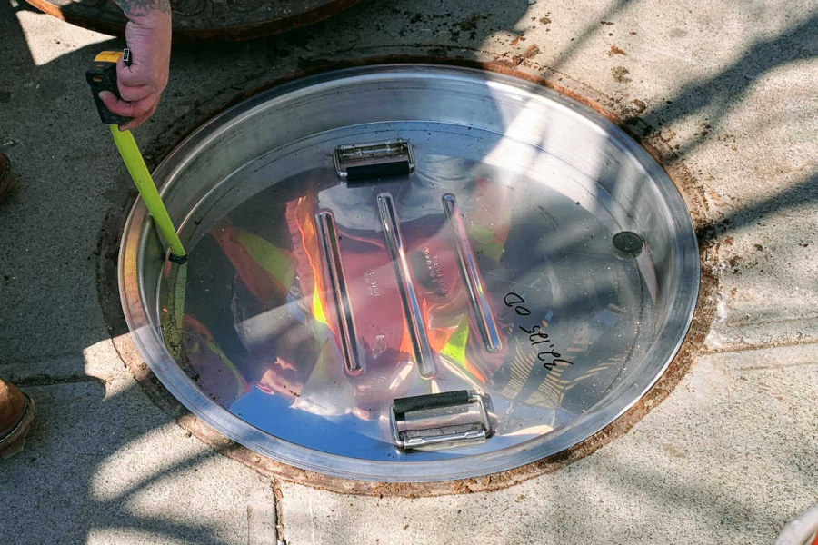
manhole inserts installed underneath manhole covers delay the flow of stormwater into underground sanitary sewer pipes
Source: Trenchless Technology, NASSCO Report - Manhole Inserts Play Key Role in Flood Prevention and Inflow Reduction
In the suburbs, stormwater typically runs into specially-built ponds that delay the speed at which the runoff drains into the creeks. That delay reduces the speed of the runoff, and slowing down artificially-accelerated runoff with artificial ponds reduces erosion. Excessive sediment is one of the three major pollutants that have damaged the Chesapeake Bay, along with excessive nitrogen and excessive phosphorous.
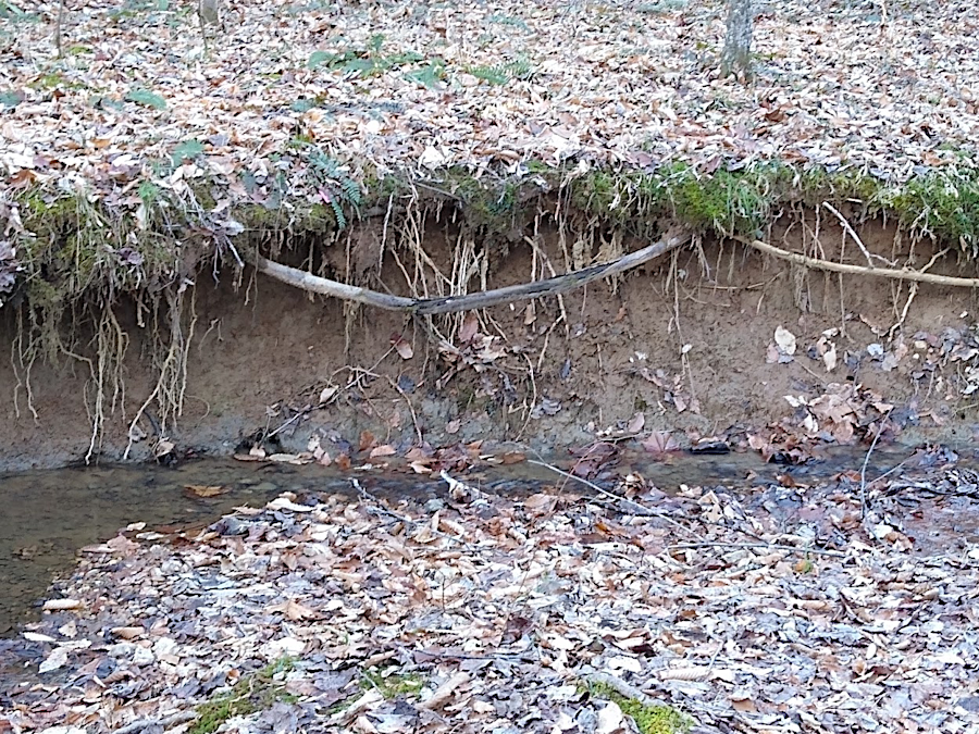
stormwater erodes streambanks and carries sediment downstream
Erosion and sediment control ordinances now require developers to reduce the impact of impermeable surfaces by building flood control structures or stormwater management ponds. When the water rushes off the parking lot, it fills the pond rather than races into the stream. The artificially-fast runoff rate from impervious surfaces is why signs on fences around stormwater ponds warn that the water rises rapidly, so children should not play in the depression.
Where stormwater is trapped briefly in stormwater management ponds or slows down in the curves of streams, some sediment particles will settle to the bottom and be trapped. Nitrogen from over-fertilized lawns or dog wastes will dissolve in the stormwater and keep flowing through the stormwater pond, but molecules of phosphorous and some lawn chemicals may stay attached to sediment particles.
When particles settle to the bottom, some pollution can be trapped ("entrained") in the sediments. As a result, stormwater ponds may improve water quality, as well as address water quantity problems even in ponds not designed to reduce pollution.
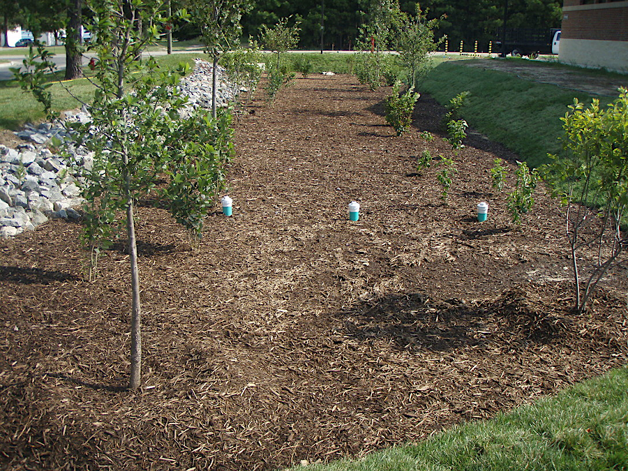
bioretention ponds are designed to increase water infiltration into soil
Source: US Army Corps of Engineers, Bioretention in Open Area
Sediment particles at the bottom of stormwater ponds are trapped only temporarily. The journey downstream will resume every 10-50 years, when a gully-washing hurricane stirs up the sediment and carries it downstream.
On July 8, 2019, 5" of rain fell within one hour on Fairfax County. That surge overloaded the capacity of the stormwater network, and overland flooding blocked roads and "lit a fire under Fairfax County supervisors to upgrade the county’s stormwater-management systems."5
Stormwater ponds help to "save" the Chesapeake Bay only if they are dredged to remove sediments.
The outflow from the pond is a relatively small pipe which limits the amount of water flowing downstream, so water level in a stream does not rise rapidly if the pond performs its intended function. The speed at which the pond drains should mimic the speed at which the now-paved area naturally drained excess rainwater. This reduces the "flashiness" of the stream, so water levels rise slowly downstream of a stormwater management pond.
"wet" stormwater pond, constructed so recently that no vegetation had developed - yet (at New Bristow Village in Prince William County)
"Dry" stormwater management ponds are empty between storms, while "wet" ponds always keep some water in them. That reduces the chance that children playing on the water's edge could get trapped during a storm, when the water level in the pond rises rapidly.
However, such ponds are "attractive nuisances" that insurance agents may view as hazards, instead of being an attractive water accent to a neighborhood already impacted by ugly parking lots. New "rain garden" alternatives to the stormwater management pond are now coming into favor.
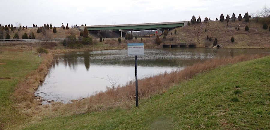
"Mason Pond" is a wet stormwater retention facility on the Fairfax Campus
One possible alternative is to reduce runoff by growing grass right on the roof of large buildings. A rooftop pasture can retard some of the runoff, since the grass and soil would retain the rainfall. The additional costs for the roof might be offset in part by reduced costs of air conditioning, since evaporating moisture in the soil would cool the roof.
Replacing paved drainage pathways with grassy swales would also reduce the speed at which water reached a stream. The swales could even develop into wetlands in some areas, mitigating the impacts of development on wildlife values.
Since parking lot and roof runoff is generally warmer than natural drainage, a rain garden also can reduce thermal stress to fish and other stream life. Runoff from a hot, black asphalt parking lot can be warm enough to kill trout, as occurred on Four Mile Run in Arlington.6
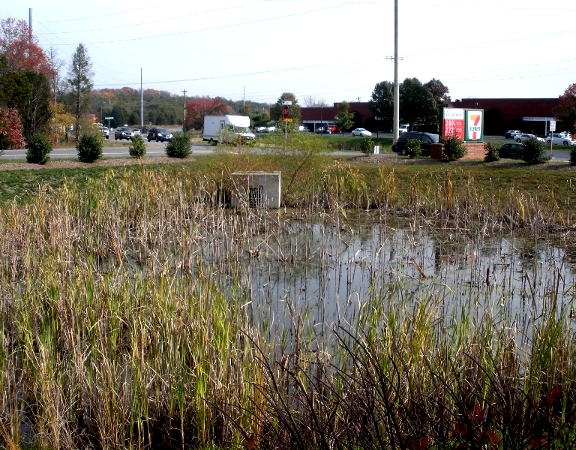
wet stormwater pond, with cattails indicating phosphorous in run-off, at 7-11
(Cushing Road and Balls Ford Road in Prince William County)
The installation of solar panels on a rooftop did not alter stormwater runoff, but utility-scale solar facilities built on grassland/forests did alter runoff. Raindrops that land on a solar panel flow off the hard surface, then land on the ground in a non-natural pattern based on the shape of the panel.
If utility-scale solar facilities were classified as impervious surfaces, then the permitting process would have to include a review of stormwater management capacity. Because the design of utility-scale solar facilities and the permeability of the groundcover beneath them varied, the Virginia Department of Environmental Quality (DEQ) struggled to meet the General Assembly requirement to develop stormwater regulations by the end of 2024.
By 2023, when the Virginia Department of Environmental Quality was regulating 77 large solar facilities, the agency found 30% had excessive runoff carrying sediment. The agency director said:7
The General Assembly passed the Virginia Erosion and Stormwater Management Act (VESCA) in 2016. Combining Erosion and Sediment Control (E&S) and Stormwater Management (SWM) regulations streamlined the process for local jurisdictions to review site permits. The State Water Control Board adopted consolidated regulations in 2023 and they became effective on July 1, 2024. The Virginia Department of Environmental Quality (DEQ) then prepared a Virginia Erosion and Sediment Control Program (VESCP) Model Ordinance for cities, counties, and towns to adopt.8
Stormwater controls, if correctly installed as pasturelands are developed, may reduce nitrogen pollution from runoff. Replacing septic systems with sewerlines that carry waste to modern treatment plans can also reduce pollution, though denser housing development in rural areas will have many other impacts beyong nitrogen flow to nearby streams.
Forested areas remain most effective at capturing nutrients; replacing trees with houses will increase pollution. Forested buffers, such as the Resource Protection Area (RPA) 100 feet wide on each side of a perennial stream required by the Chesapeake Bay Preservation Act, can intercept sediment, phosphorous, and other pollutants as well as nitrogen.
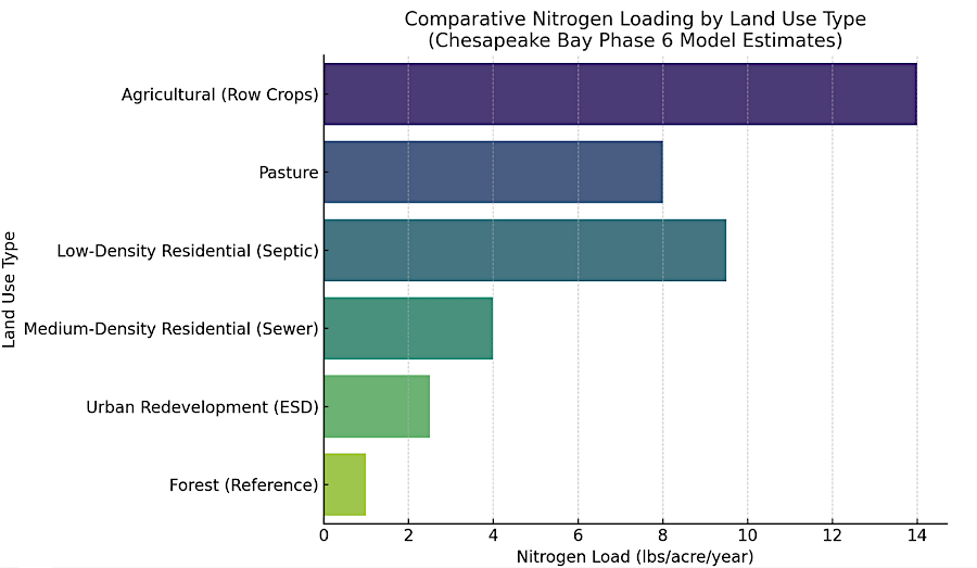
of all land uses, forests are most effective at minimizing nitrogen runoff
Source: Interstate Commission on the Potomac River Basin (ICPRB), Water Quality Impacts of Development in the Potomac River Basin and Strategies for Mitigation
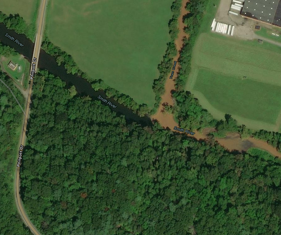
sediment in Town Creek can transform the water quality of Smith River - right at Henry County's Philpott Water Treatment Facility
Source: ESRI, ArcGIS Online
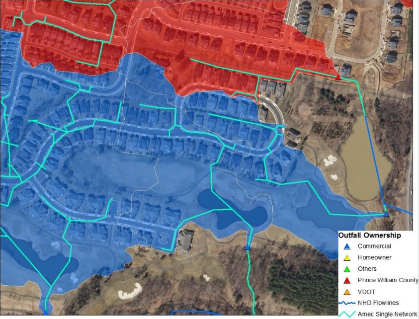
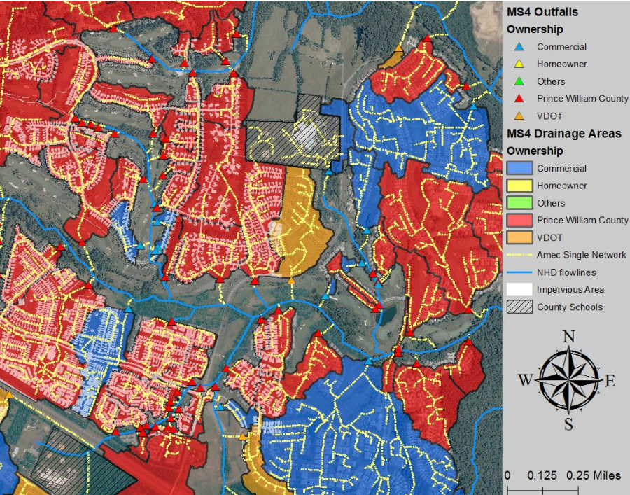
Municipal Separate Storm Sewer System (MS4) permits require jurisdictions to identify who is responsible for maintaining stormwater control infrastructure
Source: Prince William County, Annual Stormwater Management Report VSMP Permit No. 0088595 – FY 2020
a stretch of Cannon Branch, south of Manassas, was dammed to create a stormwater pond back when converting natural streams was still allowed

impervious surface (red) is concentrated in urbanized Northern Virginia, and in cities along interstate highways
Source: The Nature Conservancy, TNC/Chesapeake Bay Fish Passage Prioritization Tool
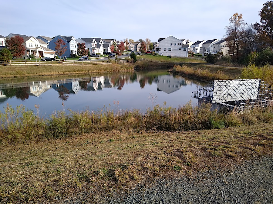
new subdivisions must create stormwater ponds to capture runoff from impervious surfaces
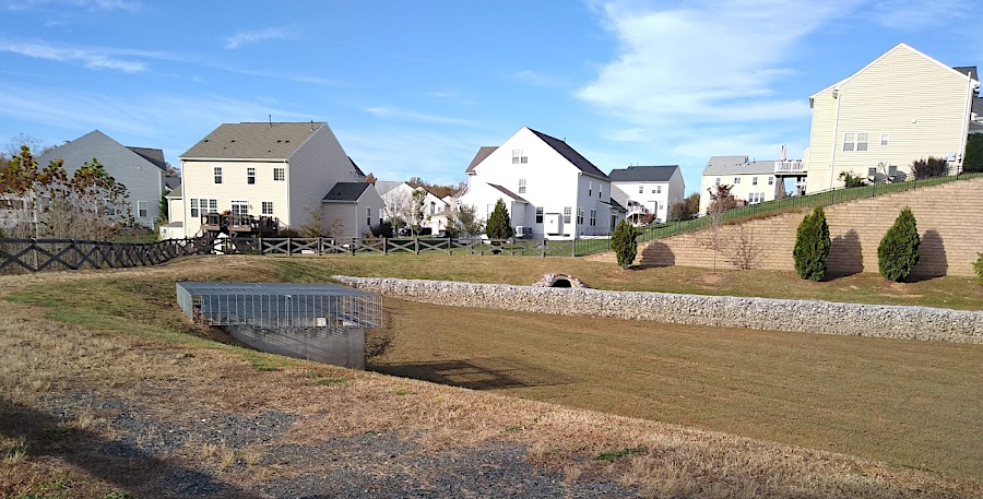
dry as well as wet stormwater ponds capture runoff, then release it with lower energy flows into local streams
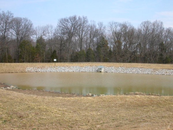
stormwater ponds release runoff through channels that use stone to diffuse the energy of the flow
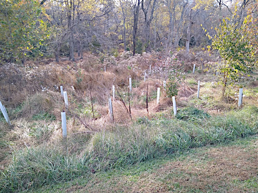
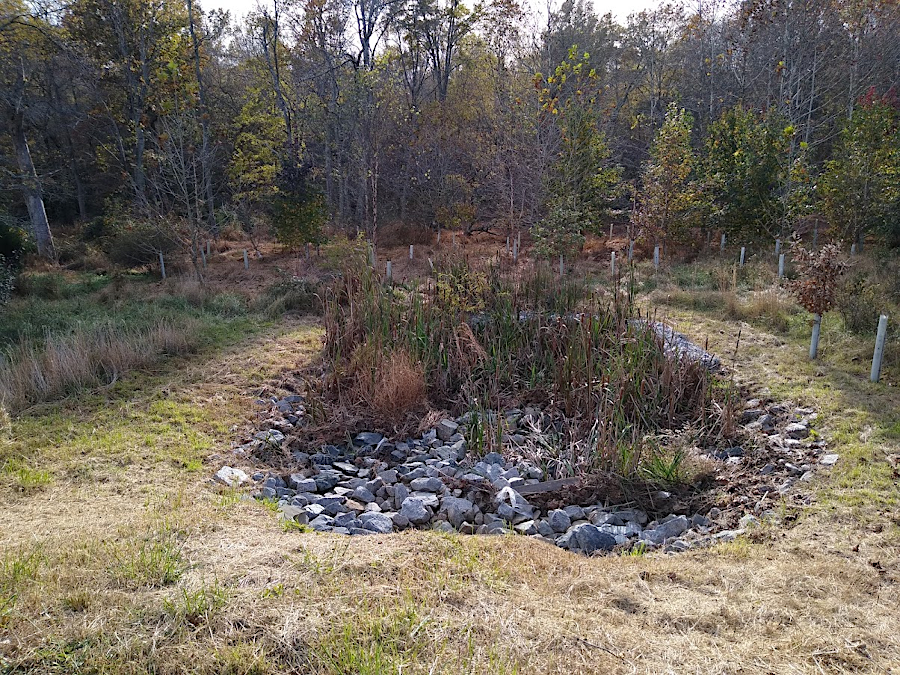
reforesting floodplains reducing runoff
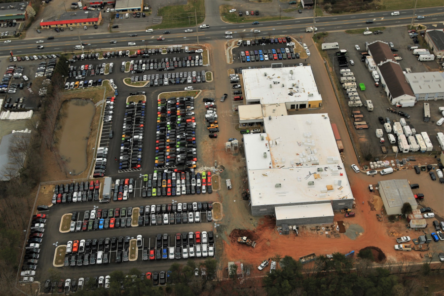
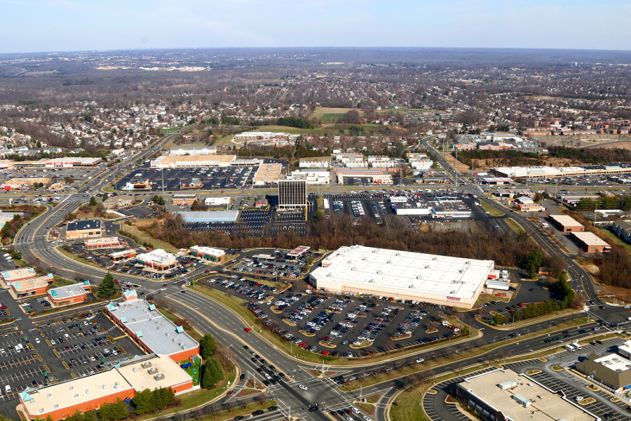
rooftops and pavement at car dealerships, such as Lindsay Chrysler Dodge Jeep Ram on Route 28 near Manassas, are impervious surfaces
Source: Historic Prince William, Aerial Photo Survey 2019