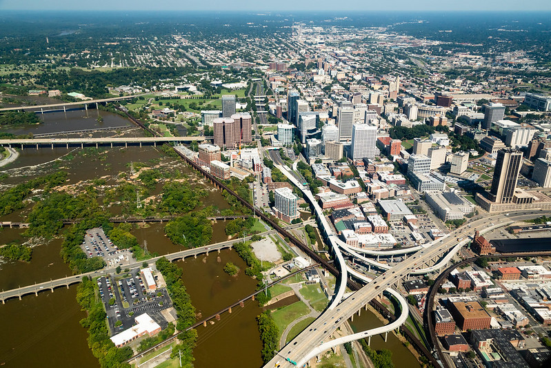
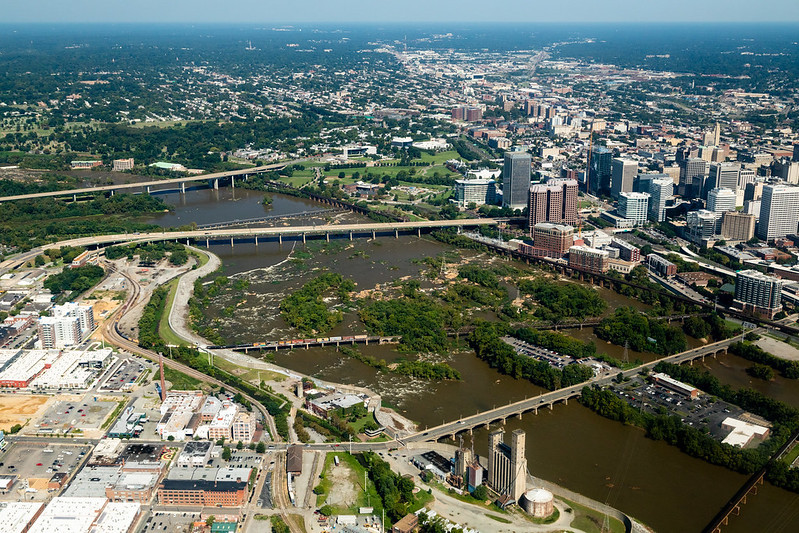
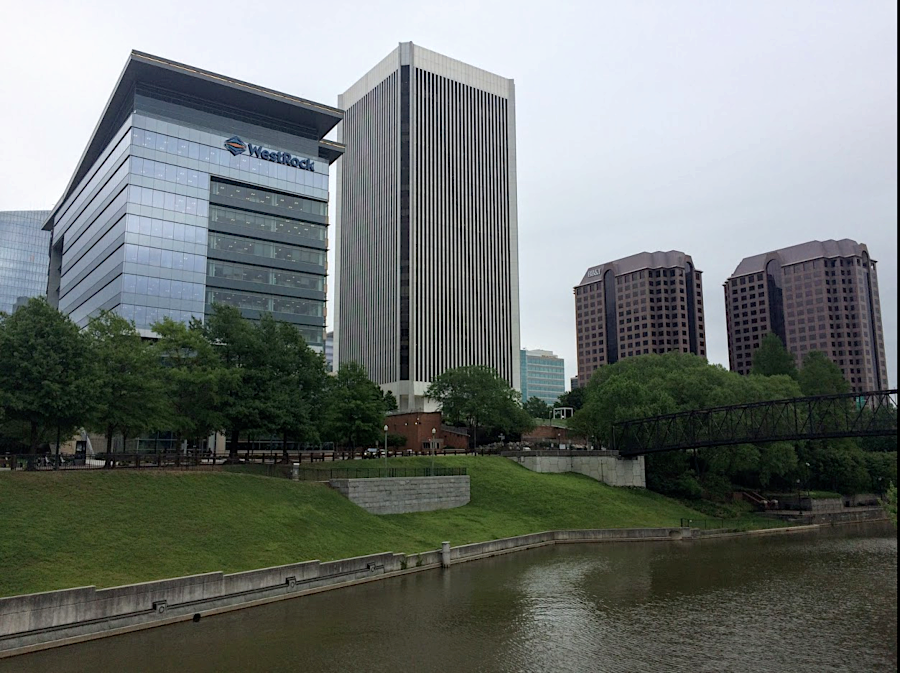
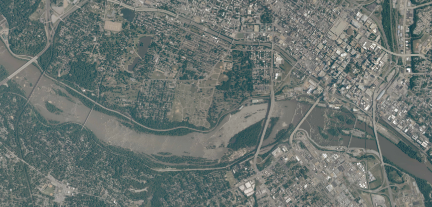
downtown Richmond, looking upstream on the James River in 2018
Source: Chesapeake Bay Program, Richmond, VA
downtown Richmond, looking upstream on the James River in 2018
Source: Chesapeake Bay Program, Richmond, VA
In 1607, one of Powhatan's sons, Parahunt, was the weroance (leader) of a small town between the new settlement at Jamestown and the Fall Line. Christopher Newport explored the site in May, 1607, and discovered further travel by ship was blocked by rapids. Gabriel Archer described Parahunt's town:1
It was a "goodly habitation" because the bottomland along the river was fertile; corn and other agricultural plants produced good harvests. What the English initially identified as Powhatan's River was full of fish. The falls of the river were important because they blocked the migration of anadromous fish such as the American shad and sturgeon. As the fish were slowed by the barrier, they were concentrated in front of Parahunt's town and easier to catch.
Captain Newport sailed up to the Fall Line in May, 1607 after the colonists had decided to settle at Jamestown. John Smith reports that over 20 English colonists were on the ship. The Fall Line, a series of "great craggy stones in the midst of the riuer, where the water falleth so rudely," blocked Newport from moving further upstream.
He sailed back downstream a couple of miles to the Native American town of Powhatan, where Chief Powhatan's son Parahunt was in charge. The English obtained a local guide there by leaving one of their own behind as a hostage. They sailed back to the Fall Line, but the guide would take them no further west. The colonists discovered the Fall Line was also a territorial edge dividing the Siouian-speaking Monacans upstream from the Algonquian-speaking people in Tsenacomoco under Powhatan's control.
The first English structure erected at what later became the site of Richmond was a cross. The colonists had built a similar cross at Cape Henry when they first landed in Virginia in April. The cross asserted the combined authority of the English crown and Anglican Church over the new land.2
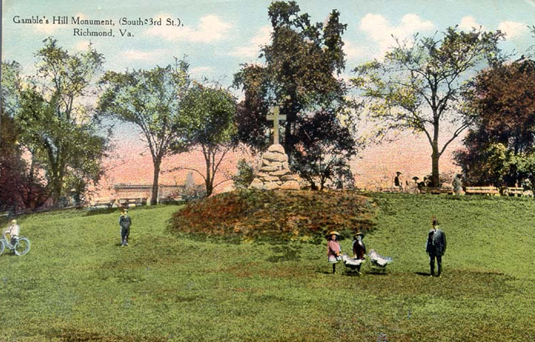
the Association for the Preservation of Virginia Antiquities (now Preservation Virginia) erected a cross on Gambles Hill in 1907 to commemorate the arrival of the English colonists 300 years earlier
Source: Virginia Commonwealth University (VCU), Gamble's Hill Monument, (South Third St.), Richmond, Va.
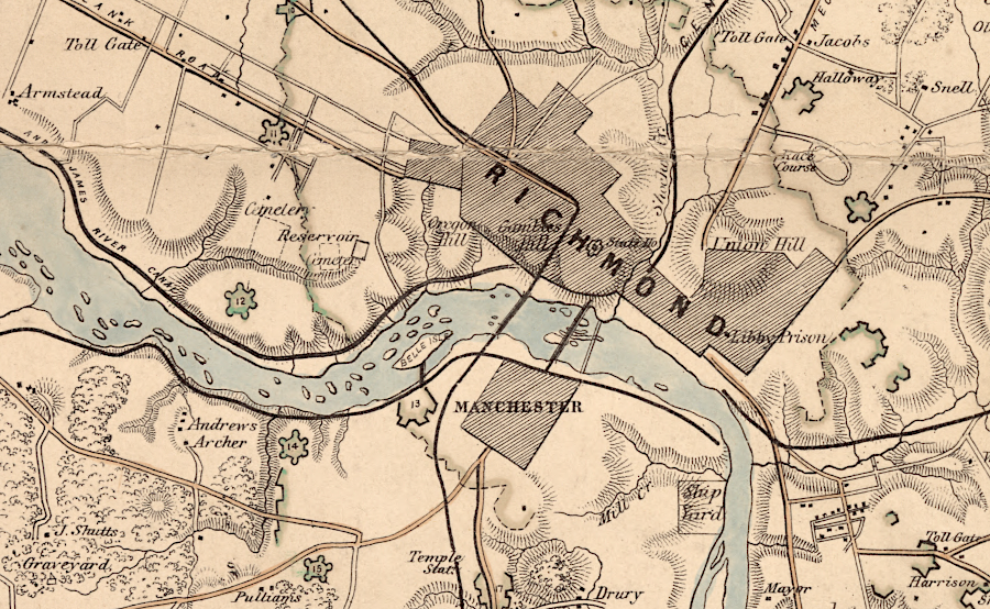
Stations for trading with the Native Americans for furs and deerskins were established during the 17th Century by Thomas Stegge/William Byrd at the Fall Line on the James River, and by Abraham Wood on the Appomattox River. They evolved into the cities of Richmond and Petersburg in the 18th Century.
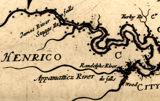
fur trading stations at the Fall Line on the James and Appomattox rivers
Source: Library of Congress, Virginia and Maryland as it is planted and inhabited this present year 1670 (by Augustine Herrman, 1670)
125 years later, the site of this town and adjacent agricultural fields would be recognized as a "natural mart" because of the barrier to shipping. After the site was surveyed by the English colonists, it quickly grew into the city of Richmond.
The new town was named by William Byrd II after the city of Richmond in England, where Byrd had lived. The appearance of the James River from what is today Church Hill resembled the bend in the Thames River at Richmond southwest of London.
As directed by Byrd, in 1737 William Mayo created a plat for defining the town boundaries and street pattern and the first lots were sold. The General Assembly issued a town charter in 1742:3
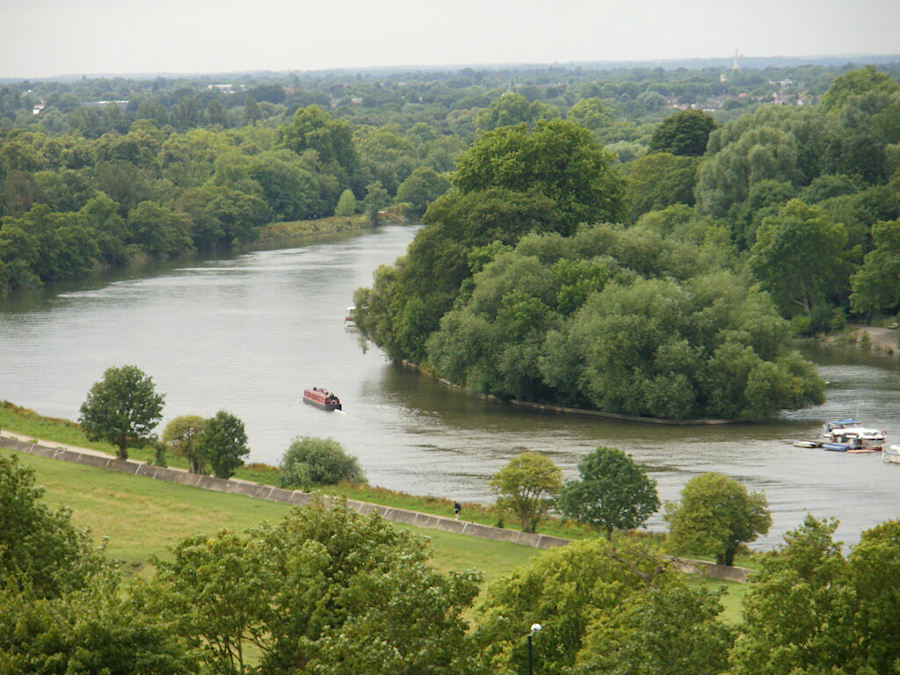
the vista of the Thames River from Richmond Hill in England led William Byrd II to name the new city at the Fall Line of the James River in VIrginia
Source: Geograph, Glover's Island, Richmond Upon Thames (by Peter S.)
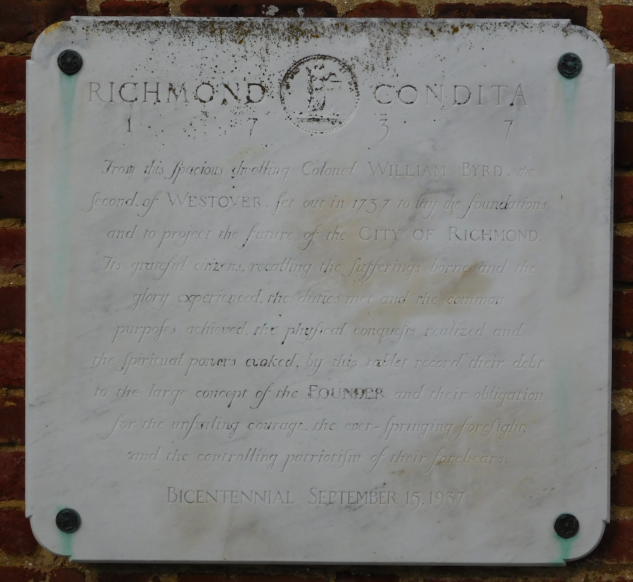
a plaque at Westover, the plantation home built by William Byrd II in Charles City County, commemorates the founding of Richmond in 1737
Richmond was chosen to be the capital of Virginia in 1780 and incorporated as a city in 1782. Having the capital in Richmond has encouraged the growth of that city, especially as the politicians have steered state and Federal funding into financing transportation improvements that would benefit the city. However, a major city had already emerged at the falls of the James after population growth had increased in the Piedmont, and before the capital was moved to Richmond during the Revolutionary War.
The Capitol Building was constructed on the highest elevation west of Shockoe Creek, with a great vista of the James River until the state constructed a high-rise office (the Blanton Building) in 1922. Today you can see the Richmond skyline, but barely a glimpse of the natural river, from the steps of the Capitol.
British attacks up the James River had demonstrated that Williamsburg was not defensible, and the rebellious politicians were at risk in Williamsburg. In fact, Richmond was not much safer - and even Charlottesville was insecure.
In January 1781, Benedict Arnold led British Rangers on a raid to Richmond. He landed 900 troops at Westover Plantation in Charles City County and marched 35 miles overland to the Virginia capital, burned the public buildings, destroyed the cannon and powder at the Westham foundry, and returned to his ships without losing a single man.
Arnold offered to spare Richmond if the Virginians would surrender the town and allow him to bring British ships upriver and remove tobacco from the warehouses. Gov. Thomas Jefferson, who was on the southern side of the river in Manchester, rejected the offer and Arnold then burned private warehouses filled with tobacco as well as public buildings. (In 1814, during another war with Britain, the leaders of Alexandria on the Potomac River chose to surrender and allow the British to plunder their warehouses.)4
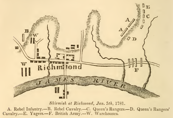
Benjamin Arnold burned the public buildings in Richmond in January, 1781
Source: Historical collections of Virginia, Skirmish at Richmond, Jan. 5th, 1781 (p.306)
Later in 1781 Lord Cornwallis marched from Charleston, SC to Yorktown, Virginia. Until October, 1781, Cornwallis was unstoppable, and in June he too raided Richmond. The General Assembly abandoned their capital city and fled towards Governor Thomas Jefferson's home county, Albemarle.
Cornwallis' cavalry officer, Banastre Tarleton, led the "Green Dragoons" westward up the Mountain Road (Route 33 today) to capture the rebel leaders at Charlottesville. Tarleton would have succeeded, except for Jack Jouett.
He was a Virginia patriot (or rebel, depending upon your perspective...) at Cuckoo Tavern in Louisa County. Jouett decided to warn Jefferson and the others. He rode across the farmfields and through the back lanes of the Piedmont, staying off the main roads and avoiding British cavalry patrols - the Virginia version of the "ride of Paul Revere." Jefferson was able to leave just ahead of the British, and the General Assembly reconvened briefly in Staunton.
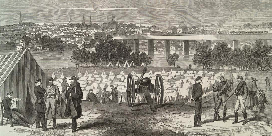
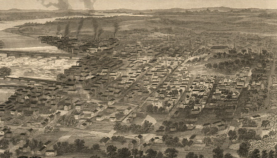
Richmond in 1861
Source: Illustrated London News, Richmond, Virginia, the Capital of the Confederate States of America (September 7, 1861)
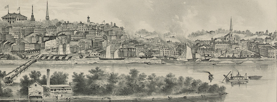
Richmond was a manufacturing and transportation center before the Civil War because the waterpower at the Fall Line provided energy for machinery, and downstream of the rapids the James River offered easy access to other ports
Source: Illustrated London News, The Civil War in America: General View of Richmond, Virginia (May 31, 1862)
Richmond's boundaries at the time of the Civil War
Source: US War Department, Atlas to accompany the official records of the Union and Confederate armies, Southeastern Virginia and Fort Monroe Showing the Approaches to Richmond and Petersburg (1862)
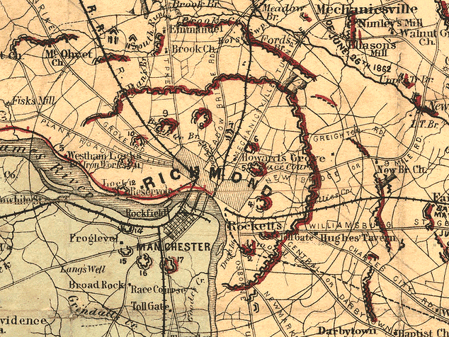
fortifications to protect the capital of the Confederacy between 1861-1865
Source: Library of Congress, Thirty five miles around Richmond, Va (by Jedediah Hotchkiss)
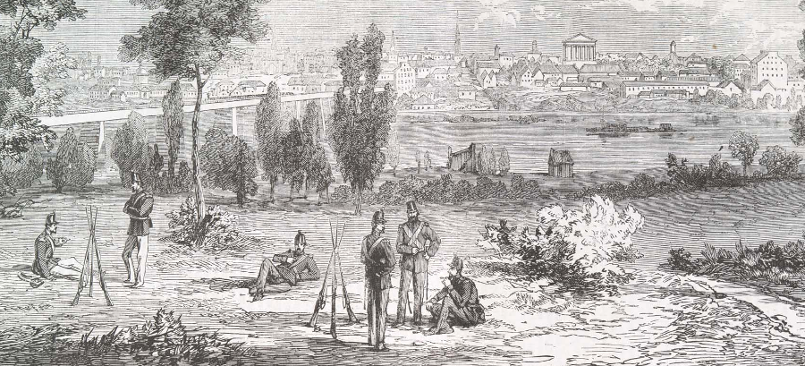
looking north across the James River at Richmond in 1861 (Richmond and Petersburg Railroad bridge on left, state capitol in the distance)
Source: Illustrated London News, The Civil War in America: View of Richmond, the Capital of Virginia (June 22, 1861)
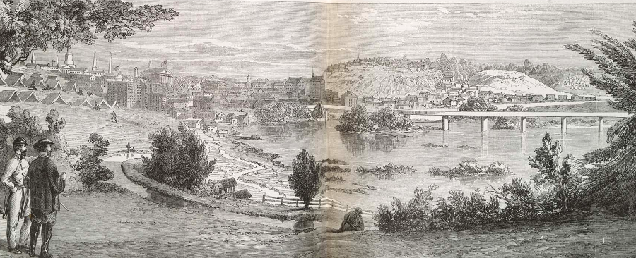
the James River and Kanawha Canal brought coal on boats and also provided waterpower directly to the Tredegar Iron Works
Source: Illustrated London News, The Civil War in America: View, From the West, of Richmond, Virginia, Capital of the Confederate States (November 15, 1862)
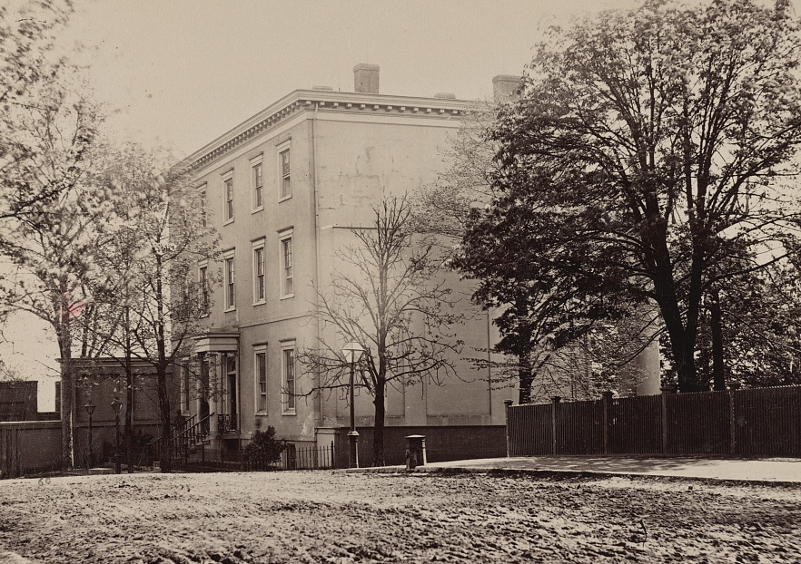
the Confederate capital moved from Montgomery (Alabama) to Richmond after Virginia seceded in 1861, and President Jefferson Davis occupied the Confederate White House until the fall of Richmond in 1865
Source: Library of Congress, House occupied by Jefferson Davis, Richmond, Va., April, 1865
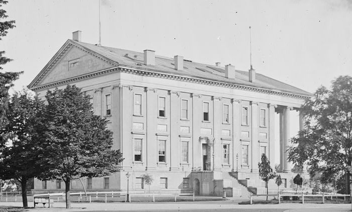
the Capitol building was a rectangular structure until 1904, when wings were added to house the House of Delegates on the east and the State Senate on the west
Source: Library of Congress, Richmond, Va. Left side and rear of Capitol
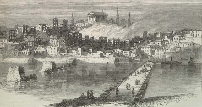
after evacuating Confederate forces destroyed bridges across the James River in April, 1865, occupying Federal troops built pontoon bridges as temporary replacements
Source: Illustrated London News, Richmond, Virginia, after Its Conquest. The City of Richmond, from the James River (May 20, 1865)
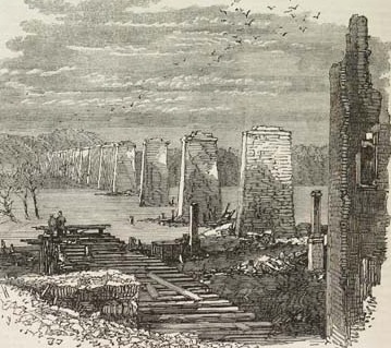
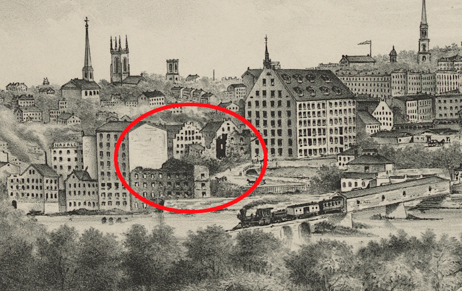
in the Evacuation Fire of April 3, 1865, Confederates destroyed the Richmond and Petersburg Railroad bridge crossing the James River
Source: Illustrated London News, Richmond, Virginia: Ruins of the Railway Bridge (July 15, 1865)
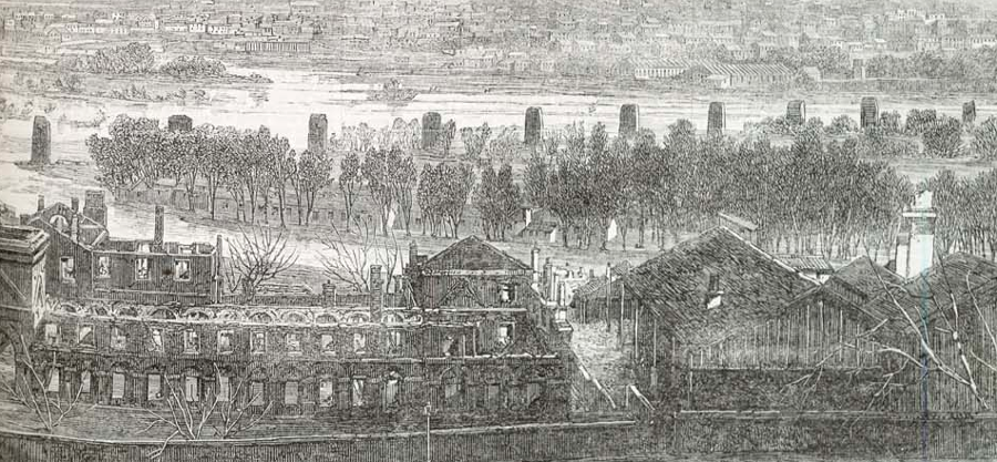
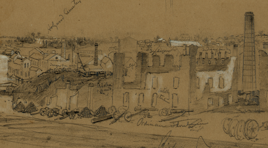
looking from the James River and Kanawha Canal past the burned-out Richmond Arsenal to the destroyed Richmond and Petersburg Railroad bridge after the Evacuation Fire in 1865
Source: Illustrated London News, Richmond, Virginia: Ruins of the Railway Bridge (July 15, 1865)
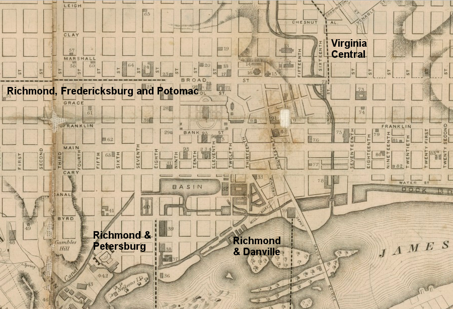
the railroads serving Richmond were not connected in 1856, so cargo had to be transferred (drayed) between stations by horse and wagon
Source: Virginia Memory, Map of the city of Richmond, Henrico County, Virginia (by William Sides, 1856)
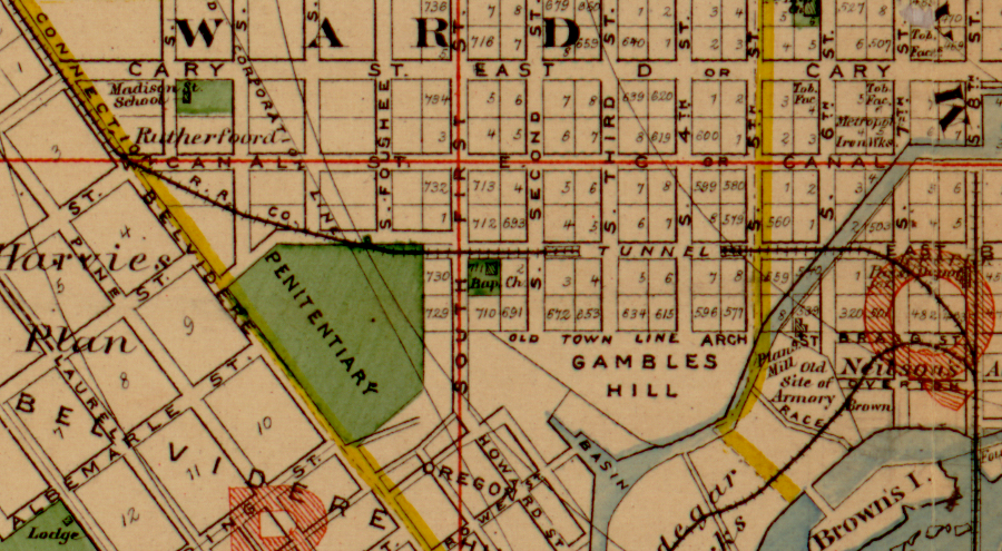
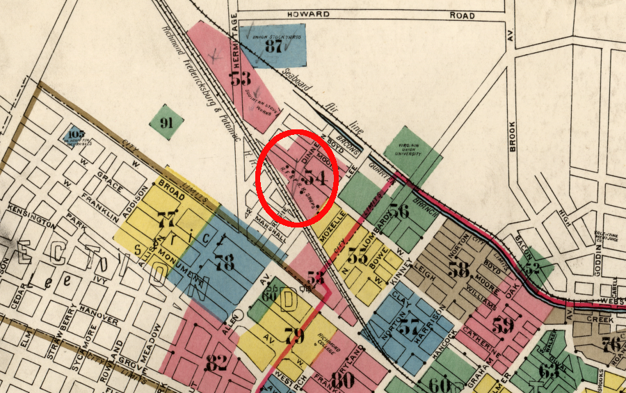
a railroad connection, which required a tunnel at Gambles Hill, linked the Richmond and Danville with the Richmond, Fredericksburg, and Potomac (RF&P)
Source: Library of Congress, Illustrated atlas of the city of Richmond, VA (1877)
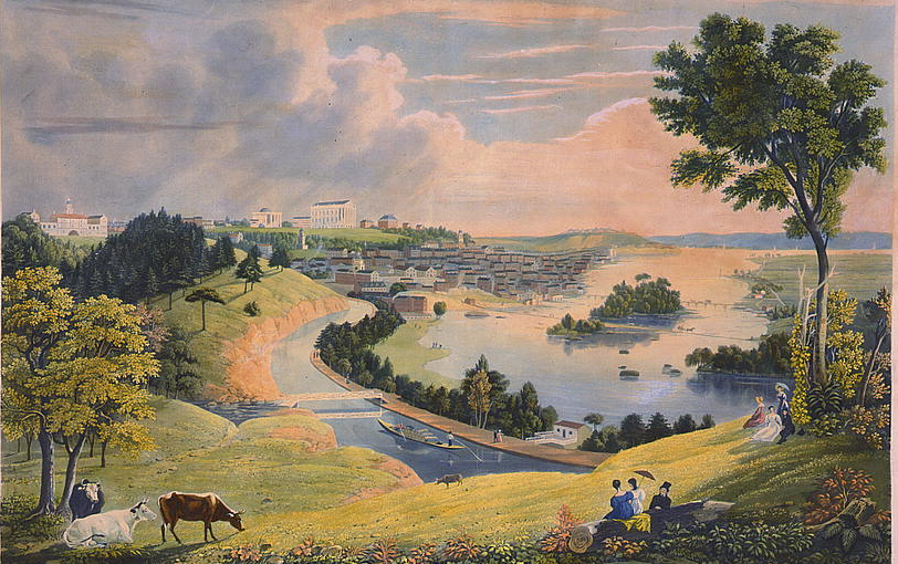
despite the pastoral scene showing the James River and Kanawha Canal, the transportation artery spurred manufacturing in Richmond by reducing transportation costs and providing waterpower to Tredegar Iron Works and various mills
Source: Library of Congress, Richmond, from the hill above the waterworks (c.1834)
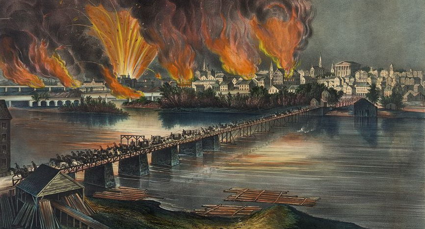
when the Confederate military and political officials abandoned Richmond after the fall of Petersburg, they set fire to warehouses on the waterfront - and the resulting Evacuation Fire destroyed much of the city's commercial district
Source: Library of Congress, The fall of Richmond, Va. on the night of April 2d. 1865
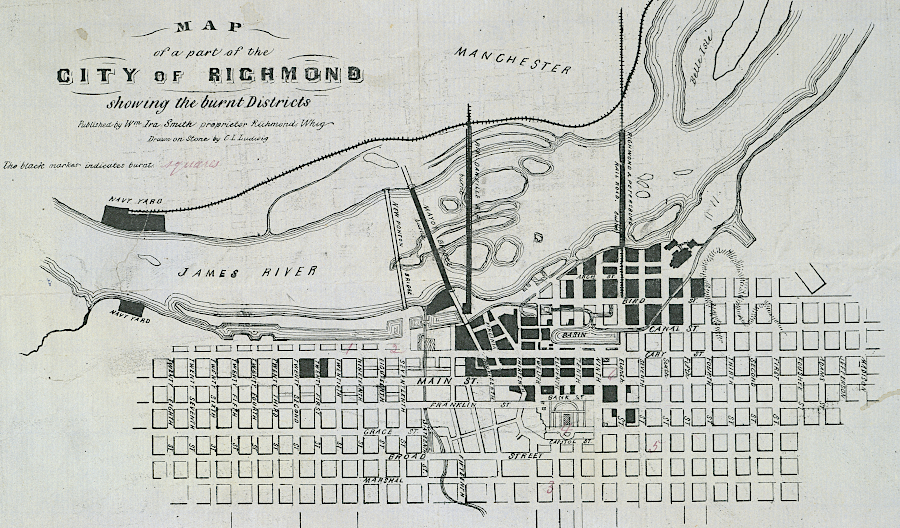
the Evacuation Fire destroyed the city center from the James River to the Capitol grounds
Source: Library of Virginia, Map of a part of the city of Richmond showing the burnt districts (by C.L. Ludwig, 1865)
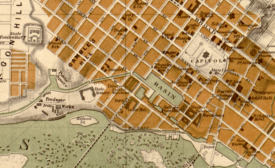
in the mid-1800's, Richmond was centered on the trade and factories associated with the James River and Kanawha Canal, which provided both transport and waterpower
Source: Library of Congress, Map of the city of Richmond, Virginia
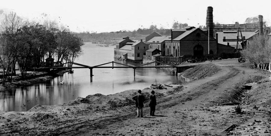
Tredegar Iron Works depended upon both free and slave labor until the end of the Civil War
Source: Library of Congress, Richmond, Va. View of the Tredegar Iron Works, with footbridge to Neilson's Island
in 1905, the shops of the Richmond, Fredericksburg and Potomac (RF&P) Railroad were still outside the city boundary
Source: Library of Congress, Sanborn Fire Insurance Map from Richmond, Independent Cities, Virginia (1905)
the Tredegar Iron Works (in background) was not destroyed in the Evacuation Fire at the end of the Civil War
Source: Library of Congress, Richmond (c April 3, 1865)
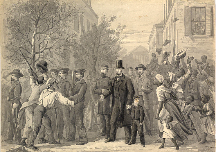
Abraham Lincoln visited Richmond on April 4, 1865
Source: Smithsonian Institution, Lincoln in Richmond
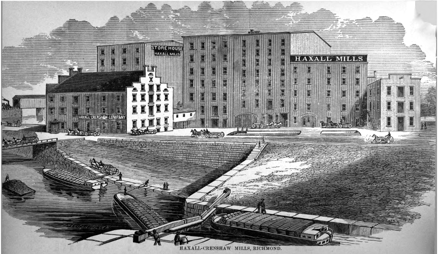
the James River and Kanawha Canal brought wheat to Richmond, where mills at the Fall Line manufactured flour shipped to international markets
Source: "The Chesapeake & Ohio Railway Directory, Containing an Illustrated History and Description of the Road," Haxall-Crenshaw Mills, Richmond (p.110)
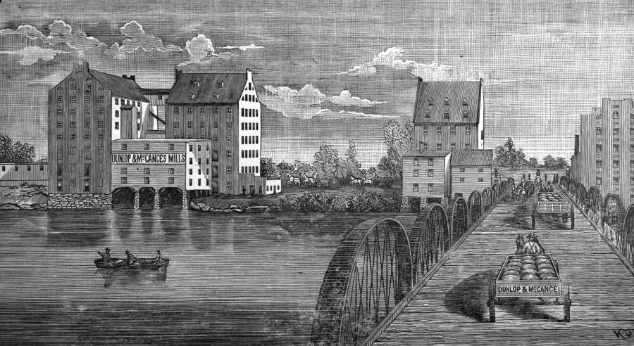
the industrial city of Manchester, south of the James River, was separate from Richmond until it merged with Richmond in 1910
Source: "The Chesapeake & Ohio Railway Directory, Containing an Illustrated History and Description of the Road," Dunlop and McCance Mill, Manchester (p.108)
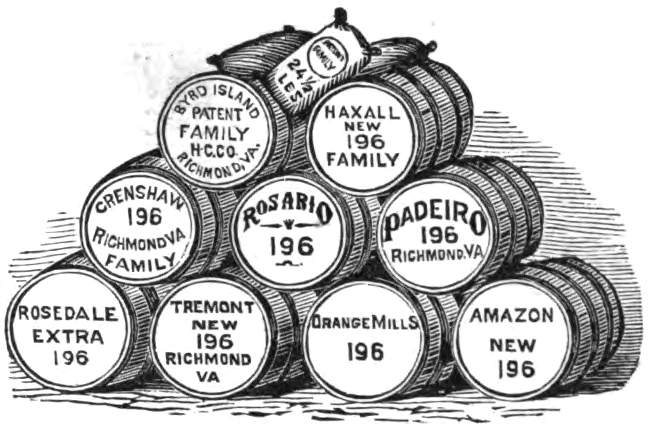
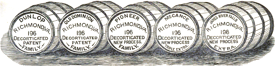
wheat was shipped in barrels
Source: The Chesapeake & Ohio Railway Directory, Containing an Illustrated History and Description of the Road (p.156, p.157)
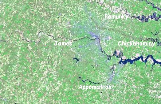
rivers near Richmond
One expressway connecting Richmond with Chesterfield County is called the Powhite Parkway. You can pronounce Powhite as "pow-hite" or "poh-white." The name could be another corruption of the name "Powhatan," or a reference to the blue-collar workers in Southside who lived along the Powhite Creek south of the James River.
In the summer of 2001, an advertising campaign by a bank triggered wide discussion regarding the correct pronunciation of the name. The First Market Bank, controlled by the local Ukrops family, tried to establish its Richmond connections by claiming it knew the correct pronunciation was "Pow-ite Parkway." That's what the Richmond Metropolitan Authority and the Virginia Department of Transportation told them, before the bank erected a large billboard.
Perhaps they were correct, but there was a strong reaction to what appeared to be a politically-correct revision of a traditional place name. The best response was by a columnist in the Richmond Times-Dispatch, who suggested revising the pronunciation of all the grocery stores owned by the family from "U-krops" to "Uk-rops."
The Richmond area has adopted "RVA" as its brand. That started after the Venture Richmond group of community leaders tasked the marketing students at Virginia Commonwealth University's Brandcenter to create some unifying symbol for the region.
Other areas, such as Hampton Roads, have failed in multiple efforts to adopt a tagline, slogan, or even a standard name for the region. The RVA symbol, with overlapping letters, succeeded in part because it did not define any aspect of the city as the dominant identity. Richmond's history is not a unifying characteristic, especially its period as the capital of the Confederate States of America. The RVA logo has been elaborated by many others, showing its unifying capacity as well as its flexibility.5
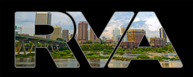

the RVA brand for Richmond was crafted by Virginia Commonwealth University students at Brandcenter
Source: Virginia Commonwealth University, Creating RVA; Amazon, CafePress RVA Sticker Rectangle Bumper Sticker Car Decal
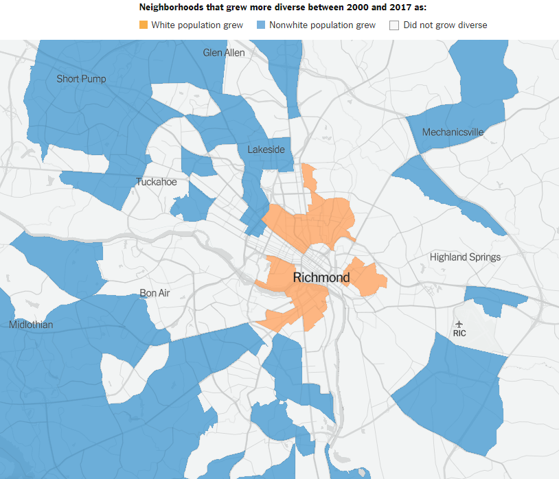
racial diversity in housing is changing, as non-whites move into the county suburbs and whites move into the urban city
Source: New York Times, The Neighborhood Is Mostly Black. The Home Buyers Are Mostly White (April 27, 2019)
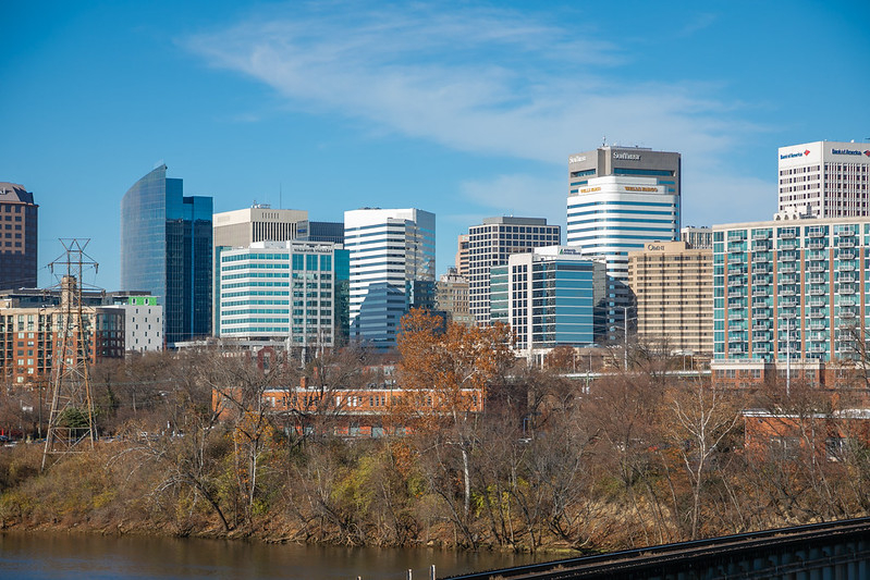
skyline of Richmond, downstream from Ninth Street Bridge
Source: Virginia Department of Transportation, Richmond City skyline
Richmond in 1864
Source: Library of Congress, Map of the neighbourhood of Richmond and Petersburg, Virginia (by A. C. Cooke and Henry James, 1864)

Mayo's Island and downtown Richmond in 1956
Source: Library of Virginia, Work bridge (October 28, 1956)
Mayo's Island (lower right) in 2018
Source: Chesapeake Bay Program, Richmond, VA

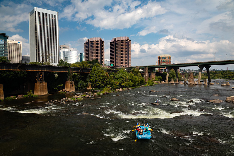
the James River is now a major recreational asset in Richmond
Source: Chesapeake Bay Program, James River in Richmond, VA and James River in Richmond, VA

industrial facilities dominated the waterfront of downtown Richmond and Manchester at the start of the Civil War in 1861
Source: Valentine Museum, Richmond, Va. and Its Vicinity (by J. Wells, 1863)

a new Robert E. Lee Bridge (now called James River Bridge) was completed in 1989
Source: Valentine Museum, New and Old Robert E. Lee Bridges (by Wallace Huey Clark, 1986)
enlisted Union soldiers were imprisoned on Belle Isle during the Civil War
Source: Illustrated London News, The War in America: Camp of Federal Prisoners on Belle Isle, Richmond (April 9, 1864)
Richmond in 1878
Source: David Rumsey Map Collection, OW Gray & Son Atlas - Gray's New Map of Richmond, Virginia (1878)

Richmond tweaked its regional logo, in its effort to recruit Amazon's second headquarters in 2018
Source: City of Richmond, Amazon HQ2 proposal
Federal Reserve and other downtown office buildings, seen from bridge over Haxall Canal
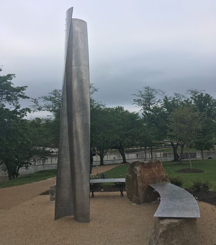
public art on Brown's Island
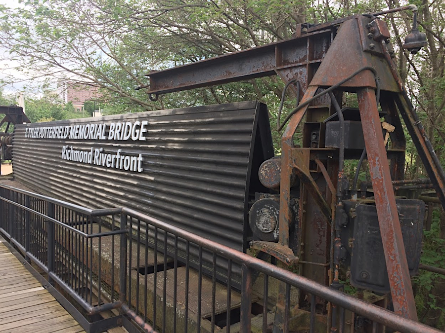
equipment used to open/close gates in the 1901 dam underneath the T. Pot Bridge has been retained
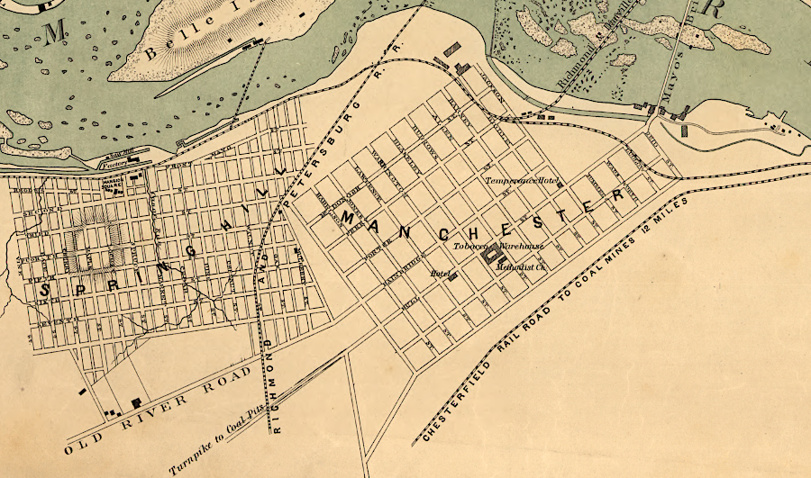
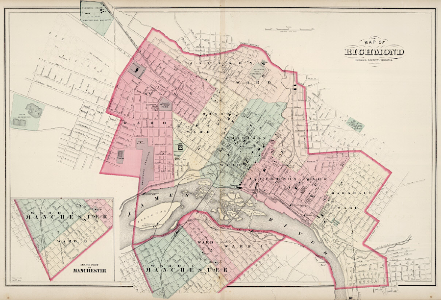
Manchester was an independent city, separate from Richmond, until 1910
Source: Library of Congress, Map of the city of Richmond, Virginia (by US Coast Survey, 1864)
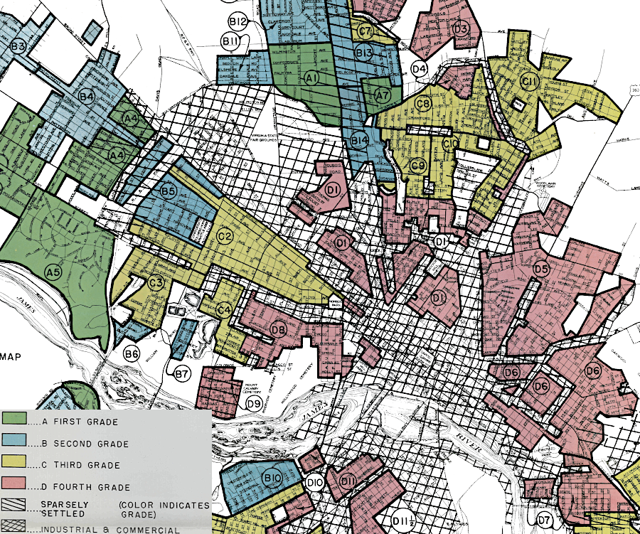
Home Owners Loan Corporation maps of Richmond in 1937 used race as a key criterion for "redlining" neighborhoods with black residents
Source: University of Richmond, Mapping Inequality: Redlining in New Deal America
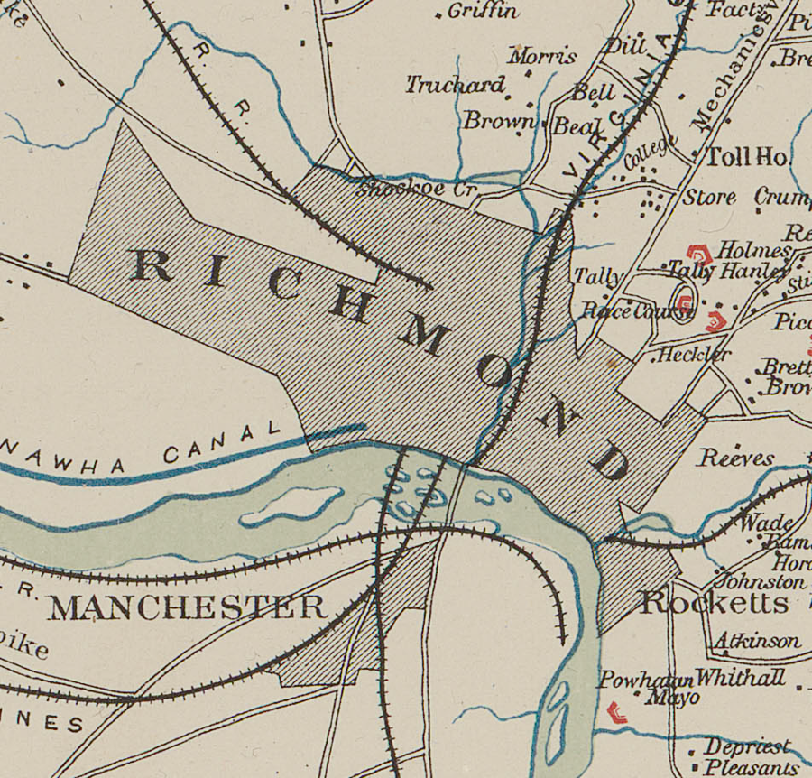
Richmond developed at the Fall Line (modern 14th Street), then expanded onto Church Hill and to the west
Source: Library of Congress, Richmond, Va. and its vicinity (1863)
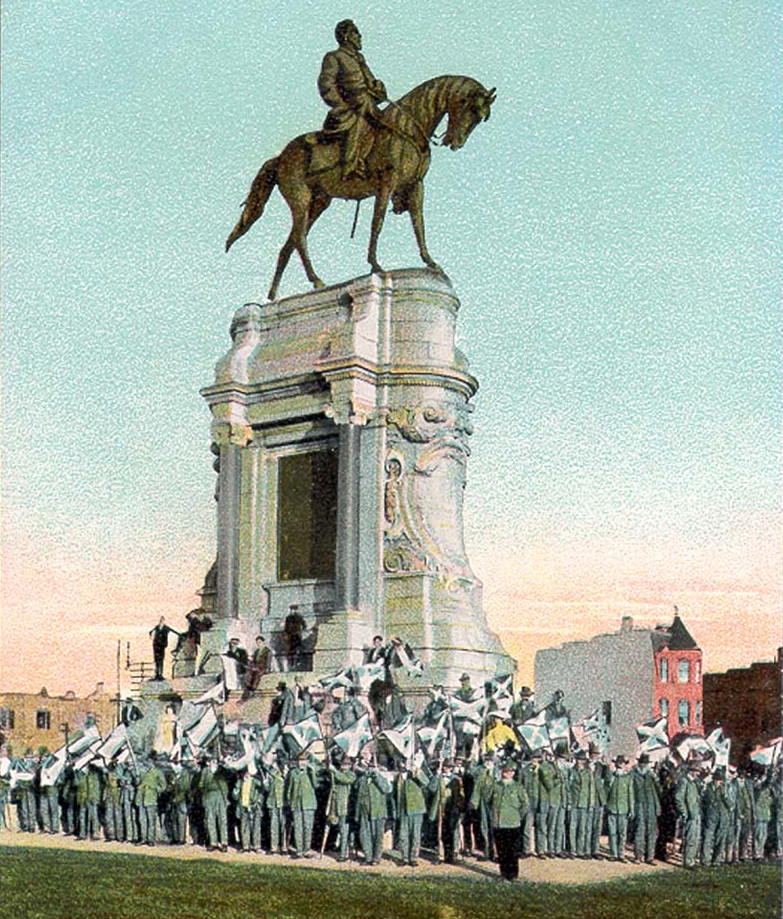
Confederate veterans gathered around the Lee Monument on Monument Avenue during a 1907 reunion
Source: Virginia Commonwealth University (VCU), Lee Monument, Richmond, Va.
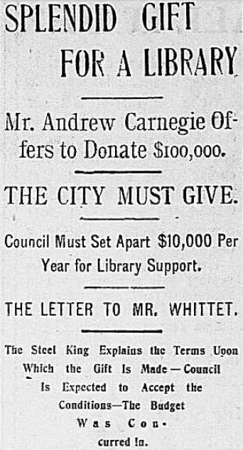
Richmond declined two offers by Andrew Carnegie to build a library in 1901 and 1906, before committing local funds in the early 1920's
Source: Library of Congress - Chronicling America: Historic American Newspapers, Richmond Times (March 2, 1901)
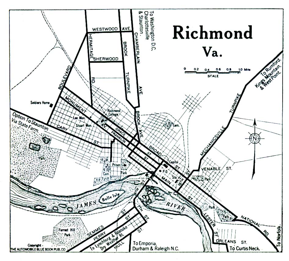
bridges across the James River in Richmond, from Powhite Parkway (in west) to I-95 (in east)
Source: US Geological Survey (USGS), Richmond 1:24,000 scale topographic map (2010)
Capitol Hill and Shockoe Valley in 1876
Source: Library of Congress, City of Richmond, VA - from Manchester - 1876
in 1876, there was still clear evidence of the 1865 Evacuation Fire
Source: Library of Congress, City of Richmond, VA - from Manchester - 1876
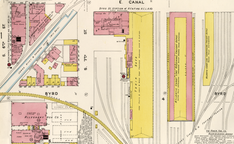
in 1905, the Richmond, Fredericksburg, and Potomac (RF&P) Railroad shared Byrd Street Station with the Atlantic Coast Line
Source: Library of Congress, Sanborn Fire Insurance Map from Richmond, Independent Cities, Virginia (1905)
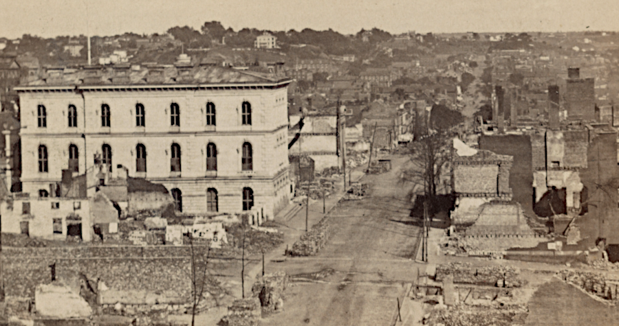
Custom House in burnt district after April 3, 1865
Source: Library of Congress, View of burnt district
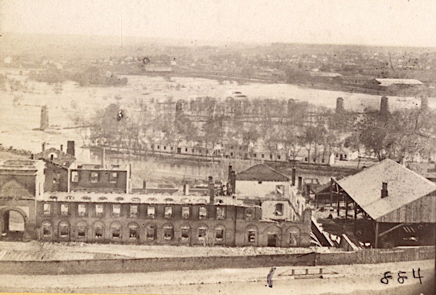
looking past the ruins of the Confederate Arsenal towards Belle Isle, after the Evacuation Fire in April 1865
Source: National Archives, Panoramic View of Richmond in Ruins

Abraham Lincoln visited Richmond on April 4, before General Robert E. Lee surrendered at Appomattox on April 9, 1865
Source: Smithsonian Institution - National Portrait Gallery, Lincoln in Richmond (1866)

the Dooley Library at First and East Franklin streets opened in 1930
Source: Library of Virginia, City, public library (February 7, 1956)