West End Richmond could be defined as "from the Belt Line to Boshers Dam"
Source: US Geological Survey 7.5x7.5 topographic quad maps for Midlothian and Bon Air (Belt Line is further east, on Richmond topo map)
West End Richmond could be defined as "from the Belt Line to Boshers Dam"
Source: US Geological Survey 7.5x7.5 topographic quad maps for Midlothian and Bon Air (Belt Line is further east, on Richmond topo map)
Within the Richmond area, various communities share common social, economic, and political interests. East End Richmond could be defined as the area from Shockoe Slip to Highland Springs. It is a significantly different place than West End Richmond, which could be defined as the area from the Belt Line to Bosher's Dam. Both communities can be contrasted to the portion of the city south of the James River; in that portion, Manchester is as different from Forest Hills/River Road as East End Richmond is distinguished from the West End.
This community profile examines various facets of the West End, starting with the physical geography.
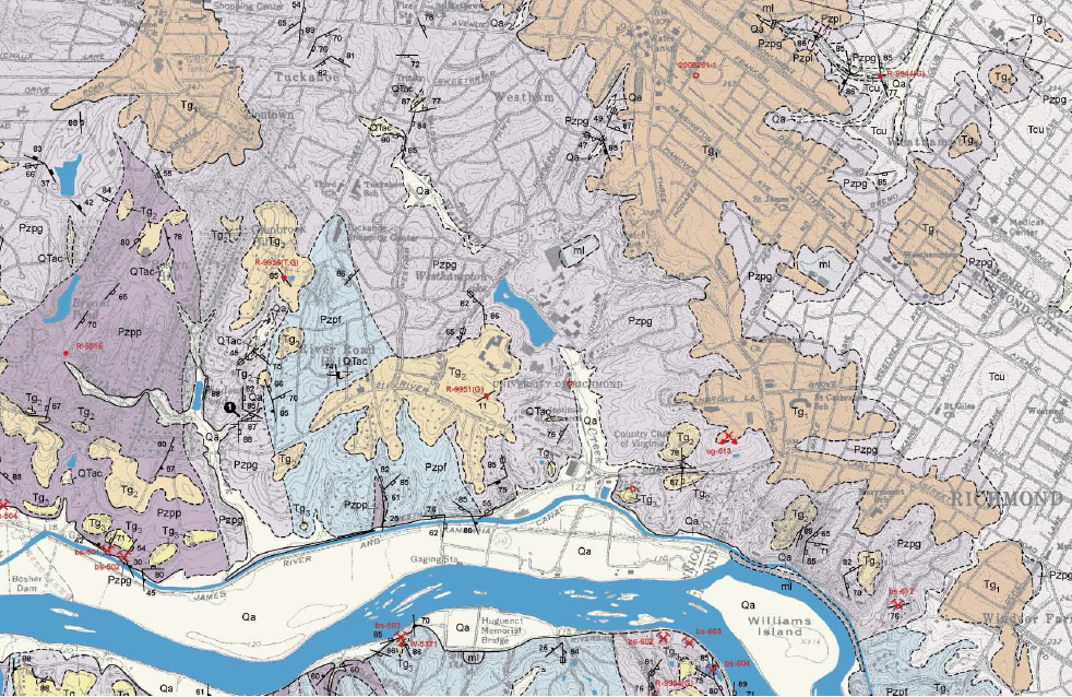
bedrock geology of West End Richmond
(symbols such as TG1 and TG2 identify Tertiary gravels, while Pzpf and Pzpg identify Petersburg granite and Qa represents Quaternary alluvium - recent sediments deposited by floods)
Source: Geologic map of the Bon Air quadrangle, Open File Report 07-03 (2002)
Richmond is located on the Fall Line, and the West End is at the upstream edge of boundary between the Coastal Plain units and Piedmont rocks.
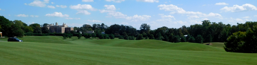
The gently sloping hills, with up to 100' of topographic relief, are clearly revealed where the forest cover has been cleared for the Westhampton Golf Course of the Country Club of Virginia and the Roslyn Conference and Retreat Center.
at the intersection of Three Chopt Road, Cary Street Road. and River Road, the Tuckahoe Condominiums tower over the rolling hills of the Country Club of Virginia
Recent Quaternary sediments, deposited in floods such as occurred after Huricane Camille in 1969, coat the edge of the river downstream from Bosher's Dam to Williams Dam. Cobbles of chert, grains of quartz, and particles of mud in those sediments were originally part of the Piedmont bedrock.
Pieces of gravel includes 600-million year old lava flows, billion-year-old granite, and mica flakes. They were eroded from the Blue Ridge slowly by rain and rarely by fast landslides in heavy storms, such as Hurricane Camille. The eroded bedrock has been carried downstream by the Rivanna River and other tributaries of the James River.
Little limestone or dolomite from the Valley and Ridge has survived the journey. The Maury River, Calfpasture River, and other tributaries are eroding the ancient Cambrian and Ordovician deposits, which were originally laid down when the crustal plate of Laurentia was south of the equator 500 million years ago. The calcium carbonate in those deposits has dissolved, with the minerals going into solution before getting to Richmond.
Some particles in those sediments at West End Richmond are remnants of harder bedrock in the Valley and Ridge. The mountains uplifted in the Taconic orogeny, then eroded to form the Queenston Delta, included metamorphic rocks such as quartzite. Those rocks, with a different chemical and physical composition, have washed down from as far west as the Allegheny Front. Craig Creek in Giles County and the Jackson River in Highland County, upper tributaries of the James River, are eroding the eastern edge of the Appalachian Plateau and transporting it piece by piece to the Chesapeake Bay, with temporary stops on the floodplains of the rivers.
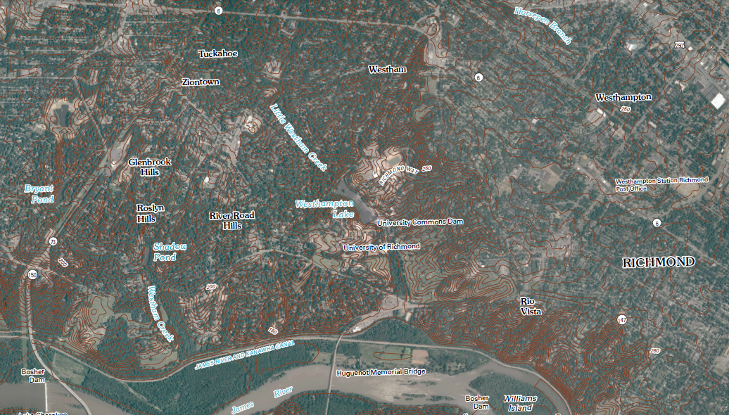
streams flowing into the James River have etched out a hilly topography in West End Richmond
Source: ArcGIS Online
In the uplands of West End Richmond, late Tertiary (Pliocene) to Quaternary (early Pleistocene) gravels cover the bedrock. The alluvium is a rich brown dirt supporting a riparian forest along the James River shoreline, while the upland gravels and granite form thin soils that require extensive fertilizer and amendments to support the vegetable gardens of suburban homes.1
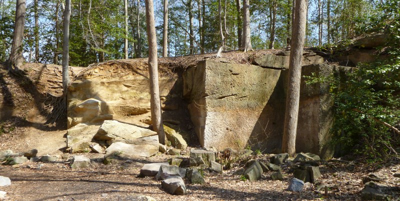
historic granite quarry on Belle Isle, downstream of West End Richmond
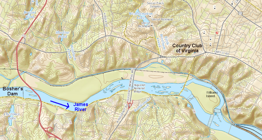
Williams Dam below Huguenot Bridge has created a slackwater pool in the James River. It covers the most-upstream set of rapids, where the Petersburg Granite is exposed in the riverbed.
The Petersburg Granite underneath the West End is 330 million years old. The silica-rich magma solidified in the Carboniferous Period, when Africa and North America collided. As the Alleghenian orogeny pushed rocks up over 20,000 feet high, it simultaneously pushed continental bedrock down as much as 10 miles - and shoved the old roots of the Taconic and Acadian orogenies west.2
In those two orogenies, island arcs were pushed up against the North American continent and Virginia's eastern edge was extended. Prior to the collision with Africa, Richmond was located on the west of the crust added by those two accretions, and the Iapetus (or Rheic) Ocean coastline was east of the modern-day Continental Shelf.
The tectonic bump with Africa shoved that crust westward; today, it is the bedrock of the Piedmont physiographic province between Richmond and the Blue Ridge mountains. Due to the thrusting of the bedrock by Africa, the location of West End Richmond went from being on the west side of the Taconic/Acadian formations to being on the east side today, and the Fall Line starts just to the east of Huguenot Bridge.3
 collision with Africa thrust rock formations so far, the location of West End Richmond ended up on eastern (rather than western) edge of Taconic/Acadian accretions Map source: US Geological Survey, A Tapestry of Time and Terrain |
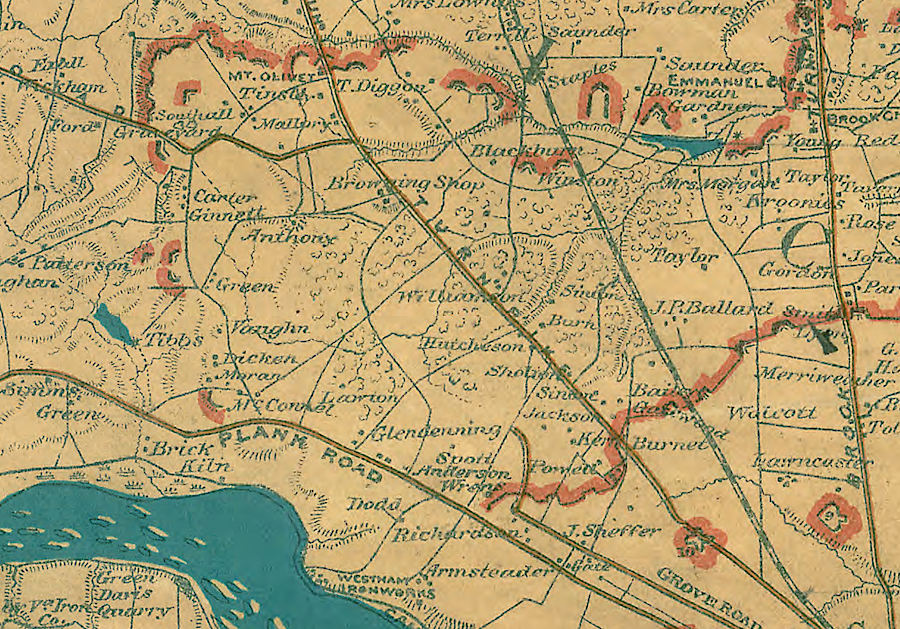
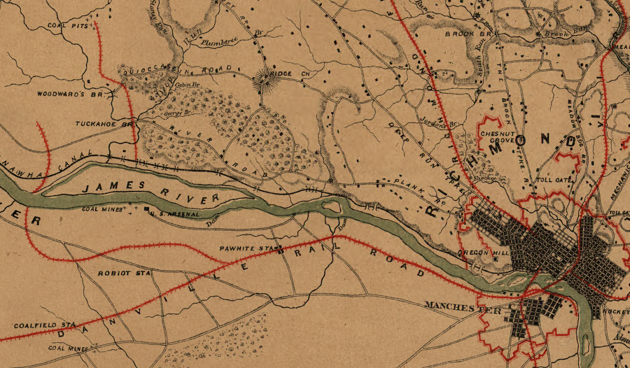
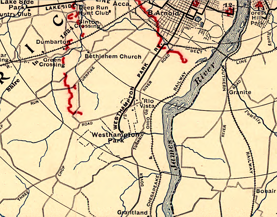
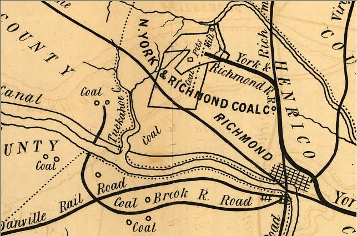 coal mines and railroads near West End Richmond Source: Library of Congress, Map of the Springfield & Deep Run estates on the Coal Lands of the N. York & Richmond Coal Co, in Henrico Co. Virginia |
When Pangea split up, the crust thinned and cracked in multiple places. The pattern of cracks in the Petersburg Granite in the West End reflect both the compression of the collision with Africa, and the extension of the crust when the supercontinent broke up and the Atlantic Ocean formed.4
Sediments washed into the low-lying basins formed as Virginia split off from Morocco, and plants were compressed into coal before they could decompose. The Richmond Triassic Basin is located about 10 miles west of the West End. Coal mining was concentrated west of Tuckahoe Creek and south of the James River in Midlothian.
The edge of the new Atlantic Ocean shoreline may have been near the location of modern-day Richmond. Later erosion exhumed the Petersburg granite, and rivers carried sediments from the Appalachians further eastward to create the Coastal Plain.
Until the Miocene epoch, West End Richmond may have remained above sea level, since no Tertiary gravels older than that period remain. When sea levels were higher 35 million years ago, West End Richmond could have been on the shoreline of the Atlantic Ocean. Miocene sediments are found today just a few miles north of the area, and of course the Coastal Plain extends all the way eastward to the current ocean shoreline.5
After 200 million years (or more...) of erosion, the Petersburg Granite neared the surface roughly 25 million years ago. The granite was then buried again under the Coastal Plain by Tertiary and Quaternary sediments, until recent erosion has once again exposed the ancient roots of the mountains formed originally during the Alleghenian orogeny.6
The Fall Line is a geologic boundary between the hard rock underlying the Piedmont and the still-remaining soft sediments of the Coastal Plain. Erosion will continue to remove those sediments from the West End, exposing more of the granite bedrock and gradually (very gradually...) moving the geologic boundary downstream.
However, erosion by the James River will cut down into bedrock, so the falls of the James will migrate upstream until they reach the Richmond Triassic basin, in the same way that the Potomac River has cut into the bedrock to form Great Falls over 10 miles upstream from the geologic boundary at Theodore Roosevelt Island.
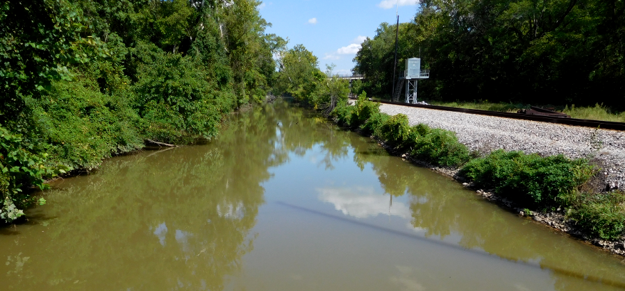
The James River and Kanawha Canal was dug in the soft Quaternary alluvium, but granite was quarried in Richmond for the locks and other structures. Granite quarries located on the south bank of the James River near Huguenot Bridge have been converted into swimming clubs today. Quarried granite was also used for curbing on streets in the older part of downtown Richmond After World War II, when suburbs were built in the West End, the primary building materials were wood and brick - not the local stone. Even the University of Richmond, built before World War I, used brick and pre-cast concrete ("cast stone") for facing the buildings, rather than local granite.7
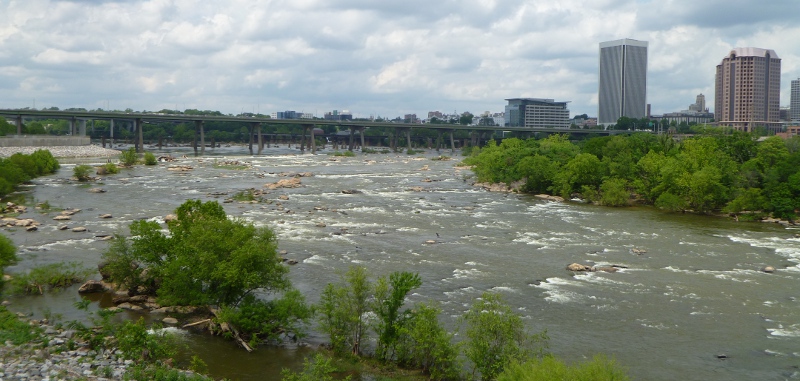
Fall Line in downtown Richmond
Tributaries of the James River and the Chickahominy River have carved out the hills of West End Richmond. The watershed divide between the rivers is marked by Cary Street Road and Three Chopt Road. Carytown is split by Cary Street Road, and stormwater pipes may divert runoff across the watershed divide in that commercial area. Similarly, Short Pump west of Richmond is on the divide.
The Country Club of Virginia, the University of Richmond and much of the land to the west is in the James River watershed. The West End that is located north and east of Cary Street Road and Three Chopt Road is in the Chickahominy river watershed. The headquarters of Altria, at the intersection of Broad Street (Route 250) and I-64, drains into Upham Brook and its tributary, Horsepen Branch.
St. Christopher's School is at the top of the Jordan's Branch watershed, which also includes the Willow Lawn Shopping Center. Jordan's Branch is also a tributary of Upham Brook, and flows under the northern edge of the Acca railroad yard before reaching its confluence with Upham Brook north of Bryan Park. Upham Brook flows east under I-95, before reaching the Chickahominy River. Since the Chickahominy is a tributary of the James, all of west End Richmond is in the James River watershed.
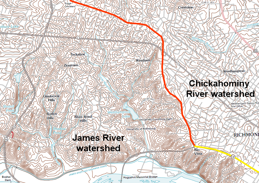
watershed divide of Chickahominy/James watersheds, with yellow marking Cary Street Road and orange marking Three Chopt Road
Source: US Geological Survey (USGS), Bon Air 7.5x7.5 topographic quad
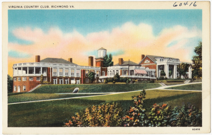
The Country Club of Virginia is located in the west end of Richmond
Source: Boston Public Library, Tichnor Brothers Postcard Collection, Virginia Country Club, Richmond, VA
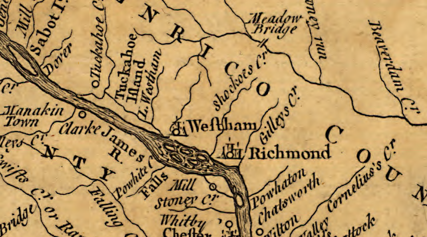
In 1752, a new town was chartered and 150 lots surveyed on farmland owned by the Randolph family. Westham was at the end of the navigable section of the James River above the Falls, so it had the potential to grow from a tobacco inspection station into an urban center.
However, development stayed concentrated near the downstream end of the falls of the James. The thinly-populated Piedmont upstream of the Fall Line offered less opportunity for trading than the downstream edge of the Fall Line, which was accessible to ocean-going ships. The potential for waterpower was downstream, and manufacturing operations (especially flour mills and the Tredegar Iron Works) developed there. The Westham Iron Foundry started by John Ballendine faded after the Revolutionary War, and by 1800 Westham was just a place name.8
Westham was established in 1752, with 150 lots in town
Source: Library of Congress, A map of the most inhabited part of Virginia containing the whole province of Maryland with part of Pensilvania, New Jersey and North Carolina. Drawn by Joshua Fry & Peter Jefferson in 1751
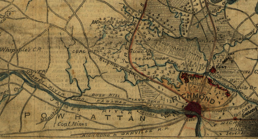
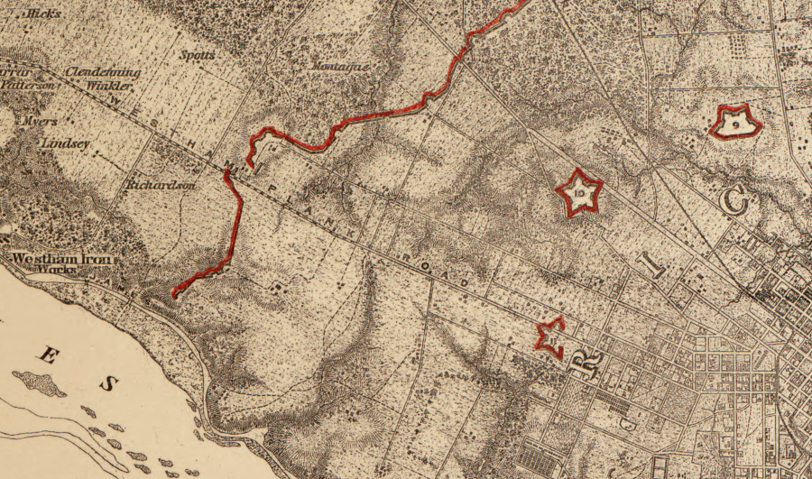
during the Civil War, today's West End of Richmond was farmland/timberland
Source: Library of Congress, Richmond & vicinity (186_)
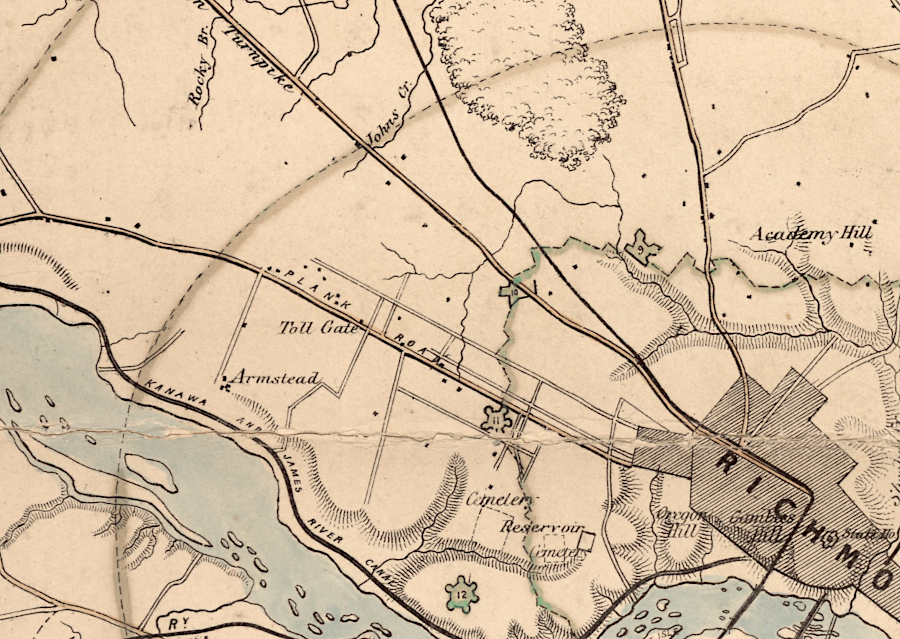
Confederates built separate lines of defense during the Civil War
Source: Library of Congress, Map of the vicinity of Richmond and part of the Peninsula (by T. Sewell Ball and Albert H. Campbell, 1864)
In 1804, the General Assembly chartered the Richmond and Columbia Turnpike Co. and the Westham Plank Road was built as a toll road to connect Richmond with the Goochland County Courthouse.9
the Westham Station structure was moved from this location, upstream of the Huguenot Bridge
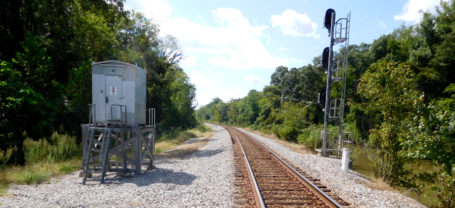
the railroad through today's West End of Richmond was not built until the Richmond and Allegheny Railroad replaced the canal; earlier coal shipments from pits to the west relied upon a water link to get to market
Source: Library of Congress, Military topographical map of eastern Virginia
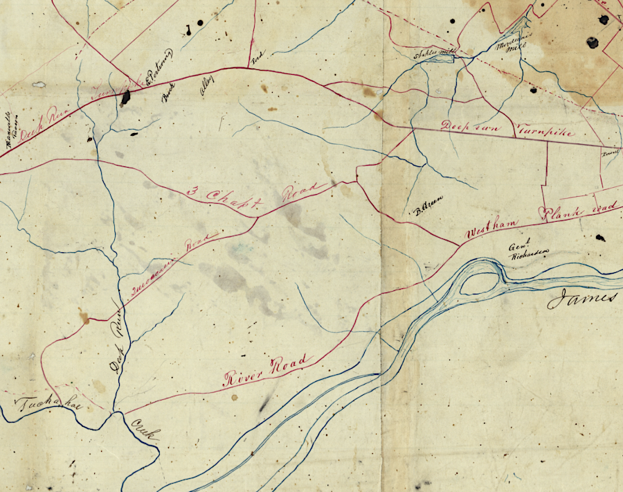
the plank road linking Richmond to the Piedmont is today's River Road, Deep Run Turnpike is now US 250, and the road connecting Bush Hill and the coal pits is Three Chopt Road
Source: Library of Congress, Map showing from Richmond to Fredericksburg, Va (Robert Knox Sneden, 1864-65)
the James River and Kanawha Canal was constructed upstream, past Westham near Richmond to Buchanan
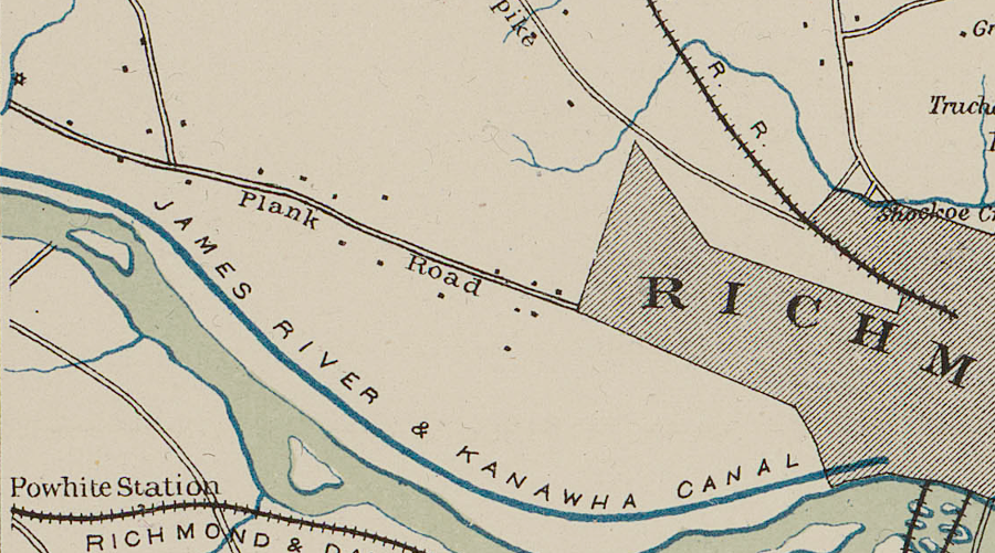
prior to the Civil War, a plank road was built to Westham
Source: US War Department, Atlas to accompany the official records of the Union and Confederate armies, Southeastern Virginia and Fort Monroe Showing the Approaches to Richmond and Petersburg (1862)
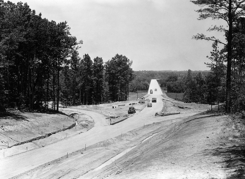
Huguenot Bridge under construction in 1950
Source: Virginia Department of Transportation, The Huguenot Bridge, 50-414
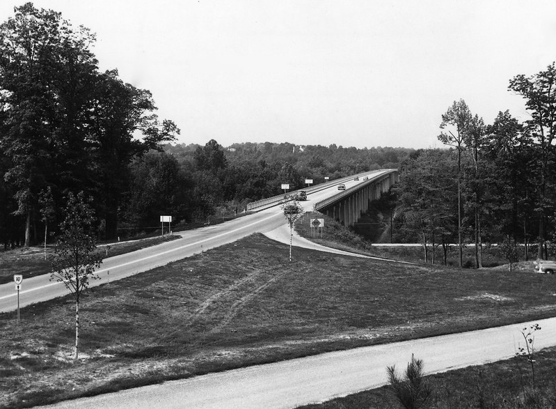
Huguenot Bridge across the James River in 1953
Source: Virginia Department of Transportation, The Huguenot Bridge, 53-1409
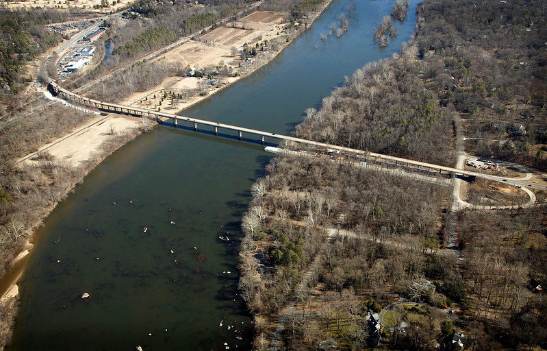
Huguenot Bridge in 2011
Source: Virginia Department of Transportation, Huguenot Memorial Bridge
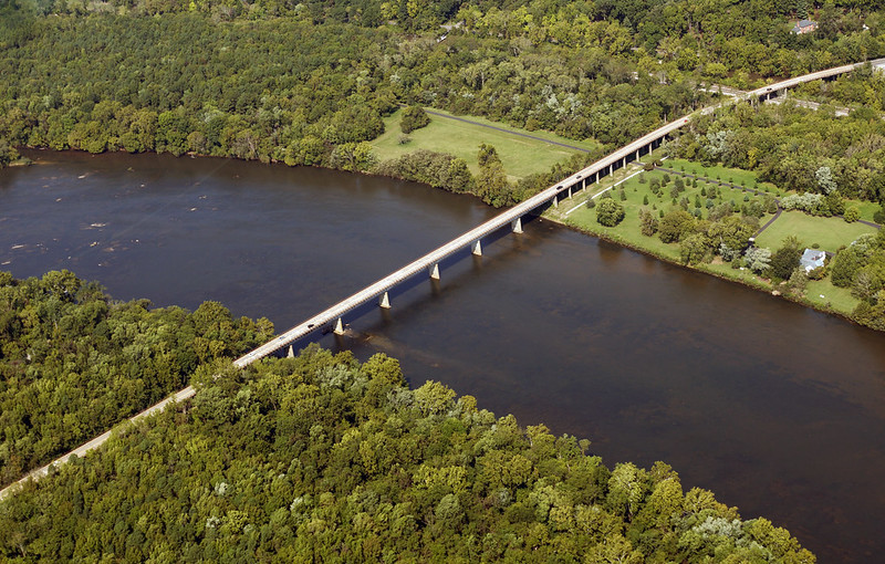
Huguenot Bridge today
Source: Virginia Department of Transportation, Huguenot Memorial Bridge
a streetcar line to what is now the University of Richmond made living in the West End more attractive for commuters
Source: Library of Congress, Map of Richmond-Petersburg and adjacent territory showing lines of communication and points of historical interest (by Virginia Passenger and Power Company, 1907)
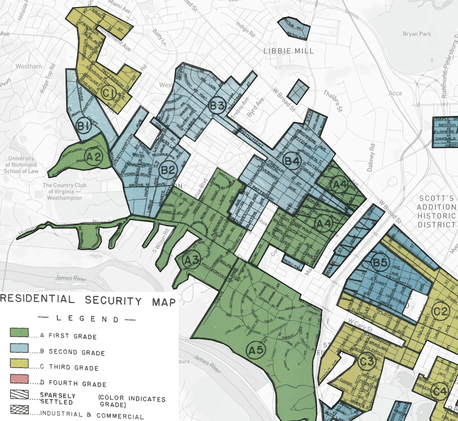
in the 1930's, no West End neighborhoods were redlined by the Home Owners' Loan Corporation and mortgage financing was readily available
Source: University of Richmond, Mapping Inequality- Redlining in New Deal America
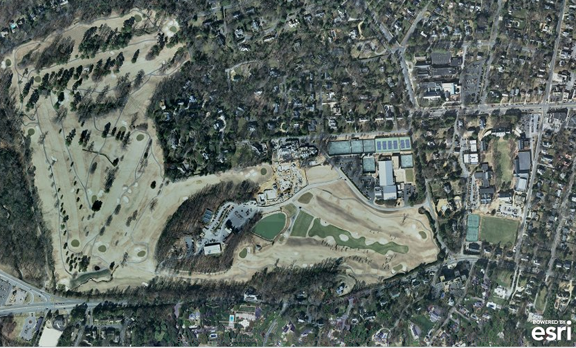
Westhampton Golf Course, Country Club of Virginia
Source: ESRI ArcGIS
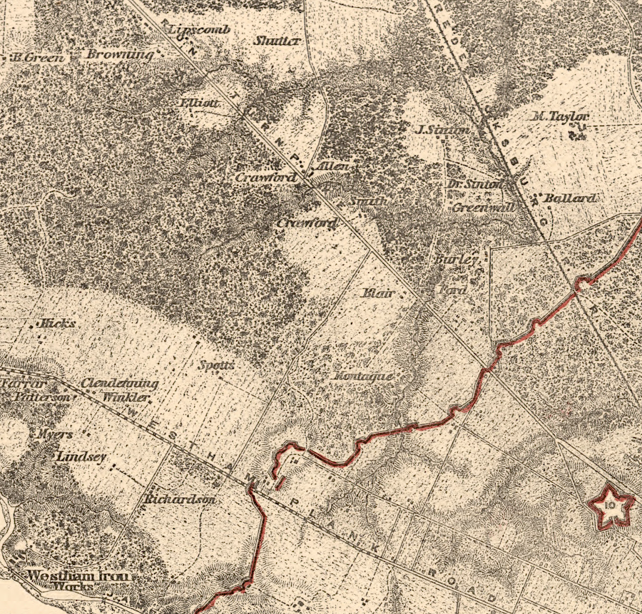
during the Civil War, the ridge at the modern intersection of Three Chopt Road and River Road (Westham Plank Road) was fortified as part of the outer defenses for the Confederate capital
Source: Library of Congress, Military maps of the United States. - Richmond, Va., 1867
west of Richmond's city limits in 1864
Source: Library of Congress, Map of the neighbourhood of Richmond and Petersburg, Virginia (by A. C. Cooke and Henry James, 1864)
west of Richmond's city limits in 1867
Source: Library of Congress, Richmond (by Nathaniel Michler and Peter Smith Michie, 1867)