Encouraging Settlement and Land Grants West of the Blue Ridge
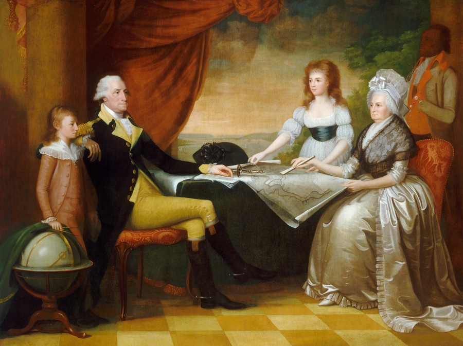
George Washington was a powerful and effective advocate for ensuring western settlers stayed part of the United States, despite the barrier of the Appalachian Mountains
Source: National Gallery of Art, The Washington Family 1789-1796 (painted by Edward Savage)
The first people to live in the Shenandoah Valley migrated there from Alaska via the Pacific Coast. The long occupation of the region began as much as 20,000 years ago as Paleo-Indians moved south of the ice sheet from Beringea and then crossed North America from the Pacific Coast. Multiple cultures developed over time. Modern archeologists attempt to distinguish changing cultural patterns over time by examining the stone tools that still remain, but there is very limited data on which to identify the different political/spiritual beliefs and customs that emerged over those many centuries.
A band of 150-300 people may have been the primary residents living in the Potomac River watershed upstream of modern Harpers Ferry about 10,000 years ago. Population then expanded as the climate warmed. Hunting/gathering expeditions began to camp in a wider variety of locations, and more specialized tools evolved as the Eastern Deciduous Forest developed and more natural resources could be exploited.
Around 5,000 BCE (Before Common Era), during the Archaic Period before the development of agriculture and the bow and arrow, the shape of stone spearpoints found in the upper Potomac River Valley suggest residents were more closely associated with a culture that stretched from southern West Virginia to central New York rather than the people living east of the Blue Ridge.
Between 2200-1350 BCE, the Terminal Archaic Period, immigrants moved into the region from the south. They manufactured a distinctive type of stone point, the Broadhead style, and made cooking pots from soapstone.
The soapstone vessels were too heavy to carry except by canoe, and the settlement pattern was different from the previous occupants. The people who arrived in the Terminal Archaic established base camps along rivers and spent less time in foraging camps on the ridges. Eels and other anadromous fish were smoked over fires, enabling longer-term storage of food.
During the Woodland period, people made pottery and hunted animals with bows and arrows. Between 800 BCE-100 CE (Common Era), there were few people living full-time in the Shenandoah Valley. That may have been a period when hunting bands from east of the Blue Ridge dominated the area, limiting year-round settlement.
About 1,000 years ago, the mound builder culture that thrived in the Ohio River Valley reached the Potomac River watershed. Groups of people could have migrated eastward across the watershed divide and settled along the Potomac River and its tributaries, including the valley of the Shenandoah River. Hunting parties had already explored all of the valleys and ridges. As agriculture was adopted at the start of the Woodland Period, the value of the soil on Potomac/Shenandoah River bottomlands may have induced people to move.
Another option is that traders exchanged ideas as well as objects, and the mound builder culture was adopted willingly by the pre-existing residents in the Potomac River watershed. Trade between the Ohio River and the Potomac River is documented by the presence near modern Cumberland, Maryland of Flint Ridge chert from Ohio. Shards of pottery dated to 200 BCE (Before Common Era) and resembling a style of the Ohio River Valley have been found along the Potomac River.
The small size (no more than 10 feet) of stone mounds found in the Shenandoah Valley, dating to the mound building period, suggests only a partial transfer of culture. According to one study by the National Park Service:1
These mounds seem so different from those of the Adena or Hopewell heartland that there is probably not a close relationship, but the idea of mound-building may certainly have spread from the Ohio Valley eastward.
Between 900-1200CE, people living in the Shenandoah Valley made two types of pottery. One was tempered with crushed limestone, and one was tempered with bits of dark chert and shale. The pottery with crushed limestone resembles pottery from the Ohio River Valley, and it is possible that two new groups moved into the area at roughly the same time and co-existed or merged.
The predominance of Keyser ware, a pottery made with crushed shell, shows a new culture developed in the valley around 1300CE. Apparently yet another group of immigrants from the west moved in, establishing what archeologists call the Luray culture. North of the Potomac River watershed, archeologists find a very similar pottery tempered with crushed shell. The Monongahela people may have moved into western Pennsylvania at the same time the Luray people established themselves to the south. The Luray culture towns were surrounded by palisades, so there was competition between people who shared the same culture or between different cultural groups.
Sometime in the 1500's, people left the Shenandoah Valley. Archeologists have found European trade goods at only one site of that culture, so the disappearance seems to be based on Native American rivalries rather than the influence of colonists. Iroquoian-speaking Senecas or Susquehannocks could have attacked the towns and displaced the people of the Luray culture. The Monongahela people lasted in western Pennsylvania until 1635, and are likely the Massawomecks that John Smith identified on his 1624 map.
Conflict between Native American groups depopulated the Piedmont and Shenandoah Valley before the French and English arrived. In the 1600's and 1700's Haudenosaunee (particularly the Seneca), Cherokee, and Catawba raiding parties moved north and south on trails both east and west of the Blue Ridge. Young men in raiding parties traveling in both directions after the last corn harvest, seeking honor and revenge, disrupted settled communities. That eventually forced the Luray culture farmers to move to a safer area, depopulating the valley.
In the 1720's and 1730's the English moved inland from the Chesapeake Bay into the Piedmont, while a significant number of Scotch-Irish immigrants and immigrants from what is modern-day Germany began moving south into the Shenandoah Valley from Pennsylvania. The Europeans settling near the Blue Ridge encountered traveling bands of hunters and warriors from different tribes, but there were almost no remaining towns to displace:2
Although a thriving Native American presence had existed in the Shenandoah Valley for at least 15,000 years and villages had been observed by 17th century Valley explorers, by the time migrants from Pennsylvania moved into and settled the Shenandoah Valley, there were no longer any permanent indigenous peoples here. The complicated reasons for the departure of the Indians included pressures from the western French fur trade as well as the movement of Virginia's English settlers as far west as the eastern foothills of the Blue Ridge Mountains.
Suffice to say, however, that at the time of permanent European migration into the Valley in the 1720s, the Valley of Virginia was devoid of permanent Native settlements but remained a thoroughfare and passageway for Native travelers and hunters. That circumstance allowed for a remarkably rapid and peaceful settlement into the Valley,
a peace that was shattered a few years later in the French and Indian War (1754-1763).
In 1700, Huguenot refugees were directed to create a new settlement just west of the Fall Line on the James River. Manakin Town, built on the site of the former Monacan town of Mowhemcho, was expected to provide a defense against Native Americans on the Piedmont. In addition to remnants of the original settlers, parties of Haudenosaunee (Iroquois) from New York and Catawba from North Carolina crossed the Piedmont annually.
The General Assembly also sought to incentivize settlement of the land west of the Blue Ridge. In an idealistic 1701 action, the General Assembly agreed to grant up to 30,000 acres to groups who agreed to settle at least 20 "fighting men" together. Each person would receive 200 acres, plus a half-acre for a home. Additional land would be allocated for construction of forts.
The settlers would not have to pay any fees for the land surveys, and for 20 years would be exempt from paying land taxes (quitrents) or serving in the county militia. To ensure enough people clustered together to create the capacity to defend what would become the western edge of settlement, the land would be held in common. The General Assembly required that "one christian man between sixteen and sixty years of age" for at least every 500 acres must remain on the land.
The legislators envisioned that a minimum of 10,000 acres would be settled. The initiative failed to attract anyone willing to commit to finding 50 settlers, so 30 years later the colonial government adopted a slightly different strategy to settle the Shenandoah Valley. Large tracts were granted for free to people who were able, through private effort, to recruit settlers. Transfer of the land from the colony to the grantee required actual settlement, so the grants had no value unless the recipients were able to find people willing to move west of the Blue Ridge and pay for land there.3
In the 1722 Treaty of Albany, Governor Spotswood succeeded in opening up lands for colonial settlement in the Piedmont on the east side of the Blue Ridge. The five Haudenosaunee tribes (which then expanded to include the Tuscarora) in New York agreed to keep their travelers always west of the Blue Ridge, especially warriors headed south to attack Siouan-speaking tribes.
As part of the deal between the nations of the Iroquois Confederacy and the New York, Pennsylvania, and Virginia colonies, Spotswood agreed in return that the colony offered no protection for any members of the 10 "nations" in Virginia who might cross to the north side of the Potomac (Kahongoronton) River or the western side of the Blue Ridge. Spotswood said:4
If any Indians of the aforenamed Nations belonging to Virginia or those whom you declare to be dependent on your five Nations shall hereafter transgress the said Boundaries without having the proper Passeports already mentioned every such Indian is by that Law liable to be put to death or transported & sold for a slave & as the Government of Virginia will not demand satisfaction for whatever you shall do to any of their Indians whom you shall take on the North Side of Potowmack River & on the West Side of the high Ridge of Mountains so your people must not look upon it as any Breach of the Peace & Friendship which Virginia desires to preserve with the five Nations, if that Government shall hang or transport any of your Indians who shall hereafter be taken without a proper Passport on the South Side of the said River & on the east Side of the said Ridge
You are come six hundred miles to treat with us & we are glad to see you You have made your Propositions to us wherein you call us Sachims & Warriors of the five Nations, & acquainted us since we had agreed not to pass the River Kahongoronton, nor the great Ridge of Mountains, that there is a Law in Virginia prohibiting us to pass that River or those Mountains under the Penalty of being transported or sold for Slaves, or put to death We do assure you we are very well satisfied with that Law & desire that those Boundaries may be for ever observed, You have also told us that you will engage for ten Nations of Indians in Virginia, that they shall not Pass to the North side of the River Kahongoronton nor to the Westward of the Great Ridge of Mountains & that if we should meet with any of them without those Boundaries, we might use them as we thought fit, without Breaking this Peace notwithstanding which we assure you if any of your Indians shall happen in our way we will not hurt them, but treat them as friends & give them victuals, so desirous we are of being at Peace with them
Spotsylvania, Hanover, and King George counties were formed in 1721, Caroline and Goochland counties in 1728, and Prince William County in 1731. In 1734 the General Assembly created Orange County with boundaries extending westward to "the utmost limits of Virginia." According to the Second Charter of 1609, Orange County extended to the Pacific Ocean and contained all the land north of latitude 36° 30' and west of the boundaries of the other colonies.6
Spotswood and later Governor Gooch were not satisfied with populating just the Piedmont east of the Blue Ridge with Protestant colonists loyal to King James I and King Charles I. They also sought to block the Catholic French from encroaching on lands claimed by Virginia west of the mountains.
In the 1600's, Governor Berkeley had used a two-pronged defense strategy to protect existing settlements against hostile Native Americans and potential French supporters. He built forts staffed by local militia, with rangers to patrol the backcountry and raise the alarm if a group of Iroquois or Susquehannocks arrived. Berkeley also relied upon tributary tribes, those dependent upon the Virginia government after the Third Anglo-Powhatan War, to block occupation of the backcountry by "strange" Native Americans.
Berkeley's strategy avoided open warfare and the associated cost of paying the militia to attack Native Americans who hunted/raided through the Piedmont intermittently rather than lived in easy-to-find, easy-to-destroy towns there. That strategy also preserved the governor's personal arrangements with fur traders, both European and Native American, who increased his wealth.
Berkeley's approach provided no mechanism to resolve settler-Native American conflicts peacefully, or to control retaliation by settlers who felt aggrieved by the loss of pigs or cattle to hunting parties. His reliance of forts and rangers was not sufficient to prevent Native Americans from raiding isolated farms in Northern Virginia.
A dispute in Stafford County erupted into reciprocal murder between settlers and Dogues. The militia then crossed the Potomac River into Maryland and attacked the Susquehannocks. That triggered a wider war. The failure of Berkeley's strategy to ensure peace on the frontier led in part to Bacon's Rebellion in 1676.
The Tuscarora War spurred Governor Spotswood to adopt a two-part strategy to defend the existing settlements in the Piedmont and to shape the settlement of lands west of the Blue Ridge. The colony's lack of military capacity was clearly demonstrated during the war. The rangers recruited to patrol and defend areas were ineffective, as were the untrained militia organized occasionally into military units.
Governor Alexander Spotswood decided to establish personal control over the trade with Native Americans by granting a monopoly to the Virginia Indian Company. He also tried to relocate the towns of the Nottoways, Meherrins, Saponies, and remaining Tuscaroras, establishing tributary tribes on the Piedmont who would provide a line of defense ("Standing Guard") against raiding expeditions of the Catawba and Iroquois.
His attempt to counter one set of Native Americans with loyal-to-and-dependent-on-the-colony tribes failed. The House of Burgesses was unwilling to provide funding, the Native Americans declined to act as sacrificial buffers, and the Virginia colonists objected strongly to a monopoly on the fur trade which excluded them from the profits.
The governor's decision to locate a group of German immigrants near the eastern edge of the Blue Ridge became the model for the successful strategy. The Germanna community did result in white Protestants creating a defensive base west of existing settlement. Recruiting new settlers, even though they were not English or Anglican, extended the defensive perimeter.
The second part of Spotswood's strategy was more successful, at least in protecting the English living on the Piedmont. He pushed the General Assembly into adopting a frontier security strategy based upon the creation of new colonial settlements west of the Blue Ridge. Rather than rely upon militia or tributary tribes to control the backcountry, Virginia would extend settlement westward with new immigrants.
Franz Ludwig Michel sought a land grant in the Shenandoah Valley in 1709, before shifting his attention to North Carolina. Jacob Stover, another Swiss entrepreneur, proposed creating a 13th colony in the Shenandoah Valley in 1729. He proposed to name it after King George, an action taken by James Oglethorpe and others when obtaining a royal charter for Georgia in 1732.
Stover planned to recruit German and Swiss immigrants to populate the area west of the Blue Ridge. in London, the Board of Trade rejected his proposal because Lord Fairfax and others already were laying claim to the area. Stover emphasized the military benefits of his proposal:7
If it is neglected to extend the bounds of Great Britain beyond these mountains to the West... it is probable that the ffrench in a short time may take possession thereof and if so the English Nation will Loose this fine opportunity.
The Board of Trade, which oversaw the colonies from London, supported an imperial strategy of expanding settlement in all the colonies (especially in Nova Scotia and South Carolina) so more land would be "fully peopled with white inhabitants."
That was a popular policy. Instead of constraining land grants to Tidewater gentry to less than 4,000 acres, Spotwood was willing to issue large blocks of western territory to men able to recruit settlers. Those men gained the opportunity to convert colony-owned land into personal wealth. The new settlers would become the line of defense, the Standing Guard. Spotsylvania County was created to manage the new settlers who would block French or Native Americans who might cross the mountains at Swift Run Gap. Brunswick County was created to guard the southern part of the Blue Ridge.8
Brunswick and Spotsylvania counties were created as part of Gov. Spotswood's strategy to increase the western population as a defensive barrier
Source: Newberry Library, Atlas of Historical County Boundaries
There was plenty of land to be occupied by new settlers. By 1720, the western Piedmont north of the Appomattox River plus the Shenandoah Valley had been depopulated. Native Americans had abandoned their towns in the watersheds of the Rappahannock, James, and Shenandoah rivers. The Monacan, Manahoacs, and others recorded by John Smith moved south to join other Sioan-speaking tribes. The Piscataway who had been displaced from Maryland around the time of Bacon's Rebellion had recently occupied a town on the Potomac River on Heater's Island near Point of Rocks, but were moving north to live in other communities.
The main potential for conflict in the Shenandoah Valley was with the Iroquois. They lived in towns in New York near the Finger Lakes, but traveled through the Piedmont and Shenandoah Valley on raids against the Cherokee in the Tennessee River watershed and the Catawba in the Piedmont of North Carolina.
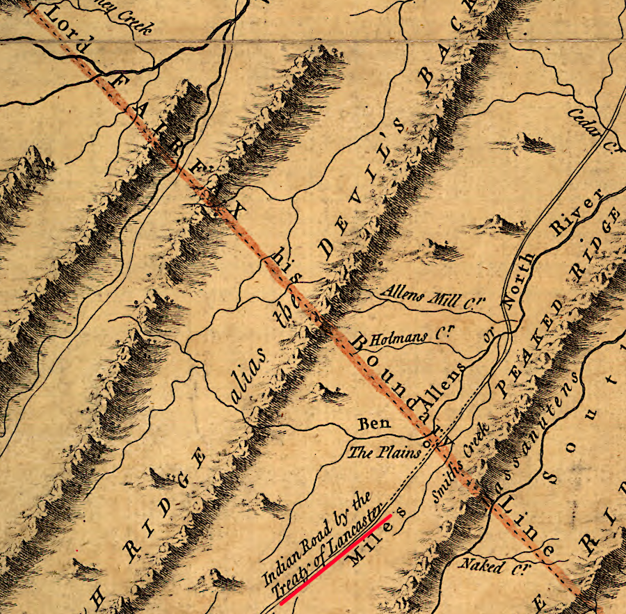
To minimize conflict with the Iroquois, Spotswood helped negotiate the 1722 Treaty of Albany. There were clear terms in that deal regarding exclusion of the Iroquois from the Piedmont east of the Blue Ridge, but the Virginians also thought that the treaty would limit Iroquois attacks on new settlements in the Shenandoah Valley. A second treaty two decades later was required to clarify Iroquois rights. The 1744 Treaty of Lancaster constrained raiding parties to a defined path within the valley.
colonial settlement of the Shenandoah Valley started after the 1722 Treaty of Albany, and by 1744 the Iroquois agreed to use the Wilderness Road during their raiding expeditions
Source: Library of Congress, A map of the most inhabited part of Virginia (by Joshua Fry and Peter Jefferson, 1755)
Spotswood's solution also required recruiting new immigrants to move onto the land west of the mountains. Without forts, tributary tribes, or settlers who perceived Williamsburg as their seat of government, there would be no effective barrier to French occupation or raids by groups such as the Shawnee through the gaps of the Blue Ridge into the Piedmont.
As colonial families had expanded in Tidewater, new farms had been established north to the Potomac River and west to the Fall Line. Traditional Virginia society slowly filled Tidewater, but natural increase and immigration into Chesapeake Bay ports did not produce enough new English colonists to expand west of the Fall Line until the 1720's.
At the time Spotswood formulated his defense-by-settlement strategy, extensive tracts of vacant land were still available in the Piedmont east of the mountains There was no demand from new immigrants, or from indentured servants who served their terms and gained their freedom in Tidewater, to push even further west across the Blue Ridge.
The solution was to import even more immigrants, even if those immigrants were not English. London officials had long encouraged using foreign Protestants to settle the frontier, rather than depopulating England itself. A key target for recruitment were Huguenots, the Protestants who fled France after Catholic King Louis XIV revoked the Edict of Nantes and ended religious toleration in 1685.
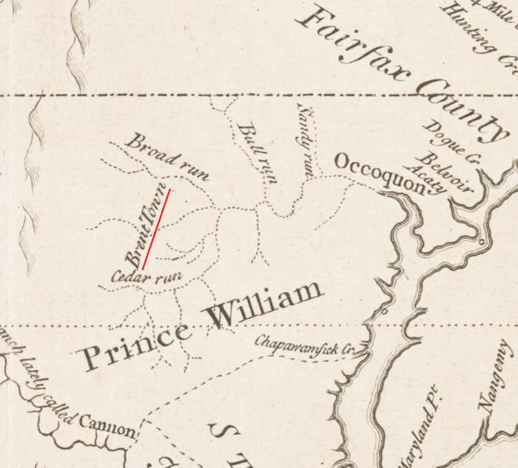
King James II had even authorized Robert Bristow, Nicholas Hayward, Richard Foote, and George Brent to recruit Catholics to the 30,000 acres that they purchased in the Piedmont from Lord Fairfax in 1687. The Brent Town tract was located in Stafford County then. Population grew so slowly on the Piedmont that Prince William County was not carved out of Stafford until 1731, and Fauquier County was not carved out of Prince William until 1757.9
The challenge of settling the lands east of the Blue Ridge was obvious in the 1720's. Recruiting people to move even further west required flexibility in determining who would be acceptable.
To settle Virginia west of the Blue Ridge before the French might arrive, religious and cultural conformity became secondary concerns. Virginia's governors did not recruit Catholics, but they loosened the legal obligations of all Virginians to be Anglicans who viewed the English monarch in London as both their political and religious leader.
By the 1720's, the source of potential new settlers for Virginia's backcountry became Pennsylvania. By then, the supply of French Huguenots was largely exhausted. Quakers in Pennsylvania encouraged immigration from Europe without discrimination, and Philadelphia became a major port of entry. Governor Spotswood and Governor Gooch calculated that land-hungry immigrants who reached Philadelphia and moved west to Lancaster were willing to keep moving.
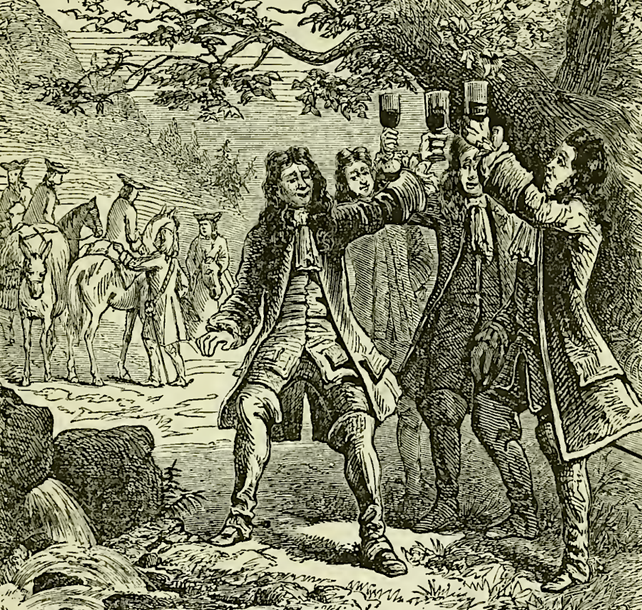
Virginia offered what those immigrants sought - high-quality farmland at low prices. Governor Spotswood and the Knights of the Golden Horseshoe had explored the Shenandoah River valley in 1716, and the future potential of raising crops and livestock there was obvious.
Imperial concerns justified breaking tradition and sacrificing potential future wealth for Tidewater families who had "insider" access for acquiring free land on the western edge of the colony. There was an urgent need to populate the region with men who would be willing to fight for Great Britain, if French and Indian warriors tried to establish control of land as far east as the Blue Ridge. Land grants to new people, from families not already represented in the General Assembly, would increase recruitment of white Christian (even though not Anglican) settlers.
The colonial leaders in Williamsburg could not wait for natural population growth in the Piedmont to finally spill over the gaps in the Blue Ridge and fill up the Shenandoah Valley. The French might fill the vacuum first. German and Scotch-Irish settlers did not share the same culture as the English - not even the same language in some cases - but if they relied upon the government in Williamsburg to have a legal claim to the land, then the new settlers would be willing to fight the French.
But whereas the Council and the families that dominated it were the principal recipients of their own largess in distributing Piedmont lands during the 1720s, most of the massive grants issued between 1730 and 1740 west of the Blue Ridge went to men of non-English origin residing outside Virginia and with neither significant ties to the Council nor the social standing to command its attention.
Moreover, conditions placed on the grants attracted the immigrant population that made the colony's mountain region economically and socially distinctive. This region lay outside the bounds of any Virginia county. No sheriff's writ ran there, no deeds could be conveyed or property confiscated for debt, and no justice of the peace held jurisdiction over it. Thus no speculator could be assured of profits from land claims. Virginia was not simply responding conventionally to population pressures with land speculation: it was deliberately provoking a migration to its marchlands where a vacuum of local government and colonial authority existed.
...The buffer settlements of European Protestants that the colonial government established west of the Blue Ridge between 1730 and 1745 were part of a larger effort to check French expansion across the interior of North America, extend English dominion, secure a western periphery destabilized by Indian conflict, and occupy mountain fastnesses otherwise a refuge to runaway slaves.
Governor Spotswood led the Knights of the Golden Horseshoe across the Blue Ridge in 1716, combining a real estate sales part with military defense planning
Source: Mary Tucker Magill, History of Virginia for the Use of Schools (1873, p.119)
Spotswood and Gooch succeeded in recruiting Scotch-Irish immigrants who came originally from Northern Ireland, and Germans who originated from the Rhine River valley. Those immigrants established communities where religion was based on Presbyterian tenets and various pietists faiths including Mennonites, Dunkers, and United Brethren.
West of the mountains, the new immigrants were not Anglicans. They brought traditions and beliefs not consistent with the established state religion of Virginia - and they were not slaveowners either. As Tidewater farms had expanded into the Piedmont in the 1720's, the economy was based on tobacco farming using slave labor. In contrast, the first permanent colonial settlers west of the Blue Ridge grew wheat and other grains rather than tobacco. Slavery was not a part of the Scotch-Irish or German immigrant culture.
Some of the recent German immigrants did not speak English. Formal documents were written in standard German, while informal conversation was in "Valley Dutch" that blended different European dialects. Cultural diversity was acceptable because the desire in Williamsburg to increased security on the western "frontier" was great. There were not enough English and Anglican Virginians living in the Piedmont who were willing to move across the Blue Ridge and accept the risk of an attack by the French or Native Americans. Populating the Shenandoah Valley with white farmers would prevent the region from becoming a haven for escaped
Governor Gooch did not require the extension of county boundaries or the creation of new counties before he issued land grants west of the Blue Ridge, and the Governor's Council did not restrict land grants to just members of the Tidewater families:11
...from 1730 to 1732 the governor and Council issued nine grants to individuals and groups for a total of 385,000 acres in the Shenandoah Valley outside the bounds of Spotsylvania County. With the exception of William Beverley, an Essex County planter with close ties to the Council, and his partners, none of these grantees were Virginians, English, or the "men of substance" that Virginia governors and the Council had depended upon to organize settlement in the Piedmont.
The first European colonists to establish a permanent home in the Shenandoah Valley may have been a German group led by Adam Miller (or Mueller). While in Williamsburg, he had learned of the opportunity in the Shenandoah Valley from some members of Spotswood's 1716 expedition. Miller crossed the Blue Ridge, perhaps at Swift Run Gap where modern Route 33 crosses, and then returned to Pennsylvania to recruit others to settle in the area.
Much of the land in the Shenandoah Valley may have been already cleared of trees, burned regularly by Native Americans to maintain grasslands ("Indian meadows") for hunting buffalo and other game.12
Sometime before 1730, Miller chose a spot on the South Fork of the Shenandoah River, west of Peaked (Massanutten) Mountain near New Market Gap. Jacob Stover claimed he owned the land there, and he sold 5,000 acres to the settlers. The eight leaders of the Massanutten Settlement had their title reconfirmed in 1733, because Stover may have sold the land before he had obtained his 10,000 acre land grant from officials in Williamsburg.13
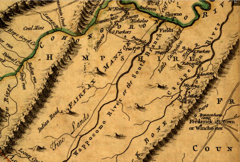
Land titles in the area were not reliable at the time. Lord Fairfax's land office was located in the Northern Neck until he moved it to Greenway Court in 1761. From it, Fairfax's agents sold parcels within the boundaries of Charles II's grant to the "headsprings" of the Rappahannock and Potomac rivers. In addition, Fairfax created several "manors" to define where he would retain ownership, such as the South Branch Manor along the South Branch of the Potomac River.
The colonial land office was located in Williamsburg from 1699-1776, and it had authority to sell land within the rest of Virginia. Both offices claimed the right to sell land west of the Blue Ridge until the 1740's, when the boundaries of the Fairfax Grant were defined and surveyed.
Colonial officials were in a hurry to create a loyal population in the Shenandoah Valley as a buffer to block potential French incursions. Populating the area with authorized settlers who relied upon official government operations to ensure land titles would also avoid creation of a sanctuary similar to the Dismal Swamp.
William Byrd II discovered when he surveyed the Virginia/Carolina boundary in 1728 that the lands along the unclear border had evolved into places that harbored runaway indentured servants and escaped slaves. Unless the officials in Williamsburg found settlers to occupy the Shenandoah Valley, the territory west of the Blue Ridge could become another "no man's land."14
Equally important, the Tidewater gentry would benefit from obtaining large land grants west of the Blue Ridge. Getting land for free, then selling smaller parcels to new immigrants, was the easiest path for the First Families of Virginia to create wealth before the American Revolution. Official land grants would incentivize the well-connected Virginia elite to find buyers dependent upon legal land titles, before the area was occupied by a large number of squatters who owed no allegiance to Virginia's colonial government.
The colonial government in Williamsburg faced competition when it issued grants. Lord Fairfax asserted his claim to lands between the headsprings of the Rappahannock and Potomac Rivers. By his interpretation of the Fairfax Grant, he owned much of the Shenandoah Valley. The threat that Fairfax might collect enormous payments for a vast stretch of land spurred Governor Gooch and his Council to give 40,000 acres in three land grants to John and Isaac Van Meter, over the objections of Fairfax's land agent Robert Carter.
The first British immigrants to settle west of the Blue Ridge walked there from Philadelphia. The Scotch-Irish arrived early, occupying the best farmlands near the Potomac River. Many German-speaking immigrants kept walking until they reached unoccupied lands south of the Fairfax Grant, creating centers of community at Woodstock and then Harrisonburg.15
The boundaries of the Fairfax Grant were surveyed in 1736; afterwards, grants from Williamsburg were located further south. Anticipating population growth as settlers migrated from Pennsylvania into the Shenandoah Valley, the General Assembly began to create new county governments west of the Blue Ridge. Frederick and Augusta counties were authorized in 1738, though actual government operations were delayed until a sufficient number of people occupied the land.
The 1744 Treaty of Lancaster with the Iroquois removed their claims to territory between the Blue Ridge and the Allegheny Front. The Iroquois retained the right to travel through the Shenandoah Valley in order to trade and raid further south, but land speculators anticipated that peace would attract settlers and asked the Council for major land grants.
On April 26, 1745, the Council approved four major grants west of the Blue Ridge. The Greenbrier Company and a group led by Robert Patton each received grants for 100,000 acres. Two other groups got 50,000-acre grants. In 1747, the well-connected Ohio Company got a grant for up to 500,000 acres west of the Appalachian Mountains.
Between 1745-1754, the Governor's Council approved 47 major grants of land. On February 19, 1754, Governor Dinwiddie also proclaimed that those who enlisted in the Virginia Regiment to fight the French and Indians would be entitled to a share of 200,000 acres near Fort Pitt:16
...one hundred thousand acres whereof to be contiguous to the said fort, and the other hundred thousand acres to be on, or near the river Ohio.
Virginia's colonial leaders operated under the philosophy that "demography is destiny." Filling the lands west of the Blue Ridge with settlers loyal to Great Britain was key to blocking the French from gaining control over the entire Mississippi River watershed. The 1748 Treaty of Aix-la-Chapel ended the War of Austrian Succession, which in North America was called King George's War (1744–1748). A year later, French Captain Bienville de Celeron canoed down the Ohio River and buried a series of lead plates to mark that country's claim to the territory.
The French rejected Governor Dinwiddie's directive, delivered by George Washington to Fort le Boeuf in 1753, that they abandon claims to the western lands within the boundaries of Virginia according to the 1609 charter. After hearing the Ohio Company had started to build a fort at the confluence of the Monongahela and Allegheny rivers, nearly 1,000 French soldiers floated to the Forks of the Ohio. They forced the Virginians to leave and built Fort Duquesne.
Governor Dinwiddie organized a 300-person military force to boldly assert Virginia's ownership of the Ohio River Valley. He promised land grants as a bounty to entice men to enlist and protect the Ohio Company fort at the Forks of the Ohio. In addition to incentivizing Virginians to fight for King George II, that offer was consistent with British policy to increase the number of settlers west of the Blue Ridge. Allocating some of the vast amount of the colony's unclaimed acreage stretching to the Mississippi River - or to the Pacific Ocean, according to some interpretations of the boundary of Virginia - would encourage veterans to move into the backcountry after the war.
Settlement would stimulate trade and increase quitrents paid to the colony. Though far from Williamsburg, veterans would be loyal to the English government. The French or Spanish living downstream along the Mississippi River and at the port of New Orleans might offer trade benefits, but those who had fought the French were not going to become allies or agents of another European power. Veterans would also provide a relatively high capacity for defending the region against Native American attacks.
George Washington ended up leading the military force westward to attack the French after Colonel Joshua Fry died. Washington attacked first, but was defeated from French troops that marched out of Fort Duquesne. The Virginians surrendered at Fort Necessity on July 3, 1754.
At the same time Washington was trying to use military force to expel the French, Benjamin Franklin led efforts to coordinate colonial policy. Prepare the different colonies for joint military defense was one benefit, but Franklin's other priority was to displace the Penn family from its ownership of Pennsylvania. He desired to convert the proprietary colony into a royal colony.
Officials in London were interested in establishing stronger and more-centralized control over the fragmented colonies. The threat from the French was Franklin's opportunity to get King George II to displace the Penn family from its proprietary control in Pennsylvania and push the pacifist Quakers out of their control of the Pennsylvania Assembly.
Franklin proposed at the June 19-July 11, 1754 Albany Congress that the colonies needed to Join or Die. The commissioners who came to New York from seven colonies adopted a plan of union, proposing that 11 colonies (excluding Georgia and Delaware) elect members to serve in a Grand Council overseen by a President General appointed by King George II. The Grand Council offered a "taxation with representation" approach; it would have the ability to raise taxes as needed for the colonies to defend against French encroachment.
Benjamin Franklin also proposed an alternative if his plan of union was not accepted. He suggested paying the Iroquois to sell their rights to the territory between the Ohio River and Lake Erie and creating two new colonies there. Having King George II create two new colonies would finesse the claims of existing colonies to western lands:17
...if such union should not take place, it is proposed that two charters be granted, each for some considerable part of the lands west of Pensylvania and the Virginian mountains, to a number of the nobility and gentry of Britain; with such Americans as shall join them in contributing to the settlement of those lands, either by paying a proportion of the expence of making such settlements, or by actually going thither in person, and settling themselves and families.
Franklin calculated that the priority of royal officials was to ensure settlement west of the mountains by people who would owe allegiance to London rather than Paris; satisfying western claims of existing colonies would be a secondary concern. He warned that the French were preparing to grow their population in the Ohio River Valley and fill the gap between settlements in Canada and Louisiana:18
Our people, being confined to the country between the sea and the mountains, cannot much more increase in number... The French will increase much more, by that acquired room and plenty of subsistence, and become a great people behind us. Many of our debtors, and loose English people, our German servants, and slaves, will probably desert to them; and increase their numbers and strength, to the lessening and weakening of ours... They will cut us off from all commerce and alliance with the western Indians, to the great prejudice of Britain, by preventing the sale and consumption of its manufactures.
...The difficulty of settling the first English colonies in America, at so great a distance from England; must have been vastly greater than the settling these proposed new colonies: for it would be the interest and advantage of all the present colonies to support these new ones; as they would cover their frontiers, and prevent the growth of the French power behind or near their present settlements; and the new country is nearly at equal distance from all the old colonies; and could easily be assisted from all of them.
And as there are already in the old colonies, many thousands of families that are ready to swarm, wanting more land; the richness and natural advantage of the Ohio country would draw most of them thither, were there but a tolerable prospect of a safe settlement. So that the new colonies would soon be full of people; and from the advantage of their situation, become much more terrible to the French settlements, than those are now to us. The gaining of the back Indian trade from the French, by the navigation of the lakes, &c. would of itself greatly weaken our enemies: it being now their principal support, it seems highly probable that in time they must be subjected to the British crown, or driven out of the country.
Such settlements may better be made now, than fifty years hence, because it is easier to settle ourselves, and thereby prevent the French settling there, as they seem now to intend, than to remove them when strongly settled.
All of the colonial legislatures which considered the proposed plan of union rejected it, fearing a loss of their autonomy. British officials made it easier to avoid coordinated action by sending an army under General Edward Braddock to Virginia. British Regulars, funded by British taxpayers, ended up being primarily responsible for defeating the French in the French and Indian War.
Colonial officials played a minimal role in making decisions in that war. For example, General Forbes ignored advice from Virginians to march on Fort Duquesne via Braddock's Road. He built his own route through Pennsylvania. The Forbes Road created better access for Pennsylvanians to settle the Ohio River Valley, and for traders from Philadelphia to profit after the war ended.
However, the British government adopted a completely different settlement approach once the threat of the French was eliminated. Pontiac's War in 1763 was successful in stopping migration to the Ohio River Valley, but only briefly. A decade after Franklin's assessment that there were "many thousands of families that are ready to swarm," thousands of settlers started to carve out farms near Fort Pitt and downstream on the Ohio River.
Peace with the Native Americans became the British priority in order to reduce the costs of maintaining British Regulars in North America. King George III issued the Proclamation of 1763. and blocked new western settlement, in an effort to minimize conflict with the Native Americans.
Implementation of the ban on western settlement as defined in the Proclamation of 1763 was spotty. British officials in London and North America rotated between inconsistent policies regarding settlement, trade, and military strategy in the 1760's.
After the Proclamation of 1763, no centralized British control over development of the western lands was successfully implemented. Colonial officials negotiated land cession deals with the Iroquois and Cherokee that were contradictory to London's directions, in part because the negotiators obtained personal benefits as part of the official negotiations. Deals such as the Treaty of Fort Stanwix involved private side deals that would be considered corrupt by modern standards.
The 13 colonies also refused to pay what the British considered to be a fair share of the costs to staff western forts and to engage diplomatically with the Cherokee, Choctaw, Creek, Shawnee, Delaware, Mingo, Iroquois, and other tribes. The Stamp Act tax and the Townsend duties were revenue generators intended to offset the costs of the French and Indian War and the continuing costs to maintain British Regulars in North America.
Those taxes were cancelled after colonial objections, except for the token retention of a tax on tea. Across the Atlantic Ocean in Great Britain, residents continued to pass high taxes. Parliament recognized that its tax policies were subsidizing colonists 3,000 miles away in North America who enjoyed a higher standard of living while paying a substantially lower tax rate.
By 1768, Great Britain abandoned efforts to centralize the management of trade with western tribes. London officials approved treaties negotiated with the Iroquois and Cherokee that began a retreat from the 1763 ban on western settlement.
To reduce costs, almost all forts west of the Appalachians from which British troops could have enforced the ban on settlement were abandoned by 1772. The Regulars who left, including Fort Pitt, were concentrated in cities such as Boston and New York.
The most effective deterrent to western settlement was not British enforcement of the Proclamation of 1763 but instead the potential of an attack by Native Americans. Risk-taking settlers still raced to establish farms at places with the best soils. The swarm of settlers gambled that they could occupy lands first and acquire legal title later, and hoped they would not be killed by Native Americans angered at the transformation of their hunting grounds.
Though royal governors were never authorized to sell large amounts of western lands after the French and Indian War, land speculators recognized that the Proclamation of 1763 was only a temporary measure. Lobbyists for the Great Ohio Company seeking the Vandalia grant were particularly successful in London. When the Earl of Hillsborough, Secretary of State for the Colonies, tried to block the company's request for 20,000,0000 acres, Benjamin Franklin and the land speculators organized by the Walpoles forced Hillsborough to resign his position.19
Virginians were frustrated by the London-imposed barrier to fulfilling Governor Dinwiddie's commitment to grant 200,000 acres to those who fought in the French and Indian War. George Washington took the lead after 1763 in getting Virginia governors to authorize land surveys and actually patent parcels. His strategy required regular recitation of the validity of those claims as he established a close personal relationships with royal governors.
After the 1768 Treaty of Fort Stanwix, the Governor's Council authorized the survey of the 200,000 acres promised to veterans. Colonial leaders anticipated that King George III would soon permit Governor Botetourt to issue patents for surveyed parcels. Such surveys required time, and as George Washington noted:20
... it was evident to me from the knowledge I have of the back Country & the rapidity with which it is settling that any considerable delay in the prosecution of our Plan woud amount to an absolute defeat of the Grant inasmuch as Emigrants are daily Seating the choice Spots of Land and waiting for the oppertunity (when the Office is opend) of solliciting a legal Title under the advantages of Possession & Improvement—two powerful Plea’s in an Infant Country.
The difficulty of completing such surveys was significant. Veterans who had served as privates were entitled to just 50 acres. Officers were entitled to thousands of acres based on their rank, but obtaining a survey of lands at distant Fort Pitt was both expensive and challenging. Once a survey had been completed, getting it approved in court in order to obtain a patent granting clear title might require defending the survey. Someone else could end up with the land based on an earlier survey, and there was a risk that the parcel defined by a Virginia surveyor would end up being in Pennsylvania once the colonial boundary was finalized.
George Washington wrote his brother Charles in 1770 that he wanted to acquire 15,000 acres at the price of five-seven pounds per thousand acres. He requested Charles Washington to quietly identify possible sellers, and to secretly purchase property. He also noted that he was planning to acquire enough warrants from other French and Indian War veterans to assemble a critical mass of land that would be worth the risky investment of getting it surveyed, even though various grants dating back to the 1740's had been:21
...made in such generall, & indeterminate terms, that if confirmd, no man can lay off a foot of Land & be sure of keeping it.
After Governor Botetourt died in 1770, Washington arranged to spend time with Governor Dunmore. Washington understood that personal relationships were an essential component in getting favorable decisions from whoever was in a position of authority. He was an effective lobbyist for those seeking to convert land owned by King George III into private land owned by colonists.
In 1773 Governor Dunmore in Williamsburg decided to open a land office and approve surveys in the disputed territory for those veterans. Since 1770 George Washington had been surveying parcels that could be claimed by military warrants based on French and Indian War service, which Washington had earned and also acquired from other soldiers.
Washington and Dunmore were racing to beat the creation of Westmoreland County by Pennsylvania officials and competing "official" surveys and patents authorized by that colony. Both colonies also were racing to beat claims of the Vandalia Company. That Pennsylvania-based group had lobbied successfully in London and developed great influence with the Privy Council, outcompeting rivals such as the Mississippi Company and absorbing the Ohio Company. It was close to obtaining official approval of a massive 20 million acre grant to establish Vandalia as a 14th colony with a capital at Pittsburgh.
To allow Virginia veterans and land speculators to acquire official patents west of the Appalachians, Dunmore had to ignore the Proclamation of 1763 and also 1773 direction issued to colonial governors by the Board of Trade. That direction mandated a new system designed to raise funds through the sale of lands at auction, after survey, and by the effective annual collection of quitrents (property taxes) from those who purchased parcels. Such funding would raise revenue and reduce the dependency of royal officials upon colonial legislators, thus increasing the flexibility of colonial governors to enforce London-issued policies without colonial legislatures threatening to cut off the governors' salaries.
The colonial governors lacked the funds for identifying which lands had not already been granted, or authorized for sale through warrants and surveys which had not been finalized. Many settlers postponed the last step of obtaining a formal grant signed by the governor, which required paying a fee and triggered the requirement to pay annual quitrents. Dunmore was willing to keep processing the land transfers, citing the exemption in the Board of Trade guidance which exempted pre-existing claims from the new process.
Washington and Dunmore planned to ride to Pittsburgh together in the summer of 1773. Washington's step-daughter Martha Parke "Patsy" Custis died from epilepsy in June, so Dunmore ended up traveling alone to the Ohio River. With Dr. John Connolly, he explored acquiring land west of the Ohio River before returning to Williamsburg.
In 1774 Lord Dunmore returned to Fort Pitt. He organized an army column and marched west towards the Shawnee town at Chillicothe. Chief Constalk, whose combination of Shawnee, Delaware, Mingo, and other warriors had just been defeated in the Battle of Point Pleasant by another army column led by Andrew Lewis, agreed in the Treaty of Camp Charlotte to sign away their land claims south of the Ohio River. That 1774 treaty achieved what the Iroquois had accepted for the the other tribes in the 1768 Treaty of Fort Stanwix but without their approval then - cession of lands south of the Ohio River.
Governor Dunmore directed Dr. John Connolly to occupy the site of Fort Pitt. Pennsylvania officials then arrested Connolly. After he was released from jail in Westmoreland County, Connolly brought 200 Virginia militia and seized control of Pittsburgh. A series of quasi-legal arrests and counter-arrests of local officials occurred as Pennsylvanians and Virginians struggled to establish control over the western edge of Pennsylvania.
Inter-colonial conflict continued until 1780, when the two states finally negotiated a peaceful deal to set the boundary. Pittsburgh ended up being over 25 miles east of the western edge of Pennsylvania.22
The American Revolution transformed who would issue official approval for transferring western lands into private ownership. Pennsylvania and Virginia finally agreed in 1780 on the boundary between those two states. Under the Articles of Confederation, Virginia and other states ceded claims to the Northwest Territory and the Southwest Territory to the national government. Virginia ensured it would have adequate acreage to award land bounties to military veterans by retaining a Virginia Military Reserve in both Kentucky and the Northwest Territory, plus 150,000 acres for the members of the George Rogers Clark expedition in 1778-1779 that captured British forts at Kaskaskia and Vincennes.
The new Continental Congress initially sought to mimic the Proclamation of 1763 and limit western settlement. The Congress had the same objective as the British government in 1763, to maintain peace and minimize the cost of stationing military forces west of the Appalachians.
The Continental Congress was no more successful with that policy than had been King George III and his appointees. Thomas Jefferson, who later played a key role in crafting the Land Ordinance of 1785 and the 1787 Northwest Ordinance, wrote in 1776 about the people moving westward without authorization:23
They will settle the lands in spite of every body.
The rapid increase of population in the new United States of America spurred steady western migration. Land hunger rather than "Manifest Destiny" spurred families to keep migrating all the way to the Pacific Ocean. Americans settling in Texas, California, and the Oregon Territory led to wars and treaties that expanded the boundaries of the United States of America westward.
The United States did not succeed in expanding to the north. Loyalists who moved to Canada after 1781 and French residents of Quebec helped turn back an American invasion in the War of 1812, and rejected multiple efforts by the United States to conquer or annex land north of the 49th parallel of latitude.
The fragmented British colonies north of the United States united in 1867 to create the new country of Canada. That has not ended American dreams of further expansion. In 2025, President Trump declared:24
The only thing that makes sense is for Canada to become our cherished Fifty-First State.
Lord Fairfax lived in what was intended to be the caretaker's house at Greenway Court, and never built a manor home
Source: The Magazine of American History, Greenway Court (1893, p.137)