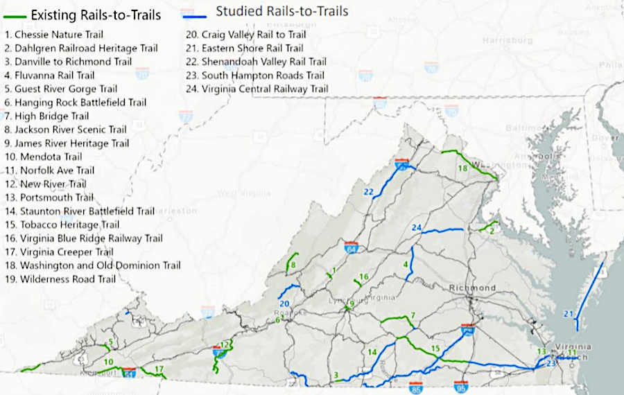
by 2021, there were 19 rail-to-trails projects in Virginia with segments open for public use
Source: Virginia Department of Rails and Public Transportation (DRPT), State Trail Advisory Committee Meeting (October 21, 2021)

by 2021, there were 19 rail-to-trails projects in Virginia with segments open for public use
Source: Virginia Department of Rails and Public Transportation (DRPT), State Trail Advisory Committee Meeting (October 21, 2021)
Some former railroads that have been abandoned have been converted into rails-to-trails projects. The conversion preserves the public right to cross private land, using the right-of-way acquired by the railroad. Otherwise, in many cases the railroad's easement is extinguished when the railroad abandons track and private landowners regain all property rights.
The first rails-to-trails project was completed in Wisconsin in 1968, the Elroy-Sparta State Trail.1
When the Norfolk Southern ceased hauling coal along the Guest River in 1988, it donated the right-of-way and the George Washington National Forest created the Guest River Gorge Trail.2
The Appalachian Trail crosses the James River on a bridge that uses the piers of an abandoned Chesapeake and Ohio (C&O) Railroad bridge, upstream at Snowden Dam (Cushaw Hydroelectric Project). When a new bridge was built in 1954 to reduce a curve in the track, the railroad removed its old bridge and sold the piers. An enthusiastic hiking couple, Bill and Laurie Foot, figured out that the Appalachian Trail could be re-routed away from the busy US 501 bridge if a new pedestrian bridge was constructed on the old piers.
They tracked down the owner, who used the piers to tie up a houseboat, and the Appalachian Trail Club purchased the piers for $1. It took another $1.5 million and about a decade to build a new bridge, including the addition of new concrete on top of the piers to raise them 10 feet higher above floodwater level. The "James River Foot Bridge" became the official route of the Appalachian Trail in 2000. The name is not a typo; it honors Bill Foot, who died just before the new pedestrian bridge was completed.3
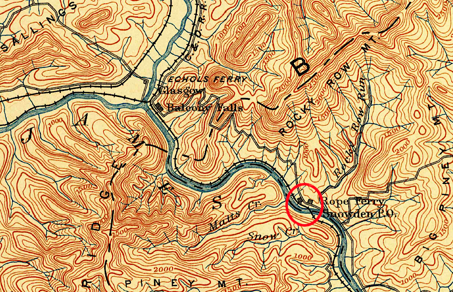
the Richmond and Alleghany Railroad built the original bridge over the James River and started using it in 1881
Source: US Geological Survey (USGS), Lexington VA 1:125,000 topographic quadrangle (1894)
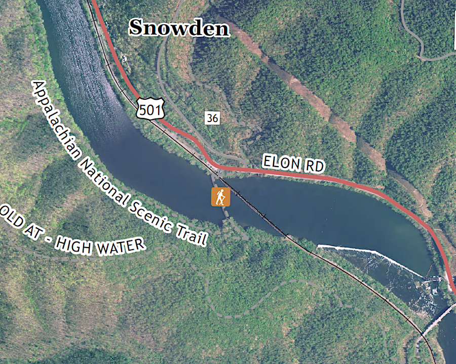
the Appalachian Trail now uses the old railroad piers for the James River Foot Bridge, named after Bill Foot
Source: US Geological Survey (USGS), Snowden VA 1:24,000 topographic quadrangle (2019)
The New York, Philadelphia and Norfolk Railroad closed the branch line between Cape Charles and Kiptopeke in 1972. The 2004 Eastern Shore Bicycle Plan proposed creating a bicycle trail from Cape Charles to the Eastern Shore National Wildlife Refuge. The first phases of the Southern Tip Bike & Hike Trail were completed in 2011 and 2019, using the abandoned rail route. Two more phases were planned to complete a fully-accessible, paved route linking to Cape Charles.4
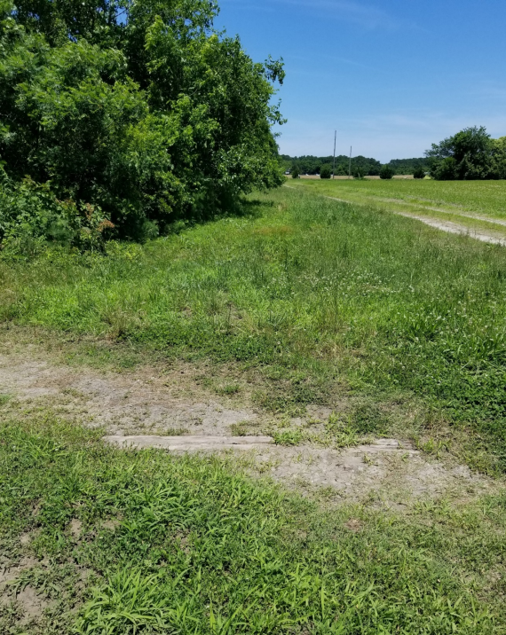
a tie from the New York, Philadelphia and Norfolk Railroad branch line to Kiptopeke still remains on the right-of-way
Source: Accomack-Northampton County Planning District Commission, Southern Tip Phases III and IV Preliminary Engineering Report and Feasibility Study (Figure 4)
In 2019, the Bay Coast Railroad ceased operations on the Eastern Shore. Accomack and Northampton counties could find new Class III shortline railroads to restore service on a portion of the track, but a 49-mile stretch between Cape Charles and Hallwood were abandoned. The 40-foot wide right of way crossed flat ground, making it especially suitable for recreational biking.5
At the time, demographers predicted the population of the Eastern Shore would decline by 20% over the next decade. After the railroad officially requested the track be "rail-banked" to allow for the trail, the executive director of the Eastern Shore Chamber of Commerce highlighted the economic development that could come from a new tourist attraction:6
In 2023, the US Department of Transportation awarded a $23 million Rebuilding American Infrastructure with Sustainability and Equity (RAISE) grant to the Accomack-Northampton Planning District Commission, to fund paving a 10-foot wide trail for nearly 17 miles between the towns of Nassawadox and Olney.7
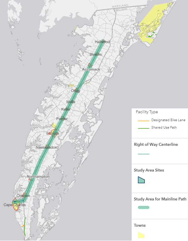
conversion of the Bay Coast Railroad into a hiking/biking trail will stretch for 49 miles
Source: Virginia Department of Transportation, Eastern Shore Rail to Trail Study, Interactive Map of Project Area
In 2022, there were 53 rail-trails in Virginia with 463 miles of trail. An additional 10 more projects could add 118 more miles.8
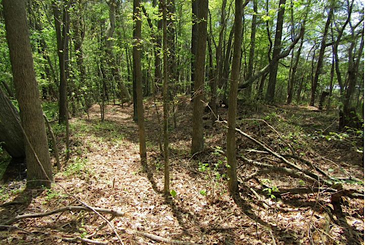
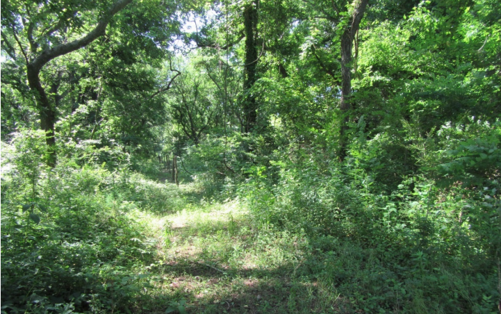
the right-of-way of the branch line of the New York, Philadelphia and Norfolk Railroad from Cape Charles to Kiptopeke reforested after abandonment
Source: Accomack-Northampton County Planning District Commission, Southern Tip Phases III and IV Preliminary Engineering Report and Feasibility Study (Figures 6 and 12)
Rail-to-trail conversions have been opposed by adjacent landowners who prefer privacy over public use. There are also concerns that railroads might be abandoned and converted into trails, and that would prevent future restoration of rail service if the demand increased later.
In Virginia, there is one clear example where a former railroad was transformed into a hiking/biking recreational trail without anticipating that demand could justify reinstalling tracks. There are intermittent efforts to transform the former Washington and Old Dominion Railway corridor so it could provide a route for commuter rail from Loudoun County to Rosslyn again.
After the railroad was officially abandoned, the land within that corridor was sold to the Virginia Electric and Power Company (VEPCO). The utility, now Dominion Energy, installed electricity transmission lines and then sold the land to the regional park authority, now known as NOVAParks. Squeezing a raillroad into the corridor now would require closing the W&OD Trail, which receives very high recreational use.9
The US Congress addressed the problem by establishing a railbanking process. As described by the Rails-to-Trails Conservancy:10
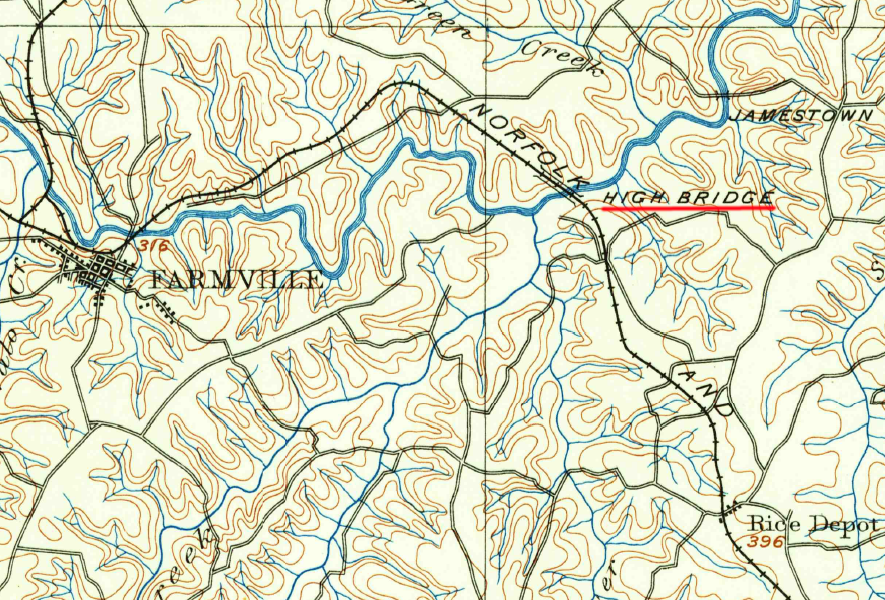
the Norfolk and Western Railroad crossed the Appomattox River via High Bridge, which is now a popular trail
Source: US Geological Survey (USGS), Farmville VA 1:125,000 topographic quadrangle (1893)