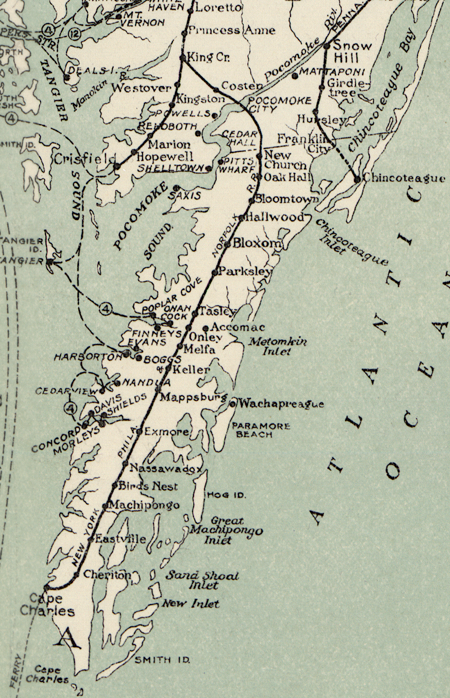
the New York, Philadelphia and Norfolk Railroad reached Cape Charles in Northampton County
Source: Library of Congress, Transportation lines of Chesapeake Bay serving the port of Baltimore MD (1926)

the New York, Philadelphia and Norfolk Railroad reached Cape Charles in Northampton County
Source: Library of Congress, Transportation lines of Chesapeake Bay serving the port of Baltimore MD (1926)
The New York, Philadelphia and Norfolk Railroad, constructed from Pocomoke City, Maryland to Cape Charles in 1884, was not the first railroad built on the Eastern Shore of Virginia.
The first track into the Eastern Shore of Virginia was built by the Worcester Railroad in 1876. It extended from Snow Hill, Maryland to the new Accomack County town of Franklin City. That first railroad, with less than a mile of track in Virginia to reach the shoreline of Chincoteague Bay, was soon renamed the Delaware, Maryland and Virginia Railroad.
The New York, Philadelphia and Norfolk Railroad was created in 1882 by consolidating the Peninsula Railroad Company of Maryland and the Peninsula Railroad of Virginia. They had the necessary charters from their respective states to build track south of Pocomoke City to the southern end of the Eastern Shore. In 1878 the Peninsula Railroad of Virginia had acquired the rights of the North and South Railroad, which had been chartered by the Virginia legislature in 1853 but never initiated construction.
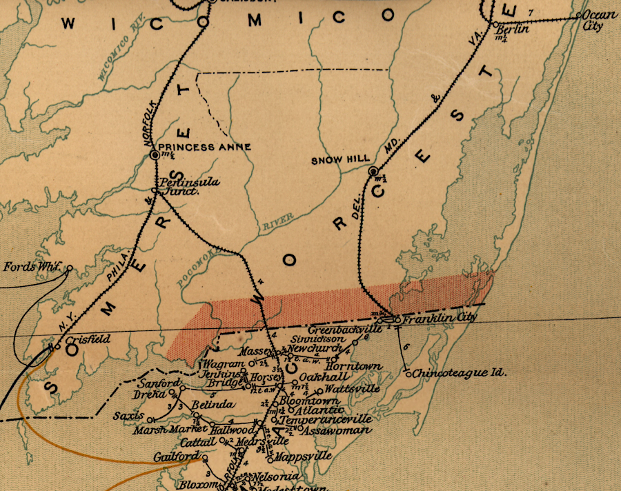
the Delmarva railroad network in 1896
Source: Library of Congress, Post route map of the state of Virginia and West Virginia (1896)
In 1884 the New York, Philadelphia and Norfolk Railroad absorbed the Eastern Shore Railroad in Maryland, just north of the boundary with Virginia. The Eastern Shore Railroad had been completed in 1866 to what became Crisfield on the Chesapeake Bay. Watermen brought massive amounts of oysters from Tangier Island and other sites to that deep water port, for shipment north to market in urban centers.
Between April-October, 1884, track was completed down the middle of Accomack and Northampton counties to the southern end of the Delmarva peninsula. Cape Charles was constructed as the endpoint on the Chesapeake Bay, with barges used to float passengers and then loaded railcars across the bay to a landing in Portsmouth.
Though there was agricultural traffic in the rural area to ship to urban centers, steamboats were already carrying much of it to market. There were no population centers, mines, or industrial facilities on Virginia's Eastern Shore to justify building the New York, Philadelphia and Norfolk Railroad.
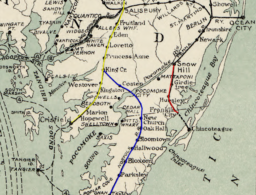
the Delaware, Maryland and Virginia Railroad (red) linked Snow Hill to Chincoteague Bay before the New York, Philadelphia and Norfolk Railroad acquired the Eastern Shore Railroad (yellow) and built south (blue)
Source: Library of Congress, Transportation lines of Chesapeake Bay serving the port of Baltimore MD (1926)
Though separate corporations built and operated various railroads on the Delmarva peninsula, the Pennsylvania Railroad controlled expansion of the rail network. The Pennsylvania Railroad recognized the potential benefits from extending its system south to Hampton Roads. A railroad north of the Chesapeake Bay could capture freight and passenger traffic going by steamboats to New York. A ferry across the bay offered the opportunity to link with the railroads that extended through North Carolina to Atlanta and Florida.
The Pennsylvania Railroad chose to cooperate with the founder of the New York, Philadelphia and Norfolk Railroad rather than build the line itself. It waited until 1908 to purchase the stock and install the Pennsylvania Railroad's choice of directors on the board of the New York, Philadelphia and Norfolk Railroad.
The Interstate Commerce Commission approved converting the railroad into the "Norfolk Division" of the Pennsylvania Railroad in 1922. That formal action came two years after the Pennsylvania Railroad took over operations with a 999-year lease. The Norfolk Division became part of the Delmarva Division in 1930, as the Pennsylvania Railroad reorganized its operations yet again.
The 66-mile route of the track south of the Maryland border is a clue to the low expectations of additional freight and passenger business from the undeveloped, rural Eastern Shore of Virginia. The rail line was designed to follow the watershed divide between the Chesapeake Bay and the Atlantic Ocean. That route minimized the expense of bridging various creeks, at the price of bypassing the coastal towns already established by the 1880's.
Track was placed down the middle of the peninsula, with only one bend in Accomack County and one in Northampton County. There were no branch lines extending to the existing communities on the Virginia portion of the Delmarva peninsula, or to the seacoast to get additional seafood traffic beyond what the Pennsylvania Railroad's subsidiaries were already carrying from Chincoteague via the Delaware, Maryland and Virginia Railroad.
The goal of the New York, Philadelphia and Norfolk Railroad was to capture freight and passengers headed to Philadelphia and New York from Norfolk and Portsmouth. As described in one modern assessment, the route:1
In 1879, before the New York, Philadelphia and Norfolk Railroad was constructed, an article in Harper's New Monthly Magazine highlighted how railroad connections shaped the economy and lifestyle of the Delmarva Peninsula north of the Virginia border near Wilmington. The absence of a railroad had an equally strong affect on the southern part:2
The New York, Philadelphia and Norfolk Railroad was organized by William Lawrence Scott. He saw the opportunity of extending that railroad's line beyond Pocomoke, Maryland to tap into potential freight and passenger business beyond Virginia's Eastern Shore. Coal brought to Hampton Roads could be transported north by rail, rather than by boat.
Scott could not convince the Pennsylvania Railroad to spend its resources to build the new line. Instead, he created a new corporation, found other investors, and hired experienced railroad executives such as A. J. Cassatt from the Pennsylvania Railroad. It was always planned that the freight and passengers would be transferred to the Pennsylvania Railroad in Delaware for final transport to urban centers.
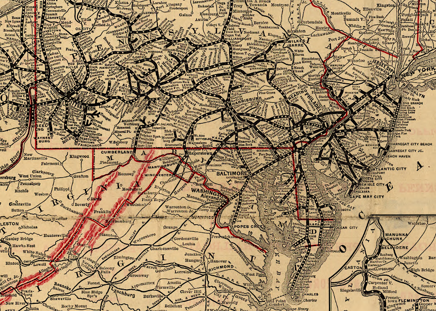
the Pennsylvania Railroad stretched from New York to Chicago and St. Louis, and expansion through Delmarva was not a priority
Source: Library of Congress, General map of the Pennsylvania Railroad and its connections (1893)
Scott planned from the beginning to create Cape Charles as a thriving seaport. He purchased 2,5000 acres from the heirs of former Virginia governor Littleton Waller Tazewell in 1883 and built a plantation home for himself there (now on the Bay Creek development and golf course).
Scott also divided 136 acres of the old Tazewell estate into 644 parcels for the town of Cape Charles and the rail yard for the New York, Philadelphia and Norfolk Railroad on the property. He named the town's east-west avenues after famous Virginians, and the north-south streets after fruits. The town was incorporated in 1886.
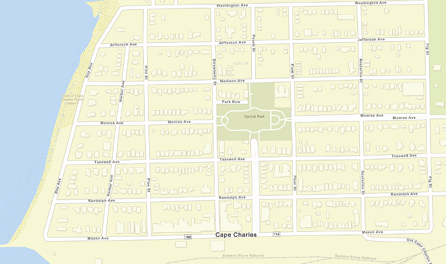
the town of Cape Charles was planned and built as part of the construction of the New York, Philadelphia and Norfolk Railroad, with streets named by the railroad's founder (Bay and Harbor avenues were added later)
Source: ESRI, ArcGIS Online
Scott commented in an 1885 interview:3
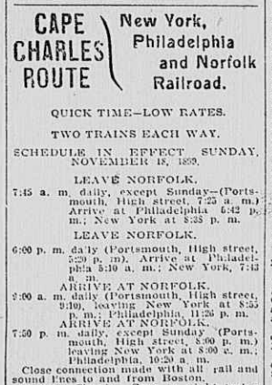
the New York, Philadelphia and Norfolk Railroad floated passengers and freight cars across the Chesapeake Bay
Source: Library of Congress, Chronicling America, Virginian-Pilot (p.9, December 23, 1899)
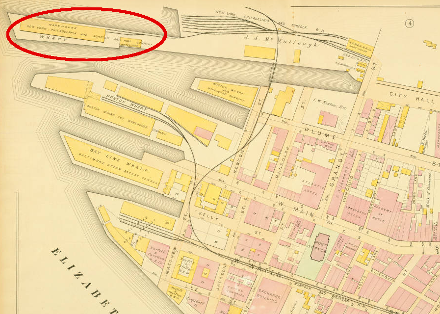
the New York, Philadelphia, and Norfolk connected to steamships with a Norfolk terminal on the Elizabeth River
Source: Norfolk Public Library, Atlas of the city of Norfolk, Va. and vicinity, including the city of Portsmouth (1889)
Rail was a more cost-effective way to ship from Hampton Roads compared to steamboat. Farmers could bring their produce ("truck") by wagon to the train stations, rather than to the coastline to ship by steamboat. Residents on the Eastern Shore took advantage of the transportation opportunity and created new towns along the line of the railroad, away from the traditional townsites along the shoreline.
Improved access to markets spurred an Eastern Shore boom in seafood, lumber, and farm produce exports to northern cities. It also shifted what farmers grew. Cheap transport by rail made corn grown in the midwestern states more competitive, so Eastern Shore farmers shifted to growing potatoes in particular. The longer growing season in Virginia, compared to farms further north, and the fast transport by railroad led to an expansion of fruit and vegetable ("truck") farming on the Delmarva peninsula:4
The location of the railroad also triggered growth of new communities in the middle of the peninsula, away from the shoreline. The initial nine railroad stations were expanded to include eleven more; most communities on Route 13 today were spurred originally by the railroad.
Melfa was named after a railroad official. Parksley, home of the Eastern Shore Railway Museum now, was planned by the Parksley Land and Improvement Company as a railroad town in 1885. Its Victorian architecture reflects the time the railroad was constructed.
An observer from England noted:5
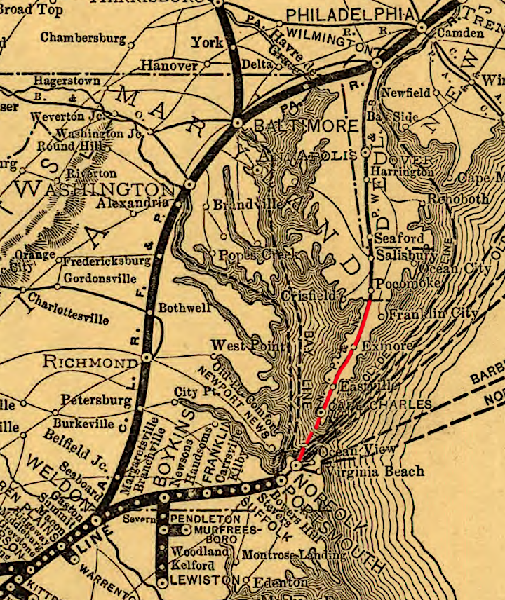
the New York, Philadelphia and Norfolk Railroad linked Eastern Shore farms and fishing towns to customers in Philadelphia and New York
Source: Library of Congress, Map of the Seaboard Air Line and its principal connections north, south, east & west, 1896 (Rand McNally and Company)
The locations of the railroad stations, in the center of the Delmarva peninsula along the watershed divide, reflect the topography of the Eastern Shore. The existing Eastern Shore road network, which had developed since colonial times, was transformed:6
No railroad bridge was economically or technically feasible for crossing the Chesapeake Bay and connecting to the south. To connect to Norfolk and points south, a barge ("car float") carried railroad cars across the Chesapeake Bay from a new harbor at Cape Charles.
Not until 1912 was a spur line completed south of the town of Cape Charles to Kiptopeke, the furthest south the railroad ever reached on the peninsula. The Cape Charles Railroad operated as a subsidiary of the New York, Philadelphia and Norfolk Railroad until 1917, when it was folded into the parent company.7
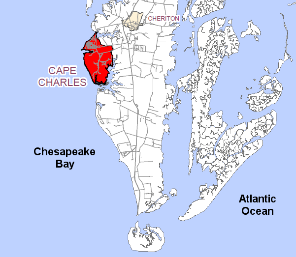
the Town of Cape Charles is 11 miles north of the "Cape Charles" tip of the Delmarva Peninsula
Source: Cape Charles Comprehensive Plan Update, Map 1 - Location of Cape Charles
Initially, the barge floated railroad cars south to Portsmouth (Port Norfolk). The new railroad had difficulty getting other Hampton Roads railroads to interchange and transfer loads on rail cars to other destinations, or to ship cargo north by rail rather than steamship.
The resistance came in part from inter-railroad rivalries, and in part because those old railroads had financial interests in the steamships that traditionally carried traffic north. In 1898, the New York, Philadelphia and Norfolk Railroad orchestrated the creation of the Norfolk & Portsmouth Belt Line Railroad, a "neutral" terminal switching company that interchanged rail cars between the various competing railroads near the Elizabeth River and still operates in south Hampton Roads.8
Starting in 1926, the railroad moved its southern connection from Portsmouth to a landing on Little Creek, located at that time in Princess Anne County. The Little Creek Extension reduced the length of the water route from 36 to 24 miles.
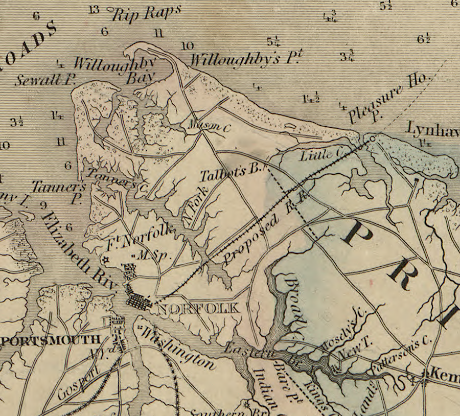
the concept of a railroad connection to Little Creek was not new; one had been proposed by 1859
Source: Library of Congress, A map of the state of Virginia (by Lewis Von Buchholtz, L. V., Herman Böÿe, Benjamin Tanner, 1859)
The New York, Philadelphia and Norfolk Railroad ended up with four miles track south of the Chesapeake Bay, running from a wharf at Little Creek through Virginia Beach to Portlock Yard. That short stretch connected the Little Creek landing to the Norfolk and Portsmouth Belt Line, which provided connections to the Norfolk Southern and CSX railroads.
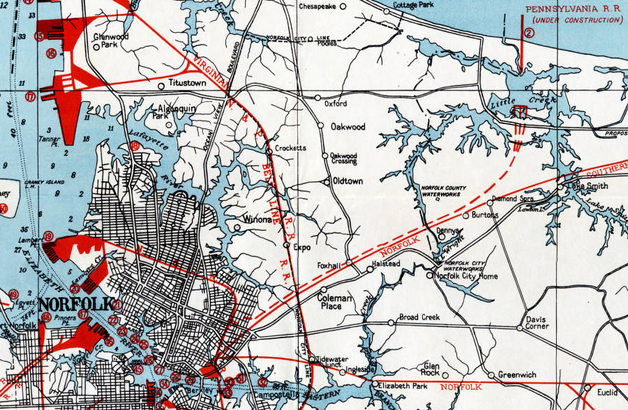
the New York, Philadelphia and Norfolk Railroad moved its car ferry to Little Creek in 1929
Source: Norfolk Public Library, Hampton Roads Port Area (1927)
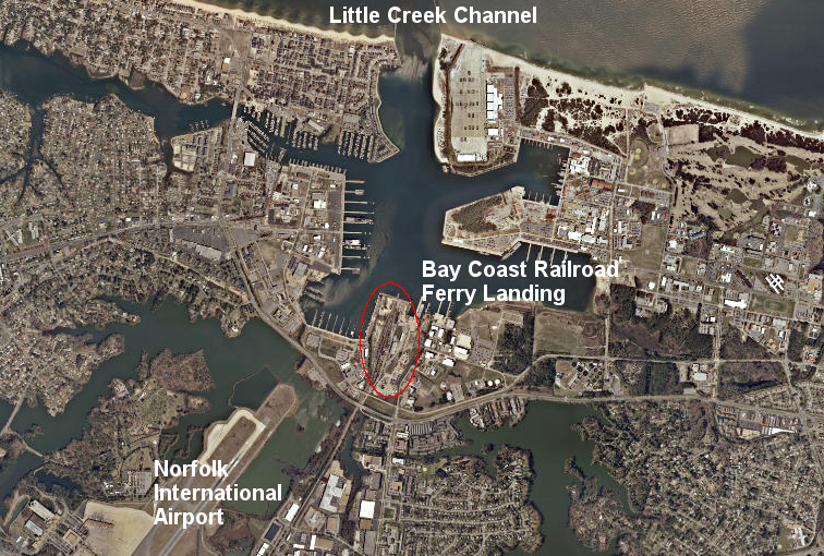
the Bay Coast Railroad floated rail cars across the water from the Eastern Shore to a railyard on Little Creek near the Norfolk International Airport
Source: ESRI, ArcGIS Online
In 1891, there was a speculative proposal to extend railroad service south to Conway, South Carolina. That idea resulted in a map, but no investment or charter for the proposed Norfolk, Wilmington & Charleston Railroad.9
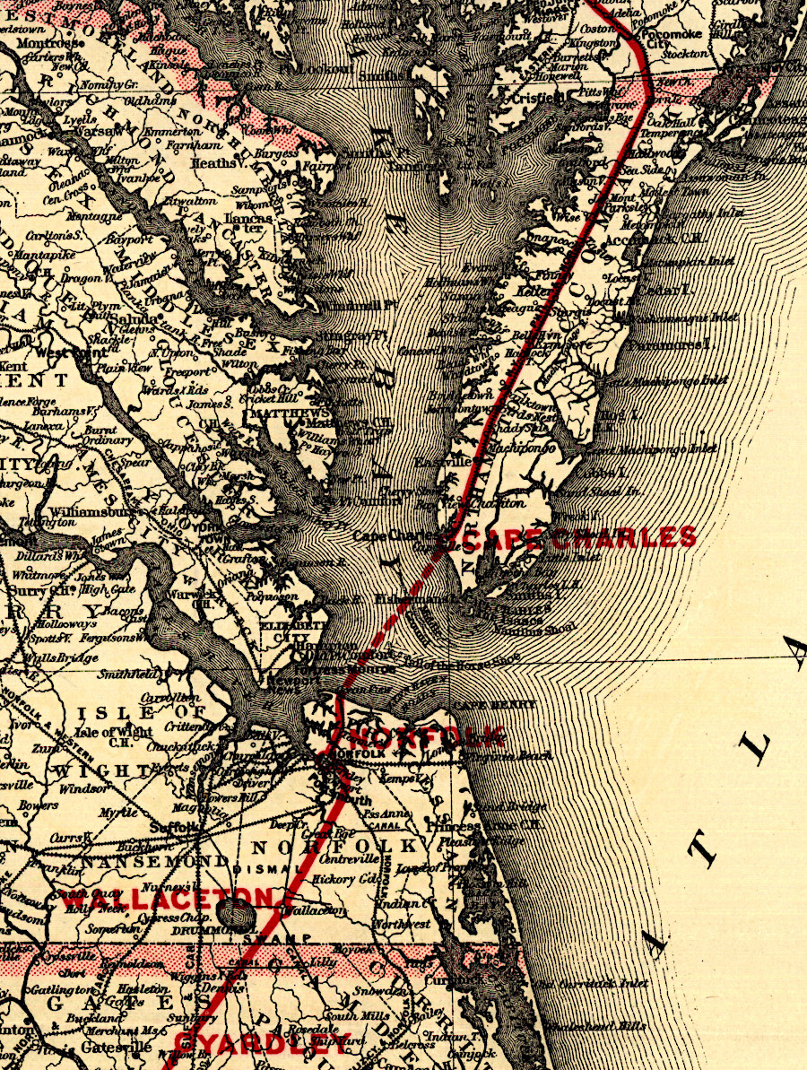
the Norfolk, Wilmington & Charleston Railroad was a speculative proposal in 1891 to connect existing rail lines and build new track from the Eastern Shore to South Carolina
Source: Library of Congress, Map showing the Norfolk, Wilmington & Charleston Railroad (1891)
The railroad started providing passenger ferry service from Cape Charles to Norfolk, stopping at Fort Monroe, in 1884. It began barging freight in loaded rail cars across the Chesapeake Bay in 1885, so later the passengers in Pullman cars could stay inside until reaching the dock. Another passenger ferry business began operating in 1930 from Cape Charles to Pine View, which is now part of Naval Station Norfolk. The Virginia Ferry Corporation, with railroad assistance, absorbed that business and switched passenger service to the wharf at Little Creek starting in 1933.
The town of Cape Charles thrived until passenger cars and trucks replaced use of the railroad after World War II. The Virginia Ferry Corporation moved its Eastern Shore landing from Cape Charles south to Kiptopeke Beach in 1950. The railroad's own passenger ferry service from Cape Charles was abandoned formally in 1953. The last passenger train ran through Cape Charles in 1958. All ferry service from Kiptopeke ended after the Chesapeake Bay Bridge-Tunnel opened in 1964.10
Rail operations on the Cape Charles-Kiptopeke branch continued until abandonment in 1972. The Nature Conservancy purchased the abandoned right-of-way in 1985.
The route used between 1912-1972 was converted into the Southern Tip Bike & Hike Trail, after track between Cape Charles and Kiptopeke was removed. Construction of a 10-wide asphalt trail, fully accessible for the disabled, was completed in phases. The first two, done in 2011 and 2019, resulted in five miles of trail from the Eastern Shore of Virginia National Wildlife Refuge to near Kiptopeke State Park. Two additional phases were planned to extend the trail to the Town of Cape Charles.11
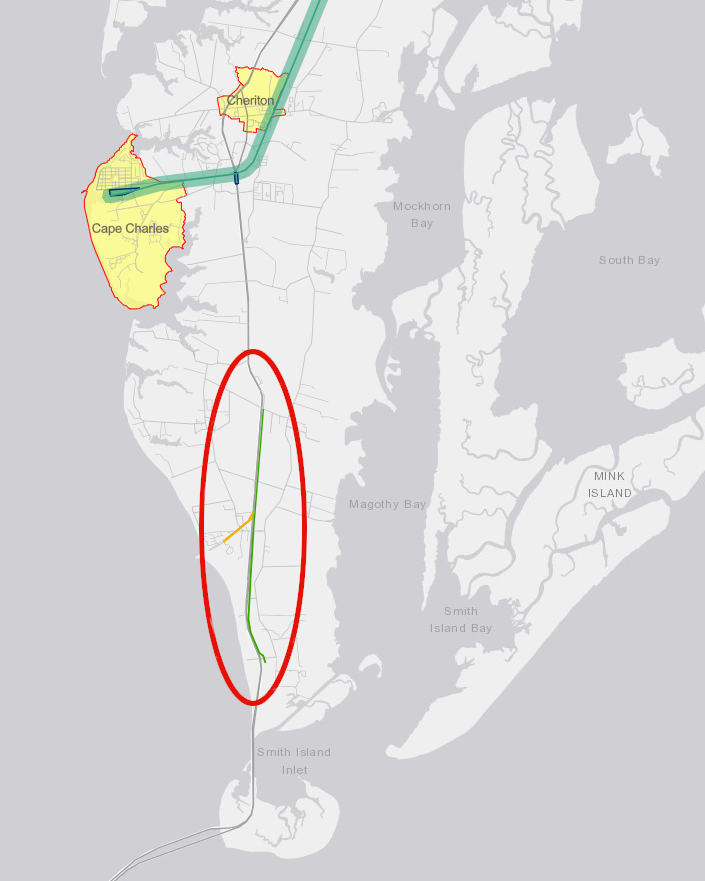
the first two phases of the Southern Tip Bike & Hike Trail linked the Eastern Shore of Virginia National Wildlife Refuge with Kiptopeke State Park by 2019
Source: Virginia Department of Transportation (VDOT), Eastern Shore Rail to Trail Study, Interactive Map of Project Area
The Pennsylvania Railroad merged into Penn Central and went bankrupt in 1970. Conrail, the successor to Penn Central, prepared to abandon the track south of Pocomoke. Northampton and Accomack counties then created the Accomack-Northampton Transportation District Commission in 1976. It arranged for a Class III short line railroad, the Virginia and Maryland Railroad, to replace Conrail's operations in 1977. That arrangement lasted until 1981, when the Accomack-Northampton Transportation District Commission purchased the track and created the Eastern Shore Railroad ("ESRR") to provide service from the Maryland border to Little Creek.
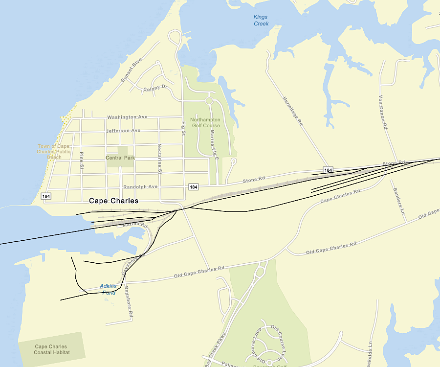
railroad tracks in Cape Charles included sidings to store cars, before loading them on the car float
Source: ESRI, ArcGIS Online
The Eastern Shore Railroad issued stock to raise funds. A private corporation, the Canonie Atlantic Company, acquired the stock, but then the Accomack-Northampton Transportation District Commission purchased the stock of the Canonie Atlantic Company.
Whether or not the railroad track was privately owned after 1985, the two counties controlled the business. One railroad customer and eight members of the Accomack-Northampton Transportation District Commission, four from Accomack County and four from Northampton County became the board members who managed the Canonie Atlantic Company and, through it, the Eastern Shore Railroad.
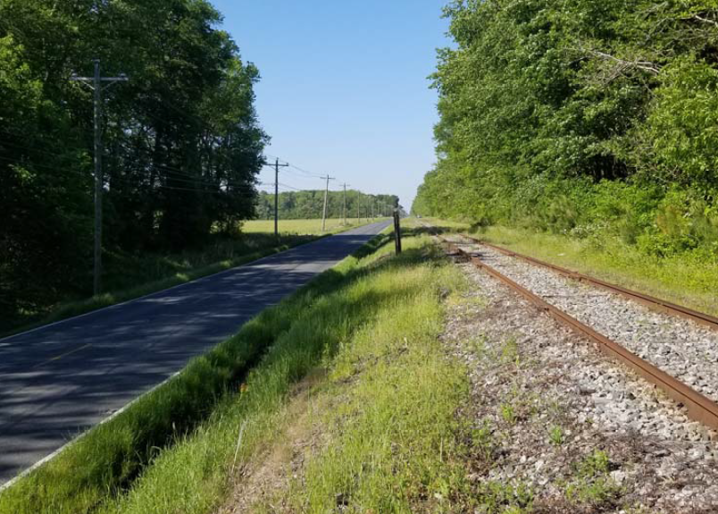
the Bay Coast Railroad track ran parallel to Route 13
Source: Virginia Department of Transportation (VDOT), Eastern Shore Rail to Trail Study - Stakeholder Meeting #3 (June 2020)
In 2005, the counties switched operators again to the Bay Coast Railroad, the common carrier name used for a Class III short line owned by Cassatt Management LLC. That company was named after Alexander Johnston Cassatt, who had been responsible for building the New York, Philadelphia and Norfolk Railroad in 1884.
Through Cassatt Management LLC, the Bay Coast Railroad was owned by the developer of the Bay Creek subdivision, a high-end community located on the south side of the town of Cape Charles. He had a 30-year lease, paying $7,000 per year to Canonie Atlantic Company. When operations ceased, the Bay Coast Railroad owed $264,000 in back taxes for its property in Little Creek.12
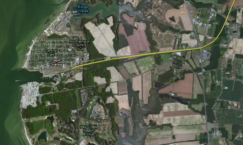
the Bay Coast Railroad (highlighted in yellow) curved from the middle of the Delmarva Peninsula to a carfloat in the Town of Cape Charles, on the Chesapeake Bay side of the Eastern Shore
Source: US Fish and Wildlife Service (FWS), Wetlands Mapper
In 2010, the Bay Coast Railroad stopped operating the car float when structural weaknesses were identified in the barge. Some cargo was carried via truck across the Chesapeake Bay Bridge-Tunnel, in the short run.
At the end of the year, after finding $1 million in funding ($700,000 in state funds and a $300,000 match provided by Accomack and Northampton counties/Bay Coast Railroad), the barge was repaired and the Bay Coast Railroad renewed car float service.13
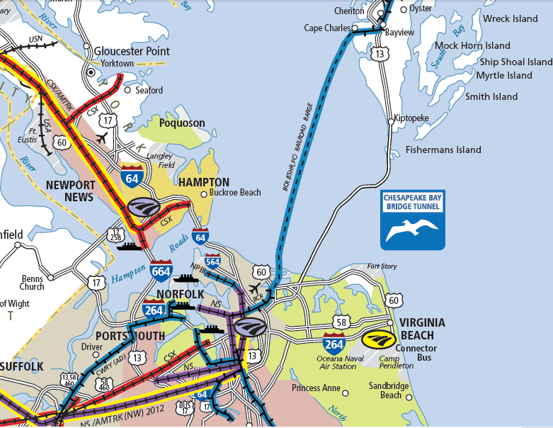
the Bay Coast Railroad once floated rail cars between Little Creek and Cape Charles
Source: Virginia Department of Rail and Public Transportation, Virginia State Railroad Map
The Bay Coast Railroad ceased operations on April 30, 2018, without providing advance notification to the Canonie Atlantic Company. In a quick scramble, Delmarva Central Railroad agreed to extend its operations in Maryland south to Hallwood. The Class III short line, owned by Carload Express, was unwilling to extend 49 miles further south to Cape Charles, since costs to provide service for just a few customers would be excessive.
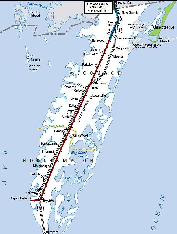
in 2019, the Virginia State Railroad Map showed the track on the Eastern Shore south of Hallwood as "Out of Service"
Source: Virginia Department of Rail and Public Transportation, Virginia State Railroad Map (2019)
The Buckingham Branch Railroad, a Class III short line railroad already operating in Virginia, agreed to provide service on the Little Creek tracks. Neither company was willing to operate the car float.14
In March, just before Bay Coast Railroad ceased operations, the railroad had moved 102 carloads. There were 29 movements on the Eastern Shore; the rest were at Little Creek. The April traffic was similar, moving just 24 carloads on the Eastern Shore and 110 at Little Creek.
Rail service on a small part of the Eastern Shore was restored in May, 2018 on the 15-mile stretch of rail from Hallwood in Accomack County north to Pocomoke City, Maryland. The carload count for Delmarva Central Railroad on that segment in September was just 11 cars.15
The two counties were unable to identify a financially-feasible scenario to maintain rail operations south of Hallwood to Cape Charles. Instead, they chose to convert the abandoned 49 miles of track between milepost 45.7 at Hallwood and milepost 94.8 at Cape Charles into a rail-to-trail project. The official groundbreaking for the Eastern Shore Rail Trail was on May 22, 2025.
When completed, the Eastern Shore of Virginia National Wildlife Refuge at the southern end of the Eastern Shore will end up being connected by a hiking/biking path to Cape Charles via the Southern Tip Bike & Hike Trail, and then by a new trail using the old railroad bed north from Cape Charles 49 miles to Hallwood near the Maryland border.16
One railroad reminder in Cape Charles is not from the railroads that operated on the Eastern Shore. A Pullman car was rescued from the scrapyard of the Norfolk Southern Railroad in Roanoke, and converted at the rail yard of the Roanoke chapter of the National Historical Railroad Society into a three bedroom fishing cabin on wheels. The railroad pulled the car behind a coal trail to Norfolk, and it was barged from Little Creek across the Chesapeake Bay to Cape Charles.
The car, renamed Southern Comfort, served as a vacation retreat on the Eastern Shore for the owners in Roanoke. As Cape Charles redeveloped, the Bay Coast Railroad could no longer provide a place for the car. It was moved to a farm near Cape Charles, to a sit without the glorious waterfront view.17
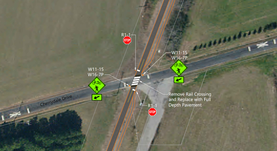
a detailed study identified how to create a bike/pedestrian trail on the old route of the New York, Philadelphia and Norfolk Railroad
Source: Virginia Department of Transportation (VDOT), virtual public information meeting for the Eastern Shore Rail to Trail Study (Typical Crossing I)
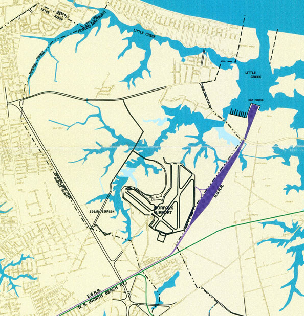
the Bay Coast Railroad (formerly known as the Eastern Shore Railroad) barged rail cars to Little Creek, and the "ESRR" rail line through Virginia Beach connected to CSX and Norfolk Southern railroads
Source: Norfolk & Portsmouth Belt Line Railroad Map
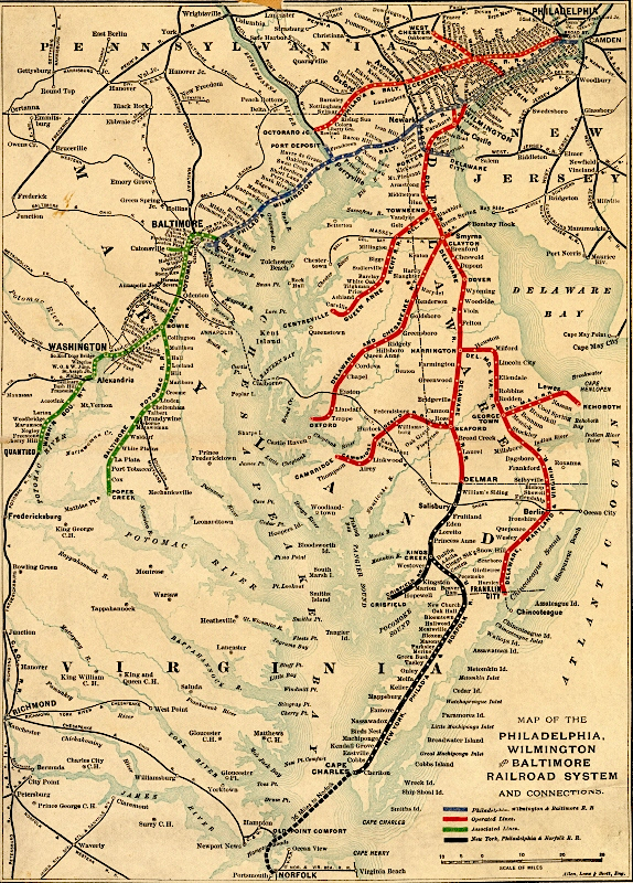
the New York, Philadelphia and Norfolk Railroad was part of a network of lines associated with the Pennsylvania Railroad
Source: Delaware Public Archives, Connecting Delmarva