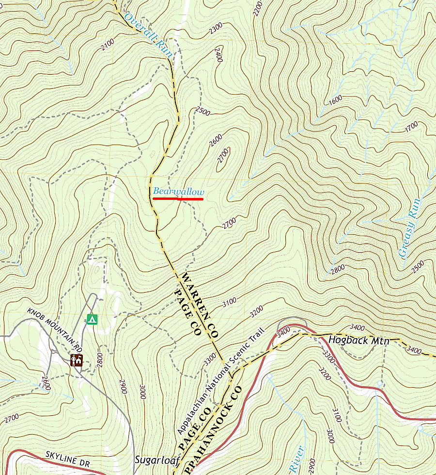
Bearwallow Swamp is in Shenandoah National Park
Source: US Geological Survey, Bentonville VA 1:24,000 topographic quadrangle (2019)
The Geographic Names Information System maintained lists all the places in Virginia labelled "swamp" on the topographic maps produced by the US Geological Survey. By that agency's definition, a swamp is a:1
There are roughly 300 places in Virginia named or classified as "swamps." All but about ten are in the Coastal Plain.
In the Piedmont and higher-elevations of Virginia, water keeps flowing downhill and rarely forms large wetlands labelled "swamp" by the US Geological Survey. Biologists are more granular in identifying natural communities. Places where water accumulates in Montane Depression Swamps, Mountain/Piedmont Seepage Swamps, and Appalachian Bogs are recognized as uniquely valuable habitat.2

Bearwallow Swamp is in Shenandoah National Park
Source: US Geological Survey, Bentonville VA 1:24,000 topographic quadrangle (2019)
Waterfalls are common west of the Fall Line, and swamps are common east of the Fall Line. Flat topography and the presence of water are both essential to the formation of swamps, while waterfalls require topographic relief in addition to water.
As leaves, needles, and other organic materials naturally decay, a sheen can appear on the surface of quiet water in a swamp. The sheen does not necessarily indicate pollution:3

features in Virginia named "swamp" are in the Coastal Plain, except about a dozen (highlighted in yellow)
Source: US Geological Survey, Geographic Names Information System Query - Results for "Swamps" in "Virginia"