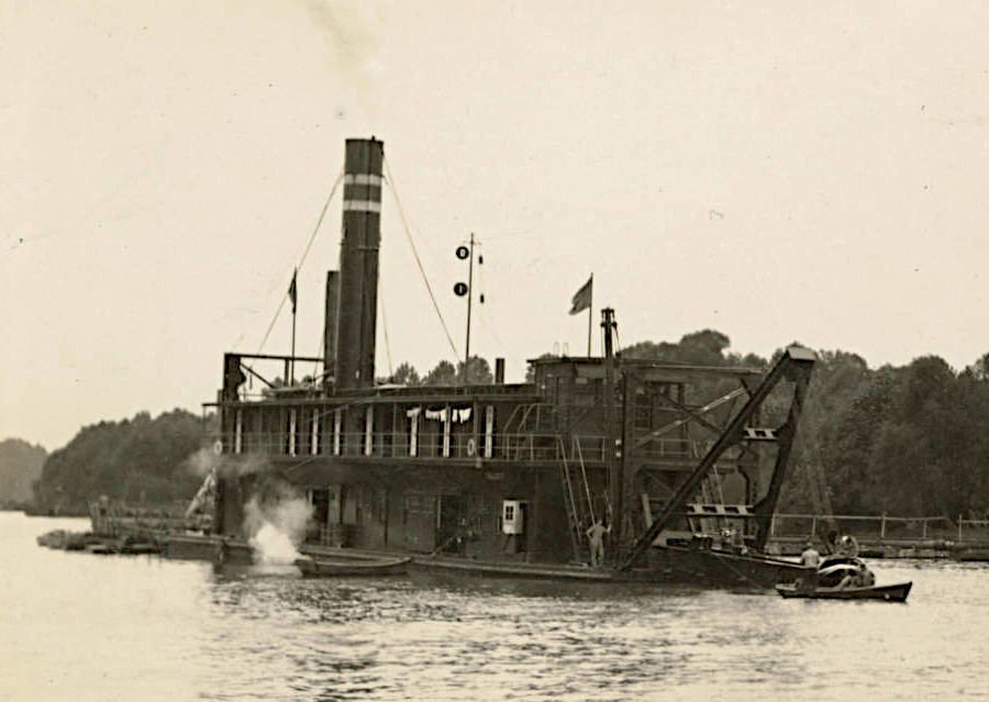
the US Army Corps of Engineers maintains shipping channels in most of Virginia's navigable rivers
Source: US Army Corps of Engineers, 119 US dredge Talcott dredging James River, Virginia (1931)

the US Army Corps of Engineers maintains shipping channels in most of Virginia's navigable rivers
Source: US Army Corps of Engineers, 119 US dredge Talcott dredging James River, Virginia (1931)
Sediment on the bottom of waterways washes into shipping channels, making them shallower. Terminals that serve large cargo-carrying ships arriving at Hampton Roads ports, and also small marinas used just by recreational boats, require that shipping channels to be maintained at a certain depth. The US the Coast Guard will remove channel markers if the depths on navigation charts are no longer accurate.
Specialized dredge ships are used to strip off the sand and clay sediments at the bottom of shipping channels to restore their depth. If the scraped material known as dredge "spoils" are simply scraped out of the channel and piled up underwater at the edge of a shipping channel, the sand and mud will quickly wash back in and refill the channel. Dredged material is treated as a form of waste and hauled away to designated disposal sites.
For small marinas, the material may be hauled to a local landfill. The distance required for transport significantly impacts the costs of channel maintenance projects. If no disposal site is nearby, it becomes too costly to maintain some channels.
By one estimate, each year Coastal Virginia must dispose of 100,000 cubic yards of dredging material. If there is a suitable location nearby and dredge spoils have the right mixture of sand and clay, they may be reutilized for shoreline, beach, and marsh restoration projects. Even with the costs of spreading the dredged material, there may be substantial savings in reduced transportation costs.
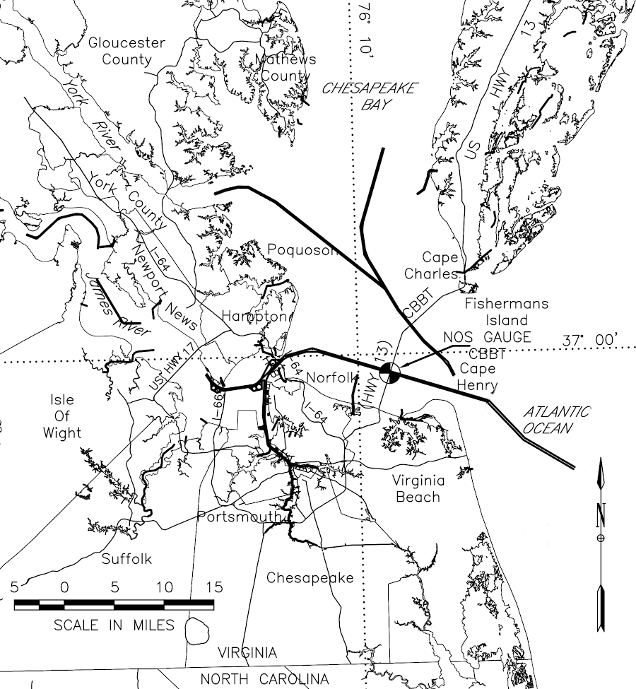
major shipping channels in Southeastern Virginia are maintained by regular dredging
Source: US Army Corps of Engineers, Atlantic Ocean Channel project condition survey of April, May and June 2014, Chesapeake Bay - Atlantic Ocean
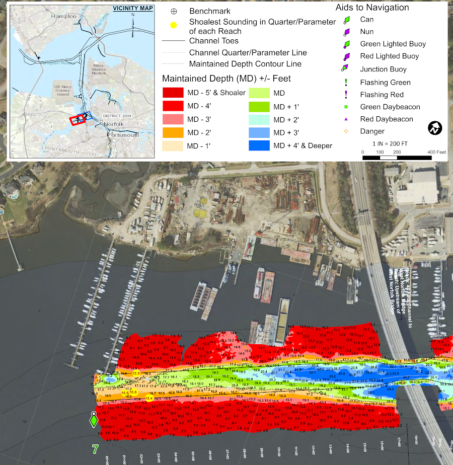
the shipping channel on the Western Branch of the Elizabeth River is maintained at a depth of at least four feet at the West Norfolk Bridge (State Route 164)
Source: US Army Corps of Engineers, Western Branch of Elizabeth River project condition survey
Starting in 2027, the US Army Corps of Engineers plans to use material dredged from the Finney Creek Channel and the Bradford Bay Channel near Wachapreague to restore tidal wetlands on Cedar Island. That will mitigate the loss of marsh habitat caused by erosion on that barrier island.
A hydraulic cutterhead dredge will excavate sediments to deepen the shipping channels, then pump the water and clay/sand through a pipeline and spray it to add a thin layer to the marshes. The Federal government will pay 65% of the $11 million cost of maintaining the shipping channel over the next 50 years.1
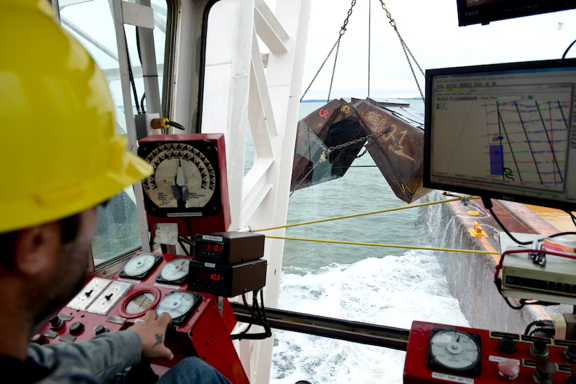
clamshells on specialized ships dig up sediments and deposit them into barges, to deepen shipping channels
Source: Joint Base Langley-Eustis, Dredging readies 7th Trans. Bde. (Ex.) for missions
The Atlantic Ocean Channel (Southern Approach), leading to the mouth of the Chesapeake Bay, is the deepest channel in Virginia. The US Army Corps of Engineers is authorized to maintain its depth at 59 feet mean lower low water, which is the averaged lowest of the low tide each day. US Navy aircraft carriers and commercial container ships transit a shipping channel on the Elizabeth River maintained at 55 feet deep, making Norfolk the deepest port on the Atlantic Ocean in the United States.2
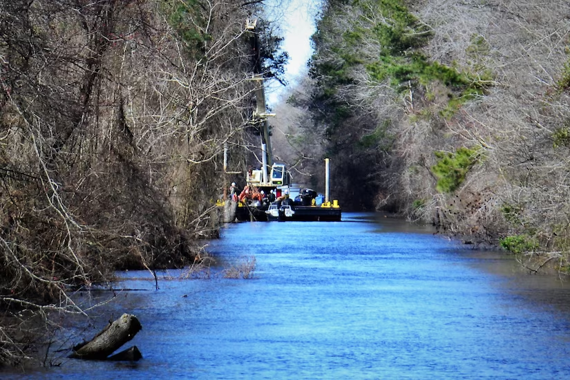
materials excavated from the Dismal Swamp Canal feeder ditch are placed in an adjacent upland placement site
Source: US Army Corps of Engineers, Norfolk District to begin Dismal Swamp Canal dredging (2019)
The largest on-land disposal site in Virginia is the Craney Island Dredged Material Management Area. It was created to stockpile material dredged to maintain Hampton Roads shipping channels.
A 20' deep channel is dredged every five years for ships to traverse the mouth of Skiffe's Creek, in order to reach Joint Base Langley-Eustis' Third Port used by the Army Mariners in the 7th Transportation Brigade (Expeditionary). In 2014, the dredge spoils were barged to the Norfolk Ocean Disposal Site.
In 2022, those spoils were pumped via a pipeline to the Fort Eustis Dredged Material Management Area. The water from the pipeline runs off into Milstead Creek, while some of the dirt is used to raise the height of the berms to as much as 40' high.3
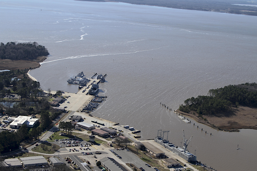
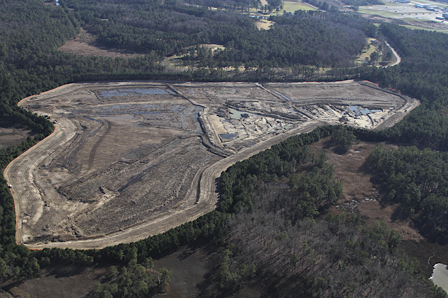
dredge spoils from the Skiffes Creek navigation channel at Fort Eustis Third Port facility are now deposited at the 70-acre Fort Eustis Dredge Material Management Area
Source: US Army Corps of Engineers, Post’s dredge material handling finishes construction (2016)
Underwater disposal sites have been designated along the Atlantic Ocean shoreline. Barging materials to those locations is typically less expensive than on-land disposal. When deepening of the Thimble Shoal Channel, spoils were barged to the Dam Neck Ocean Disposal Site as well as the Craney Island Dredged Material Management Area.4
Maintenance dredging is done every 12 to 15 months to avoid narrowing the channel to terminals at Norfolk and to ensure their depth is not reduced. The channel to Newport News must be dredged every three-four years.5
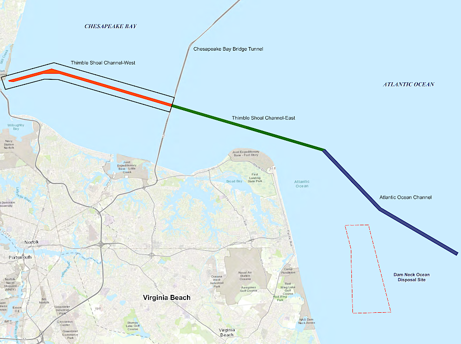
multiple underwater disposal sites have been designated by the US Army Corps of Engineers, including the Dam Neck Ocean Disposal Site
Source: US Army Corps of Engineers, Norfolk Harbor Navigation Operations and Maintenance Project, Thimble Shoal Channel – West – Proposed dredged material Transport, and Placement at the Dam Neck Ocean Disposal Site
The Norfolk Ocean Disposal Site (NODS), also known as the Norfolk Ocean Dredged Material Disposal Site (NODMDS), was officially established in 1993. Based on the 1972 Marine Pollution, Research, and Sanctuaries Act, the Environmental Protection Agency (EPA) is responsible for oversight of potential pollution. The US Army Corps of Engineers and the Environmental Protection Agency update the Site Management and Monitoring Plan every 10 years.
The disposal site is circular, with a radius of four miles and an area of 50 nautical miles. Water depth ranges from 43-85 feet, and the seafloor is relatively flat.
The original purpose of the Norfolk Ocean Disposal Site was to accept silt and clay dredged at Yorktown Naval Weapons Station. In 2013, it received material that was excavated for construction of the Midtown Tunnel between Portsmouth-Norfolk. A year later, spoils from the Joint Base Langley-Eustis were deposited at the Norfolk Ocean Disposal Site. In 2017, the site was used for sediments excavated for the Langley Fuel Pier Replacement Project.6
A nrew approach to beneficial use of dredge spoils is being developed for sediments that have too high a percentage of clay particles and can not be used for beach sand replenishment projects. Using a technique developed originally by the Romans, mud from the York River channel has been used in making concrete.
By substituting sediments for some of the cement, the carbon footprint of manufacturing shoreline rip-rap and oyster restoration platforms could be reduced. A company making concrete ExoForms anticipates that, if the process works on an industrial scale, barriers will cost almost 50% less than transporting concrete or granite from inland quarries. One of the founders of the company noted:7
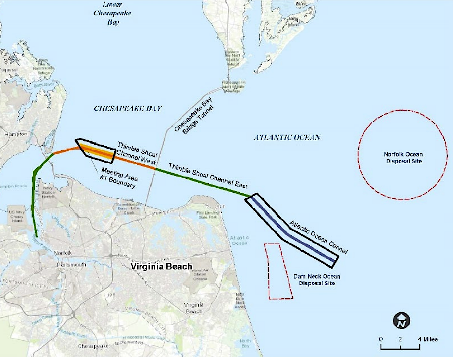
the Norfolk Ocean Disposal Site is outside of the designated shipping channels entering Chesapeake Bay
Source: US Army Corps of Engineers, Norfolk Harbor Navigation Improvements Project, Atlantic Ocean Channel and Meeting Area 1 – Proposed Maintenance and New Work Dredging, Transport, and Placement at the Dam Neck Ocean Disposal Site and the Craney Island Dredged Material Management Area