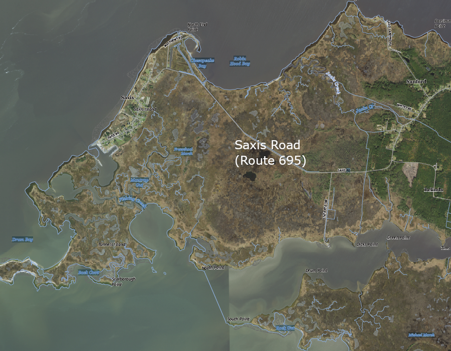
when Saxis Road (Route 695) is covered by high water, Saxis becomes a new Chesapeake Bay island
Source: US Geological Survey (USGS), Saxis VA 1:24,000 topographic quadrangle (2022)

when Saxis Road (Route 695) is covered by high water, Saxis becomes a new Chesapeake Bay island
Source: US Geological Survey (USGS), Saxis VA 1:24,000 topographic quadrangle (2022)
What is now the Town of Saxis in Accomack County was at the top of a sandy ridge 18,000 years ago, with the Susquehanna River flowing in a river valley to the west. As the ice sheet of the Wisconsin glacial advance melted, sea level rose and the Chesapeake Bay formed. Saltwater marshes formed east of Saxis as the lower lands flooded.
John Smith observed the site in 1608, but did not land there in part because of sandbars and shallow water. Saxis has always been perceived by Europeans as an island, despite its physical connection to the mainland. When first patented in 1666 by Robert Sikes and George Parker, it was known as Sikes' Island.
When the boom in oystering and clamming occurred after the Civil War, population at Saxis swelled. At its peak in 1910, there were 636 people there. The economy centered upon collecting shellfish from the Chesapeake Bay and shipping canned food to customers living in Baltimore, New York and other places north of the Eastern Shore.
In 1903, the Steamboat Wharf was constructed. Boats unloaded at the end where the water was six feet deep. Because of the sandy shallows, that was 650 yards west of Saxis. To lower the construction cost, the wharf was not extended eastward all the way eastward to the town; instead, the wharf was built as a transfer station. Large boats requiring water at least six feet deep unloaded oysters, clams, merchandise and passengers at the western end of the wharf. Everything was then moved to the eastern end of the wharf and loaded on smaller boats that were able to navigate in shallow water and transported to Saxis.
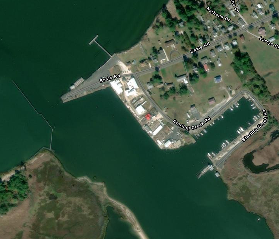
The 1933 hurricane destroyed Steamboat Wharf. During the Great Depression, Saxis residents moved to take shipyard jobs in Newport News and at DuPont facilities in Delaware. As part of the Federal response to the Great Depression, the US Army Corps of Engineers dredged a channel and created an anchorage in Starlings Creek, and in 1938 Saxis Road to the mainland was paved. The road enabled trucks to carry shucked oysters to northern customers after World War II, and to transport softshell crabs today.
Hurricane Hazel hit Saxis in 1954. In 1965, the US Army Corps of Engineers build a new harbor on the north side of Starlings Creek. Hurricane Floyd in 1990 and Hurricane Sandy in 2012 washed away crab houses and residences. Population has declined to 100 current residents, plus another 100 summertime seasonal residents. The Saxis Museum, which opened in 2013 in the former Crockett Store, displays how the 14 general stores once on the island once serviced local residents.1

the US Army Corps of Engineers built the current harbor in 1965
Source: ESRI, ArcGIS Online
Saxis Road (Route 695) still links the Town of Saxis to Route 13 in the middle of the Eastern Shore. The shoreline with the Chesapeake Bay is retreating by nearly five feet per year, and storm surges and rising tides flood the highway once a month where it passes through Freeschool Marsh east of town.
After Hurricane Sandy in 2012, a boat blocked the road. The mayor viewed that storm as a local benefit because funding was provided afterwards to raise houses, dredge the harbor, and build artificial reefs. At least 10 more houses still needed to be raised. A new superstorm might damage the town, but might also provide a new surge of funding for larger culverts on Saxis Road, jacking up more houses, and building more shoreline storm surge barriers.
According to the Resilience Adaptation Feasibility Tool (RAFT), SAXIS scored 54 on a scale of 100. The Saxis Resilience Implementation Team used it to identify how to communicate evacuation plans and assess who would be staying in town when storms hit.
As sea level rises, Saxis Road and the marsh through which it passes will be drowned. The town will be isolated as a new island surrounded by water. One resident compared the height of Saxis, and thus its future, to other Chesapeake Bay islands:2

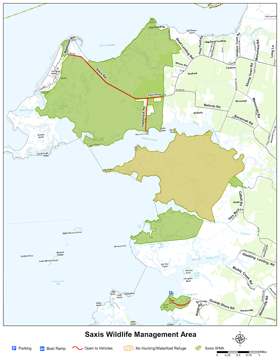
the Michael Marsh section of Saxis Wildlife Management Area is closed to hunting
Source: Virginia Department of Wildlife Resources, Saxis Wildlife Management Area