Fairfax County was carved out of Prince William County in 1742. The first county seat was near Tysons Corner, from which Courthouse Road connected to the port at Alexandria.1
The county was reduced in size in 1757, when Loudoun County was created with a courthouse at Leesburg. In 1798, the boundary was changed to accommodate residents west of Difficult Run. They traveled to Alexandria rather than Leesburg to sell farm products, and preferred to do business and engage with others at the Fairfax County courthouse. The General Assembly moved a slice of Loudoun County between the mouth of Sugarland Run and Difficult Run back into Fairfax County.2
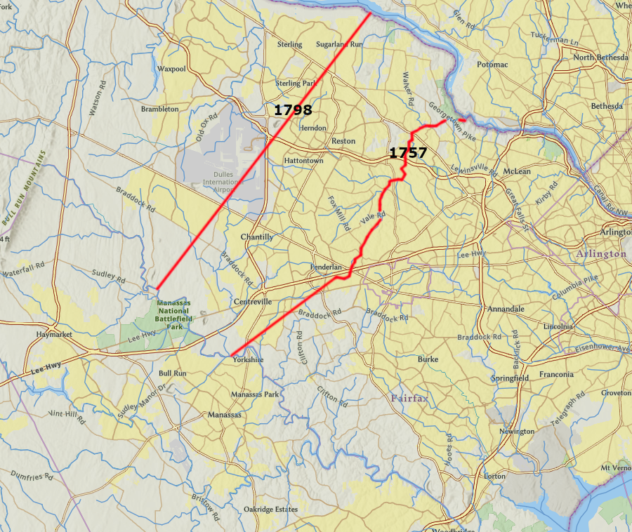
in 1798, land between the mouths of Difficult Run and Sugarland Run was returned to Fairfax County
Source: ESRI, ArcGIS Online
Fairfax County had to move its courthouse in 1800, when 32 square miles with the courthouse and the port of Alexandria were transferred to the Federal government to become part of the District of Columbia. In 1799, Fairfax County acquired four acres on a hill in the middle of the reshaped county from Richard Ratcliffe.
Fairfax County built its new brick courthouse on that hill, and Ratcliffe sold lots and built a tavern to accommodate people coming to court days. The General Assembly chartered the new town of Providence at the new courthouse in 1805.
The all-brick Fairfax County Courthouse was completed in 1802. To improve its appearance, a cupola with a bell was added in 1844.
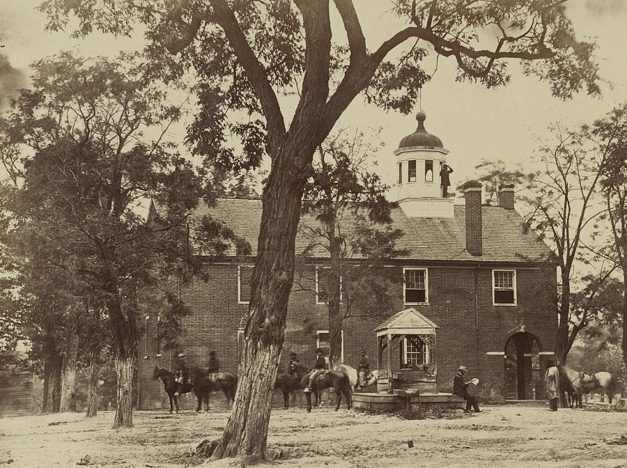
a cupola and bell were added to the Fairfax County Courthouse in 1844, and remain on the building today
Source: Library of Congress, Fairfax Court House, Va. (by Timothy H. O'Sullivan, 1863)
The county seat of Fairfax County could not be falled "Fairfax" at the time. That name was already being used by Culpeper County, the only jurisdiction where George Washington was appointed the county surveyor.
Culpeper County changed the name of its county seat to "Culpeper" in 1859. Town with the Fairfax County courthouse, which was granted a charter by the General Assembly in 1874, was called "Fairfax" then3
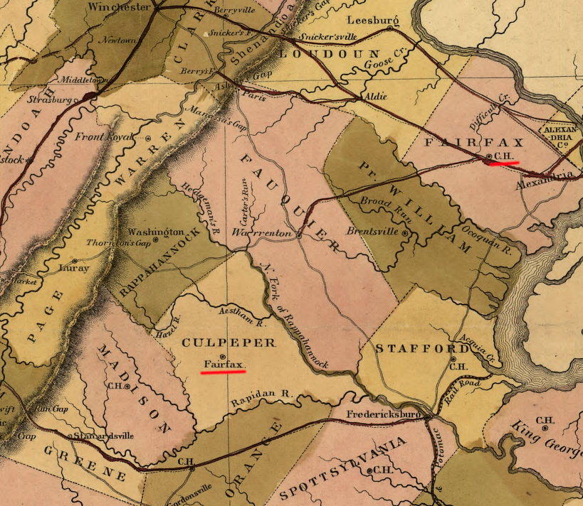
the county seat of Culpeper was called Fairfax until 1859
Source: Library of Congress, A map of the internal improvements of Virginia (by Claudius Crozet, 1848)
Fairfax County ended up acquiring 47.8 acres to build a jail and other administrative structures around the courthouse. When the Town of Fairfax became the independent City of Fairfax in 1961, the city's boundaries were drawn to omit the county's land around the old courthouse. It became a island of county-administered land surrounded by a separate jurisdiction.
In 1969, a 13-story office building was complete to house the expanding administrative offices for the fast-growing county. A new courthouse complex was constructed, along with Adult and Juvenile Detention Centers. The Historic Legato School was moved to the "island."
To accommodate the ancticipated growth in county offices, Fairfax acquired land west of the city and created a new government complex. The Board of Supervisors and most administrative offices moved to Government Center in 1992. The police, fire, and rescue agencies remained in the Massey Building, the 13-story tower that was named after the first county executive.4
A new headquarters for those agencies was completed at Government Center and opened in 2017. The county then proceeded to plan the demolition of the Massey Building, which would not be cost-effective to rehabilitate. One supervisor joked at the dedication of the new public safety building in 2017:5
Source: Fairfax County
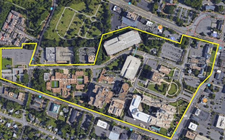
the old courthouse complex for Fairfax County is now a 47.8-acre island completely surrounded by the City of Fairfax
Source: Fairfax County, Massey Complex Master Plan Project
Lorton area, morphing over time
Source: Google Earth Engine
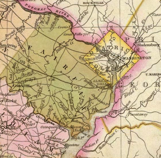
when first created, Fairfax County included land now part of Arlington and Loudoun counties
Source: Library of Congress, A plan of the county of Fairfax on Potomack River the middle of which is in 39°, 12' No. latitude. (by Daniel Jenings, 1748?)
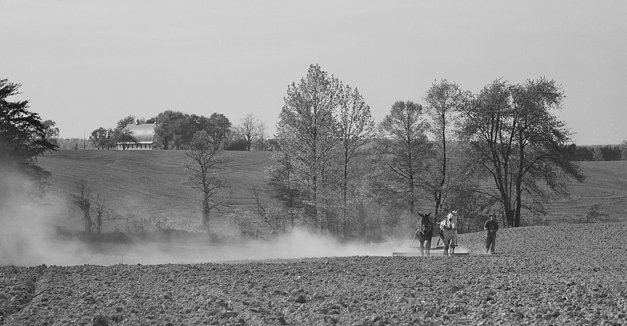
Fairfax County, next to the District of Columbia market, was the highest-producing source of dairy products in Virginia before World War II
Source: Library of Congress, Harrowing cornfield on dairy farm in Fairfax County, Virginia (by Marion Post Wolcott, May 1941)
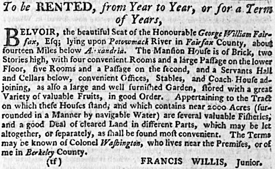
George William Fairfax returned to England in 1773 and George Washington arranged to lease his property at Belvoir
Source: Virginia Chronicle, Virginia Gazette (November 10, 1774, p.6)
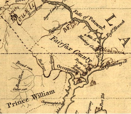
Fairfax County in 1747 (note boundary is Difficult Run)
Source: Library of Congress, A survey of the northern neck of Virginia, being the lands belonging to the Rt. Honourable Thomas Lord Fairfax Baron Cameron, bounded by & within the Bay of Chesapoyocke and between the rivers
Rappahannock and Potowmack:With the courses of the rivers Rappahannock and Potowmack, in Virginia, as surveyed according to order in the years 1736 & 1737
Fairfax County was rural during the Civil War
Source: Library of Congress, A map of the state of Virginia, constructed in conformity to law (Lewis Von Buchholtz, 1859)
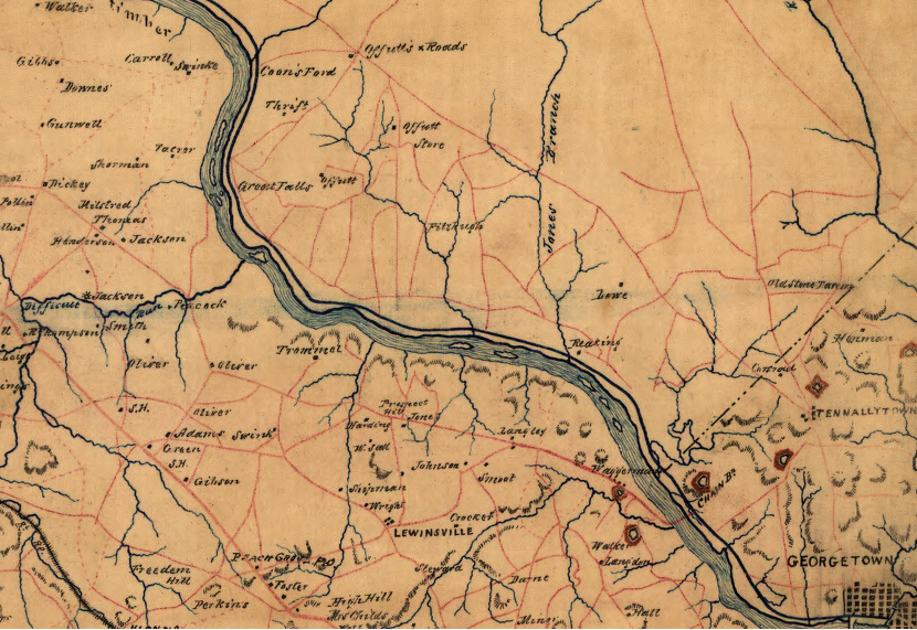
Great Falls area, 1864
Source: Library of Congress, A map of Fairfax County, and parts of Loudoun and Prince William Counties, Va., and the District of Columbia
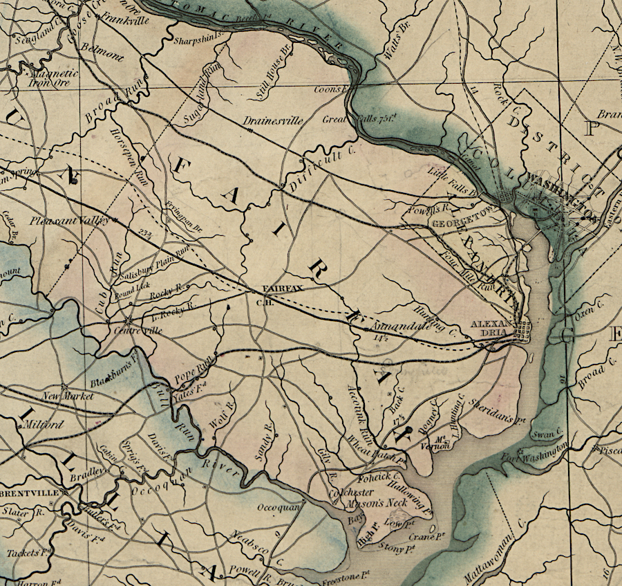
Fairfax County in 1827
Source: David Rumsey Historical Map Collection, A Map of the State of Virginia (Herman Boye, 1827)
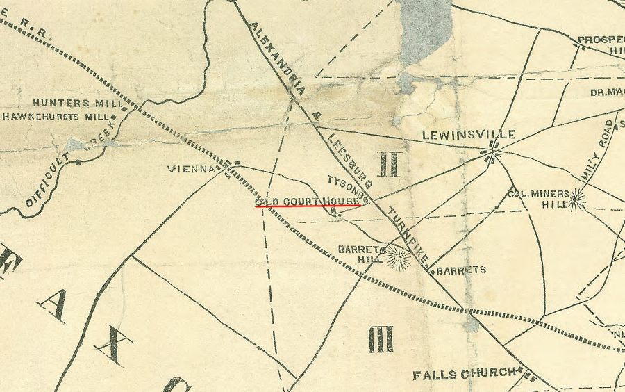
the first (1742) courthouse for Fairfax County was located at Tysons, as recorded on a Civil War map almost 120 years later
Source: Library of Congress, The National lines before Washington (published in the New York Times, 1861)
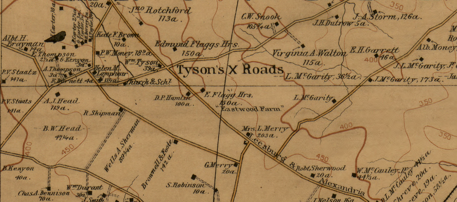
Tysons in 1894
Source: Library of Congress, The vicinity of Washington, D.C. (by G. M. Hopkins, 1894)
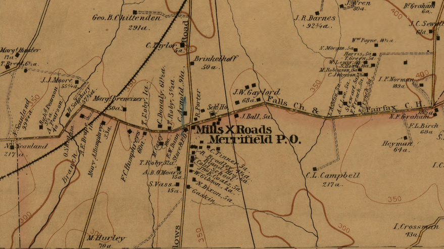
Merrifield/Mosaic District in 1894
Source: Library of Congress, The vicinity of Washington, D.C. (by G. M. Hopkins, 1894)
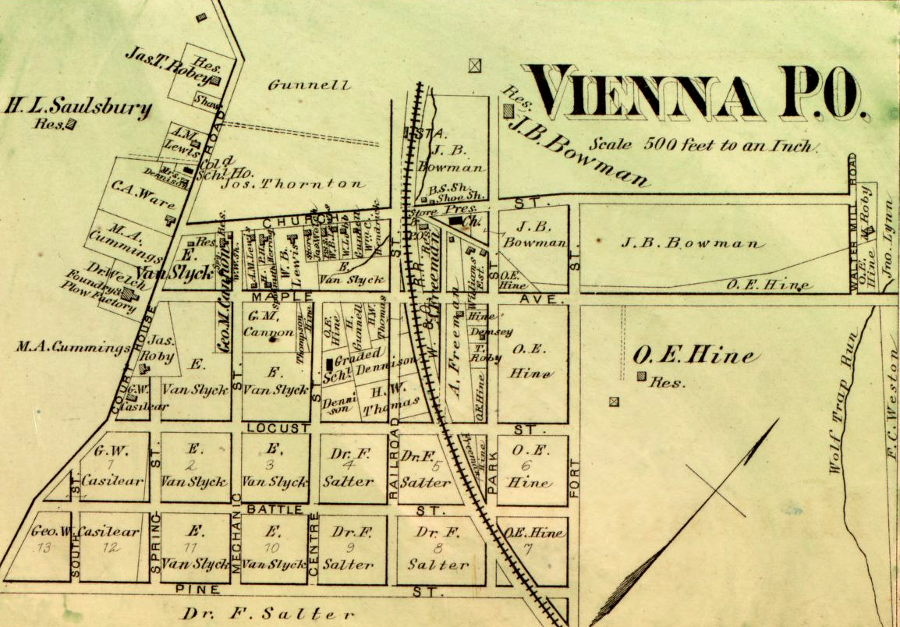
Vienna in 1878
Source: Library of Congress, Atlas of fifteen miles around Washington (by G. M. Hopkins, 1878)
western Fairfax County in 1878
Source: Library of Congress, Atlas of fifteen miles around Washington (by G. M. Hopkins, 1878)
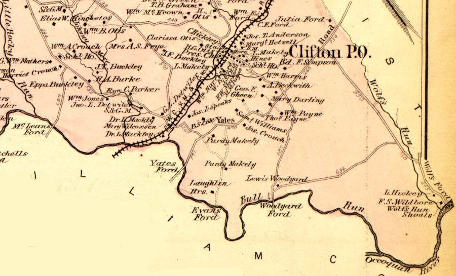
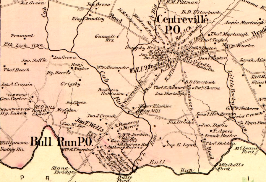
southern Fairfax County in 1878
Source: Library of Congress, Atlas of fifteen miles around Washington (by G. M. Hopkins, 1878)
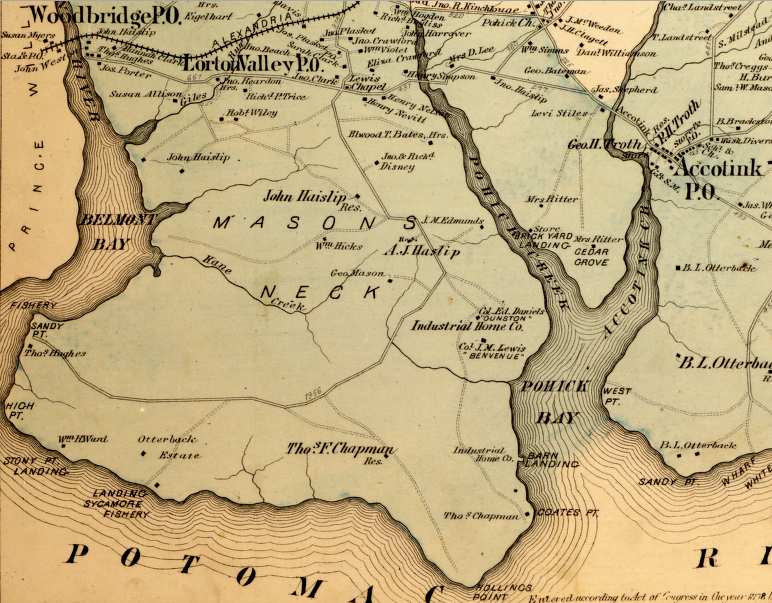
Mason Neck in 1878
Source: Library of Congress, Atlas of fifteen miles around Washington (by G. M. Hopkins, 1878)
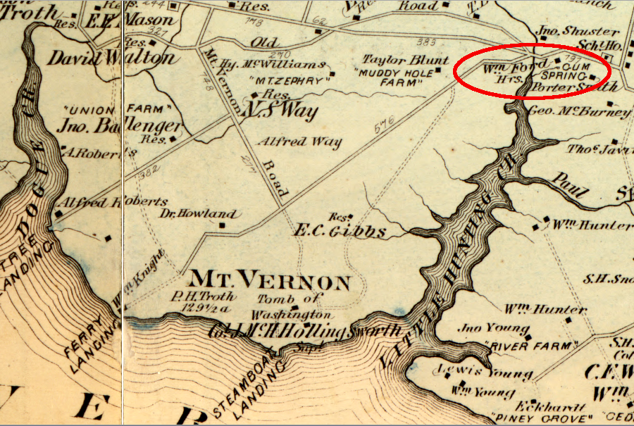
after George Washington's sister-in-law, Hannah Bushrod Washington, freed her slave West, he took the last name of Ford and settled in Gum Spring
Source: Library of Congress, Atlas of fifteen miles around Washington (by G. M. Hopkins, 1878)
Source: WUSA9, Baileys Crossroads; a circus, an inn, and a patriotic anthem
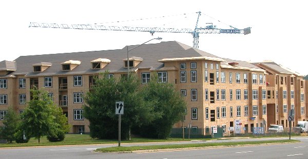
Townhomes at Vienna Metro Station, 2002
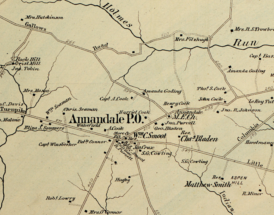
the modern road intersections at Annandale reflect historic road patterns
Source: Library of Congress, Atlas of fifteen miles around Washington (Griffith Morgan Hopkins, 1879)
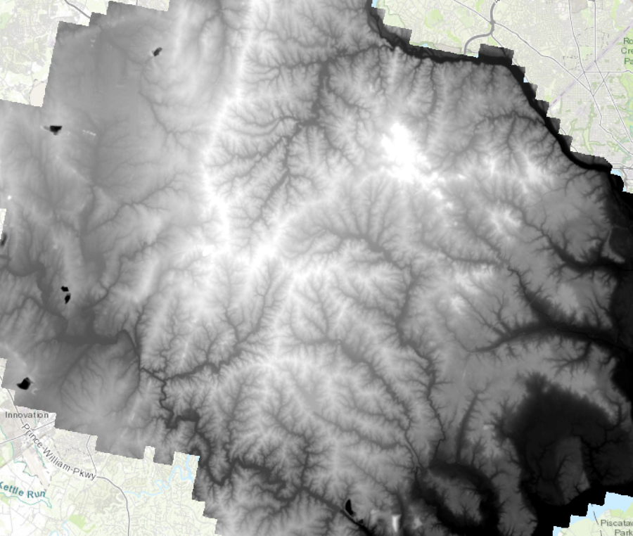
all streams in Fairfax County ultimately flow into the Potomac River
Source: Fairfax County, LiDAR Digital Terrain Model - 2018