Arlington County
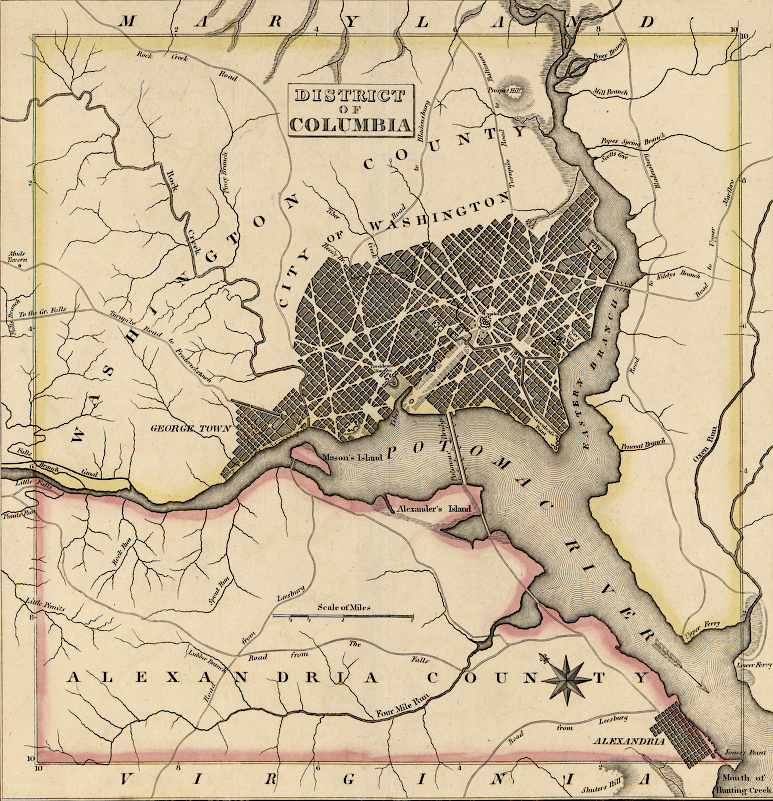
that part of the District of Columbia which was carved out of Fairfax County in 1800 was named Alexandria County, and renamed Arlington County in 1920
Source: Library of Congress, Geographical, statistical, and historical map of the District of Columbia (1827)
In 1800, Virginia gave the Federal government a portion of Fairfax County to create the District of Columbia, implementing part of the bargain made in 1790 to move the national capital to the Potomac River. The cession forced Fairfax County to move its courthouse from the town of Alexandria, leading to the development further inland of what is now the City of Fairfax.
Virginia's contribution to the District of Columbia became Alexandria County, within the District. The Federal government built all of its public buildings north of the Potomac River, and the Alexandria area received few benefits from being part of the District of Columbia. Virginia did not fund public improvements either, since after 1800 Alexandria County was not within the state's boundaries.
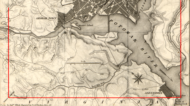
Land speculators still saw potential, especially after construction of Long Bridge spanned the Potomac River. A group of investors from New York platted a city on the southern shoreline of the District. As a marketing ploy, they named their new development Jackson City and got President Andrew Jackson to lay a cornerstone there during a January 11, 1836 ceremony. Only a few structures were developed prior to the Civil War.1
That land was retroceded back to Virginia and Alexandria County, Virginia was created in 1847. Alexandria merchants were finally able to get support from Virginia's Bureau of Public Works to finance turnpikes, canals, and railroads.
When the US Congress abolished the slave trade in the District of Columbia as part of the Compromise of 1850, Alexandria County was no longer part of the District. During the 1850's, the town of Alexandria developed as a major center for the slave-trading business.
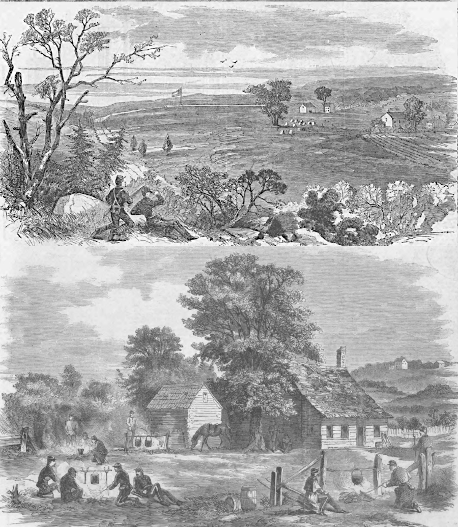
the view from a Federal outpost on Munson's Hill at the start of the Civil War reveals how Northern Virginia was an agricultural area in 1861
Source: Harpers Weekly, The Rebel Steamer "Page" (October 5, 1861, p.629)
During the Civil War, Alexandria County was occupied by Union troops. The Union governor of the Restored State of Virginia, Francis Pierpont, brought the state capital to Alexandria between 1863-1865.
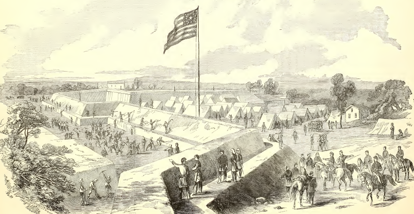
Alexandria County was occupied throughout the Civil War, and Fort Corcoran on Arlington Heights was just one of many military encampments
Source: Frank Leslie's Illustrated History of the Civil War (p.27)
After the Civil War, the US Congress began restricting gambling and prostitution operations in the District of Columbia. The vice trade simply moved across the Long Bridge to Jackson City and the Rosslyn area in Alexandria County. That side of the Potomac River was outside Federal jurisdiction.
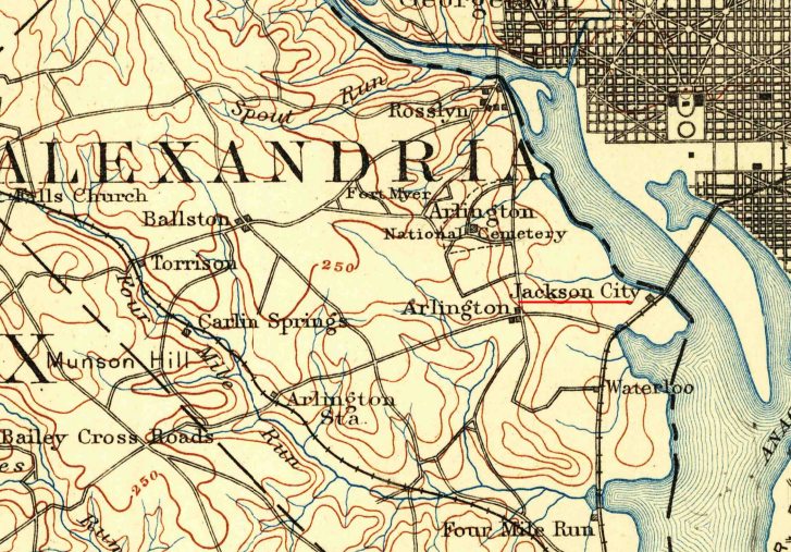
Jackson City attracted gambling and prostitution from the District of Columbia in the 1870's and 1880's
Source: US Geological Survey (USGS), Mt. Veron Quadrangle (1L125,000 scale) (1894)
Local politicians, including the elected sheriff, were corrupted. Jackson City and Rosslyn in Arlington County became infamous in the 1880's as centers of crime, and farmers carting their crops through the area traveled in groups for protection. The Evening Star reported in 1892 that the Arlington County sheriff caught everyone by surprise when he raided a keno house. The few arrests were triggered when the keno operator refused to pay off a bet, and business as usual was re-established as soon as the sheriff's deputies left:2
- Sheriff Veitch and several deputies drove up the road in carriages and left their vehicles not far from one of the notorious gambling dens. No significance was attached to his appearance, as the county officers are about there every day
and have not troubled the places for months.
- An occasional arrest of some petty offender had been made, and that had given evidence of vigilance on part of the officer. But a big gambling place had not been raided for so long a time that a feeling of safety was equal to that
of persons doing a regularly licensed business...
- ...Yesterday afternoon after the raid as made business was suspended about the place for fully fifteen minutes, for the officers remained there that length of time. After that the doors were opened, and when night came on the salooons were brightly lighted up and business flourished as usual.
General Assembly attempts in 1892 to block gambling at Jackson City failed
Source: Chronicling America, Evening Star (January 23, 1892, p.5)
The Alexander Island racetrack offered gambling on horses between 1895-97, while the St. Asaph racetrack closer to the town of Alexandria managed to stay a gambling den for another decade.
In 1895, Governor Charles O'Ferrall included his concerns about lawlessness in his report to the General Assembly, and compared part of Alexandria County to England's penal colony in Australia:3
- From Jackson City to the line of Fairfax County, a distance of five miles, more or less, the laws of this state have been for a long period put at defiance, and that part of Virginia's territory made a typical Botany bay for the criminal and degraded classes of Washington city. There gambling saloons and disreputable houses display their brazen fronts day and night, and every species of crime is committed. The law officers are either powerless, or they wilfully neglect their duty...
- Radical measures must be adopted to relieve the locality of its morally-leprous character...
In 1903 Alexandria residents not allied with Governor Thomas S. Martin's "machine" elected Crandal Mackay as Attorney General (Commonwealth's Attorney) for Alexandria County, with a winning margin of just two votes. Mackay promised reform, but could not rely upon the sheriff's deputies. His solution was to assemble a posse and conduct raids, physically smashing up the gambling dens and houses of ill repute.4
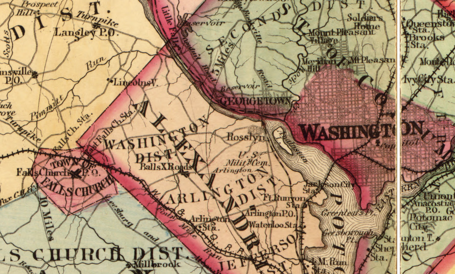
After the 1869 state constitution was adopted, cities were treated as independent jurisdictions, separate from adjacent counties. The original boundaries of Alexandria County, after retrocession in 1847, matched the straight lines surveyed for the creation of the District of Columbia. Subsequent annexations by the City of Alexandria have altered the original straight lines, creating the shape of Arlington County today.
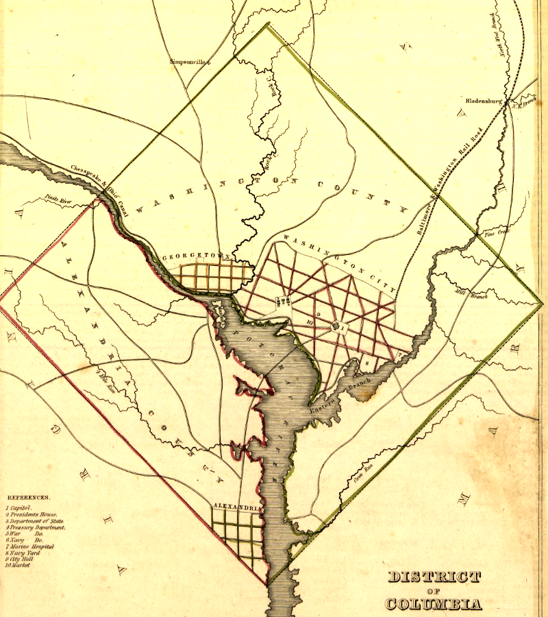
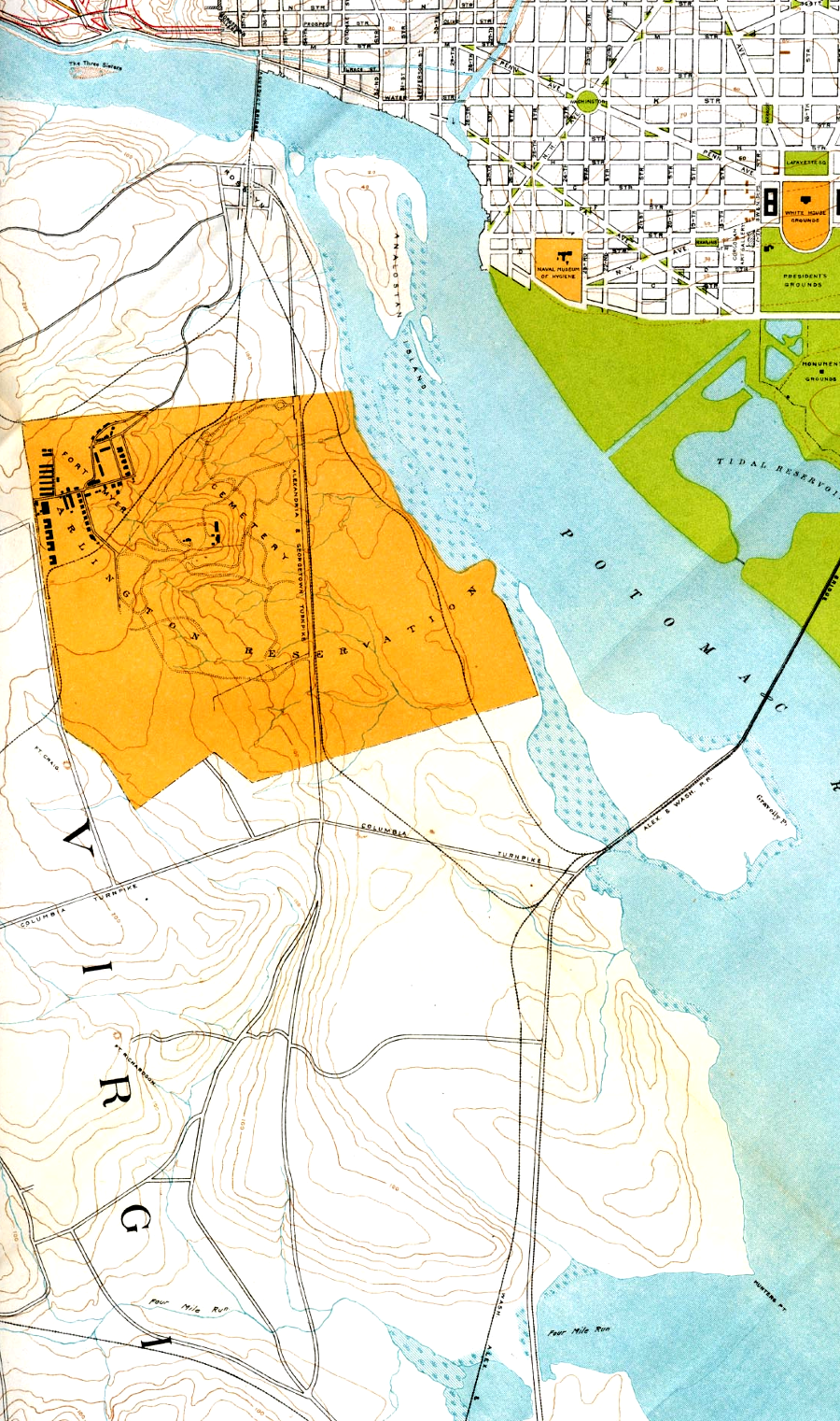
boundaries of District of Columbia defined the borders of Alexandria County, when it was "retroceded" back to Virginia in 1847
Source: Library of Congress, District of Columbia (1835)
It was renamed Arlington in 1920 to avoid confusion with the independent city of Alexandria. Rapid population growth led to development of new subdivisions. In many cases the developers used the same street names. Finding an address on a street named Lee, Washington, Virginia, or especially Arlington required knowing the neighborhood before finding the street.
Arlington County renamed its streets in 1934, after the Postal Service mandated elimination of duplicate names before it would designate a postmaster in the county. That led to construction in 1937 of the first Federal building in Arlington County, the post office in Clarendon.
The Street Naming Committee rationalized Arlington's street names by following a formula. As described by the Arlington Public Library:5
- - The county is divided into two sections, North and South Arlington, generally separated by Arlington Boulevard (US Route 50).
- - Numbered streets generally run east-west, parallel to Arlington Boulevard, and North and South designations follow numbered street names.
- - Named streets generally run north-south, and North and South designations precede named street names. These streets are generally named in alphabetical order from east to west, skipping the letters X, Y, and Z. When the end of the alphabet is reached, it is repeated with additional syllables-- thus Oak and Quinn Streets are to the east of Oakland and Quincy, which are in turn east of Ohio and Quantico Streets.
In 1941, the Post Office ignored geography and gave the new Pentagon building in Arlington County a mailing address of "Washington, DC." When Zip Codes were created to direct mail more efficiently, six associated with Washington, DC were assigned to the offices of the Secretary of Defense, Joint Chiefs of Staff, Army, Air Force, Navy, and Marine Corps (20301, 20318, 20310, 20330, 20350, and 20380).6
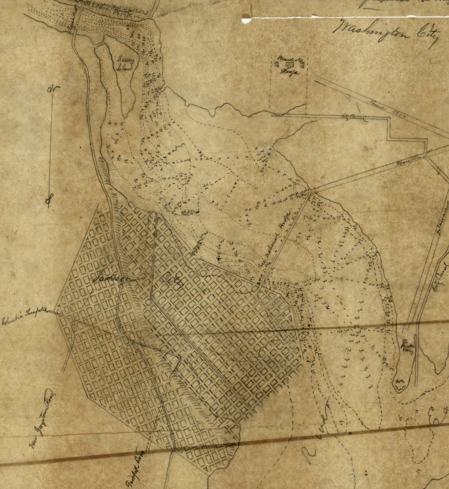
the portion of Virginia ceded to the District of Columbia was undeveloped farmland outside of Alexandria
Source: Library of Congress, Territoire de Columbia (1820)
the Virginia portion of the District of Columbia was known as Alexandria County after it was retroceded to Virginia in 1847, until being renamed Arlington County in 1920 to distinguish it from the independent City of Alexandria
Source: Library of Congress, A map of the state of Virginia, constructed in conformity to law from the late surveys authorized by the legislature and other original and authentic documents (1859)
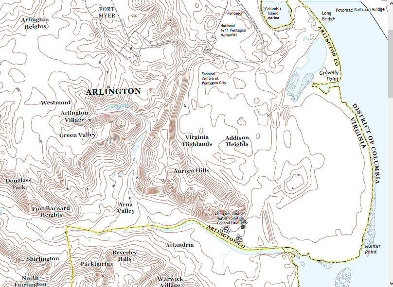
topography of Arlington County
Source: US Geological Survey (USGS), Alexandria, VA-DC-MD (2013)
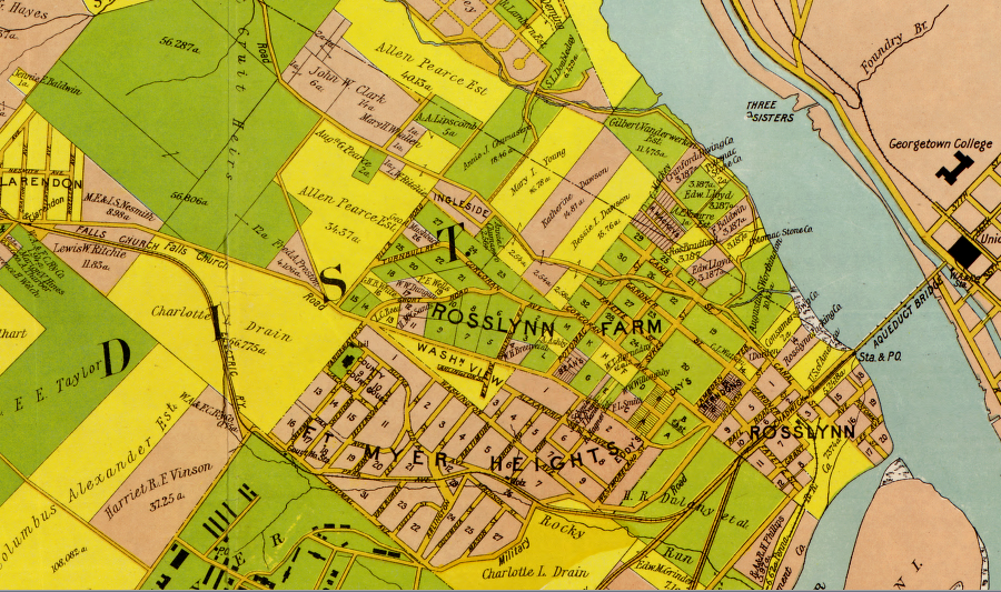
in 1900, "Rosslynn" was a rough neighborhood
Source: Library of Congress, Map of Alexandria County, Virginia for the Virginia Title Co. (1900)
Links
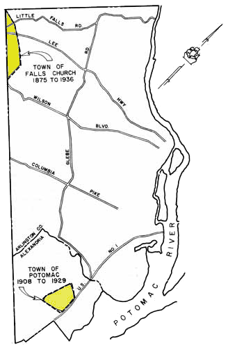
the Town of Potomac disappeared when annexed by Alexandria, and residents in the Town of Falls Church who lived in Arlington County had the boundary altered so they were excluded
Source: A History of the Boundaries of Arlington County, Virginia
References
1. Callum Cleary, "Jackson City: Arlington's Monte Carlo," Boundary Stones blog, WETA, October 6, 2017, https://blogs.weta.org/boundarystones/2017/10/06/jackson-city-arlingtons-monte-carlo (last checked February 13, 2018)
2. "Monte Carlo Raided," Evening Star, October 31, 1892, p.10, https://chroniclingamerica.loc.gov/lccn/sn83045462/1892-10-31/ed-1/seq-10/ (last checked April 2, 2018)
3. "Journal of the House of Delegates of the Commonwealth of Virginia," Commonwealth of Virginia, 1895, p.45, https://books.google.com/books?id=1xwSAAAAYAAJ (last checked February 13, 2018)
4. Callum Cleary, "Jackson City: Arlington's Monte Carlo," Boundary Stones blog, WETA, October 6, 2017, https://blogs.weta.org/boundarystones/2017/10/06/jackson-city-arlingtons-monte-carlo; Jay Roberts, "Jackson City," October 15, 2013, http://jay.typepad.com/william_jay/2013/10/jackson-city.html (last checked February 13, 2018)
5. "Do You Know What Your Street Used To Be Named?," Arlington Public Library, January 15, 2013, https://library.arlingtonva.us/2013/01/15/do-you-know-what-your-street-used-to-be-named-back-pages/ (last checked January 14, 2020)
6. "Do You Know What Your Street Used To Be Named?," Arlington Public Library, https://library.arlingtonva.us/2013/01/15/do-you-know-what-your-street-used-to-be-named-back-pages/; "Facts & Figures: Zip Codes," Pentagon Tours, Department of Defense, https://pentagontours.osd.mil/Tours/facts-zip.jsp (last checked February 17, 2018)
in 1901, there was no I-66 through Rosslyn, no Pentagon, no I-95 or Memorial Bridge, and no airport north of Four Mile Run
Source: University of Texas Perry-Castaneda Library, Map of the District of Columbia, No. D-287, Commission on the Improvement of the Park System, 1901
the Town of Falls Church included East Falls Church in 1878
Source: Library of Congress, Atlas of fifteen miles around Washington (1878)
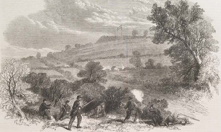
in 1861, Confederates controlled Munson's Hill
Source: Illustrated London News, The Civil War in America: Munson's Hill. With the Earthwork Thrown up by the Confederates in Front of the Union Lines, Virginia (October 5, 1861)
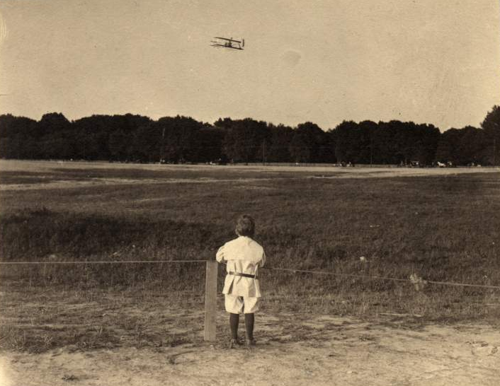
the Wright Military Flyer was tested at Fort Myer in 1908
Source: Smithsonian Institution, Events, 1908, Fort Myer (VA), Wright (Co) Type A Military Trials
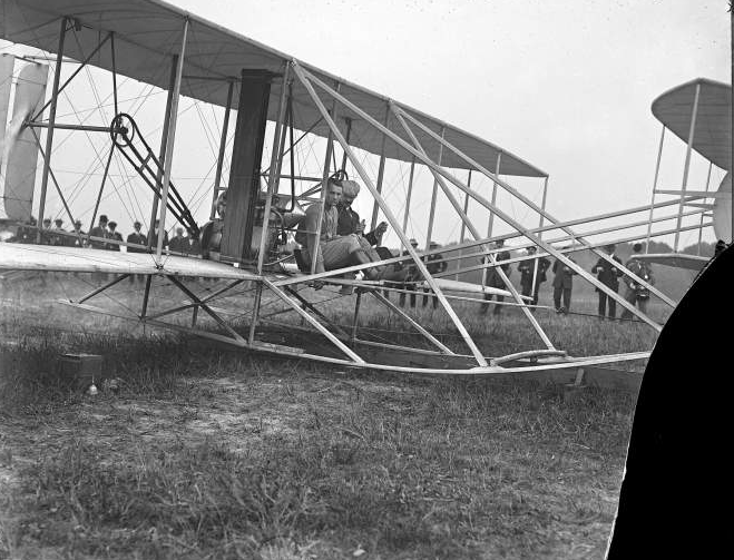
Orville Wright in the Wright Military Flyer at Fort Myer in 1908 with Lt. Thomas Selfridge (closest to camera), taking off just before Selfridge was killed
Source: Smithsonian Institution, Lieut. Thomas E. Selfridge seated in Wright airplane with Mr. Wright at Fort Myer, Virginia, day of accident (cause of Lt. Selfridge's death) - September 17, 1908

Lt. Thomas Selfridge was killed in the first fatal aircraft accident in the US, at Ft. Myer in Arlington County (wing of crashed plane visible on left)
Source: Smithsonian Institution, Unidentified doctors bend over Lt. Thomas Selfridge (lying on ground, legs extending at left) after he was fatally injured in the crash of the Wright 1908 Military Flyer at the Army Trials at Fort Myer, Virginia, September 17, 1908
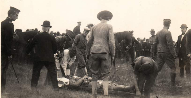
soldiers and civilians gather around Lt. Thomas Selfridge (on stretcher) after he was fatally injured in the crash of the Wright (Co) Type A Military biplane
Source: Smithsonian Institution, Events, 1908, Fort Myer (VA), Wright (Co) Type A Military Trials, Selfridge Crash
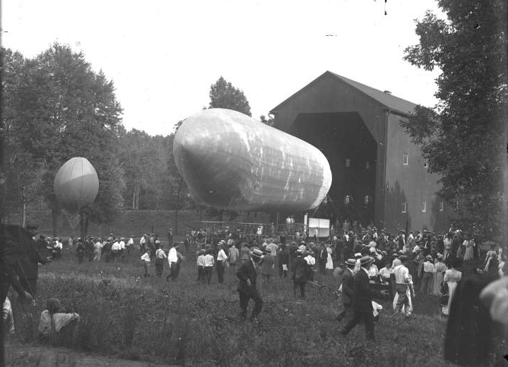
the military used Fort Myer as a base for Signal Corps balloons in 1908
Source: Smithsonian Institution, Events, 1908, Fort Myer (VA), US Army (Baldwin) Airship "Signal Corps No. 1"
Jackson City was platted at the Virginia end of Long Bridge
Source: Library of Congress, Map of Jackson City opposite the city of Washington at the south end of the Potomac Free Bridge (by Joseph M. Toner, 1870's)
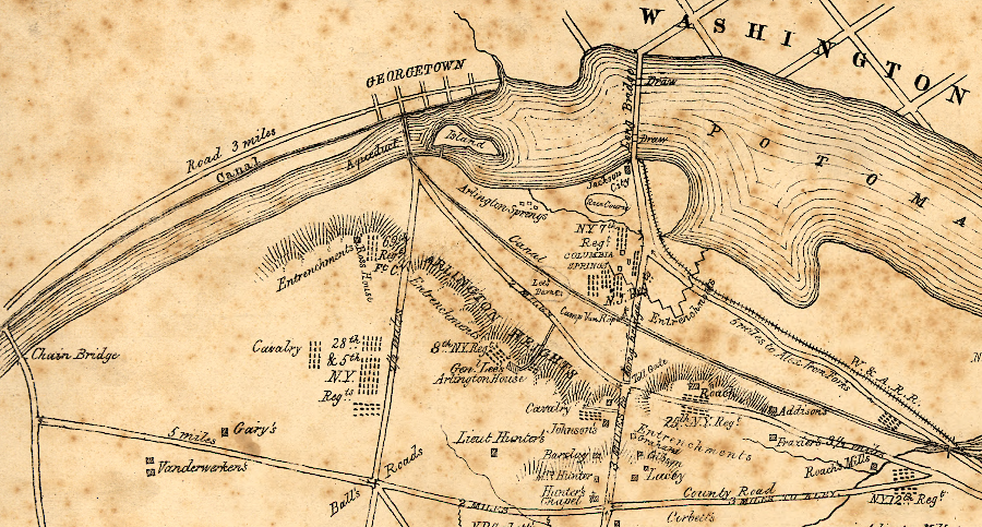
three bridges across the Potomac River connected Alexandria County to Washington, DC in 1861
Source: Library of Congress, Sketch of the seat of war in Alexandria & Fairfax Cos. (by V. P. Corbett, 1861)
Virginia Counties
Virginia Places