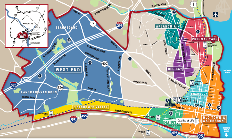
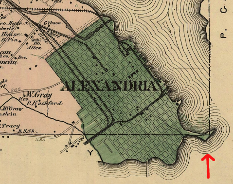
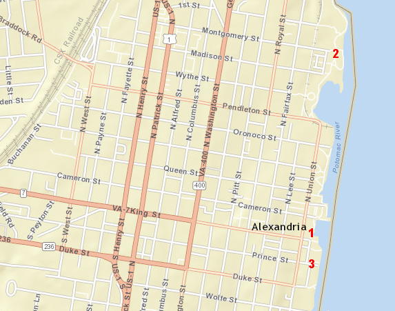
Alexandria's boundaries extend from the Potomac River west past I-395
Source: Alexandria Economic Development Partnership, Alexandria Overview Brochure
Alexandria's boundaries extend from the Potomac River west past I-395
Source: Alexandria Economic Development Partnership, Alexandria Overview Brochure
Alexandria was chartered by the General Assembly in 1749, immediately after a charter for a parallel town at Dumfries was approved. Scottish merchants were the sparkplugs behind the creation of the two new communities; the tobacco warehouses already at those locations were magnets for customers.
Both port cities were given the same set of street names, but the merchants ultimately chose one city over the other. Dumfries faded as a commercial center, in part because its harbor silted in and ocean-going ships found it difficult to reach the Dumfries wharves for loading/unloading cargo. In contrast, the capacity to load ships at Alexandria was improved by filling in the shallow harbor and extending the wharves into deeper water. Two blocks of land have been added to the waterfront, extending today from the back of the Carlyle House to the boardwalk in front of the Torpedo Factory Art Gallery.
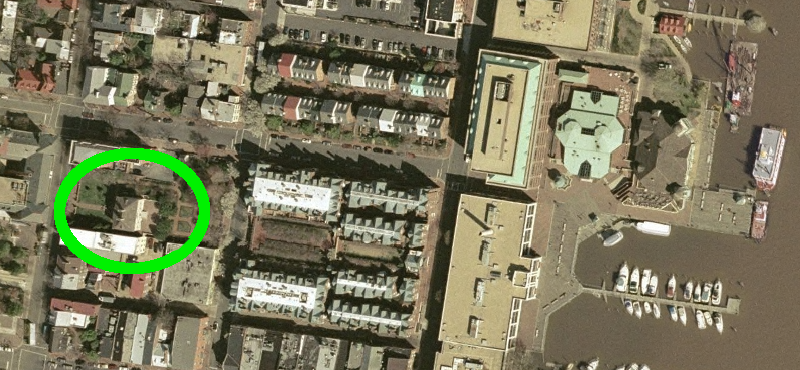
Carlyle House in Alexandria (circled) and extent of land filled to create new waterfront
Source: GIS Spatial Data Server at Radford University
Thomas Carlyle's house was used as General Braddock's headquarters in 1755, as he prepared to march to Fort Duquesne and expel the French from the Forks of the Ohio River. Braddock assembled several colonial governors there to announce his plans, and his need for supplies. His march to the west did not create modern Braddock's Road, though farmers bringing supplies from western Fairfax County may have started using that name for their route to Alexandria.
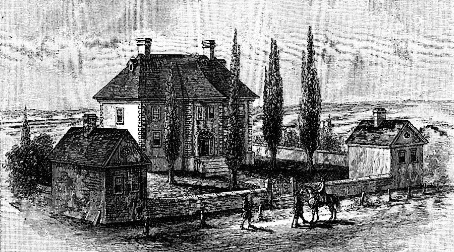
General Braddock used the Carlyle House in Alexandria as his base in the 1755 campaign to expel the French from the Ohio River
Source: Harper's Monthy, Washington As a Burgher (Volume LX, 1879-1880, p.357)
The relationship between Alexandria and the rest of Virginia has been complex at times. Alexandria was once part of Lord Fairfax's "proprietary" land grant. Theoretically, after the initial grant to King Charles II's friends, the area was outside the control of colonial officials to issue land grants.
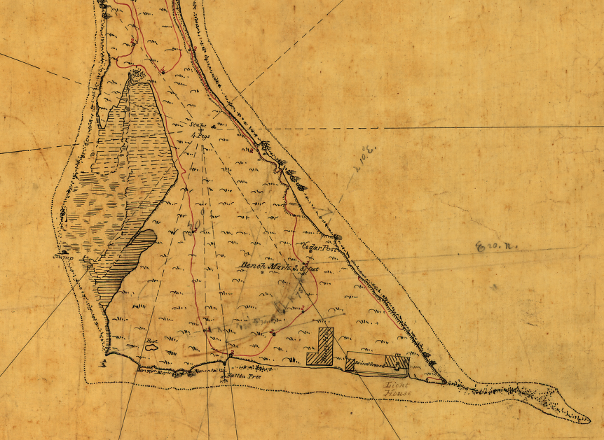
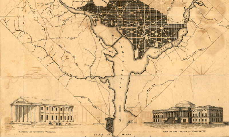
Alexandria was transferred to the District of Columbia when the national capital moved from Philadelphia to the Potomac River in 1800. George Washington had maneuvered to have the developed portion of the Potomac waterfront in Virginia included within the boundaries of the new national capital, under the terms of the 1790 Residence Act. The southern tip of the District boundary was defined by a stone placed at Jones Point.
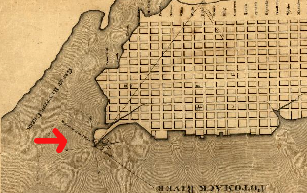
Jones Point, southern tip of DC (before land upstream was filled in for Virginia Shipbuilding yard in WWI)
Source: Library of Congress, Plan of the town of Alexandria in the District of Columbia, 1798 / engrav'd by T. Clarke, New York.
Jones Point, 1878
Source: Library of Congress, Atlas of fifteen miles around Washington, including the counties of Fairfax and Alexandria, Virginia / compiled and published from actual surveys by G.M. Hopkins
Washington may have expected Alexandria to benefit from an expected economic boom, as people moved to the new capital. However, public buildings such as the Capitol and White House were located north of the Potomac River. Alexandria County suffered, because neither Virginia nor DC would use public funds to develop the area.
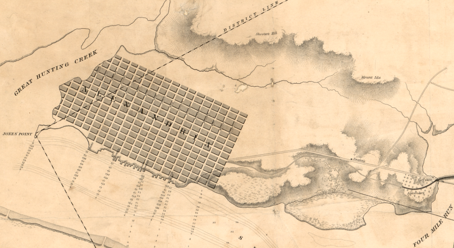
by 1841, Alexandria had expanded across the Virginia-District of Columbia boundary to Great Hunting Creek
Source: Library of Congress, Chart of the head of navigation of the Potomac River shewing the route of the Alexandria Canal (1841)
In 1856, after the retrocession of the Virginia portion of the District of Columbia, the Federal government built a lighthouse at Jones Point. The lighthouse keepers cabin was located adjacent to the stone marking the southern tip of the District, and both structures are still there today.
Jones Point lighthouse, prior to shoreline being altered to create land for a WWI shipbuilding yard
(which converted Jones Point into a peninsula)
Source: Library of Congress, Jones Point, Potomac River, near Alexandria, Virginia / surveyed for the Engineer Department, April 1863

Jones Point in 1864
Source: National Oceanic and Atmospheric Administration (NOAA), Map of the Banks of the Potomac River from Alexandria to Fort Washington, 1864
One economic activity in Alexandria was the slave trade, including the Franklin & Armfield business located at 1315 Duke Street. In the Compromise of 1850, the US Congress banned slavery in the District of Columbia, which was under Federal control.
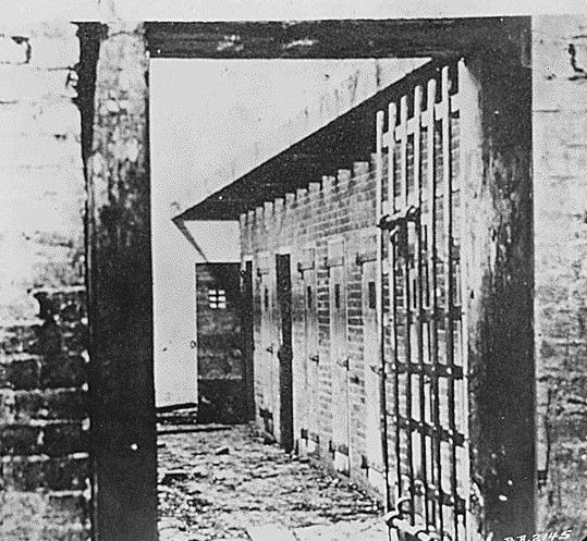
Alexandria was a major slave-trading center with jails to constrain enslaved people, both before and after retrocession
Source: National Archives, Slave Pen-Interior. Alexandria, Virginia
Alexandria and Virginia officials recognized the handwriting on the wall. They agitated in the 1840's to return or "retrocede" the Virginia portion of the District (south of the Potomac River) to Virginia. After a vote on the issue in Alexandria, the territory was returned back to Virginia in 1847.
Had the retrocession not occurred prior to the banning of slavery in DC in 1850, the Federal District could have become a flash point for Virginia slaves trying to escape into the "free" North. Retrocession placed a psychological and physical barrier, the Potomac River, between free vs. slave territory.
Alexandria County, which received minimal investment for construction of public buildings in the District of Columbia
Source: Library of Congress, Plan of the city of Washington and territory of Columbia / engraved by W. & D. Lizars, Edin'r.
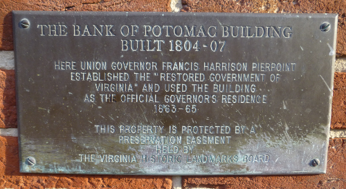
Few Virginians realize that Alexandria was the state capital between 1863-65, at least according to the Federal government based in Washington, DC. When Virginia seceded from the Union in 1861, Richmond became the capital of the Confederate Virginia - but the northern states remaining in the Union did not recognize the new Confederate government.
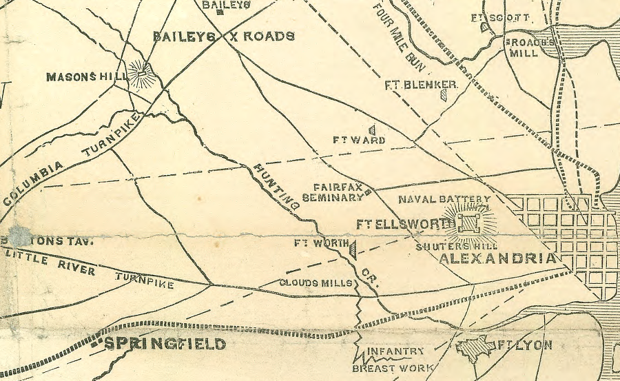
starting in 1861, Union troops built Fort Ellsworth at Shuters Hill plus other fortifications to protect Alexandria and Washington, DC
Source: Library of Congress, The National lines before Washington (published in the New York Times, 1861)
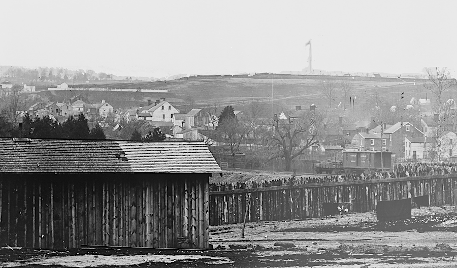
Alexandria was fortified after being occupied by the Union Army on May 14, 1861
Source: National Park Service, Fort Ellsworth, Arlington Line, overlooking Alexandria, Virginia
Instead, a competing "Restored Government of Virginia" was created by the Union sympathizers in Virginia in 1861. Since the old location in Richmond was occupied by Confederate sympathizers, the Union side established the state capital of its version of Virginia in Wheeling, on the Ohio River. That location was far from the slave-owning Tidewater counties, safe from Confederate attack, and easily accessible from the northern states.
There was just one problem: West Virginia became a separate state in 1863, and Wheeling became the capital of the new state. Forty-eight counties now belonged to West Virginia, not Virginia. The governor of the Union version of Virginia, Francis Pierpont, had to leave Wheeling and move back to what remained of Virginia.
After the creation of West Virginia in 1863, there were few locations available within the now-altered boundaries of Virginia for Union sympathizers to locate a capital of the Restored Government of Virginia. The Civil War was still being hotly contested, and it was not clear which side would win.
Not all of the remaining territory of Virginia was controlled by Confederates, however. The Emancipation Proclamation listed the areas under Federal control, and thus "safe" for locating the Union version of Virginia state government until the Federal army captured Richmond. In Virginia, those Federally-controlled areas included the counties of Berkley, Accomac, Northampton, Elizabeth City, York, Princess Ann, and Norfolk, plus the cities of Norfolk and Portsmouth.1
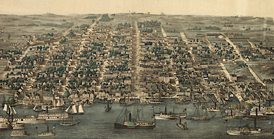
the Union army occupied Alexandria starting on May 14, 1861
Source: Library of Congress, Birds eye view of Alexandria, Va (by Charles Magnus, 1863)
The Eastern Shore was too far away for any government center. Hampton Roads was under military control of the Army, and the control of the military leaders would have limited the authority of any civilian state officials in the Norfolk area.
Governor Pierpont chose to locate the Restored Government in Alexandria, in the shadow of his political sponsors in Washington and in a community protected by a ring of Federal Army forts. Alexandria served as the state capital, with Pierpont operating out of his office at 415 Prince Street as the state governor, until the Union Army finally captured Richmond in April, 1865. At that point, the state government moved south again to the traditional capital, with the capitol building and the Governor's Mansion.
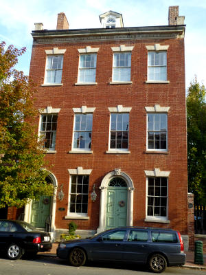
415 Prince Street, site of Governor's Pierpont's office (when Alexandria was the capital of "Restored" Virginia in 1863-65)

Alexandria was a major center for trading slaves prior to the Civil War
Source: National Archives, Slave pen of Price, Birch and Co., Alexandria, Va
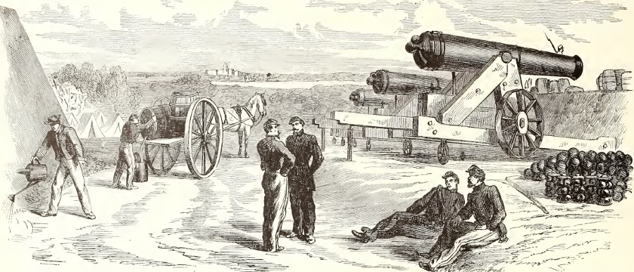
during the Civil War, Union forces built a ring of forts around Alexandria to protect againt Confederate attacks
Source: Frank Leslie's Illustrated History of the Civil War, Section of Fort Runyon, VA., Guarding the Road to Alexandria, Occupied By the Twenty-First Regiment,New York Volunteers, August, 1861 (p.243)
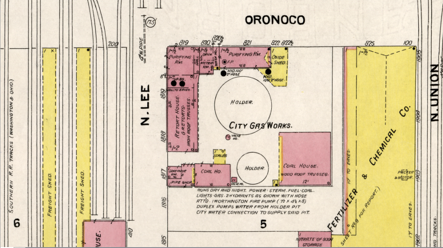
Alexandria Gas Works produced methane from coal
Source: Library of Congress, Sanborn Fire Insurance Map from Alexandria, Independent Cities, Virginia (1907)
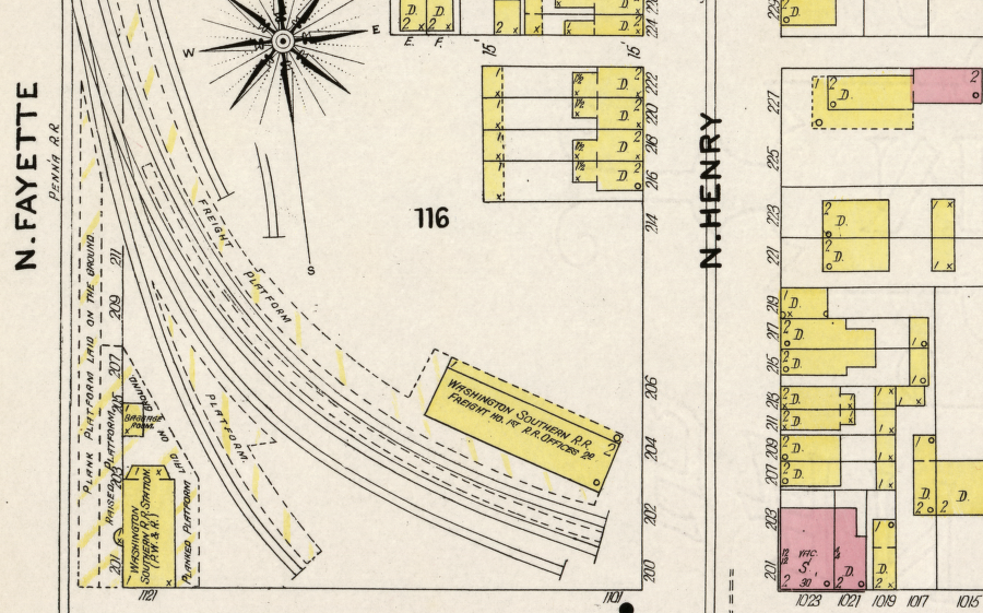
Alexandria railroad station in 1907
Source: Library of Congress, Sanborn Fire Insurance Map from Alexandria, Independent Cities, Virginia (1907)
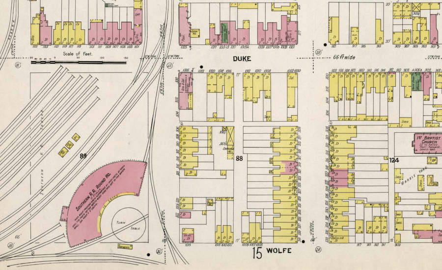
the Southern Rainway roundhouse was located on Wolfe Street, between Fayette and Henry streets
Source: Library of Congress, Sanborn Fire Insurance Map from Alexandria, Independent Cities, Virginia (1907)
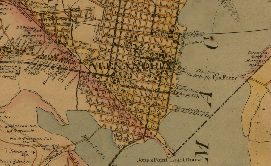
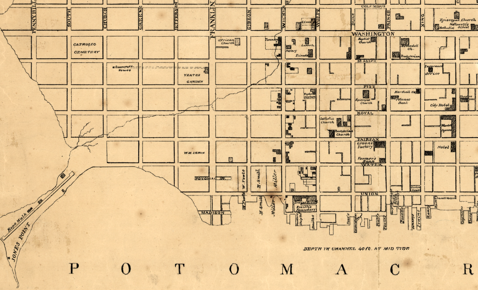
Alexandria waterfront in 1894
Source: Library of Congress, The vicinity of Washington, D.C. (by G. M. Hopkins, 1894)
Alexandria finally boomed again after World War I. As the Federal government expanded during the Great Depression, World War II, and the Cold War, demand for housing increased. The Alexandria Water Company built Lake Barcroft to supply drinking water to the city in 1915, then switched to the new and larger Occoquan Reservoir in 1950.

Lake Barcroft and Alexandria, 1942
Source: Library of Congress, Esso pictorial guide to Washington, D.C., and vicinity : 1942.
The city also annexed land from Alexandria/Arlington County. The western boundary, once at First Street, ended up at Four Mile Run.
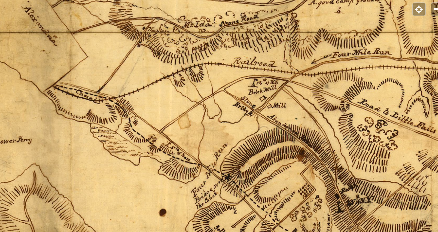
at the start of the Civil War, Alexandria's boundary was near modern First Street rather than Four Mile Run
Source: Library of Congress, Reconnaissance in advance of Camp Mansfield (186__)
Gentrification finally converted most low-cost housing into expensive townhomes/condos between 1970 and 2000. That affected the character of the city, displacing minorities as different neighborhoods were redeveloped. The high costs to buy or rent in the Old Town area limit socio-economic diversity, and redevelopment plans extend all the way to Alexandria's western border.
The Beauregard area, near the Mark Center on I-395, is an inside-the-Beltway suburb of 3-story apartments and townhomes offering 5,000 units of "workforce housing" with relatively low rents. Alexandria has approved a suburban renewal plan permitting development of seven new mixed-use neighborhoods. Half of the existing housing units will be removed, replaced by more-dense development that will generate greater income for the property owners and higher taxes for the city. To mitigate gentrification concerns, the developers have committed to provide 800 affordable housing units. As noted by one land use specialist who also served on the city's planning commission:2
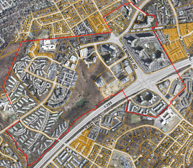
redevelopment of Alexandria's Beauregard neighborhood (shown here before completion of the Mark Center) has triggered debate over the pattern of displacing poor and minorities (gentrification)
Source: City of Alexandria, Beauregard Small Area Plan Boundary Map
As real estate agents constantly repeat, value of property is determined by three things - location, location, and location. What makes Alexandria so attractive? It's not a center of manufacturing. It's not a high-tech community like Silicon Valley. It's a small city... but it's adjacent to Washington DC. Alexandria is ranked 4th in the nation (behind Washington, DC, New York, and Chicago) as the headquarters location for trade associations.3
Alexandria offers a convenient commute to the Federal agencies via the George Washington Memorial Parkway or the Metro (both constructed primarily by funding from the Federal government). The taxpayers and business leaders in Alexandria required a national commitment to build the I-495 interstate highway, a state commitment (with Federal contribution) to build the new Woodrow Wilson Bridge, and a regional commitment in order to build the Metrorail system - but the leaders of Alexandria have always made sure that the city had excellent transportation facilities.
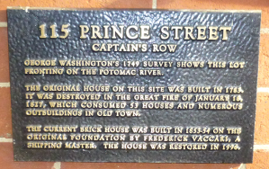
The benefits of a thriving city, linked to the rest of Virginia and in the shadow of the national capital, are reflected in Alexandria's sky-high property values. For example, the historic townhouse at 115 Prince Street is located on a tree-lined stretch of a road laid out in 1749. Today, the pavement on that block ("Captains Row" between Lee and Union streets) is still historic cobblestones rather than asphalt.
The townhome at 115 Prince Street has a basement, which is possible because the edge of the Potomac River has been moved two blocks away as the land on the waterfront was expanded. What today is Union Street used to be part of the Potomac River.
To move into Alexandria today, you have to be prepared to pay dearly for property. The 2013 real estate taxes for that 3,200 square feet townhome on "Captains Row" were $23,000, based on Alexandria's property tax rate and the city's appraisal of property values:4
Appraised Land Value: $615,794
Appraised Building Value: $1,612,901
Total Appraised Value: $2,228,695
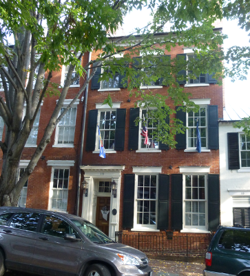
115 Prince Street is located at the former edge of the Potomac River

one block of Prince Street is still paved in cobblestones
Alexandria's plans to redevelop along the waterfront have been as controversial as the Beauregard Small Area Plan. The waterfront was an industrial zone until the 1950's, but today is a mix of parks, cultural sites, restaurants/retail, and high-cost housing. The most obvious example of the transformation is the Torpedo Factory at the foot of King Street, where artists exibit paintings, sculpture, weavings, etc. in a structure once used to manufacture torpedoes for US Navy submarines.
In 2012, after 150 public meetings during three years, the Alexandria City Council approved rezoning the waterfront to permit replacing two warehouses with hotels. Opponents preferred more museums and parkland rather than commercialization of the waterfront. The hotels will replace the Robinson Terminal warehouses, which formerly stored newsprint for the Washington Post.5
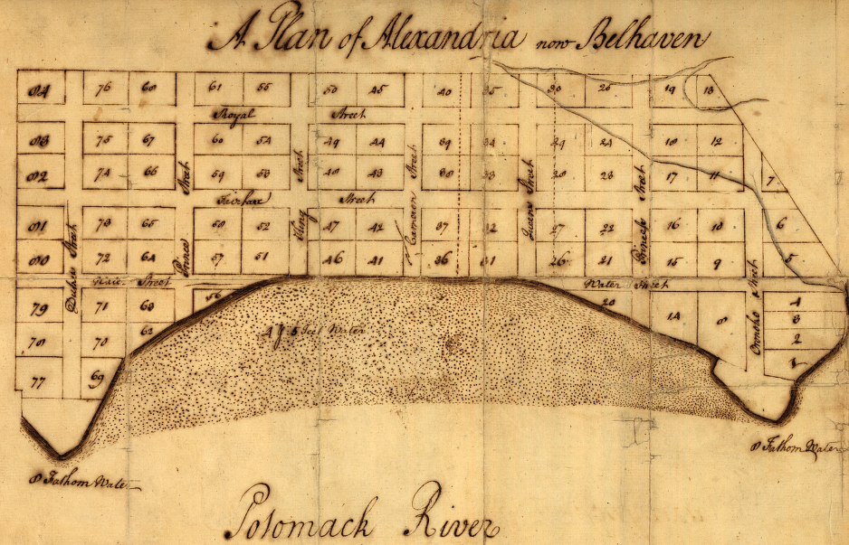
George Washington's 1749 survey of Alexandria shows the earlier edge of the Potomac River
("Water" is now "Lee" street, and 115 Prince Street is on Lot 56)
Source: Library of Congress, A plan of Alexandria, now Belhaven
Increasing public access to the river is a key part of the waterfront plan, but plans to develop a public pier and marina where King Street meets the edge of the Potomac River were delayed by a US Department of the Interior lawsuit. In 1973, the Federal government claimed that land in Alexandria located east of the historic 1791 shoreline was owned by the Federal government, and pressured 34 property owners to allow public access along the Potomac River in exchange for "quieting title" to those claims and resolving ownership.
In 1983, the Federal government blocked a negotiated deal with the Old Dominion Boat Club, which owned a key half-acre lot on the shoreline at King Street. The city would have purchased the land and the boat club would have relocated to other waterfront property at the base of Montgomery Streeet eight blocks away, but Federal officials objected to the development of a new bothouse and marina. The boat club won a court case in 2008 and then the appeal in 2011; the government claim of ownership was flatly rejected.
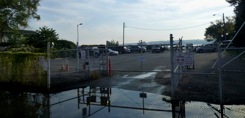
Old Dominion Boat Club parking lot on edge of the Potomac River in 2013
Alexandria then chose to threaten condemnation of the land occupied by the Old Dominon Boat Club, including the club's waterfront parking lot surrounded by a chain link fence. In 2014, a deal was finally settled. Alexandria purchased the 0.5 acre lot for $5 million. It will relocate the Old Dominion Boat Club to the city-owned Beachcomber's Building one block away at the end of Prince Street, and a new marina will be created there. A public plaza, Fitzgerald Square, will be constructed at the boat club's old location on King Street and a continuous public trail will run along the shoreline.6
the 1983 deal to move the Old Town Boat Club from its location on King Street (1) to Montgomery Street (2) was blocked by the Federal government, but in 2014 Alexandria succeeeded in negotiating relocation to Prince Street (3)
Source: ESRI, ArcGIS Online
Alexandria city plan and waterfront, 1862
Source: Library of Congress, Plan of Alexandria (1862)
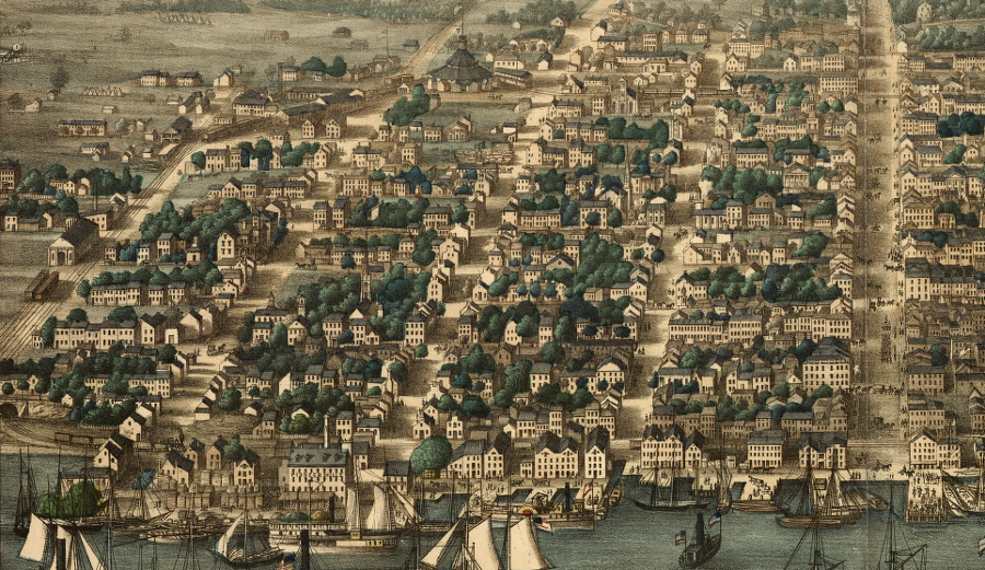
Alexandria waterfront in 1863, from railroad tunnel on Wilkes Street to King Street
Source: Library of Congress, Birds eye view of Alexandria, Va
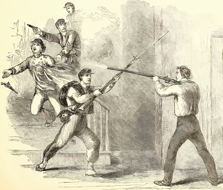
Union forces invaded Alexandria on May 24, 1861, and the colonel of the 11th New York Regiment was killed after tearing down the Confederate flag on top of a hotel on King Street in Alexandria
Source: Frank Leslie's Scenes and Portraits of the Civil War, The Murder Of Colonel Ellsworth At The Marshall House, Alexandria, VA, May 24th, 1861 (p.23)
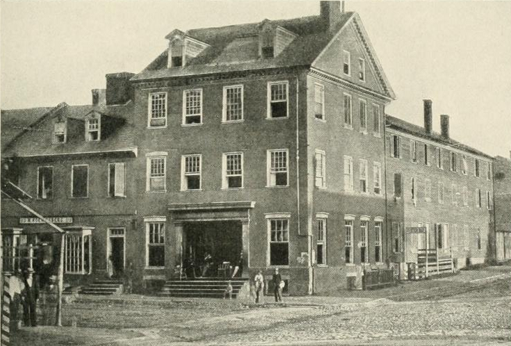
the first Civil War combat death in Alexandria occurred at the Marshall House on King Street
Source: The Photographic History of the Civil War, Marshall House, Alexandria, Virginia, 1861 (p.351)
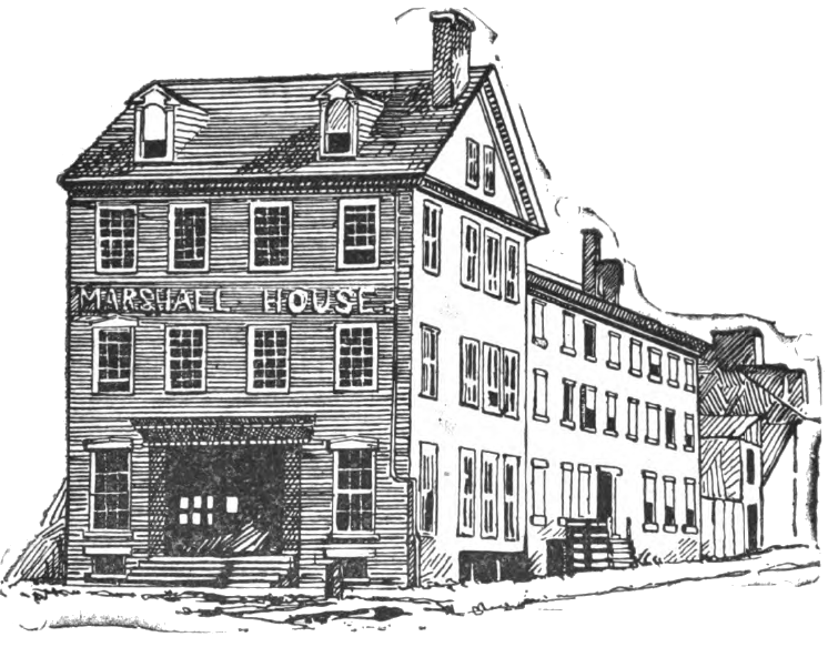
Colonel Ellsworth led the New York Fire Zouaves into the Marshall House to remove the Confederate flag on the roof that was visible from Washington DC
Source: Some Old Historic Landmarks of Virginia and Maryland, Marshall House (p.15)
downtown Alexandria (before new Woodrow Wilson Bridge was built)
Source: GIS Spatial Data Server at Radford University
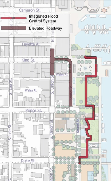
Alexandria is planning for sea level rise between 2.3 to 5.2 feet by 2100
Source: Alexandria Waterfront DRAFT Small Area Plan (Figure 11)
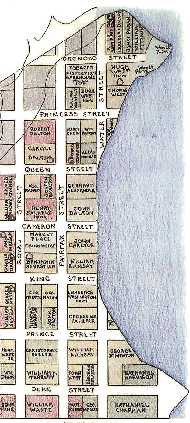
landowners in Alexandria, 1760
Source: Fairfax County, Interpretive Historical Map of Fairfax County Virginia in 1760 (created by Beth Mitchell, edited by Donald M Sweig, 1987)
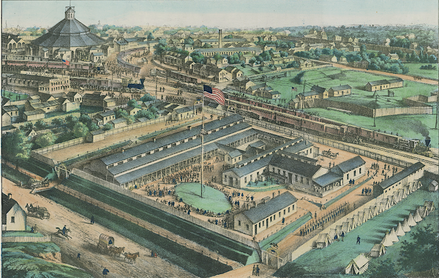
Union troops occupied Alexandria from the first day of the Civil War
Source: Library of Virginia, Alan M. Voorhees Map Collection, Soldiers Rest, Alexandria, Va.: commanded by Capt. John J. Hoff (by Chas Magnus, 1864)
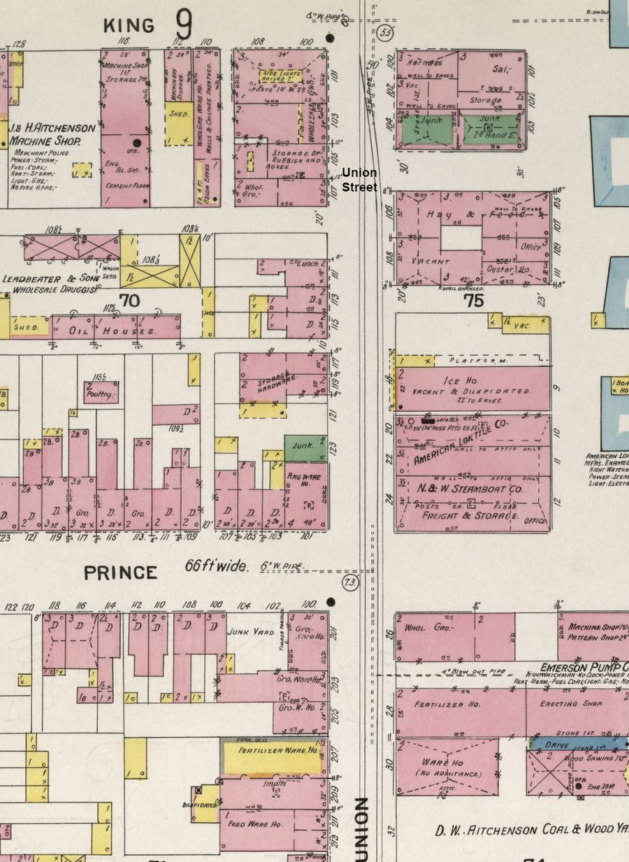
the Alexandria waterfront was industrial in 1907
Source: Library of Congress, Sanborn Fire Insurance Map from Alexandria, Independent Cities, Virginia (Sanborn Map Company, November 1907)