Assateague Island extends from Toms Cove in Virginia to Ocean City in Maryland
(black line indicates Accomack County boundary)
Source: ESRI, ArcGIS Online
Assateague Island extends from Toms Cove in Virginia to Ocean City in Maryland
(black line indicates Accomack County boundary)
Source: ESRI, ArcGIS Online
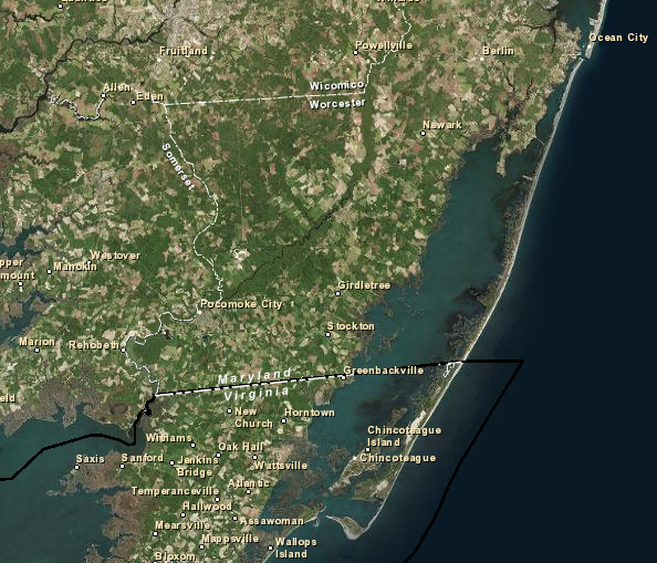
Two Federal agencies manage land in the far northeastern corner of Virginia for conservation and recreational use.
The US Fish and Wildlife Service administers Chincoteague National Wildlife Refuge, and the National Park Service manages Assateague Island National Seashore down to the Maryland-Virginia border. The National Park Service lost an interagency battle within the Department of the Interior to manage the Virginia portion as well as the Maryland portion of Assateague Island, but still maintains a visitor center in Virginia.
Both Federal agencies have to cooperate with local and state officials, who at one time sought to develop Assateague Island into a seashore resort rather than to conserve its natural values. In 1934, the National Park Service identified a dozen possible national seashore recreational areas, and recommended that the:1
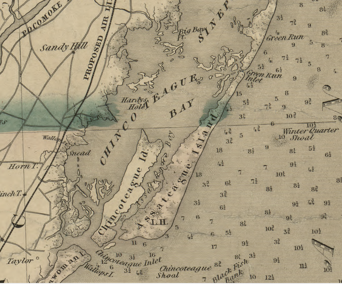
Assateague Island is east of Chincoteague Island, and stretches north into Maryland
Source: Library of Congress, A map of the state of Virginia, constructed in conformity to law from the late surveys authorized by the legislature and other original and authentic documents (1859)
In 1943, the US Fish and Wildlife Service established a national wildlife refuge on the southern end of Assateague Island to protect habitat for snow geese. In the 1950's, private developers subdivided the Maryland portion and built Baltimore Boulevard on the northern end. After the state received a donation of 540 acres for a new park, Maryland built a bridge to Assateague Island to facilitate development of vacation homes there.
Across the border in Virginia, the Chincoteague-Assateague Bridge and Beach Authority had planned a bridge to link Chincoteague and Assateague islands since 1955. That bridge was completed in 1962, but the Ash Wednesday storm that year showed that the flooding risk on Assateague Island was high and vacationers living there in proposed resort subdivisions would be at risk.
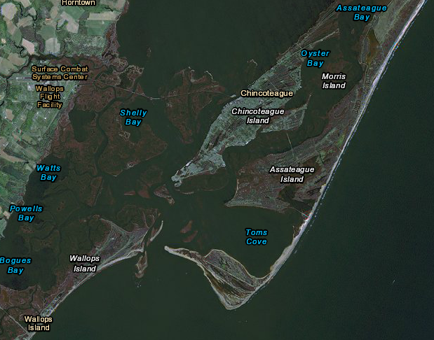
Chincoteague Island is separated by water from the mainland (to the west) and Assateague Island (to the east)
Source: US Fish and Wildlife Service, Wetlands Mapper
In 1963, the Federal government proposed to block development and create a public park, the Assateague Island National Seashore. Under that proposal:2
Maryland Representative Rogers C. B. Morton proposed consolidating all development on the island into three communities, including one at Tom's Cove in Virginia that would focus on a wildlife center and museum. Speculators and landowners in Maryland still opposed the Federal "land grab," and even suggested moving the seashore to Parramore and Hog islands in Virginia.
In 1965 the National Park Service countered with a different proposal, but still supported building a road down the middle of Assateague Island from the Maryland state park almost to the Chincoteague National Wildlife Refuge.
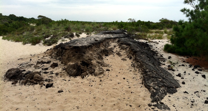
remnants of Baltimore Boulevard, built in the 1950's to facilitate development on Assateague Island south of Ocean City inlet but severely damaged in the 1962 storm
The extent of that proposed road became a key part of the debate. Some Virginia officials interested in maximizing economic development (especially jobs from new home construction and visitor services) proposed the road should be extended all the way to link the bridges in Maryland and Virginia, even at the cost of disrupting the refuge's waterfowl habitat:3
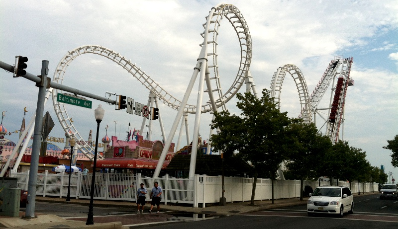
modern-day Baltimore Avenue at Ocean City, on Fenwick Island north of inlet, shows how Assateague Island could have developed
Conservationists and the US Fish and Wildlife Service opposed building the extension of Baltimore Boulevard south to Virginia. The National Park Service postponed requests for funding the road. After tourism-based businesses on Chincoteague Island reached a critical mass, they began to fear that the road though Assateague Island would siphon off tourists and facilitate competition from potential new development on Assateague Island.4
Once the business interests joined the opposition, the road project was dead. However, the desire to allow travel by over-the-sand motorized vehicles helped to block designation of any wilderness on Assateague Island.5
The beach on Assateague Island is a major attraction to tourists. For decades, the National Park Service maintained a parking lot for beach access that was close to the Atlantic Ocean. However, as the shape of the island changed and the southern end of Assateague moved westward 10-13 feet per year, the lot was flooded more regularly. Maintenance costs climbed to $400,000 annually, and in the two decades since 2003 the Federal agency spent $15 million to keep the lot open.
The mayor of Chincoteague said in 2024:6
The Assateague Island National Seashore designed a new gravel parking lot with space for 961 vehicles, same as the existing lot, at a new location 2.5 miles to the north. The opening was planned for 2025, with construction to be finished in 2026. The plan included eliminating the Toms Cove Visitor's Center, managed by the National Park Service. Visitor services would be relocated to the Herbert H. Bateman Educational and Administrative Center, which was managed by the US Fish and Wildlife Service.
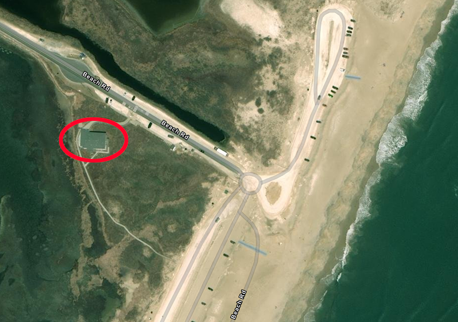
in 2024, the Toms Cove Visitor's Center (red circle) and parking were right next to the beach on the Atlantic Ocean
Source: ESRI, ArcGIS Online
Moving the parking generated some objections from Chincoteague town officials. Storm damage was expected to be much less at the new site, which was much further back from the shoreline, but the walk to the beach would be longer. At a minimum, visitors would have to walk at least 100 yards. One member of the Chincoteague Town Council member complained:7
Once the new beach opened in 2026, the US Fish and Wildlife Service expected natural processes to convert the old beach into wildlife habitat with dunes and saltmarsh. A news story stated:8
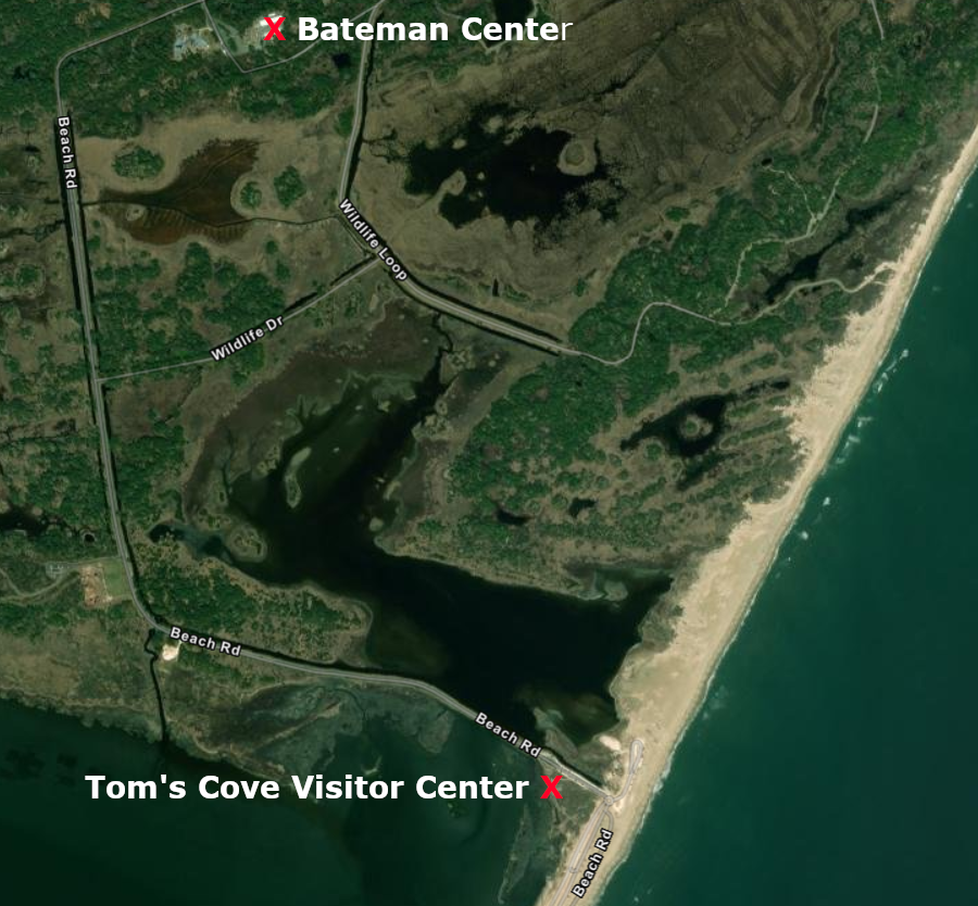
the Bateman Center is over a mile inland from the beach
Source: ESRI, ArcGIS Online
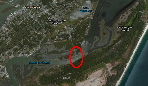
the bridge linking Chincoteague and Assateague islands was built in 1962
Source: ESRI, ArcGIS Online
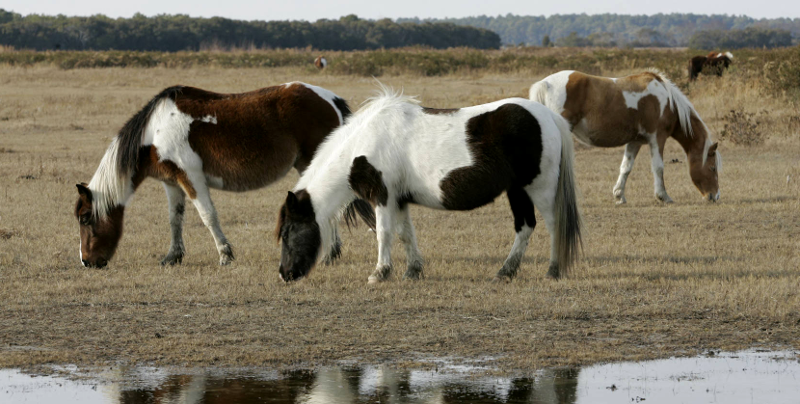
the ponies at Chincoteague are major tourist attractions, even though they are not native wildlife
Source: US Fish and Wildlife Service, Herd of Chincoteague ponies