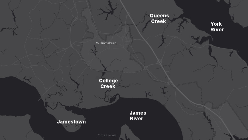
Middle Plantation, which grew into Williamsburg, was located on the watershed divide where the trails dried out first after rains
Source: ESRI, ArcGIS Online
Middle Plantation, which grew into Williamsburg, was located on the watershed divide where the trails dried out first after rains
Source: ESRI, ArcGIS Online
Middle Plantation was started in 1632 as a small outpost halfway between Jamestown on the James River and Chiskiack on the York River. Middle Plantation anchored the center of the six-mile wall built in 1634 after the conclusion of the Second Anglo-Powhatan war, to exclude Native Americans from the Peninsula. The outpost was located on the watershed divide, at the headwaters of Archer's Hope Creek (known today as College Creek) and Queens Creek.
The General Assembly passed "An act for the Seatinge of the middle Plantation" which mandated that a percentage of the population in the area had to contribute their labor in "securinge that the tract of land lying betweene the sayd creekes," and land grants were offered to encourage settlement at Middle Plantation:1
After the statehouse at Jamestown burned in 1698, Williamsburg became the capital of the Virginia colony. The House of Burgesses, the Council of the Governor, and the General Court met in the "capitol," a building constructed as the replacement for the "statehouse" in Jamestown. Williamsburg served as the colonial capital (with the building known as the Capitol) from 1699-1776. When Virginia declared independence from England in 1776, Williamsburg became capital of an independent state for three years.
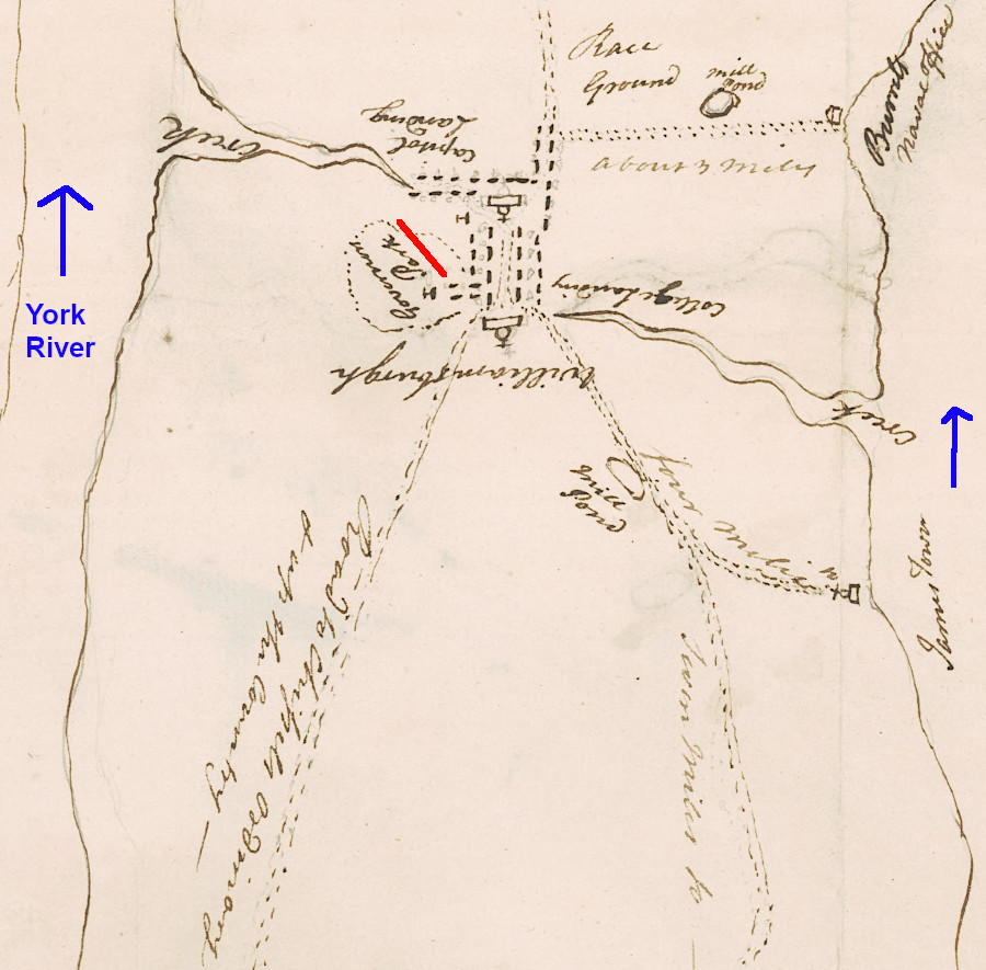
in 1781, the Virginia Governor no longer lived at the "park" in Williamsburg
Source: University of Michigan, William L. Clements Library, Williamsburgh & the slip of land between York & James rivers from thence to Hampton
In 1780, the capital of the Commonwealth of Virginia moved to Richmond. Williamsburg slowly faded into obscurity, except for historic ceremonies. For example, Governor Kaine was inaugurated at the old Capitol in Williamsburg on January 14, 2006, when major repairs to the State Capitol building in Richmond made it unavailable.
Because Williamsburg lacked economic vitality after the capital was moved, many old buildings were preserved rather than torn down and replaced. This "mothballing" of the colonial capital facilitated restoration, once Reverend Dr. W. A. R. Goodwin convinced John D. Rockefeller to commit the financial resources. As Goodwin described it:2
Williamsburg may have been a "better" location than Jamestown, but as Virginia's population moved inland and north, efforts to move the capital from Williamsburg increased.
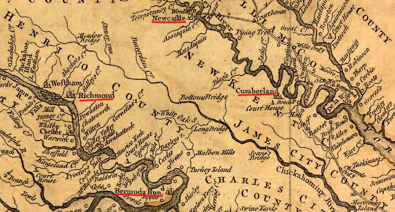
alternative sites considered for a new capital to replace Williamsburg were located on the Pamunkey and James rivers, and Richmond was chosen
Source: Library of Congress, A map of the most inhabited part of Virginia containing the whole province of Maryland with part of Pensilvania, New Jersey and North Carolina. Drawn by Joshua Fry & Peter Jefferson in 1751
In 1738, Speaker of the House John Randolph (from Williamsburg) died and was replaced by John Robinson (from King and Queen County). Northern Neck members renewed the effort to move the colonial capital from Williamsburg to "a more convenient place" in the York or even the Rappahannock watershed.
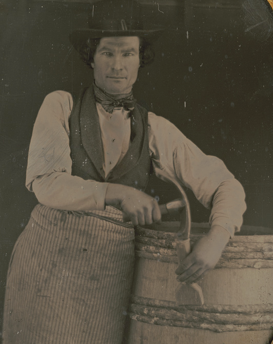
as the capital of Virginia between 1699-1780, Williamsburg was a central place offering employment to coopers, silversmiths, gunsmiths, and other artisans
Source: Library of Congress, Occupational portrait of a cooper, three-quarter length, with barrel and tools
Williamsburg supporters skillfully blocked any shift by forcing a decision on a specific new location, splitting the opposition to remaining in Williamsburg. First, the do-not-move-from-Williamsburg burgesses joined with advocates of moving to a location on the York River and blocked a proposed move to Bermuda Hundred on James River. Then the do-not-move-from-Williamsburg burgesses united with Bermuda Hundred advocates, and blocked a proposed move to West Point on the York River.
In 1747 the Capitol building in Williamsburg burned. Gov. Gooch asked the General Assembly to appropriate funds for rebuilding in Williamsburg, but burgesses approved relocating to a site on the Pamunkey River in New Kent County (next to lands of William Gray and New-Year Smith).
Gov. Gooch supported a move, initially, but the House of Burgesses specifically rejected a moving to Newcastle in Hanover County or to a location on the James River. The Upper House of General Assembly, appointed by King of England, rejected any move because "most of them lived in Williamsburg or within a day's carriage ride."
After the House of Burgesses rejected rebuilding plans, in 1748 it had to reconsider what to do. The burgesses considered Cumberland, on the Pamunkey River downstream from Newcastle, where a ferry provided access to Williamsburg from the north , but ultimately voted to stay in Williamsburg. Then the House reconsidered and voted for Newcastle, but the other have of the General Assembly (the appointed Council) split 4-3 and rejected the change. The supporters of moving the capital argued for Newcastle that "it is much more central being Fifty miles higher upon the Country, consequently so much nearer the bulk of the people," but lost.
In 1752, the Northern Neck burgesses tried again. Once again the burgesses approved a shift to Newcastle, and once again the Council killed it. Landon Carter said rejection came because the Council members lived "all in a Neck."
In 1761, a bill to move the colonial capital from Williamsburg came within one vote of succeeding in the House of Burgesses. A 1766 effort also failed in the House. In 1770 the customhouse for District of the Upper James River was moved from Williamsburg to Bermuda Hundred, but in 1772 the Council blocked a proposed move of the capital further inland. That same year, the General Assembly approved a canal to connect Williamsburg to the York River and the James River, a maneuver that may have preserved Williamsburg as the capital - if the canal had been built.
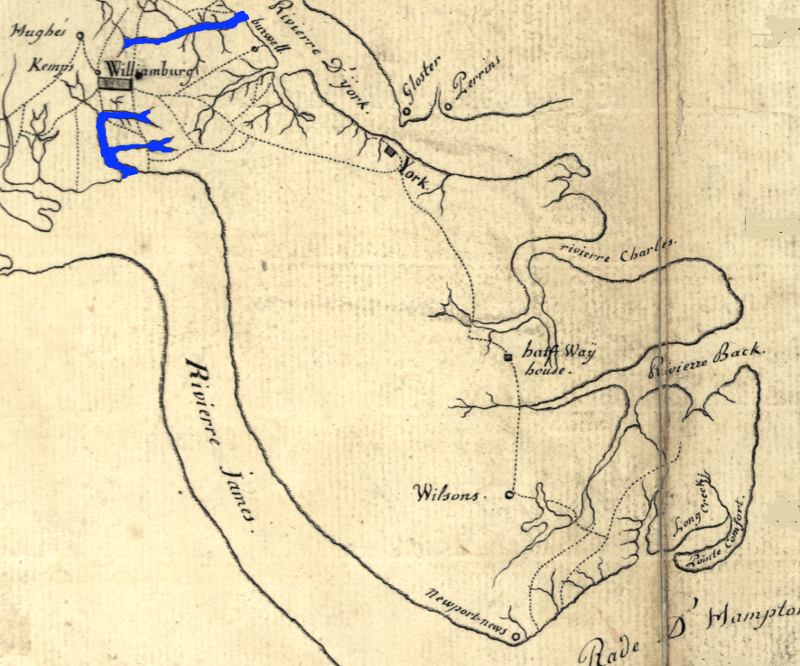
Williamsburg, halfway between the James and York rivers
Source: Library of Congress, Plan des environs de Williamsburg, York, Hampton, et Portsmouth
According to an analysis of the decision to move the capital away from Williamsburg, published by Alonzo T. Dill and Brent Tartar in Virginia Cavalcade in 1980, changes in the demographics of Virginia helped drive the decision:3
Also, the appointed Council was replaced with elected Senate members after 1776. State Senators who lived far from Williamsburg were able to shape the decision. Creation of the bicameral legislature resulted in:
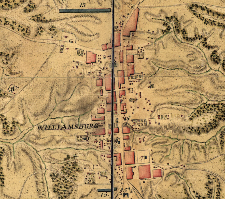
Williamsburg was a compact town with structures centered on Duke of Gloucester Street, at the end of the American Revolution
Source: Library of Congress, Carte des environs de Williamsburg en Virginie (Armee de Rochambeau, 1782)
In 1776, Thomas Jefferson introduced yet another bill to move the capital inland. The shift was finally approved in 1779, in fear that Williamsburg was too exposed to attack by the British forces during the Revolutionary War.
Richmond may have been a "winner" in the contest to move the capital inland to a location on the Pamunkey or James rivers. but it was not a secure location. British forces plundered Richmond and Manchester in 1781 before Cornwallis was trapped at Yorktown. However, the General Assembly twice rejected efforts to move the capital back to Williamsburg (in 1780 and again in 1783). As Dill and Tartar noted:
After the capital was moved to Richmond, the warehouses at Newcastle lost importance. Tobacco production declined in the area, and deep-water vessels could no longer sail as far upstream after erosion from agricultural operations moved silt into the Pamunkey River. Ultimately, Newcastle was abandoned and is now a cornfield.
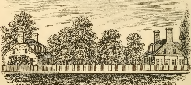
the Governor's Palace in Williamsburg burned after Yorktown
Source: Historical collections of Virginia, Remains of Lord Dunmore's Palace (p.328)
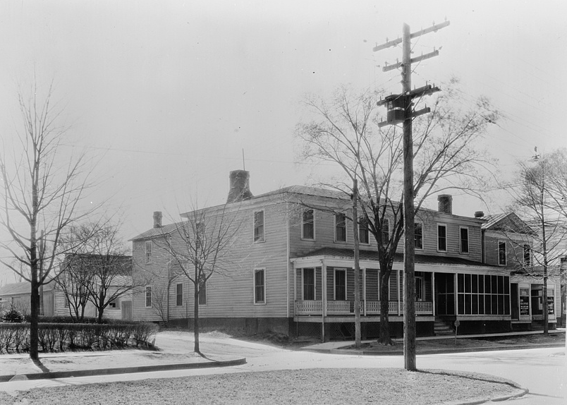
some historic buildings survived, though interiors and exteriors were modified, before Colonial Williamsburg returned them to their colonial-era appearance
Source: Library of Congress, The Market Square Tavern before restoration (1943)
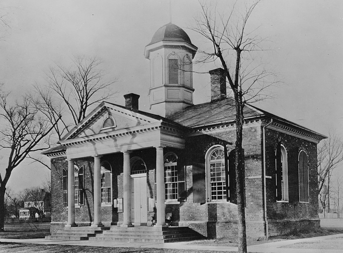
the James City County Courthouse in 1943
Source: Library of Congress, The old courthouse before restoration (1943)
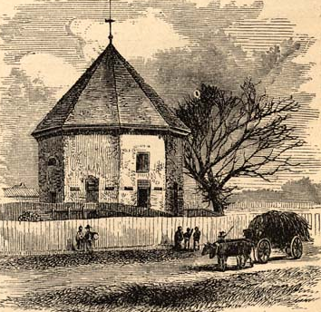
the colonial powder magazine after the Civil War, and before restoration
Source: University of North Carolina, The Great South; A Record of Journeys in Louisiana, Texas, the Indian Territory, Missouri, Arkansas, Mississippi, Alabama, Georgia, Florida, South Carolina, North Carolina, Kentucky, Tennessee, Virginia, West Virginia, and Maryland (1875)
restored Public Hospital for Persons of Insane and Disordered Minds in Williamsburg, opened in 1773 as first mental hospital in United States
the roads to and from Williamsburg in 1789
Source: Library of Congress, A survey of the roads of the United States of America (Christopher Colles, 1789)