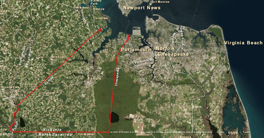
Suffolk is the largest city in land area (430 square miles) in Virginia
Source: ESRI, ArcGIS Online
Suffolk is the largest city in land area (430 square miles) in Virginia
Source: ESRI, ArcGIS Online
When the English colonists arrived in 1607, they sailed up what they named the James River and passed by the Nansemond tribe on the south bank. The English ended up naming the Nansemond River after that tribe, one of the Algonquian-speaking components of Powhatan's paramount confederacy.
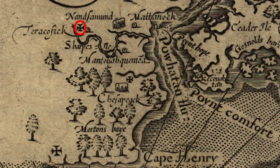
John Smith explored up the Nansemond River to the site marked with a Maltese cross
Source: Library of Congress, Virginia / discovered and discribed by Captayn John Smith
The Nansemond tribe's primary town was on Dumpling Island. They harvested plants and wildlife from the swamp and brackish waters of the Nansemond River, but it was their corn fields that attracted the English. Christopher Newport's first attempt to trade for corn in 1608 led to a brief exchange of gunfire and arrows, followed by multiple communications, an exchange of hostages, and then some trading. In 1609, during John Smith's second exploration of the Chesapeake Bay, the English had to fire their muskets and destroy several wooden canoes before the Nansemonds were willing to trade for corn.1
In 1609, John Smith decided to disperse settlement away from Jamestown. Colonists were exhausting the resources near the fort, and needed to obtain food from additional territory. Smith sent 60 colonists to occupy the town of the Nansemonds, but the Native Americans resisted. After two English messengers were killed, the colonists destroyed the Nansemond town and temple on Dumpling Island, but then abandoned the site:2
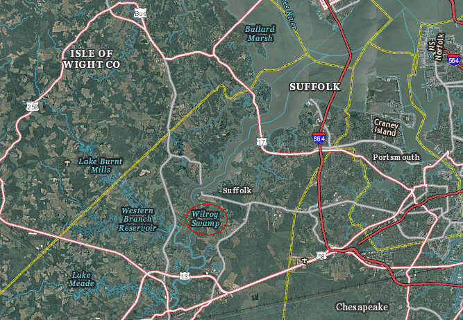
Dumpling Island was located at Wilroy Swamp, upstream from the mouth of the Nansemond River
Source: US Geological Survey (USGS), The National Map
Nansemond County was created in 1637, when population growth justified division of New Norfolk County into Upper Norfolk County and Lower Norfolk County. In 1646, Upper Norfolk County was renamed Nansemond County.
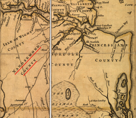
Thomas Fry and Peter Jefferson mapped Nansemond County in 1751
Source: Library of Congress, A map of the most inhabited part of Virginia containing the whole province of Maryland with part of Pensilvania, New Jersey and North Carolina
The first English colonist known to permanently occupy the current site of Suffolk was John Constant. He set up a trading post in the 1720's, over a century after Jamestown was founded - so the names of previous occupants may just be lost to history. Even Constant's legacy has been altered by a spelling mistake. When a highway through the city was built in the 1950's, it was named Constance Road rather than Constant's Road.3
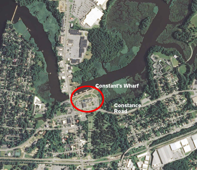
Constant's Wharf Park & Marina is named after John Constant, as is the incorrectly-spelled Constance Road
Source: US Geological Survey (USGS), Suffolk 7.5x7.5 topographic quadrangle (2013)
The stimulus to create a town on the Nansemond River was the Tobacco Inspection Act of 1730, finally pushed through the General Assembly by Governor Gooch. Officials in London, as well as major merchants, wanted to create towns and concentrate settlement in Virginia. Modifying the low-density settlement pattern to establish towns offered a more cost-effective way to collect export taxes. Inspection stations would also provide quality control and limit export of "trash" tobacco; merchants were expected to increase the price paid to all Virginia planters after inspection ensured higher quality tobacco exports.
Towns would also streamline shipment of tobacco to England. Since the English had arrived in 1607, the deep river channels throughout Tidewater Virginia had allowed many plantation owners to build individual wharves for shipping hogsheads of tobacco across the Atlantic Ocean. Small farmers near a larger plantation, including laborers who had acquired some land after completing their term of indenture, would grow perhaps one hogshead of tobacco each year. The farmers with limited acreage would transport their tobacco in small ships ("shallops") to the large plantation wharves, but there were dozens of such wharves in Tidewater. Ships were delayed for months by the inefficient process of stopping at so many different locations to gather a complete load of hogsheads for a transatlantic trip.
Suffolk grew into a town after the 1730 law, which identified a location "At the widow Constance's, at Sleepy-Hole Point, in Nansemond County" for an inspection warehouse.4
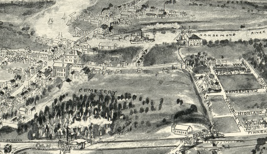
the City of Suffolk started as a tobacco inspection warehouse on the Nansemond River, before multiple railroads arrived
Source: Library of Congress, Birds eye view of Suffolk, Nansemond Co., Va. 1907
In 1742, the General Assembly officially named the community that had developed around Constant's Wharf and the tobacco inspection station as "Suffolk." Governor Gooch's family had come originally from Suffolk, so the legislators were honoring him.
In 1808, the town of Suffolk was chartered, and it was incorporated as an independent city in 1910. The current City of Suffolk was formed in 1974, when the city of Suffolk merged with the County of Nansemond (including the towns of Holland and Whaleyville).5
Suffolk and the Nansemond River, at the start of the American Revolution
Source: University of Michigan, William L. Clements Library, Part of the modern counties of Princess Anne, Norfolk, and Nansemond, Virginia
The timber in the Great Dismal Swamp east of Suffolk was a key economic resource for colonists. William Byrd II had recognized the potential when he helped survey the Virginia-North Carolina boundary in 1732. However, the area inland from the navigable channel of the Nansemond River was so isolated that it served as a refuge for those who escaped enslavement and mulattoes, people who faced severe discrimination if they tried to mix with the rest of the colonial population. A "maroon" population lived in the swamplands.
In 1763 the Dismal Swamp Land Company was chartered; George Washington was a major leader in the project. One vision was to drain the swamp and convert it into farmland for growing hemp, the fibers of which would be spun into rope.
Digging ditches, even with slave labor, was difficult and the Dismal Swamp Land Company made little progress in draining the swamp. Timber harvest was easier, with loads manufactured from bald cypress and Atlantic White Cedar floated down Shingle Creek to the wharves at Suffolk.
The "naval stores" (pitch and turpentine) concentrated there, and the easy access up the Nansemond River, made Suffolk a target in the Revolutionary War. After the French allied with the rebelling colonists in America in 1788, the British military was stretched thin in a world-wide war.
One way to break the stalemate at New York (which had been surrounded by George Washington's army for three years) was for the British to cut off the military supplies coming to New York from Virginia, and to cause enough economic pain in the southern colonies to force the Continental Congress to negotiate for peace and reunion with England.

because timber harvest could be conducted in isolated swampland, Nansemond County was relatively attractive to free people of color prior to the Civil War
Source: National Endowment for the Humanities - The Great Dismal Swamp, Dred: A Tale of the Great Dismal Swamp
The 1779 Mathew-Collier raid into the Chesapeake Bay burned military resources stockpiled in Virginia. In addition, private warehouses and ships loaded with tobacco were looted, in order to enrich the English and impoverish the rebels. In mid-May of 1779, after capturing Norfolk and Portsmouth and destroying the Gosport Navy Yard, the British sailed upstream to Suffolk. They captured the town without opposition. The naval stores (and most buildings in town) were easily destroyed in a dramatic conflagration:6
the 1779 Mathew-Collier raid of the British Navy burned Suffolk and the supplies stored there
Source: Library of Congress, A Plan of the entrance of Chesapeak [sic] Bay, with James and York Rivers
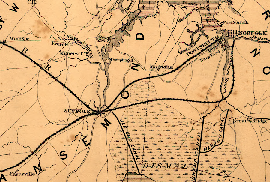
Some trade through Suffolk came from North Carolina, because shipping through Albemarle/Pamlico Sound was difficult due to the barrier islands. Suffolk was on the Chesapeake Bay, and the Nansemond River offered a transportation route to export farm products lumber to Philadelphia, New York, and Europe, but getting goods through the swamps to Suffolk remained difficult after the Revolutionary War.

Shingle Creek was named after the main product floated downstream from the swamplands to Suffolk
Source: US Geological Survey (USGS), Suffolk 7.5x7.5 topographic quadrangle (2013)
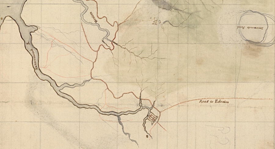
To facilitate transport by water, Shingle Creek was extended with ditches into the swamp southeast of Suffolk. When George Washington was president, the Dismal Swamp Canal Company started digging a full-scale canal, but Washington sold his investment in the speculative project before the Jericho Canal was completed.7
Jericho Ditch linked Lake Drummond and the Nansemond River
Source: US Geological Survey (USGS), Suffolk 15x15 topographic quadrangle (1919)
The main railroads built through Suffolk were designed to draw trade away from Petersburg and the Roanoke River. When Portsmouth constructed the Portsmouth and Roanoke Railroad (later renamed the Seaboard and Roanoke Railroad) to intercept traffic at the Roanoke River Canal in North Carolina, Petersburg and Richmond merchants sent a gang into North Carolina and literally tore up the tracks to block competition. The Civil War occurred just three years after the Norfolk and Petersburg Railroad was finally built, so its effect on shipping at other port cities occurred later.
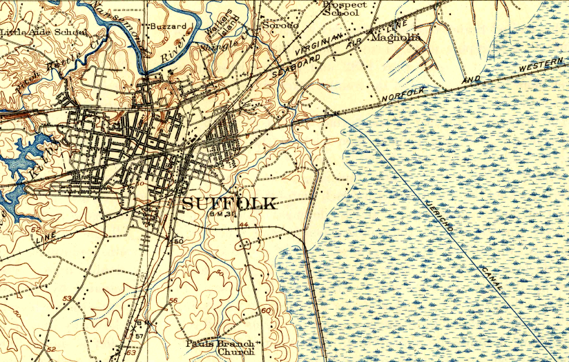
Suffolk got its main rail connections, including the Seaboard and Roanoke Railroad, because it was in-between the ports on the Elizabeth River and the hinterland from which those ports sought to draw traffic
Source: Library of Congress, Map of the Seaboard & Roanoke Railroad from Portsmouth, Va. to Weldon, N.C (1847)
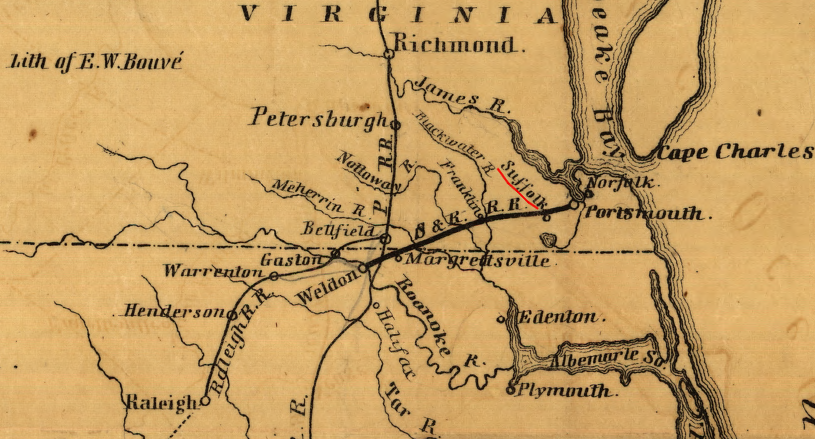
two railroads ran through Suffolk prior to the Civil War
Source: Library of Congress, Map of eastern Virginia (1862)
During the American Civil War in 1863, Suffolk was occupied by the Union Army in order to block potential Confederate raids on Norfolk and Portsmouth. James Longstreet brought his division to the area to resupply, and he briefly laid siege to Suffolk. The firepower and maneuverability of the US Navy in the Nansemond River was too great for the Confederates, and they abandoned southeastern Virginia in preparation for the march that ended at Gettysburg. Suffolk itself had no strategic value; it had no manufacturing center or political significance. After Longstreet left, the Union forces also withdrew to defensive lines closer to the Elizabeth River.
After the Civil War, Suffolk grew into a manufacturing center for processing timber harvested from the swamps in southeastern Virginia and northeastern North Carolina. Railroads, including the Suffolk and Carolina Railroad and the Norfolk and Carolina Railroad, brought logs to mills at Suffolk.
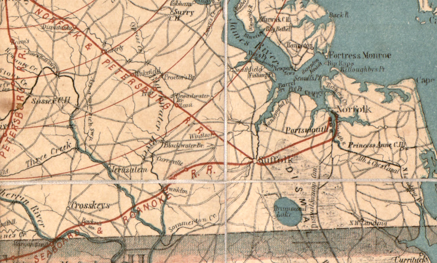
Other railroads passed through Suffolk to reach shipping terminals on the Elizabeth River. Railroads passed through Suffolk because it was located on the narrow stretch of high land between the Nansemond River and the Dismal Swamp.
multiple railroads brought logs from the swamps to mills in Suffolk, or passed through to reach shipping terminals on the Elizabeth River
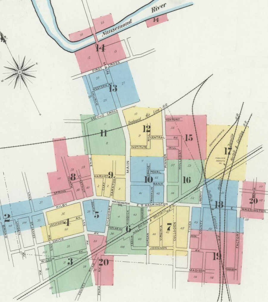
Source: Library of Congress, Sanborn Fire Insurance Map from Suffolk (Sanborn Map Company, April 1898)
With its highways and railroads, Suffolk is well-positioned to be a center for distribution warehouses. In 2022, a company requested the city to rezone 510 acres near Route 58 to allow construction of 5 million square feet of warehouse space, creating up to 9,000 jobs. If all 10 warehouses were constructed, the proposed Port 460 Logistics Center would become the third-largest warehouse complex in the United States.
The Port 460 Logistics Center would receive goods from the Port of Virginia terminals in Portsmouth and ship truckloads to inland destinations. The site had already been designated as a foreign trade zone service area, but was not yet zoned for industrial development. Primary oppositions from local residents was concern about adding more trucks to the already-congested roads.
One of the developers indicated that demand for warehouse space was growing in the area because manufacturing was moving out of China. More goods would be produced in Malaysia and other Southeast Asian countries, and shipped to East Coast ports:8
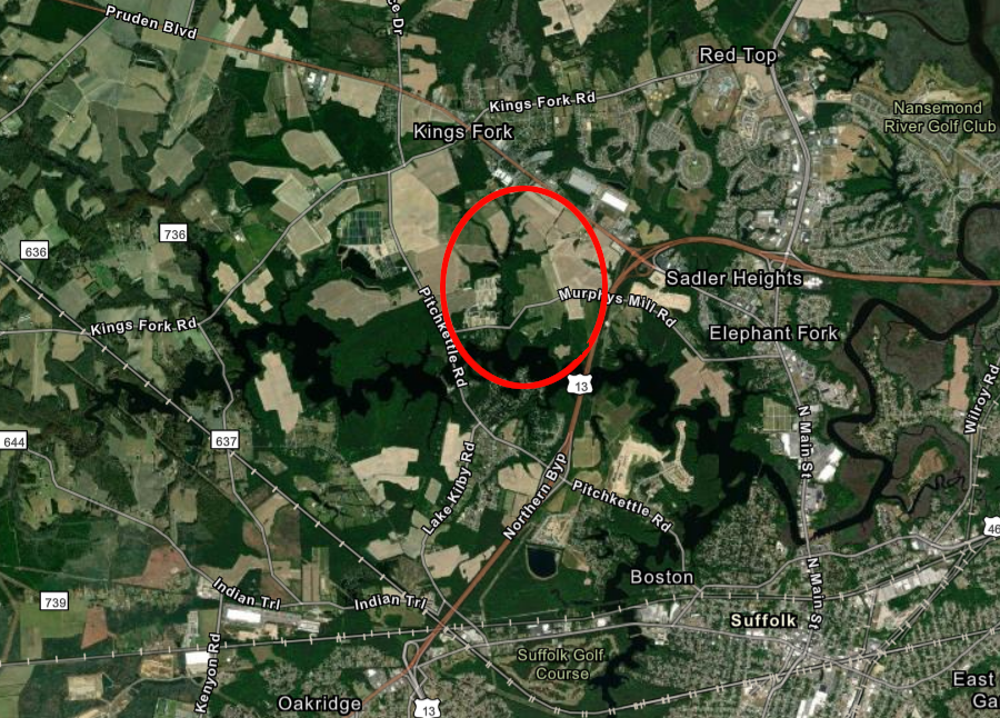
the Port 460 Logistics Center was proposed for construction northwest of downtown Suffolk
Source: ESRI, ArcGIS Online
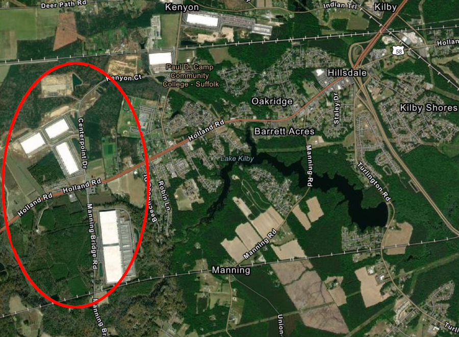
Virginia Port Logistics Park, west of downtown Suffolk, has 5 million feet of warehouse space
Source: ESRI, ArcGIS Online
the independent city of Suffolk provided an additional level of services to urbanized areas, beyond what Nansemond County offered, until the jurisdictions merged in 1974
Source: US Geological Survey (USGS), Suffolk 7.5x7.5 topographic quadrangle (1954)

before Suffolk developed, Portsmouth dammed tributaries of the Nansemond River to create reservoirs for drinking water
Source: ESRI, ArcGIS Online
the Seaboard and Roanoke Railroad and the Norfolk and Petersburg Railroad passed through Suffolk in 1862
Source: Library of Congress, Map of part of Virginia, Maryland, and Delaware: from the best authorities (1861)
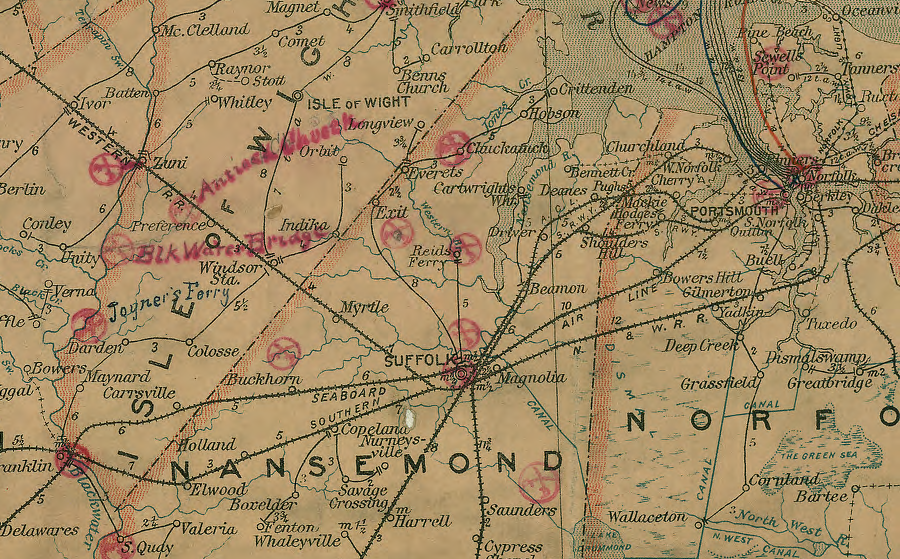
Suffolk was a railroad center in 1906
Source: Library of Congress, Post route map of the states of Virginia and West Virginia (Postmaster General, 1906)
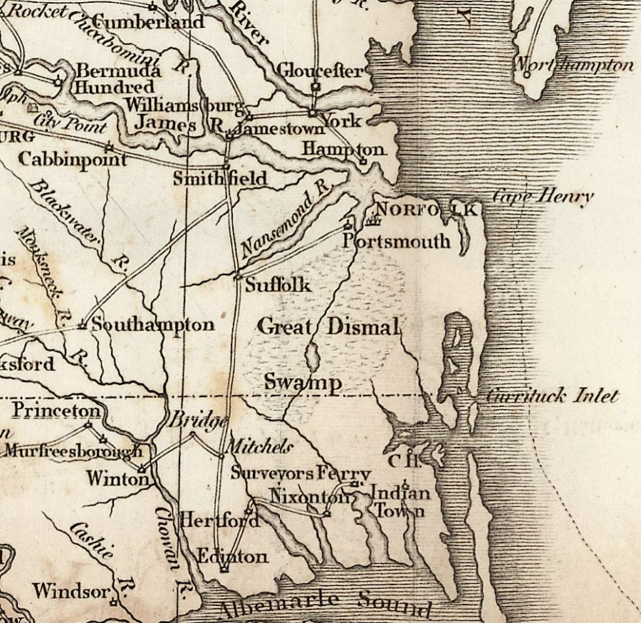
North Carolina trade headed for a port on the Chesapeake Bay passed through Suffolk until completion of the Dismal Swamp Canal
Source: Library of Virginia, Alan M. Voorhees Map Collection, Map of the southern provinces of the United States (by John Russell, 1805)
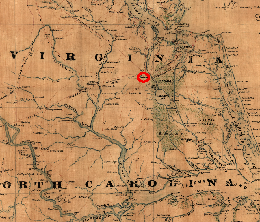
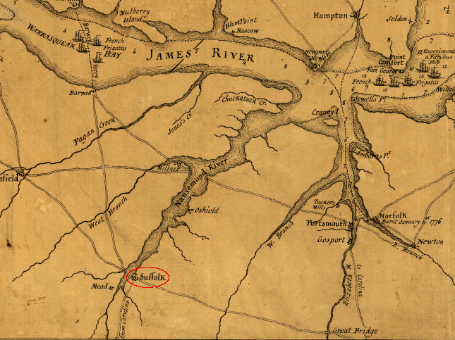
Suffolk competed with Norfolk/Portsmouth for trade from North Carolina that sought a port on the Chesapeake Bay
Source: Library of Congress, A Plan of the entrance of Chesapeak [sic] Bay, with James and York Rivers
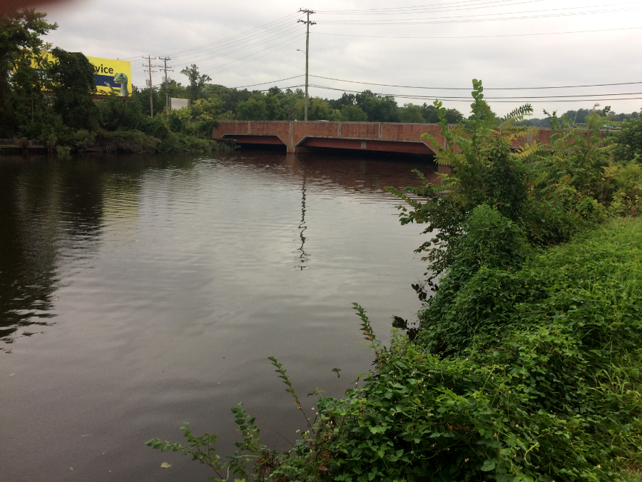
Route 460 bridge over the Nansemond River, just north of US 58 intersection
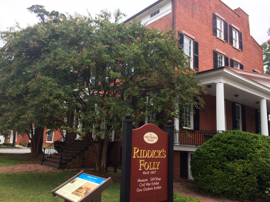
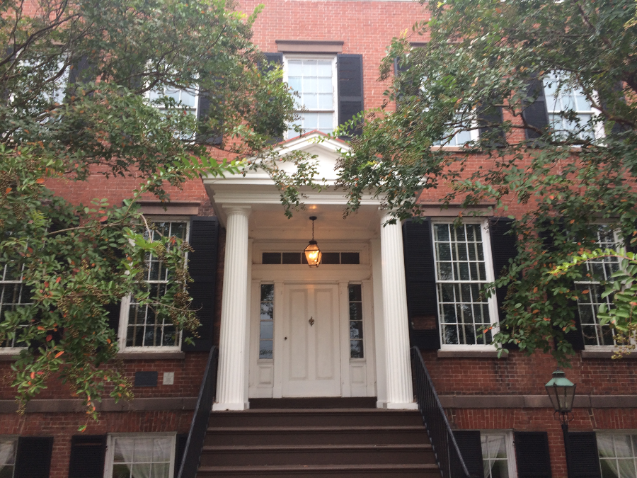
Riddick's Folly, headquarters of Union Major General John J. Peck for a month in 1863
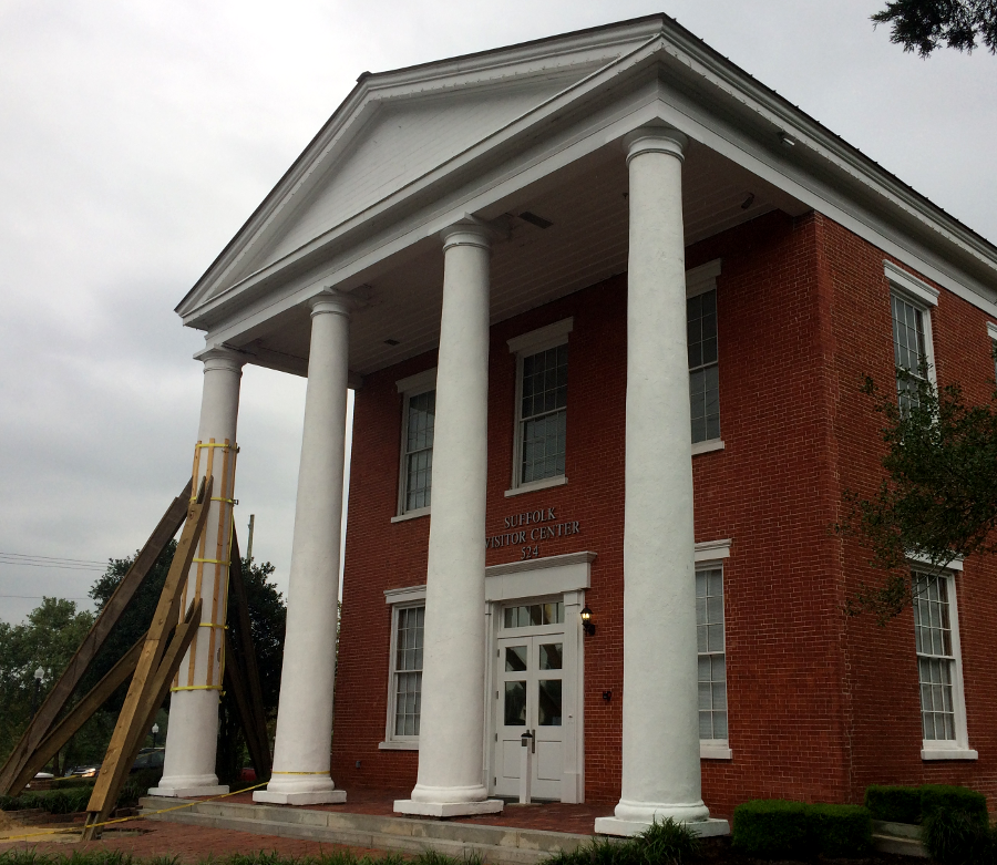
former Nansemond County Courthouse, now Suffolk Visitor Center
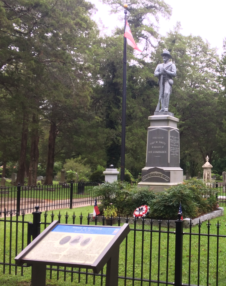
Confederate memorial at Cedar Hill Cemetery in Suffolk