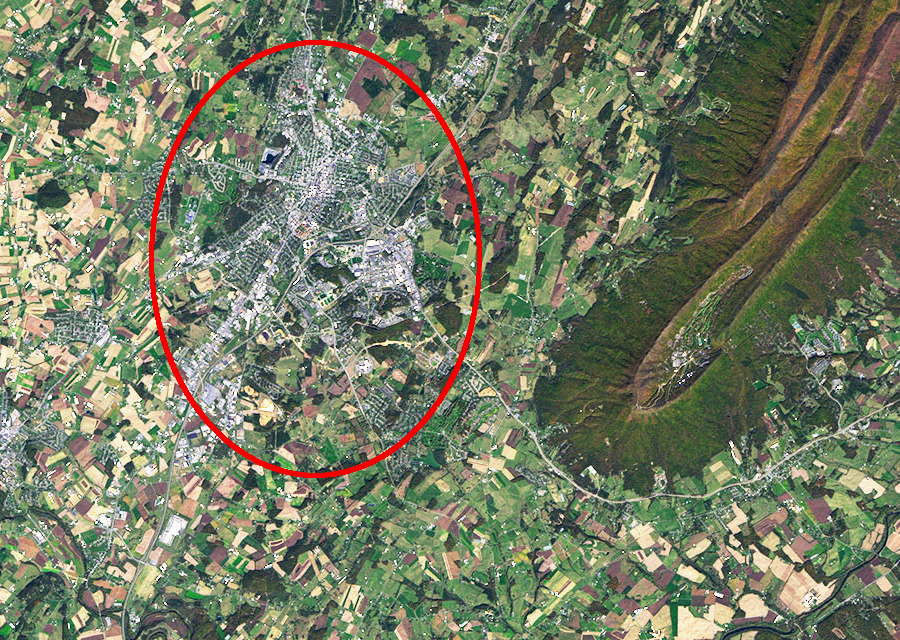
Harrisonburg is located west of the southern tip of Massanutten Mountain, in the Shenandoah Valley
Source: National Aeronautics and Space Administration (NASA), Earth Observatory, The Sinuous Shenandoah
Harrisonburg is located west of the southern tip of Massanutten Mountain, in the Shenandoah Valley
Source: National Aeronautics and Space Administration (NASA), Earth Observatory, The Sinuous Shenandoah
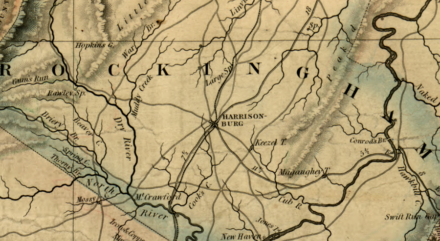
Harrisonburg was the geographic and transportation center of Rockingham County prior to the Civil War
Source: Library of Congress, A map of the state of Virginia by Herman B e (1826), updated by Lewis von Buchholtz (1859)
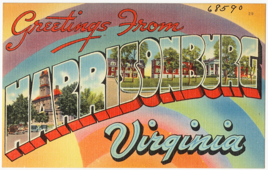
a 1930-1945 tourist postcard for Harrisonburg highlighted the county courthouse and James Madison University's brick buildings
Source: Boston Public Library, Tichnor Brothers Postcard Collection, Greetings from Harris[on]burg, Virginia
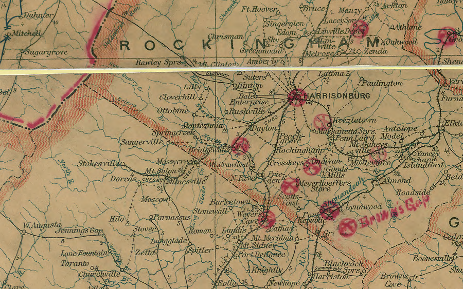
Harrisonburg was served by two railroads in 1906
Source: Library of Congress, Post route map of the states of Virginia and West Virginia (Postmaster General, 1906)
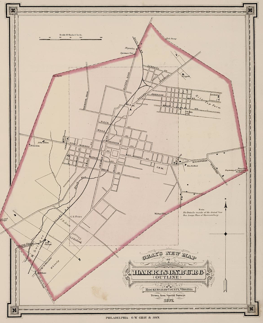
Harrsonburg in 1878
Source: David Rumsey Map Collection, OW Gray & Son Atlas - Gray's New Map of Gordonsville and Harisonburg, Virginia (1878)
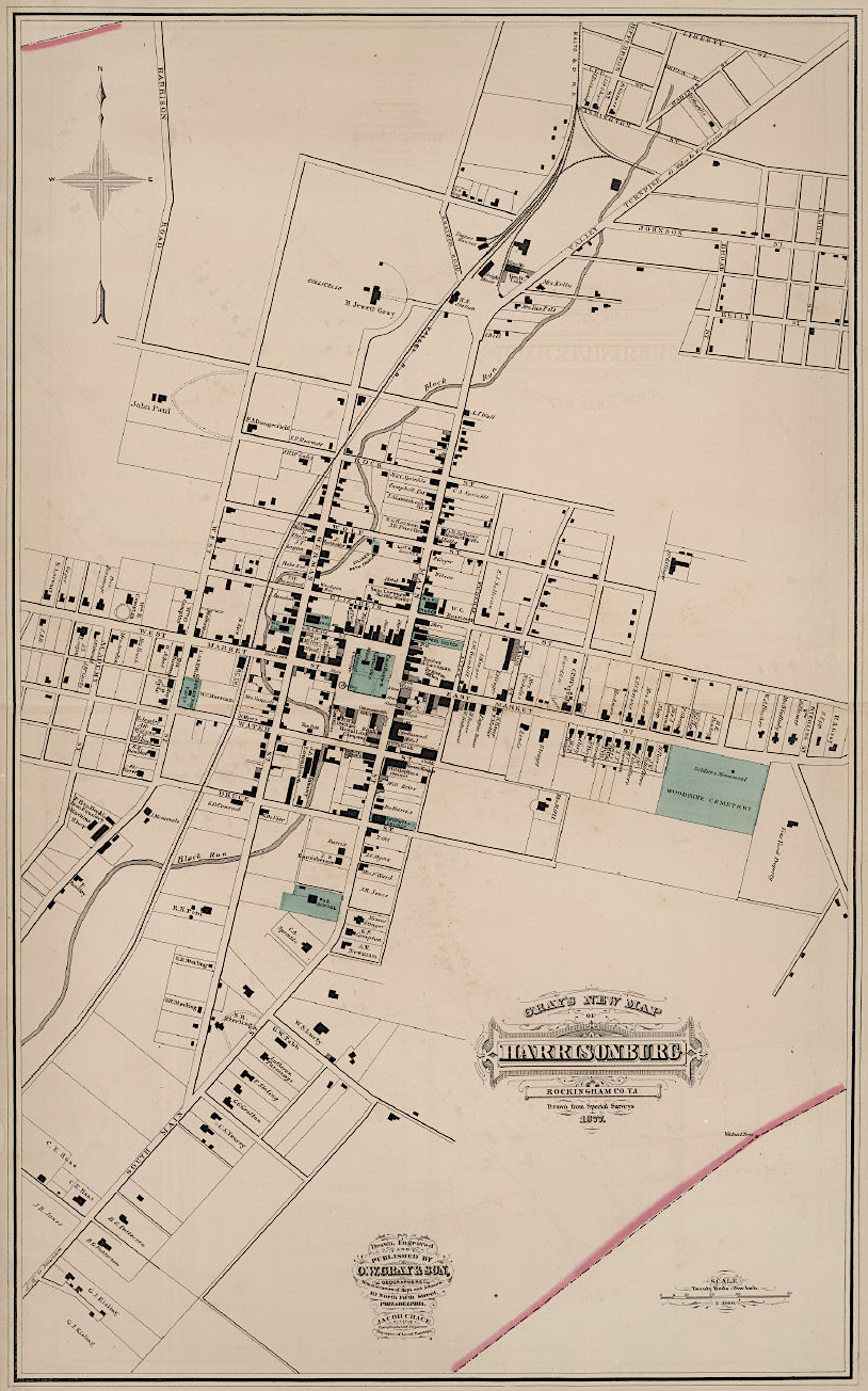
Harrsonburg in 1878
Source: David Rumsey Map Collection, OW Gray & Son Atlas - Gray's New Map of Harisonburg, Virginia (1878)