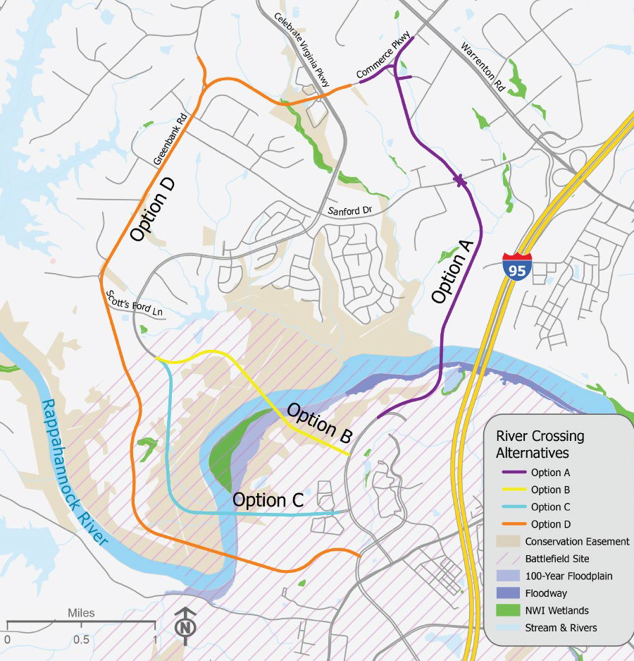
four options for a new Rappahannock River crossing were presented to the public in 2024
Source: Fredericksburg Area Metropolitan Planning Organization (FAMPO), River Crossing Parkway Alternatives Study
four options for a new Rappahannock River crossing were presented to the public in 2024
Source: Fredericksburg Area Metropolitan Planning Organization (FAMPO), River Crossing Parkway Alternatives Study
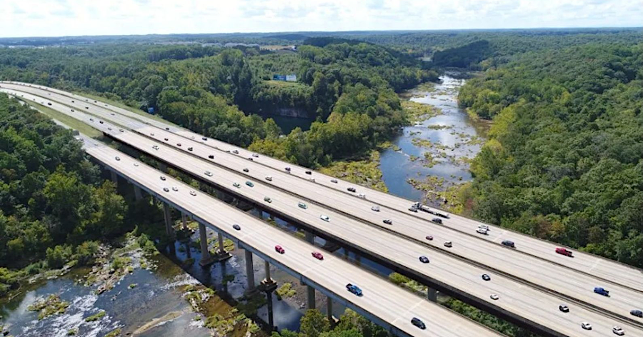
In 2023 the Fredericksburg Area Metropolitan Planning Organization (FAMPO) began serious planning for a new highway bridge crossing the Rappahannock River, located west of I-95. That started as the Virginia Department of Transportation and Transurban completed two new I-95 bridges across the river, doubling capacity after five years of construction. Transurban had the contract to operate the toll lanes which were extended 10 miles further south to Stafford County.
The study claimd it was not ntended to create a beltway around Fredericksburg:1
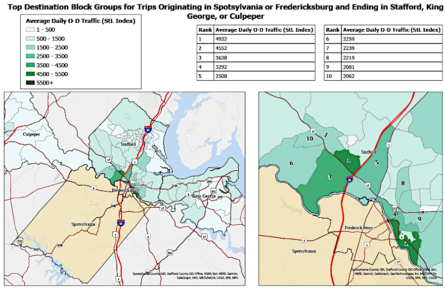
destinations for most northbound trips originating in Spotsylvania and Fredericksburg were in Stafford County, not for long commutes to Northern Virginia/DC
Source: Fredericksburg Area Metropolitan Planning Organization (FAMPO), River Crossing Research Report (Map 3)
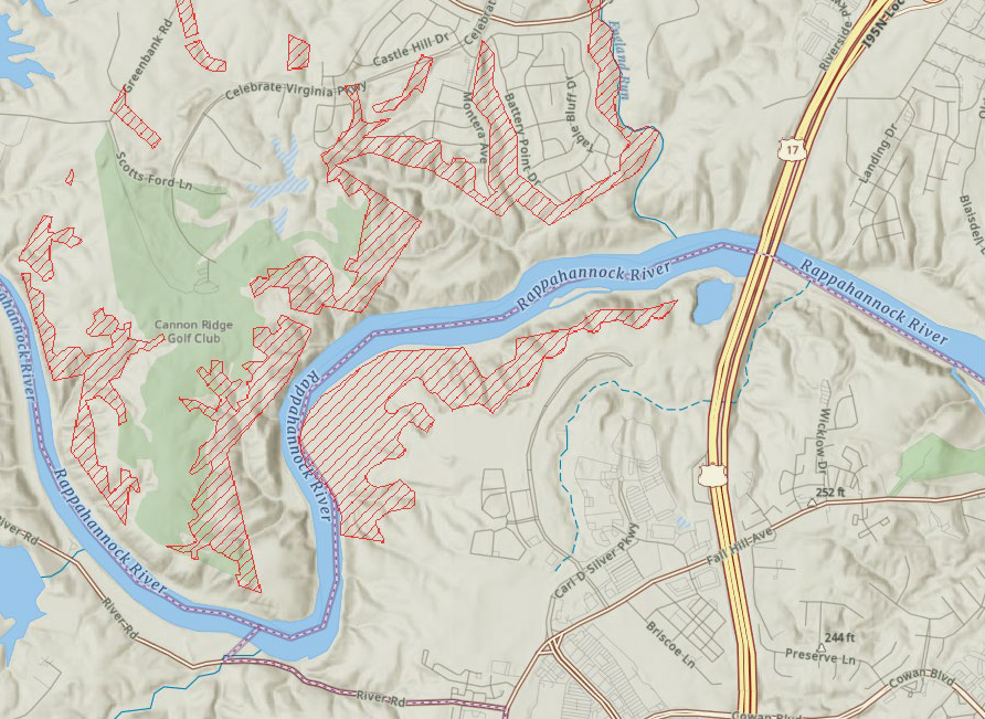
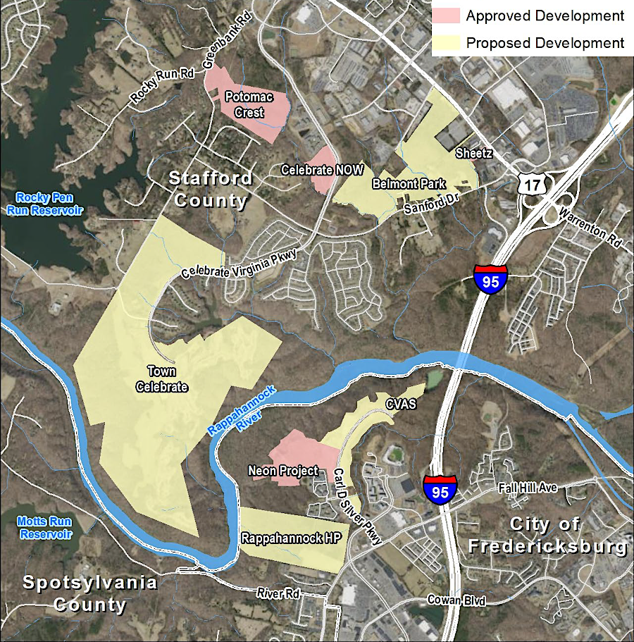
A new crossing had to comply with conservation easements along the Rappahannock River held by the Virginia Outdoors Foundation and the Northern Virginia Conservation Trust. In 1969, the City of Fredericksburg purchased 4,800 acres of land upstream from the city from Virginia Electric and Power Company (VEPCO). VEPCO had acquired the Frederickesburg Power Company, which had purchased the Rappahannock Navigation Company rights on the Rappahannock and Rivanna River and then built Embrey Dam.
Fredericksburg anticipated using the land as its requird match for the Salem Church Dam, but that project was blocked by public oppoition in 1974 and cancelled in 1989.
The Friends of the Rappahannock organized in 1985. That non-government organization mobilized public support from removal of Embrey Dam and protection of a free-flowing Rappahannock River. In 2006, Fredricksburg placed 4,232 acres along the river under a permanent conservation easement held by the Virginia Outdoors Foundation, the Virginia Board of Game and Inland Fisheries, and the Nature Conservancy. The easement specifically authorized creation of up to five river access points occupying no more than 42 acres, and did not preclude the construction, maintenance, repair or reconstruction of roads or bridges, so a new Rappahannock River Crossing through the protected land could be permitted.
When the Silver Companies created the 2,500-acre Celebrate Virginia! project, Fredericksburg rezoned the land before the developer filed an application. That early rezoning eliminated the potential for the city to obtain proffers to offset public impacts.
Partially in respose to a political uproar, the Silver Companies donated a conservation easement on a 132-acre riverfront parcel in Fredericksburg to the Virginia Outdoors Foundation. To obtain Department of Environmental Quality (DEQ) approval for a golf course in Stafford County, the developer donated an easement on a 308-acre parcel in Stafford County to the Northern Virginia Conservation Trust (NVCT).
The easement held by the Virginia Outdoors Foundation on the southern bank of the Rappahannock River, acquired from the city, authorizes a new bridge. However, the second easement on the southern bank of the Rappahannock River, held by the Virginia Outdoors Foundation and acquired from the Silver Companies, does not authorize a new bridge. Both the grantor and the grantee of the easement would have to get the Circuit Court to approve a deed modification before a new Rappahannock River crossing could impact acres protected now by the "co-held" southern easement.2
easements managed by the Northern Virginia Conservation Trust (NVCT)
Source: Fredericksburg Area Metropolitan Planning Organization (FAMPO), River Crossing Research Report (Map 7)
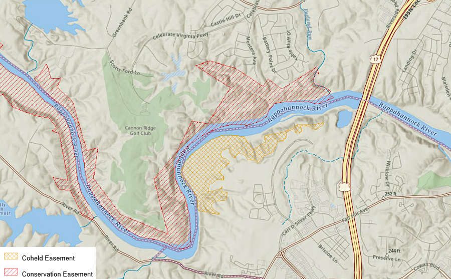
on the southern edge of the Rapahannock River, one easement co-held by the Virginia Outdoors Foundation (VOF) did not authorize a new bridge
Source: Fredericksburg Area Metropolitan Planning Organization (FAMPO), River Crossing Research Report (Map 8)
By early 2024, the regional organization had identified four options to link Route 17 in Stafford County with the Celebrate Virginia development in the City of Fredericksburg. To the surprise of the planners, city officials declared in January that Options B and C to connect to that road were not acceptable because large-scale mixed-use development was planned on Gordon Shelton Boulevard. The city considered those two options to be "DOA," or Dead On Arrival.3
traffic was predicted to increase west of I-95, where new developments were planned
Source: Fredericksburg Area Metropolitan Planning Organization (FAMPO), River Crossing Parkway Alternatives Study
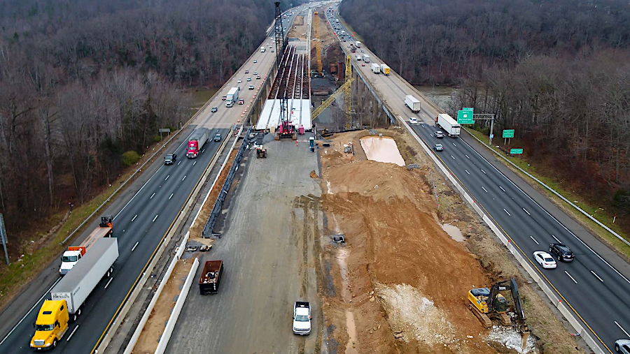
as capacity of I-95 bridges was doubled in 2023, the Fredericksburg Area Metropolitan Planning Organization began plans to add new bridges upstream
Source: Virginia Department of Transportation (VDOT), Improve 95; I-95 Southbound Rappahannock River Crossing