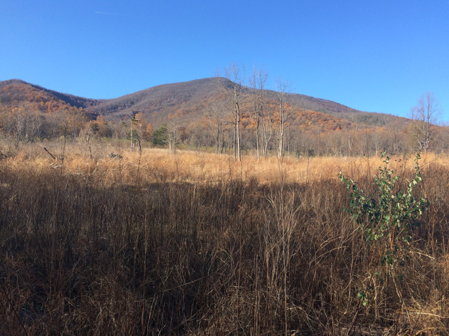
looking west at the Blue Ridge from Lesesne State Forest (Nelson County)
looking west at the Blue Ridge from Lesesne State Forest (Nelson County)
The boundaries of the Blue Ridge physiographic province near Charlottesville can be treated differently than the geological boundaries.
The igneous bedrock of the Blue Ridge extends east of Charlottesville, to Pantops Mountain and the Southwest Mountains. Erosion has flattened much of the landscape west of Charlottesville, making it appear topographically as an extension of the Piedmont.
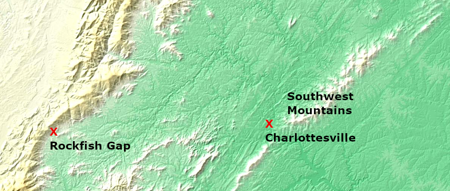
between Charlottesville and Rockfish Gap, erosion has flattened the igneoud bedrock so it resembles the Piedmont physiographic province
Source: US Geological Survey (USGS), National Map - DEM Viewer
The Blue Ridge north of Roanoke is significantly different from the Blue Ridge south of Roanoke. The topography north of Roanoke includes a narrow ridge extending north to the Maryland border. The ridge extends north into Pennsylvania, and formed a military barrier during the Civil War.
Robert E. Lee used the mountain barrier to screen his Army of Northern Virginia in 1863 when it invaded Pennsylvania. Lee expected his cavalry to block the mountain passes while the troops marched up the Great Valley on the west side. The army then re-crossed the mountains, marching towards Harrisburg to burn the Pennsylvania Railroad bridge over the Susquehanna River. After being blocked at Gettysburg, Lee used the Blue Ridge again as a protective barrier as he led the army back into Virginia.
South of the James River and Roanoke, the ridge spreads out into a plateau which drains largely to the Mississippi River. Floyd, Carrol, and Grayson counties are essentially perched on the Blue Ridge. Mother Nature and Father Time made that area the "roof of Virginia."
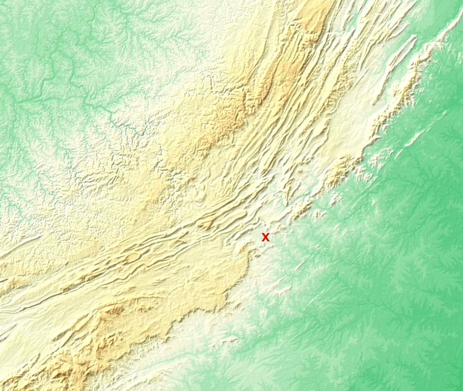
south of Roanoke (red X), the Blue Ridge widens into a plateau rather than a narrow mountain ridge
Source: US Geological Survey (USGS), National Map - DEM Viewer
The Blue Ridge Parkway is located on the eastern edge of Floyd County, which lies primarily in the Misississippi River watershed. Rain that falls on Floyd County flows westward into the New River, except at the northern edge of the county. The southeastern corner of the Carrol County boundary includes a slice of the Pee Dee watershed, as does a part of Grayson County. The Eastern Continental Divide runs through those three counties.
Floyd is upstream of everywhere else. It is at the top of the watershed, with the headwaters of the Little River in Floyd County. All the streams run off the mountains and outside the county, while no streams drain into Floyd County. Among other things, that means the agricultural waste from cattle on Floyd County pastures will drain into Montgomery County, but there is no equivalent drainage into Floyd to raise local sensitivities about offsite environmental/water quality impacts.
Roads have always been poor in the Blue Ridge, north or south of Roanoke. Not surprisingly, "market agriculture" in the mountains has always been restricted to products that were easy to ship.
Instead of wagonloads of corn, Blue Ridge mountaineers concentrated their grain into cattle, hogs, and liquor before shipping it. In contrast, farmers living along water transportation routes could ship bulk products. Buckingham County could load heavy slate on canal boats that went down the James River and Kanawha Canal to Tidewater, but otherwise canals, roads, and railroads were scarce in the Blue Ridge.
The valleys, with good transportation and good soil, exported crops to marketplaces at a distance. Most agricultural products grown on Blue Ridge farms were consumed on Blue Ridge farms. Some products were sold at market, such as livestock and some tobacco, in order to acquire items that could not be obtained through pure subsistence agriculture. Blue Ridge mountaineers needed lead and gunpowder and guns, coffee, farm tools, salt, and other items not manufactured locally.
These were not isolated, cut-off-from-humanity backwoodsmen, and it would be simplistic to suggest that only the mountaineers engaged in "subsistence plus" agriculture. They sold surplus agricultural products to distant purchasers, so their farming was "subsistence plus" - not purely for local survival, but not primarily for cash either.
Of course, the Tidewater Virginia area, with all of its river-based transportation, still included a lot of self-sufficiency in producing food and clothing on the plantation for local use. Storekeepers had to extend credit and engage in barter for three centuries, until network of paved roads was after completed World War Two in some areas.
Today the economy revolves around cash throughout all regions of Virginia - but some Floyd County residents are using a local form of "script" rather than Uncle Sam's greenbacks, to assist in the purchase of local goods. The homogenization that comes with the arrival of a Wal-Mart may be on the horizon, but local pride and boosterism is still alive in Floyd.

John Smith learned of the existence of the Blue Ridge at the headwaters of the Rappahannock River in 1608, by interrogating a Native American captive
Source: Library of Congress, Virginia (by John Smith, 1624)