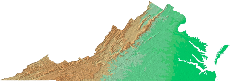
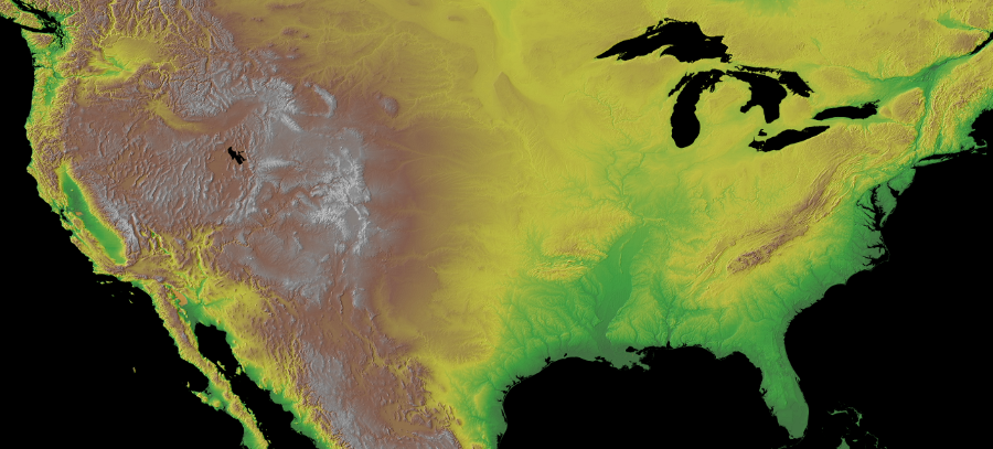
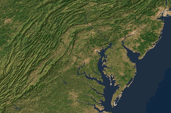
shaded relief map of Virginia
Source: USGS Open-File Report 99-11, Color Shaded Relief Map of the Conterminous United States
shaded relief map of Virginia
Source: USGS Open-File Report 99-11, Color Shaded Relief Map of the Conterminous United States
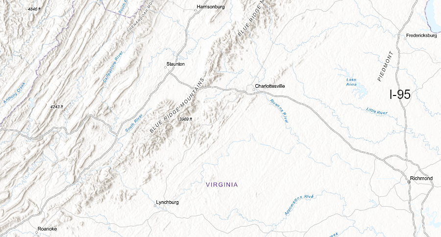
Virginia is not flat. Elevation varies from sea level in Tidewater rivers east of the Fall Line to the tallest peak, Mount Rogers in Grayson County, at 5,729 feet.
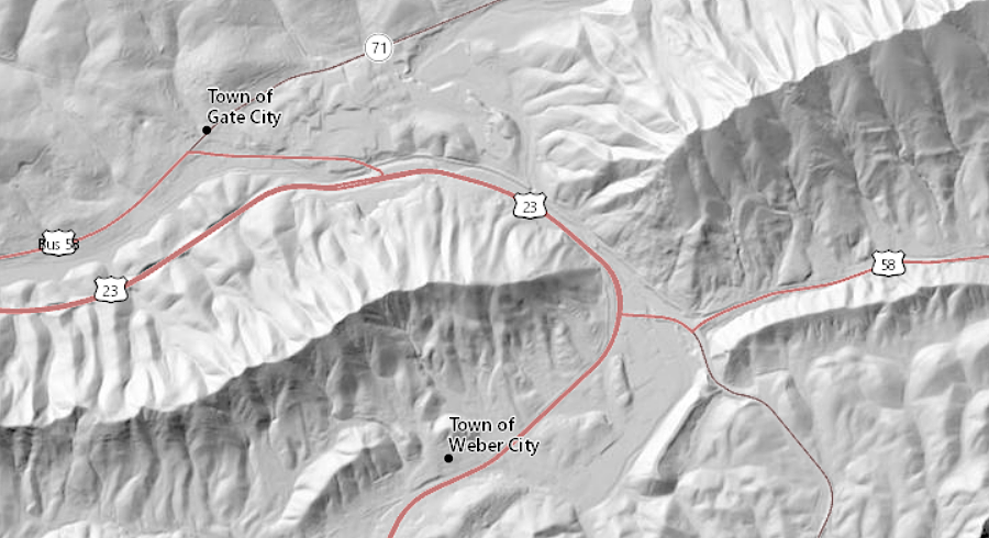
Colonial settlement patterns were shaped by topography. The Fall Line blocked ships from moving upstream into the Piedmont. Further west, settlers built roads through the lowest, easiest-to-travel passes through the Blue Ridge and the Appalachians. Towns such as Winchester and Staunton developed where east-west roads across the mountains intersected north-south roads through the valleys.
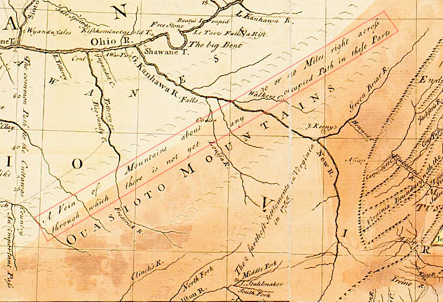
there were few routes for colonists to carry agricultural products to market across the Allegheny Mountains in the 1700's
Source: University of Michigan Library, A general map of the middle British colonies, in America (by Lewis Evans, 1755)
Farmers, particularly west of the Blue Ridge, took advantage of hillsides to build "bank barns" with multiple floors. Hay could be unloaded into the barn from one side, and when needed that hay could be unloaded into a wagon on a lower level on the other side.
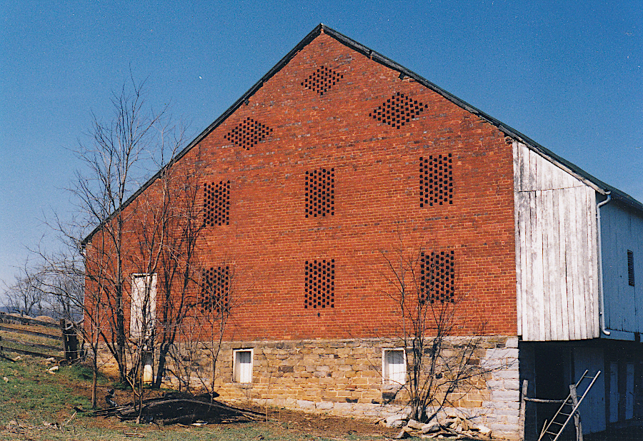
the Henry Mish Barn, built in 1849 in Augusta County, survived the Valley barn-burning campaigns by Union forces
Source: Virginia Department of Historic Resources (DHR), Henry Mish Barn
Millers took advantage of topographic relief when locating their mills. Water flowing at one elevation could be transported through a mill stream to power a water wheel at a mill built lower down on the stream channel.
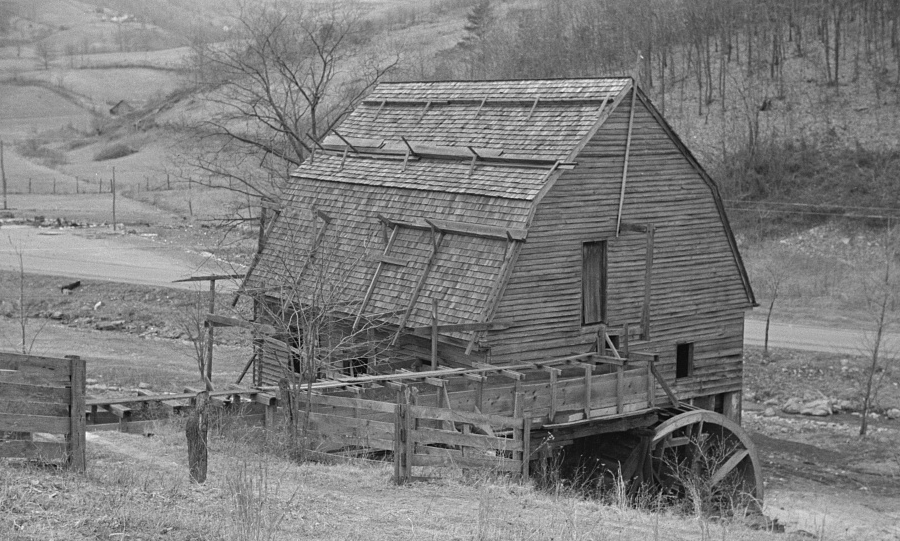
mill streams provided the falling water that powered gristmills
Source: Library of Congress, 1
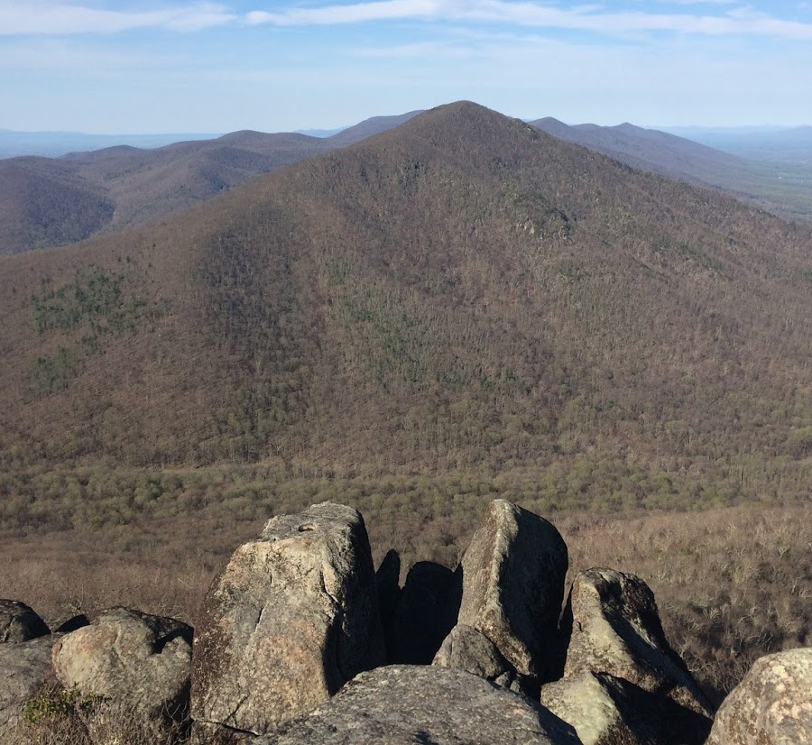
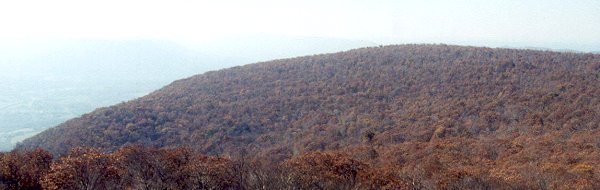
Flat Top Mountain, seen from the peak of Sharp Top Mountain (Peaks of Otter in Bedford County)
Jefferson hoped that the low height of the Appalachians meant that mountains in the western states would be equally low. After being elected president in 1800, he sent Meriwether Lewis and William Clark on an expedition to find a pathway from the Missouri River to the Pacific Ocean.
If the French concept of "symmetrical geography" was correct, then the western edge of the North American continent would be a mirror image of the eastern edge. If Lewis and Clark discovered low mountains commencing about 150 miles from the western seacoast, disposed in ridges one behind another, then American trade routes from the newly-acquired Louisiana Territory to the Pacific Ocean would be easy to develop. (Of course, Lewis and Clark discovered the Rocky Mountains instead of a mirror image of the Appalachians.)2
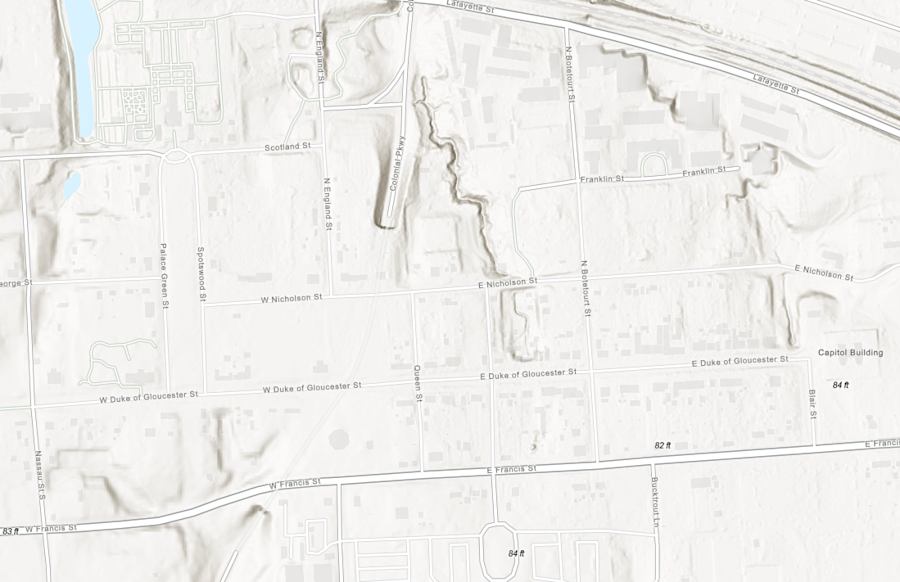
Gov. Francis Nicholson had ravines filled in to create a flat Duke of Gloucester Street in the new capital of Williamsburg
Source: ESRI, ArcGIS Online
What is tall enough to be called a "mountain" in Virginia? There are no official government criteria for distinguishing a "mountain" vs. a "hill." Local custom has determined place names, usually as European colonists first settled an area. The US Board of Geographic Names prefers to use common names created by local residents, so US Geological Survey maps label streams as a "run" or "creek" or whatever is the commonly-used term.
Paul Larson at Southern Utah University has suggested one criterion for a topographic standard for defining a mountain vs. a hill:3
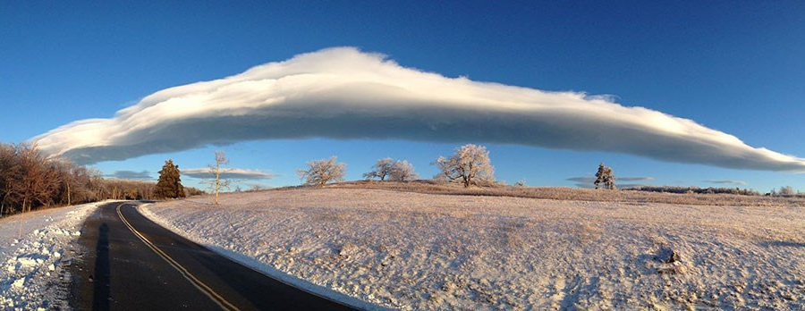
moisture in air masses pushed up by mountains will cool and can condense into orographic clouds, as at Big Meadows on Skyline Drive
Source: National Park Service, Winter in Shenandoah
Today, we know that Grayson County is the "roof" of Virginia, the county with the highest average elevation and the highest peaks in Virginia. Whitetop Mountain appears to be the tallest peak for many casual observers.4
Whitetop, like the Peaks of Otter, stands slightly apart from other ridges. The treeless, bald appearance (the white top...) also makes the mountain more eye-catching than nearby Mount Rogers, which is more than 50' taller. If the Fraser firs and red spruces covering Mount Rogers and blocking the view from the top continue to die off, then there's a chance that the highest point in Virginia will be easier to recognize.
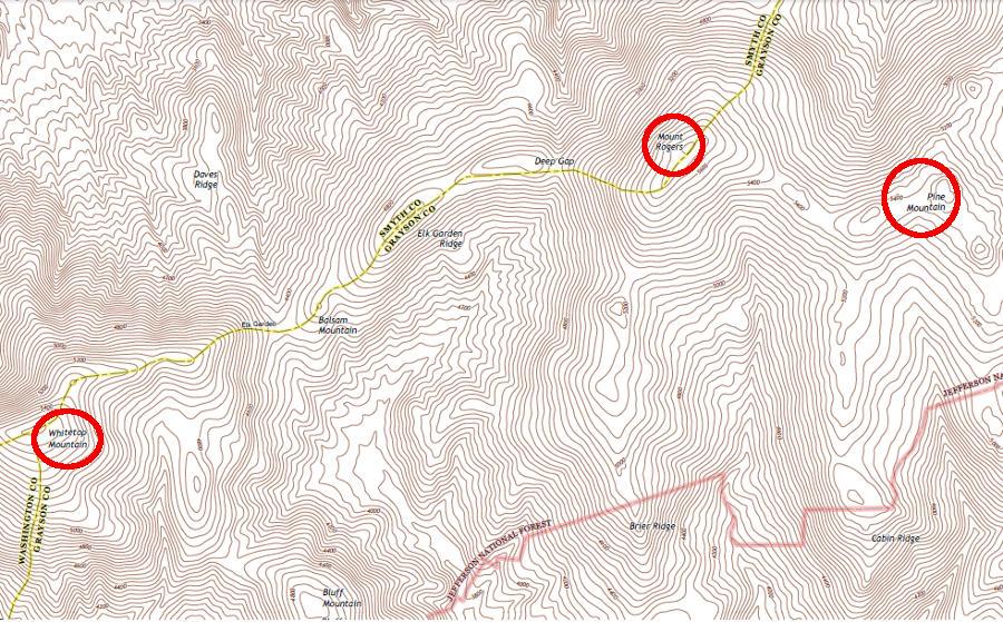
the three tallest summits in Virginia are located in Grayson County
Source: US Geological Survey, Whitetop Mountain 7.5x7.5 topographic quadrangle (2013)
Using the 1:24,000 scale topographic maps produced by the US Geological Survey, we can identify the individual summits in Virginia. A topo quadrangle map that has not been updated for 50 years will still have accurate elevation data, even though the indications of land use (especially boundaries of urban/suburban development) may be inaccurate.
According to the Geographic Names Information System (GNIS), Virginia has about 1,850 features named a "summit" (about 100 over 4,000 feet tall), plus almost 700 records of a "ridge."
Butcher Fork is eroding the ridges in Wise County, as seen from Powell Valley Overlook on US 23
However, height is a relative feature. In Accomack County, the named ridges are low in elevation, but the slight difference in height above the surrounding land is important enough to be affect the drainage and to be noticed. Bulls Head in Accomack County is called a summit - even though the site is just 2 feet above sea level, and appear to be more of a point that a summit.5
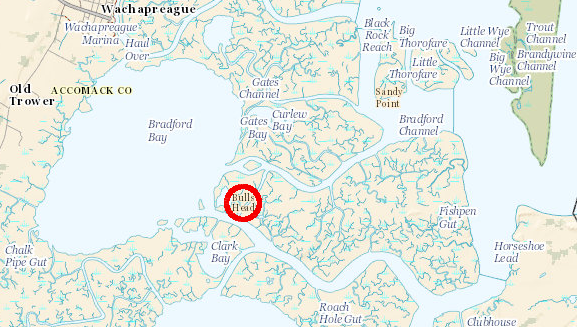
Bulls Head "summit" in Accomack County
Source: US Geological Survey (USGS), National Map

Grayson and Smyth counties, with highest elevations in Virginia
Source: NOAA, Global Land One-km Base Elevation Project (GLOBE) database
At 5,729 feet, Mount Rogers is taller than the mile-high city of Denver. However, the mountains in Virginia are not breath-taking peaks, because there is rarely more than 2,000 feet of topographic relief in Virginia. "Relief" is the difference in elevation between the top of a mountain and the bottom of the adjacent valley.
From a distance, the mountains in the western states offer a dramatic contrast to the flat valleys/plains at their base. The Rocky Mountains rise thousands of feet from the Great Plains, and Mount Whitney in California offers 14,000 feet of relief between its peak vs. Death Valley.6
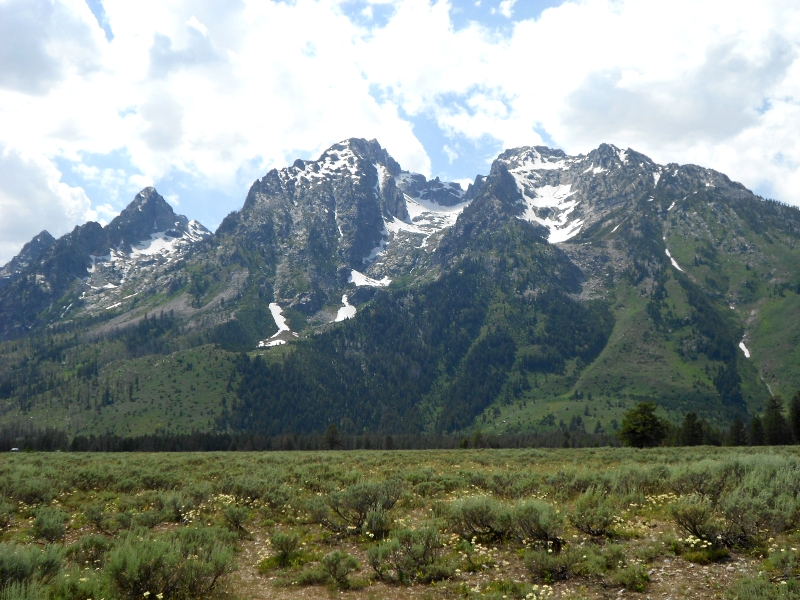
Tetons in Wyoming (Virginia has no "relief" comparable to the Rocky Mountains...)
Tourism officials make the most of the remaining topographic relief in the state, highlighting scenic mountain vistas and cool summer nights in the mountains. The Appalachian Trail is aligned to follow the ridgelines of Virginia mountains, so the views can be spectacular. (You could s-t-r-e-t-c-h the standard explanation of Virginia topography a little further. If you think in terms of tectonic plates rather than continents, Virginia could be described as reaching not just from sea level, but from the Abyssal Plain of the deep Atlantic Ocean to the top of Mount Rogers.)
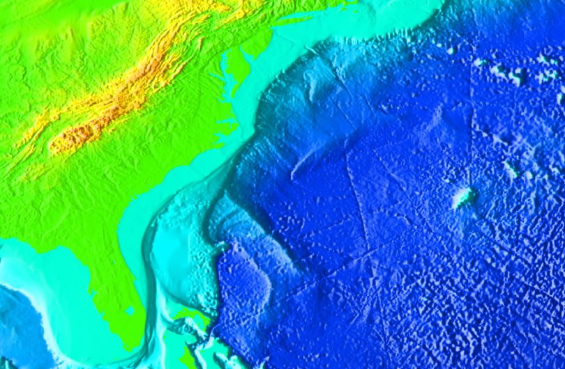
relief of Virginia, from Atlantic Ocean to Blue Ridge summit
Source: NOAA National Geophysical Data Center
The eastern side of Virginia, bordered by the Chesapeake Bay and Atlantic Ocean, is relatively flat. The Coastal Plain has cliffs along the sides of Tidewater rivers at places such as Westmoreland State Park, plus ridges eroded by streams flowing into the main rivers.
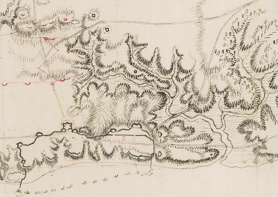
Lord Cornwallis took advantage of the topography at Yorktown when building fortifications in 1781
Source: University of Michigan, William L. Clements Library, The British works at Yorktown and Gloucester (by Alexander Sutherland)
There are also 20-50 foot scarps where high sea levels since the Cretaceous Period have etched a ridge into the sediments, including the Suffolk Scarp next to Dismal Swamp and Surry Scarp further west near I-95.
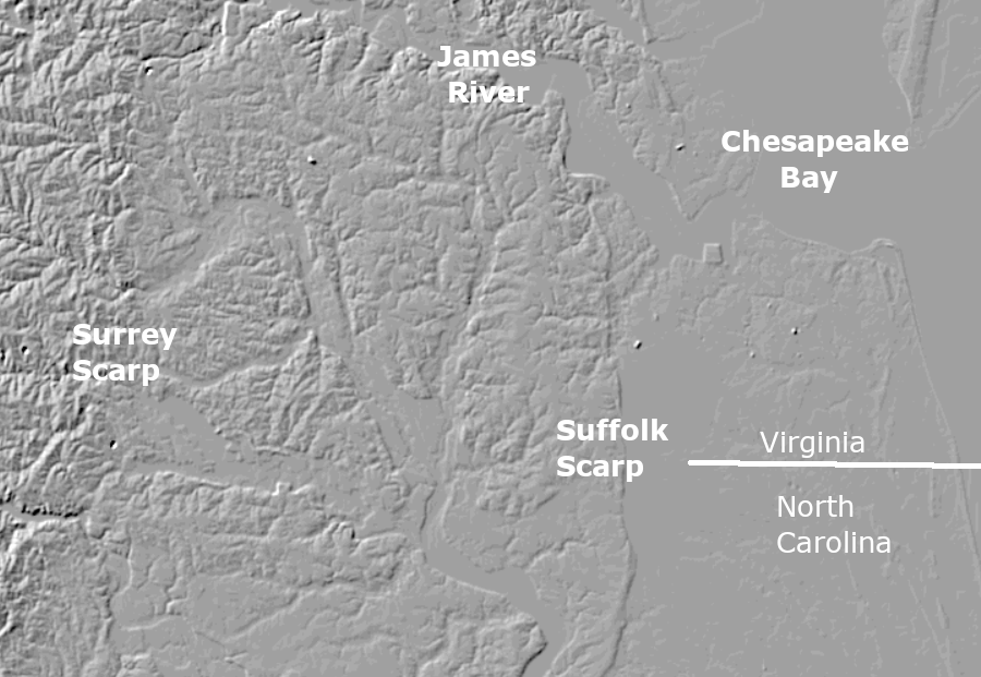
scarps and cliffs on the edge of Tidewater rivers provide the greatest elevation change on the Coastal Plain
Source: US Geological Survey (USGS), The National Map
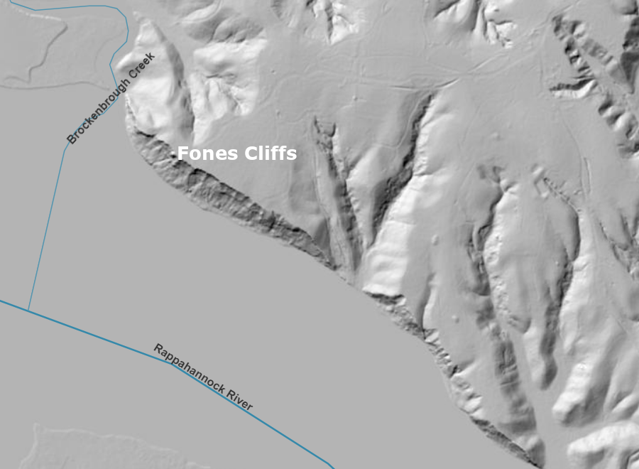
John Smith saw Fones Cliffs on the Rappahannock River in 1608
Source: ESRI, ArcGis Online
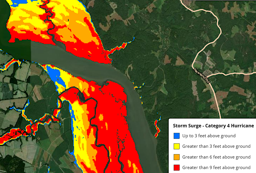
the storm surge from even a Class 4 hurricane would not flood Fones Cliffs, in contrast to the land on the opposite side of the Rappahannock River
Source: National Oceanic and Atmospheric Administration (NOAA), Coastal County Snapshots
The mountains are concentrated on the west side of the state. Why is Virginia not completely flat, or completely mountainous? Virginia is relatively flat for the same reason that the state has only two natural lakes: after 200 million years of erosion, the land has been worn down. Virginia's mountains were created as much by erosion as by uplift, and whatever is at the surface of the land today will end up in the streams.
At one time, 200 million years ago after Africa had collided with North America, Virginia had mountains that would have rivaled the Alps or Himalayas. Since then, rain, wind and gravity have transported the rocks down, down, downhill. The ancestral Appalachians were located near the route of I-95 today, and their "roots" beneath the surface were as deep as the mountains were high above the surface.
travelers have chosen to pass through Moccasin Gap for perhaps 15,000 years
Source: US Geological Survey, National Map
The ancestral Appalachian mountains are gone, long since eroded away. The sedimentary remnants are scattered today from the Ohio River to the Outer Continental Shelf. Granite quarries from Occoquan to Emporia, cut into the ancient roots, mark the location of where the collision between Gondwana (Africa) and Laurentia (North America) created the highest mountain range in Virginia in the last 500+ million years.
The modern Appalachians, the Allegheny Plateau located on the western edge of Virginia, were uplifted far more recently. They may have been pushed up to their current levels in the last 30 million years.7
the ancestral Appalachians were located along what is now I-95, far east of the more-recent uplift creating the modern Allegheny Plateau
Source: ESRI, ArcGIS Online
The Appalachian Mountains that were 6,000 meters (20,000 feet) high about 250 million years ago, after being thrust up by the collision of Africa and North America, eventually eroded into a flat peneplain. One study showed average erosion of the bedrock in the Blue Ridge to be 6 meters/million years. Softer sedimentary rock erodes faster, and on average a mountain range is flattened within 20 million years.
Virginia is not a flat peneplain today; the modern landscape across the state is not as flat as at Dismal Swamp or on the Eastern Shore. Obviously there is uplift still occurring in Virginia, as well as erosion.
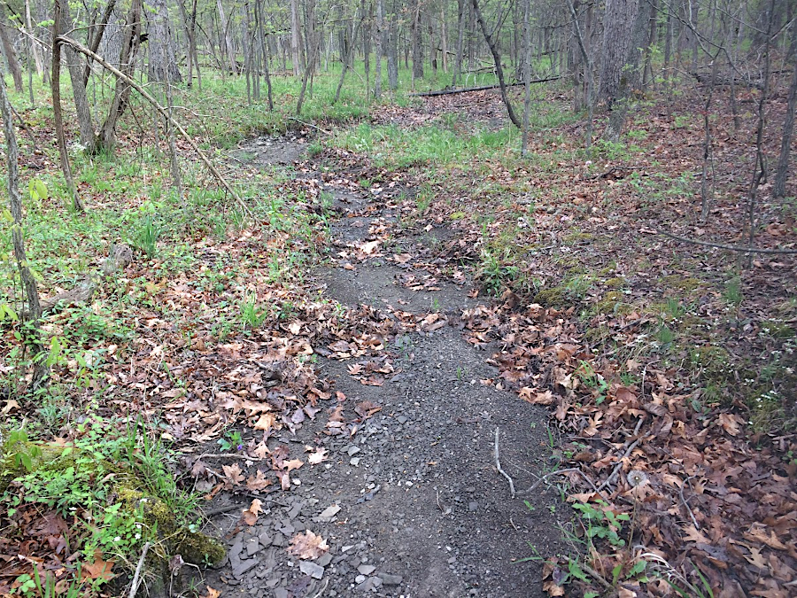
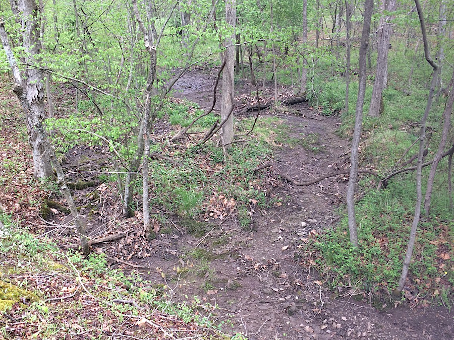
the volume and speed of flowing water erodes the ground surface and etches stream channels over time
Since the Appalachian/Alleghanian Orogeny, that uplift is triggered by three forces. The tectonic plate is still being squeezed as it migrates westward, so there is some upward pressure from the drift on continental plates.
There may be currents deep in the mantle, with hotter-than-average rock rising outward from the core. At the surface, the hot magma pushes the solid crust of the earth upward. The effect is similar to the way that bubbles rising up from the bottom of a pot of boiling water will create ripples on the surface.
A third factor is isostatic uplift. If you place a thin wooden board on top of two bricks and then place a weight in the center, the board will bend downwards Remove the weight, and the board will spring back to a flat horizontal shape in "isostatic rebound." When mountains pushed up by tectonic or other forces erode away, the earth's crust rebounds slowly and regional uplift occurs.
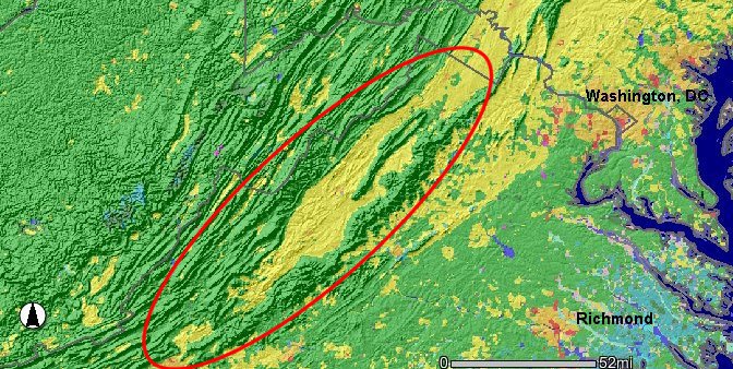
Also key to Virginia topography is the different types of bedrock exposed at the surface. Hard metamorphic and igneous rocks, such as the Catoctin greenstone in Shenandoah National Park, erodes slower than sedimentary limestone and shale. Massanutten Mountain exists because there is a hard sandstone layer on the eastern and western sides, eroding slower than the limestones and shales in the Page Valley to the east and the Shenandoah Valley to the west.8
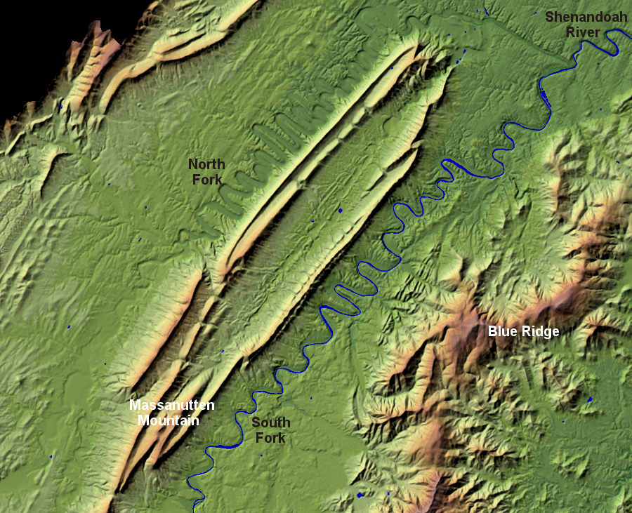
the South Fork and the North Fork of the Shenandoah River are carrying away the sediments that erode off Massanutten Mountain, and etching out valleys on either side
Source: USGS Earth Resources Observation and Science (EROS) Center, National Elevation Dataset - Shaded Relief Map of Virginia
Differential erosion (and some recent uplift) has left Virginia some remaining minor "ups and downs" with cliffs and waterfalls, but don't come to Virginia to climb 14,000-foot mountains. Virginia's landscape is too old, too eroded, too worn out. To climb tall peaks, go west where the Rocky Mountains are only 65 million years old. The tall mountains and natural lakes in the western states have not been drained by their outlet streams yet - but the time will come when the Rockies are as old as the Appalachians, and the relief will be much less.
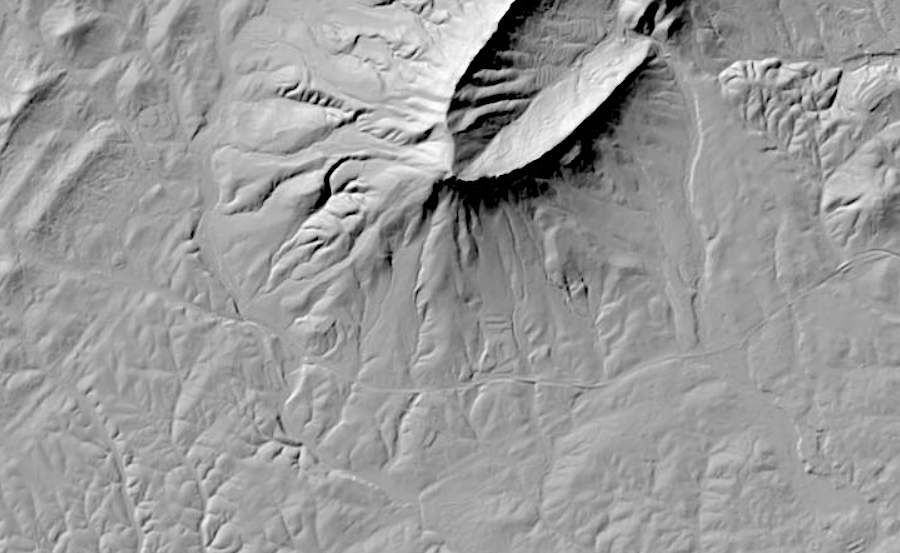
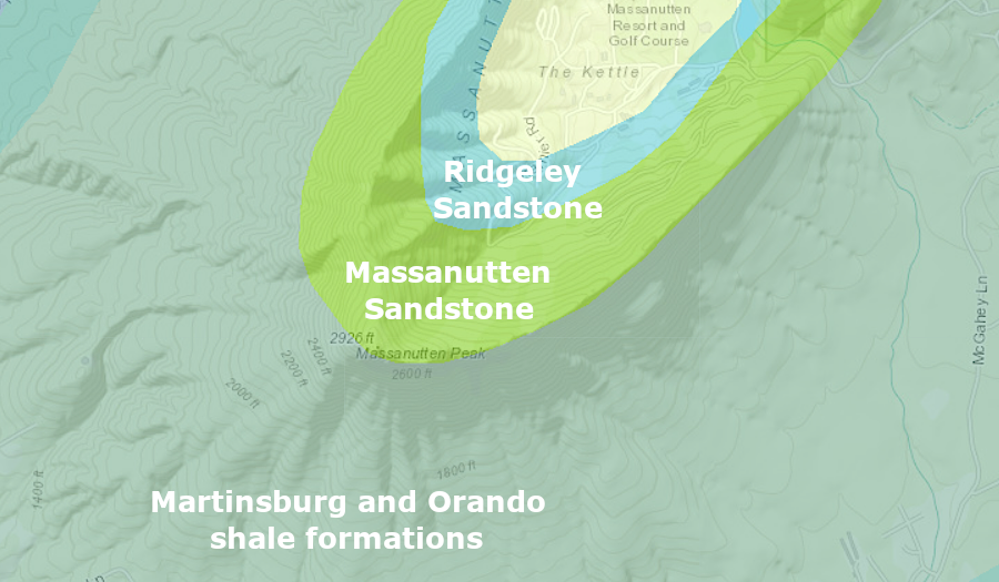
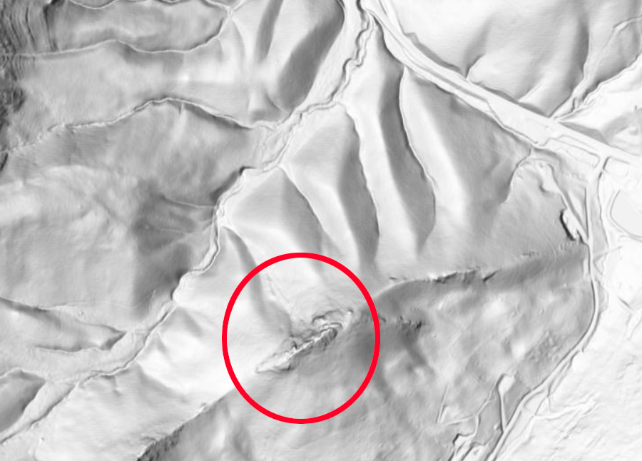
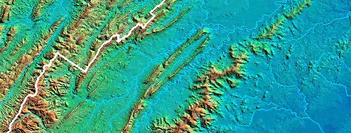
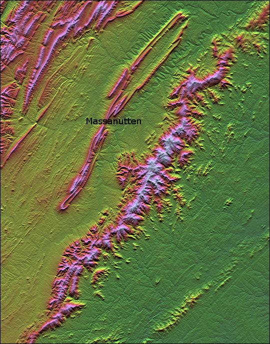
differential erosion created the topography at the southern end of Massanutten Mountain, where resistant sandstone formations are adjacent to faster-to-erode shale formations
Source: US Geological Survey (USGS), The National Map and Virginia Department of Energy, Geology Mineral Resources
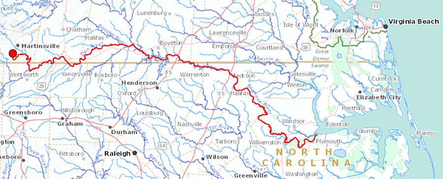
The high parts of Virginia are still being eroded away; the solid earth is moving. Southwestern Virginia is washing downstream towards the Gulf of Mexico, as the tributaries of the Tennessee River and the New River carve away at the Appalachian Plateau and carry sediments downstream. The tributaries of the Potomac, Rappahannock, York, James, and Roanoke rivers are carrying Virginia's mountains to the Atlantic Ocean.
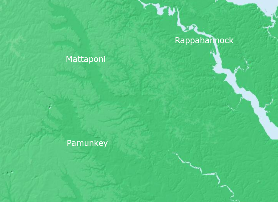
tributaries of the Pamunkey and Mattaponi rivers have etched valleys in the Piedmont physiographic province
Source: US Geological Survey (USGS), The National Map
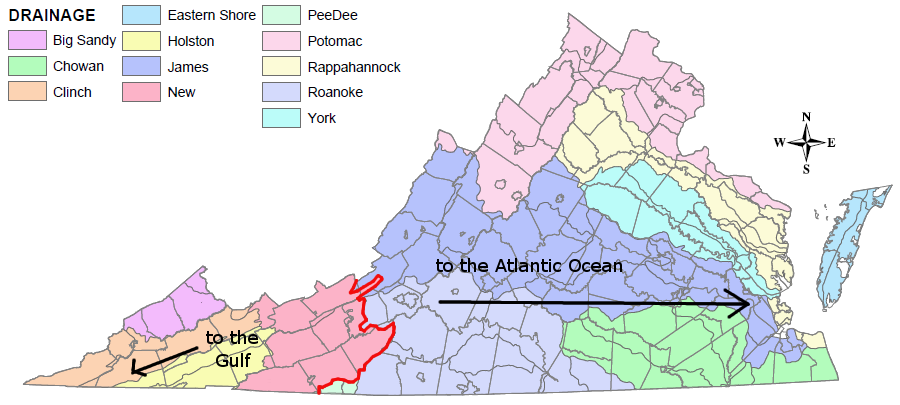
the mountains erode and particles go to where the rivers go - some to the Gulf of Mexico and some to the Atlantic Ocean
Source: Virginia Department of Wildlife Resources, Virginia Watersheds
Most of the islands in Virginia's part of the Chesapeake Bay have eroded away; the only remaining populated island (Tangier) may have to be abandoned by 2050. The barrier islands and marshes along the Eastern Shore are being submerged by sea level rise, reducing the amount of dry land. Relict dune lines, formed when sea level was lower and sediments accumulated at the mouth of the Susquehanna River, create what little topographic relief is present on Virginia's Eastern Shore. The highest point there is Butler's Bluff in Northampton County, at just 69 feet in elevation.9
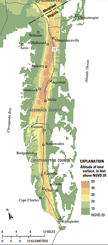
all of Virginia's Eastern Shore is below 70 feet in elevation, but wind-blow sand piled up into dunes still creates a little topographic relief
Source: US Geological Survey (USGS), Simulation of Groundwater-Level and Salinity Changes
in the Eastern Shore, Virginia (Figure 2)
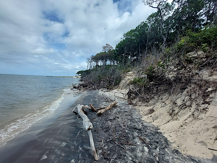
dunes, such as at Savage Neck Natural Area Preserve, create topographic relief on the Eastern Shore
Rain carries sediments down hillsides into valleys, and sediments accumulate in the valleys until rivers carry the soil particles further downstream. The Blue Ridge in Shenandoah National Park is eroding today at roughly 20 meters per million years. If that is an average rate since the Alleghanian Orogeny 250 million years ago, then 14,000 feet of the mountains in Virginia at the end of the Paleozoic Era could have washed away. Erosion may have been faster when the mountains were higher - other studies report erosion at 30 meters/million years in the Great Smoky Mountains, and up to 54 meters/million years in the in Susquehanna River basin.10
Today the granite "roots" of those ancestral Appalachians (such as the Vulcan quarry in Occoquan, or the granite rapids in the James River in Richmond) provide the best evidence of the old mountains that once stood on the eastern edge of the Piedmont, where traffic now races down I-95.
Virginia's valleys are eroding also, just as the mountains are wearing away and getting lower over time. Rainfall after each storm carries some of Virginia down towards sea level. After every rainstorm, muddy water running off every parking lot transports sediment downstream to the drain, mimicking the "carry me down to sea level" effect of erosion across the state.
Dams trap sediment, delaying the speed at with the sand, silt, and clay particles from eroding mountains end up being deposited as sediments on the Outer Continental Shelf beneath the Atlantic Ocean. A metal tag tossed into Marrrowbone Creek in Henry County in 1950 was discovered 150 miles downstream on a bank of the Roanoke River in 2023. Following the winding stream channels, the tag may have traveled 250 miles over 72 years.
For part of that journey, the tag was probably trapped behind dams until getting flushed downstream. From the perspective of geologic time, all of the dams in the Roanoke River watershed are just temporary barriers to the flow of eroded particles moving downstream. With that erosion, the Blue Ridge will be lowered to sea level within 20-50 million years unless there is uplift from some force.11
Marrowbone Creek carries sediments from the Blue Ridge downstream to, ultimately, the Atlantic Ocean
Source: US Geological Survey, Streamer
One issue debated by geologists: are the mountains and valleys of Virginia in "dynamic equilibrium" and eroding at the same rate? If Virginia's mountains are eroding faster than the valleys, then Virginia will appear to get flatter and flatter over time and relief will disappear, until the state is a flat, topographically boring peneplain.
However, if Virginia's valleys are being excavated faster than new sediments are eroding from hillsides and re-filling the valleys, then topographic relief in Virginia will increase as valleys get eroded away at a rate faster than adjacent mountains.
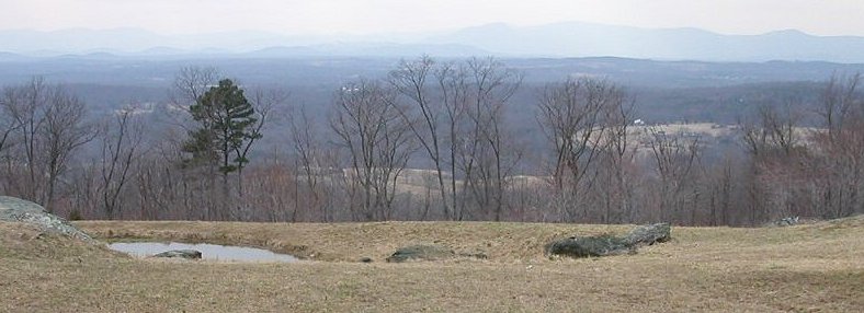
Looking towards the Blue Ridge on the western boundary of Fauquier County
Erosion in the Coastal Plain is reshaping the cliffs at Westmoreland State Park, destroying archeological sites along the Chesapeake Bay, and replacing dry land with wetlands and mud flats.
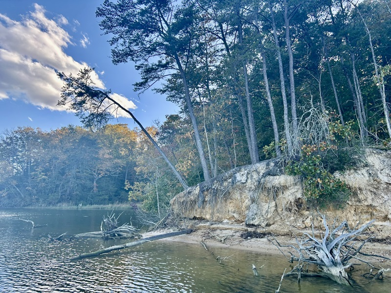
erosion in Tidewater is altering vegetation along the river edges
Source: Virginia Department of Historical Resources, Caught in a Whirlwind: The Chesapeake Shoreline Survey
Various studies, using different techniques, do not provide a simple answer for all mountain ranges. In some places, the pattern is clear. In the Basin and Range province of Nevada, sediments are accumulating in valleys so fast the mountain ranges are being buried - while in the valleys of Vermont, rivers are removing valley sediments at least as fast as the soil is washing down the mountains.
For the central Appalachians, sediments on the continental shelf of the Atlantic Ocean provide evidence of increased erosion in the last 3-4 million years - but where did those sediments come from? Climate changes during the Quaternary Era (including multiple ice ages) may have increased removal of valley sediments faster than the speed at which mountain slopes eroded. If that is the case, then the topographic relief between valley floors and mountain tops increased, and it would appear the mountains of Virginia have grown more impressive.12
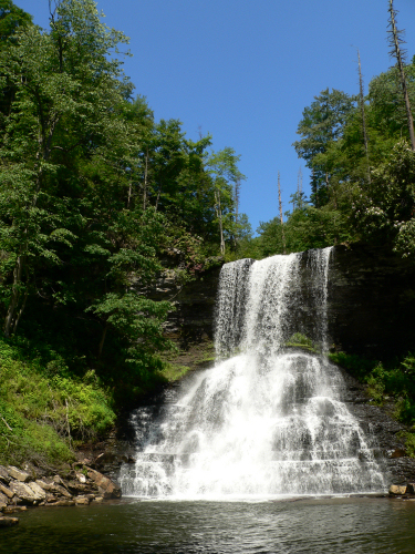
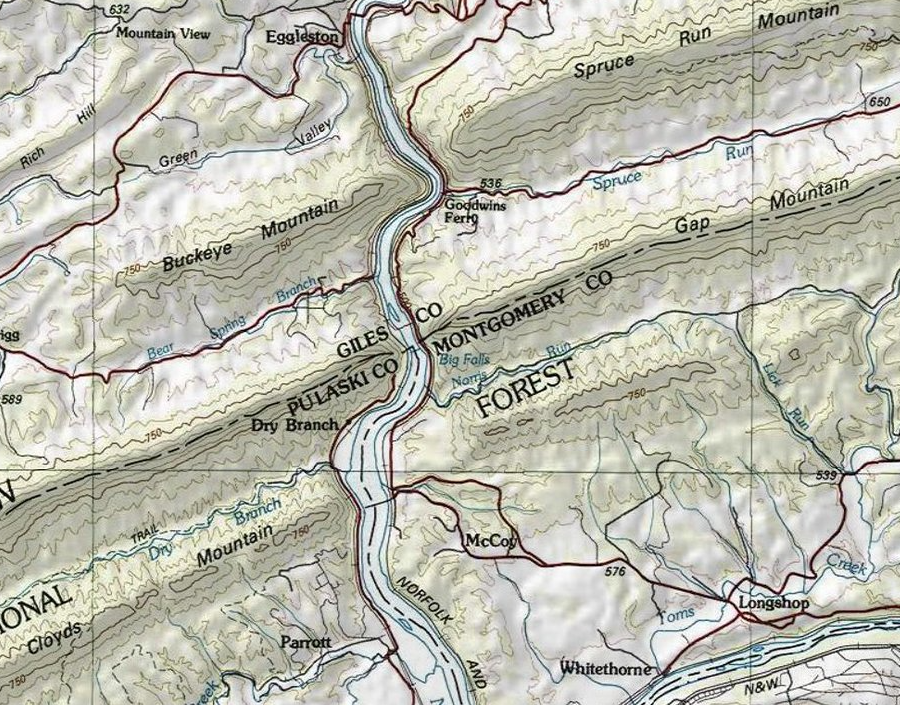
the mountainous topography of southwestern Virginia resulted in tourist attractions such as Cascades on Little Stony Creek (Giles County)
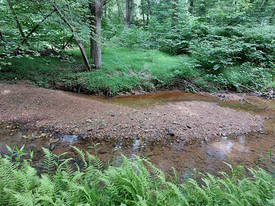
erosion naturally lowers land elevation and creates gravel bars in creek valleys (Fraser Preserve, Fairfax County)
Though Virginia's topographic relief is not great compared to the western United States, the Fall Line, Blue Ridge and Alleghany Front still affected the travel routes of the Native Americans and served as a barrier to European settlement in the 1700's. The physical geography helped shape the boundaries of cultural regions and county boundaries, and of course the path of canals, railroads, and modern highways.
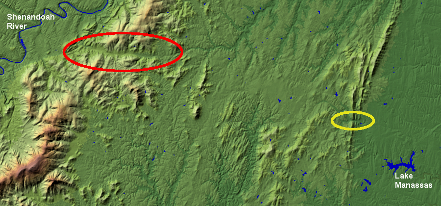
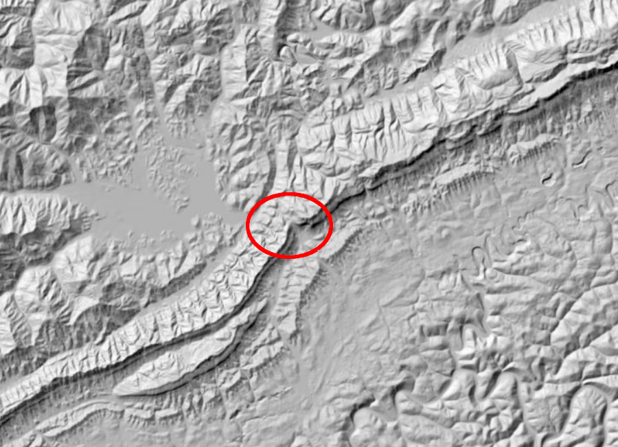
Interstate highways were built through three gaps in the Blue Ridge: I-77 goes through Fancy Gap, I-64 through Afton Gap, and I-66 through Thoroughfare Gap (yellow circle) and Manassas Gap (red circle)
Source: USGS Earth Resources Observation and Science (EROS) Center, National Elevation Dataset - Shaded Relief Map of Virginia
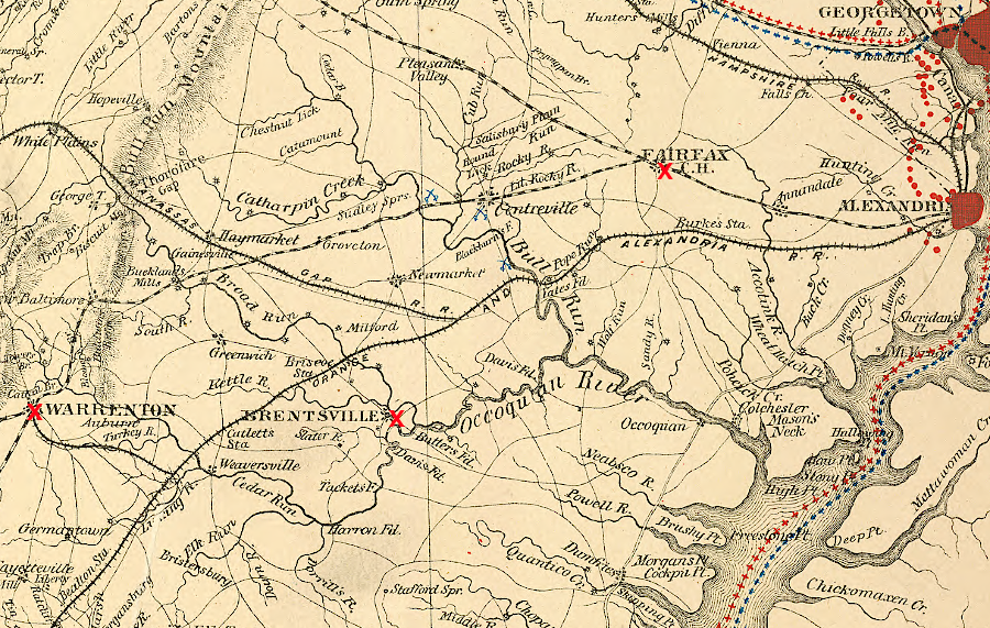
to minimize topographic relief ("grade"), the Orange and Alexandria Railroad bypassed county seats in Fairfax and Prince William and built a branch line in Fauquier County
Source: Library of Congress, Central Virginia: showing Lieut. Gen'l. U.S. Grant's campaign and marches of the armies under his command in 1864-5 (US War Department. Engineer Bureau, between 1864 and 1869)
I-77 cuts through the mountains in Bland County
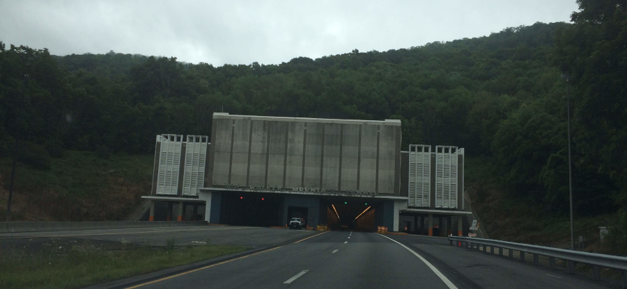
the Big Walker Mountain tunnel on I-77 in Bland County
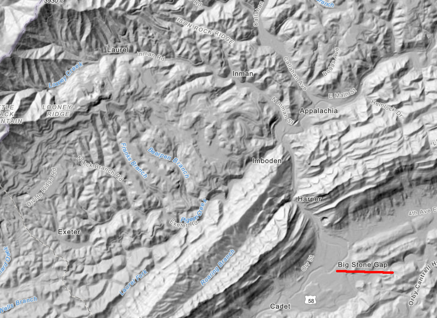
Powell River carved a gap through Stone Mountain, and the town of Big Stone Gap developed because railroads used that low spot to access coal mines
Source: ESRI, ArcGIS Online
Eastern Virginia is so flat, the European settlers who arrived at the Atlantic shoreline were able to migrate westward with few physical limits for 100 years - until they reached the Blue Ridge.
The 1,000-foot climb up through the gaps in the Blue Ridge was a significant barrier to travel from eastern Virginia into the Shenandoah Valley. Until the 1900's, most vehicles struggling up the mountain roads were one-horsepower wagons.
immigrants moving west from the Chesapeake Bay had to climb up/over the Blue Ridge
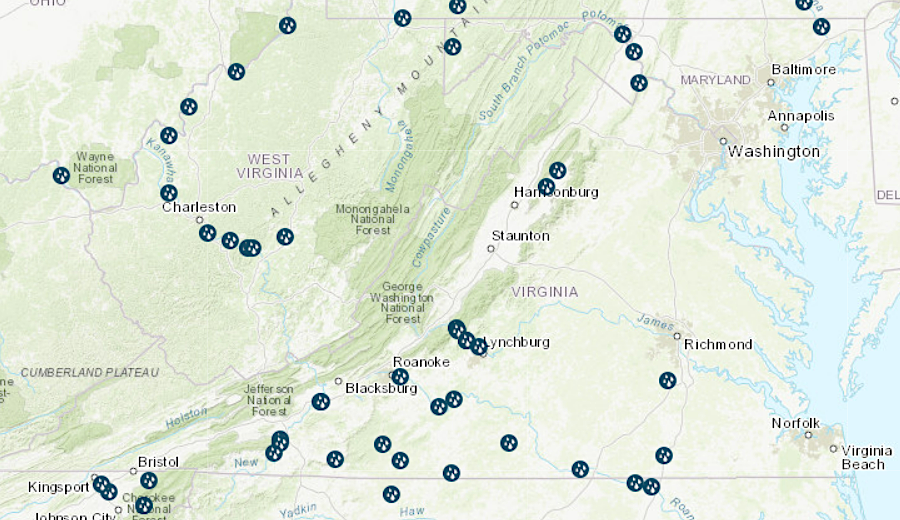
all of Virginia's hydroelectric plants are west of the Coastal Plain
Source: Energy Information Administration, U.S. Energy Mapping System
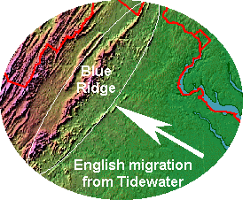
In contrast, European settlers coming from the Philadelphia region could access the Shenandoah Valley through an easier route, without the mountain climb. Starting in the 1730's, the Pennsylvania "Dutch" along with the Scotch-Irish moved into the Shenandoah Valley from the north. Today, the Amish, Mennonites, and Dunkers in Virginia are still concentrated west of the Blue Ridge, reflecting that historical migration in the mid-1700's.
topography facilitated immigration of Pennsylvania "Dutch" (German) immigrants to the Shenandoah Valley
Source: Global Land One-km Base Elevation (GLOBE) Project
The Europeans who first settled in the Shenandoah Valley were different from the Europeans who first settled in Tidewater. Differences in agricultural crops, the extent of slavery, and even the shape of the barns between Tidewater and the Shenandoah Valley can be traced back to the initial settlement pattern shaped by the topography; there is a clear link between physical and cultural geography.
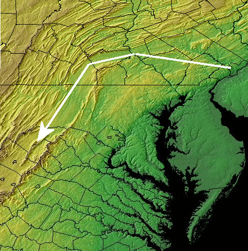
Settlers migrated west through Cumberland Gap, which provided a relatively easy path through the Allegheny Front compared to following the New River or crossing the watershed divide separating the James and Kanawha rivers. By 1792, enough people had settled west of Cumberland Gap to justify creating Kentucky as a separate state.
Cumberland Gap facilitated the settlement of Kentucky
Source: ESRI, ArcGIS Online
In the last 400 years, farmers have leveled fields by removing humps of soil and filling low swales to simplify tilling for wheat, corn, and other row crops. Homeowners have done the same to grow turfgrass, without having low spots in the lawn that support weeds. Designers of roads, ballfields, and landfills very carefully reshape the local topography to drain water from the center to the sides, and urban engineers have developed a complicated pattern of storm drains to carry rainwater away from structures.
Tourism officials welcome the vistas provided by topographic relief. The Appalachian Trail is routed along ridges in order to maximize scenic views.
the Appalachian Trail passes by Dragon's Tooth in Roanoke County
Source: US Geological Survey (USGS), Nation Map 3DEP Elevation - Multi-Directional Hillside
Quarries and landfills are common revisions of Virginia topography.
the Construction Demolition and Debris landfill at Lorton (Fairfax County) topped out at 410 feet in elevation
Source: Fairfax County, Lorton CDD Landfill Closure
Most quarries excavated prior to the last century have been re-filled, leaving little evidence of their previous use. There is a Quarry Road in the City of Manassas, but no quarry today. Modern quarries are likely to be repurposed as lakes. Both Loudoun and Fairfax counties have arranged for quarries to be converted into water banks, storing drinking water that will be needed in a drought.
since the Civil War, the forest has regrown over the historic quarry at Thoroughfare Gap in western Prince William County
Mining the kyanite at Willis Mountain has transformed it. Across the Appalachian Plateau, mountaintop removal for strip mining coal has changed the topography even more dramatically.
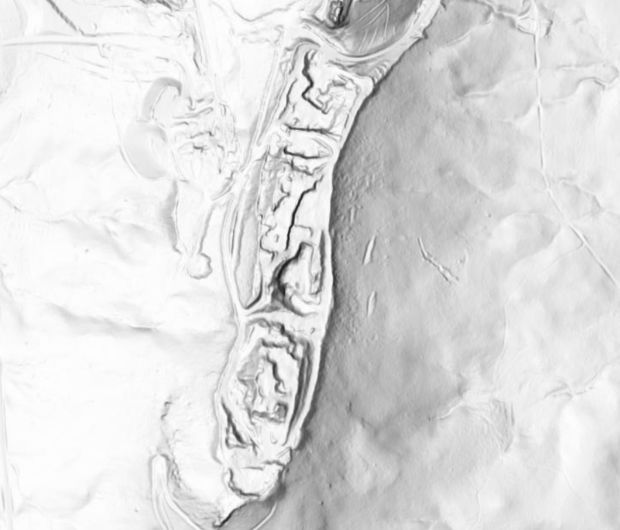
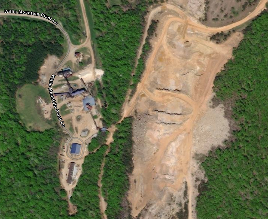
the shape of Willis Mountain has been transformed by mining
Source: US Geological Survey (USGS), Nation Map 3DEP Elevation - Multi-Directional Hillside; ESRI, ArcGIS Online
Taking advantage of local topography is a key part of military training. Officers sought to place their troops on high places when on the defense, forcing attacking troops to climb uphill.
During the Revolutionary War siege at Yorktown and on multiple battlefields in the Civil War, soldiers dug trenches and "foxholes" to alter the natural topography and protect themselves from hostile fire. As a counter-measure, artillery commanders used mortars to lob projectiles above the trenches.
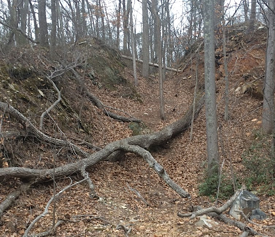
landscape transformation by Civil War soldiers is still visible more than 150 years later
Source: National Park Service, Trenches at Cold Harbor (photo by Robert Underwood)
Artillery officers placed cannon at high spots, enhancing the range of their cannon. When troops were moving fast, careful placement of artillery at high spots on the battlefield was not always possible. At times, such as during the Battle of Buckland on October 19, 1863, placing cannon on a hill was counter-productive.
Erosion by Broad Run in western Prince William County created a conical hill with 60 feet of topographic relief. For perhaps the last 15,000 years, travelers moving along the eastern edge of the Blue Ridge must have stopped to enjoy the view from that hilltop. According to oral tradition, Native Americans had established a trading place at the ford crossing Broad Run at the base of the hill - and the hill itself was viewed as a ceremonial dancing ground ("step mound") by the Cherokee.
During the Mexican-American War in 1848, a similar hill was a factor in the Battle of Cerro Gordo. Captain Robert E. Lee and other engineers created a route for the American troops to flank the army of Santa Anna, leading to a victory and ultimately to the American army's capture of Mexico City. The 60' high conical hill in Prince William County was named Cerro Gordo to honor the victory.
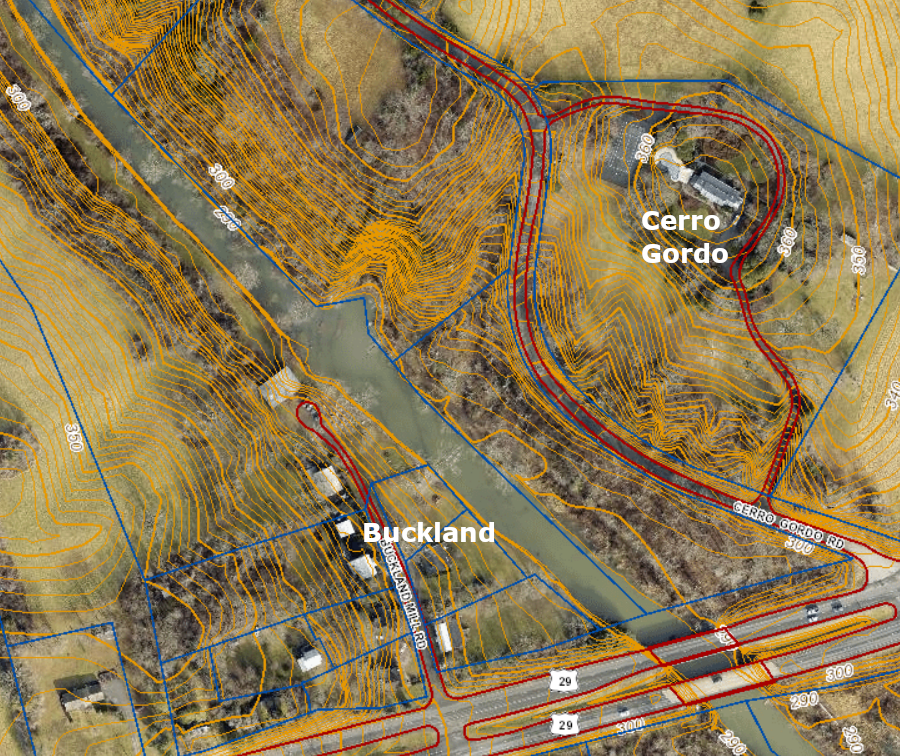
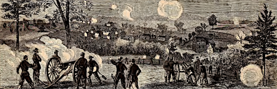
the steep drop from Cerro Gordo to Buckland prevented Union cannon from hitting the town during the 1863 Battle of Buckland
Source: Prince William County, County Mapper and Harper's Magazine, Buckland, Scene of a Cavalry Skirmish With Stuart (p.725, November 14, 1863)
Union forces occupied the hill during the Battle of Buckland. General George A. Custer placed artillery on Cerro Gordo in order to fire down into Buckland and disrupt General J. E. B. Stuart's cavalry there. However, the Union cannon could not depress their tubes low enough to hit the houses in Buckland; instead, rounds flew over the town and caused no harm to the Confederate forces.13
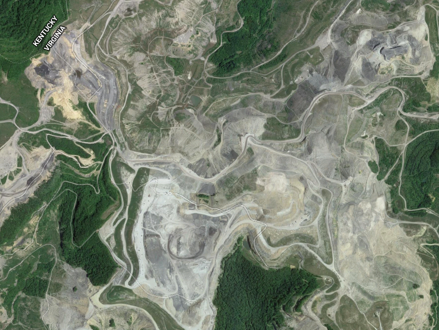
strip mining coal by mountaintop removal has reshaped the topography of the Appalachian Plateau in Southwestern Virginia
Source: GoogleMaps
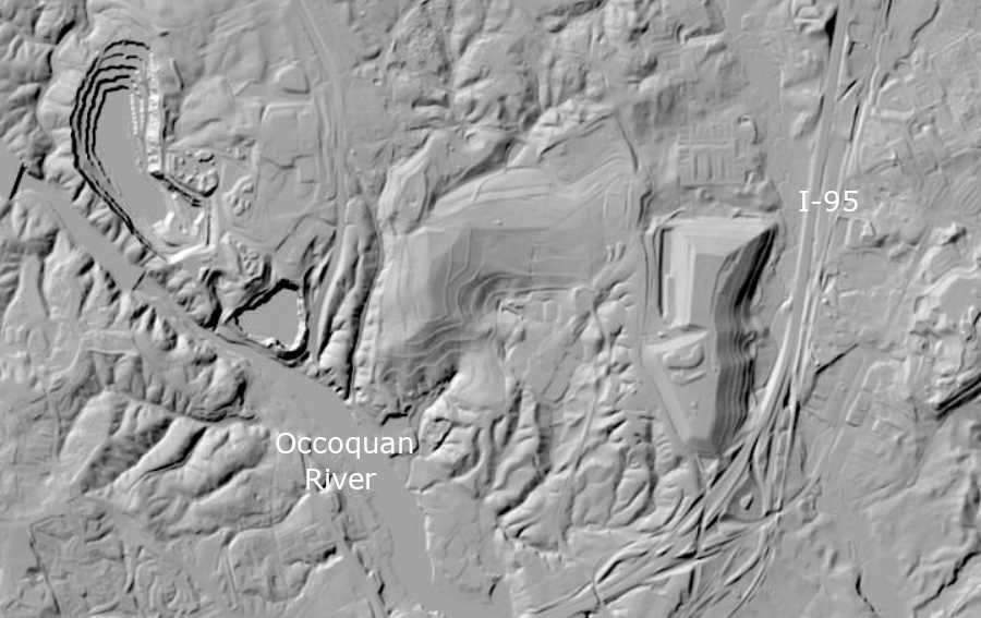
topography in Fairfax County has been reshaped by excavating a quarry (left) and creating an artificially-high landfill (right)
Source: US Geological Survey (USGS), The National Map
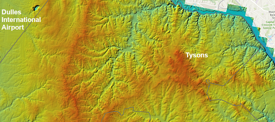
the highest point in Fairfax County is Tysons, but there is also a ridge on the western side of the county
Source: Fairfax County, LiDAR Elevation Viewer
Virginia county boundaries in 1732 show there still were no organized political units west of the Blue Ridge
Source: Newman Library - Atlas of Historical County Boundaries
Fort Valley between the exposed flanks of the Massanutten Mountain syncline, in the Shenandoah Valley between the Blue Ridge and West Virginia
erosion + time = topographic relief
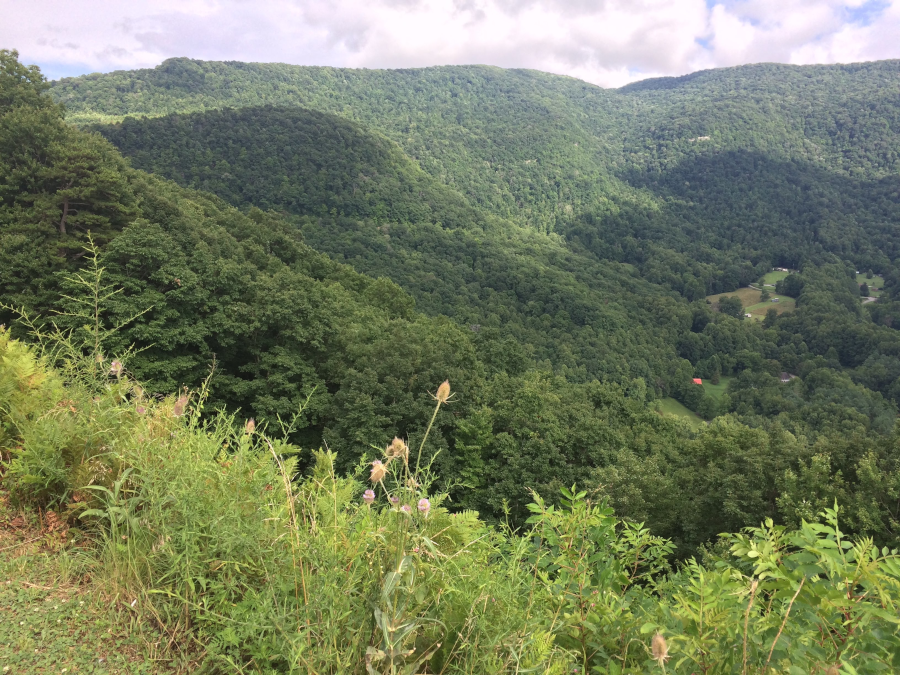
looking from Butt Mountain towards the Narrows in Giles County
Virginia has mountains and valleys with greater relief than states in the mid-continent, but more-recent tectonic forces have uplifted the Rocky Mountains to create peaks over 14,000 feet high
Source: National Oceanic and Atmospheric Administration, GLOBE: A Gallery of High Resolution Images
Source: USGS Earth Resources Observation and Science (EROS) Center, National Elevation Dataset - Shaded Relief Map of Virginia
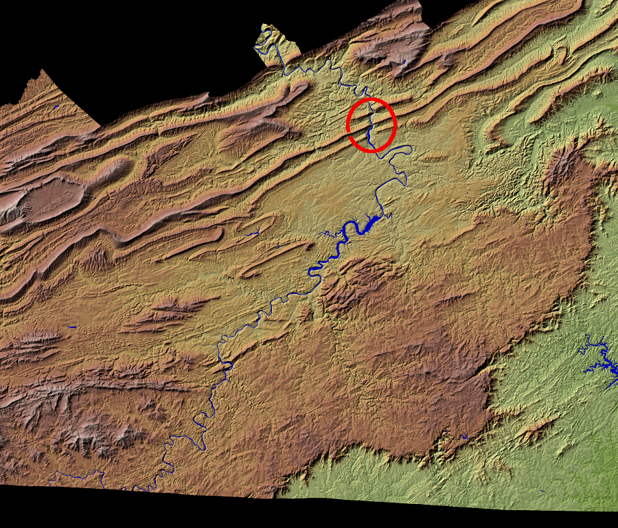
the New River, often described as the oldest river in Virginia, has carved its channel faster than Cloyds/Brush, Walker/Gap, and Buckeye/Spruce Run mountains have been uplifted by tectonic forces
Source: ESRI, ArcGIS Online
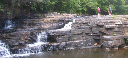
Dismal Falls (Giles County) drops a dozen feet over resistant Silurian-age Keefer sandstone
Mid-Atlantic topography (North Carolina to Pennsylvania
Source: National Atlas
Valley of Virginia (Shenandoah and Roanoke River valleys)
Source: US Geological Survey Seamless Data Viewer
relief of Virginia, from Blue Ridge west through Shenandoah Valley to North Mountain
(showing Massanutten Mountain in middle of the valley)
Source: NASA Earth Observatory
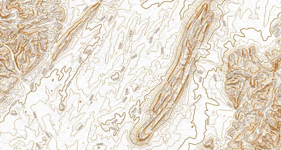
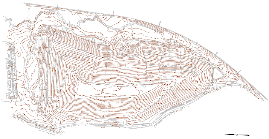
elevation contours of the Shenandoah Valley, with southern end of Massanutten Mountain
Source: US Geological Survey (USGS), The National Map