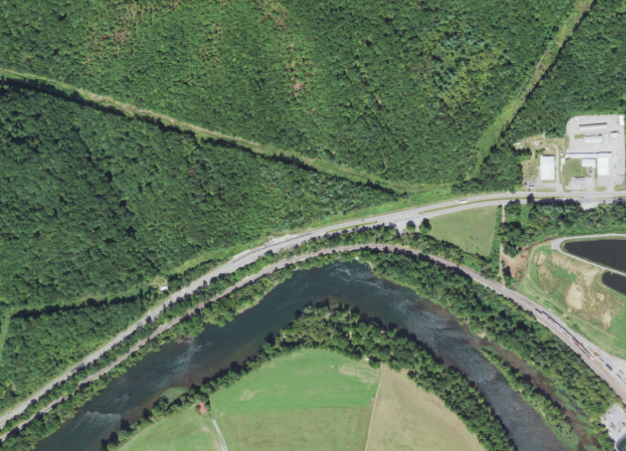
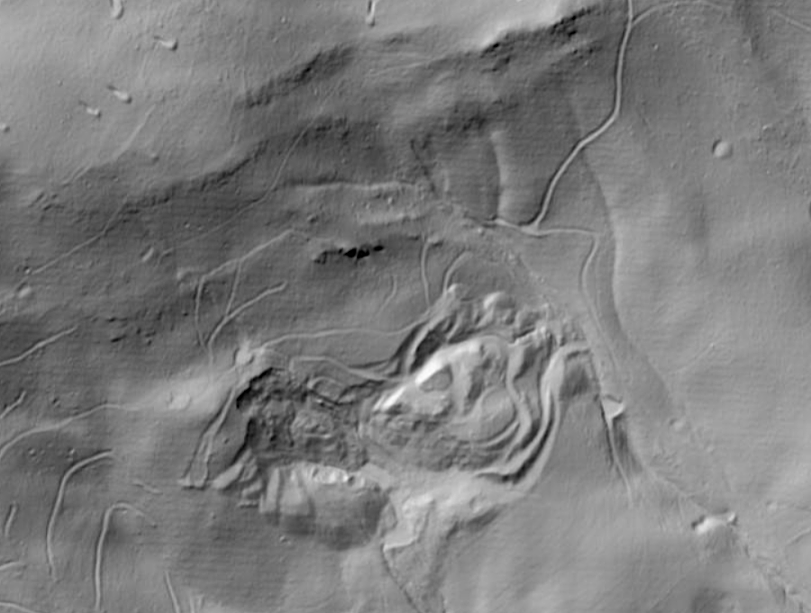
LIDAR reveals an active landslide along US 460 west of Narrows (Giles County)
Source: US Geological Survey (USGS), The National Map
Rocks weather in place. Temperature and pressure are lower near the land surface, and water is more present than in the bedrock hundreds of feet deep. As elements realign within mineral crystals based upon the changed environmental conditions, minerals morph. Felspars transform into clays, for example.
Erosion is different from weathering. Erosion occurs when rocks move. The transformation of minerals near the land surface weakens the bonds between particles. Gravity, facilitated by wind and water acting upon those particles, determines how erosion will shape the landscape. Slow, gradual transport of particles occurs daily. Rapid transport of large masses of particles, landslides, occur less often.
Geologists identify five types of landslides, where rocks, debris or earth move down a slope: falls, topples, slides, spreads, and flows. Gravity is always a factor is moving material down a slope. Landslides are where a distinct mass moves at a faster rate than the adjacent material. The movement can be quick like a rockfall, or occur as a slow shift of a slice of a hillside.
Earthquakes and hurricanes can trigger landslides. Climate change can result in freezing and thawing cycles that cause a mass to move downslope gradually. Shifts in groundwater flow can initiate and halt landslides. Erosion by a stream undercutting a mass of rock, or by construction of a highway/railroad, can initiate "mass wasting" and force expensive repairs to clear clots of dirt/rock that clog a transportation artery.1
Mass wasting events (debris slides) have initiation points where a layer of soil breaks free and begins to slide downhill. The break can occur when a patch of soil becomes saturated with rainwater and liquifies, or when a column of soil becomes so saturated that its weight causes a break.
A scarp forms at the uphill side at the initiation point, often looking like an ice cream scoop carved out a slice of ground. The initial patch of moving soil collides with the soil on the downhill side.
As a slide moves, new soil and vegetation on the surface are incorporated. The extra weight of the moving block then detaches more soil as the slide moves downhill. A landslide gathers speed, moving up to 30 miles per hour if rainfall has provided enough water for lubrication. Slides accumulate more mass until the slope decreases and the effects of gravity dissipate.
A debris flow typically stops when it reaches a flatter slope. There the debris can pile up 30 feet high, burying houses and transforming the landscape. Trees ripped from the hillside will rot and be replaced through the natural vegetation succession process, unless debris is removed in a storm cleanup project and the site is replanted intentionally.
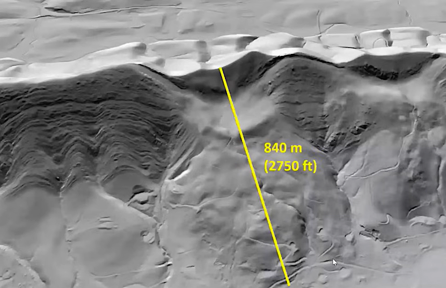
a landslide on Catawba Mountain traveled a half-mile
Source: US Geological Survey (USGS) Presentations, You'll never believe why the side of this mountain fell off!
On the surface, rocks and boulders will be jumbled together and not sorted by size. Soon after a flow stops moving, the soil is likely to be deep enough to support forest growth. Any mature trees that survived the debris flow will have scars on their uphill side, and for decades may show an accumulation of debris which is elevated above the land surface on the downhill side.
After a few centuries, soil and vegetation often obscures the evidence of a debris flow. Scarps erode, making it difficult to determine historic routes of landslides. Modern development can obliterate much of the evidence.
Debris flows that occurred several thousands of years ago can be identified in LIDAR imagery. Topography viewed via LIDAR resembles the pattern of lumpy mashed potatoes. In 2025, The Virginia Department of Energy published maps showing landslides in Albemarle and Nelson counties that were identified by LIDAR and, in many cases, field checked by on-the-ground visits.
The report was intended to outline areas that were at risk of future debris flows that created hazards for modern infrastructure. Houses and roads have been built in the past, especially in the Wintergreen development in Nelson County, that are located withing the 1% of the two counties that were identified as being high hazard risk areas.
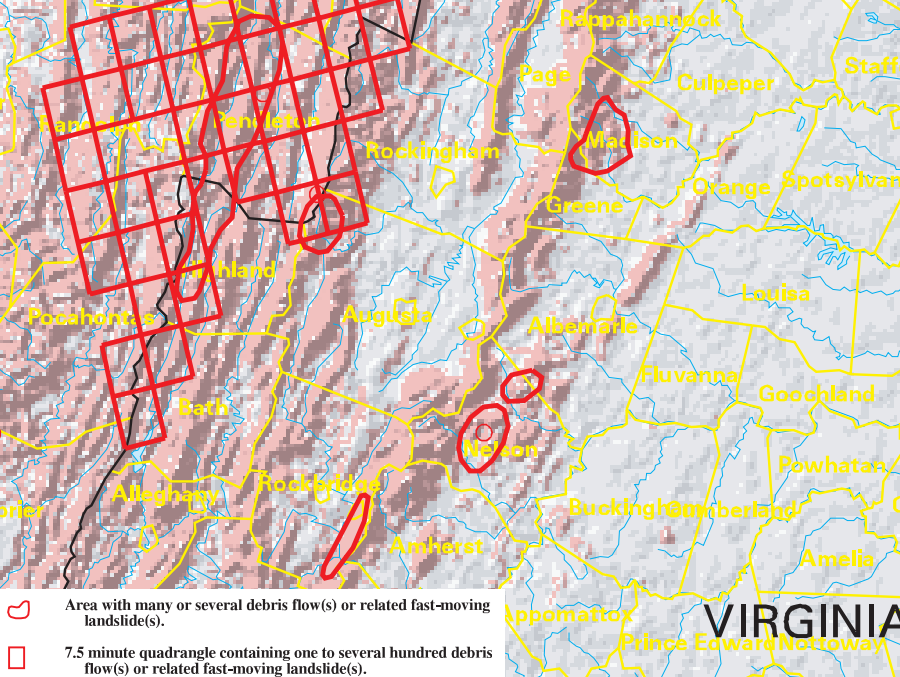
landslide risk in higher in the Blue Ridge and Allegheny Plateau, and minimal in the Piedmont
Source: US Geological Survey (USGS), Map Showing Inventory and Regional Susceptibility for Holocene Debris Flows, and Related Fast-Moving Landslides in the Conterminous United States (1999)
Source: USGS Presentations, You'll never believe why the side of this mountain fell off!
statewide, landslide risk is a low hazard
Source: Virginia Department of Emergency Management, Commonwealth of Virginia 2023 Hazard Mitigation Plan
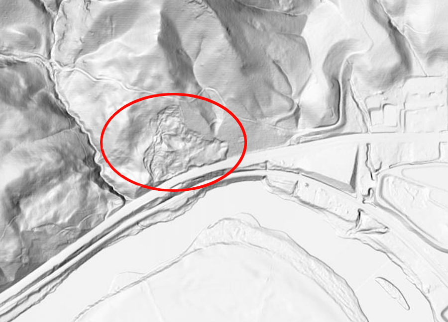
evidence of an ancient landslide on Sinking Creek Mountain in Giles County
Source: US Geological Survey (USGS), Nation Map 3DEP Elevation - Hillside