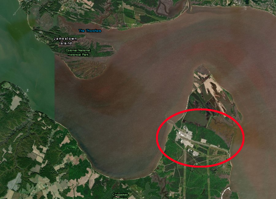
the Surry nuclear power plant is on the Hog Island peninsula downstream from Jamestown
Source: ESRI, ArcGIS Online
the Surry nuclear power plant is on the Hog Island peninsula downstream from Jamestown
Source: ESRI, ArcGIS Online
Virginia has four commercial nuclear reactors generating low-cost, carbon-free electricity. Two reactors are located at the Lake Anna Power Station, and two at the Surry Power Station.
In all four reactors, electricity is produced from uranium oxide (UO2) which has been enriched so the natural percentage of the U-235 isotope has been increased from 0.7% to 3.5%. That qualifies as low-enriched uranium, not the highly-enriched uranium with at least 25% U-235 that used in nuclear weapons.1
Dominion Power, a private investor-owned utility, built Surry 1 and Surry 2 on Hog Island peninsula in Surry County. Construction was started in 1972 and 1973, using the Westinghouse, three-loop, pressurized water design. Today the reactors are capable of generating a total of 1,638 megawatt, The rural county benefits from property taxes paid on the high-value facilities. Dominion Power reported in 2019 that the facility employed over 900 workers, with an average salary over $90,000.1
The location was chosen in part because the site was isolated from large population centers, the land was inexpensive to acquire, and water was available for cooling.
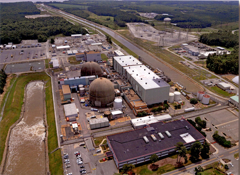
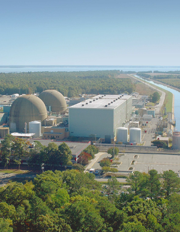
There are reactor containment domes at Surry but no large no cooling towers, an iconic fixture at most nuclear power plants.
containment domes at Surry limit the potential of a release of radioactivity from the reactors
Source: Nuclear Regulatory Commission, 2017 Annual Radioactive Effluent Release Report - Surry Power Station
The canal across Hog Island allows Dominion Power to pull water from the downstream side, use it to cool the pipes filled with steam that powers the turbines, then discharge the river water on the upstream side of the peninsula. The water is 7°F warmer, attracting fish in the winter months.2
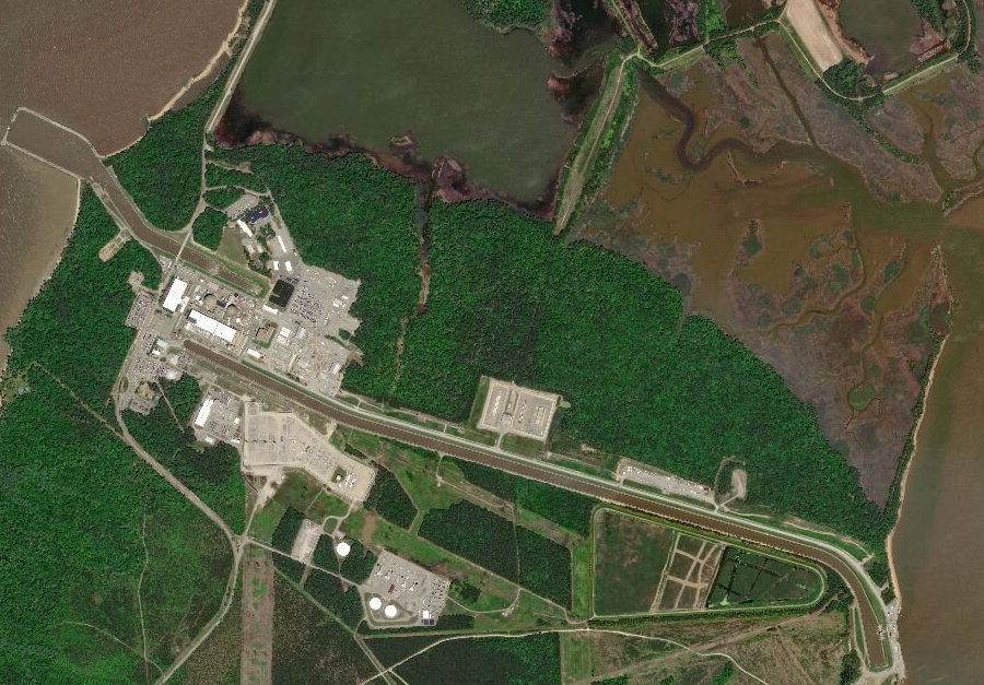
water in the canal on Hog Island moves from the downstream side west to the Surry nuclear power plant, to discharge on the upstream side
Source: ESRI, ArcGIS Online
The original licenses for the reactors at Surry were for 40 years. Dominion Power obtained a 20-year extension in 2003, so they could operate until 2032 and 2033.
In 2018, the utility company applied for an additional 20-year term. To get approval, Dominion Power projected the application process and required replacements/upgrades to the power plants would cost $4 billion over 10 years. In 2021 the Nuclear Regulatory Commission approved Surry Unit 1 to operate until May 25, 2052, and Unit 2 to operate until Jan. 29, 2053.3
Surry 1 & 2
Source: Dominion Power, Surry Power Station Units 1 and 2, Application for Subsequent License Renewal
Nuclear power plants can release radioactivity into the atmosphere, despite the best efforts of the operators. In 1982 a fire in a storage building at Surry burned waste material with a low level of contamination, causing a release that exceeded the thresholds set by the Nuclear Regulatory Commission. The airborne contamination was .0025 percent above the level, while the water contamination was .02 percent higher.4
Response to a release will be based on the risks. Dominion Power and the Virginia Department of Emergency Management have defined an Emergency Planning Zone (EPZ) extending 10 miles in all directions from the plant. People are more likely to be moved quickly from that zone, especially from the area downwind from the nuclear power plant, to pre-defined Evacuation Assembly Centers.
Planning exercises help train all the agencies that might be required to act. For example, Virginia State Parks personnel train to evacuate visitors from Chippokes Plantation State Park. The Virginia Department of Health has a supply of Potassium Iodide (KI) kits in case the filters and sprays at the Surry plant do not capture the radioactive materials during an unplanned event. Doses would be administered at the Emergency Evacuation Centers to flood the thyroid gland with non-radioactive potassium iodide. That would block the uptake of radioactive isotopes of iodide released from the nuclear power plant, and protect the thyroid gland.5
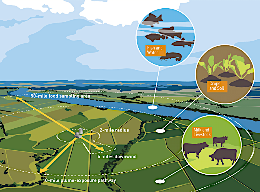
There is also an Ingestion Pathway Zone (IPZ) with a 50-mile radius. Much of any particulate material in a radioactive plume would be deposited on the ground within that zone, so milk from cows and goats could be contaminated long after the release event has ended. The Virginia Department of Game & Inland Fisheries would collect samples from fish and wildlife, for testing by the Virginia Department of Health.6
The first emergency plans were developed before the reactors were operational. If humans had to be evacuated from the 10-mile zone around the plant, the process would start with an alert transmitted through the Emergency Broadcast System. A three-minute blast on sirens scattered around the area would provide warning. Local personnel would visit each house previously identified with an invalid living there, or without a phone or car. In 1983, over 150,000 people lived within the 10-mile zone, then called the Plume Exposure Pathway. The director of emergency planning for the utility stated:7
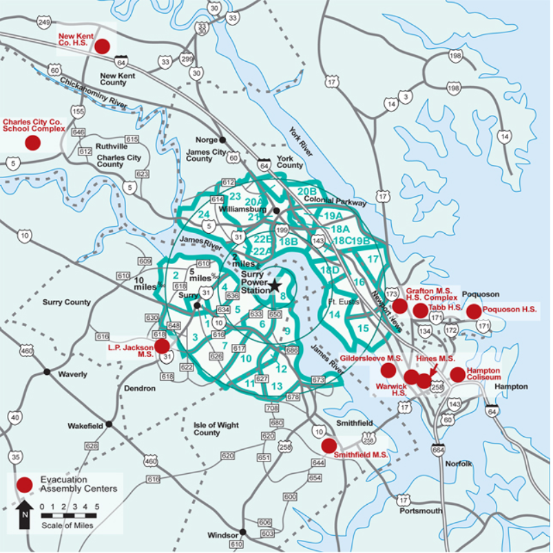
evacuation zones for the Surry nuclear power plant
Source: Dominion Energy, Surry's evacuation zones, routes and assembly centers
The location on Hog Island provided easy access to water, but has exposed the Surry Power Station to the risks of sea level rise. The facility was designed in the 1960's, before the threat of global warming and rising sea levels was well-recognized. New data suggests that the nuclear power plant could be flooded in a worst-case scenario storm.
A Bloomberg BusinessWeek article in 2019 noted:8
Source: Dominion Power, Nuclear Visitors Centers
evacuation zones are based on levels of risk
Source: Nuclear Regulatory Commission, NRC Emergency Preparedness Maps