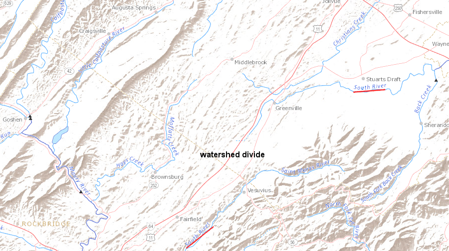
at the watershed divide separating the Shenandoah/James rivers, one South River flows south to the James River and a separate South River flows north to the Shenandoah River
Source: US Geological Survey (USGS), National Atlas Streamer
at the watershed divide separating the Shenandoah/James rivers, one South River flows south to the James River and a separate South River flows north to the Shenandoah River
Source: US Geological Survey (USGS), National Atlas Streamer
Drivers going south on Interstate 81 from Staunton towards Lexington climb to the divide between the Shenandoah and James Rivers at the Raphine/Steele's Tavern exit, at the boundary of Augusta and Rockbridge counties. The climb is a subtle rise; there is no clear dividing line indicating the traveler has literally "crossed the divide."
The headwaters of each river are etching away at the same bedrock; the relative energy of the two streams is basically the same at the divide. There is no clear ridgeline visible to identify watershed boundaries. I-81 continues through the "Valley of Virginia," and the landscape in the James River watershed appears to be just an extension to the south of the Sheanandoah Valley.
The two streams flowing in opposite directions, away from the watershed divide separating the Shenandoah/James rivers at this spot, are both called the South River. One "South River" flows north to Port Republic, where it joins with the Middle and North rivers to form the South Fork of the Shenandoah River. That water flows north to Harpers Ferry, then veers east to cut through the Blue Ridge and go via the Potomac River to Washington DC and the Chesapeake Bay.
The other "South River" flows south into the Maury River near Lexington. The Maury River joins the James River at Glasgow, and the James River cuts through the Blue Ridge at Balcony Falls on its trip to Richmond.
Water traveling south or north down either South River will go 230-250 miles to reach Tidewater. A more-direct path to the Potomac River would be only 135 miles, but the circuitous paths of Virginia's creeks, runs, streams and rivers reflects eons of erosion. Straight lines on maps almost always reflect some intervention in nature by humans.
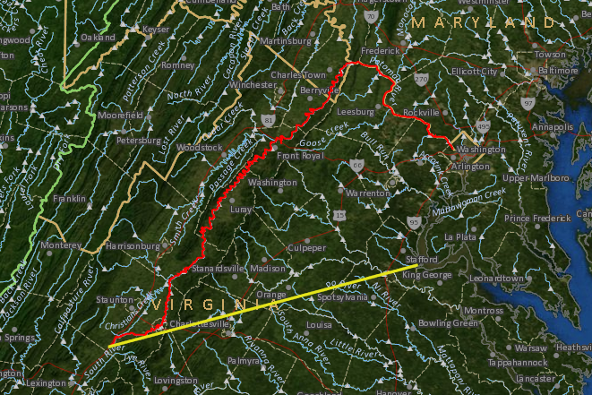
the 255-mile natural flow path from South River headwaters to Tidewater via the Shenandoah and Potomac (rivers red line) is much longer than 135-mile straight shot (yellow line)
Source: US Geological Survey (USGS), National Atlas Streamer
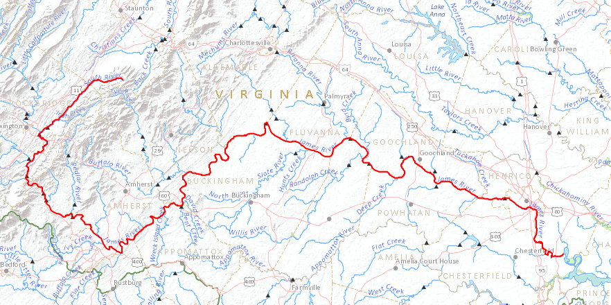
raindrops that flow down the South River into the Maury River will join the James River, and flow past Richmond on their trip to the Chesapeake Bay
Source: US Geological Survey (USGS), National Atlas Streamer
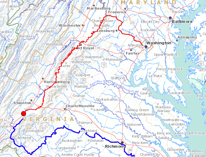
raindrops that flow down the South River into the Shenandoah River (red line) will join the Potomac River and flow past Washington DC on their trip to the Chesapeake Bay, unlike raindrops that flow into the Maury and James rivers (blue line)
Source: US Geological Survey (USGS), National Atlas Streamer