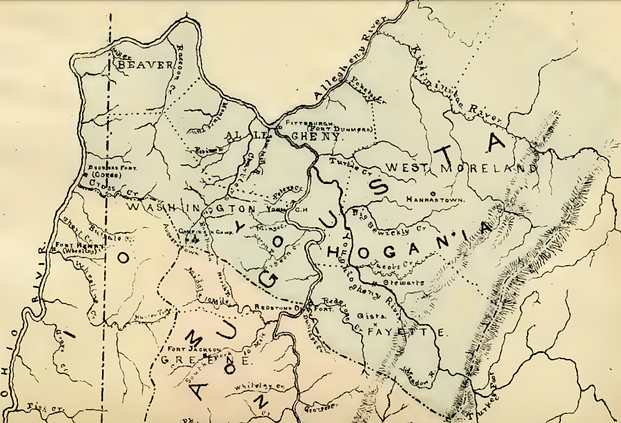
Yohogania County deeply intruded into land claimed by Pennsylvania
Source: Boyd Crumrine, History of Washington County, Pennsylvania: with biographical sketches of many of its pioneers and prominent men (1882, facing pp.182-183)
Yohogania County deeply intruded into land claimed by Pennsylvania
Source: Boyd Crumrine, History of Washington County, Pennsylvania: with biographical sketches of many of its pioneers and prominent men (1882, facing pp.182-183)
The District of West Augusta, created in 1774, was divided by the Virginia General Assembly into three counties on November 7, 1776.
That was more than five months after the colony of Virginia had declared its independence from Great Britain. In 1774 the General Assembly has sought to avoid violating the Proclamation of 1763, which prohibited settlement west of the Alleghenies, by creating a "district." Irritating officials in London over the Proclamation of 1763 was no longer a relevant concern by late 1776, by which time Governor Dunmore had been forced to flee from the Governor's Palace in Williamsburg.
Establishing three counties enhanced the ability to raise troops for regiments authorized by the new state legislature in Williamsburg. Soldiers were recruited for the Continental Army surrounding Boston, the First and Second Virginia regiments stationed primarily in Tidewater, and for defense of the Virginia backcountry on the western edge of the state. The Shawnee had lost Dunmore's War in 1774, but the peace was fragile. The Delaware and other western tribes associated with the Iroquois were allying with the British. Creating civil government was important for managing land titles, but establishing a military force was the priority.
In addition, Pennsylvania and Virginia were contesting ownership of the land between the Allegheny and Monongahela rivers, upstream from Fort Pitt on the Forks of the Ohio. Pennsylvania created Westmoreland County on February 26, 1773. Virginia had to create its own counties if it expected to govern the area.1
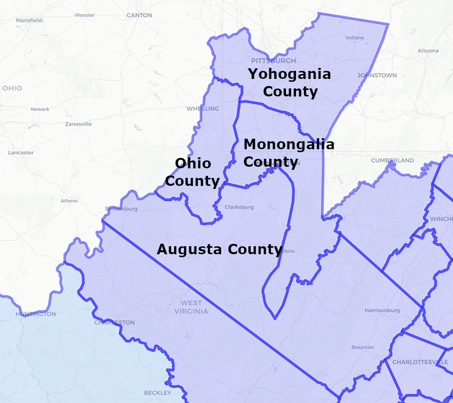
the District of West Augusta was split into three counties on November 7, 1776
Source: Newberry Library, Atlas of Historical County Boundaries
The western edge of Yohogania County was defined by the Ohio River upstream to the Kiskimentas River.