Manassas
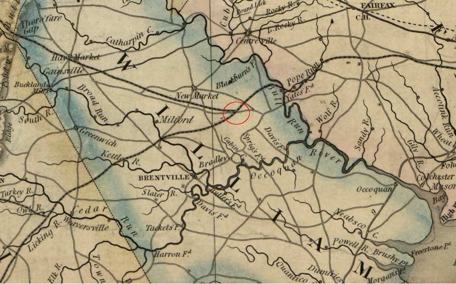
prior to the Civil War, the junction of the Orange and Alexandria Railroad and the Manassas Gap Railroad was still farmland, with not enough development to justify a name on the map ("New Market" on the Warrenton-Alexandria Turnpike is now the intersection of I-66 and Route 234)
Source: Library of Congress, A map of the state of Virginia, constructed in conformity to law from the late surveys authorized by the legislature and other original and authentic documents (1859)
Settlement at Manassas started after two railroads connected there in 1854.
There was no Olde Towne Manassas settled by English colonists, like Williamsburg or Occoquan or Alexandria. For many years there was a prominent sign for the Olde Towne Motel in downtown Manassas, but the area was agricultural with scattered farms until the 1850's. Manassas was first chartered as a town in 1873 - after the Civil War, and almost a century after the American Revolution ended the colonial era.
Olde English names for places in Manassas are historical anachronisms
When the English colonists arrived in 1607, the current site of Manassas was in a boundary zone. Algonquian-speaking Native Americans had a town at the mouth of the Occoquan River, Tauxenent. John Smith indicated the Siouan-speaking Mannahoaks controlled the land west of the Fall Line, though hunters from the "Taux/Doeg/Dogue" villages may have moved upstream to harest deer and turkey from the borderland.
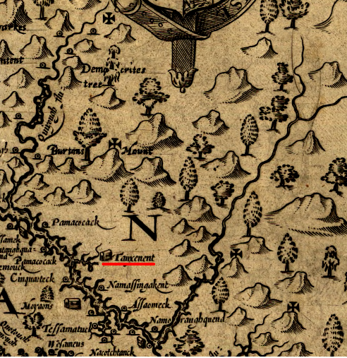
John Smith never explored inland to the what today is Manassas, and added place names (Democrites Tree, Burtons Mount) to the empty/unexplored area in 1624 to recognize people he honored1
Source: Library of Congress, Virginia / discovered and discribed by Captayn John Smith
Initial colonial settlement focused on lands east of the Fall Line, or near to the navigable rivers. Tobacco was a bulky, heavy crop to transport by wagon, so the Manassas area was not a priority for settlement until the 1700's. After the Treaty of Albany in 1722 restricted the Iroquois to west of the Blue Ridge. "King" Carter issued grants to acquire thousands of acres in the area that later developed into Manassas.
Fences, barns, houses, and other structures for the initial quarters and plantations were constructed from the abundant wood. Later, the local sandstone was quarried to build imposing plantation houses such as Ben Lomond (complete with stone slave quarters) and public structures such as the Stone Bridge over Bull Run, and the Stone House used as a tavern and toll booth on the Warrenton-Alexandria Turnpike. Local clay was also converted into artificial stone, baked into bricks and used to build plantation homes such as Liberia.
The headwaters of the Occoquan River was agricultural "back country" feeding its trade to Alexandria, after construction of the Warrenton-Alexandria Turnpike around 1820 and then the Orange and Alexandria Railroad thirty years later. Business could have gone towards Dumfries, but that town failed to expand on its road extending westward to the base of the Blue Ridge near modern-day Catlett. A separate colonial road ran from Ashby Gap (where modern Route 50 crosses the western flank of the Blue Ridge) southeast to Neville's Ordinary (near modern Warrenton) to Fredericksburg, but it was not improved to match the quality of the transportation options to Alexandria.
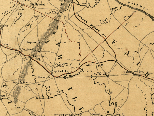
before a junction connected the Orange and Alexandria and the Manassas Gap railroads, there was no reason for a settlement at what became Manassas
Source: Library of Congress, Map and profile of the Orange and Alexandria Rail Road with its Warrenton Branch and a portion of the Manasses [sic] Gap Rail Road, to show its point of connection (August Faul, 1854?)
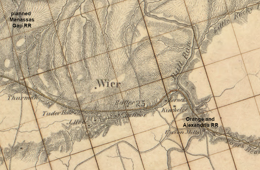
Though the Culpeper Basin near modern Manassas is flat, the topography and watershed boundaries were key to the development and later growth of Manassas. The path of the Warrenton-Alexandria Turnpike could includes grades as steep as 5%, and it was routed as straight as possible to connect the Potomac River port city with the county seat of Fauquier County. The Orange and Alexandria Railroad, however, was designed with a maximum grade of just 1.25% (66 feet in a mile) so locomotives would use their power to pull heavy loads forward rather than uphill.2
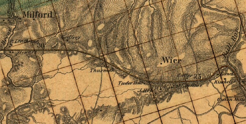
when the Orange and Alexandria was completed through Prince William County in 1851, the major plantation near the future site of Manassas was Liberia (owned by the Weir family)
Source: Library of Congress, Map and profile of the Orange and Alexandria Rail Road with its Warrenton Branch and a portion of the Manasses [sic] Gap Rail Road, to show its point of connection
The "flat route" through the Piedmont east of the Blue Ridge bypassed the county seats of Fairfax, Prince William, and Fauquier counties - all of which had courthouses built on relatively high locations, adding prominence to the public buildings. The primary objective of the railroad was to ship freight, not to encourage town development, and the cost of excavating dirt and creating a flat route was too high.
Being bypassed affected those communities in three different ways. The town of Fairfax coped by shipping goods via wagon from Fairfax Station to the town three miles away. Warrenton negotiated successfully to get the railroad to construct a branch line, connecting the town to the mainline at Catlett. In Prince William County, Brentsville failed to revive after the destruction of the Civil War, though the distance to the raiload was also three miles. It ultimately lost its status as county seat when the Prince William courthouse was moved to Manassas in 1893.
In 1854, the farmers of northern Fauquier County partnered with the merchants in Alexandria to build the Manassas Gap Railroad. It crossed the Blue Ridge through Thoroughfare Gap/Manssasas Gap, and drew not just Fauquier County trade but also Shenandoah Valley business to Alexandria. The rail line started construction westward from the Orange and Alexandria Railroad station at Tudor Hall. The intersection of the two railroads was named Manassas Junction.
The origins of the name "Manassas" are undocumented, but the reason for locating the junction at that location are obvious. The Manassas Gap route was shaped by the watershed divide between Broad Run and Bull Run. The railroad engineers sought to minimize the amount of cuts and fills and avoid expensive bridges across streams by building along the ridge that separated Broad Run and Bull Run.
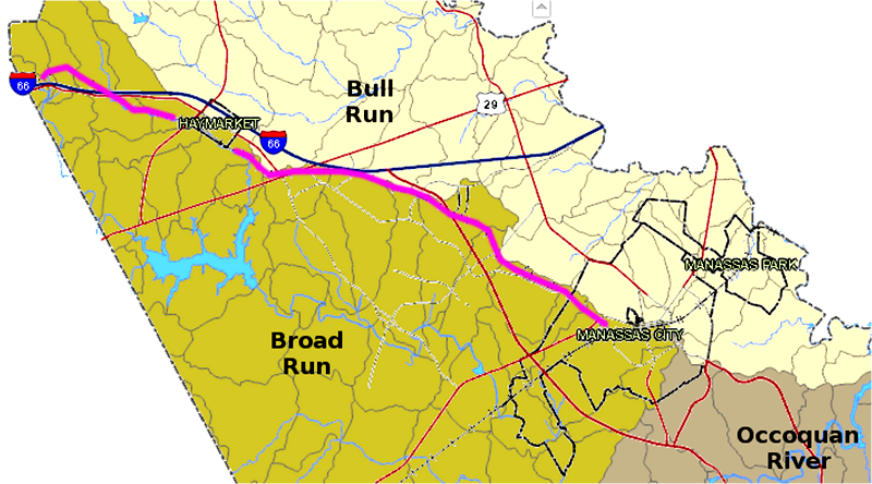
Manassas Gap Railroad (purple line) follows the watershed divide west towards Thoroughfare Gap
Map Source: Prince William County, County Mapper XM
The Manassas Gap Railroad had to pay a fee to the Orange and Alexandria Railroad to run trains from Alxandria to the junction. To expand its service area and avoid those fees, the investors in the Manassas Gap line started to build an Indepenent Line from Gainesville to Alexandria, with a branch extending into Loudoun County. The expensive cuts and fills, and the abutments for bridges across Bull Run and Cub Run, were built by 1857. In addition, rails were purchased for completion of the new independent line that would eliminate most of the traffic through the junction at Manassas.
A financial recession started in 1857, triggered in part by the shotage of hard currency in the astern states after the SS Central America sank off the South Carolina coast and the expected shipment of gold from California never arrived in New York. The town of Herndon in Fairfax County is named after the captain of the steamship, who died along with 425 passengers.
The Panic of 1857 blocked the Manassas Gap Railroad investors from borrowng the money needed to lay the rails, and then the Civil War intervened. After the war, the two rail lines were merged under common ownership. That eliminated the risk of an "independent line" that would cause the landowners at the junction at Manassas to see property values decline.
The junction became a military target in 1861. The Union Army wanted to capture the Confederate capital at Richmond. There was a dirt road but no direct rail connection running south between Alexandria and Richmond. In 1861 passengers and freight were carried from Alexandria by steamboat south on the Potomac River, downstream to Aquia Landing near Fredericksburg, to the northern extension of the Richmond, Fredericksburg, and Potomac (RF&P) Railroad. That railroad provided the railroad connection from Fredericksburg south to Richmond.
Marching troops to Fredericksburg involved difficult logistics to support the horses pulling wagons carrying supplies. The longer route via the Orange and Alexandria Railroad connection to Gordonsville, then the Virginia Central Railroad connection to Richmond, would be easier.
The Union Army, under General Irvin McDowell, marched west from Alexandria to Manassas rather than due south towards Richmond. The junction of the Orange and Alexandria (O&A) and Manassas Gap railroads is why the first major land battle in the Civil War occurred in 1861 near Manassas.
McDowell planned to seize Manassas, establish a supply depot there, then march along the Orange and Alexandria Railroad south to Gordonsville. Trains would carry hay for the horses pulling artillery and supply wagons, as well as food and ammunition for the troops. Once the Union Army reached Gordonsville, it would follow the route of the Virginia Central to Richmond, capture the Confederate capital, and end the rebellion in 1861.
Well, that was the plan...
Manassas was initially a Confederate supply depot, with the O&A providing the connection to Richmond, Charlottesville, and points south. Federal ships controlled traffic on the Potomac River, so ships could not supply the Confederate army standing in the way of the Union's "On to Richmond" campaign. Confederate General P. G. T. Beauregard at Manassas depended upon the single-track Orange and Alexandria Railroad for troop reinforcements, food, ammunition, and other material for his 22,000 soldiers.
The Confederates established a defensive line along Bull Run to block the Union advance. West of the Blue Ridge, at the northern end of the valley near Winchester, there was another Confederate army with 10,000 Confederate troops under General Joseph Johnston. It's job was to block any advance by the Union Army, commanded by General Robert Patterson, from marching up the Shenandoah Valley and then east across the Blue Ridge towards Richmond.3
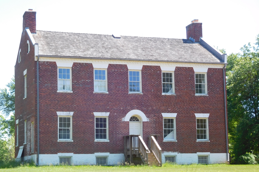
both Confederate and Union leaders used the Liberia plantation house, now maintained by Manassas as a house museum
The Blue Ridge mountains between Manassas and the Shenandoah Valley split both Union and Confederate armies - but the Confederates were innovative enough to use the Manassas Gap Railroad to overcome that barrier. That railroad extended west from Manassas Junction through the Blue Ridge into the Shenandoah Valley.
When Union General Irvin McDowell moved from Alexanmdria to Manassas, Johnston slipped away from the Shenandoah Valley. He marched east through Ashby Gap (modern Route 50), south down Goose Creek (modern Route 17), and loaded his troops on boxcars at Delaplane (then called Piedmont Station). General Patterson did not follow.
The Confederates won the July 21, 1861 battle at Manassas because they managed to concentrate more troops on the battlefield that the Union Army. Following that victory, the Confederates established a front line of pickets near Alexandria and built forts at Centreville.
To supply the soldiers at Centreville, a military railroad was completed in February 1862 from Manassas to a site just south of the fortifications. Manassas Junction briefly became the hub of three railroads. The Confederates withdrew in early March, 1862, abandoning their defensive line and moving south to Richmond in order to deal with the Union Army marching up the Peninsula under General McClellan.
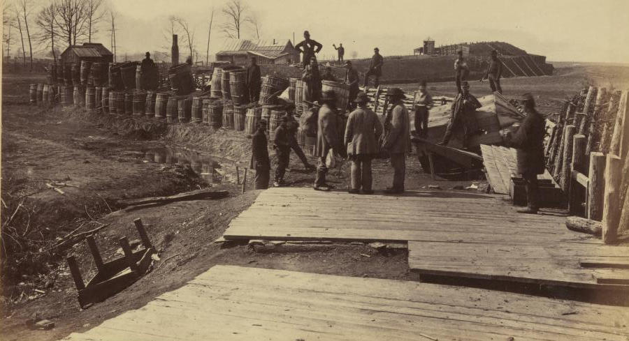
Confederates built forts in 1861-1862 to protect the railroad junction
Source: Alexander Gardner, Gardner's Photographic Sketch Book of the War
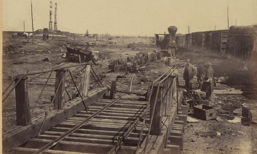
Confederates destroyed equipment at Manassas before moving to the Peninsula in March, 1862
Source: Alexander Gardner, Gardner's Photographic Sketch Book of the War
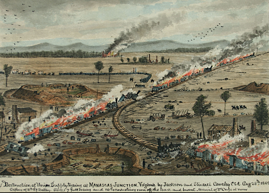
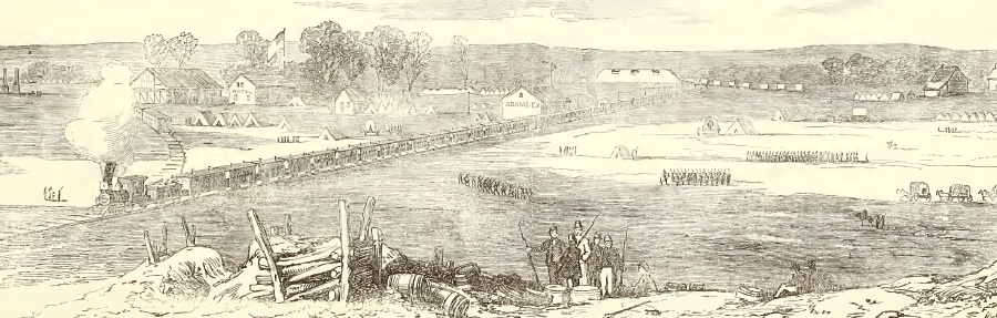
the Union supply depot at Manassas was destroyed in August, 1862
Source: George Washington University, The Destruction of the Union Supply Trains at Manassas Junction, Virginia, by Jackson and Stuart's Cavalry C.S.A., August 28, 1862 (by Robert Knox Sneden, ~1875)
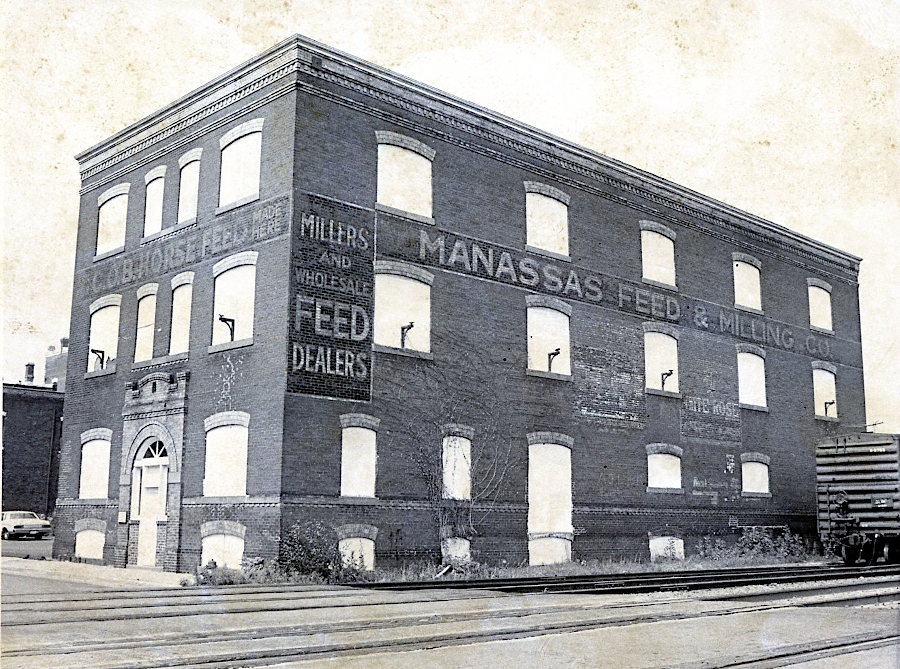
the Hopkins Candy Factory, built in 1908 after the 1905 fire, was a feed store before becoming home to Center for the Arts
Source: Historic Prince William
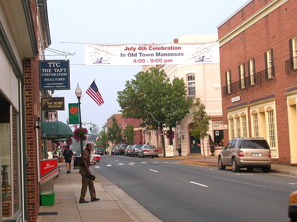
banners over Center Street in downtown Manassas alert commuters about reasons to return and spend money in Manassas
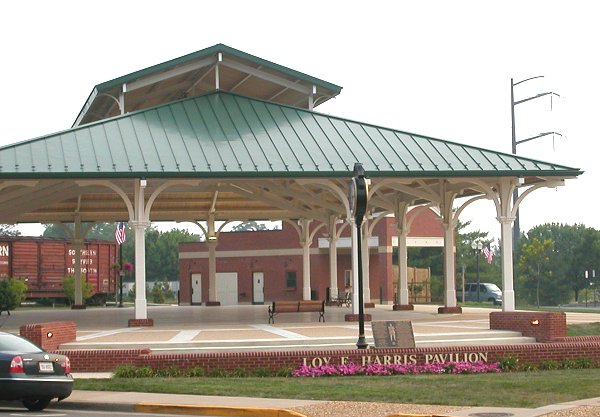
events at the Harris Pavilion draw crowds to downtown Manassas
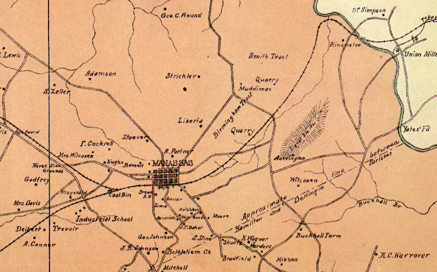
Prince William County in 1901
Source: Library of Congress, Town of Manassas in 1901 (by William H. Brown, 1901)
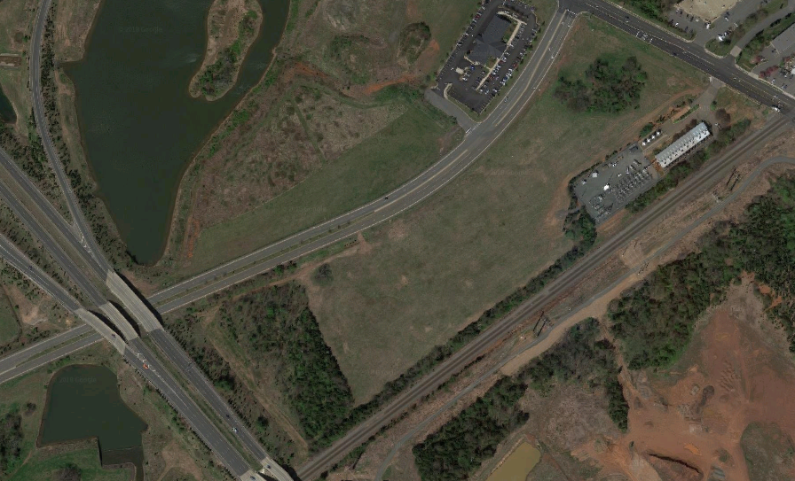
site of the Landing at Cannon Branch, before construction in 2018
Source: GoogleMaps
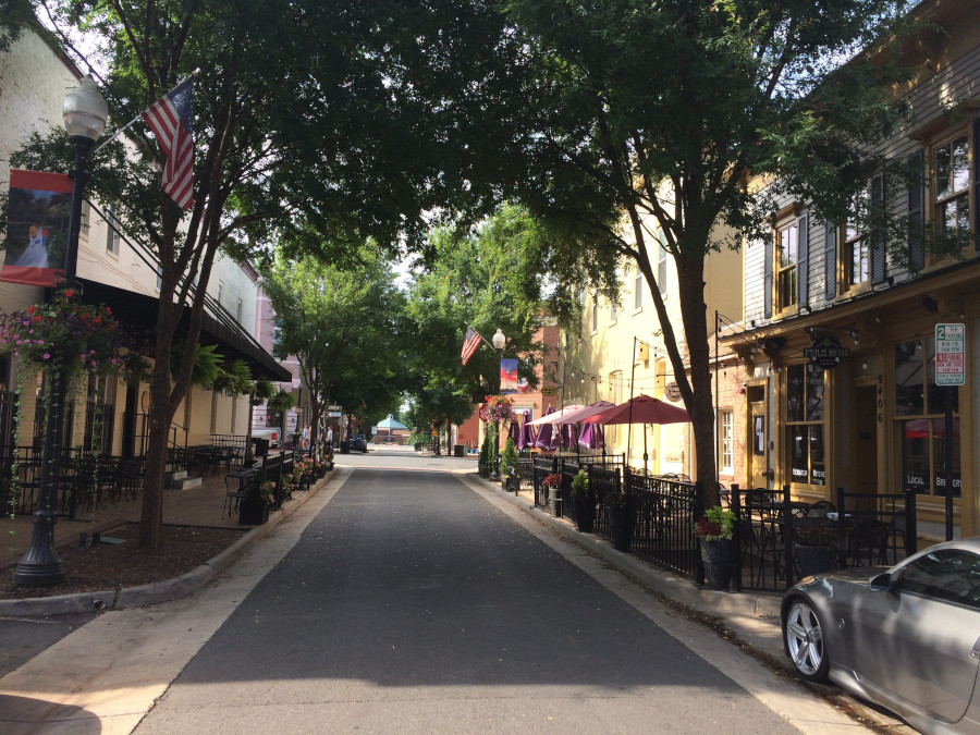
Battle Street was rebuilt with wider sidewalks to encourage downtown dining and entertainment
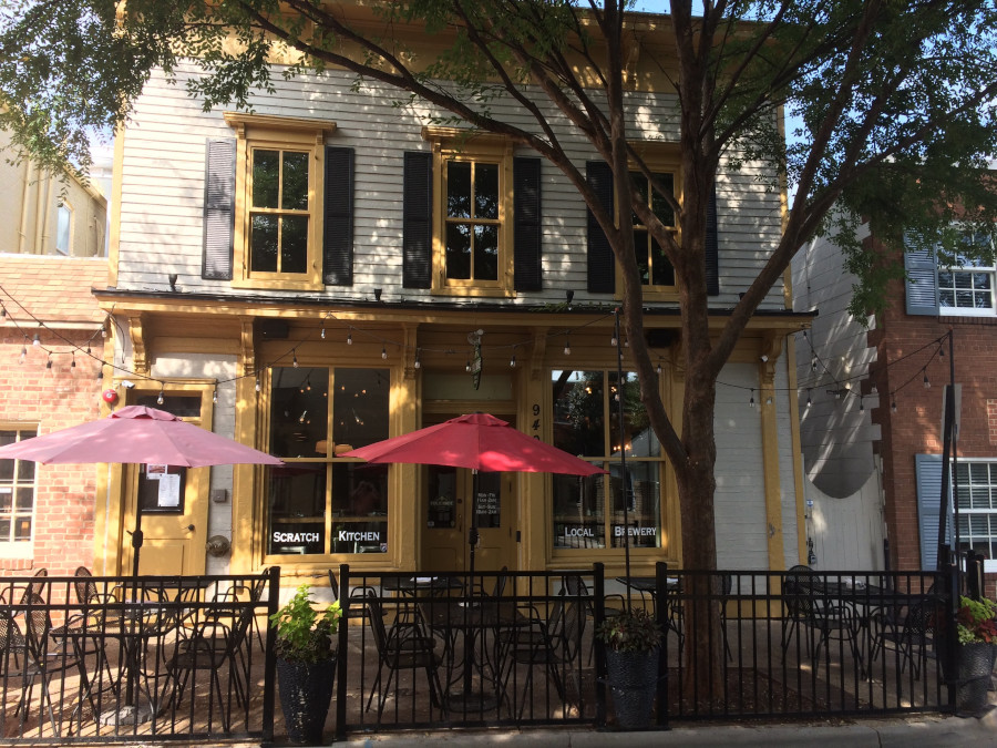
one of the oldest structures in Manassas is a restaurant generating taxes, not a museum requiring donations and tax support
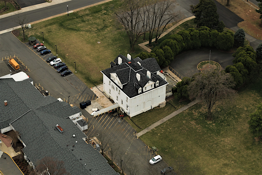
Annaburg Manor
Source: Historic Prince William, Aerial Photo Survey 2019
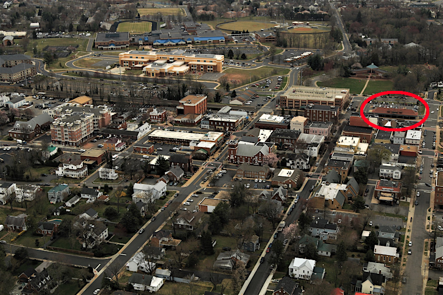
railroad station (red circle) in downtown Manassas
Source: Historic Prince William, Aerial Photo Survey 2019
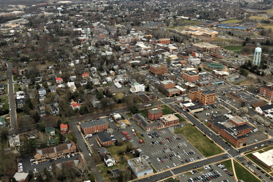
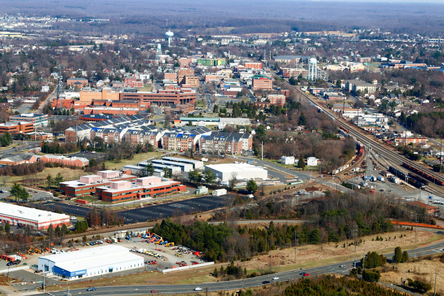
downtown Manassas
Source: Historic Prince William, Aerial Photo Survey 2019
Messenger Place in downtown Manassas
Links
Manassas Gap Railroad - proposed route in 1855, with no connection to Orange and Alexandria Railroad
(at future site of Manassas)
Source: Library of Congress, Thomas Dwyer map - Map of the Manassas Gap Railroad and its extensions; September, 1855
References
1. "Portraits of Melancholy II," Deborah Taylor-Pearce, revised 30 April 2007, http://www.she-philosopher.com/gallery/melancholyP2.html (last checked February 14, 2013)
2. Robert F. Hunter, "The Turnpike Movement in Virginia, 1816-1860," The Virginia Magazine of History and Biography, July 1961 (Vol. 69, No. 3), p.282, http://www.jstor.org/stable/i392996; Letter from T. C. Atkinson (Chief Engineer) to James Brown Jr. (Second Auditor), April 17, 1852, in Annual Reports of Officers, Boards and Institutions of the Commonwealth of Virginia, p.18, http://books.google.com/books?id=jJIaAQAAIAAJ&pg=RA8-PA18 (last checked February 16, 2013)
3. "The Battle of First Manassas (First Bull Run)," National Park Service, Manassas National Battlefield Park, http://www.nps.gov/mana/historyculture/first-manassas.htm (last checked February 13, 2013)
Manassas was a military target during the Civil War because it was a railroad junction where Union forces built warehouses
Source: Frank Leslie's Illustrated History of the Civil War, Commissariat Depot of the United States Army of the Rapahannock at Manassas, VA (p.327)
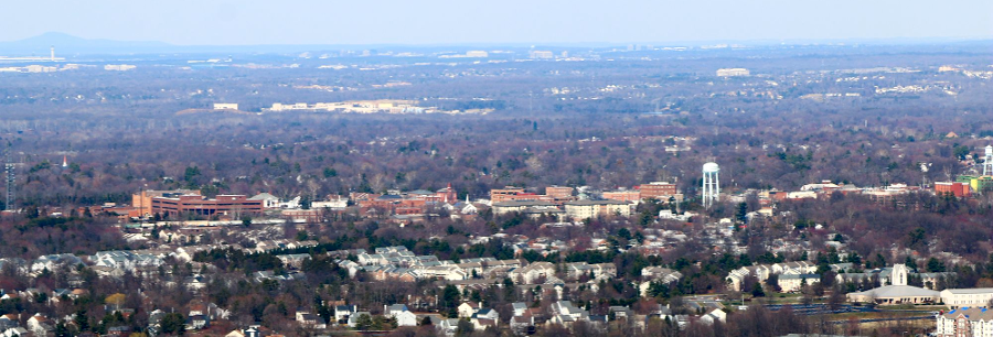
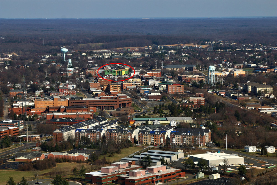
downtown Manassas in 2018, from Judicial Center (on left) to old water tower next to fire station (on right)
Source: Historic Prince William, Courthouse in Manassas
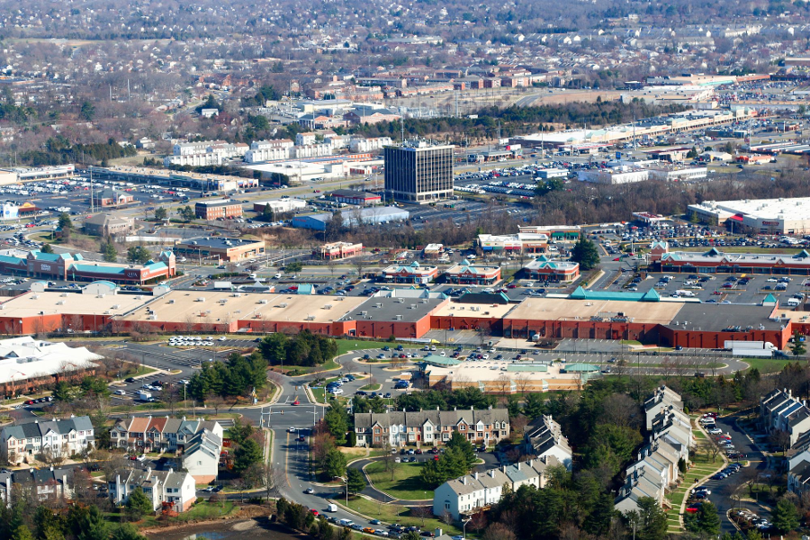
IBM's construction of a computer chip manufacturing plant triggered the multi-story Sudley Tower, but other development was just low-rise buildings
Source: Historic Prince William, Balls Ford Rd. and The Salvation Army Family Store - #317
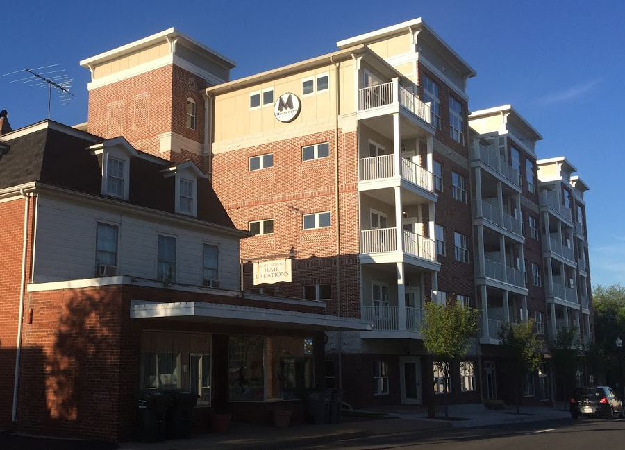
the former home of the Manassas Journal-Messenger newspaper became a 94-unit condo building ("Messenger Place") in 2018
Source: Historic Prince William, Manassas Courthouse - #342
the railroad junction that stimulated initial development of Manassas is still used, now by the Norfolk Southern railroad
Source: Historic Prince William, Manassas Courthouse - #343
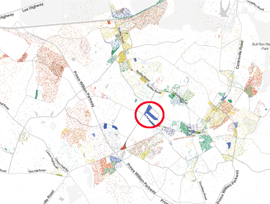

Professional Services jobs (blue dots) in Manassas are concentrated where IBM opened its plant in 1968
Source: Robert Manduca, Employment in America, 2014
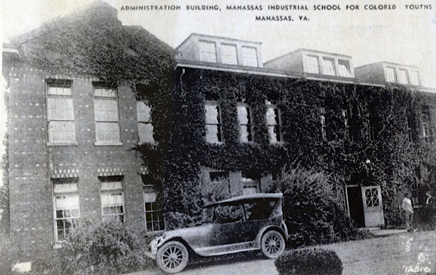
the current Jennie Dean Memorial is located at the site of the Manassas Industrial School
Source: Historic Prince William
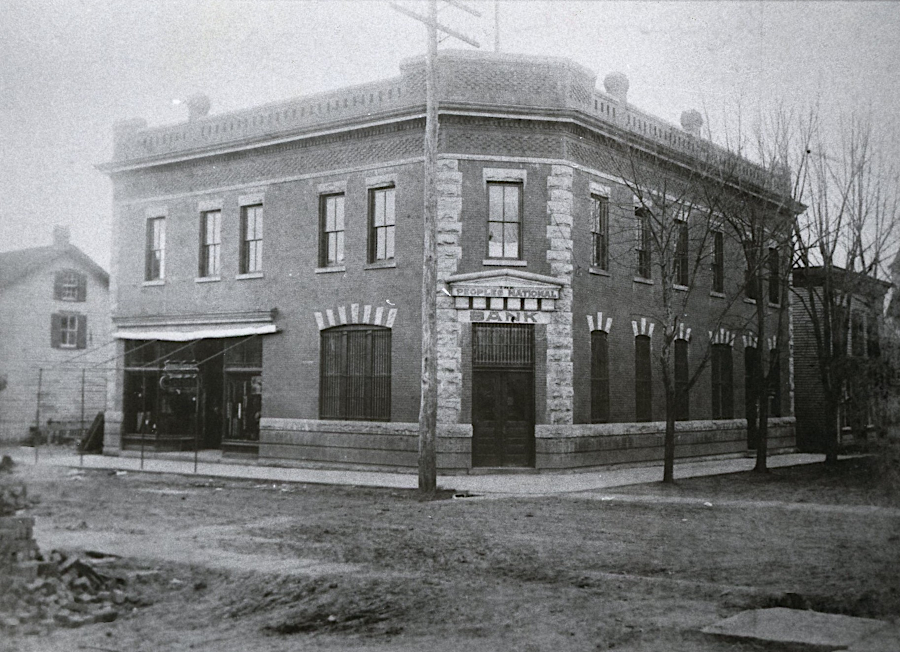
the Peoples Bank, built in 1904, survived the 1905 fire
Source: Historic Prince William
the road south of Wolf's Ford, where French artillery crossed the Occoquan River in 1781, was known as Telphone Road in 1901
Source: Library of Congress, Map of northern Virginia (1894); Map of Prince William County, Virginia
Cities and Towns
Virginia Places