a wooden cover extended the life of a bridge from less than 10 years to 30-40 years
Source: Virginia Department of Transportation, Humpback Bridge
a wooden cover extended the life of a bridge from less than 10 years to 30-40 years
Source: Virginia Department of Transportation, Humpback Bridge
In the 1700's and 1800's, most Virginia bridges were built with their wooden structure and deck exposed to the elements. Rain, ice, sunlight, and other components of natural decay forced major repairs and replacement typically within 10 years.
Hundreds of bridges were covered with wooden roofs to protect the structure. A cover to keep a bridge dry added substantial expense, but was judged to be worth the extra investment. A covered bridge might last 30-40 years, assuming a flood did not wash it away.1
The first of the 10,000 covered bridges constructed in the United States was built in 1805 over the Schuylkill River in Philadelphia. Today, just 850 still remain.
most covered bridges were replaced by the state highway department, in order to accommodate increased traffic
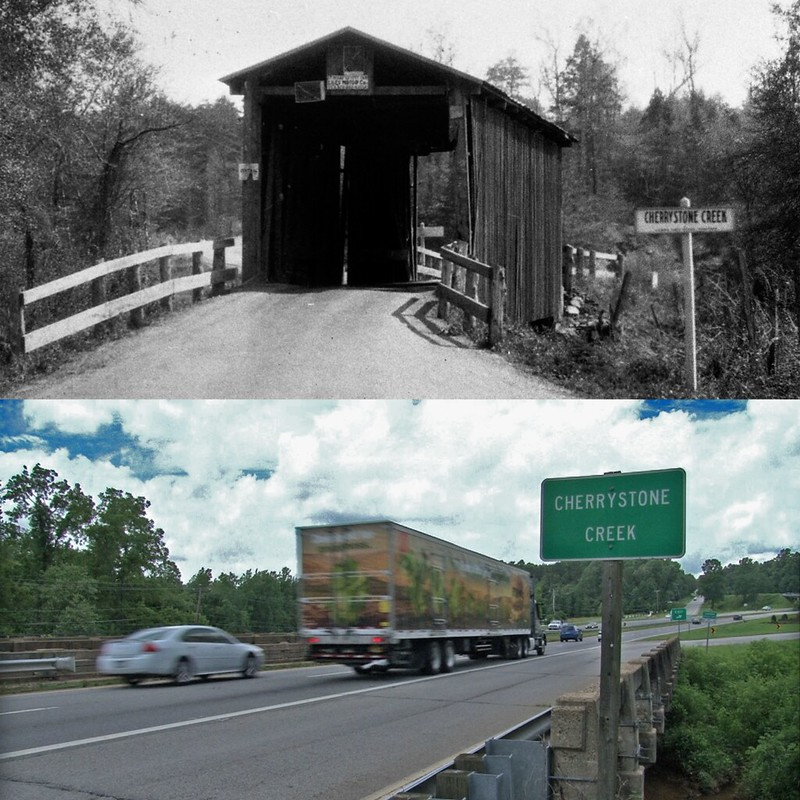
Source: Virginia Department of Transportation, Cherrystone Creek, Then & Now
The earliest documented covered bridge in Virginia is the Clearwater Park bridge across the Jackson River in Alleghany County. It was built in 1834, and washed away in 1887. The last wooden bridge to be constructed in Virginia was built across the Hyco River in Halifax County in 1925.
At least 137 wooden bridges have been documented in Virginia at some time, with some covered and some with trusses and beams exposed. Almost all have been replaced with overhead steel truss bridges, or with bridges using other designs that rely upon a metal structure.
the database identifying 137 wooden bridges in Virginia includes wooden truss structures without a cover
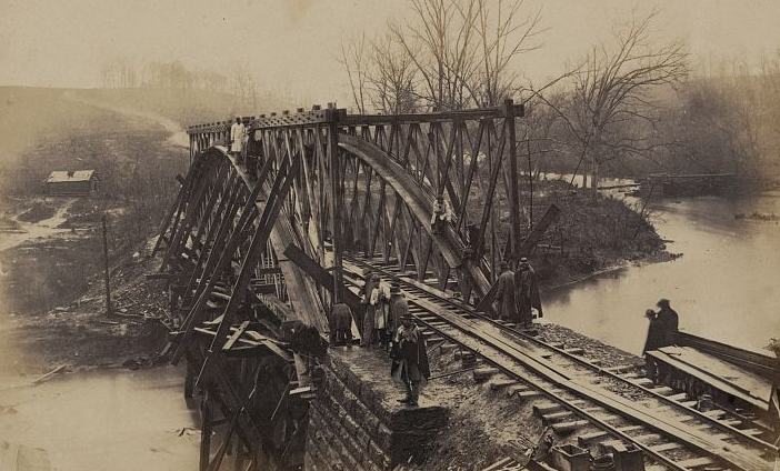
Source: Library of Congress, Part of construction corps building new military truss bridge across Bull Run, April 1863
Virginia had eight covered bridges in 2015, but only six in 2020.
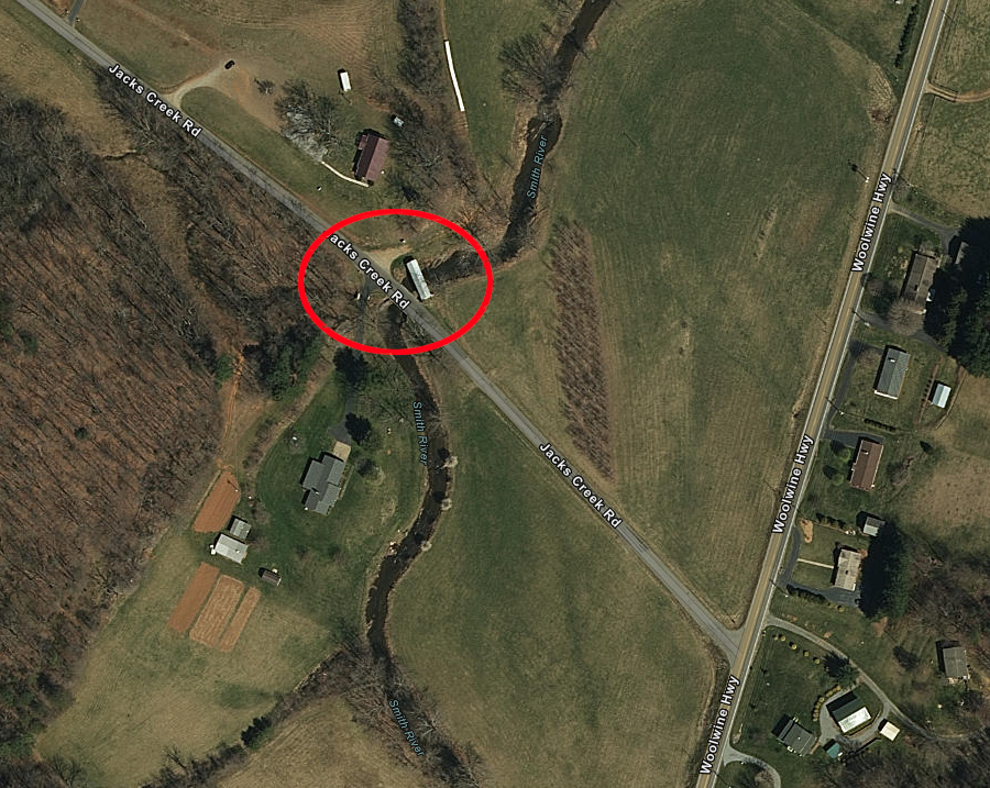
The Bob White Covered Bridge was destroyed in a 2015 flash flood. The bridge, south of Woolwine in Patrick County, was no longer was no longer being used to carry vehicles on Jacks Creek Road (Route 708) across the Smith River. After just the concrete abutments were left, the Virginia Department of Historic Resources delisted the bridge from the Virginia Landmarks Register and the National Park Service delisted it from the National Register of Historic Places.
The C.K. Reynolds Covered Bridge, on private property in Giles County, was destroyed in a 2017 storm. Of the six covered bridges that still remain in Virginia, four are maintained by public agencies and are open for public visits.2
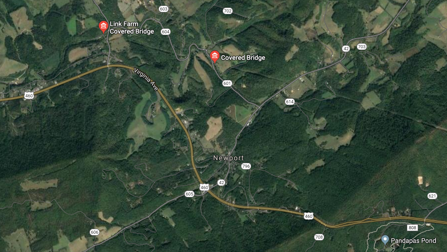
the Link Farm and Sinking Creek covered bridges are close to each other, near Newport in Giles County
Source: GoogleMaps
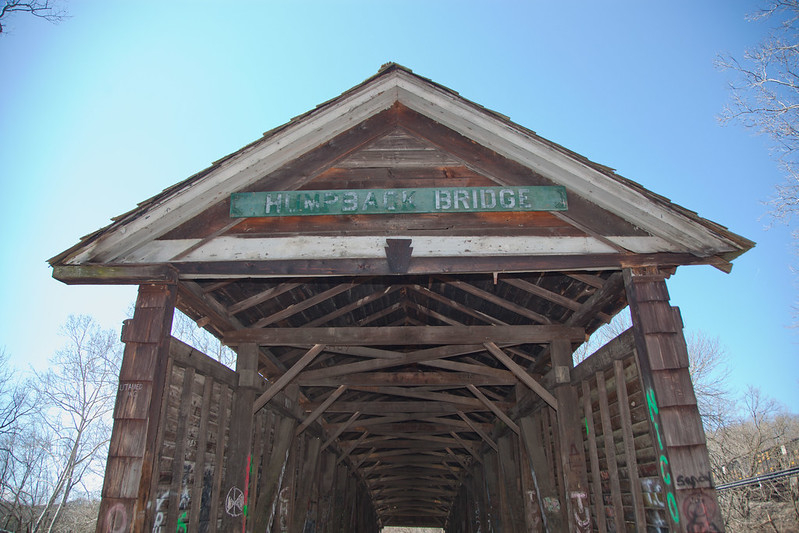
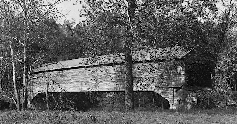
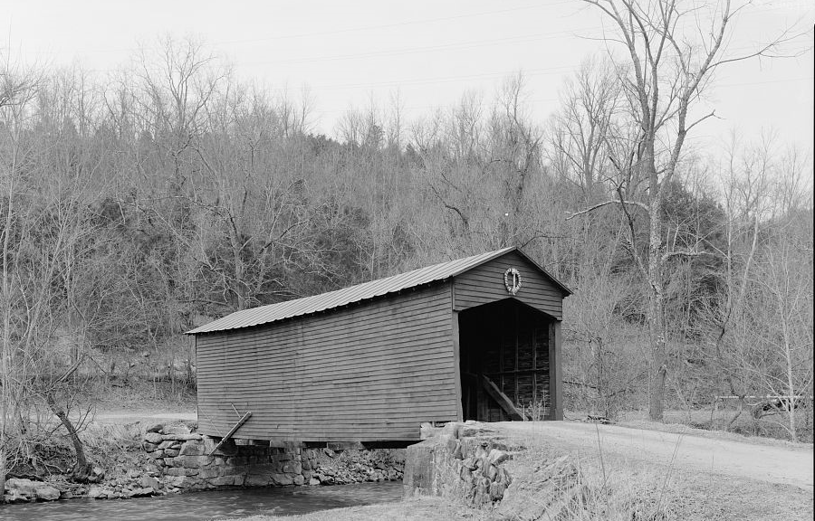
The oldest remaining covered bridge in Virginia is the Humpback Bridge, known for its distinctive shape with a four-foot rise in the middle. It was the fourth bridge built across Dunlap Creek in Alleghany County. The James River and Kanawha Turnpike, which built the first bridge over the creek in 1820, chose to build a covered bridge in 1857. That bridge survived the Civil War and various floods, in part because it had no support pier in the center which could be washed away in the major floods of 1877, 1913, and 2016.
A steel truss bridge was built at the site in 1929 and the Humpback Bridge stopped carrying US 60 vehicle traffic. It was leased to a nearby farmer who used it in the 1930's and 1940's as a hay storage barn. In the 1950's, the Covington Business and Professional Women's Club mobilized public support and funding for the Virginia Department of Highways to restore it. The Humpback Bridge Wayside, dedicated in 1954, still welcomes visitors.
The Humpback Bridge is the only Virginia bridge designated by the US Department of the Interior as a National Historic Landmark. The only other covered bridge in the United States with an arched multiple kingpost truss, the Ponn Humpback Covered Bridge in Ohio, burned down in 2013.3
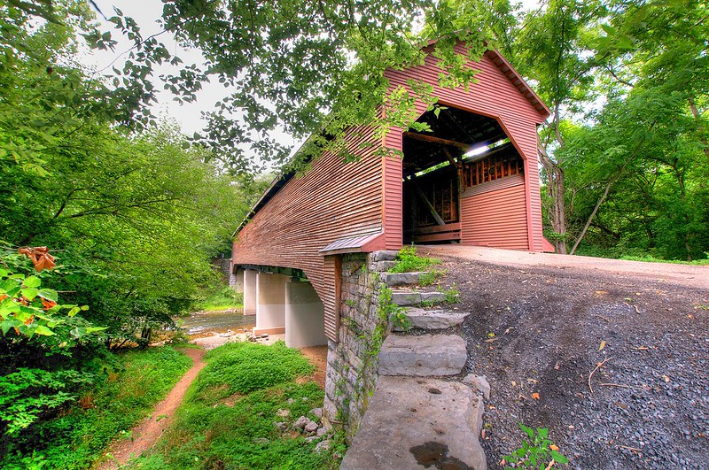
In 1894, workers dug 10' down to install the stone abutments that support the Meems Bottom Covered Bridge, which crossed the North Fork of the Shenandoah River in Shenandoah County. Two wood arches spanned the 204-foot distance between the limestone abutments. The abutment blocks were quarried nearby, and the lumber for the bridge came from General G.S. Meems's adjacent farm.
On Halloween in 1976, arsonists destroyed the 1894 bridge. Using some of the original wooden timbers, the Virginia Department of Transportation rebuilt the covered bridge in 1979. The rebuilt bridge rests on steel beams and concrete piers, altering the historic character but providing greater stability for vehicle traffic. It is the only covered bridge that still carries vehicles on the public road system in Virginia.
Since reconstruction, two tractor-trailer drivers following GPS directions have ignored all the signage and tried to cross the bridge.
In addition to floods and inattentive drivers, arson is one of the greatest threats to the remaining wooden bridges. After reconstruction of Meems Bottom Covered Bridge:4
the Virginia Department of Transportation rebuilt Meems Bottom Covered Bridge, with concrete piers and steel girders, after arsonists burned the historic covered bridge in 1976
Source: Virginia Department of Historic Preservation, Meems Bottom Covered Bridge and James Walsh, Meems Bottom Covered Bridge
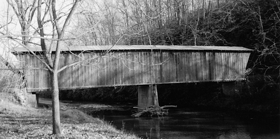
A sheet metal roof was built on the Jack's Creek Covered Bridge in 1914. It crosses the Smith River in Patrick County, though today it is used only for pedestrians and a modern bridge is used by cars and trucks on Jacks Creek Road. The Jack's Creek Covered Bridge was unpainted until the Woolwine Ruritan Club raised funds for a new metal roof and a paint job in 1969.5
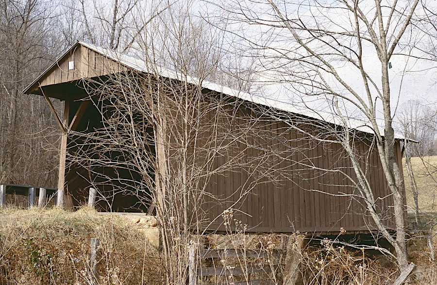
the Jack's Creek Covered Bridge has crossed the Smith River in Patrick County since 1914
Source: Virginia Department of Historic Preservation, Jack's Creek Covered Bridge
the Jack's Creek Covered Bridge no longer carries modern traffic
Source: ESRI, ArcGIS Online
The Bob White Covered Bridge was built in 1921 across the Smith River, downstream of the Jack's Creek Covered Bridge. From the beginning, it was constructed on concrete piers.
Bob White Covered Bridge before the 2015 flood
Source: Virginia Department of Historic Preservation, Bob White Covered Bridge
Only the concrete abutment in the middle of the river remains, after destruction in a 2015 flood. A Covered Bridge Committee based in Patrick County tried to raise the funds necessary to restore the bridge, but the Go Fund Me campaign did not succeed.6

the Bob White Covered Bridge is no longer a tourist attraction in Patrick County, but the Jack's Creek Covered Bridge still remains
Source: TripAdvisor, Bob White Covered Bridge
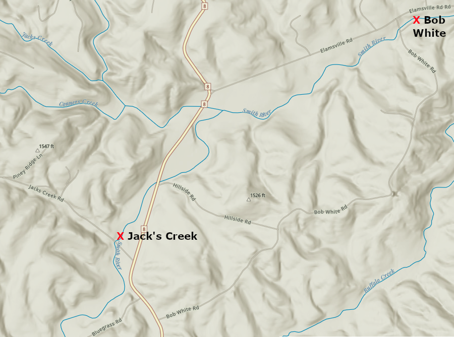
Patrick County had two covered bridges, until a 2015 flood destroyed the Bob White Covered Bridge
Source: ESRI, ArcGIS Online
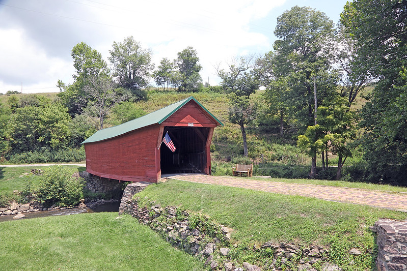
The Sinking Creek Bridge was constructed in Giles County's Clover Hollow in 1916. When a new structure was completed in 1949, the bridge was left intact. It is maintained today by Giles County as a tourist attraction, and open for pedestrian use. Sale of commemorative bricks in 1998 funded new footings and paint for the wooden bridge, and the bricks formed a new walkway from the parking area to the structure.7
bridge over Sinking Creek in Clover Hollow (Giles County)
Source: Virginia Department of Transportation, Clover Hollow
The Biedler Farm covered bridge, constructed c.1896, is on private land. It crosses Smith Creek in Rockingham County.8
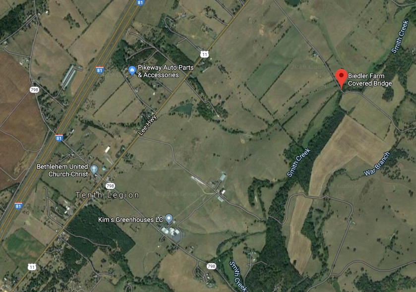
the Biedler Farm covered bridge is on private land, not open to public viewing, northeast of Tenth Legion between I-81 and the Blue Ridge
Source: GoogleMaps
Though the Links Farm Bridge in Giles County is privately owned, it is readily visible for people driving on VA 700 to Mountain Lake. The original 1912 structure has been well-maintained.9
Links Farm covered bridge, crossing Sinking Creek in Giles County, is on private land but easily visible from VA 700
Source: Library of Congress, Link Farm Covered Bridge, Spanning Sinking Creek, Newport, Giles County, VA
The last covered bridge to disappear in Virginia was the C.K. Reynolds Covered Bridge over Sinking Creek in Giles County, built originally in 1919. One end washed away in a 2007 flood, but it was repaired. A 2012 storm nearly blew down the wooden cover protecting the bridge, but a tractor and hay baler parked inside kept it intact. A March 1, 2017 windstorm finally knocked the cover over completely. The steel girders on the concrete abutments remained and the bridge was still functional, but it was no longer a covered bridge.10
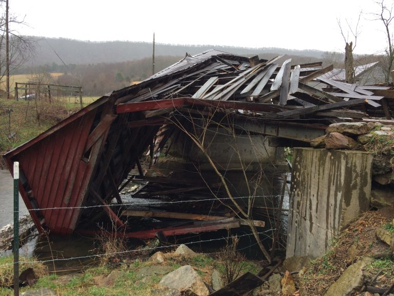
a 2017 windstorm blew down the wooden cover for the C.K. Reynolds bridge over Sinking Creek in Giles County
Source: Landis Legacy Farm, About the Farm
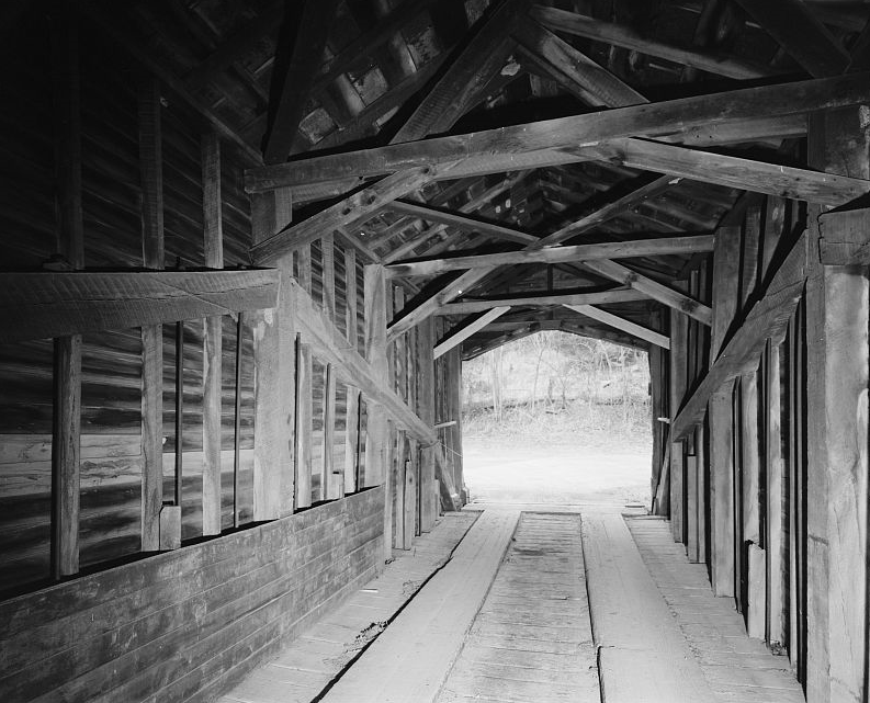
inside the wooden cover of the Links Farm bridge in Giles County
Source: Library of Congress, Link Farm Covered Bridge, Spanning Sinking Creek, Newport, Giles County, VA
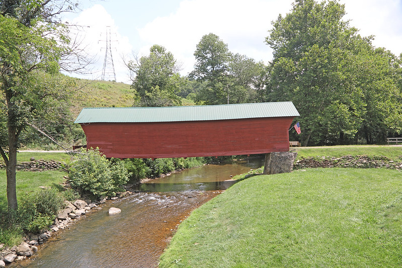
Sinking Creek Bridge in Giles County
Source: Virginia Department of Transportation, Clover Hollow