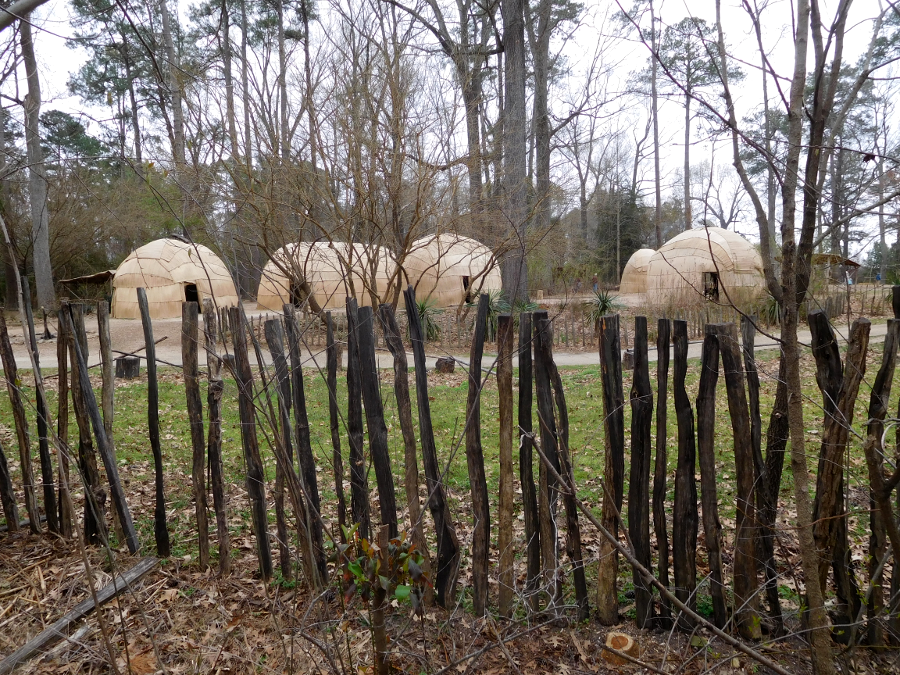
Native Americans built palisades to protect towns in Tidewater Virginia
Native Americans built palisades to protect towns in Tidewater Virginia
The first fortified sites in Virginia were constructed by Native Americans who built wooden walls ("palisades") around their towns. Tree trunks and large branches were aligned to encircle the houses in a town, providing a defensive barrier. The palisades were designed for tribal conflicts that used bows-and-arrow technology.
Starting in 1607 at Jamestown, the English colonists initiated the construction of similar fortifications. The English desired protection against both the Native Americans and a potential attack by European ships armed with cannon. The colonists expected that if a Spanish ship ever sailed upstream past Hog Island, it would be coming to eliminate the English colony rather than to trade and exchange pleasantries.
The first fort built by the English colonists at Jamestown was not substantial. The initial focus was on exploration and discovery, not investing in defense.
Soon after unloading the Susan Constant, Godspeed, and Discovery, Captain Newport led an expedition upstream with over 20 men. On May 26, while some members of the expedition were upstream, the Paspahegh attacked the new settlement at Jamestown. The English struggled to defend themselves since their guns were still in storage. The attack was ended by cannon fire from the ships.
John Smith reported that one boy was killed on Discovery and 13-14 were wounded. After the assault:1
The incentive to work fast was obvious. Six or seven times during the construction, the Paspahegh lay in ambush. They managed to wound several colonists, one of whom died.2
George Percy reported that construction of Virginia's first substantial military fortification was completed within three weeks. It was based on a European design:3
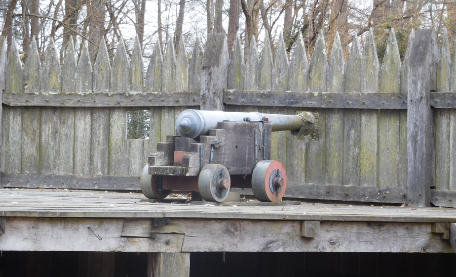
the English brought cannon to Virginia because they feared an attack by a Spanish ship, and the weapons did provide necessary protection against Native Americans
Powhatan sent representatives to the triangle-shaped enclosure, including Pocahontas, to trade and to spy on the uninvited newcomers. Gates in the wooden wall of "James Fort" allowed the colonists to control which Native Americans could circulate within the area occupied by the colonists, and when they could be there.
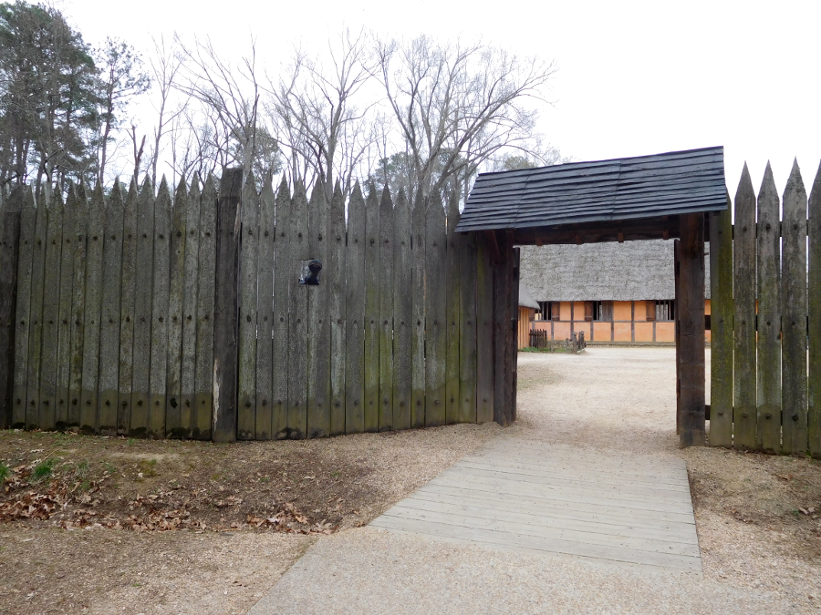
front gate of reconstructed fort at Jamestown Settlement, a tourism-based site operated by the state of Virginia since the 350th anniversary in 1957
The colonists did not isolate themselves inside their new fort; they too had a need for interaction. Engaging with the "naturals" gave the colonists some intelligence about the indigenous residents and about the area they planned to occupy. The English also needed food, and hoped to discover gold.
Discussions and bargaining occurred both outside and within the walls of the fort. William Strachey's secondhand account of a naked Pocahontas doing cartwheels inside the fort may not be accurate, but it does reflect the willingness of the colonists to allow Native Americans inside the palisade.4
The cannon at James Fort were probably inadequate to prevent a successful Spanish attack, but no enemy warship sailed that far upstream and the defenses were never tested. The fort's wooden palisade did allow the English to control access by Native Americans, reducing the threat of a surprise assault on the ground. As revealed in the 1622 uprising, the colony's intelligence gathering capabilities - and analytical skills to anticipate an attack - were inadequate.
The second fort built in Virginia by the English colonists was at Point Comfort in 1609. The initial fort there was called Fort Algernourne, sometimes spelled Algernon.
When locating Fort Algernourne in 1609, the English did not displace the Kecoughtans living in their town just east of the Hampton River. The fort sheltered 30 colonists who thrived on seafood during the Starving Time of 1609-10. In contrast, those living at Jamestown were so hungry that at least one settler resorted to cannibalism..
Fort Algernourne did not have cannon with sufficient range to block enemy ships from sailing up the James River, but did provide an early warning system to give Jamestown time to prepare for defense. Men stationed at Point Comfort could also provide fresh water and "comfort" to English sailors who had just crossed the 3,000-mile Atlantic Ocean and reached the Chesapeake Bay.
In 1610, Sir Thomas Dale changed the Virginia Company policy for dealing with the "naturals." He attacked the Kecoughtans and forced them off their land, initiating the settlement of Hampton. In 1611, Lord De la Warre had Fort Charles and Fort Henry constructed on either side of the Hampton River. Today Hampton is the longest continuously-occupied site in North America established by the English. The city advertises that it is "the oldest continuous community in English America."
Lord De la Warre also ordered construction of Fort West at the Fall Line of the James River "upon an Island invironed also with Corne ground." He lacked the boats and soldiers required to station people full-time at three forts, but had the infrastructure prepared in case of need.5
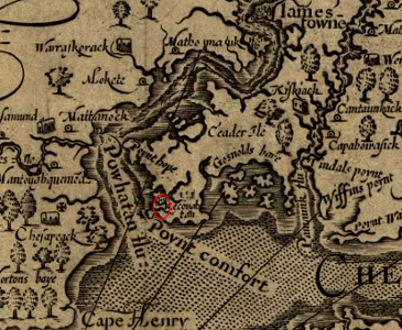
John Smith's map showing Point Comfort, site of Fort Algernon, Fort George, and finally Fort Monroe
Source: Library of Congress, Virginia / discovered and discribed by Captayn John Smith, 1606
The next colonial settlements established after Jamestown and Hampton, including Bermuda Hundred and Henricus, were built on peninsulas downstream of the Fall Line. Sir Thomas Dale brought military discipline to the colony after the Starving Time of 1609-1610. He proposed the Virginia Company send 2,000 men so he could create five strongholds capable of resisting a Spanish attack.
The Virginia Company lacked the resources to built five forts, but Dale did construct new fortified settlements at Henricus and Bermuda Hundred. The farms there were protected by wooden walls which were built between riverbanks. The walls provided protection from land attack by the hostile neighbors, rather than Spanish invaders coming by ship. By constructing a palisade across a narrow peninsula jutting into the James River, Dale was able to create a Henryco Fort that encompassed seven acres during the winter of 1611-1612.
The peninsula at Bermuda Hundred, enclosed by the end of 1613, encompassed eight square miles of good farmland. The fort at Jamestown, when built in 1607, enclosed just one acre.
The Native Americans in Virginia could use canoes to attack the river side of colonial settlements where no palisade had been constructed, but English placed cannons there primarily for protection against European or pirate assault. Even without a triangular fort at the new settlements such as the one at Jamestown, the firepower at bastions which could shoot towards the river was considered sufficient protection against potential amphibious attack by Algonquian-speaking warriors.6
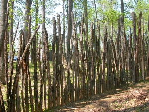
palisade at Henricus reconstruction (note gaps between trees forming wall, in contrast to reconstruction at Jamestown where more labor was available)
Defense needs changed over time. The power of the paramount chiefdom ruled initially by Chief Powhatan was broken within less than 50 years of English occupation. As the colonists established farms on the Peninsula, Middle Peninsula, and then finally the Northern Neck, most Powhatans were forced to abandon Tidewater. Their lifestyle of living in hunting camps and agricultural towns was replaced by colonists occupying year-round houses. Fences protected gardens against animals, but scattered houses were not fortified against an attack.
In 1622, Opechancanough caught the English by surprise and led an uprising. It was a desperate but well-planned response to the expansion of the colonists into Tsenacomoco. The fort at Henricus quickly was overwhelmed; everyone there was killed or fled to Jamestown. However, no Native Americans attacked the fort at Jamestown or the settlement at Hampton - even though the forts built there to protect against the Spanish had decayed away.
In two settlements south of the James River, Bennett's Welcome and Basse's Choice, 52 colonists were killed. In response, in 1623 the English expelled the Warraskoyack from their traditional territory and built a fort called "The Castle" in Isle of Wight County.
That fort was named Fort Boykin when rebuilt by rebelling Virginia colonists in the Revolutionary War. Fort Boykin was rebuilt and expanded again during the War of 1812 and then the Civil War. Today it is a public park in Isle of Wight County.7
New forts were established in 1646 after a treaty ended the Third Anglo-Powhatan War. Two of them were south of the James River, and were part of the defensive perimeter. Native Americans seeking to trade had to come to those forts; otherwise, they were considered to be a threat.
As Sir Thomas Dale demonstrated at Henricus and Bermuda Hundred, fortifications included more than small enclosed forts. In 1633, a wooden palisade was constructed between the James and York rivers, passing through Middle Plantation (later the site of Williamsburg), in order to exclude Native Americans from the Peninsula.8
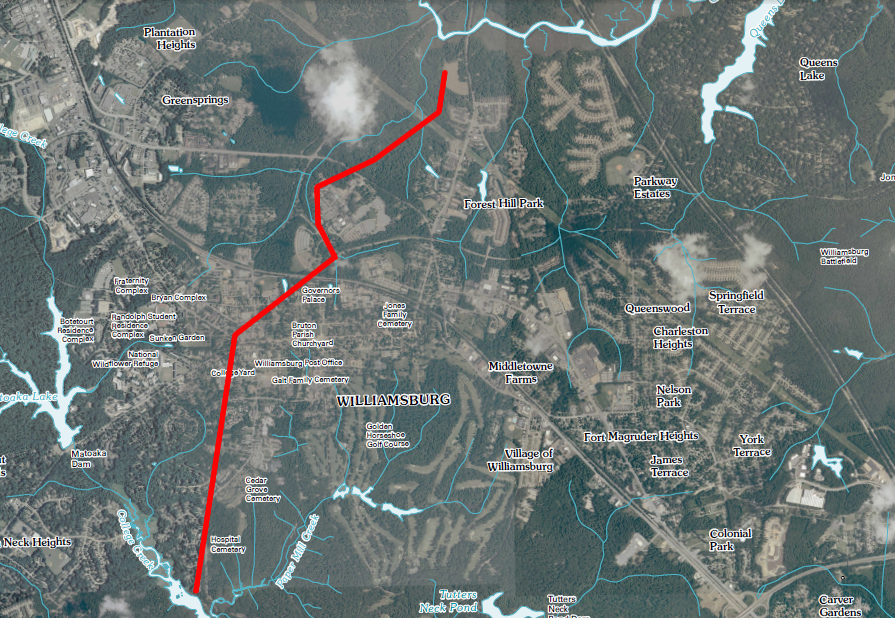
approximate route of 1634 palisade across the Peninsula, cutting through modern-day Williamsburg
Source: location of palisade from Phillip Levy, A New Look at an Old Wall. Indians, Englishmen, Landscape, and the 1634 Palisade at Middle Plantation
(overlaid on USGS 7.5 minute topo, 2010)
After the 1644 uprising, Opechancanough was captured and murdered while in English custody, and the English systematically destroyed Algonquian towns and cornfields. The remnants of Powhatan's political organization were fragmented, never to be reassembled.
After 1644, the main Indian threat to the English colonists in Virginia came from bands of northern Indians raiding into Virginia from Pennsylvania and New York. The 1646 treaty signed by Opechancanough's successor, Necotowance, required the Virginia tribes to be allies with the English against such raids. In 1656 the leader of the Pamunkey Tribe (Totopotomoy) was killed while fighting "Rickohockans" (perhaps offshoots of the Seneca tribe in western New York, or Cherokees from the Tennessee River watershed) at Bloody Run, in what is now the Church Hill area of Richmond.
Once the paramount chiefdom structure of Powhatan was destroyed, the primary interactions between the English and the remaining tribes in Virginia were based on the fur trade. When the English first arrived in 1607, Powhatan established his tribal organization as the "middleman" who would take a cut of the profits. Powhatan blocked the Siouan-speaking tribes west of the Fall Line from direct trade with the English at Jamestown.
Powhatan was not unique in this approach. In New England, the Iroquois tribes blocked the English from trading with the Hurons and others who lived further inland, and extracted high prices from the English for furs and skins until the American Revolution disrupted relationships.
The fur trade depended upon Native Americans harvesting a surplus of furs and food from their lands far from English settlements, and bringing the furs/skins to Tidewater settlements to trade with the English. In 1645, the General Assembly restricted trade between Native Americans and colonists to three forts.
Fort Charles was at the falls of the James River (modern-day Richmond). Fort Royall was located on the Pamunkey River on an island at the mouth of Totopotomoy Creek, near Opechancanough's capital. Those two forts helped define a perimeter west of the 1633 palisade. Fort James was located deep inside that perimeter at the confluence of Diascund Creek and the Chickahominy River.
In early 1646, the General Assembly authorized construction of Fort Henry (and 45 soldiers to staff it) at the mouth of the Appomattox River. In late 1646, after Opechancanough was captured and murdered, his successor Necotowance signed a peace treaty. The General Assembly then gave Fort Henry to its commander, Captain Abraham Wood, along with a land grant. Donating the fort eliminated the cost for the colony to maintain it.
William Byrd I acquired Fort Charles on the James River. He developed trading relationships with Native Americans who exchanged deerskins and other furs for weapons, bullets, gunpowder, and various supplies. Cadwalleder Jones did the same at the fort which the colony had built on the Rappahannock River at the current site of Fredericksburg.9
Fears of Spanish attack on the eastern edge of the colony faded in the 1600's, as the Royal Navy grew and Spain's military capacity faded. Coastal fortifications received minimal attention except for sporadic concern during wars in Europe which could spill over into North America.
In the 1660's and 1670's, there were several wars between England and the Dutch. The Anglo-Dutch wars led the General Assembly to authorize in 1667 the construction of forts on the James, Nansemond, York, Rappahannock, and Potomac rivers. In 1673, forts were also authorized in Isle of Wight County and Lower Norfolk County. Local residents were required to pay for constructing and staffing the forts intended to protect their county.
Forts on the western edge of settlement were built in response to Native American attacks, and then abandoned because of the cost of staffing them. What is now Prince William County had few colonists at the time of Native American attacks which preceded Bacon's Rebellion. The stone walls in the basement of the Bel Air house may be the remnants of a 1670's fort that housed rangers assigned to patrol the headwaters of the Occoquan River.
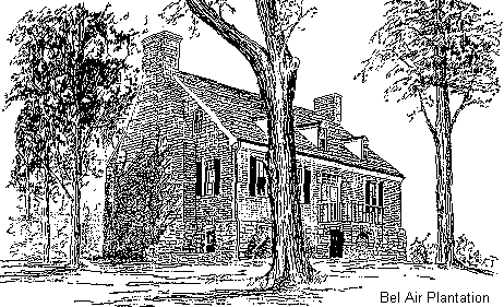
Bel Air, perhaps the oldest building in Prince William County
The fort in Lower Norfolk County was completed in 1780 at Four Farthing Point, now known as Town Point. The "Half Moone" fort is commemorated today by the nearby docking site for cruise ships, the Half Moone Cruise Terminal.
An attempt by Governor Berkeley to build a new fort at Point Comfort ended when a 1667 hurricane washed away the construction materials before the structure was completed. Because Royal Navy guardships sent to Virginia were inadequate and there were no forts on the shoreline with cannon to provide protection, the Dutch were able to sail into the Chesapeake Bay in 1667 and 1673 and capture/destroy tobacco ships.
In 1672, at the start of the Third Anglo-Dutch War, Governor Berkeley contracted with William Drummond to build a new fort at Jamestown. Berkeley, one of eight Lords Proprietors that were awarded the Carolina colony by King Charles II in 1663, had appointed Drummond to govern the Carolina territory around Albemarle Sound.
Drummond did such a poor job of building the fort, and constructed it so slowly, that Governor Berkeley had him arrested. The two ended up being political enemies. Drummond supported Bacon's Rebellion in 1676, during which Jamestown was burned. The man contracted in 1672 to build a fortification to protect the colonial capital ended up helping to burn Jamestown. When Governor Berkeley regained power, he had William Drummond executed soon after he was captured.10
After Opechancanough organized a massive assault on colonial settlements in 1622, the General Assembly prioritized use of tax revenue to protect against Native American attacks on the western edge of the colony.
Petersburg, Virginia developed from the fur-trading Fort Henry granted to Captain Abraham Wood in 1646. Petersburg is named after Peter Jones, grandson of Abraham Wood.
In 1650, Wood, Edward Bland, and seven others traveled southwest of the fort for nine days. Their mission was to establish trading relationships with the Native Americans on the Piedmont. For a fort to be effective for defense and for trading, it was necessary to gather intelligence about the nearby territory and to establish relationships with the Native Americans who lived there.
In 1673, Abraham Wood sent explorers James Needham and Gabriel Arthur further west. That expedition was intended to establish direct trade with the Cherokee in the Tennessee River watershed. Wood was trying to bypass the Occaneechi tribe. They acted as middlemen at the traditional trading post on the Roanoke River near modern-day Clarksville, until their town was destroyed in Bacon's Rebellion in 1676.
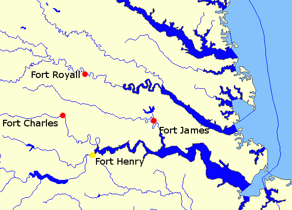
forts established in 1645 (in red) and 1646 (in yellow)
Map Source: US Geological Survey, National Atlas
Both colonists and Native Americans benefited from fur/deerskin trading transactions. In the 1600's, the English stayed east of the Fall Line. Through trade at the forts, tribes living west of the Fall Line got access to English metal products, textiles, and guns.
The French found the fur trade to be sufficiently lucrative that they never sent large numbers of colonists to North America. In Canada, Louisiana, and the Ohio River Valley, the French focused on building relationships that increased trading. Because they did not try to occupy large amounts of North American land and create an agricultural colony, the French could minimize their investment in fortifications to defend again attacks by Native Americans.
The colonial fur trade in Virginia always was a rough business, as William Claiborne discovered in the 1630's. In addition to conflicts between tribes for control of the hunting territory, the English fought among themselves.
Bacon's Rebellion in 1676 was triggered in part by rivalries between Governor Berkeley and his friends (who had been given special rights for engaging in the fur trade) and the out-of-power planters who lived at the edges of colonial settlement. The risks of living in the backcountry, the interface of English/Indian territory (the "frontier"), were exacerbated in 1675 by Susquehannocks who were retaliating for murders of their headmen in Maryland by Virginia militia.
Governor Berkeley's response was to build a few forts and hire rangers to patrol between them, reacting to murders and chasing after bands of warriors. A special per-person tax was imposed on all
The Susquehannocks easily evaded the rangers. Backcountry settlers wanted a more aggressive policy, including attacks on Native American towns that would displace the indigenous residents and facilitate expanded settlement.
The rangers were less-than-perfect sensors, and northern raiders could slip into Virginia undetected. When Nathaniel Bacon's overseer was killed by Indians, he launched a rebellion against the establishment based in Jamestown, attacked the peaceful Indians who were allied with Governor Berkeley - and even burned Jamestown itself, before Bacon died and the rebellion fizzled.
Representatives from the Parliamentary government then in control of England conducted an assessment of the causes of the rebellion. It included this evaluation of the value of the forts:11
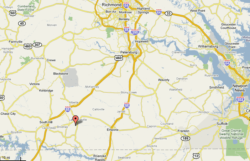
site of Fort Christanna, 1714-1717
Source: US Geological Survey (USGS), Geographic Names Information System
With one exception, there was little need to build forts in the Piedmont between the Fall Line and the Blue Ridge after Bacon's Rebellion. Once colonial settlement moved west of the Fall Line in the early 1700's, there were few resident Native Americans remaining in towns. Monacans moved into the valleys of the Blue Ridge. Siouan-speaking tribes coalesced on the Roanoke River and with the Catawba on the Carolina Piedmont. The Virginia Piedmont had become a zone without Native American towns.
The exception was the Tuscarora War. In 1711, the Tuscarora uprising began in North Carolina. No Virginia settlements were attacked, but Governor Spotswood had to protect the southern frontier.
Spotswood first ensured the "tributary tribes," including the Iroquoian-speaking Meherrin and Nottoway, would stay allied with Virginia. They reaffirmed they would be peaceful.
In 1713, the General Assembly was still concerned about the war crossing the border. It agreed to fund 11 companies of rangers, 132 men, to patrol the backcountry. That expensive investment did not provide cost-effective security. As demonstrated throughout the 1600's, the Native Americans evaded the rangers.
Spotswood wanted more than just short-term assurances from the tributary tribes. He aimed to establish a lasting peace by placing ministers/teachers in each of their towns, eventually acculturating the Native Americans and ensuring they were dependent upon trade goods supplied by the English.
The supply of ministers/teachers was inadequate, so he could not distribute English leaders to all the Native American towns. His solution was to centralize the towns, moving all the residents to a single fort. Just a dozen men stationed there could provide as much security as all the angers. Centralizing people minimized the costs for keeping any group from joining the Tuscarora, while also increasing the capacity of the colony to protect its tributary tribes from attack by the Iroquois.
Governor Spotswood eventually got the General Assembly to fund a fort at Fort Christanna, south of modern-day Lawrenceville in Brunswick County. At the time, the site on the Meherrin River was at the edge of British colonial power. The modern historical marker at the site calls it "The Farthest Western Outpost of the British Empire."
The Tuscaroras who had not joined in the uprising initially agreed to move to the fort, but never did. The Nottoways and Meherrins, which had traditionally not moved their towns, never committed to uproot themselves and resettle at Fort Cristanna in an unfamiliar location with other tribes.
Spotswood had more success with various Siouan-speaking groups, including the Saponis. They agreed to aggregate into one community located at Fort Christanna.
One part of the governor's plan for Fort Christanna was to centralize trade there. He got the legislature to authorize a new monopoly for the Virginia Indian Company. While standardizing business relationships might minimize dishonest bargaining, the monopoly excluded William Byrd I (who was away in England) and others from profiting from the Native American fur trade.
The governor also planned for a second fort to be constructed further north. Some Tuscarora had avoided the fighting by moving temporarily into Virginia. Spotswood wanted to relocate them at Germanna, but they returned to North Carolina instead. He ended up placing German-speaking immigrants at the site he named Germanna. It was located beyond the boundary of any colonial county at the time; Spotsylvania County was not created until 1721.12
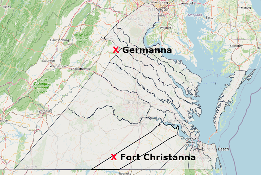
after the outbreak of the Tuscarora War in 1711, Governor Spotswood got two forts built on the western edge of colonial settlement
Source: Newberry Library, Atlas of Historical Boundaries
A surprise attack in 1717 by Iroquois rivals, on the Native American groups he had gathered peacefully at Fort Christanna, damaged his strategy. However, his main opposition was rival Virginia traders who traded weapons and other products for furs and skins, independent from Spotswood's licensed trading program.
Source: Historic Forrest, Fort Christanna (1714 Virginia Fort)
For 130 years after the destruction of the Powhatan tribes, from the 1644 uprising to the intrusion into Kentucky in the 1770's, colonist/Native American conflicts on the Virginia frontier were triggered by trading rivalries between tribes as well as by Native American resistance to colonial settlement.
When English settlement crossed beyond the Fall Line and started to occupy the Piedmont in the early 1700's, there were few Native American towns remaining east of the Blue Ridge. New diseases brought from Europe had reduced the Native American population throughout Virginia.
In the Piedmont, attacks from raiding Catawbas from the south and Iroquois from the north had emptied out much of the region between the travels of John Lederer in 1669/1670 and the arrival of a large number of settlers starting farms 60 years later. The Piedmont and valleys west of the Blue Ridge, from the Potomac River to the headwaters of the Tennessee and Yadkin rivers, was a shatter zone where Native American towns were displaced.
In the 1722 Treaty of Albany, the Iroquois agreed to travel only west of the Blue Ridge when passing through Virginia. The Iroquois continued their raids against the Catawba in the Piedmont of North Carolina after 1722, but agreed to travel on a "war path" west of the Blue Ridge for those expeditions. The Catawba headed north used that same route. The risks to settlers carving new farms out of the wilderness east of the Blue Ridge were greatly diminished.13
West of the Blue Ridge, traveling groups of Native Americans were still a threat. Until the French and Indian War, the most common danger there was that a raiding party would kill livestock for food.
When colonial occupation of the Shenandoah Valley started in the 1730's, the resident tribes had already migrated out of the valleys west of the Blue Ridge. The Manahoacs, Monacans, Tutelo,, Saponi, and others had abandoned the towns which had been occupied since the adoption of agriculture. Colonization disrupted Native American hunting patterns, particularly of the Shawnee, but apparently did not result in large-scale displacement of Native American towns... because the towns were already gone. As in the Piedmont, the Siouan-speaking residents in the Valley and Ridge towns moved to avoid raiders from more-powerful tribes north and south of Virginia.
The threat to settlers west of the Blue Ridge after the 1722 Treaty of Albany came from occasional traveling bands of Cherokee and Catawba moving north, Iroquois raiding to the south, and from hunting parties of Shawnee, Delaware, and Mingo who lived primarily near the Ohio River.
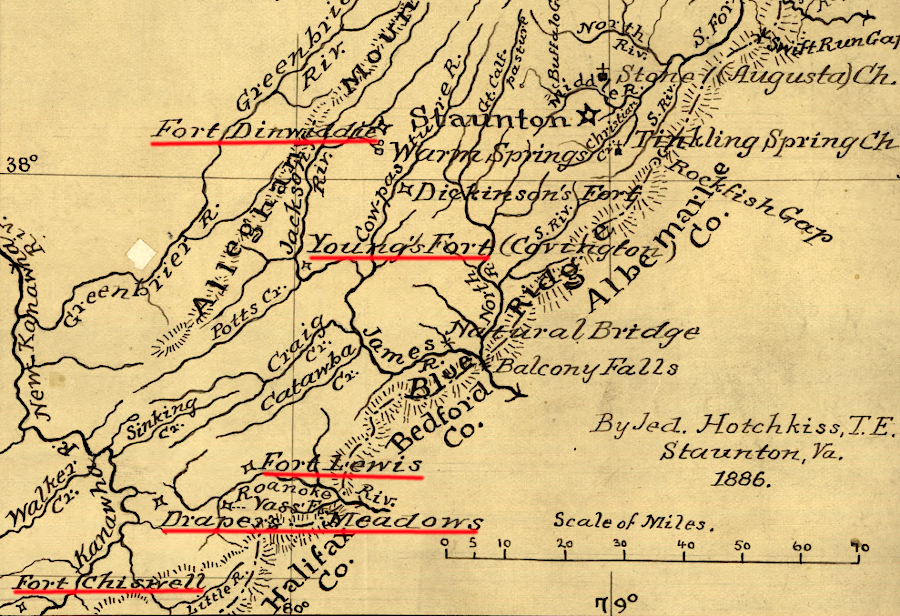
French and Indian War forts west of the Blue Ridge, between the New and Shenandoah rivers
Source: Library of Congress, Map of part of Augusta County, Colony of Virginia, 1755-1760
For settlers west of the Blue Ridge, the General Assembly in Williamsburg did not fund construction of forts and militia forces to staff them except during the French and Indian War and the American Revolution. Colonists living in isolated farms west of the Blue Ridge built sturdy wooden houses that also served as defensive structures rather than facilities dedicated to just military protection. Such houses are called "forts" in many reports written in colonial days, especially after settlement reached the Shenandoah Valley. Nearby families would gather for common protection at fortified houses when there was a specific alarm that a war party was nearby.
Those frontier forts have disappeared over time, except for one discovered in 2019. A lawyer with a personal interest in Virginia's frontier forts recognized that the historic Byrnside-Beirne-Johnson House near Union, West Virginia could have been constructed around Byrnside's Fort. The fort had been built in 1770, when the Shawnee still disputed control over the borderlands of Virginia.14
Before the French and Indian War, the Ohio Company invested in forts on the upper Potomac River and at the Forks of the Ohio. They were intended to serve as trading places with the western tribes, and as a supply base for surveyors and settlers moving to lands granted to the Ohio Company. At the start of the French and Indian War, General Braddock relied upon those forts to support his march to capture Fort Duquesne from the French.
During that war, numerous forts were constructed west of the Blue Ridge stretching all the way to the Mississippi River. Consistent with the experience prior to Bacon's Rebellion in 1676, the Shawnee were able to avoid the forts as they attacked plantations from Winchester south to the New River. Colonists finally ended those attacks through offensive operations rather than defensive fortifications. Threatening to destroy the Shawnee towns near the Ohio River, and capturing the French forts which provided supplies, brought an end to the raids.
Source: Civil Rights Lawyer, I Found a Revolutionary War Log Fort Inside a House
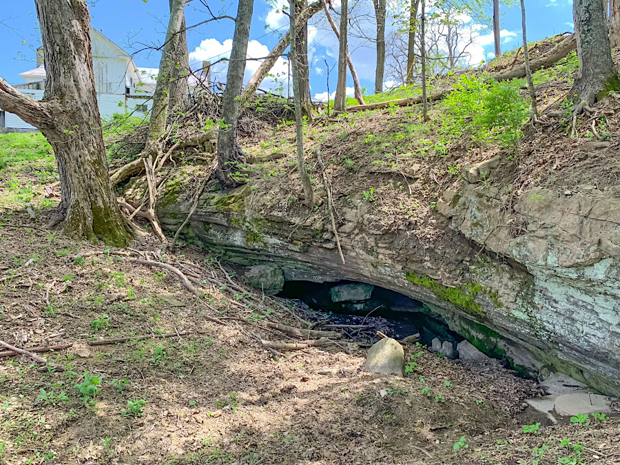
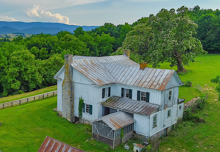
Byrnside's Fort, obscured until 2019 inside the historic Byrnside-Beirne-Johnson House, was located next to a spring emerging from a cave that provided drinking water in 1770
Source: X (Twitter), The Civil Rights Lawyer
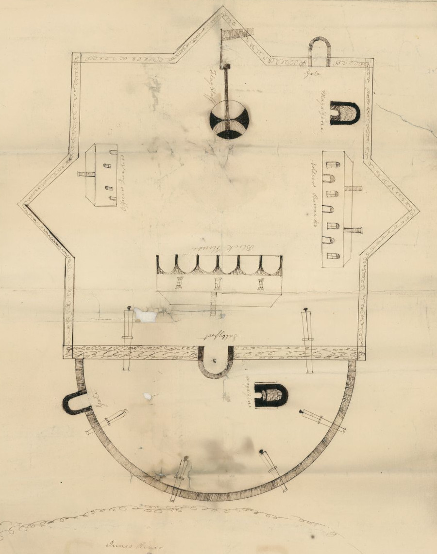
Fort Powhatan on the James River, after the War of 1812
Source: Library of Congress, lan of Fort Powhatan, Prince George County, Virginia (by Elijah Brown, 1819?)