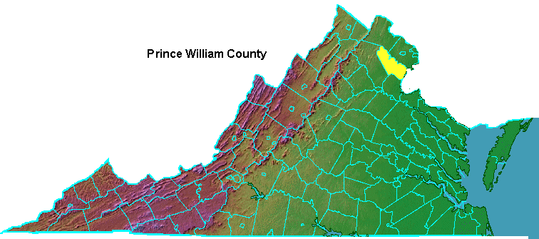
Prince William was formed in 1731 (1730 according to the Old Style calendar). The General Assembly named it after the second son of George II.
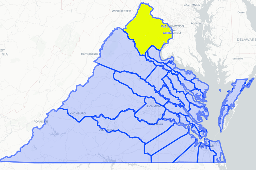
Prince William County was carved out of Stafford and King George counties in 1731
Source: Newberry Library, Atlas of Historical County Boundaries
Prince William was made the Duke of Cumberland in 1726 when he was five years old; he was only nine years old when honored by the name of the new county. Cumberland County and Cumberland Gap are two other Virginia places named after him.
King George II and his wife Caroline liked Prince William far better than his older brother Frederick. Frederick became a focal point for people who opposed George II and/or could not gain influence under him, but thought they might do better by being allies with the man who would become the next king. Frderick served as a rival, not an ally, of his father.
Prince William still missed a chance at becoming king after his brother Frederick died in 1751. Instead, King George II and Parliament chose the late Frederick's oldest son, George, to become King George III.
Frederick's son was only 13 years old at the time. His mother Augusta was prepared to serve as regent if necessary until the new Prince of Wales turned 18. However, George II lived nine more years until 1760, when young George III was crowned. His 39-year old uncle remained the Duke of Cumberland.
Prince William was trained initially to be Lord High Admiral of the British Navy, but he preferred the army. During the War of Austrian Succession on the continent, he was wounded in the Battle of Dettingen. Today's Episcopal Parish of Dettingen in Prince William County is named after that British victory.1
In 1745, back in Britain, Prince William won a smashing victory at Culloden that stopped an uprising led by "Bonnie Prince Charlie" and his Scottish troops. This eliminated the threat from the rival House of Stuart (sons of King James II) to the legitimacy of the English kings from the German state of Hanover. which was renamed the "House of Windsor" after World War I.
Prince William treated the defeated Highlanders so harshly that he earned the name "Butcher of Culloden." The winning British called him "Sweet William," but the losers called him "Stinking Billy."2
Prince William's military reputation was destroyed in one of the maneuverings during what the Virginians referred to as the French and Indian War. Prince William signed the Treaty of Kloster-Zeven in 1757 with the French, after his father King George II directed him to negotiate a way out of the situation without losing the English army on the continent - or losing the Hanover territory. The English Parliament was furious over the failure to fight and at least distract the French on the continent. Prince William ended up serving as his father's scapegoat and resigned in disgrace from the army.3
Prince William County was established at the same time as Sir William Gooch was serving as the Governor (technically, Lieutenant Governor). He convinced the General Assembly to pass he Tobacco Inspection Act of 1730, intended to raise the price at which Virginia tobacco was sold in England by blocking the shipment of low-quality tobacco. The selection of inspectors was determined by the local gentry. When some tobacco failed inspection and was burned as trash, small farmers objected to the fairness of the inspection process and the economic losses.
Thomas Harrison led the wealthy faction in Prince William that controlled the inspection process. Thomas Osborne led the less-wealthy faction, largely Scots-Irish immigrants, who resorted at one point to burning warehouses and stockpiles of harvested tobacco. The local militia was called out to suppress the "Prince William Rebellion," and in 1732 the Governor's Council required leaders of the rebellious group to give bond to ensure good behavior.
The wealthier faction lived in eastern Prince William County. That led to petitions in 1732, 1736, 1738, 1740, and 1742 to divide the county.4
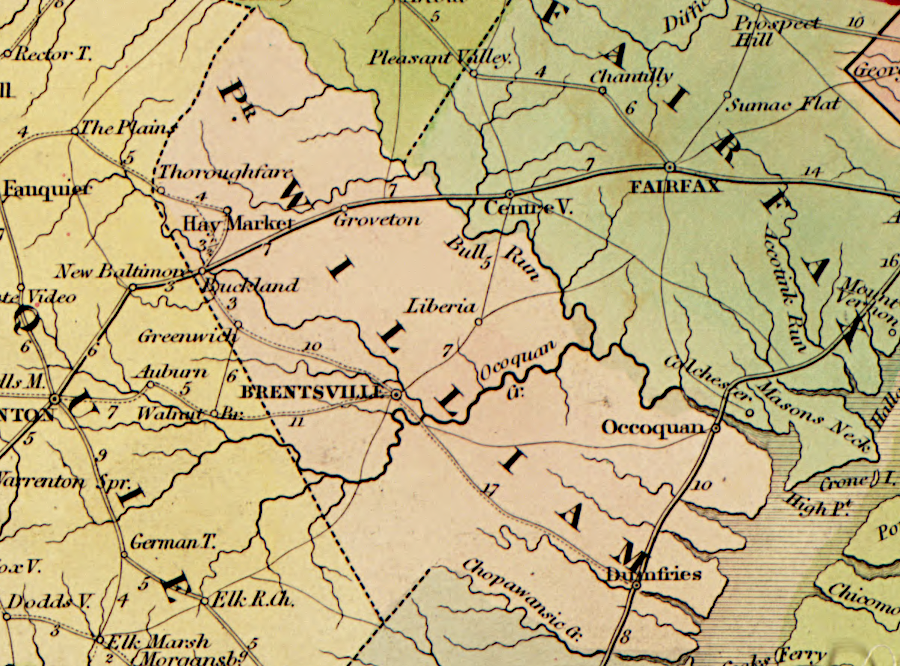
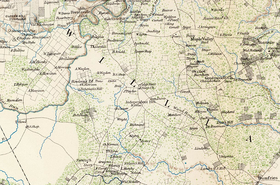
Brentsville was the county seat of Prince William County between 1822-1896
Source: Library of Congress, The American atlas, exhibiting the post offices, post roads, rail roads, canals, and the physical & political divisions of the United States of North America (by John Arrowsmith, 1839)
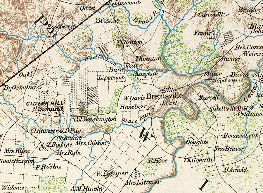
during the Civil War, Union troops scattered county records in the Clerk's Office and courthouse at Brentsville
Source: David Rumsey Historical Map Collection, Surveys for military defenses. Map of northeastern Virginia and vicinity of Washington. Sheet 2 (by J.J. Young and W. Hesselbach, 1862)
Prince William County was a farm-based area until World War II. It evolved into a bedroom community after Shirley Highway was completed in 1949, providing a two-lane bypass to Route 1 until the second two lanes were completed in 1952.5
the Fry-Jefferson map of Virginia shows the limited transportation network in Prince William County in 1755
Source: Library of Congress, A map of the most inhabited part of Virginia containing the whole province of Maryland with part of Pensilvania, New Jersey and North Carolina (by Joshua Fry and Peter Jefferson, 1755)
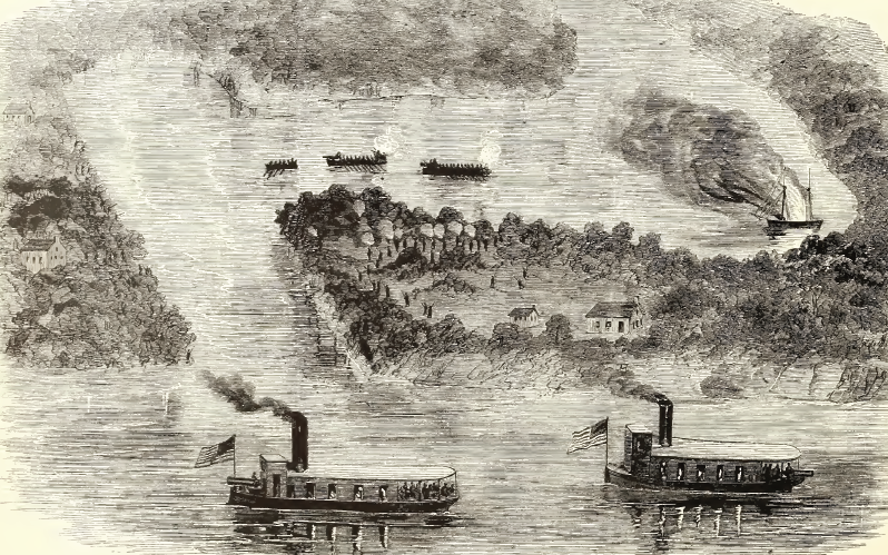
along the Prince William County shoreline, Confederates managed to control the Potomac River between October 1861-March 1862
Source: Frank Leslie's Illustrated History of the Civil War, Birds-Eye View of the Burning of a Confederate Schooner on Quantico or Dumfries Creek, Potomac River, on the Night of October 11th, 1861, By Lieutenant A. D. Harrell and a Detachment from the Potomac Flotilla (p.282)
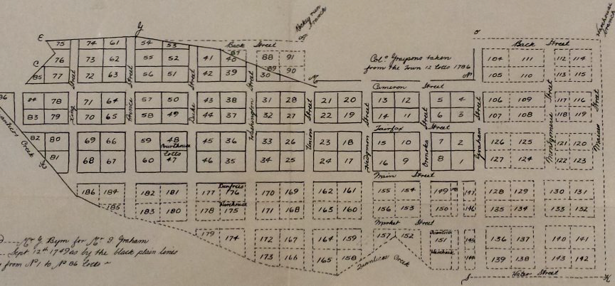
Dumfries (above) was chartered on the same day as Alexandria in 1749, using the same street names
Source: Prince William County Historic Preservation Division, Historic Perspectives (Fall 2016)
Prince William County in 1901
Source: Library of Congress, Prince William County in 1901 (by William H. Brown, 1901)
in 1906, two railroads connected Alexandria with Prince William County
Source: Library of Congress, Post route map of the states of Virginia and West Virginia (Postmaster General, 1906)
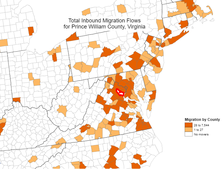
jurisdictions from which people moved into Prince William County
Source: Bureau of Census, Census Flow Mapper
in 1848, roads were already established through Prince William on routes now followed by I-95 and I-66
Source: Library of Congress, A map of the internal improvements of Virginia (by Claudius Crozet, 1848)


new construction in the Town of Occoquan includes high-priced townhomes on the waterfront
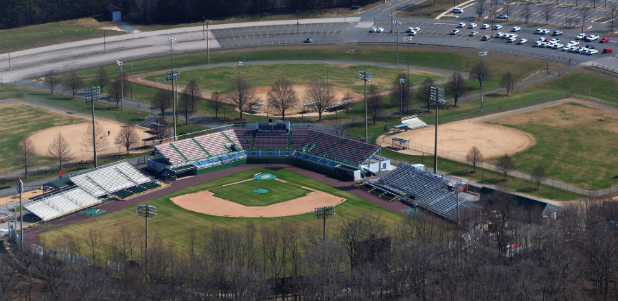
Prince William County owns the baseball stadium used by the minor league team, the Cannons
Source: Historic Prince William, PWC Stadium Complex
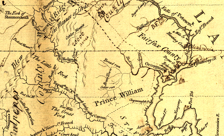
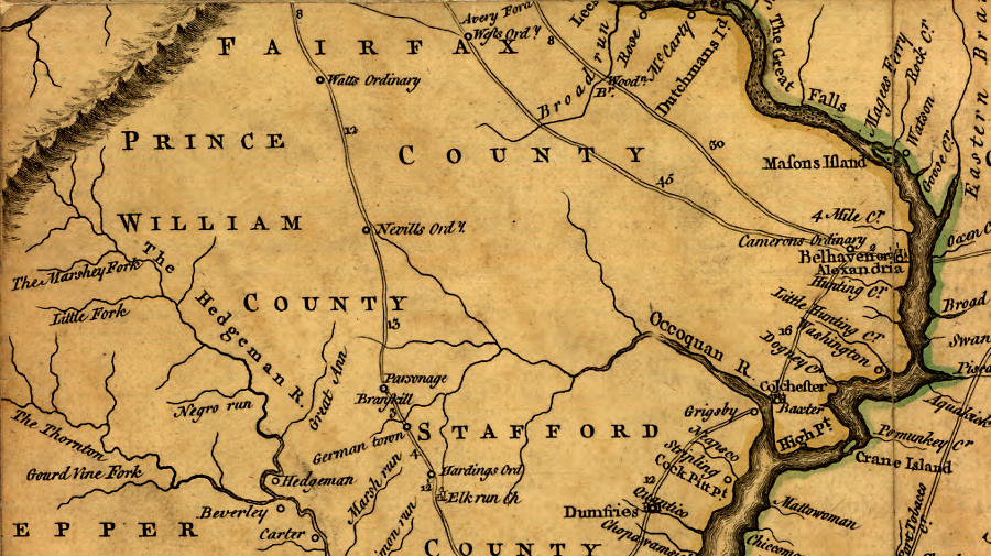
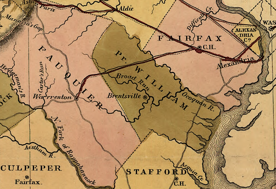
Prince William County, 1737
Source: Library of Congress, A survey of the northern neck of Virginia...
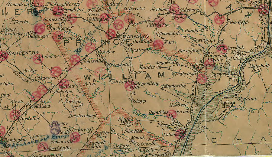
Prince William County in 1862
Source: David Rumsey Historical Map Collection, Surveys for military defenses. Map of northeastern Virginia and vicinity of Washington. Sheet 2 (by J.J. Young and W. Hesselbach, August 1, 1862)
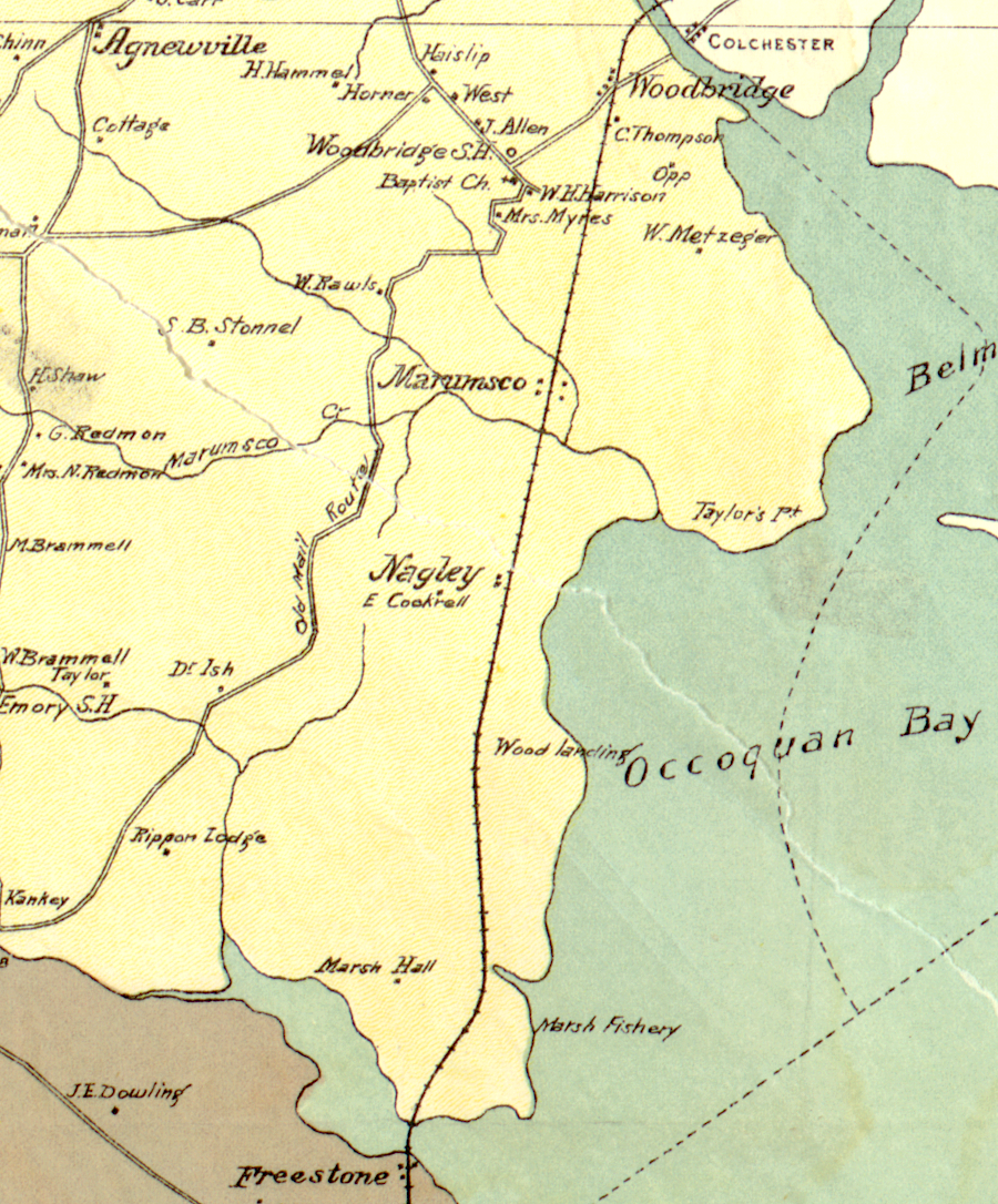
in 1900, there was little development between future Route 1 and the Potomac River in northern Prince William County
Source: Library of Congress, Map of northern Virginia (1894); Map of Prince William County, Virginia