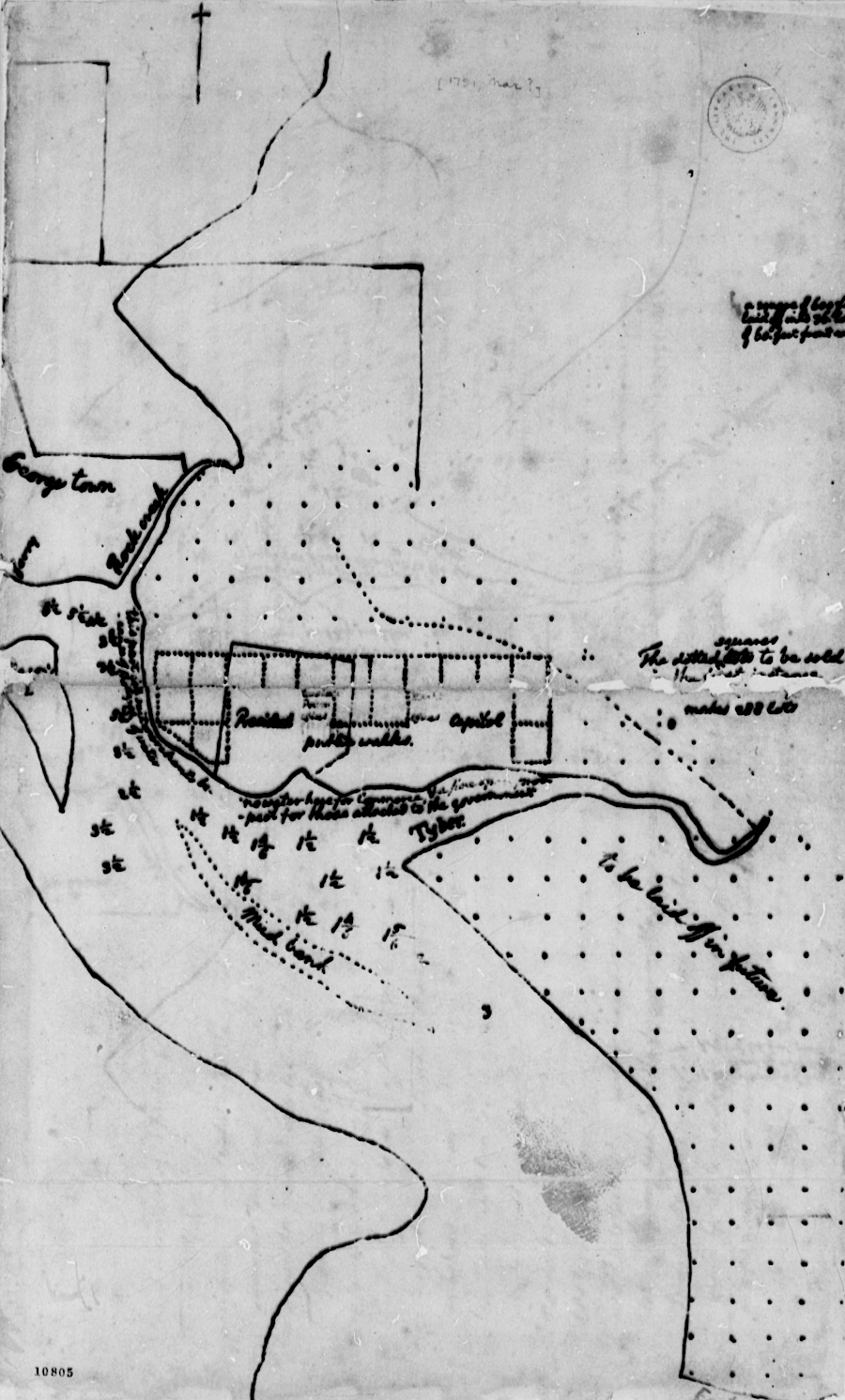
George Washington determined where the new national capital would be located on the Potomac River
Source: Library of Congress, George Washington, March 31, 1791, Proclamation of Federal District with Map

George Washington determined where the new national capital would be located on the Potomac River
Source: Library of Congress, George Washington, March 31, 1791, Proclamation of Federal District with Map
The Articles of Confederation, adopted in 1777 and ratified finally in 1781, did not specify a permanent location where the Continental Congress would meet. Aricle IX said only:1
Delegates at the 1787 Constitutional Convention in Philadelphia established that the national capital would be located within a district controlled by the Federal government, not by a single state. Size of the district was limited to 100 square miles.
That decision was shaped by the Pensylvania Mutiny in June, 1783. At that time, Continental Army soldiers were unhappy that their promised pay was not being delivered. On June 17, 1783, about 400 soldiers surrounded the members on Congress who were meeting in Independence Hall in Philadelphia. Negtiations led to a peaceful conclusion of the confrontation that day.
The Congress then asked the Pennsylvania state government to call out the state militia and provide protection. The state government declined, perhaps because it was unclear if the militia would use force if the Continental Army soldiers renewed their threat. In response, the Congress left Philadelphia on June 22 and reassembled at the College of New Jersey in Princeton, New Jersey.
Four years later, members of the 1787 Constitutional Convention crafted Article I, Section 8 so no state government would have the power to control the security of Federal officials in the new capital. The new Constitution said:2
The Congress did not settle down quickly after laving Philadelphia in June, 1783. In November, 1783 it moved from Princeton to Annapolis, Maryland, where the unfinished Maryland State House was available. George Washingon resigned his commission as general of the Continental Army AND the Continental Congress ratified the Treaty of Paris, ending the American Revolution, while meting in Annapolis.
The legislators moved again in August 1784 to Trenton, New Jersey, and in January 1785 to New York City. The Congress was still meeting there when George Washington was inaugurated as the first President of the United States on April 30, 1789.3
On July 16, 1790, the US Congress passed the "Act for Establishing the Temporary and Permanent Seat of the Government of the United States," or the Residence Act. It determined that for the next 10 years, Philadelphia would serve as the home of the Federal government. The national capital would move in 1800 to a site on the Potomac River, on 100 square miles where Maryland and Virginia would cede political control to the Federal government. President Washington was autorized to establish a commission to determine the exact location of the new capital.
The Residence Act was a political compromise. Northern members of the Congress opposed locating the capital within a slave state. Souternern members desired Federal affirmation of the institution of slavery, and also hoped to creae a commercial center in the South comparable to Philadelphia, New York, and Boston.
Members of the North and South wer also split over the recommendaions made by the secretary of Trasury, Alexander Hamilton, in his "Report on Public Credit." Hamilton sought to strengthen the central government, pulling power away from 13 individual state governments, by increasing the financial role and capacity of the Federal government.
He proposed repaying the remaining Revolutional War debts of the states by selling bonds backed by the natinal government, and paid off through national taxes. Wealthy buyers of th Fderal bonds would then be inclined to support the power of the Federal government. The ability to effectively raise national taxes would lead to the US Congress and President having a central role in the economic and political choices of the new nation.
The assumption of state debts was attractive primarily to Northern states. Southern states had repaid a higher percentage already; Virginia had repaid nearly all of its Revolutional War debt. Many of the people who would be repaid lived in Northern states. They had purchased state bonds at a discount, and full repayment by the Federal government would guarantee a good profit on their investments.
On June 20, 1790, James Madison and Alexander Hamilton came to a private dinner hosted by Thomas Jefferson. In the "room where it happened," the three agreed to a compromise in which the Northern states were satisfied by debt assumption and Southern states were satisfied by the location of the new capital. The Residence Act was passed less than a month later. In the US Senate, te voe was 14-12. In the House of Representatives, the vote was 31-29.
Betwen 1790-1800, Philadelphia sought to change the dcision and remain as the national capital. The effort failed, and on May 15, 1780 the Federal offices started to move south. Philadelphia's last day as the capital was June 11, 1800.4
The Residence Act had stated:5
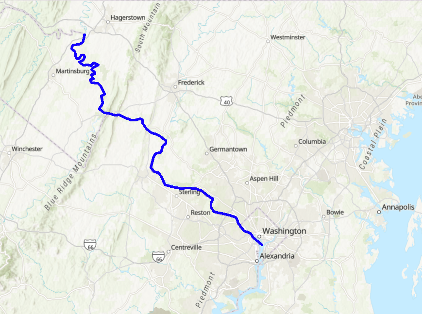
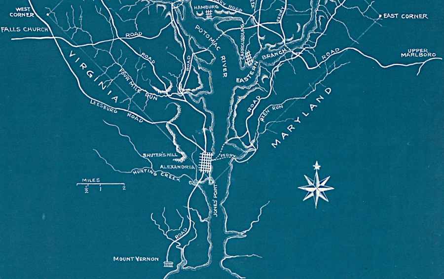
The 1790 Residence Act authorized a location downstream from modern Williamsport, Maryland and upstream from Anacostia. However, George Washington desired that Alexandria be included within the 10-mile square of the new District of Columbia. To include Alexandria in what was expected to become a vibrant commercial center, Washington first proclaimed his decision on January 24, 1791 and then had Congress revise the requirements in the Residence Act so the lower apex of the 10-mile square could be placed at the mouth of Hunting Creek.
Washington's proclamation was sufficient to prevent the First Congress from reconsidering its earlier decision to place the new capital on the Potomac River. The revision, which Washington signed on March 3, 1791, said:6

the 1790 Residency Act authorized locating the District of Columbia somewhere between the mouth of the Anacostia River and Conococheague Creek
Source: ESRI, ArcGIS Online

George Washington got Congress to revise the initial boundaries in the 1790 Residency Act so Alexandria could be included in the District of Columbia
Source: Library of Congress, 1791 map of District of Columbia, before the city was laid out...
Maryland ceded control
Pierre L'Enfant provided the initial design f the new city. Though he was ultimately fired, his pattern of squares is still obvious today. The District of Columbia was 100 square miles when established in 1800. The Virginia portion was "revested" in 1846, moving the boundary north to the low water mark of the Potomac River along the shoreline of Alexandria and what is today Arlington County.
In 1910, the District was in need of land for a prison. It initially purchased 1,500 acres downstream of Alexandria, but local objections forced the city to transfer the land to another Federal jurisdiction, the US Army. To supply water to Camp A. A. Humphreys (renamed Fort Belvoir in 1935), the Corps of Engineers built Lake Accotink in 1918.
The area was so rural that the camp could open the dam gates when Fort Belvoir needs more water and use Accotink Creek as an open pipeline. Today, the lake is a Fairfax County park.
To build a prison, the District then purchased land at Lorton. That too was "inappropriate" to Fairfax residents, and the various prisons built by the District at Lorton have been closed. The house with the quirky sign out front, "Prison View Estates," now faces a development and parkland known as Laurel Hill. Sic gloria transit.