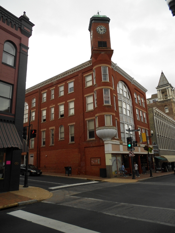
Staunton
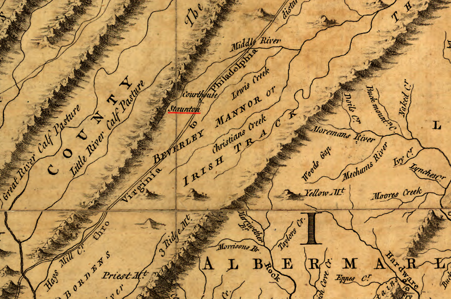
the 1755 Fry-Jefferson map of Virginia showed Staunton as the county seat of Augusta County
Source: Library of Congress, A map of the most inhabited part of Virginia containing the whole province of Maryland with part of Pensilvania, New Jersey and North Carolina (by Joshua Fry and Peter Jefferson, 1755)
Staunton got started when one of the settlers migrating south from Philadelphia into the "back country" of Virginia stopped at a creek and started a farm. Today, Lewis Creek is named after John Lewis, that settler in 1732.
He was from a French Huguenot family, religious refugees who fled to North America. Like Joist Hite who created the first settlement further north, John Lewis risked the lives and fortune of his family to settle on a dangerous frontier because European leaders considered his Protestant religion to be a subversive threat against the authority of the Catholic monarch.
In 1745, the area was so populated that the first courthouse for Augusta County would be built a mile west at Beverley's "Mill Place." In 1747, that site was renamed Staunton after the wife of Governor Gooch, Lady Rebecca Staunton.
Governor Gooch encouraged non-Anglican immigrants from Pennsylvania to settle in Virginia west of the Blue Ridge, continuing the policy of his predecessor Governor Spotswood. Though there was no separation of church and state in England and the Church of England was the official established religion in Virginia, Virginia officials did not require a homogenous population with just one religion. By accepting diversity on the edge of settlement, the colony competed successfully to attract immigrants that would serve as a buffer against French and/or Native American attacks.
Those immigrants also bought land, enabling the gentry in Tidewater to increase their wealth. The General Assembly issued a major land grant in 1736 for 118,491 acres to William Beverley. South of his "Manor of Beverley," the colony granted 92,100 acres to Benjamin Borden, and within two years he recruited the 100 settlers required by the legislature before transferring title to the land. Borden's parcel became known as the "Irish Tract," and Beverley also sold much of his land to Scotch-Irish immigrants.1
The officials in Williamsburg anticipated that settlement west of the Blue Ridge would require new counties to handle local issues. The General Assembly provisionally created Frederick and Augusta counties in 1738, defining the Blue Ridge as their future eastern borders, but did not organize new county courts until the population increased. Frederick County was officially established in 1743, and it took two more years for enough migrants to settle on land further south before Augusta County was organized in 1745. Staunton itself got a municipal charter in 1761.
Staunton grew because it was on the Great Wagon Road from Philadelphia, providing shelter and food for travelers. It offered waterpower for local farmers to grind their grains, and its role as a government center cemented its significance in the county.
Between June 7-23, 1781, Staunton was the capital of Virginia. The General Assembly fled there after being chased out of Richmond by the invading British, and after Lieutenant Colonel Banastre Tarleton just missed capturing Thomas Jefferson and many members of the legislature in Charlottesville.
Jefferson did not join the General Assembly in Staunton, because his term as governor expired on June 2. While meeting at Trinity Church, the legislators elected Thomas Nelson as the third governor of Virginia.2
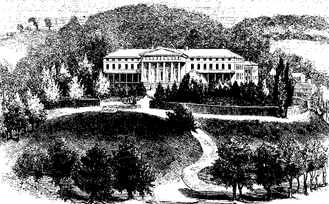
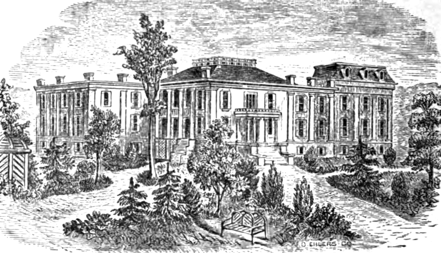
"Asylym for the Deaf and Dumb" in Staunton, prior to Civil War
Source: Scribner's Monthly, Virginia Illustrated (February 1855)
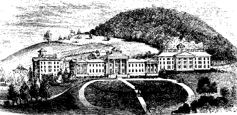
"Hospital for the Insane" in Staunton, prior to Civil War
Source: Scribner's Monthly, Virginia Illustrated (February 1855)
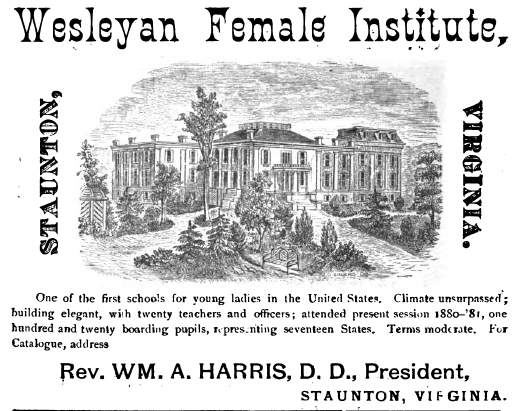
Methodists started the Wesleyan Female Institute in 1846
Source: "The Chesapeake & Ohio Railway Directory, Containing an Illustrated History and Description of the Road," Wesleyan Female Institute (p.293)
Links
- Staunton
- Automobile Blue Book map (1919 roads)
- Encyclopedia Virginia
- Fire Engineering
- Friends of Shenandoah Mountain
- Library of Congress - Panoramic Maps, 1847-1929
- The Great South; A Record of Journeys in Louisiana, Texas, the Indian Territory, Missouri, Arkansas, Mississippi, Alabama, Georgia, Florida, South Carolina, North Carolina, Kentucky, Tennessee, Virginia, West Virginia, and Maryland
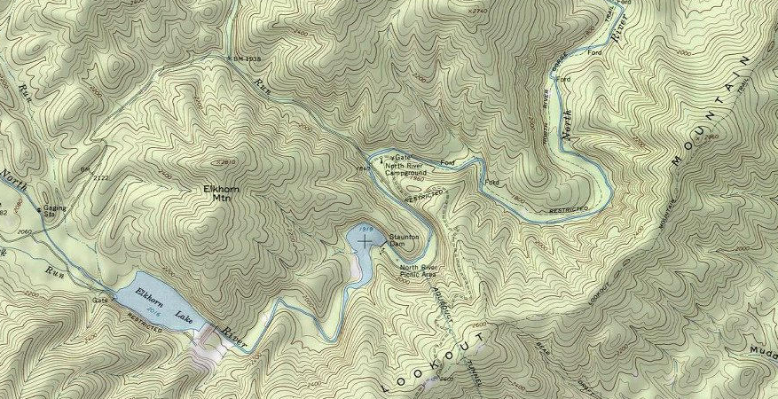
Elkhorn Lake provides flood control and recreation, upstream of Staunton's water reservoir on the North River
Source: ESRI, ArcGIS Online
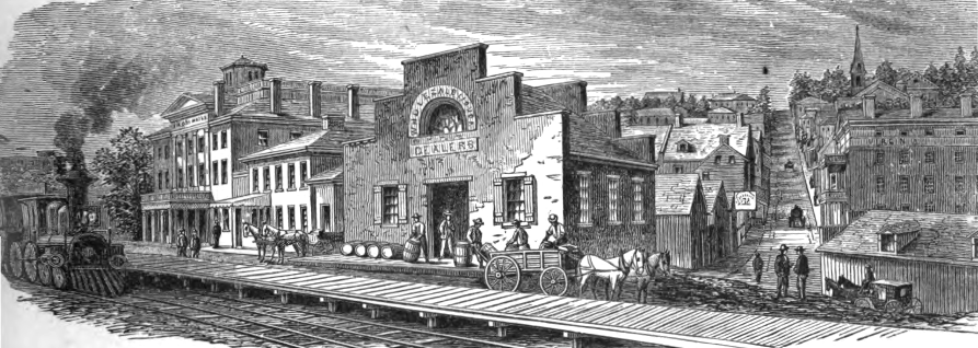
the Wharf neighborhood of Staunton was centered on the Chesapeake and Ohio Railroad's passenger and freight depots
Source: "The Chesapeake & Ohio Railway Directory, Containing an Illustrated History and Description of the Road," Staunton - View from the Railroad (p.288)
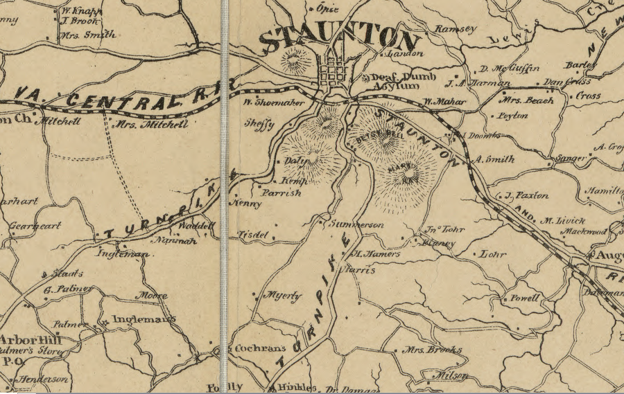
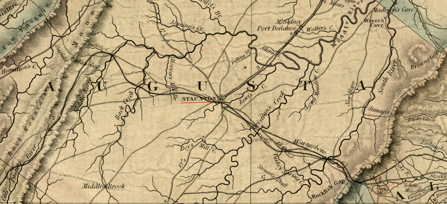
various roads linked Staunton to other communities, and the Virginia Central Railroad provided the critical connection to a port city on the Fall Line
Source: Library of Congress, Map of Augusta County, Virginia (by Jedediah Hotchkiss, 1875)
References
1. Larry Hoefling, Chasing the Frontier: Scots-Irish in Early America, iUniverse, 2005, p.35, http://books.google.com/books?id=og7NJHT0PqQC (last checked August 8, 2014)
2. Jim Zeender, "Thomas Jefferson: Governor of Virginia, Part II," The National Archives - Pieces of History, May 16, 2013, https://prologue.blogs.archives.gov/2013/05/16/thomas-jefferson-governor-of-virginia-part-ii/; "Charlottesville and Albemarle County Courthouse Historic District," National Register of Historic Places Inventory - Nomination Form, National Park Service, July 28, 1982, Continuation Sheet #5, pp.1-2, http://www.dhr.virginia.gov/registers/Cities/Charlottesville/104-0072_CharlottesvilleAndAlbemarleCountyCourthouse_HD_1982_1995_Final_Nomination.pdf; "History," Trinity Episcopal Church, http://trinitystaunton.org/about-us/history/ (last checked October 22, 2017)
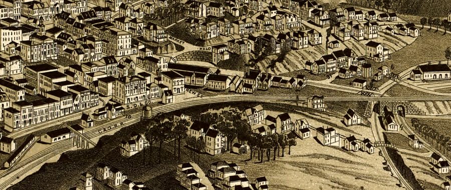
Sears Hill, pedestrian bridge over Chesapeake and Ohio tracks to railroad depot, and Augusta County courthouse (circled) in 1891
Source: Library of Congress, Perspective map of the city of Staunton, Va., county seat of Augusta County, Virginia 1891
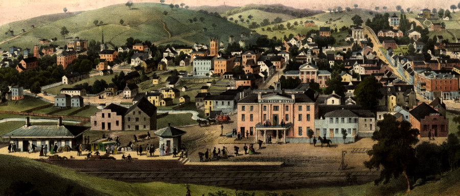
Staunton's railroad depot in 1856, prior to construction of the Wharf
Source: Library of Congress, Staunton, Va. / drawn from nature by Ed. Beyer
like Winchester, Staunton developed a transportation network prior to the Civil War to draw farms goods to the city for transport to market via turnpikes and railroads
Source: Library of Congress, A map of the state of Virginia, constructed in conformity to law from the late surveys authorized by the legislature and other original and authentic documents (1859)
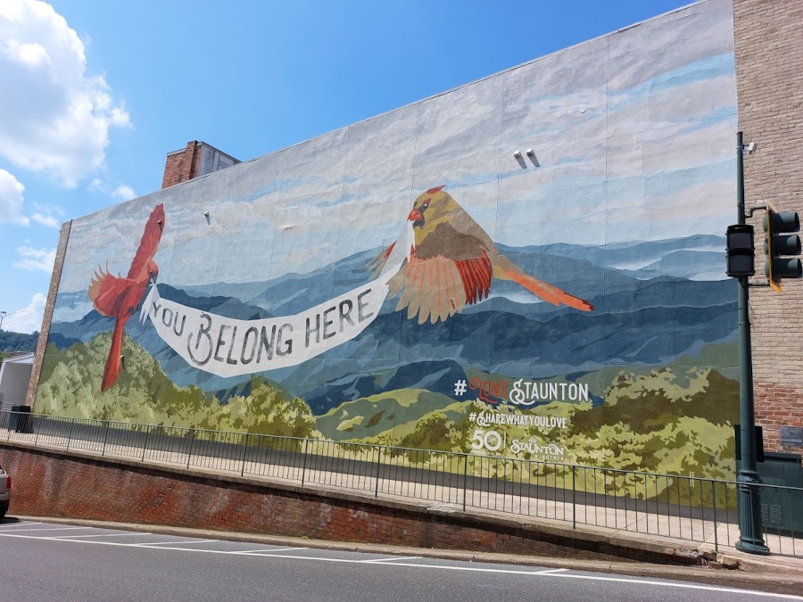
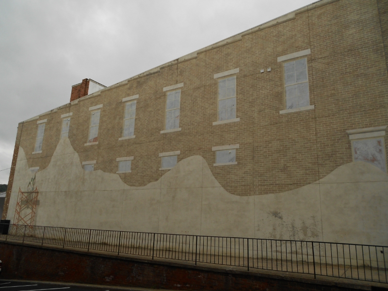
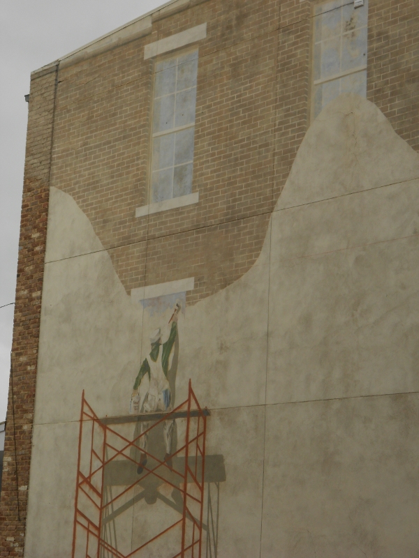
the mural at the corner of Beverle and Central streets was updated in 2019
Cities and Towns
Geography of Virginia


