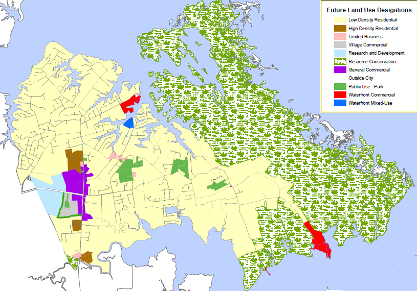
50% of the 10,000 acres in Poquoson are wetlands
Source: City of Poquoson Comprehensive Plan 2008-2028, Future Land Use Map (Map 8-4)
50% of the 10,000 acres in Poquoson are wetlands
Source: City of Poquoson Comprehensive Plan 2008-2028, Future Land Use Map (Map 8-4)
Poquoson incorporated as a town in 1952, in order to operate a public school system separate from the rest of York County. The county's one high school had been located in the Poquoson area ever since 1910, but population growth after World War II was further east. Poquoson residents feared a new high school would be constructed in mid-county, but incorporation as a town allowed the community to establish a public school system independent of York County.
The town chose to become an independent city in 1975, before the General Assembly imposed a moratorium that blocked conversion to city status. The population in Poquoson has a household income level 30% greater than the Virginia average, in part because 80% of the workers in the city commute to jobs in Hampton, Newport News, and other Hampton Roads jurisdictions - especially to NASA Langley Research Center and Joint Base Langley-Eustis.1
Poquoson also has an racial mix unlike its neighbors. The Bureau of Census calculated in 2013 that it was 95% white, in contrast to Hampton (44% white), Newport News (51% white), York County (77% white), and Virginia overall (71% white).2
Poquoson is one of the jurisdictions most endangered by sea level rise. The Virginia Institute of Marine Science calculated that 5,089 acres of the total 9,395 acres within Poquoson are wetlands, including 4,100 acres within Plum Tree Island Marsh. 3,500 acres of marsh are protected within the boundaries of Plum Tree Island National Wildlife Refuge, which was established in 1972 after the Air Force used it as a bombing range between 1917-1952.3
After Hurricane Isabel in 2003, 50% of the homes filed disaster recovery or flood insurance claims. The city then revised its ordinances and now requires the first floor of new structures be at least three feet above the Base Flood Elevation, or the height at which there is a 1% chance of a flood (a "100-year" flood). The Federal Emergency Management Agency (FEMA) requires only a one foot increase, but Poquoson is anticipating higher-than-average sea level rise. It even made arrangements with Langley Speedway (a relatively high spot in town) for residents to park cars there to avoid floodwaters.4
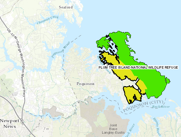
in addition to the wetlands already acquired by the US Fish and Wildlife Service (colored green), the authorized boundaries of Plum Tree Island National Wildlife Refuge would allow for further acquisition of wetlands east of Lawson Road/Poquoson Avenue (colored yellow)
Source: ESRI, ArcGIS Online

Poquoson's wetlands will be submerged in the storm surge from a Category 1 hurricane, and much of the developed town in a Category 2
Source: Virginia Department of Emergency Management, Know Your Storm Surge Risk - Poquoson
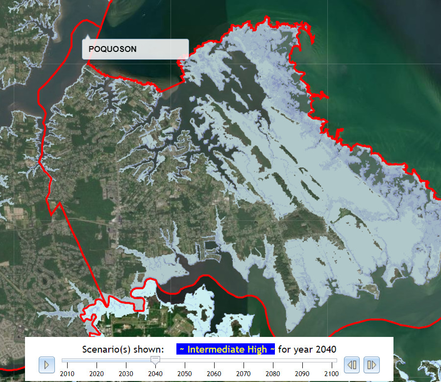
in the Intermediate High scenario for sea level rise, the marshes on the eastern edge of Poquoson would be inundated by 2040
Source: Commonwealth Center for Recurrent Flooding Resiliency, Sea Level Rise Projection
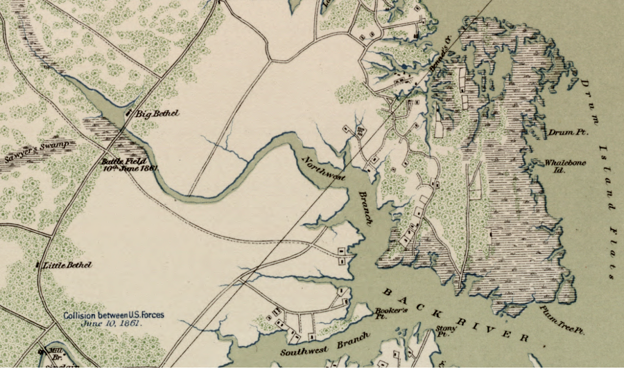
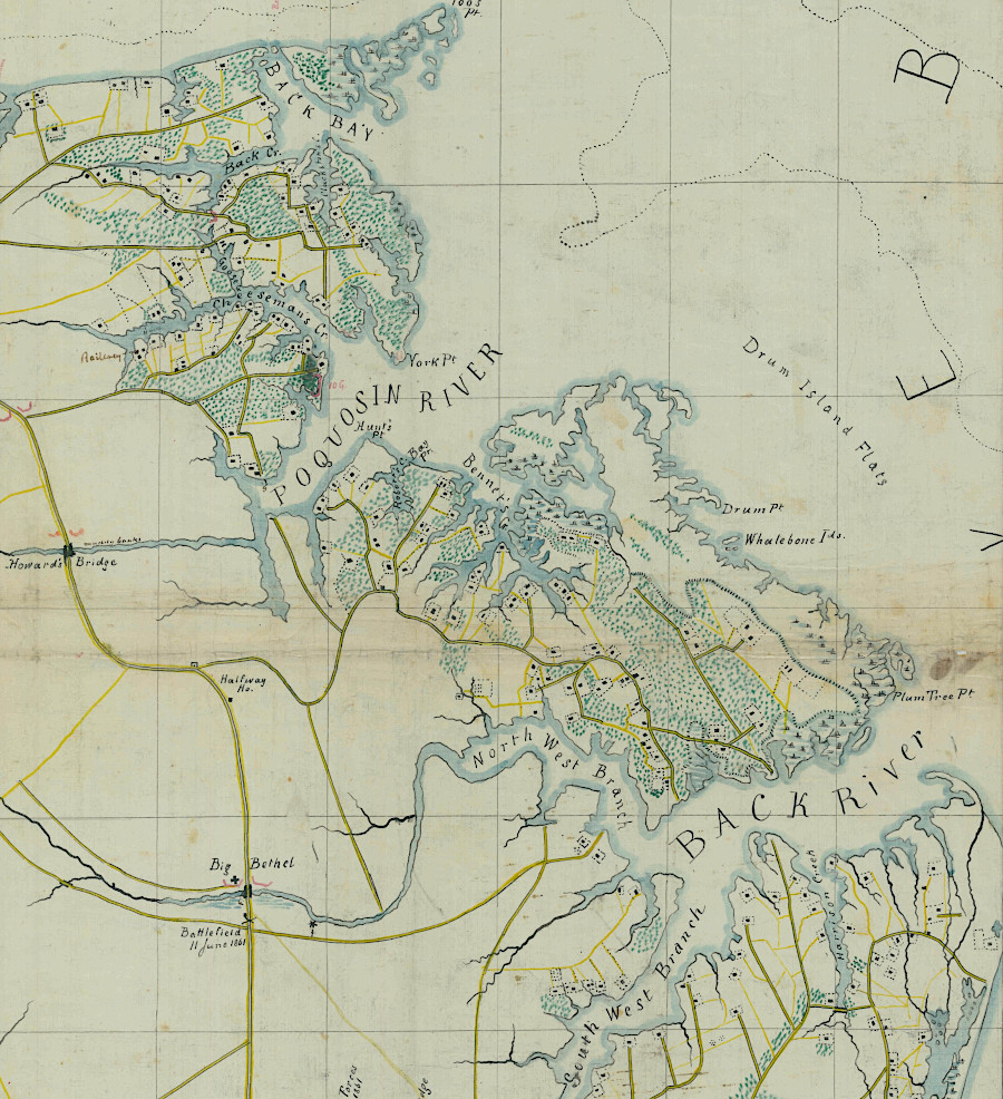
Poquoson, at the time of the Civil War
Source: Library of Congress, Atlas of the War of the Rebellion, Yorktown to Williamsburg, Va. (1892)
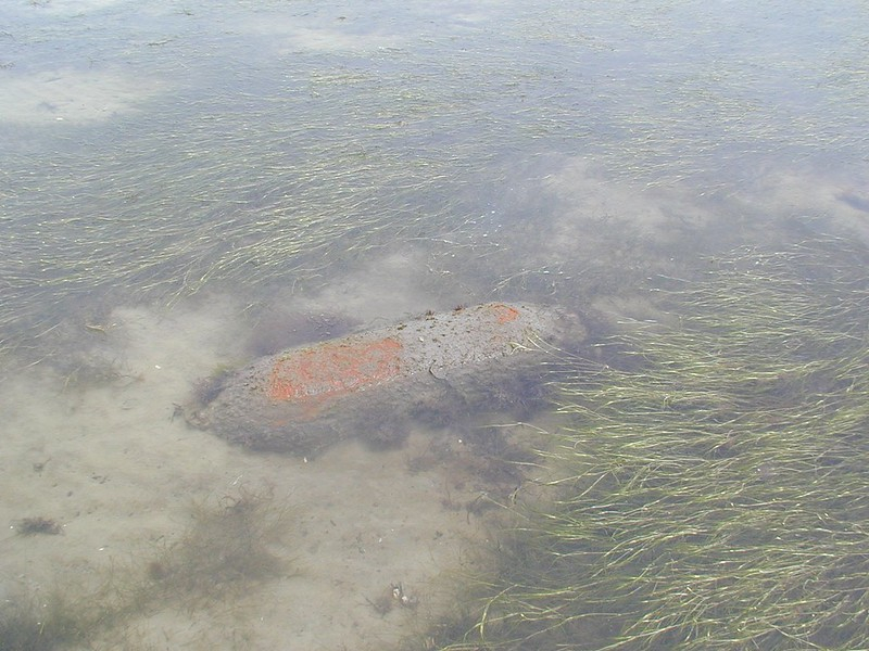
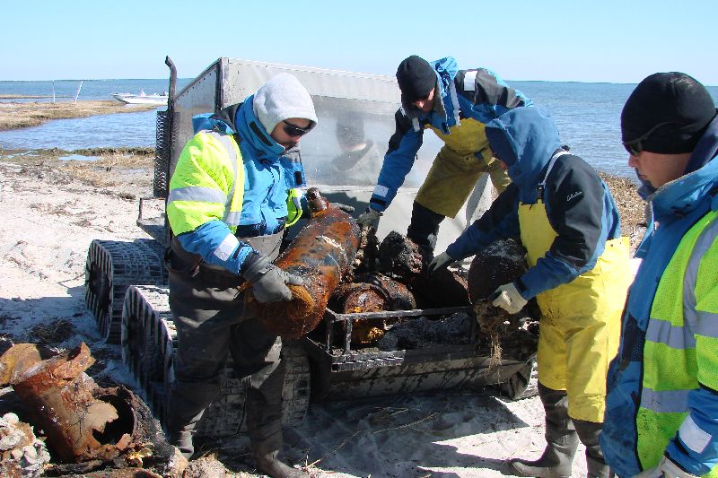
unexploded ordinance litters the marshes at Poquoson
Source: US Army Corps of Engineers, 090107-A-8647-007 and 20090218-A-0000B-003
Poquoson at the start of the Civil War
Source: National Archives, Sheet No. 1 Military Reconnaissance