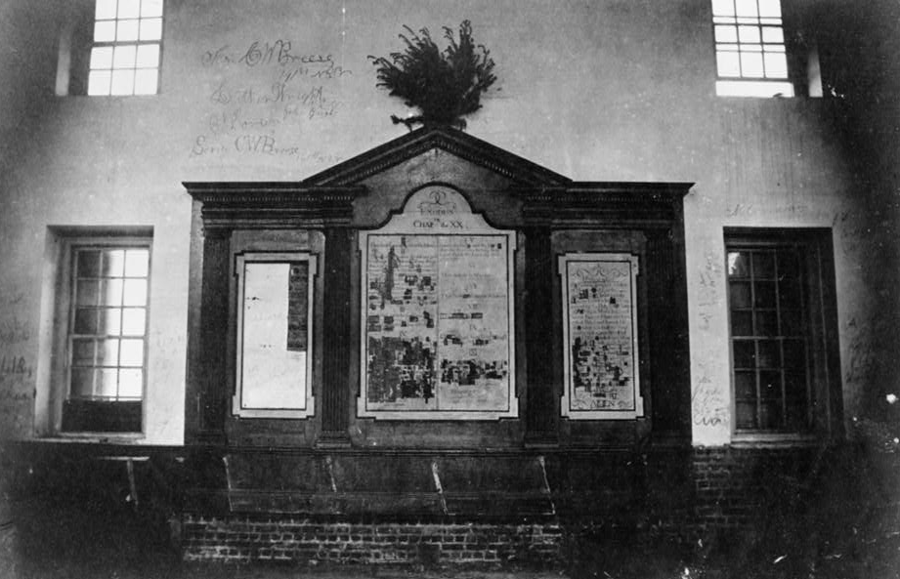
Union troops occupied Falls Church during the Civil War
Source: Library of Congress, Interior of Falls Church, VA
Union troops occupied Falls Church during the Civil War
Source: Library of Congress, Interior of Falls Church, VA
The church at Falls Church started as a "chapel of ease" for the Truro Parish, which was carved out of Hamilton Parish in 1732. In 1733 the vestry authorized construction of wooden structures on the Occoquan River at Pohick, on Goose Creek, and in-between on the road to Little Falls. The "in-between" church was at the crossroads of two dirt paths, one leading from the interior to Alexandria (now US 7) and the other leading to the Potomac River at Little Falls (now US 29).
The minister would occasionally hold services at each site, but lay readers were responsible for the services on most Sundays. By 1742, the population north of the Occoquan River had grown large enough to justify splitting Fairfax County from Prince William County. The new courthouse was built at a site near modern Tysons Corner.
The port of Alexandria was chartered in 1749 and quickly became the county's most-populated area, and the courthouse was moved to Alexandria in 1752. The courthouse moved again in 1800 to a hilltop seven miles southwest of Falls Church, and the crossroads with the church never managed to become the county seat.
The name "Falls Church" first appeared in the vestry records in 1757. Between 1767-69, the wooden structure was replaced with the current brick church, designed and constructed by Col. James Wren. He included interior galleries in the design, but those were not added until a 1959 remodeling that also removed the east wall to add a new chancel. Another remodeling after the Civil War, during which the church was used as a stable by Union forces, changed the entrance from the south to the west side.1
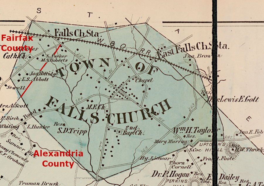
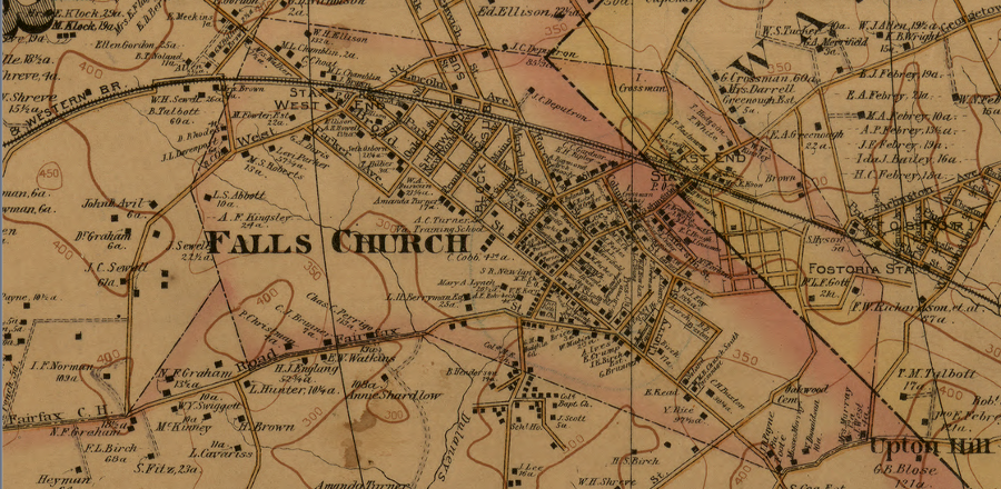
the Town of Falls Church originally included a western portion within Fairfax County
Source: Library of Congress, Atlas of fifteen miles around Washington, including the counties of Fairfax and Alexandria, Virginia (G.M. Hopkins, 1879)
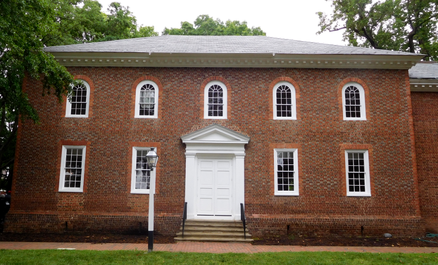
the main entrance to the 1769 Falls Church was on the south side, until a remodelling after the Civil War
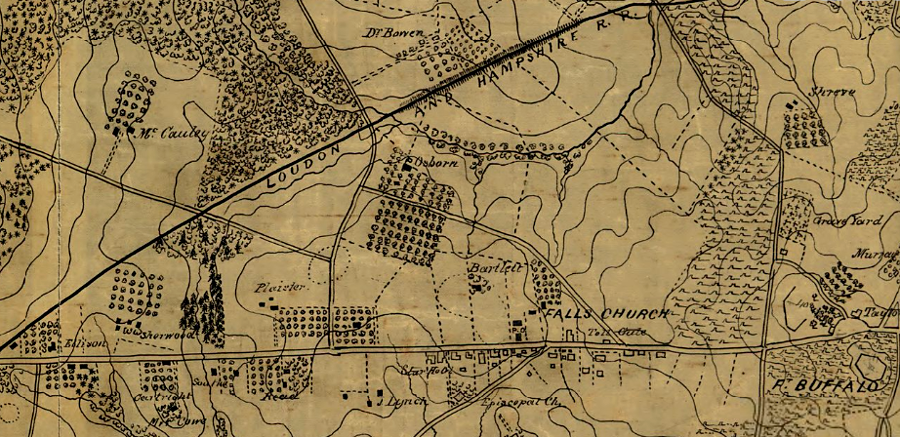
Falls Church in 1861
Source: Library of Congress, Sketch of the seat of war in Alexandria & Fairfax Cos. (1861)
Falls Church in 1894
Source: Library of Congress, The vicinity of Washington, D.C. (by G. M. Hopkins, 1894)
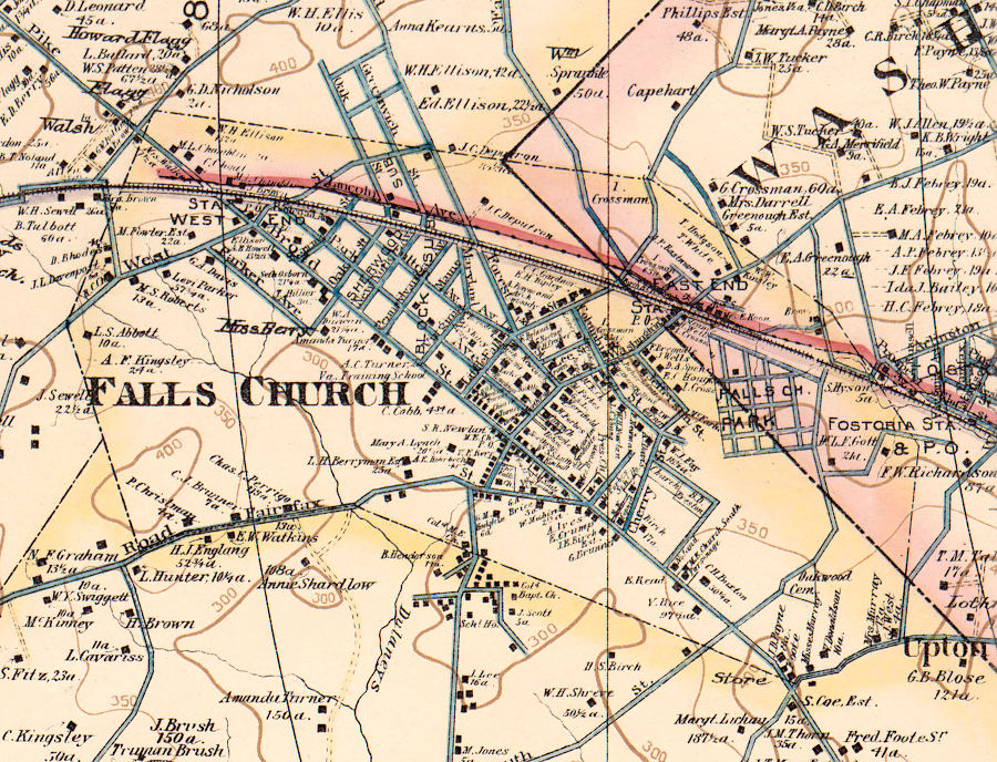
the east end of Falls Church originally was located in Alexandria (now Arlington) County
Source: Library of Congress, Baist's map of the vicinity of Washington D.C. (1904)
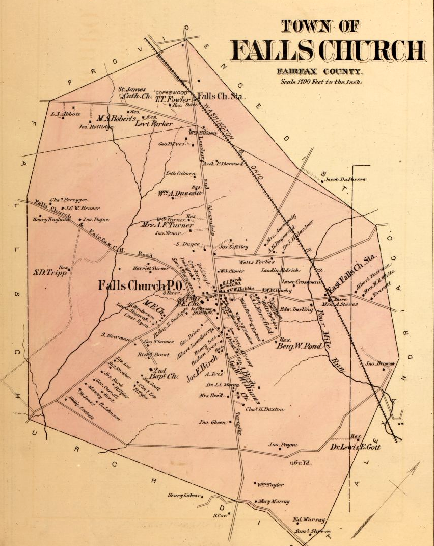
Falls Church in 1878
Source: Library of Congress, Atlas of fifteen miles around Washington (by G. M. Hopkins, 1878)
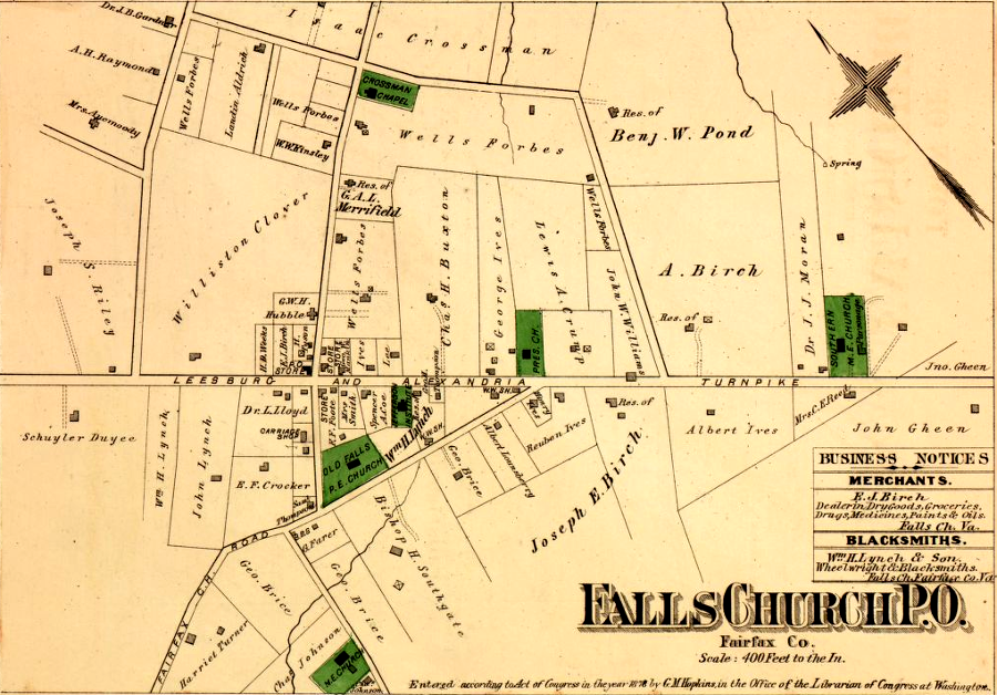
Falls Church in 1878
Source: Library of Congress, Atlas of fifteen miles around Washington (by G. M. Hopkins, 1878)