From Staunton to Harrisonburg, the primary connections to Richmond went through Swift Run Gap and Rockfish Gap in the Blue Ridge. The Mountain Road (now US Route 33) crossed at Swift Run Gap. The Three Chopt Road" (still called the same in West End Richmond) was marked originally with three notches on trees, to identify the colonial era path through the woods from the Blue Ridge to the falls at Richmond. Three Chopt Road crossed the Blue Ridge at Browns Gap, slightly north of Rockfish Gap.
The James River and Kanawha Canal, built in the first half of the 1800's, became the primary transportation corridor between Richmond and Lexington. The canal carried cargo and people on relatively fast trips along the river - and in 1863, Stonewall Jackson's body was returned via a canal boat to Lexington for burial. Further north, in the lower Shenandoah Valley, the Manassas Gap Railroad carried products to Alexandria.
One city was not connected to the transportation network extending east from the Shenandoah Valley. Fredericksburg, the major Fall Line city between Alexandria and Richmond, never established an effective transportation link to become a market city for the Valley - or even the Piedmont, after failing to build a canal system up the Rappahannock River.
A highway map of Virginia today reveals just US Route 17 connecting Fredericksburg directly with the Valley. That highway crosses the Blue Ridge at Ashby Gap, which is where Alexandria merchants intercepted the Valley trade with their first turnpike.
For the last 150 years, most trade and travelers from the middle of the Shenandoah Valley have followed the Little River Turnpike (now US Route 236/50) or used the railroad built through Manassas Gap to reach Alexandria. Even today there is no railroad and no interstate highway leading west of Fredericksburg. In contrast, I-64 leads west of Richmond and I-66 leads west of Alexandria.
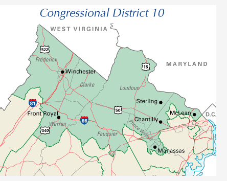
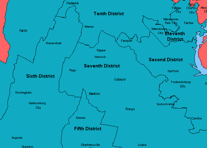
This pattern of transportation shaped the economic and political connections of the Valley and of Fredericksburg. Congressional district boundaries show the effects of the transportation investments made prior to the Civil War. In the 2000 redistricting, the Tenth Congressional District stretched from the edge of Arlington County to West Virginia but other Districts were split by the Blue Ridge - except for Page County, which was placed in the same Seventh Congressional District as the western suburbs of Richmond.
The boundaries for State Senate districts for General Assembly elections showed the importance of the Blue Ridge - though the northern part of the valley was politically connected to the Piedmont in District 26 and District 27:
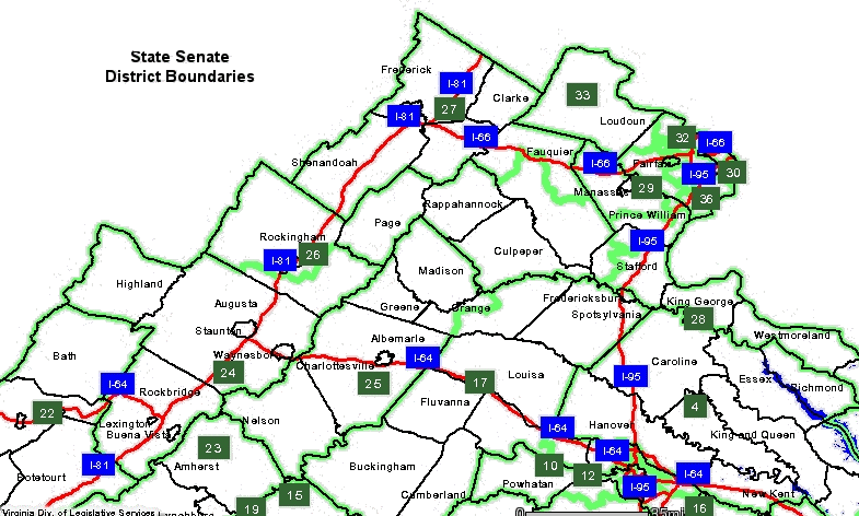
Source: Virginia Division of Legislative Services