Colonial Shipping and Town Development in Tidewater
The Chesapeake Bay was not an impassable barrier to the Native Americans, but it was the English who brought new technology to really take advantage of the Chesapeake Bay (and its navigable tributaries, up to the Fall Line). Virginia's Tidewater rivers were highways, not barriers, for the English.
|
The English had far greater mobility on the water than on the land. Wind energy, captured by sails, powered the European ships along those highways.
The Virginia peninsulas were covered with forests, and building roads required a major investment of labor to clear a path. As soon as it rained, the clay soil on the path would turn to soft mud. The English response was to reinforce the soil with shells, rocks, or wood to establish a solid base for wagons. The first Virginia road, reinforced with shells, was built in the early days of settlement at Jamestown.
However, roads required labor. In the 1600's colonial Virginia was perpetually short of laborers - one reason the institution of slavery was established, when it became clear that the supply of indentured servants from England would be inadequate. Virginia had plenty of land for growing tobacco, but not enough people willing to do that work voluntarily - and at the wages the emerging colonial gentry was willing to pay in the mid-1600's.
In contrast to the peninsulas covered with trees and with soft soils, Virginia's rivers were wide and deep enough for the colonial sailing ships. Rivers were navigable until they reached the Fall Line. It was easy to carry passengers and cargo by ship from England, all the way across the Atlantic Ocean, to the individual wharves of the plantations on the shoreline. There, the ships would unload the people and manufactured goods from England and load up with Virginia tobacco for the return journey. Thoughout Tidewater, each plantation along the river had direct access to international shipping.
|
|
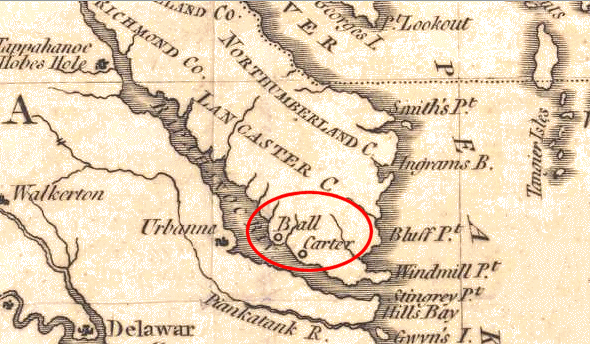
Large ships also carried small boats ("shallops") that could be rowed into the smallest coves and creeks. In 1608, John Smith explored the shoreline thoroughly up the Potomac River, to the Fall Line at modern-day Washington DC. On that journey John Smith was wounded by a sting ray at the location known ever since as Stingray Point - and the small creek that reportedly supplied the mud used to ease the pain is still known as Antipoison Creek.
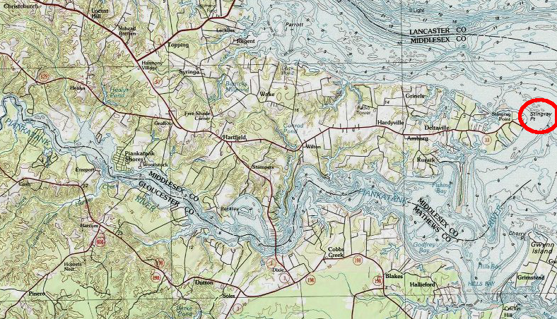
Stingray Point, at confluence of Piankatank and Rappahannock rivers
Map Source: US Fish and Wildlife Service,
Wetlands Mapper
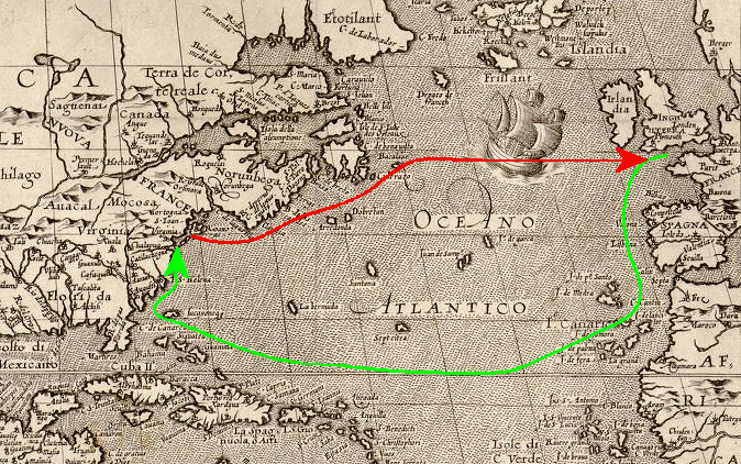
The greatest danger for English sailors was not the occasional sting ray, but the transatlantic voyage from England to Virginia. It was a long journey, and the ships did not sail straight across the Atlantic Ocean. English ship captains sailed south towards the Cape Verde islands off the coast of Africa, to get fresh food and water - and also to take advantage of westward-flowing ocean currents and west winds to reach the New World.
English captains could have sailed due west from London to North America. Samuel Argall chose at more-direct route to Virginia in 1609, sailing west from the Azores to Bermuda and then to Virginia. The shorter "ready way" path required loading ships with fewer provisions, and avoided the Spanish colonies in the New World.
Prior to the invention of the steamship, most travel across the Atlantic Ocean depended upon prevailing winds and currents, and sailors would travel extra miles in order to get the speeed boost from wind and water. By the time North America was discovered by the Europeans, their sailing technology allowed ships to travel upwind. Captains could tack back and forth, moving the booms and sails from one side of the boat to the other. "Coming about" was rough on the wooden boats, but it allowed a ship to use windpower to reach a particular point, even if the wind was coming fom that direction.
(In weather reports and in sailing, the direction from which the wind blows gives the wind its name. The wind is recorded as an "east wind" if it is blowing from east to west. In a "northeaster" storm at Virginia Beach, the wind comes from the northeast and blows from the ocean onto the land. Such storms are typically winter low pressure systems that cause higher-than-normal beach erosion.
The National Park Service describes the typical 1500's transatlantic sail from England as follows:1
- Following the clockwise flow of winds and currents, the expeditions sailed south from England, past Spain and Portugal, and stopped over at the Canaries, Madeiras, or Cape Verdes for food and water before attempting the long Atlantic crossing. In the absence of major obstacles, such as foul weather or pirates, this leg of the voyage usually took ten to fourteen days.
- Then, with the northeasterly trade winds and the Equatorial Current at their backs, the voyagers made for the West Indies, sailing as a later generation of English square-rig sailors would say "south 'til the butter melts, then west." An uneventful crossing usually required four or five weeks.
- After replenishing supplies once again, the fleet picked up the Florida Current (precursor of the Gulf Stream) and followed it northeast from around the Strait of Florida to the latitude of Roanoke - a trip of another ten days to two weeks.
- For the return trip to England, ships usually took the Gulf Stream and its extension, the North Atlantic Drift, back to Europe, perhaps with a stop in the Azores for provisions and prize ships. Being more direct, the homeward voyage usually took much less time.
Another historical description said:2
- The influence of the Gulf Stream in the colonization of North America was about this time very great. In 1606 the English divided their possessions into two parts, the northern part of Virginia (new England and vicinity) was one, and the present North Carolina and Chesapeake Bay region the other, and for each a company was established and commissioned by the King. The route used in going to the first was that tried in 1602 by Capt. Bartholomew Gosnold, crossing the Atlantic on about the fortieth parallel, while the southern expeditions held the old passage through the trades and Caribbean. The Dutch vessels bound to New York adopted the West Indian route, so that Nantucket really became the dividing line of travel, and a difference in destination of a degree in latitude necessitated a difference of thirty degrees in route.
The direct path across the Atlantic Ocean was known to ship captains sailing to Virginia for mosty of the colonial era of Virginia. However, the first oceanography texts were not published until Mathew Fontaine Maury, superintendent of the United States Naval Observatory, documented them from US Navy logbook records. (He ended up as a Confederate officer, and is commemorated today by a statue on Monument Avenue in Richmond. Also, Maury River near Lexington was named after him. The previous name was "North River" - but the change minimized confusion with the separate "North River" on the other side of the James/Shenandoah watershed divide that drains towards Waynesboro.)
Aside from the occasional hurricane/northeaster storm, or threat of a foreign or pirate ship, the Chesapeake Bay was a safe location for the English ships. Exploring inland on the peninsulas or "necks" of land in Tidewater Virginia (such as the "Northern Neck") was far more challenging. The English slept on their ships, when first exploring the edges of the Chesapeake Bay, because setting up camp was far harder than the logistics of a floating hotel.
Until the 1830's, when Virginians built their first railroads, travel by boat was the easiest way to haul freight. Boat travel was often the easiest way for moving people as well as freight, until automobiles and modern roads were built starting in the 1920's.
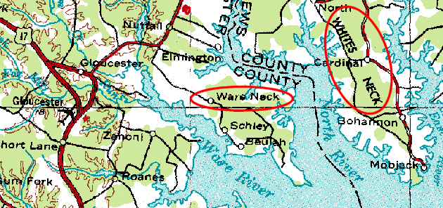
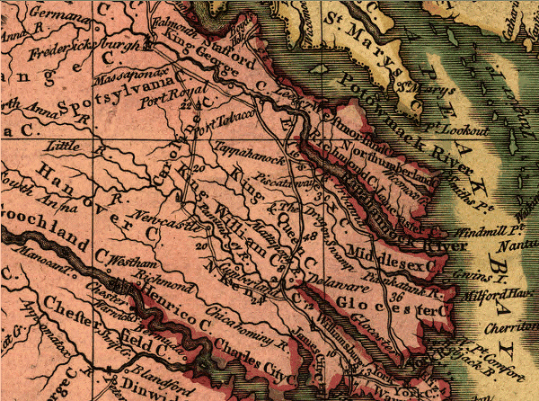
Virginia peninsulas or "necks" of land, separated from each other by navigable bays and rivers
Source:
Microsoft Research Maps
In early colonial times, the Algonquian natives had the advantage over the English on land. The Algonquians knew the terrain and could surprise the English explorers, so water travel was safer for the English. The arrows of the Native Americans travelled less that the 100-yard length of a modern football field, and rarely did the Powhatans venture forth in canoes in large enough numbers to threaten a ship. The sailors could sleep relatively well when offshore, floating in the Chesapeake Bay, Hampton Roads, or a river mouth.
However, most of us today would find it difficult to appreciate the experience, since we'd be disgusted by the smells and the hygiene of a crowded 17th Century vessel on a hot summer night. Imagine spending four months crossing the Atlantic Ocean on a boat the size of a school bus, without showers - or even a bathroom...
The location of Jamestown was chosen in part because of its easy access to the water. It was located on a bend of the James River where the river was deep enough for the transatlantic ships to tie up to trees on the shoreline, without running aground ("good parking" for the ships).
- If you visit Jamestown, don't look for the Nina, Pinta, and Santa Maria that you learned about in elementary school, and still hear mentioned on Columbus Day. As a savvy graduate of this class, you'll remember that Columbus sailed the ocean blue in 1492 - but Jamestown was settled in 1607, when 104 colonists arrived on the Susan Constant, Godspeed, and Discovery.
- Don't look for a reconstruction of the Mayflower, either. That ship appeared off Cape Cod in Massachusetts in 1620 - 13 years after Jamestown was settled. The Massachusetts colonists were latecomers to America. Don't let anyone tell you the "Pilgrims" were the first colonists in the New World. Remember that the Virginia colonists arrived in 1607 on the Susan Constant, Godspeed, and Discovery. However, before getting too jazzed over the 400-year history of Jamestown, remember that the Spanish had settled North America long before Jamestown was established. If you want to see the oldest European colonial sites in what is now the mainland of the United States, go to Saint Augustine and Sante Fe, New Mexico.
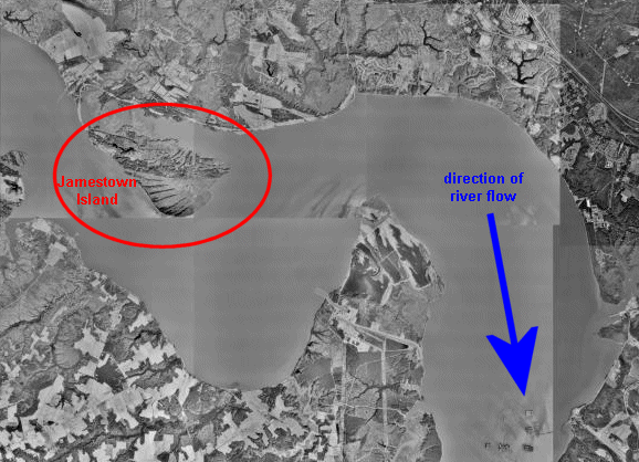
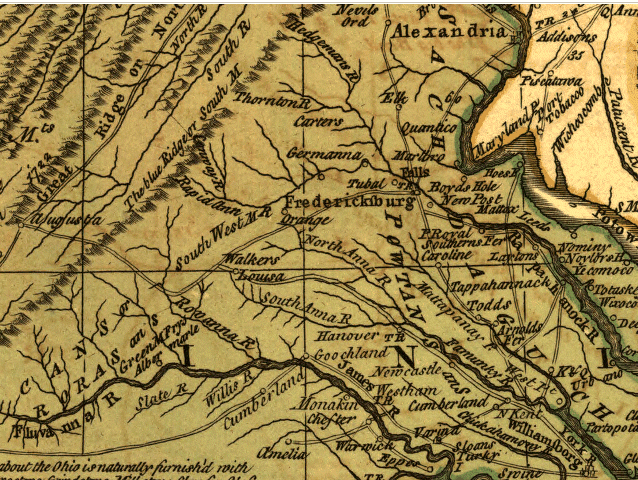
Jamestown - at an easier-to-defend spot in the bend of the river
(easier than where? what locations might have been "better"?)
Source:
Microsoft Research Maps
In 1607, it took the English three weeks to first sail up the James River from Hampton Roads. Christopher Newport, the captain responsible for the Susan Constant, Godspeed, and Discovery, did not know the locations of the sandbars and mudbanks and did not want to run aground. He quickly discovered that the natural channel of the James River is about 20 feet deep, from Hampton Roads up to Richmond. The ships that sailed between Virginia ports and England, or to other East Coast ports (Boston, New York, Philadelphia, Baltimore, and Charleston were the largest in 1776), had no difficulty sailing up Tidewater Virginia rivers. The small ships had a shallow draft - they could sail all the way to the Fall Line without running aground.
Only after the Civil War did the larger sailing ships used for international trade to Bermuda, the Caribbean Islands, Europe, and Africa - require an artificially-deepened channel to reach Virginia's Fall Line cities. In modern times, Norfolk relies upon Federal assistance for dredging a 55-foot deep channel for loaded ships sailing out of the Norfolk International Terminals.
Jamestown developed as the first English outpost or supply base in Virginia. It then evolved into a government center, but - like Washington DC - Jamestown never developed into a manufacturing center. Today, it's a historic site. Other places in Virginia, not the first center of English settlement, developed as the major centers of population and economic activity... and it took a long time for any commercial centers to develop in Virginia.
In the Massachusetts colony, Boston quickly became a center of population and economic activity. Quebec, Montreal, New York, Philadelphia, and Charleston quickly became the focal points for other colonies. In contrast, no major city grew in Virginia. It remained a highly-decentralized colony, with the population scattered on plantations along the shoreline of all the navigable rivers in Tidewater. The only town of significance in Virginia for 125 years was the capital of the colony, at Jamestown (1607-1699) and then Williamsburg (1699-1780). When the capital moved from Jamestown to Williamsburg, Jamestown declined into insignificance.
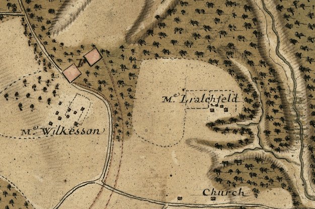
pattern of open fields, forests, roads and buildings - plantations near Green Spring (Williamsburg area), 1781
Source:
Library of Congress
The English immigrants and the natural-born residents in colonial Virginia lived on tobacco plantations that were far apart from each other. Colonists did not concentrate in a central city. Like the Native Americans, the early colonists moved their crops to new fields when soil fertilty was exhausted.
The richest members of Virginia society had control over vast tracts of land. They could afford to abandon old fields and, with cheap labor, clear new fields. The richest Virginians could also build a main (manor) house. Many people think of the mansion houses like Tara in the old movie Gone With the Wind, when your hear a place described as a "plantation." However, in Virginia there was no clear distinction between "plantations" and "farms," and many plantations lacked fancy houses.
Only the rich gentry could afford to construct the brick manor houses. George Washington built his "seat" at Mount Vernon of wood, before he got fabulously wealthy. He was clever enough to add sand to the paint, so Mount Vernon was painted to look like a stone house that would convey to visitors the appearance of great wealth and stability. Some of the rich gentry, honored now as the colonial version of the First Families of Virginia (FFV's), owned vast tracts of land. The rich gentry could afford to establish satellite communities, outlying farms known as "quarters." There, a gang of laborers raised tobacco, plus enough corn/wheat to feed the laborers and enough hay for the draft animals (oxen, mules, and sometimes horses). The quarters would rely upon the manor house farm for key supplies such as farm tools. After all, the option of going into town to pick up a few things was not available...
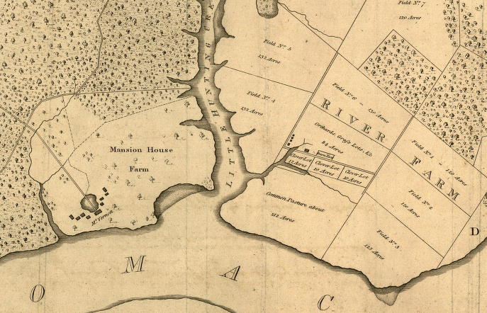
Manor House Farm - with mansion house of Mount Vernon, owned by George Washington
Source:
Library of Congress
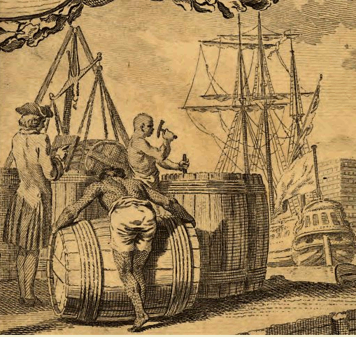
Each plantation (or quarter) was occupied by roughly the population of an Algonquian town. However, the main plantations had a direct connection to international trade, through individual wharfs or docks on each plantation. Ships would load tobacco hogsheads and unload goods such as glass, clothing, guns, and other manufactured products imported from England, so the Virginia economy was tightly integrated with the English economy until 1775.
There was no economic incentive in Virginia to centralize settlement. Scattered agricultural outposts, with direct shipping via Tidewater rivers to Europe, was most cost-effective settlement pattern until the population grew enough to settle lands in the Piedmont, above the Fall Line. Economically, the orders from London officials to develop towns in Virginia were unrealistic. Instead, each plantation in Tidewater Virginia was separate and largely independent from its neighbors, shipping tobacco directly overseas from the plantation wharf and importing manufactured goods directly to that wharf.
Colonial Virginians worked hard, but they did not want to haul piles of tobacco leaves or roll 1,000-pound casks of tobacco several extra miles just because British officials sitting in comfortable offices in London signed a document telling the colonials to concentrate their tobacco trade at a few ports. Virginia's Tidewater rivers were deep enough for the tobacco ships to reach far inland. It was far easier for the plantation to roll a barrel (hogshead) of tobacco to the nearby shoreline, than to transport it along a dirt road to some distant location.
John Mitchell's 1755 "A Map of the British and French dominions in North America"
(note the 1755 roads between Fredericksburg and Williamsburg,
and the absence of roads to Richmond - which would not become the capital until 20 years later)
Source:
Library of Congress
Colonial Virginia roads were poor, where they existed at all. Hauling a bulk commodity like tobacco on dirt roads was a major challenge. Substantial work and time was required to move the crop from the tobaccco fields to the river wharfs, and the crop would often be degraded in quality by transport overland. Pavement was non-existent and even bridges were rare. When the hogsheads were rolled through muddy streams, enough water would leak inside to stain the tobacco leaves and encourage mold to grow, ruining the crop.
However, English officials always wanted the Virginia farmers to centralize trade. Royal governors were ordered to establish towns in Virginia, so the human settlement pattern in Virginia would be similar to that in England. Centralizing settlement would:
- facilitate the collection of taxes
- enable inspection of the hogsheads for quality (planters could hide"trash tobacco" with weeds and even dirt in their hogsheads, surrounded by their good-quality leaf, but their slight increase in quantity caused European buyers to reduce prices for all tobacco)
- increase efficiency for the ship owners in England
It was inefficient for the large transatlantic ships to sail from plantation to plantation. Ships wasted a lot of time loading a few hogsheads at small plantation wharfs. The smallest farms growing tobacco, perhaps owned by a recently-freed indentured servant or new immigrant just getting started, might produce 1,000-2,000 pounds of tobacco each season. (Still, the person growing the crop might refer to himself as a "planter," and to the site as a "plantation.")
That's a lot of weight. If you lift 40-pound bags of dog food, you can imagine the hard labor required to move 1,000 pounds of leaves from hot fields in the summer. Still, 1,000-2,000 pounds was enough to fill only 1-2 hogsheads, after the dried leaves were pressed or "prized" into the barrels. Only occasionally could ship captains stop at one wharf and load an entire ship with 50-100 hogsheads, usually at the large plantations where the rich gentry had the labor and land to plant, grow, harvest, and package 50-100,000 pounds of tobacco in a year.
The ship owners were well-represented in Parliament, while the Virginia tobacco planters were not. (Beginning to see an economic reason why the rich gentry in Virginia would choose to risk their life, liberty, and sacred honor in order to become free from English control?) There were intense disputes between the royal governors and the House of Burgesses regarding the creation of tobacco inspection centers, but in the 1730's Virginia finally committed to a tobacco inspection program. Legal exports could only be shipped from warehouses where tobacco had been certified as meeting the minimum standards. Inspectors were not angels, and bribery was not unknown, but the decision to centralize trade finally provided the economic stimulus for towns to develop in Virginia.
"A general map of the middle British colonies in America" - 1771
Note how many roads follow watershed divides from Tidewater into the backcountry...
and note how few roads go north-south, where bridges would be required to cross rivers
(had Charlottesville, near the headwaters of the Rivanna River, developed into a town worth noting on this 1771 map?)
Source:
Library of Congress
References
1. Roanoke Revisited Heritage Education Program, "Atlantic Crossings," http://www.nps.gov/fora/atlantic.htm (last checked October 3, 2003)
2. John Elliott Pillsbury, The Gulf Stream, http://www.history.noaa.gov/stories/gulfstream3.html (last checked October 3, 2003)
Ports in Virginia
From Feet to Space: Transportation in Virginia
Virginia Places