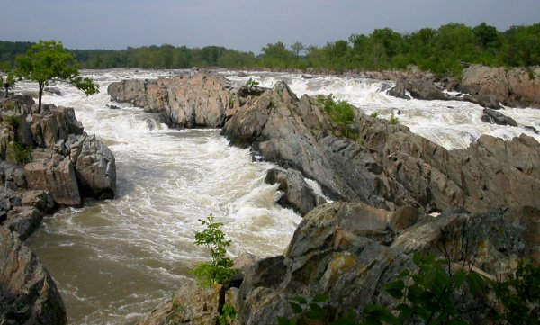
Great Falls on the Potomac River - bypassed by the Patowmack Canal
Source: Mational Park Service, Great Falls Park, Virginia
Great Falls on the Potomac River - bypassed by the Patowmack Canal
Source: Mational Park Service, Great Falls Park, Virginia
George Washington is often credited with being the visionary who championed carving a canal across the Appalachian Mountains to link the Ohio River with the Potomac River. A canal would result in cheaper transportation of western agricultural products to markets on the East Coast, and lower-cost delivery of manufactured goods into the interior. That would raise the value of publicly-owned western lands ceded by the states so the Continental Congress could form a Northwest Territory, and also increase the value of private lands acquired by speculators such as Washington.
In February 1772, he got the Virginia General Assembly to authorize improving navigation on the Potomac River upstream to Fort Cumberland with the right to acquire all the land necessary to "cut, support, and repair, such canals, locks and other works, which may be found necessary in carrying into execution this undertaking." Private investors were responsible for paying for the land and cost of construction, but the General Assembly also approved a lottery whose profits could be applied to the project.
In October 1784 after the American Revolution, the General Assembly chartered the Potomac Company. Maryland also approved constructing a canal. That approval was essential because, under its 1632 charter, Maryland owned the river up to the shoreline of Virginia. Investors were to be repaid for the costs on initial construction, operations, and maintenance through tolls to be collected at the mouth of the South Branch, Payne's Fall, and Great Falls.1
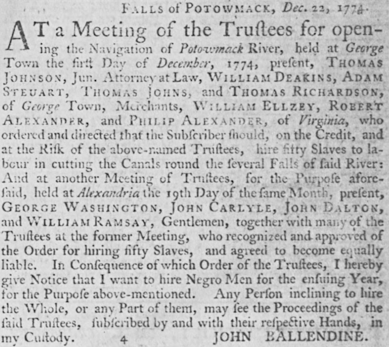
trustees of the Patowmack Canal first met in December 1774
Source: Virginia Chronicle, Virginia Gazette (Dixon and Hunter) (January 14, 1775)
Washington's primary reason was not to increase his land values. When he traveled through western Pennsylvania in 1784, he discovered that squatters on his land felt no allegiance to the Confederation nor any obligation to pay rent to landowners. Washington recognized that the people living west of the Appalachians would ship their goods down the Ohio and Mississippi rivers, though territory controlled by Spain. Spanish control of New Orleans gave that European nation leverage to draw the western settlers away from the 13 states, perhaps into a Spanish-controlled confederacy separate from the United States.
Washington made his concerns clear just as the settlers in far-western North Carolina sought to create an independent State of Franklin and as settlers in Kentucky began to agitated for separation from Virginia, and before Shays Rebellion erupted in western Massachusetts. In 1784, Washington urged Virginia Governor Benjamin Harrison to authorize a canal up the Potomac River. In describing the settlers, Washington wrote:1
Washington had led the army in the American Revolution in order to create a national bond among 13 states. Unless there were effective transportation links crossing the Appalachians, he recognized that the United States would be limited to control of land just along the Atlantic Ocean. Settlers west of the mountains could ally with rival European nations, or establish an independent nation, constraining the future of the country that Washington created - unless political leaders used trade to create a tight economic alliance between settlers in the Mississippi River watershed with those settlers in the Atlantic Ocean watershed.
Cross-mountain trade required cross-mountain transportation networks. Virginia leaders had hoped General Braddock would build a road in 1755 that linked Alexandria to the Forks of the Ohio. Failure of his expedition led to General Forbes extending a the Pennsylvania road network instead, linking Philadelphia to the Ohio River. That route facilitated cross-mountain trade after the French and Indian War, but ships sailed up the Delaware River to Philadelphia and Virginia gained no economic benefit.
A better transportation connection would allow Virginia to compete with Pennsylvania. At the end of the 1700's, before the development of railroads, the best technology for moving freight economically was by water. Since no river crossed the Appalachians naturally, the next best option was to create a canal. After retiring from leadership of the army, Washington pressed for development of a canal up the Potomac River to establish a link with the Ohio River.
Washington explained his motivations for canal construction in a 1784 letter to Henry Knox:2
The first political barrier was that the new state of Maryland owned the Potomac River and all the land on the north bank based on its 1632 charter, while Virginia controlled the southern bank. Any canal would require improvements along both banks, plus dams and locks within the river. With his personal stature, Washington was able to get the Maryland legislatures to charter the Patowmack Canal Company in 1785.
Washington could have focused on improving water transportation on the James River rather than on the Potomac River. He had used grants earned by service in the French and Indian War to acquire thousands of acres of land on the Kanawha River. Washington knew from visting both river valleys that improving the short gap between the Potomac and Monongahela rivers was more practical, and there were far more settlers on the Ohio River who needed access to a port than were living in the Kanawha River valley.

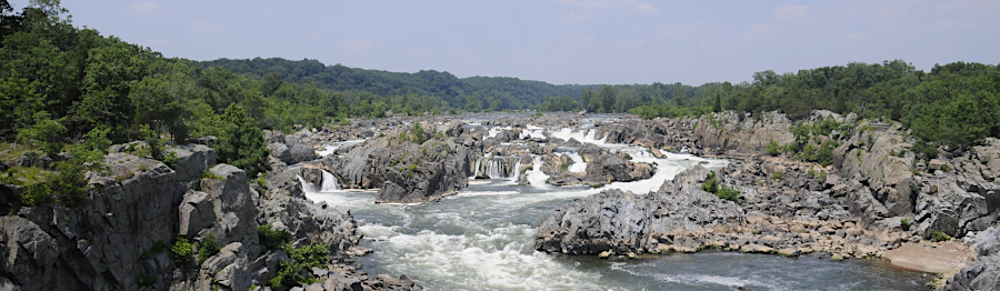
the Patowmack Company built a money-losing canal at Matilda Falls (now Great Falls)
Source: National Park Service, The Patowmack Canal
The first physical barrier he faced was a set of high rapids known today as Great Falls. Construction started that same year, but was slow. The metamorphic rock was hard to excavate using just black powder inserted into holes created by human-powered drilling. Workers doing the digging included both white men, some of whom were indentured servants, and enslaved laborers who received no compensation for their contribution. The Patowmack Canal, on the Virginia side of the rapids, was not completed until 17 years later in 1802.3
Henry Lee III, "Lighthorse Harry" Lee, gambled heavily that the canal would stimulate economic activity and raise land values along the Potomac River. The Virginia General Assembly chartered the town of Matildaville in 1790. It served as the headquarters for the Patowmack Company and the housing site for laborers chipping down through 60 feet of hard bedrock. He named the site after his first wife. He planned to create an industrial town with financial assistance from northern investors.
Like Washington, Lee had optimistic visions of how a canal to the Ohio River would strengthen the new nation as settlers would move inland and stimulate trade with merchants based in seaports on the East Cost. He told James Madison:4
the Patowmack Company required 17 years to build a canal to bypass Matilda Falls (now Great Falls)
Source: National Park Service, Great Falls Park
Unlike Washington, Lee became financially overstretched in the 1790's. He was unable to repay his debts, much less obtain the additional funds necessary to develop mills and ironworks and build out Matildaville at "Matilda Falls." Travel through the canal did not generate adequate revenues for operations and maintenance, including repairs after floods.
The Patowmack Company sold its assets and rights to build the canal to the Chesapeake & Ohio Canal (C&O) Company.
The new company chose to build the C&O Canal on the north bank of the Potomac River. The works at Matildaville were abandoned, and are now owned and interpreted by the National Park Service.5
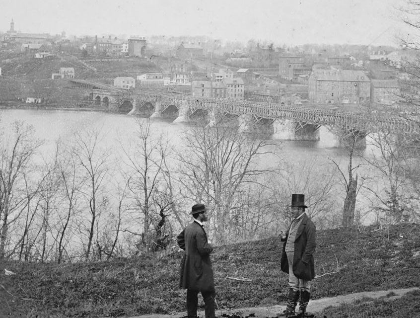
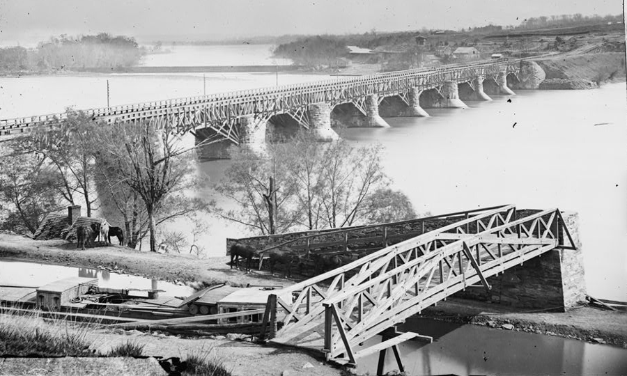
the C&O Canal was extended to Alexandria when an aqueduct was built across the Potomac River (and the aqueduct was used as a bridge during the Civil War)
Source: Library of Congress, Washington, D.C. The Aqueduct bridge and Georgetown from the Virginia bank
the C&O Canal was on the north side of the aqueduct
Source: Library of Congress, Washington, D.C. Closer view of Aqueduct Bridge, with Chesapeake and Ohio Canal in foreground
Source: Lovettsville Historical Society & Museum, Down the Old Potomac On the C&O Canal; A Thomas Edison Film (1917)
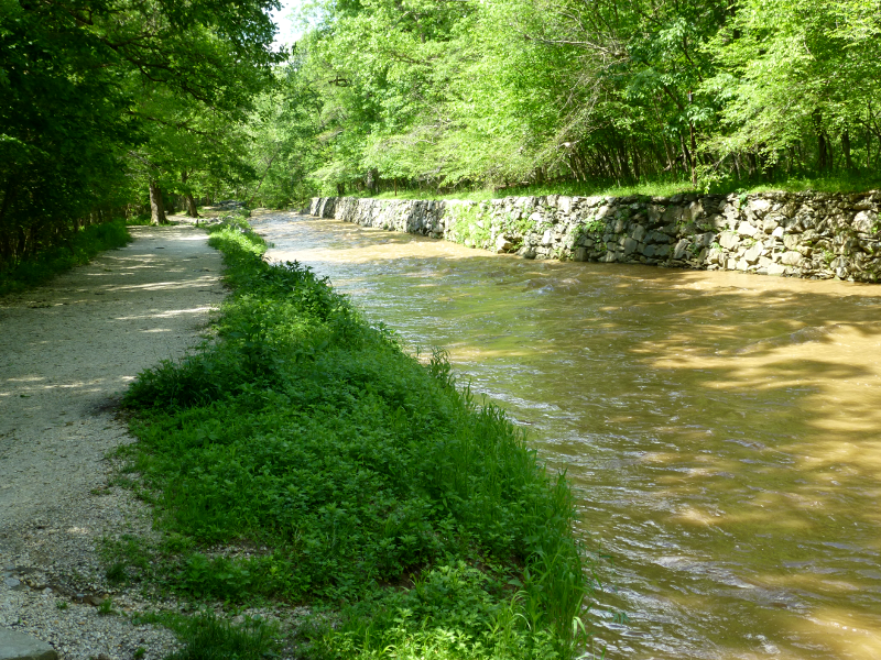
the Patowmack Canal on its upstream end included a wall to separate the boat channel from the river
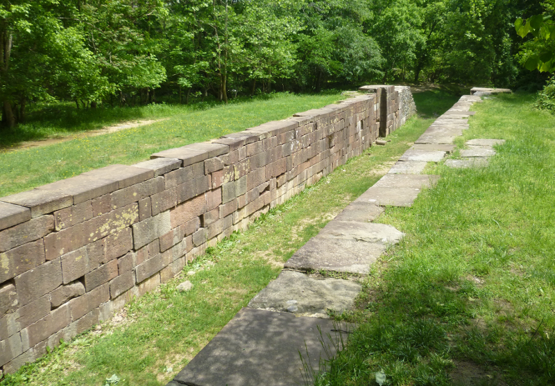
the Patowmack Canal included five locks at the downstream end of the bypass around Great Falls, to raise/lower boats 75 feet in elevation
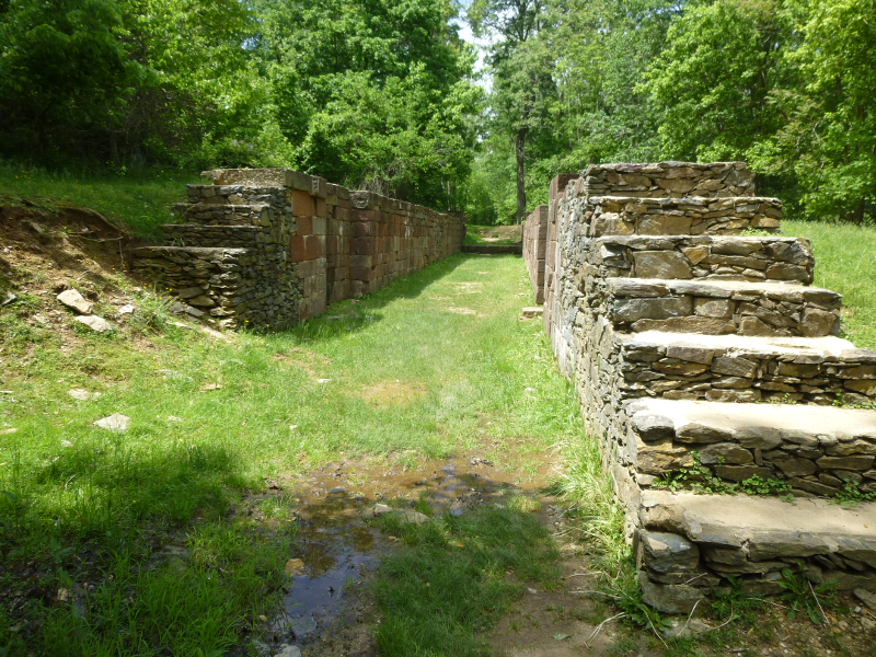
canal boats that passed around Great Falls headed downstream would be lowered 10 feet in Lock 1, and then pass through four more locks before returning to the Potomac River
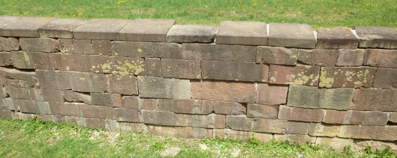
locks were constructed primarily from sandstone quarried at Seneca Creek and floated down to Great Falls
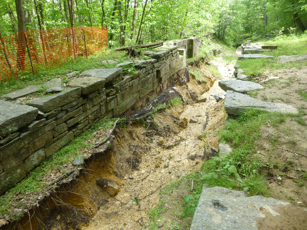
in 2014, storms eroded the remnants of the Patowmack Canal
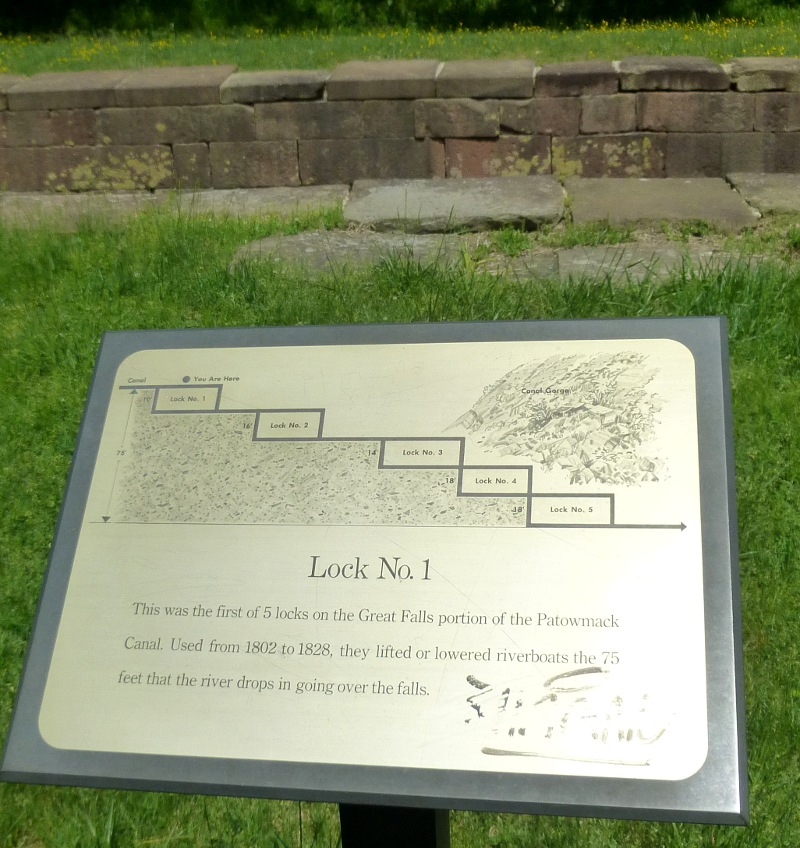
signs installed by the National Park Service explain the design of the Patowmack Canal
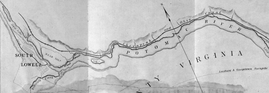
in 1845, a proposal to use the waterpower at Great Falls included creating a milling and manufacturing community called South Lowell at the former site of Matildaville
Source: Library of Congress, The water power at the Great Falls of the Potomac
today, the C&O Canal towpath is a popular route for bikers and hikers