the Dismal Swamp Canal enabled boats traveling down the Roanoke (Chowan) River to Albemarle Sound to access a Chesapeake Bay port on the Elizabeth River
Source: University of Virginia, Plan of the Portsmouth and Roanoke Rail Road
the Dismal Swamp Canal enabled boats traveling down the Roanoke (Chowan) River to Albemarle Sound to access a Chesapeake Bay port on the Elizabeth River
Source: University of Virginia, Plan of the Portsmouth and Roanoke Rail Road
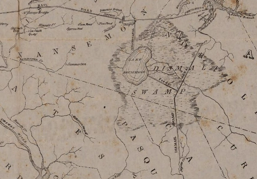
The Dismal Swamp Canal was the Commonwealth of Virginia's first large-scale public works project. It enabled boats to travel from Pasquotank River, North Carolina to Deep Creek and then the South Branch of the Elizabeth River. Boats loaded with agricultural products from coastal North Carolina and the Roanoke River watershed could reach wharves at Portsmouth and Norfolk, where cargo could be loaded onto ships going to markets in the northeastern states, Europe, and the Caribbean.
The canal first opened in 1805. The Federal government required it to be deepened, and to provide financial support the US Congress bought stock in the company in 1827.1
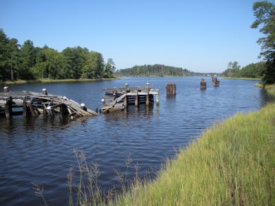
Albemarle and Chesapeake Canal east of Great Bridge Lock, linking East Branch of Elizabeth River with North Landing River
aerial view of Albemarle and Chesapeake Canal
Source: US Department of Agriculture Geospatial Data Gateway
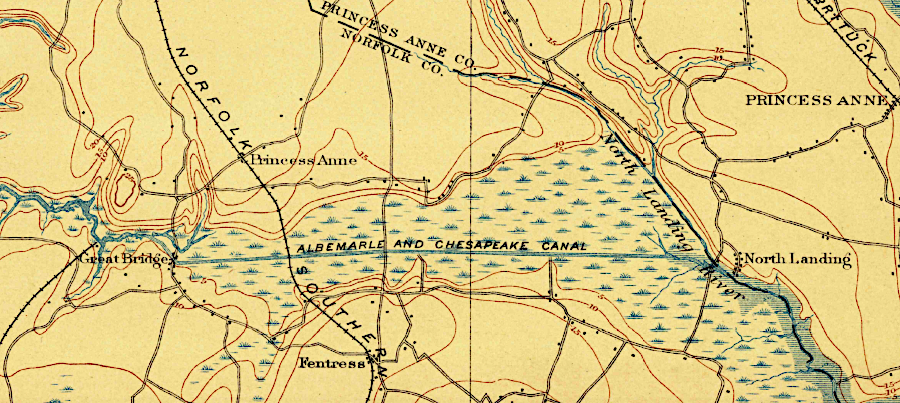
Albemarle and Chesapeake Canal, connecting Southern Branch of Elizabeth River with North Landing River in 1902
Source: US Geological Survey (USGS), Norfolk 30x30 topographic map (1902)
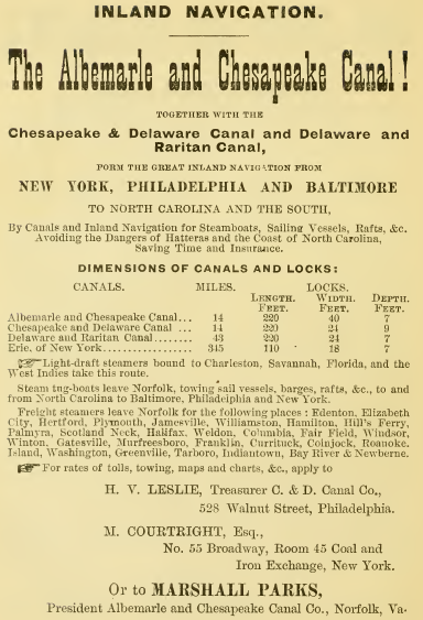
the Albemarle and Chesapeake Canal advertised its suitability for inland navigation in 1881
Source: Internet Archive, A history of Old Point Comfort and Fortress Monroe, Va., from 1608 to January 1st, 1881 (1881)
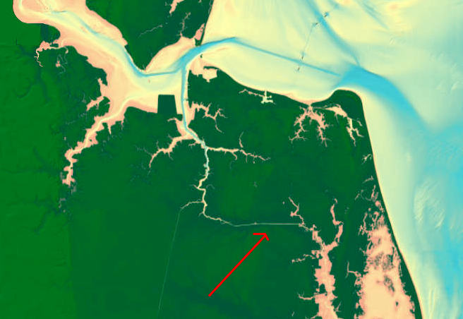
bathymetry near Albemarle and Chesapeake Canal
Source: National Ocean Service Hydrographic Survey Data, Bathymetry Map Service
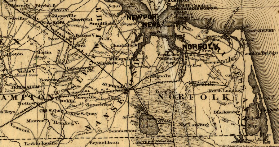
railroads linked Suffolk, Portsmouth, and Norfolk to the east, while the Albemarle and Chesapeake Canal linked to North Carolina in the south
Source: Library of Congress, Map showing the Fredericksburg & Gordonsville Rail Road of Virginia (1869)
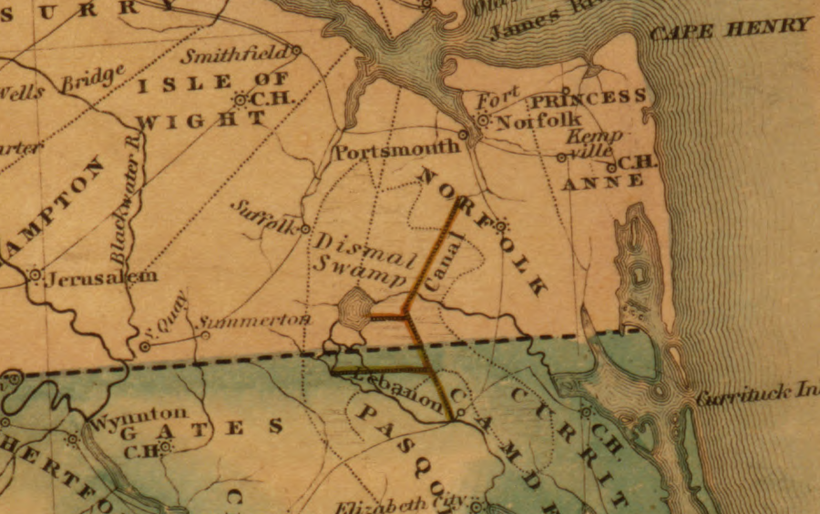
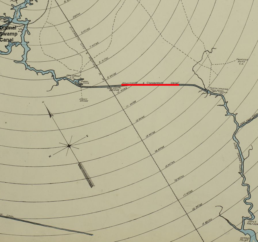
Dismal Swamp Canal in 1834
Source: Library of Congress, Map of the United States compiled from the latest and most accurate surveys by Amos Lay (1834)
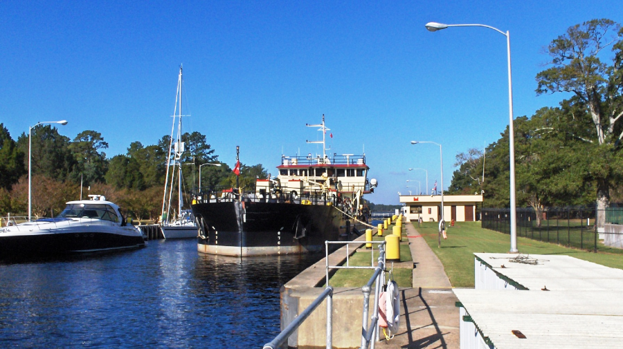
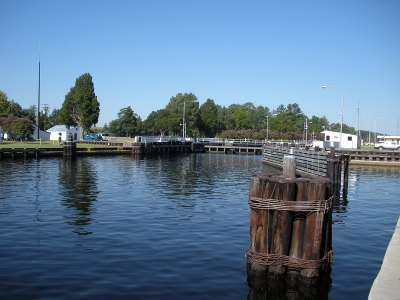
Great Bridge Lock on the Albemarle and Chesapeake Canal
Source: US Army Corps of Engineers, Norfolk District Image Gallery
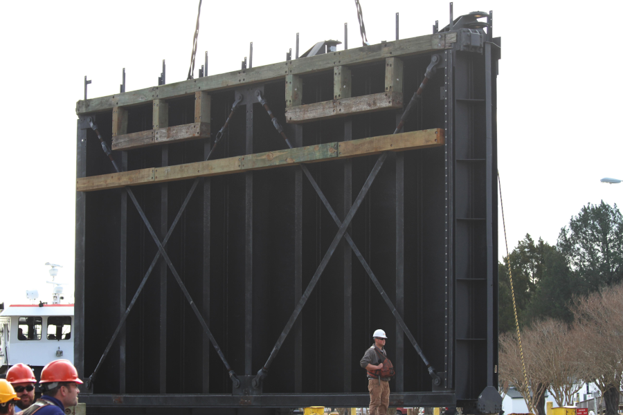
about every 25 years, the Corps of Engineers refurbishes the 72-ton gates for the Great Bridge Lock on the Albemarle and Chesapeake Canal
Source: US Army Corps of Engineers, Norfolk District Image Gallery
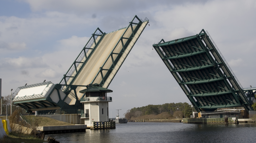
a bridge has crossed the Southern Branch of the Elizabeth River since before the Revolutionary War
Source: US Army Corps of Engineers, Norfolk District Image Gallery
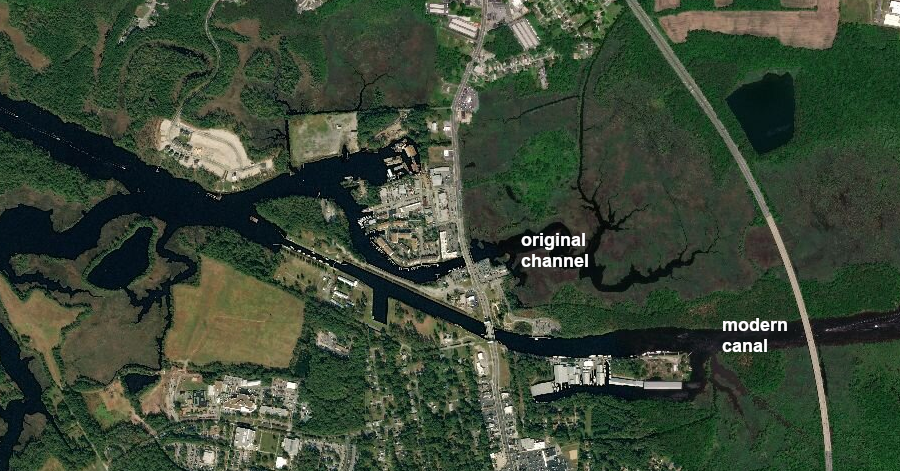
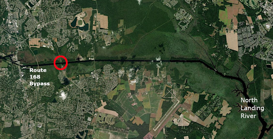
at Great Bridge, the Albemarle and Chesapeake Canal was excavated south of the original channel of the Southern Branch of the Elizabeth River
Source: ESRI, ArcGIS Online
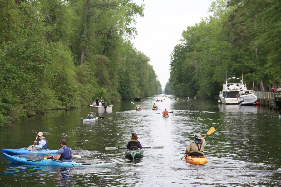
the annual Paddle for the Border on the Dismal Swamp Canal starts at the South Mills, North Carolina visitor center
Source: US Army Corps of Engineers, Norfolk District Image Gallery
the Albemarle and Chesapeake Canal competed with the Elizabeth City & Norfolk Railroad (later the "original" Norfolk Southern) and the Dismal Swamp Canal
Source: Library of Congress, Sanborn Fire Insurance Map from Norfolk, Independent Cities, Virginia (Sanborn Map Company, 1887)
1. James C. Burke, "North Carolinas First Railroads, A Study in Historical Geography," PhD thesis, University of North Carolina at Greensboro, 2008, p.65, https://libres.uncg.edu/ir/uncg/f/Burke_uncg_0154D_10006.pdf (December 31, 2018)