the seven-mile Upper Appomattox Canal bypassed the rapids upstream of Petersburg
Source: Library of Congress, S.E. portion of Virginia and N.E. portion of N'th Carolina (by Thomas Jefferson Cram, 186_)
the seven-mile Upper Appomattox Canal bypassed the rapids upstream of Petersburg
Source: Library of Congress, S.E. portion of Virginia and N.E. portion of N'th Carolina (by Thomas Jefferson Cram, 186_)
Petersburg is located at the Fall Line, where rapids on the Appomattox River blocked travel upstream. The General Assembly authorized navigation improvements upstream in 1745, and chartered Petersburg as a town in 1748.
The potential for settlement and trade up to the river's headwaters had increased after the Iroquois agreed, in the 1744 Treaty of Lancaster, to abandon their claims to lands west of the Blue Ridge. Settlement west of the mountains would not bring agricultural products to Petersburg, but it was clear the population growth would increase in the Piedmont
The Upper Appomattox Canal company was chartered in 1795, a decade after George Washington organized the Patowmack Company to improve navigation on the Potomac River. It upgraded the channel for batteaux to travel downstream from Farmville by building wing dams. At the Fall Line rapids, it build a canal with four locks.
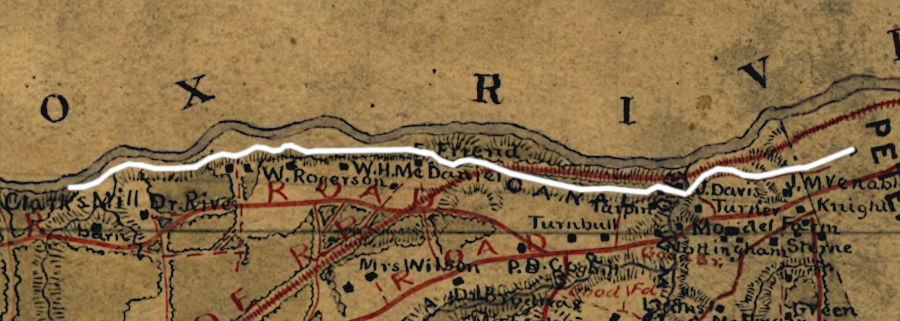
the Upper Appomattox Canal had four locks to adjust for topographic relief
Source: Library of Virginia, A correct map of Dinwiddie County (by Isham E. Hargrave, 1820)
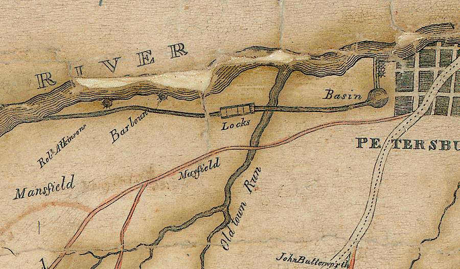
The canal was not designed to allow batteaux to continue downstream, bypassing Petersburg. Instead, the downstream end of the Upper Appomattox Canal was a basin for boats to unload. It was constructed near the intersection of modern West High and South streets.1
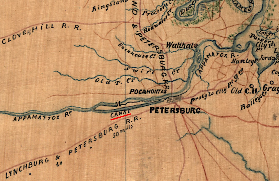
the South Side Railroad captured business from the Upper Appomattox Canal
Source: Library of Congress, Map of Dinwiddie County, Va (1864)
The South Side Railroad competed with the Upper Appomattox Canal. Both were designed to move agricultural products from the Piedmont to the wharves and docks of Petersburg at the Fall Line. The railroad was more cost-effective and won the competition, a pattern repeated across the Eastern Seaboard after the Civil War.
The canal was converted into the bed of the Seaboard Airline Railroad by 1908.2
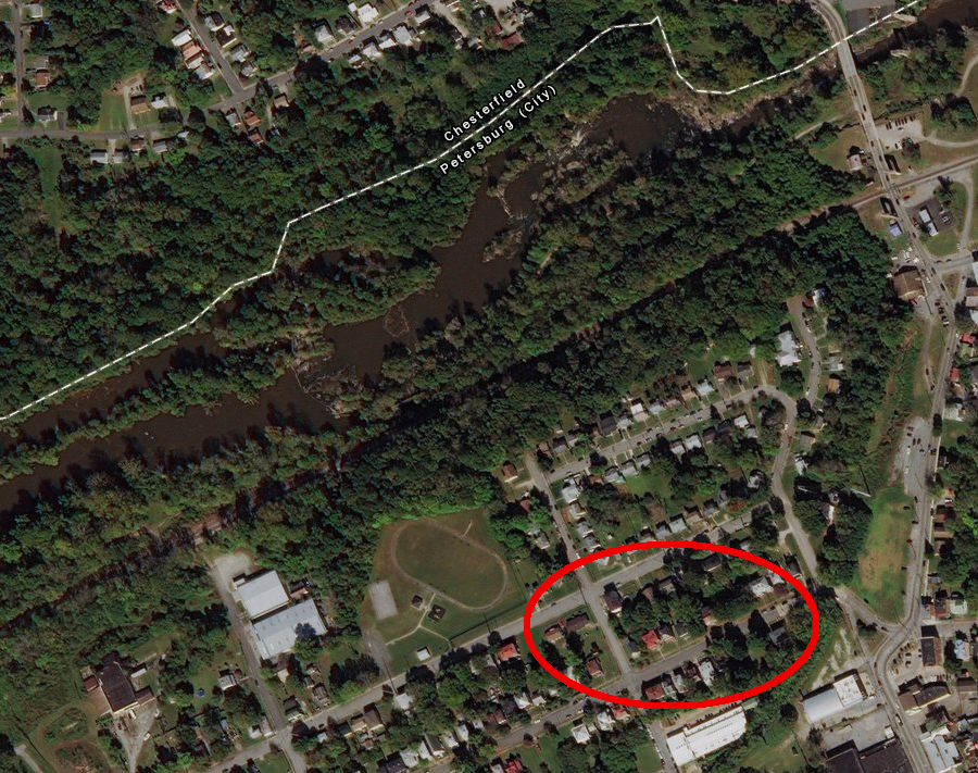
the turning basin of the Upper Appomattox Canal was filled in by 1908 to become the trackbed of the Seaboard Airline Railroad
Source: ESRI, ArcGIS Online
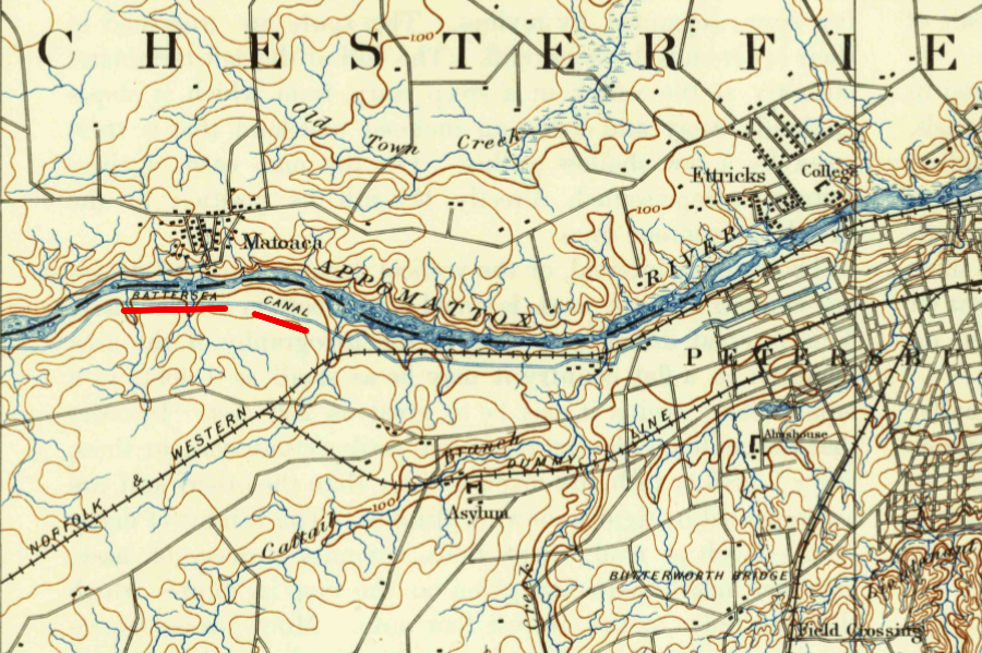
in 1894, the Upper Appomattox Canal was called the Battersea Canal
Source: US Geological Survey, Petersburg, VA 1:62,500 scale topographic quadrangle (1894)
 >
>
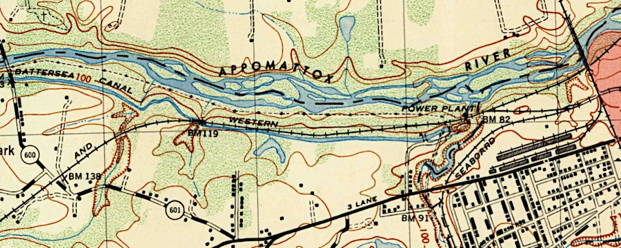
the Battersea Canal became a feeder for a hydroelectric power plant
Source: US Geological Survey, Petersburg, VA 1:25,000 scale topographic quadrangle (1949)