The Disconnect Between Transportation and Land Use Planning
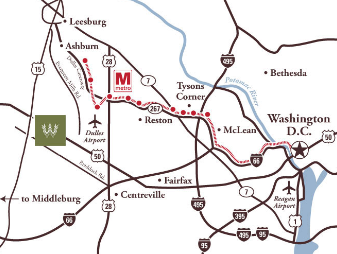
in 2017, the Willowsford subdivisions on Route 50 in Loudoun were advertising the future Metrorail extension north of Dulles airport
Source: Willowsford Management, LLC
State officials have controlled the development of the local road system since the Byrd Road Law was passed in 1932, while local (county/city/town) officials have control over land use plans, including zoning private property for permitted uses.
- Code of Virginia §15.2-2223
- The local planning commission shall prepare and recommend a comprehensive plan for the physical development of the territory within its jurisdiction and every governing body shall adopt a comprehensive plan for the territory under its jurisdiction... The plan, with the accompanying maps, plats, charts, and descriptive matter, shall show the locality's long-range recommendations for the general development of the territory covered by the plan.
- Code of Virginia §15.2-2280
- Any locality may, by ordinance, classify the territory under its jurisdiction or any substantial portion thereof into districts of such number, shape and size as it may deem best suited to carry out the purposes of this article, and in each district it may regulate, restrict, permit, prohibit, and determine the following:
- The use of land, buildings, structures and other premises for agricultural, business, industrial, residential, flood plain and other specific uses;
- The size, height, area, bulk, location, erection, construction, reconstruction, alteration, repair, maintenance, razing, or removal of structures;
- The areas and dimensions of land, water, and air space to be occupied by buildings, structures and uses, and of courts, yards, and other open spaces to be left unoccupied by uses and structures, including variations in the sizes of lots based on whether a public or community water supply or sewer system is available and used; or
- The excavation or mining of soil or other natural resources.
- Code of Virginia §33.1-69
- The control, supervision, management and jurisdiction over the secondary system of state highways shall be vested in the Department of Transportation and the maintenance and improvement, including construction and reconstruction, of such secondary system of state highways shall be by the Commonwealth under the supervision of the Commonwealth Transportation Commissioner. The boards of supervisors or other governing bodies of the several counties and the county road board or county road commission of any county operating under a county road board or county road commission shall have no control, supervision, management and jurisdiction over such public roads, causeways, bridges, landings and wharves, constituting the secondary system of state highways.
When the Byrd Road Law was passed, only Arlington and Henrico counties kept control of their local roads, and thus retained the capability to align transportation with land use. Tim Kaine's successful campaign for governor in November 2005 included a promise to increase local involvement in the transportation planning process... and 50 years from now, control over local development will still be a political issue.
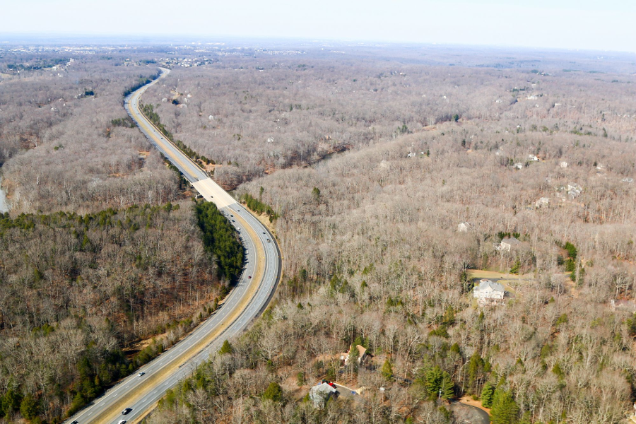
in 2018, much of the land in Prince William County along the Occoquan River was still undeveloped
Source: Historic Prince William, Bridge over Occoquan River at Prince William Parkway
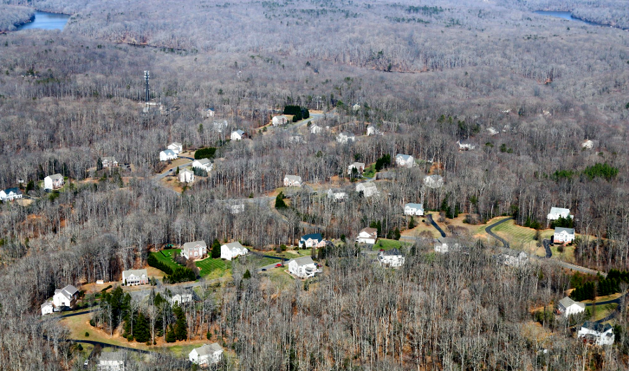
in 2018, SR-1 zoning allowed for one-acre lots on Crooked Creek Road
Source: Historic Prince William, Crooked Creek Drive
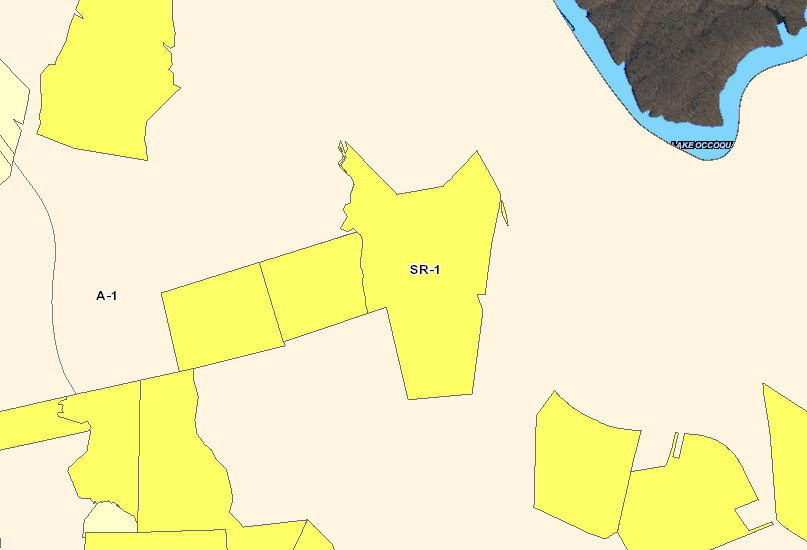
A-1 zoning, requiring 10-acre lots, surround the SR-1 zoning on Crooked Creek Road
Source: Prince William County, County Mapper
Land Use Planning in Virginia
Virginia Places