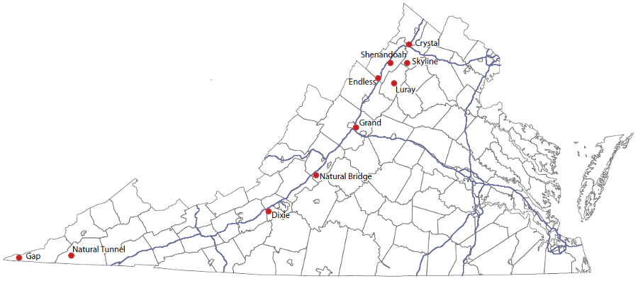
all commercial caves in Virginia are located in the limestone formations west of the Blue Ridge
Source: Virginia Department of Energy, Caves

all commercial caves in Virginia are located in the limestone formations west of the Blue Ridge
Source: Virginia Department of Energy, Caves
There are eight commercial caves in Virgina that welcome visitors - Gap Cave, Dixie Caverns, Endless Caverns, Grand Caverns, Luray Caverns, Natural Bridge Cavern, Shenandoah Caverns, Skyline Caverns. In addition, Norfolk Southern stops train trips one day a year at Natural Tunnel State Park, allowing visitors to walk inside the tunnel.
The oldest commercial show cave in America was discovered by a hunter near Waynesboro in 1804. The landowner, Matthias Amend, sought to have the cave named after himself, but locals chose to name it Weyers Cave after the hunter Bernard (Barnette) Weyer. Later it was called Grottoes of the Shenandoah, but since 1926 is has been known known as Grand Caverns.
Grand Caverns highlights its history as the oldest commercial show cave in North America; tours started in 1806. Guides also point out the 230 Confederate and Union signatures inside the cave.
Grand Caverns was privately owned until 1974, and operated by the Upper Valley Regional Park Authority between 1974-2009. When the cities of Staunton and Harrisonburg and the counties of Augusta and Rockingham dissolved their regional park authority, the Town of Grottoes took ownership and responsibility for offering commercial tours.1
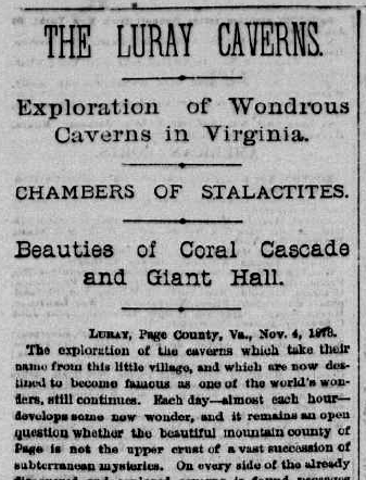
Major Alexander J. Brand's article in the New York Herald provided the name for Luray Caverns
Source: Chronicling America, The New York Herald (November 6, 1878)
Volunteers from the National Speleological Society started to support this publicly-owned cave, when it requested assistance in preparing a new cave map prior to the 2006 bicentennial. New mapping determined the cave was closer to four miles long rather than just one mile. The process re-discovered the original entrance to Fountain Cave, and led to the discovery of nearly a dozen new caves.
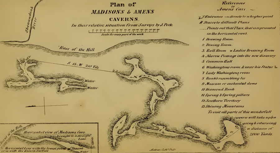
an 1853 edition of Notes On The State Of Virginia included Thomas Jefferson's map of Madison's Cave, plus a map of Amens Cavern (now known as Grand Caverns)
Source: Internet Archive, Notes On The State Of Virginia (1853 edition)
In 2022, James Madison University partnered with the Town of Grottoes to get the cave designated as a geoheritage site. The National Park Service maintained an "Unofficial National Register of Geoheritage Sites," and at the time no Virginia caves were listed. The students at James Madison University also used LIDAR to create a three-dimensional representation of Grand Caverns. The mapping included all parts of the cave, including sections not on the public tour route.2
Other commercial caves in Virginia have been renamed as well. In late 2002, the National Park Service re-opened the old Cudjo Cave at Cumberland Gap National Historic Park. Within the park, paved Highway 23 through the gap was obliterated after the Cumberland Gap Tunnel was completed and the approximate contours of the historic road were restored. At the end of that process, the National Park Service restored the most historic name of the cave, Gap Cave. At other times, it has also been known as King Solomon's Cave and Soldier's Cave.3
Thomas Jefferson referred to it as Gap Cave in his Notes on the State of Virginia, and indicated that it was a "blowing cave." In such caves, daily temperature changes trigger movement of outside air through the cave entrance, into or out of a cave in which air temperature is consistent throughout the year.4
The commercial caverns in Virginia are not the longest, or deepest, in the state. Instead, they are the most convenient for tourists, due to their location near highways and the ability to create walking paths underground. There is a cluster of four commercial caves in the northern ("lower") part of the Shenandoah Valley. Grand Caverns, Endless Caverns, Shenandoah Caverns, and Luray Caverns are located within less than a 1-hour drive from each other.5
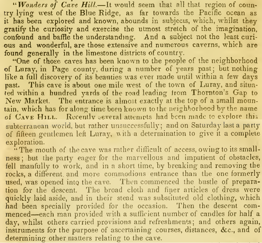
the Shenandoah Sentinel described a visit to Rufner's Cave near Luray in 1825
Source: A new and comprehensive gazetteer of Virginia, and the District of Columbia (by Joseph Martin, 1935)
The commercial cave business is a business, requiring owners to either make a profit or to subsidize operations. A cave with spectacular formations such as Luray Caverns can attract 500,000 visitors annually even though it is not on an interstate highway, but less-spectacular Dixie Caverns right at Exit 132 on I-81 gets only 30,000 visitors each year. To generate revenue, Endless Caverns also operates a recreational vehicle (RV) and camping area.6
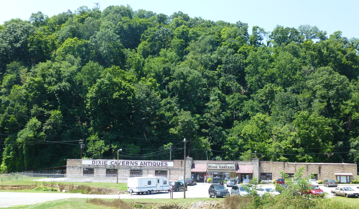
the cave at Dixie Caverns, found thanks to a search for a dog named Dixie, is in the hill behind the entrance
In 2010, tourism declined in an economic recession. Crystal Caverns at Hupp's Hill (also known as Hupp's Cave and Battlefield Crystal Caverns) closed after being open to the public since 1922. The Crystal Caverns at Hupp's Hill name reflects the purity of the Chambersburg formation limestone, which resulted in crystals that sparkled when illuminated.
The National Speleological Society considered partnering with the nearby Cedar Creek Battlefield Foundation and the Town of Strasburg, to re-open the cave occasionally to offer public tours.7
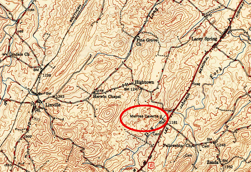
before construction of I-81, Melrose Caverns sought to attract customers who were driving on Route 11
Source: US Geological Survey (USGS), Broadway VA 1:62,5000 topographic quadrangle (1950)
One of the owners of the Melrose Caverns north of Harrisonburg was David Harrison. He carved his name inside the cave in 1818; a 1793 date by someone else has also been recorded. In 1833, historian Samuel Kercheval wrote:8
The pre-Civil War farmhouse and a kitchen/meat house dating back to the 1820's still survive at the Harrison Farmstead.
The cave was opened for public tours in 1929 by Edward T. Brown, who had recently opened Endless Caverns ten miles away in 1920. Brown advertised the cave as the "Blue Grottoes of Virginia and Civil War Museum." The color of the local limestone/dolomite was a reason for the name. It was then renamed Virginia Caverns, and finally Melrose Caverns. Other cave owners may have complained that "Virginia Caverns" indicated some form of official state support and created unfair competition.
Improvement of the Valley Pike as US 11 in the 1920's stimulated development of the commercial cave operation. Construction of I-81 in the 1960's ended the business because drivers on I-81 had no interchange with direct access to the site. The 99-year lease arranged by Col. Brown with Frances Harrison and Thomas Harrison was cancelled and regular commercial tours stopped in 1967. The Melrose Caverns Filling Station, built in 1929 to supplement income from the cave tours, also closed around 1970.
After commercial tours ended, the cave was used as a theater and party destination by James Madison University students. Between 2012-2020, the Virginia Region of the National Speleological Society helped prepare the cave for hosting commercial tours again. Trash and old electrical wiring for lighting was removed, and around the time COVID-19 struck the cave was reopened.
Today visitors can make a reservation for a tour at Melrose Civil War Caverns. Guides highlight the Civil War experience and the Registry Column. The Melrose Caverns Lodge and other farm buildings can be rented for weddings and special events.
Tours highlight how both Confederate and Union soldiers visited the cave during the Civil War. They left their names on the walls and what is now called the "Registry Column" inside the cave. In April 1862, Union soldiers under General Nathaniel P. Banks camped in the area:9
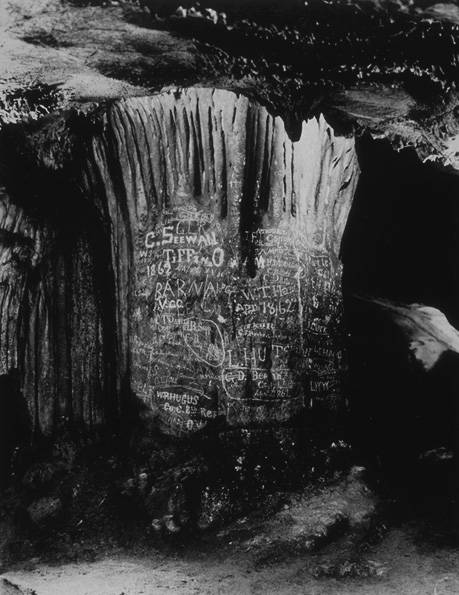
in 1939, the Virginia New York World's Fair Commission included Melrose Cave's Registry Column in the list of the state's wonders to highlight
Source: Library of Virginia, A few of the inscriptions made on "Registry Column" by Union and Confederate soldiers during the War Between the States
Giant Caverns, at the town of Narrows on the New River, used to be a commercial cave but is no longer open to the public. When the town sought to buy the land with the cave in 2014, the Virginia Department of Conservation and Recreation (DCR) helped negotiate an arrangement with the West Virginia Cave Conservancy. That state agency is the center of cave and karst expertise within Virginia government, and was interested in preserving both the cave and a cave beetle species living within it.
The town carved out a four-acre parcel which was acquired by the West Virginia Cave Conservancy, a non-government organization. The conservancy ended up owning both cave entrances, and he town was relieved of the burden of managing cave access.
In 2024, cavers exploring Giant Caverns discovered a dog trapped 40' underground. It was hungry and thirsty, but otherwise in good condition. After three hours of effort, the cavers extracted the dog and took it to the Giles County Animal Shelter.
Most animals trapped in caves become future fossils, and Giant Caverns has plenty of skulls and bones. One of the dog rescuers commented:10
At Shenandoah Caverns, "one that did not get away" at least 12,000 years ago was a Mylohyus. A fossil of that pig-like animal was discovered in 2023 by the Shenandoah County Cave Survey. The commercial cave had welcomed visitors for a century, but the remote passage had never been open for public use. Whatever chased the Mylohyus underground did not get a meal, but the animal never returned to the surface.11
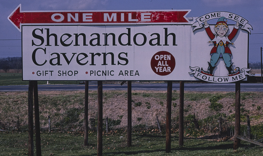
billboards guided tourists to caves from Route 11
Source: Library of Congress, Shenandoah Caverns billboard, Route 11, near New Market, New Market, Virginia (by John Margolies, 1982)
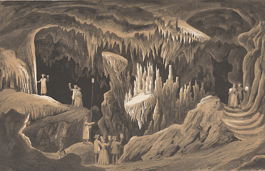
the oldest commercial show cave in the United States is Weyers Cave, which is now called Grand Caverns
Source: National Gallery of Art, The Drums and the Tapestry Room, Weyers Cave (1857)